Tour du Queyras
How would you rate Tour du Queyras?
Tap a star to share your experience and help other hikers.
Tour du Queyras: GR58 Hiking Guide
HikeList Score
Tour du Queyras scored 84/100 on HikeList's trail-quality metrics.
See score breakdownHide breakdown
- Ideal length 96
- Balanced challenge 80
- Scenery & wildness 98
- Varied terrain 76
- Accommodation 67
- Food & support 72
- Path quality 98
- Season flexibility 76
Computed from length, challenge, scenery & wildness, terrain variety, accommodation, food & support, path quality and season flexibility.
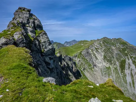
The Tour du Queyras is the GR58: a waymarked 110 km loop in the Queyras Regional Natural Park, Hautes-Alpes, France, on the Italian border. Most hikers take 8-10 days, with about 7,900 m of ascent. It is hard but non-technical: expect long climbs, rocky high cols and changing Alpine weather, but no glaciers or scrambling. It suits fit, sure-footed walkers who want a quieter southern French Alps circuit than the busiest classic routes.
Route Overview
The GR58 is a circular route, so you can start and finish in any Queyras village. Common trailheads are Ceillac, Abries and Ville-Vieille / Chateau-Queyras, and the loop is often walked anticlockwise. The route links Ceillac, Saint-Veran, Refuge Agnel, Abries, L'Echalp, Refuge de Furfande, Arvieux / Brunissard, Chateau-Queyras and Ville-Vieille, crossing high passes including Col Fromage, Col des Estronques, Col de Chamoussiere, Col du Malrif, Col de Peas and Col de Furfande. For other French mountain walking ideas, compare it with the Chartreuse Trail GR9 segment or the Cirque de Gavarnie trails.
Queyras history and the GR58
The Queyras was part of the Republic of the Escartons, a federation of Alpine valleys around Monte Viso that held unusual fiscal and political self-government. The Queyras escarton dates from a 1343 charter, and the route still links historic high villages shaped by this borderland setting. The GR58 itself is a modern FFRandonnee long-distance circuit, waymarked with red-and-white GR blazes.
Notable highlights
- Saint-Veran (about 2,042 m): One of Europe's highest permanently inhabited communes, known for traditional timber-and-stone Queyras chalets and painted sundials, including work by Giovanni Francesco Zarbula.
- Col de Chamoussiere and Pic de Caramantran: Col de Chamoussiere is the high point of the loop at about 2,884 m. Fit walkers can add the non-technical detour to Pic de Caramantran, a 3,025 m summit near the Italian border.
- Monte Viso views: The pyramidal 3,841 m Monte Viso rises just over the Italian frontier and dominates sections of the eastern skyline, especially around high lakes such as Lac Foreant and Lac Egorgeou.
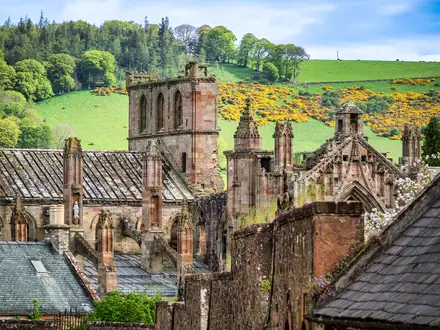
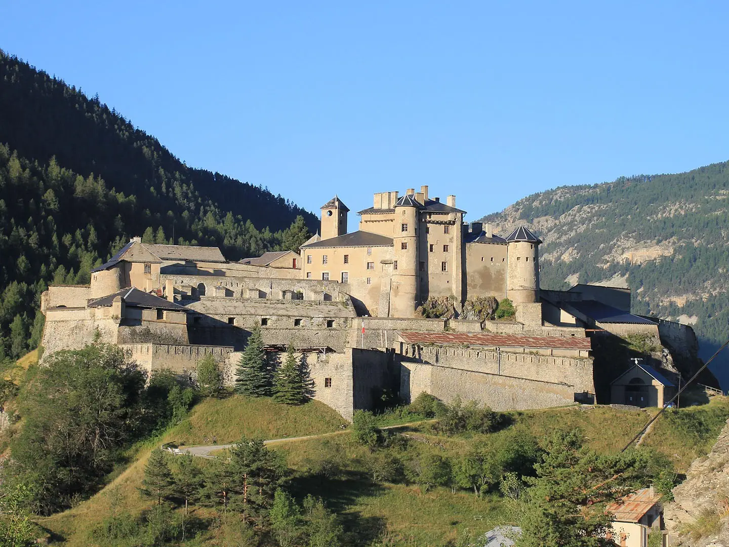
- Chateau-Queyras citadel: A medieval fortress on a rocky spur above the Guil valley, later remodelled in the Vauban style. It is one of the strongest landmarks on the western side of the loop.
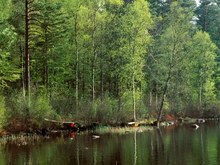
- Queyras villages and alpine flora: The route passes traditional hamlets, larch forest, alpine pasture and flower-rich slopes with orange lilies, edelweiss, gentians and alpine orchids, plus chances of seeing ibex and chamois.
Challenges to expect
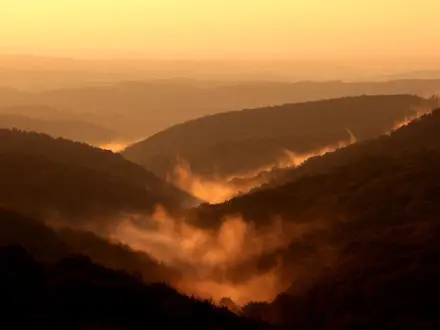
The Tour du Queyras is demanding because of repeated high passes, long ascent days and rocky ground, not technical climbing. Snow can linger on high cols into early July, and afternoon storms are possible in the Alps. Waymarking is clear, but you still need mountain navigation skills. Book gites and refuges early for July and August; services are concentrated in villages and refuges.
HikeList Score
Tour du Queyras scored 84/100 on HikeList's trail-quality metrics.
See score breakdownHide breakdown
- Ideal length 96
- Balanced challenge 80
- Scenery & wildness 98
- Varied terrain 76
- Accommodation 67
- Food & support 72
- Path quality 98
- Season flexibility 76
Computed from length, challenge, scenery & wildness, terrain variety, accommodation, food & support, path quality and season flexibility.
Show more data Show less
- Mountainous
- Forest
- Valley
- Rocky
- Dirt
- Gites
- Huts
- Wild Camping Spots
- Pet Friendly
- Restrooms
- Water Sources
- Campsites
- Shelters
In these collections
Photos from hikers
Taken on the trail by people who've reviewed Tour du Queyras.
Begin your trek from Ville-Vieille, crossing the verdant meadows and ascending gradually toward Col Fromage. Along the way, enjoy scenic views of the Queyras valleys before descending into the picturesque alpine village of Ceillac, known for its charming church and welcoming accommodations. Expect sections of rocky trail, forested paths, and open alpine scenery.
Leave Ceillac and begin the ascent to Col des Estronques, a stunning high-mountain pass with panoramic views. Descend through larch forests and past the iconic wooden chalets toward the historic village of Saint-Véran, one of the highest permanently inhabited settlements in Europe, offering insights into local alpine culture.
Depart Saint-Véran and traverse beautiful upland meadows on your way toward the Col de Chamoussière. The route then continues to Refuge Agnel, situated at the base of the imposing Col Agnel. This hut provides a comfortable resting point, nestled amidst dramatic rocky landscapes.
Starting with an ascent over Col Vieux and Col de Chardin, this section is marked by expansive views and possible sightings of wildlife such as ibex. Descend along alpine tarns and through valleys rich in wildflowers, gradually arriving at the vibrant village of Abriès.
The path from Abriès leads you through mixed forests and up towards open pastures, passing through ancient hamlets with traditional Queyrassian architecture. The journey culminates at Refuge de Furfande, located in a scenic setting beneath striking jagged peaks.
Begin with a gentle descent through the Furfande pasturelands, followed by a traverse of rolling hills and valleys. Arrive in the charming village of Arvieux, where you can rest and enjoy local food after a day surrounded by rugged alpine scenery.
Follow trails alongside mountain streams and through wooded valleys as you make your way to the historic village of Château-Queyras. Take the opportunity to visit its famed medieval citadel, a unique feature along the route.
The final stage is a relatively gentle walk along the Guil River, winding through alpine meadows and forests in the Queyras valley. Complete the loop as you return to Ville-Vieille, where the journey began.
Reviews
How would you rate Tour du Queyras?
Tap a star to start your review — you could be the first.