Jungfrau Region Circular Walk
How would you rate Jungfrau Region Circular Walk?
Tap a star to share your experience and help other hikers.
Jungfrau Region Circular Walk: Bernese Oberland Trek
HikeList Score
Jungfrau Region Circular Walk scored 77/100 on HikeList's trail-quality metrics.
See score breakdownHide breakdown
- Ideal length 95
- Balanced challenge 52
- Scenery & wildness 88
- Varied terrain 87
- Accommodation 66
- Food & support 54
- Path quality 98
- Season flexibility 76
Computed from length, challenge, scenery & wildness, terrain variety, accommodation, food & support, path quality and season flexibility.
The Jungfrau Region Circular Walk is a hard, 111 km alpine loop in the Bernese Oberland of Switzerland, usually walked in 9–10 days. Popularised by Kev Reynolds’s Cicerone guide Tour of the Jungfrau Region, it suits fit, experienced mountain walkers who are comfortable with sustained climbs, high alpine paths and changeable mountain weather. The route circles the Eiger, Mönch and Jungfrau, linking Grindelwald, Wengen, Lauterbrunnen, Mürren and the Schilthorn.
Route Overview
This is a clockwise horseshoe loop beginning at Schynige Platte, reached by the historic rack railway from Wilderswil, and returning to Wilderswil or Interlaken. The route crosses classic Bernese Oberland terrain: the Faulhorn ridge, Bachalpsee, First, Grindelwald, Grosse Scheidegg, the Eiger Trail beneath the Eiger north face, Kleine Scheidegg, Wengen, the Lauterbrunnen valley, Stechelberg/Obersteinberg, Mürren and the Schilthorn. There is no single branded waymarking for the “Tour of the Jungfrau”; you follow Swiss yellow signs and white-red-white mountain waymarks between named destinations. Mountain railways, cable cars and funiculars can shorten or link stages. For comparable Swiss multi-day routes, see the Alpine Pass Route or the Bernina Trek.
Alpine tourism and the Tour of the Jungfrau Region
The Jungfrau region has been central to Alpine tourism since the 19th century. The Faulhorn summit hotel dates from 1830, the Schynige Platte rack railway opened in 1893, and the Jungfrau Railway reached the Jungfraujoch, the “Top of Europe”, in 1912. The circular trek was codified for English-speaking walkers by Kev Reynolds in the Cicerone guide Tour of the Jungfrau Region. The area lies within and beside the Swiss Alps Jungfrau-Aletsch UNESCO World Heritage Site, which also connects naturally with the Aletsch Glacier UNESCO Trail.
Notable highlights
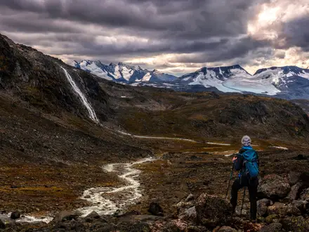
- Eiger, Mönch and Jungfrau: The walk circles this iconic Bernese Oberland trio. The Jungfrau reaches 4,158 m, while the Eiger’s north face is one of the best-known walls in the Alps.
- Bachalpsee: A celebrated alpine lake near First above Grindelwald, around 2,265 m. On calm mornings it reflects the Schreckhorn and Wetterhorn.
- Faulhorn: A 2,681 m summit on the classic Faulhornweg ridge. Its summit hotel opened in 1830 and is one of the oldest mountain hotels in the Alps.
- Eiger Trail: This dramatic path runs beneath the Eiger north face between Eigergletscher and Alpiglen, giving close-up views of the wall.
- Lauterbrunnen valley: A deep, glacier-carved U-shaped valley lined with up to 72 waterfalls, including the free-leaping Staubbach Fall.
- Schilthorn: The 2,969 m high point of the tour, crowned by the revolving Piz Gloria restaurant from the 1969 James Bond film On Her Majesty’s Secret Service.
Challenges to expect
Expect a strenuous alpine trek rather than a low-level valley walk. Daily stages can involve big ascents, long descents, rocky or exposed sections, and navigation at busy junctions where the route is not branded as a single trail. Snow can linger on high passes before late June, and transport costs add up. If you want a shorter glacier-focused alternative nearby, compare the Aletsch Glacier Panorama Trail.
HikeList Score
Jungfrau Region Circular Walk scored 77/100 on HikeList's trail-quality metrics.
See score breakdownHide breakdown
- Ideal length 95
- Balanced challenge 52
- Scenery & wildness 88
- Varied terrain 87
- Accommodation 66
- Food & support 54
- Path quality 98
- Season flexibility 76
Computed from length, challenge, scenery & wildness, terrain variety, accommodation, food & support, path quality and season flexibility.
 Switzerland
Show more data Show less
- Mountainous
- Alpine
- Forest
- Pasture
- Rocky
- Dirt
- Huts
- Hotels
Photos from hikers
Taken on the trail by people who've reviewed Jungfrau Region Circular Walk.
Reviews
How would you rate Jungfrau Region Circular Walk?
Tap a star to start your review — you could be the first.