Borders Abbeys Way
How would you rate Borders Abbeys Way?
Tap a star to share your experience and help other hikers.
Borders Abbeys Way: A Practical Hiking Guide
HikeList Score
Borders Abbeys Way scored 91/100 on HikeList's trail-quality metrics.
See score breakdownHide breakdown
- Ideal length 89
- Balanced challenge 100
- Scenery & wildness 71
- Varied terrain 100
- Accommodation 100
- Food & support 94
- Path quality 98
- Season flexibility 89
Computed from length, challenge, scenery & wildness, terrain variety, accommodation, food & support, path quality and season flexibility.
The Borders Abbeys Way is a 109 km circular long-distance trail through the Scottish Borders in Scotland. It links Melrose, Dryburgh, Kelso and Jedburgh Abbeys across the Tweed and Teviot valleys, usually taking around six days, with 5–6 days common. Difficulty is moderate: mostly low-level, off-road walking on riverside paths, farmland, woodland and quiet lanes, with rougher, hillier sections around Black Law and the Jedburgh–Hawick–Selkirk middle stages.
Route Overview
The route is a loop, not a point-to-point trail. Tweedbank railway station near Melrose is the usual modern start and finish because it sits on the Borders Railway, but you can begin in Melrose, Kelso, Jedburgh, Hawick or Selkirk and walk either clockwise or anti-clockwise. The circuit passes Melrose Abbey, Newtown St Boswells, St Boswells, Dryburgh Abbey, Kelso Abbey, Roxburgh Castle ruins, Jedburgh Abbey, Denholm, Black Law, Hawick, Hornshole, Selkirk and Abbotsford before returning towards Tweedbank/Melrose. If you are comparing Scottish multi-day walks, see the neighbouring Annandale Way, the Arran Coastal Way or the Ayrshire Coastal Path.
Abbeys, Borders history and Sir Walter Scott
The Borders Abbeys Way opened in 2006 after the route was completed in 2005. It was created to link the four great Borders abbeys, all founded under David I of Scotland in the 12th century. These religious houses were home to monks between the 12th and 16th centuries and were repeatedly damaged during the Anglo-Scottish wars. The trail also passes close to Abbotsford, the Tweed-side home of Sir Walter Scott, and connects with St Cuthbert’s Way, the Southern Upland Way, the Cross Borders Drove Road and the Romans and Reivers Route.
Notable highlights
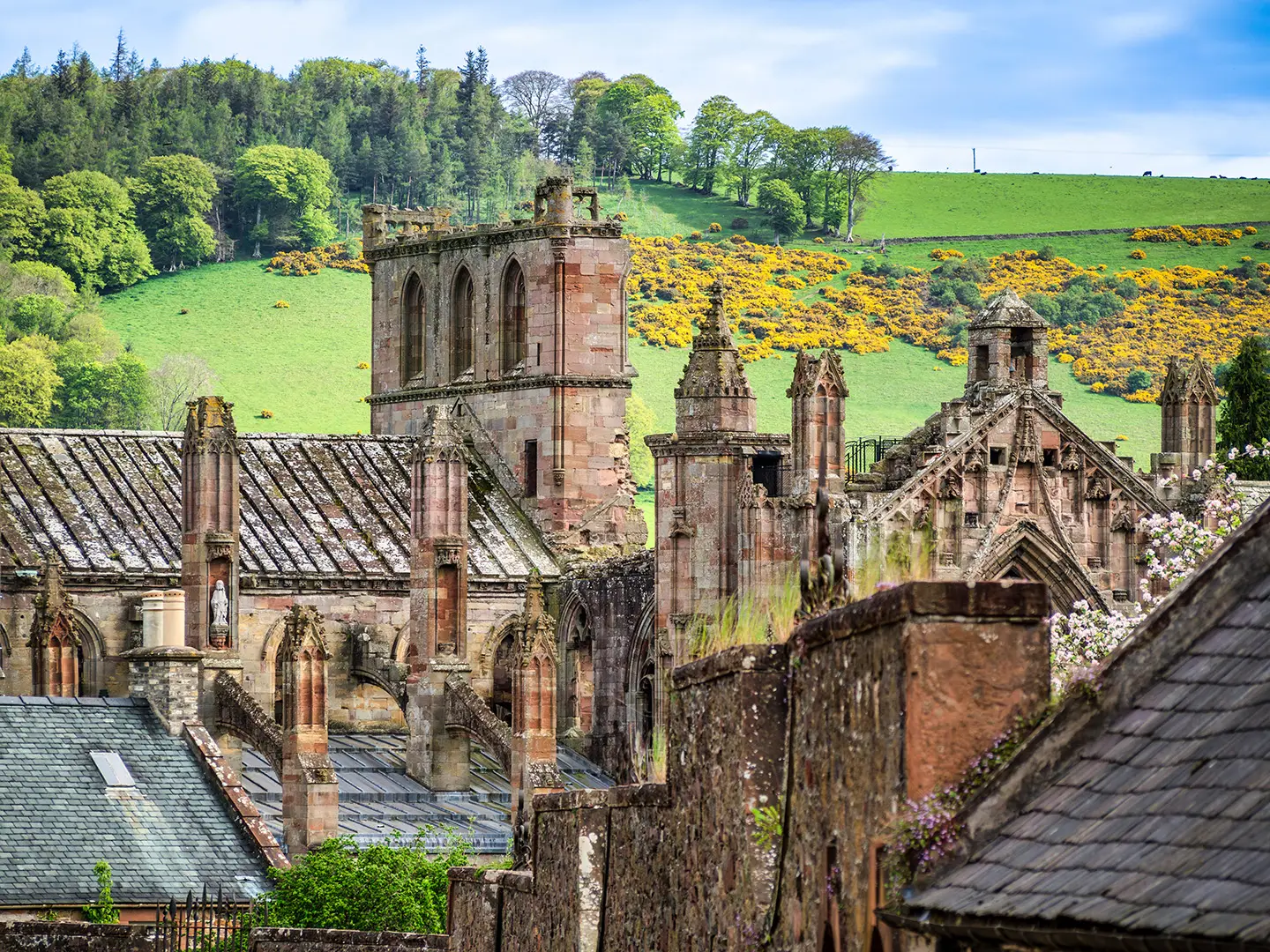
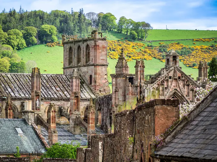
- Melrose Abbey (Cistercian ruin): A red-sandstone abbey ruin and Scotland’s first Cistercian house, founded in 1136. The embalmed heart of King Robert the Bruce is buried within its grounds.
- Dryburgh Abbey (wooded Tweed setting): The most secluded of the four abbeys, set in a wooded loop of the River Tweed. Sir Walter Scott and Field Marshal Earl Haig are buried here.
- Jedburgh Abbey (Augustinian abbey church): A tall, remarkably complete abbey church founded around 1138. It stands above Jedburgh, close to the old border with England.
- Kelso Abbey (surviving west end): Once the largest and wealthiest of the Borders abbeys. Today the dramatic surviving fragment gives a clear sense of its former scale.
- Abbotsford (home of Sir Walter Scott): The romantic baronial house built by Sir Walter Scott beside the River Tweed. The trail passes close by between Melrose and Selkirk.
- Black Law (route high point): The trail reaches about 338 m on the flank of Black Law during the Jedburgh–Hawick stage. A short detour to the summit gives wide views over the Borders hills.
Challenges to expect
Expect moderate rather than mountainous walking. The main effort comes from the cumulative distance and the hillier Jedburgh–Hawick–Selkirk stages, with the route topping out around Black Law at about 338 m. Paths can be muddy after rain, especially on farmland and rougher high ground. Waymarking is in place, but carry a map or GPS. There are no huts or bothies, so plan accommodation in towns or campsites ahead.
HikeList Score
Borders Abbeys Way scored 91/100 on HikeList's trail-quality metrics.
See score breakdownHide breakdown
- Ideal length 89
- Balanced challenge 100
- Scenery & wildness 71
- Varied terrain 100
- Accommodation 100
- Food & support 94
- Path quality 98
- Season flexibility 89
Computed from length, challenge, scenery & wildness, terrain variety, accommodation, food & support, path quality and season flexibility.
 United Kingdom
 Scotland
Show more data Show less
- Lowland
- Riverside
- Farmland
- Rolling Pasture
- Woodland
- Rough High Ground
- Riverside Paths
- Field Paths
- Forest Tracks
- Historic Drove Roads
- Disused Railway Lines
- Minor Roads
- B&Bs
- Inns
- Hotels
- Campsites
- Family Friendly
- Dog Friendly On Leash
- Restrooms
- Potable Water Sources
- Established Campsites
- Public Transport Access Points
Download Our Full Guide to Borders Abbeys Way FREE!
Get our comprehensive guide to this hike for free. Save it for later reading or print out at home.
In these collections
Photos from hikers
Taken on the trail by people who've reviewed Borders Abbeys Way.
Borders Abbeys Way: The Complete Guide
 i
Image by Colin & Linda McKie
i
Image by Colin & Linda McKie The Borders Abbeys Way is a history-rich circuit through the Scottish Borders, linking Melrose, Dryburgh, Kelso and Jedburgh abbeys across the Tweed and Teviot valleys. It suits walkers who want a proper long-distance route without high mountain terrain, with Border towns, riverside paths and quiet countryside doing most of the work.
Most hikers now start at Tweedbank, using the Borders Railway from Edinburgh, then walk into the Melrose side of the loop. From there the route moves between abbey towns, farmland, woodland, minor lanes and long pastoral river sections beside the Tweed and Teviot.
This is not a technical trail, and the waymarking makes navigation relatively straightforward in normal conditions. The harder days come from distance, accumulated fatigue and the rougher, hillier open ground on the Jedburgh–Hawick and Hawick–Selkirk stages, especially after rain.
Planning matters because there are no huts or bothies on the route. Accommodation is in towns such as Melrose, St Boswells, Kelso, Jedburgh, Hawick and Selkirk, so beds, transport links and any luggage transfer should be arranged before setting off.
This guide covers stages, daily planning, accommodation, food, transport, terrain and the common mistakes to avoid.
Stage-by-Stage Guide
Stage 1: Tweedbank to Newtown St Boswells via Melrose — 8 km
This is the shortest day on the Tweedbank-based itinerary and works well as an arrival-day stage if train times allow. From Tweedbank the route links into Melrose, where Melrose Abbey is the first major abbey on the circuit, before continuing towards Newtown St Boswells.
The walking is low-level and pastoral, with the usual Borders Abbeys Way mix of paths, field edges and quiet lanes rather than mountain terrain. It is still worth having waterproof footwear after rain, as even the easy early miles can be muddy on farmland sections.
Melrose is the key place on this stage. The abbey is one of the route’s defining sites, and the town is the last substantial service point before the overnight stop if accommodation has been booked around Newtown St Boswells or St Boswells.
Food and water: Tweedbank is primarily useful for rail access, while Melrose is the main practical stop for food and drink on this short stage. Carry water from the start or from Melrose rather than assuming frequent refills on the path.
Accommodation: Overnight options are usually arranged in the Newtown St Boswells / St Boswells area or back in Melrose if preferred. Accommodation on the Borders Abbeys Way is in towns and villages rather than huts or bothies, so book ahead.
Transport and access: Tweedbank is the railhead for the whole route, with the Borders Railway running to and from Edinburgh Waverley. Melrose is about 2 miles from Tweedbank on foot, or a short bus ride on services such as the 226, X62 or 68; current timetables should be checked before travelling.
Navigation notes: Waymarking uses the white ‘AW’ Abbeys Way symbol, but the beginning of a circular route can feel less obvious than a linear trail. Have the Scottish Borders Council map or OS mapping ready before leaving Tweedbank, especially if walking straight from the station.
Stage 2: Newtown St Boswells to Kelso via Dryburgh, Maxton and Roxburgh — 28 km
This is the longest stage in the six-day itinerary and should be treated as a full day, even though the terrain remains mostly low-level. It links the St Boswells area with Dryburgh, Maxton, Roxburgh and Kelso, giving a strong mix of riverside walking, farmland and historic Borders sites.
Dryburgh Abbey is the major early highlight: a secluded ruin in a wooded loop of the River Tweed, with the graves of Sir Walter Scott and Field Marshal Earl Haig. Scott’s View lies a short way off-route near Dryburgh and is a worthwhile detour only if time, daylight and legs allow.
The route then continues through quiet Borders country towards Roxburgh and Kelso. Near Roxburgh, the grass-covered earthworks of Roxburgh Castle mark the site of a once-important royal stronghold, before the day finishes at Kelso and its abbey beside the town’s Georgian square.
Expect a varied but non-technical day: riverside paths, field paths, woodland and quiet lanes. The distance is the main challenge, and muddy ground can slow the pace after wet weather, particularly on farmland sections.
Food and water: Start with a full day’s food and water unless specific services have been checked in advance. St Boswells, Dryburgh, Maxton and Roxburgh are useful route markers, but do not plan the day around guaranteed open shops or cafés in smaller places without checking current provision.
Accommodation: Kelso is one of the main overnight towns on the route, with the usual mix of hotels, inns, B&Bs and guesthouses. Book ahead, particularly if walking in peak spring, summer or early autumn periods.
Transport and access: Newtown St Boswells / St Boswells and Kelso are reached by Borders Buses rather than rail. Galashiels is the main regional interchange for onward buses; current times should be checked before relying on a same-day connection.
Navigation notes: The stage has enough changes of terrain and small settlements that waymarks should be backed up with a map. Pay particular attention where riverside or field paths meet minor roads, as these are common places to miss a post or choose the wrong lane.
Stage 3: Kelso to Jedburgh — 21 km
This stage leaves Kelso and heads south-west towards Jedburgh, moving away from the River Tweed country into a quieter rural section of the circuit. It is a moderate day by distance, with less of the long-stage pressure of the Newtown St Boswells to Kelso leg.
The day begins with Kelso Abbey close at hand. Although only the west end survives, its scale is an important reminder of how wealthy and powerful the abbey once was.
The route itself is mainly low-level Borders walking on farmland paths, tracks and quiet roads. It is not technical, but field sections can be wet or claggy after rain, and progress may be slower than the distance suggests if conditions are heavy underfoot.
Jedburgh is the clear target for the day. Its tall Augustinian abbey church stands above the town and is one of the most complete and impressive ruins on the circuit.
Food and water: Kelso is the main place to stock up before setting out. Carry enough food and water for the day unless current services on or near the route have been checked in advance.
Accommodation: Jedburgh is a standard overnight stop, with town-based accommodation rather than trail huts. Accommodation should be reserved before arrival, especially for walkers using luggage transfer or fixed-stage itineraries.
Transport and access: Kelso and Jedburgh are both bus-served Border towns, with no rail station on this part of the loop. Connections are by Borders Buses, generally linking through regional hubs such as Galashiels; check current timetables before planning a late start or early finish.
Navigation notes: This is a stage where the waymarked route can feel less dramatic than the abbey-to-abbey endpoints. Keep checking the ‘AW’ waymarks at field exits, road junctions and track splits rather than assuming the broadest track is always correct.
Stage 4: Jedburgh to Hawick via Denholm — 21 km
The Jedburgh to Hawick stage is one of the rougher and hillier parts of the Borders Abbeys Way. It is still moderate rather than mountainous, but it feels more remote and more open than the earlier riverside and farmland stages.
The route leaves Jedburgh and heads through Border country towards Denholm before continuing to Hawick. Denholm is the main named place between the two towns and is useful for pacing the day, although services should be checked before relying on it for food or drink.
Black Law is the key high-ground feature of this stage. A short detour to its summit reaches around 338 m and gives wide views over the Border hills, though it should only be added if weather and time are suitable.
Expect more exposed open ground, rougher paths and muddy going after rain. This is not technical terrain, but it asks for better clothing, footwear and navigation discipline than the gentler early stages.
Food and water: Leave Jedburgh with enough food and water for the full stage unless current facilities in Denholm have been checked. Hawick is the reliable end-of-day service town.
Accommodation: Hawick is one of the main Borders towns on the route, with accommodation in town rather than on the trail. Book ahead; there are no bothies or huts to fall back on.
Transport and access: Jedburgh, Denholm and Hawick are road-accessible, and Jedburgh and Hawick are served by Borders Buses rather than rail. Hawick is a practical point to join or leave the route by bus, but current services should be checked before travelling.
Navigation notes: Take particular care on the higher and rougher ground, especially in poor visibility. Waymarking is present, but an OS map or the official route map is important where open ground, farm tracks and minor roads intersect.
Stage 5: Hawick to Selkirk via the high ground near Ashkirk — 20 km
This is the second of the hillier middle stages and reaches the highest ground of the Borders Abbeys Way, at about 339 m between Hawick and Selkirk. It is a moderate-distance day, but the open ground and cumulative fatigue from previous stages can make it feel tougher than the numbers suggest.
The stage leaves Hawick, a historic textile and Common Riding town on the River Teviot, and crosses quieter Borders country towards Selkirk. The route passes near Ashkirk and over the high ground associated with Bishop’s Stone, which operators commonly identify as the top of the route at roughly 337 m.
The walking is a mix of tracks, open ground, farmland and quiet lanes. After wet weather, this is one of the sections most likely to be muddy, and the exposed stretches can feel committing in poor weather even though the altitude is modest.
Selkirk is the day’s endpoint, another historic Borders mill town and a practical overnight base before the final return towards Tweedbank. The approach into town marks the end of the rougher central part of the walk.
Food and water: Hawick is the place to stock up before setting out. Carry enough food and water for the day, as intermediate resupply should not be assumed without checking current services.
Accommodation: Selkirk has town-based accommodation options and is a normal overnight stop on six-day itineraries. Advance booking is important, particularly if baggage transfer is being used.
Transport and access: Hawick and Selkirk are both served by Borders Buses rather than rail. Galashiels is the main transport interchange in this part of the Borders; check current bus times before building in an exit or rest-day plan.
Navigation notes: This is a stage for keeping the map accessible, not buried in the pack. On open or muddy high ground, the safest approach is to keep confirming each waymark and track junction rather than relying on a distant line of posts or a phone alone.
Stage 6: Selkirk to Tweedbank via Abbotsford — 14 km
The final stage returns from Selkirk towards Tweedbank and the railway, with a gentler distance than the two previous days. It is a useful buffer stage if train travel is planned at the end, but still needs a normal walking-day margin for mud, stops and wayfinding.
The route passes close to Abbotsford, Sir Walter Scott’s baronial house beside the River Tweed. This gives the last day a strong literary and Tweed-valley character before the circuit closes near Tweedbank.
Terrain returns to the familiar Borders Abbeys Way pattern of riverside paths, field paths, woodland, quiet lanes and short sections of easy track. Conditions are generally straightforward, but wet farmland and shaded woodland can remain slippery after rain.
The finish at Tweedbank is the most convenient modern endpoint because of the railway. If accommodation or extra sightseeing is planned in Melrose, allow for the short onward connection between Tweedbank and Melrose.
Food and water: Selkirk is the place to begin with food and water for the day. Tweedbank gives transport access, while nearby Melrose is the more obvious place for post-walk services if continuing there.
Accommodation: Walkers finishing the route can stay in Melrose, Tweedbank area accommodation if available, or use the train connection out. If breaking the loop here rather than leaving immediately, book accommodation in advance.
Transport and access: Tweedbank is the rail terminus for the Borders Railway to Edinburgh Waverley, with a typical journey time of about 55–60 minutes. Buses also link Tweedbank and Melrose, and Galashiels one stop earlier is the main regional interchange; current rail and bus times should be checked before travelling.
Navigation notes: Do not mentally finish the walk too early. The final miles still use the same waymarked path system, and field edges, lane junctions and woodland tracks can all require attention before the route reaches Tweedbank.
Recommended Itinerary
The most practical modern schedule is a 6-day circuit from Tweedbank, using the railway terminus for access and staying in the Border towns each night. This keeps the two rougher, hillier middle stages manageable and avoids trying to combine long sections where accommodation choices are limited.
Standard 6-day itinerary
| Day | From | To | Approx. distance | Why this stage makes sense | Services/accommodation notes |
|---|---|---|---|---|---|
| 1 | Tweedbank | Newtown St Boswells, via Melrose | 8 km | A short opening day works well after arriving by train at Tweedbank. It also gives time for Melrose Abbey before continuing towards the St Boswells area. | Tweedbank has rail access. Melrose and St Boswells/Newtown St Boswells are the key service points for this stage; accommodation should be booked ahead. |
| 2 | Newtown St Boswells | Kelso | 28 km | This is the longest day, but it follows the Tweed-side abbey country and keeps the route moving between natural overnight towns. Dryburgh Abbey, St Boswells, Maxton and Roxburgh sit on or near this section before Kelso. | Kelso is one of the main overnight towns on the route. Because this is a long day, check food, opening hours and any baggage-transfer arrangements before committing. |
| 3 | Kelso | Jedburgh | 21 km | A straightforward abbey-to-abbey stage, linking Kelso Abbey with Jedburgh Abbey and keeping the daily distance moderate after the long previous day. | Kelso and Jedburgh both have town services and accommodation. There are no huts or bothies, so overnight plans need to be fixed in advance. |
| 4 | Jedburgh | Hawick | 21 km | This is one of the more demanding walking days, with rougher and hillier open ground than the early Tweed-side stages. Black Law is the notable high ground on this section, with a short detour to the summit. | Hawick is the main overnight stop. Denholm is the principal intermediate village named on the route, but do not rely on intermediate services without checking before travelling. |
| 5 | Hawick | Selkirk | 20 km | Another hillier stage, crossing open Borders ground between the Teviot and Ettrick areas. The route’s high point is about 339 m on the high ground between Hawick and Selkirk. | Selkirk is a natural overnight base with town services. This stage can be muddy after rain, so allow enough time rather than treating the distance as a fast lowland walk. |
| 6 | Selkirk | Tweedbank | 14 km | A shorter final day brings the route back towards the Tweedbank/Melrose side of the circuit, passing near Abbotsford before returning to the railway. | Tweedbank has trains to Edinburgh via the Borders Railway. If finishing in Melrose instead, allow for the onward walk or bus to Tweedbank station. Current rail and bus times should be checked before travelling. |
Slower option
A slower 7-day version suits walkers who want more time at the abbeys, prefer shorter days, or are carrying full overnight kit. The obvious place to ease the schedule is around the long Newtown St Boswells–Kelso day, but exact stopping points and distances depend on accommodation availability, so check official mapping and bookable beds before planning a split.
Another simple slower approach is to stay in Melrose before or after the walk and keep the Tweedbank station access separate from the main circuit. This is useful if arriving late by train or if visiting Melrose Abbey and Abbotsford without rushing the walking day.
Faster option
A 5-day itinerary is possible for fit walkers by following the traditional five abbey-to-abbey sections: Melrose–Kelso, Kelso–Jedburgh, Jedburgh–Hawick, Hawick–Selkirk and Selkirk–Melrose. This gives a compact schedule, but the Melrose–Kelso stage is long and the Jedburgh–Hawick and Hawick–Selkirk stages are the rougher, hillier parts of the route.
For a 5-day plan using public transport, allow separately for getting between Tweedbank station and Melrose at the start and finish. The total distance rises when the Tweedbank spur is included, so check official mapping before booking accommodation or onward travel.
Planning the Route
How many days to allow
Most walkers should plan the Borders Abbeys Way over six days if starting and finishing at Tweedbank. That gives a manageable first day from the railway at Tweedbank through Melrose, then keeps the remaining overnight stops in the main Border towns where accommodation and transport are most practical.
A five-day walk is realistic for fit walkers, especially if following the older abbey-to-abbey breakdown from Melrose rather than adding the Tweedbank railway spur as a separate start and finish. The trade-off is a long Melrose–Kelso day and less time for the abbeys, Abbotsford, Scott’s View or short detours such as Black Law.
This is not a route that rewards rushing. The walking is generally moderate, but the two rougher, hillier middle stages between Jedburgh, Hawick and Selkirk can feel harder after wet weather, and the historical stops are a major part of the route.
Natural overnight stops
Daily stages are largely dictated by the Border towns. There are no huts or bothies on the route, and the most practical overnight pattern uses existing accommodation in or around Melrose, Newtown St Boswells/St Boswells, Kelso, Jedburgh, Hawick and Selkirk.
A typical Tweedbank-based plan is:
| Stage | Overnight planning notes |
|---|---|
| Tweedbank to Newtown St Boswells via Melrose | Short opening day, useful if arriving by train from Edinburgh and allowing time for Melrose Abbey. |
| Newtown St Boswells to Kelso | One of the longest days; start with food and water rather than assuming convenient supplies between villages. |
| Kelso to Jedburgh | A full walking day between two useful town bases. |
| Jedburgh to Hawick | Hillier and rougher than the early Tweed-side walking; allow for mud after rain. |
| Hawick to Selkirk | Another open, hillier stage, reaching the highest ground of the route at about 339 m. |
| Selkirk to Tweedbank | Shorter final stage, passing the Abbotsford side of the loop before returning to the railway. |
Accommodation should be booked before setting out, particularly in busier holiday periods or if walking with luggage transfer. The towns are close enough to make the route straightforward to organise, but not close enough to rely on finding last-minute beds every evening.
Direction and starting point
The route is circular, so it can be started at any point and walked clockwise or anti-clockwise. Since the Borders Railway opened, Tweedbank has become the most practical start for many walkers because trains run from Edinburgh Waverley to the terminus there, with Melrose about 2 miles away on foot or a short bus ride.
There is no strong technical reason to favour one direction. Choose the direction that best fits accommodation availability, transport times and whether you want a shorter first or final day. Older itineraries often start from Melrose, Kelso or Jedburgh, so check stage distances carefully when comparing guidebooks, operator itineraries and downloadable route notes.
Shortening, extending and section hiking
Section hiking is practical because the route links towns with bus connections, with Galashiels acting as the main transport interchange and Tweedbank providing rail access. Buses serve Melrose, Selkirk, Kelso, Jedburgh and Hawick, but current timetables should be checked before travelling, especially for weekend or evening journeys.
For a shorter trip, walk one or two abbey-to-abbey sections and return by bus rather than trying to force the whole circuit into too few days. The most obvious short breaks are based around the abbey towns: Melrose, Dryburgh, Kelso and Jedburgh.
To extend the route without making the walking harder, add time for abbey visits, Abbotsford, Scott’s View or a more relaxed final day back to Tweedbank. A rest or half-day in Kelso, Jedburgh, Hawick or Selkirk can also make the middle of the walk feel less compressed.
What to plan most carefully
Accommodation is the key planning task. There are B&Bs, guesthouses, inns and hotels in the main towns, plus some campsites, but no bothies or trail huts. Self-guided operators can arrange pre-booked accommodation and daily luggage transfer; availability and baggage-transfer details should be checked before booking travel.
Food and water planning is simple in the towns but more important on the longer rural stages. Carry lunch, snacks and enough water each day, especially on Newtown St Boswells–Kelso, Jedburgh–Hawick and Hawick–Selkirk, where the walking is longer, more open or less convenient for mid-stage resupply.
Navigation is usually straightforward because the route is waymarked with the white “AW” Abbeys Way symbol on posts. Do not rely on waymarks alone: carry the Scottish Borders Council route brochures or map, plus offline mapping or the relevant OS maps. Useful OS Explorer sheets are OL16, 331, 338 and 339; Landranger 73, 74, 79 and 80 also cover the route.
Transport is good for a rural Scottish long-distance path, but it still needs checking. The Borders Railway runs between Edinburgh Waverley and Tweedbank in about 55–60 minutes, while the other route towns depend on Borders Buses rather than rail. Check current ScotRail and Borders Buses times before relying on connections.
Weather and ground conditions matter more than altitude. Much of the walk is low-level riverside, farmland and woodland, but field paths and open ground can be muddy after rain, and the Jedburgh–Hawick and Hawick–Selkirk sections are the ones to treat with most respect in poor weather.
Permits are not a defining planning issue on the Borders Abbeys Way. The practical priorities are booked accommodation, reliable transport links, current route information and carrying enough food, water and waterproof clothing for each stage.
Towns, Villages and Overnight Stops
Accommodation planning on the Borders Abbeys Way is town-based. There are no bothies or trail huts, so most walkers use B&Bs, guesthouses, inns or hotels in the main Border towns, with any camping arranged separately where sites are available.
Book ahead, especially if walking a fixed 5–6 day itinerary or using luggage transfer. The smaller settlements on the route are useful for navigation and rest stops, but should not be relied on for food, accommodation or transport unless arrangements have been made in advance.
| Place | Best use for hikers | Overnight suitability |
|---|---|---|
| Tweedbank | Rail access, start/finish, access to Melrose | Possible, but Melrose is usually the more practical base |
| Melrose | Abbey visit, accommodation, food, start/finish base | Excellent |
| Newtown St Boswells / St Boswells | First-stage halt on a Tweedbank-based itinerary | Good, but book carefully |
| Dryburgh | Abbey visit near the Tweed | Usually a passing stop rather than a main overnight base |
| Maxton / Roxburgh | Small route settlements between Dryburgh and Kelso | Do not rely on services without checking |
| Kelso | Major overnight town, abbey, food and supplies | Excellent |
| Jedburgh | Major overnight town, abbey, food and supplies | Excellent |
| Denholm | Useful village on the Jedburgh–Hawick stage | Possible only if pre-arranged; Hawick is the main halt |
| Hawick | Major overnight town before the hillier Hawick–Selkirk section | Excellent |
| Ashkirk area | Near-route rural section before Selkirk | Not a normal overnight stop |
| Selkirk | Major overnight town for the final leg to Tweedbank/Melrose | Excellent |
| Abbotsford area | Landmark near the return to Tweedbank/Melrose | Passing stop rather than an overnight base |
Tweedbank
Tweedbank is the usual modern start and finish because it is the terminus of the Borders Railway from Edinburgh Waverley. The train journey from Edinburgh takes about 55–60 minutes, making this the simplest railhead for the route.
Tweedbank is around 2 miles from Melrose, about 30 minutes on foot, or a short bus ride on services such as the 226, X62 or 68. Current rail and bus times should be checked before travelling.
It can work as an overnight base, but many walkers continue to Melrose for the abbey, accommodation and evening services. If starting late after arriving by train, Tweedbank may still be a practical place to break the journey if accommodation has been booked.
Melrose
Melrose is one of the best overnight stops on the route and is the traditional starting point in older route descriptions. It sits close to Tweedbank and gives immediate access to Melrose Abbey, one of the four key abbey sites on the circuit.
As one of the main Border towns on the Way, Melrose has the strongest case for a pre- or post-walk night, especially for walkers arriving by train at Tweedbank. It is also a sensible place to meet a luggage-transfer itinerary or to adjust the first and final days of a circular walk.
Use Melrose for food, accommodation and route admin rather than leaving these to smaller places nearby. Opening times for cafés, pubs, shops and visitor sites should be checked before relying on them, particularly outside the main walking season.
Newtown St Boswells
Newtown St Boswells is the usual first overnight halt on the 6-day Tweedbank-based itinerary, reached after the short opening stage via Melrose. It sits before the longer Newtown St Boswells to Kelso day, so an early start from here is useful.
Accommodation in this part of the route should be booked with care, as the practical overnight area may involve Newtown St Boswells, St Boswells or nearby accommodation rather than a single obvious trail-centre. Do not assume late availability.
For food and evening arrangements, check exactly what is open and where it sits in relation to the path. This is a functional staging point rather than a place to leave logistics unresolved.
St Boswells
St Boswells is one of the named accommodation towns for the Borders Abbeys Way and is closely linked with the Newtown St Boswells overnight area. It is useful for breaking the route before the long section towards Dryburgh, Maxton, Roxburgh and Kelso.
It can be a good overnight stop if accommodation is available, especially for walkers who prefer to avoid rushing the opening day from Tweedbank and Melrose. Make sure the booked accommodation is practical for rejoining the Way the next morning.
Transport in this area is by bus rather than rail. Galashiels is the main public-transport interchange for onward buses in the Borders, and current Borders Buses timetables should be checked before building a section-walk around St Boswells.
Dryburgh
Dryburgh is important because of Dryburgh Abbey, set in a wooded loop of the River Tweed. It is one of the most worthwhile stops on the route between St Boswells and Kelso, but it is not usually the main overnight halt on a standard 6-day itinerary.
Plan Dryburgh as a visit or rest stop rather than assuming there will be convenient food, shops or accommodation exactly where needed. If trying to stop here overnight, arrangements should be made in advance and the distance back to the Way checked carefully.
Dryburgh also gives access to nearby route highlights around the Tweed valley, including Scott’s View a short way off-route. Factor any detour into the long day towards Kelso.
Maxton
Maxton lies on the long Newtown St Boswells to Kelso stage, after the Dryburgh area and before Roxburgh. For most walkers it is a passing settlement rather than an overnight base.
Do not rely on Maxton for resupply, meals or transport without checking current local provision. This part of the day is best approached with food and water already carried from the start of the stage.
Its main value is as a waypoint on a longer rural section. If the weather has been wet, allow time for slower going on farmland and riverside paths rather than planning tight onward connections.
Roxburgh
Roxburgh is passed before Kelso, close to the historic Roxburgh Castle earthworks and the Tweed/Teviot confluence area. It is a useful landmark late in the Newtown St Boswells to Kelso stage.
For most itineraries, Kelso is the practical overnight stop rather than Roxburgh. Walkers should not count on Roxburgh for full services unless these have been checked before travelling.
The key planning point is timing: the stage into Kelso is one of the longest on the common 6-day schedule. Keep enough daylight and energy for the final approach rather than treating Roxburgh as a guaranteed fallback.
Kelso
Kelso is one of the strongest overnight stops on the Borders Abbeys Way. It sits at the end of the long stage from Newtown St Boswells and before the onward walk to Jedburgh.
The town is a main accommodation base on the route, with B&Bs, guesthouses, inns and hotels available in the wider Borders towns. It is also a sensible place to plan an evening meal and next-day supplies, although exact opening times should be checked before arrival.
Kelso Abbey stands beside the town’s cobbled Georgian square and is one of the four abbeys that define the route. The town is reached by bus rather than rail; rail access for the route remains via Tweedbank, with Galashiels acting as the main interchange for buses around the Borders.
Jedburgh
Jedburgh is the next major overnight town after Kelso and another key abbey stop. Jedburgh Abbey stands prominently in the town and is one of the most substantial ruins on the circuit.
This is a good place to stay before the Jedburgh to Hawick stage, which is hillier and rougher than the easier river-valley sections. Accommodation should be booked ahead, particularly if using luggage transfer or walking in a fixed schedule.
Use Jedburgh for food and supplies before leaving for Hawick. The following stage crosses more open ground and should not be treated as a village-to-village stroll with guaranteed services throughout.
Public transport is by Borders Buses rather than rail. Check current bus times before planning to start, finish or bail out here.
Denholm
Denholm lies on the Jedburgh to Hawick stage and is the most useful named settlement between the two towns. It can provide a psychological break on a day that becomes more committing than the earlier riverside stages.
Hawick is the main overnight target on the standard itinerary. Denholm may work for a shorter custom stage only if accommodation and food have been arranged in advance.
Do not leave resupply planning to Denholm without checking what is open on the day. The safer approach is to leave Jedburgh carrying what is needed to reach Hawick.
Hawick
Hawick is a major overnight stop and a key planning point on the southern half of the route. It sits on the River Teviot and has long associations with the Borders textile and Common Riding traditions.
For walkers, Hawick matters because it follows the rougher Jedburgh–Hawick stage and comes before the Hawick–Selkirk section, another hillier day over open ground. It is a sensible place to restock, dry kit and prepare for slower conditions if the ground is wet.
Accommodation is available in the main Border-town style: B&Bs, guesthouses, inns and hotels, with some camping options on the wider route. Book ahead, as there are no huts or bothies to fall back on.
Hawick is served by bus rather than rail. Any plan to join, leave or shorten the route here should be built around current Borders Buses timetables.
Ashkirk (near)
The route passes near Ashkirk on the Hawick to Selkirk stage. This is a rural part of the walk and should be treated as open-country route planning rather than town-to-town service planning.
Ashkirk is not a normal overnight stop on the standard Borders Abbeys Way itinerary. If considering accommodation nearby, confirm the exact location, access from the Way and onward rejoining point before booking.
Carry the food and water needed for the Hawick–Selkirk day. This section reaches the route’s highest ground, about 339 m, and can be muddy after rain.
Selkirk
Selkirk is the main overnight stop before the final leg back towards Tweedbank and Melrose. It is a historic Borders town on the Ettrick side of the route and another centre associated with textiles and Common Riding traditions.
It works well as the final night on a 6-day itinerary, leaving a shorter last stage to Tweedbank. That makes it a useful place to build in some recovery after the hillier Hawick–Selkirk day.
Accommodation should still be booked ahead, especially for walkers who need to catch a train from Tweedbank the next day. Food, breakfast and packed-lunch arrangements should be checked with the accommodation or in town before setting out.
Selkirk is reached by bus rather than rail. For section-walkers, connections should be checked through current Borders Buses information, with Galashiels the main interchange in the area.
Abbotsford (near)
The Way passes close to Abbotsford near the Melrose and Tweedbank side of the loop. It is best treated as a landmark or short stop rather than an overnight base.
Abbotsford is Sir Walter Scott’s house beside the Tweed and makes a useful point of interest on the return towards Tweedbank. If visiting, allow time for the detour or stop so the final train connection is not rushed.
There is no need to plan food or accommodation around Abbotsford unless a specific booking has been made nearby. Most walkers will finish at Tweedbank for the railway or continue to Melrose for the final night.
Getting to the Start
Tweedbank, near Melrose, is the most practical modern start for the Borders Abbeys Way because it is the terminus of the Borders Railway. The route is circular, so walkers with accommodation or transport arranged elsewhere can also begin at Melrose, Kelso, Jedburgh, Hawick, Selkirk or another town on the loop.
By train
The nearest rail station to the usual start is Tweedbank. ScotRail’s Borders Railway runs from Edinburgh Waverley to Tweedbank in about 55–60 minutes, making this one of the easier rural Scottish long-distance trails to reach by public transport.
Tweedbank station is about 2 miles / 30 minutes on foot from Melrose Abbey. If starting the walk from Melrose rather than directly from Tweedbank, this short approach can either be walked or covered by local bus; services 226, X62 and 68 are listed for the Tweedbank–Melrose link, taking roughly 10 minutes. This should be checked before travelling.
Galashiels, one stop before Tweedbank, is the main transport interchange for the area. It is useful if connecting by bus to other towns on the circuit, including Melrose, Selkirk, Kelso, Jedburgh and Hawick.
By bus
The Borders Abbeys Way towns are linked by Borders Buses rather than by rail, except for Tweedbank and nearby Galashiels. This matters if starting somewhere other than Tweedbank, or if shortening the walk and joining at Kelso, Jedburgh, Hawick or Selkirk.
For the standard Tweedbank/Melrose start, use the train to Tweedbank or Galashiels and then the local bus connection towards Melrose if not walking the approach. Bus timetables in the Scottish Borders can vary by day and season, especially at weekends and on public holidays. This should be checked before travelling.
Local taxis can be useful for short links between Tweedbank station, Melrose and pre-booked accommodation, particularly for late arrivals or if carrying heavy luggage. Pre-booking is sensible, as this is not an area where a taxi should be assumed to be waiting at every station or town rank.
By car
Because the Borders Abbeys Way is a loop, driving is logistically straightforward if long-stay parking is arranged: leave the car at the chosen start town and return to the same place at the end. Tweedbank/Melrose is the most common choice for walkers combining the trail with rail access, but the loop can also be started from other towns if accommodation and parking work better there.
Do not assume that station, town-centre or visitor parking is suitable for several days. Long-stay parking arrangements should be checked with accommodation providers or the relevant local parking information before leaving a vehicle for the duration of the walk. This should be checked before travelling.
From the nearest airport
Edinburgh Airport is the nearest major airport. From Edinburgh, continue to Edinburgh Waverley for the Borders Railway to Tweedbank, then walk or take a short bus connection to Melrose if starting there.
Build in extra time if arriving by air on the same day as the first stage. Even though the first Tweedbank-to-Newtown St Boswells stage is short, missed flight, city or rail connections can still affect accommodation check-in and the start of the walk.
Where to stay before starting
Melrose is the most convenient pre-walk base for most hikers because it sits on the route, has the abbey, and is close to Tweedbank station. Staying in Melrose also lets you begin the first walking day without needing a complicated morning transfer.
Tweedbank itself is the railhead, but Melrose is usually the more practical overnight choice for route atmosphere and services. If beginning elsewhere on the circuit, the main accommodation towns are Newtown St Boswells, St Boswells, Kelso, Jedburgh, Hawick and Selkirk.
Accommodation on this trail is in towns and villages, not in huts or bothies. Book the first night and the following stage accommodation in advance, especially if relying on a fixed public-transport arrival time or using luggage transfer.
Getting Home from the Finish
The Borders Abbeys Way is a circular route, so most walkers finish where they started. For a modern Tweedbank-based itinerary, that means finishing at Tweedbank railway station, or in Melrose if using the older town-based start. If you began elsewhere on the loop, your exit will normally be by Borders Buses to Galashiels or Tweedbank, then rail onward.
By train
Tweedbank is the key railhead for the finish. The Borders Railway runs from Tweedbank to Edinburgh Waverley, with a typical journey time of about 55–60 minutes.
This is one of the main advantages of using Tweedbank as the start and finish: you can step off the final stage and leave the Borders by rail without needing a long transfer. Edinburgh Waverley gives onward connections across Scotland and the rest of the UK.
Melrose itself has no railway station. If finishing in Melrose rather than Tweedbank, allow for the final connection to Tweedbank: it is about 2 miles on foot, roughly 30 minutes, or a short local bus journey. Current ScotRail times should be checked before travelling, especially for evening and Sunday finishes.
By bus
Local buses are useful if you finish in Melrose, or if your circular walk starts and ends at another Borders town rather than Tweedbank. Galashiels, one stop before Tweedbank on the railway, is the main transport interchange for the area.
Buses link Galashiels with Melrose, Selkirk, Kelso, Jedburgh and Hawick. From Melrose to Tweedbank, the 226, X62 and 68 are among the services used for the short connection, but route numbers and frequencies can change, so current Borders Buses timetables should be checked before relying on them.
If finishing late in the day, do not assume an easy bus connection from the smaller towns on the loop. Build in a margin for the final stage, particularly after the rougher middle sections or in poor weather, and check the last practical bus or train before setting out that morning.
By car/taxi
If a car has been left at Tweedbank, the circular nature of the walk makes the finish straightforward. Tweedbank is the most convenient place to plan around because it combines the rail terminus with road access and the short link to Melrose.
Taxis are useful for the short Melrose–Tweedbank transfer, for reaching accommodation at the end of the walk, or for bailing out from one of the towns if a stage is cut short. Availability can be limited at busy times or in the evening, so taxis should be booked ahead rather than treated as guaranteed on arrival.
For walkers finishing in Kelso, Jedburgh, Hawick or Selkirk because they have started there, onward travel is usually by bus or taxi rather than rail. Galashiels and Tweedbank are the practical rail-connection points.
From the nearest airport
Edinburgh Airport is the nearest major airport for the Borders Abbeys Way. From the finish at Tweedbank, the usual onward route is by Borders Railway to Edinburgh, then onward to the airport by the appropriate city transport connection.
Do not plan a tight flight connection on the same day as finishing unless the final stage, train times and onward airport transfer have all been checked carefully. A late finish, reduced evening services or Sunday timetables can make an overnight stay in the Borders or Edinburgh the safer option.
Where to stay at the finish
Melrose is the most natural place to stay at the end of a Tweedbank/Melrose itinerary, with accommodation in the town and a short onward link to the station at Tweedbank. Tweedbank itself is best treated primarily as the rail access point rather than the main overnight base.
If finishing late, staying in Melrose avoids rushing the final miles and gives more flexibility with onward travel the next morning. Accommodation on this route should be booked ahead, especially because there are no trail huts or bothies and most walkers depend on B&Bs, guesthouses, inns or hotels in the Border towns.
Which Direction Should You Walk?
The Borders Abbeys Way is a circular route, so there is no compulsory direction. The most practical modern approach is to start and finish at Tweedbank, using the Borders Railway, and follow the usual six-day sequence: Tweedbank/Melrose, Newtown St Boswells, Kelso, Jedburgh, Hawick, Selkirk, then back to Tweedbank.
Older descriptions of the route may start the loop at Melrose, Kelso or Jedburgh, but Tweedbank is now the easiest start for most walkers arriving by public transport. Direction matters less than how the stages fall for accommodation, long days and the hillier ground.
Clockwise: Tweedbank to Kelso, Jedburgh, Hawick and Selkirk
This is the best default direction for most walkers. It gives a short first day from Tweedbank to Newtown St Boswells via Melrose, which works well if travelling to the Borders the same morning or allowing time for Melrose Abbey.
The longest stage, Newtown St Boswells to Kelso, then comes early, after that gentle introduction. The rougher and hillier open-ground sections between Jedburgh, Hawick and Selkirk sit in the middle of the walk, when most walkers have settled into the route but are not yet on the final tired day.
The final stage from Selkirk back to Tweedbank is a manageable finish, with the railway at the end. This is useful if connecting back to Edinburgh Waverley, although current ScotRail times should be checked before travelling.
Anti-clockwise: Tweedbank to Selkirk, Hawick, Jedburgh and Kelso
Walking anti-clockwise also works, especially if accommodation availability fits better that way. It gives a moderate first stage to Selkirk, then puts the hillier Hawick–Selkirk and Jedburgh–Hawick ground early in the walk.
The main drawback is that the long Kelso to Newtown St Boswells stage falls late in the itinerary. Some walkers may like finishing with a very short final day from Newtown St Boswells back towards Tweedbank via Melrose, but others will find the late long day less appealing.
Anti-clockwise can also be attractive if the aim is to leave Melrose Abbey for the final approach rather than visiting it at the start. For a practical end-to-end schedule, however, it offers no clear transport advantage over the clockwise direction.
Climbs, weather and logistics
There is no major climbing advantage either way. The route is mostly low-level, with the harder walking concentrated on the Jedburgh–Hawick and Hawick–Selkirk sections whichever direction you choose.
Wind and weather do not create a reliable directional preference on this route. The exposed high ground between Hawick and Selkirk, and the open ground around the Jedburgh–Hawick stage, deserve a forecast check in either direction.
Accommodation is the bigger factor. Beds are in the Border towns rather than in huts or bothies, so the best direction may simply be the one that gives available rooms in Newtown St Boswells, Kelso, Jedburgh, Hawick and Selkirk on the right nights. If using a self-guided operator with luggage transfer, the available itinerary may also determine the direction.
Recommendation
For most independent walkers, the best direction is clockwise from Tweedbank/Melrose: Tweedbank → Newtown St Boswells → Kelso → Jedburgh → Hawick → Selkirk → Tweedbank. It has the cleanest transport logic, a short first day, the long Kelso stage early, the rougher middle stages in a sensible position, and a straightforward railway finish at Tweedbank.
Accommodation Along the Route
The Borders Abbeys Way works well as an inn-to-inn walk, provided accommodation is booked ahead. The practical overnight bases are the Border towns on or very close to the route: Melrose, St Boswells, Kelso, Jedburgh, Hawick and Selkirk.
There are no trail huts or bothies on the route. Wild or informal shelter-based planning is therefore not realistic for most walkers; the route is best planned around B&Bs, guesthouses, inns and hotels, with some camping possible where sites are available.
Best overnight pattern
For the common 6-day Tweedbank-based itinerary, the usual accommodation chain is:
- Before starting: Tweedbank/Melrose area, with Melrose the more obvious overnight base.
- Night 1: Newtown St Boswells or St Boswells.
- Night 2: Kelso.
- Night 3: Jedburgh.
- Night 4: Hawick.
- Night 5: Selkirk.
- After finishing: Melrose/Tweedbank area, or onward travel by rail from Tweedbank.
A 5-day version normally uses the larger abbey-to-abbey town stops: Melrose, Kelso, Jedburgh, Hawick, Selkirk and back to Melrose/Tweedbank. This avoids an overnight stop around Newtown St Boswells/St Boswells, but makes the Melrose/St Boswells to Kelso day long at around 28 km.
Where accommodation is easiest
Melrose, Kelso, Jedburgh, Hawick and Selkirk are the strongest planning bases. They are proper Border towns with the best chance of B&Bs, guesthouses, inns and hotels, and they fit the natural stage ends of the route.
St Boswells and Newtown St Boswells are useful for the first night on the 6-day version, but choice is more limited than in the larger towns. Book this night early, as moving it can affect the long onward stage to Kelso.
The smaller places between the main towns — including Dryburgh, Maxton, Roxburgh, Denholm, the Ashkirk area and Abbotsford — should not be relied on as overnight bases unless a specific booking has already been made. They are better treated as passing points, not accommodation anchors.
| Place | Accommodation level | Best for | Notes |
|---|---|---|---|
| Tweedbank | Limited | Rail start/finish logistics | The Borders Railway terminus is here, but most walkers use nearby Melrose as the main overnight base. |
| Melrose | Good | Pre-walk night, final night, 5-day itinerary start/finish | Strong practical base close to Melrose Abbey and about 2 miles / 30 minutes on foot from Tweedbank station. |
| Newtown St Boswells / St Boswells | Limited | First night on a 6-day itinerary | Useful for shortening the first day from Tweedbank and setting up the long day to Kelso. Book ahead. |
| Dryburgh | Limited/none | Passing point near Dryburgh Abbey | Do not rely on it as a stage end unless accommodation has been booked in advance. |
| Maxton | Limited/none | Passing point | Not a standard overnight stop for the route. |
| Roxburgh | Limited/none | Passing point before Kelso | Better treated as part of the walking stage into Kelso. |
| Kelso | Good | Main overnight stop | One of the key abbey towns and a natural stage end after the long Tweed valley section. |
| Jedburgh | Good | Main overnight stop | Standard overnight base between Kelso and Hawick. |
| Denholm | Limited | Possible intermediate stop only with a specific booking | Could help split the Jedburgh–Hawick section if accommodation and transport work, but this should be checked before travelling. |
| Hawick | Good | Main overnight stop | Practical town base before the hillier Hawick–Selkirk section. |
| Ashkirk area | Limited/none | Passing area | Not a dependable accommodation base for most itineraries. |
| Selkirk | Good | Main overnight stop | Standard final-night stop before returning towards Tweedbank/Melrose. |
| Abbotsford / Tweedbank approach | Limited | Final approach to the railway | Most walkers either continue to Tweedbank for rail travel or overnight in the Melrose area. |
Booking strategy
Book all overnight stops before committing to travel, especially if walking in spring, summer or autumn weekends. The route passes through small rural towns where capacity can be limited, and a full town may force a long bus or taxi transfer.
The most important nights to secure early are St Boswells/Newtown St Boswells, Kelso and Selkirk, because they sit at key points in the stage pattern. If any of these is unavailable, the walking days can become awkward unless transport is arranged.
Self-guided walking companies offer pre-booked B&B accommodation with daily luggage transfer on the Borders Abbeys Way. This is the simplest option for walkers who want the route to function as a supported inn-to-inn holiday without carrying a full pack.
Transfers and awkward gaps
Because the route is circular and passes through several towns, it is possible to solve some accommodation gaps with local buses or taxis. This is most useful if a preferred town is full or if a walker wants to split one of the longer stages.
Do not assume evening transport will fit a walking itinerary. Current Borders Buses times, taxi availability and any luggage-transfer arrangements should be checked before travelling.
Camping and Wild Camping
The Borders Abbeys Way can be camped, but it is not a trail built around campsites. There are no bothies, huts or official trail shelters, and formal accommodation is mainly in the Border towns: Melrose, St Boswells, Kelso, Jedburgh, Hawick and Selkirk.
Some campsites exist in the wider route corridor, but they should be treated as fixed bookings rather than assumed stage-end facilities. Availability, seasonal opening, tent pitches and distance from the waymarked route should be checked before travelling.
Does the route suit camping?
Camping is most practical for walkers who are happy carrying a full overnight load and adjusting daily stages around confirmed campsite locations. The standard 5–6 day schedule is based on town-to-town walking, so a camping itinerary may need shorter or longer days than the usual stage plan.
The route is mostly low-level farmland, riverside paths, woodland, field tracks and quiet lanes. That makes it straightforward walking with a pack, but it also means much of the land is enclosed, worked, grazed or close to settlements, which limits easy wild-camping options.
The rougher, hillier ground on the Jedburgh–Hawick and Hawick–Selkirk sections is the most natural fit for a more self-sufficient camping approach. Even there, the hills are not remote wilderness: expect working countryside, exposed ground, mud after rain and limited guaranteed water.
Wild camping in practice
Wild camping in Scotland is governed by outdoor access responsibilities and local restrictions. It must be lightweight, discreet, short-stay and away from buildings, roads, livestock, crops, enclosed fields and managed visitor sites. Current local guidance should be checked before relying on any wild-camping plan.
On this route, the practical reality is that many attractive-looking places are not suitable. Riverside sections beside the Tweed and Teviot can be close to paths, farmland, settlements or managed land, while the abbey towns are busy, built-up places where wild camping is inappropriate.
Do not camp in or beside the abbey grounds, historic visitor sites, town parks, private gardens, farmyards, cropped fields or areas with livestock. If a pitch would be visible from houses, roads or popular paths, move on.
Stage-by-stage camping practicality
| Section | Camping practicality |
|---|---|
| Tweedbank / Melrose to Newtown St Boswells | Short, settled and not a natural wild-camping stage. Better used for reaching booked accommodation or a confirmed campsite. |
| Newtown St Boswells to Kelso | Long and largely rural, but much of the walking is through working farmland and riverside country. Do not assume informal pitches; confirm formal options before setting out. |
| Kelso to Jedburgh | Town-to-town stage with services at each end. Camping requires a confirmed pitch or a responsible, legal plan away from settlement and farmland pressures. |
| Jedburgh to Hawick | One of the better sections for self-sufficient walkers because it is hillier and rougher, with open ground around Black Law. It can be muddy and exposed, and water should not be assumed. |
| Hawick to Selkirk | The other main open-ground section, reaching the route’s high ground between the towns. Possible in principle for experienced campers, but exposed in poor weather and still crossing working countryside. |
| Selkirk to Tweedbank | Shorter, more settled and close to Abbotsford, the Tweed and the railway finish. Usually better walked as a final day rather than treated as a wild-camping section. |
Water and resupply
The route passes regular towns, so the safest water plan is to fill up in settlements and carry enough for the stage. This matters most on the Jedburgh–Hawick and Hawick–Selkirk sections, where the walking is hillier and services are less frequent between the stage towns.
Although the Rivers Tweed and Teviot shape much of the route, river water should not be treated as automatically drinkable. If using natural water, it should be filtered or treated, and walkers should be alert to agricultural run-off, livestock and low-flow conditions.
Food resupply is best planned around the main towns rather than the smaller places on the line. Do not rely on every village or hamlet having open shops, cafés or evening meals.
Fires, stoves and low-impact camping
Use a camping stove rather than an open fire. Open fires are a poor fit for this route because of farmland, woodland, dry grass risk, private land, livestock and the need to leave no trace.
A responsible pitch should be late in, early out, with no ground damage, no litter, no toilet waste left near paths or watercourses, and no disturbance to stock or wildlife. Camp well away from the abbeys, houses, farm buildings, roads and the waymarked path itself.
Seasonal considerations
The normal walking season is spring to autumn. In wet periods, field paths and the higher middle sections can become muddy, which makes camping with a heavier pack slower and more tiring.
The high point is only about 339 m, but the open ground between Jedburgh, Hawick and Selkirk can still feel exposed in wind and rain. A camping plan should allow for poor-weather alternatives in the towns, especially outside high summer.
Food, Water and Resupply
The Borders Abbeys Way is best planned as a town-to-town walk. Food is straightforward at the overnight stops, but it should not be treated as a route with frequent mid-stage resupply. Several sections cross farmland, riverside paths, woodland, quiet lanes and open ground where there may be no dependable food stop between the start and finish of the day.
Carry a packed lunch and snacks on every stage unless a specific café, pub, village shop, supermarket or petrol-station stop has been checked in advance. Rural opening hours can be short, seasonal and affected by Sunday trading, so do not plan a long day around an unconfirmed lunch stop.
Resupply pattern
The main places to organise food are the Border towns on or beside the route: Tweedbank, Melrose, Newtown St Boswells or St Boswells, Kelso, Jedburgh, Hawick and Selkirk. These are the practical points for evening meals, breakfast supplies and packed lunches.
Smaller places on the route, including Dryburgh, Maxton, Roxburgh, Denholm and the area near Ashkirk, should be treated as limited or unreliable for walker resupply unless current opening times have been checked. This matters most on the longer and hillier middle stages, where arriving late or finding a closed café can leave a long gap with no food.
If staying in B&Bs, guesthouses, inns or hotels, ask the evening before about breakfast times and whether a packed lunch can be provided. If that is not possible, buy food before leaving town.
Water
Start each day with enough water to reach the next town. For most walkers, 1.5–2 litres is a sensible starting range in normal conditions, with more needed in warm weather or if walking the rougher, hillier Jedburgh–Hawick and Hawick–Selkirk stages slowly.
The route follows or approaches the Rivers Tweed and Teviot in places, but river water should not be treated as a routine drinking source. Much of the route passes through farmland and settled valleys, so untreated water may be affected by livestock, agricultural run-off or settlement. If natural water has to be used, filter or treat it properly.
The most reliable refill points are accommodation, cafés, pubs and other businesses in the towns. Do not assume public taps will be available on the trail. Fill bottles before leaving each overnight stop, especially before the 28 km Newtown St Boswells to Kelso stage and the more open Hawick to Selkirk section.
| Section | Food availability | Water availability | Notes |
|---|---|---|---|
| Tweedbank to Newtown St Boswells via Melrose | Short stage with the best food options likely around Melrose and the start/end towns. | Fill before leaving Tweedbank or Melrose; this is a short day, but do not start empty. | Useful first day to buy supplies for the next, longer stage. |
| Newtown St Boswells to Kelso | Longest day at about 28 km. Treat intermediate places such as St Boswells, Dryburgh, Maxton and Roxburgh as limited unless opening times have been checked. | Start with full bottles. Refill only where businesses are open; do not rely on the River Tweed as untreated drinking water. | Carry a packed lunch, extra snacks and enough water for a full day. |
| Kelso to Jedburgh | Town-to-town stage; arrange food in Kelso before leaving and in Jedburgh on arrival. | Fill in Kelso. Refill opportunities between towns should be checked before relying on them. | Carry lunch and snacks even if hoping to stop en route. |
| Jedburgh to Hawick via Denholm | Limited between the main towns. Denholm should only be used as a planned food stop if current services are known to be open. | Fill in Jedburgh. Natural sources should be filtered or treated if used. | One of the rougher, hillier stages; carry enough food for a slow day. |
| Hawick to Selkirk | Limited on the hillier, more open ground between towns, including the area near Ashkirk. | Fill in Hawick and carry enough to reach Selkirk. Take more in warm weather. | Do not depend on mid-stage resupply. This is a key stage for self-sufficiency. |
| Selkirk to Tweedbank | Shorter final stage. Carry snacks or lunch depending on start time, then resupply around Tweedbank or Melrose. | Fill in Selkirk before setting off. | The stage is shorter, but food and drink still need planning if travelling onward the same day. |
Practical carrying advice
For a standard 6-day itinerary, carry one day’s walking food at a time: lunch, high-energy snacks and a small emergency reserve. The emergency food is especially useful on the longer Newtown St Boswells–Kelso day and on the Jedburgh–Hawick and Hawick–Selkirk stages, where slower going after rain can stretch the day.
If walking the route in 5 days, the food and water planning becomes less forgiving because daily distances are longer. Buy supplies before leaving each overnight town and check Sunday and seasonal opening hours before travelling.
Terrain, Conditions and Difficulty in Practice
The Borders Abbeys Way is moderate in the practical, long-distance-walking sense: the paths are generally straightforward, the route is waymarked, and the highest ground is only about 339 m. It is not a technical hill route, but it is still a 109 km circuit with roughly 1,900–1,966 m of ascent spread across several days.
The easier sections are mainly low-level walking beside the River Tweed and River Teviot, across farmland, through woodland and along quiet lanes. The harder work comes from the longer daily distances, muddy field and open-ground sections after rain, and the hillier middle part of the route between Jedburgh, Hawick and Selkirk.
Path surfaces and underfoot conditions
Expect a varied but mostly non-technical mix of surfaces:
| Terrain type | What it means in practice |
|---|---|
| Riverside paths | Generally gentle walking beside the Tweed and Teviot, but can be damp or muddy after wet weather. |
| Farmland and field paths | Easy in dry conditions, slower when churned, wet or overgrown. Allow time for gates and field boundaries. |
| Woodland and forest tracks | Usually straightforward, with some wetter or leaf-covered sections in poor weather. |
| Historic drove roads and open ground | Rougher underfoot than the valley paths, especially on the Jedburgh–Hawick and Hawick–Selkirk stages. |
| Disused railway sections | Typically easier, more level walking where they occur. |
| Quiet minor roads | Useful for progress, but still require normal care with traffic, especially on bends and narrow rural lanes. |
There is no scrambling, no sustained rocky ground and no technical mountain terrain. Standard walking boots or robust trail shoes with good grip are more appropriate than lightweight urban footwear, especially outside settled summer weather.
The hillier middle stages
The route’s reputation as a moderate walk can be misleading if judged only by altitude. The high point is modest, but the middle of the circuit has longer, rougher and more open stages than the abbey towns and riverside sections suggest.
The Jedburgh–Hawick stage crosses higher ground, with Black Law at around 338 m reached by a short detour from the route’s high part. The Hawick–Selkirk stage also crosses open high ground, with the route’s high point usually given at about 339 m near Bishop’s Stone. These are not mountain days, but they feel more remote and weather-dependent than the lower Tweed-side walking.
In wet conditions, these stages can be noticeably slower. Mud, wet grass and rougher ground can turn an otherwise moderate day into a longer effort, particularly when carrying a full pack.
Stage-by-stage terrain feel
| Stage | Practical terrain notes |
|---|---|
| Tweedbank to Newtown St Boswells via Melrose | Shorter, lower-level walking with the Tweedbank/Melrose approach adding the modern rail-linked start. A comparatively gentle first day if using the six-day itinerary. |
| Newtown St Boswells to Kelso | The longest listed day at about 28 km. The difficulty is less about height gain and more about sustained distance on mixed riverside, farmland and quiet-lane terrain. |
| Kelso to Jedburgh | Moderate distance with varied valley and farmland walking. Conditions underfoot after rain will affect the pace more than any technical difficulty. |
| Jedburgh to Hawick | One of the tougher days in practice, with rougher, hillier open ground and the option of the short detour to Black Law. Good weather makes a significant difference. |
| Hawick to Selkirk | Another hillier, more open stage, reaching the route’s highest ground at about 339 m. Navigation and pacing deserve more attention here than on the lower riverside sections. |
| Selkirk to Tweedbank | A shorter final stage on the six-day version, returning towards the Tweedbank/Melrose side of the loop and passing close to Abbotsford. |
Mud, wet weather and seasonal changes
Mud is the main condition-related difficulty on the Borders Abbeys Way. Farmland, field edges and open high ground can all become wet and slow after rain, and the Borders can have damp ground well beyond the day of the weather itself.
Spring can bring good walking conditions, but paths through fields may still be soft. Summer usually gives the easiest underfoot travel, though long grass and warm conditions can slow progress on farmland sections. Autumn is often a strong season for the route, but shorter daylight and wetter ground make early starts more important on the longer stages.
Winter is not the usual season for this route. The trail remains low by Scottish hill standards, but short daylight, wet ground, wind on open sections and possible poor conditions make it less forgiving than the height alone suggests.
Road walking and traffic awareness
The route includes quiet minor roads as part of its mix of surfaces. These are not the defining feature of the walk, but they do affect the feel of some stages and can be tiring after softer ground.
Use normal rural-road caution: keep aware on narrow lanes, bends and crests, and do not assume traffic will be slow or frequent enough to hear early. A small visible item on the pack is useful in poor light or rain.
Navigation and waymarking
The route is waymarked with the white ‘AW’ Abbeys Way symbol on posts, which makes it easier to follow than an unmarked cross-country route. Even so, a map or reliable offline mapping is still sensible, especially on farmland, through woodland and across the more open Jedburgh–Hawick and Hawick–Selkirk stages.
Waymarks can be missed where paths meet lanes, field edges or tracks. Any current diversions or path issues should be checked before travelling, particularly if relying on a fixed accommodation schedule.
Livestock, farmland and access practicalities
Much of the route’s lowland character comes from farmland. Walkers should be prepared for livestock fields, gates and field boundaries, and should follow the signed line carefully where it crosses working land.
Keep dogs under close control where livestock are present, leave gates as found, and avoid blocking farm access points during rests. Muddy gateways and churned field entrances are among the places most likely to slow progress after rain.
What makes the route harder than it looks
The Borders Abbeys Way is approachable, but several practical factors add up:
- the circuit is still about 109 km when walked from Tweedbank;
- one day on the common six-day itinerary is around 28 km;
- the middle stages are rougher, hillier and more open;
- muddy farmland can reduce pace significantly;
- there are no huts or bothies, so daily distances are tied to booked accommodation in the towns;
- weather has a bigger effect on comfort and speed on the open high ground than the modest altitude suggests.
For reasonably fit walkers, the route is a suitable first or early long-distance trail if the daily stages are chosen sensibly. For anyone carrying camping gear or walking it in fewer days, the same terrain becomes more demanding because the challenge is cumulative rather than technical.
Weather and Best Time to Walk
The Borders Abbeys Way is best treated as a spring, summer or autumn walk. It is mostly low-level, with no technical mountain ground, but the route crosses exposed open country between Jedburgh, Hawick and Selkirk and uses farmland paths that can become muddy after rain.
Late spring and early autumn are often the most practical windows: enough daylight for the longer stages, less pressure on accommodation than the height of summer, and generally more comfortable walking temperatures. Summer gives the longest days, which helps on the 28 km Newtown St Boswells to Kelso stage, but accommodation in the Border towns should still be booked ahead.
Seasonal planning
| Season | What to expect | Planning advice |
|---|---|---|
| Spring | A good walking season, with improving daylight and generally manageable temperatures. Field paths and higher ground may still be soft after wet spells. | Carry waterproofs and expect mud on farmland sections. Book accommodation ahead, especially around weekends. |
| Summer | Long daylight hours make the 20–28 km stages easier to manage. Warm days are possible, but rain and wind should still be planned for. | Start early on the longer days, carry water between towns, and do not rely on finding last-minute accommodation. |
| Autumn | Often a strong choice for quieter walking, but daylight shortens and wet ground becomes more likely. | Build in realistic stage times, especially on Jedburgh–Hawick and Hawick–Selkirk, where the route is rougher and hillier. |
| Winter | Possible for fit, well-equipped walkers, but not the ideal season for the full route. Short days, wet ground, cold wind and occasional snow or ice on higher open sections can make progress slower. | Treat winter as a serious low-level Scottish walk rather than a casual town-to-town route. Check weather, transport and accommodation before travelling. |
Weather issues that matter on this route
Rain is the main practical issue. The route uses riverside paths beside the Tweed and Teviot, field paths, woodland, quiet lanes and open high ground; after sustained rain, farmland and the Jedburgh–Hawick and Hawick–Selkirk sections can be muddy and slower than the distance suggests.
Wind and poor visibility matter most on the higher, more open middle stages. The route’s high point is only about 339 m, but exposed ground between Hawick and Selkirk can feel much more serious in bad weather than the low overall altitude implies.
Snow is not usually the defining hazard of the Borders Abbeys Way, but winter snow, ice or frozen mud can affect the higher sections. In those conditions, the route remains navigationally important even though it is waymarked with the white “AW” symbol.
Daylight and stage length
Daylight is a real planning factor because several stages are long for a moderate route. The Newtown St Boswells to Kelso stage is about 28 km, while Kelso to Jedburgh, Jedburgh to Hawick and Hawick to Selkirk are all around 20–21 km.
In spring and autumn, start early enough to finish in daylight, particularly if staying off-route or needing onward transport. In winter, the full six-day itinerary leaves little margin for delays unless stages are shortened or extra nights are added.
Accommodation and seasonal availability
There are no bothies or trail huts on the Borders Abbeys Way, so the weather plan is tied to town accommodation. Nights are normally taken in places such as Melrose, Newtown St Boswells, Kelso, Jedburgh, Hawick and Selkirk, with B&Bs, guesthouses, inns and hotels needing to be booked ahead.
Summer and weekends can put pressure on rooms in the smaller towns. In the quieter months, some services may operate reduced hours or have limited availability; accommodation, food options, baggage transfer and bus times should be checked before travelling.
Insects and underfoot conditions
Long grass, woodland edges and farmland mean basic tick precautions are sensible in the warmer months: keep legs covered where practical and check skin and clothing after walking.
Mud is the more consistent seasonal nuisance. Waterproof footwear or trail shoes with reliable grip are useful outside dry summer spells, and gaiters can be worthwhile if walking after heavy rain.
Safety Notes
The Borders Abbeys Way is a moderate, low-level Scottish Borders route rather than a technical mountain walk, but it still needs normal hillwalking judgement. The main risks are cumulative fatigue, wet or muddy ground, exposed open sections between Jedburgh, Hawick and Selkirk, short road sections, farmland hazards and changing weather.
In an emergency in the UK, call 999 or 112 and ask for the appropriate service. If rescue is needed away from a road or town, be ready to give a grid reference, nearby route feature, the direction of travel and the last settlement passed.
Navigation and mobile signal
The route is waymarked with the white “AW” Abbeys Way symbol, but waymarking should not be the only navigation method. Carry suitable mapping for the route, plus a charged phone or GPS device, and know the day’s exit points before leaving town.
Mobile reception should not be relied on continuously across rural farmland, woodland and open ground. Download maps and route notes for offline use, and avoid using a phone as the only navigation tool on the longer middle stages.
Before setting off each morning, check for any current path diversions, damaged waymarks or access changes. This should be checked before travelling, especially after storms or periods of heavy rain.
Longer and more exposed sections
The most committing days are the rougher, hillier stages between Jedburgh and Hawick and between Hawick and Selkirk. These cross more open ground, can be muddy after rain and have fewer easy facilities than the town-to-town river sections.
Although the high point is only about 339 m, weather can still feel exposed in wind, rain or low cloud. Carry waterproofs, an insulating layer, hat and gloves outside high summer, and allow extra time if the ground is saturated.
Do not underestimate the effect of walking several 20 km-plus days in succession. Blisters, sore joints and fatigue are more likely hazards on this trail than dramatic terrain; start early enough to avoid rushing late in the day.
Roads, lanes and crossings
The route uses some quiet minor roads and lanes. Walk facing oncoming traffic where there is no pavement, take extra care on bends and crests, and use a headtorch or reflective detail if walking in poor light.
Road sections are not the place to relax navigation. It is easy to miss a waymark where the path leaves a lane for farmland, woodland or riverside track, so check junctions carefully.
Farmland and livestock
Much of the Borders Abbeys Way passes through working farmland. Keep to the line of the path, leave gates as found and give livestock plenty of space.
Dogs should be kept under close control, especially around sheep and cattle. If cattle become curious or defensive, move calmly, give them space and do not get between cows and calves.
Muddy field paths are common after rain. Footwear with good grip is more useful than lightweight town shoes, even though the route is mostly low-level.
Rivers and wet ground
The route follows long stretches near the River Tweed and River Teviot. These are part of the character of the walk, but riverbanks can be slippery, particularly after rain, frost or leaf fall.
Avoid standing close to eroded banks, and take care where riverside paths are narrow or wet. There is no need to enter the water as part of the normal route.
Heat, cold and daily supplies
In warm weather, the long open and farmland sections can feel more tiring than their height suggests. Carry enough water for the full stage, particularly between the main Border towns, and do not assume every small place on the map will have open shops or cafés.
In cold or wet weather, the risk is gradual chilling rather than altitude. A dry warm layer, waterproof jacket and enough food to keep moving are sensible even on a forecast that looks reasonable in the morning.
Solo hiking
The Borders Abbeys Way is suitable for competent solo walkers, but the quieter middle sections deserve a conservative approach. Leave a route plan with accommodation or a trusted contact, including the intended finish town for the day.
Solo walkers should be especially disciplined about start times, battery life, offline mapping and not pressing on into poor visibility or worsening weather without a clear exit plan.
Check before each day’s walk
Before leaving accommodation, check:
- the day’s distance, ascent and likely walking time;
- the weather forecast, especially wind, rain and temperature on open ground;
- current bus or onward transport options if cutting a stage short;
- water and food for the full day;
- phone battery, offline maps and paper or backup navigation;
- any route diversions or access notices;
- expected arrival time at the next booked accommodation.
The route is well suited to independent walkers, but it rewards steady planning rather than improvisation.
Gear Recommendations
The Borders Abbeys Way is not a technical hill route, but it is still a multi-day Scottish walk with long stages, muddy farmland, exposed open ground and changeable weather. Pack for sustained low-level walking rather than mountaineering: comfortable footwear, reliable waterproofs, enough food and water for the longer stages, and navigation that does not depend entirely on waymarks.
Footwear
Lightweight walking boots or robust trail shoes with good grip are the best fit for most walkers. The route uses riverside paths, field paths, woodland tracks, historic drove roads, quiet lanes and rougher open ground, so footwear needs to cope with both hard surfaces and wet mud.
Waterproof footwear is useful in spring and autumn, and after prolonged rain at any time of year. The Jedburgh–Hawick and Hawick–Selkirk sections are the most likely to feel rougher and wetter underfoot, particularly across higher open ground.
Gaiters are not essential, but they are worthwhile after rain if walking through muddy fields or wet grass. Trainers with poor tread are a bad choice for a full circuit, especially on the hillier middle stages.
Waterproofs and Clothing
Carry a proper waterproof jacket every day, even in summer. Waterproof trousers are strongly recommended for the full route, because several stages include exposed farmland and open ground where there may be little shelter if weather turns.
A warm mid-layer is sensible throughout the main walking season. The highest ground is only about 339 m, but the Borders can still feel cold and windy on open sections between Jedburgh, Hawick and Selkirk.
For spring and autumn, add a hat, gloves and an extra insulating layer. Summer walkers should still carry warm clothing rather than relying on valley conditions in Melrose, Kelso or Jedburgh to reflect the weather on higher ground.
Navigation
The route is waymarked with the white AW Abbeys Way symbol, but do not treat waymarking as the only navigation tool. Field edges, forestry tracks and open moorland-style sections are exactly where missed posts or poor visibility can cost time.
Carry at least one reliable offline navigation option:
| Navigation item | Route-specific use |
|---|---|
| OS mapping | Recommended Explorer sheets are OL16, 331, 338 and 339; Landranger 73, 74, 79 and 80 also cover the route. |
| Downloaded PDF maps | Scottish Borders Council provides free stage brochures and a full circular-route map. Save them offline before starting. |
| GPX/offline app | Useful for checking position where farmland paths, tracks and lanes intersect. |
| Paper backup | Sensible for a multi-day route where phone battery or signal may become an issue. |
A compass is worth carrying if using paper maps, particularly for the higher middle sections. Any current path diversions should be checked before travelling.
Water and Food Carry
There are towns at the stage ends, but do not rely on frequent food or water stops between them. The longest commonly walked day is Newtown St Boswells to Kelso at about 28 km, and the Kelso–Jedburgh, Jedburgh–Hawick and Hawick–Selkirk stages are each around 20–21 km.
Most walkers should start each day with enough water for the full stage, especially in warm weather. A capacity of around 1.5–2 litres will suit many hikers, with more needed if walking fast, carrying camping gear or tackling the longer stages in summer.
Carry lunch and emergency snacks each day. Even though the route links substantial Border towns, the walking itself includes rural stretches where there may be no convenient shop, café or pub at the right point in the day.
Trekking Poles
Trekking poles are optional, but useful. They help on muddy field paths, reduce fatigue over a 5–6 day itinerary, and add stability on the rougher, hillier ground between Jedburgh, Hawick and Selkirk.
Poles are less important on the easier riverside and lane sections, so fast or minimalist walkers may prefer to leave them behind. If using poles, fit rubber tips for road and lane sections where appropriate.
Power, Phone and Lighting
Carry a small power bank if using a phone for maps, GPX, accommodation details or bus and rail information. This is particularly useful for section hikers relying on Borders Buses, as onward travel may depend on live or downloaded timetable information.
A headtorch is sensible outside high summer and essential for anyone planning long days. The 28 km Newtown St Boswells to Kelso stage and the 20 km-plus middle days leave less margin if progress is slowed by mud, navigation or poor weather.
Sun and Insect Protection
The route has long open sections through farmland and higher ground, so sun protection matters in settled weather. Pack sunglasses, sunscreen and a cap or brimmed hat in late spring and summer.
Insect repellent can be useful in warm, still conditions, especially around riverside, woodland and grassy sections. This is a small item, but worth carrying if walking in summer.
Inn-to-Inn Hikers
Inn-to-inn walkers can keep the load light, especially when using pre-booked accommodation in Melrose, St Boswells/Newtown St Boswells, Kelso, Jedburgh, Hawick and Selkirk. Self-guided operators offer baggage transfer, but availability and arrangements should be checked before booking.
A daypack of around 20–30 litres is usually enough for waterproofs, warm layers, lunch, water, navigation, first aid, power bank and any personal items. Do not strip the pack too far: the route is low-level, but the longer stages still require self-sufficiency between towns.
Campers
There are some campsites on or near the wider route, but there are no bothies or trail huts. Camping itineraries need more planning than B&B itineraries, and overnight stops should be checked before travelling.
Campers should carry a full sleep system, stove if needed, and enough food for any section where evening supplies are uncertain. Because the route has several long days, keep camping gear compact and avoid overloading the pack; muddy ground and repeated road-to-field transitions become much harder with excessive weight.
Fast and Section Hikers
Fast walkers and day-section hikers can go lighter, but should still carry waterproofs, a warm layer, food, water, navigation and a headtorch when daylight is limited. The waymarking makes the route accessible, but it is still possible to lose time at field boundaries, track junctions or in poor visibility.
Transport planning is part of the kit for section hiking. Tweedbank has rail access, while the other towns on the loop rely on buses via the Borders network; current timetables should be checked before travelling and saved offline where possible.
Budget and Costs
Costs on the Borders Abbeys Way are driven mainly by accommodation choice. There are no bothies, huts or dedicated trail shelters, so most walkers either book B&Bs, guesthouses, inns or hotels in the Border towns, or use campsites where they fit the itinerary.
Prices for rooms, camping, taxis, baggage transfer and self-guided packages change by season and availability. Current prices should be checked before booking.
Main cost items
| Cost item | What to budget for |
|---|---|
| Accommodation | B&Bs, guesthouses, inns and hotels in Melrose, Newtown St Boswells / St Boswells, Kelso, Jedburgh, Hawick and Selkirk are the normal choice. Book ahead, especially if walking a fixed 5–6 day itinerary. |
| Camping | Some campsites are available in the area, but the route is not a hut-to-hut or campsite-every-night trail. Check locations carefully against the day’s stage before committing to a camping itinerary. |
| Food | Town-based accommodation makes food planning straightforward compared with remote Scottish routes. Budget for breakfasts where not included, packed lunches or shop supplies, and evening meals in towns. Opening days and hours should be checked in smaller places. |
| Transport to the route | The usual modern access point is Tweedbank, reached by the Borders Railway from Edinburgh Waverley in about 55–60 minutes. Tweedbank is about 2 miles / 30 minutes on foot from Melrose, with bus options also serving the link. Check current ScotRail and Borders Buses fares and timetables before travelling. |
| Local buses and taxis | Useful for reaching Melrose from Tweedbank, shortening a stage, recovering from injury or returning to a booked base. The other towns on the loop are linked by Borders Buses rather than rail. Taxi availability and prices should be checked locally in advance, particularly for early starts or evening moves. |
| Luggage transfer | Self-guided operators offer pre-booked accommodation with daily luggage transfer. Independent walkers may also be able to arrange baggage movement, but availability and prices should be checked with operators before relying on it. |
| Abbey and attraction visits | The route links Melrose, Dryburgh, Kelso and Jedburgh abbeys, with Abbotsford close to the Melrose / Tweedbank side of the loop. If entering paid sites, allow extra budget and check current opening arrangements. |
Budget approaches
Lower-budget approach: camp where practical, carry more food, use the train and buses rather than taxis, and avoid luggage transfer. This needs careful stage planning because campsites are not guaranteed at every natural stopping point and there are no bothies or huts.
Mid-range approach: book B&Bs or guesthouses in the stage towns, buy lunches locally, eat in pubs or cafés in the evenings, and use public transport for access via Tweedbank. This is the most typical independent way to walk the route and gives the best balance between comfort and cost control.
Comfortable approach: use hotels or higher-end inns, add luggage transfer, allow for taxis if needed, and build in paid visits to abbeys and other attractions. A self-guided package can simplify the logistics by bundling accommodation and baggage transfer, but it will usually cost more than arranging the walk independently.
Planning notes for keeping costs under control
The circular layout helps with transport costs because the start and finish can be the same place, most often Tweedbank or Melrose. There is no need to pay for a long point-to-point transfer at the end if the itinerary returns to the same rail access point.
The longest accommodation-sensitive stretches are the town-to-town stages such as Newtown St Boswells to Kelso, Kelso to Jedburgh, Jedburgh to Hawick and Hawick to Selkirk. Once rooms are booked, changing the itinerary can be awkward, so it is worth securing accommodation before committing to train tickets or luggage transfer.
Solo walkers should expect accommodation to be proportionally more expensive than for two people sharing. Anyone walking at busy periods should book early rather than relying on same-day availability in the smaller Border towns.
Luggage Transfer, Guided Tours and Support Services
Luggage transfer
The Borders Abbeys Way is well suited to luggage transfer because it links established Border towns with accommodation in Melrose, Newtown St Boswells, St Boswells, Kelso, Jedburgh, Hawick and Selkirk. With no bothies or trail huts, most walkers are already moving between booked B&Bs, guesthouses, inns or hotels, so a couriered bag can make the longer middle stages much more comfortable.
Self-guided operators offer daily baggage transfer on the route. Companies such as Absolute Escapes provide Borders Abbeys Way packages that include pre-booked accommodation and baggage movement between overnight stops.
This is most useful if:
- you want to walk with a daypack only;
- you are tackling the route in 5–6 days and want to reduce pack weight on the 20 km-plus stages;
- you are walking the muddier, hillier Jedburgh–Hawick and Hawick–Selkirk sections in wet conditions;
- you prefer not to spend time arranging separate accommodation and transfers in each town.
It is less necessary for fit walkers carrying a light pack, especially if using a 6-day itinerary and staying directly on the route. The trail is moderate rather than remote or technical, and the towns are frequent enough for an independent, self-supported walk if accommodation is booked ahead.
Baggage rules, collection times, maximum bag weight and seasonal availability vary by operator. Confirm current details when booking, and make sure every overnight stop will accept and store transferred luggage.
Self-guided walking holidays
A self-guided package is the simplest supported option for the Borders Abbeys Way. These holidays generally suit walkers who want the independence of walking at their own pace but prefer accommodation and luggage logistics to be arranged in advance.
On this route, a typical self-guided set-up is a 5–6 day itinerary starting and finishing around Tweedbank or Melrose, with overnight stops in the main Border towns and daily baggage transfer. This works particularly well because the route is circular and can be joined at different points, although Tweedbank is the most practical modern start for rail access.
Check carefully whether the package includes the Tweedbank spur or starts from Melrose itself. Some itineraries and older route descriptions use the abbey-to-abbey circuit from Melrose, Kelso or Jedburgh, while the common modern distance of about 109 km / 68 miles includes reaching and leaving Tweedbank station.
Before booking, check:
- exact start and finish point;
- number of walking days;
- whether baggage transfer is included every day;
- accommodation standard and meal arrangements;
- cancellation terms;
- current railway and bus connections for arrival and departure.
Guided walking
A guide is not normally required for the Borders Abbeys Way. The route is waymarked with the white “AW” Abbeys Way symbol and follows mostly low-level riverside paths, farmland tracks, woodland, quiet lanes and historic routes.
Guided support may still suit groups, first-time long-distance walkers, or anyone wanting additional help with pacing, navigation confidence and local context around the abbeys and Border towns. Availability of fully guided departures can vary, so this should be checked before travelling.
Even on a supported or guided itinerary, walkers should carry their own map or digital navigation, waterproofs, food and water for the day. The open ground between Jedburgh, Hawick and Selkirk can feel more exposed than the lower riverside sections, and conditions underfoot can deteriorate after rain.
Taxi transfers and local back-up
Taxis can be useful for joining accommodation slightly off-route, shortening a day, or recovering to the nearest town if weather, injury or time becomes a problem. They are also helpful where a walker chooses to stay two nights in one place and transfer back to the trailhead the next morning.
Do not rely on being able to summon a taxi at short notice from every rural point on the route. Book ahead where possible, especially for early starts, evening pick-ups, Sundays or journeys between smaller places such as Maxton, Roxburgh, Denholm or Ashkirk.
Public transport can also provide useful support, with the Borders Railway serving Tweedbank and Galashiels, and Borders Buses linking the main towns on and around the loop. Current train and bus times should be checked before travelling, particularly if using them as part of a contingency plan rather than just for arrival and departure.
Shorter Hikes and Best Sections
The Borders Abbeys Way is easy to break into town-to-town sections because it links Melrose, St Boswells, Kelso, Jedburgh, Hawick and Selkirk rather than crossing remote mountain country. The main constraint is transport: Tweedbank has the railway, while the other trail towns rely on Borders Buses, usually with Galashiels as the main interchange. Current bus and train times should be checked before travelling.
| Best for | Suggested section | Approx distance | Why choose it | Transport notes |
|---|---|---|---|---|
| Easy day walk / first taste | Tweedbank to Newtown St Boswells via Melrose | 8 km / 5 miles | Short, straightforward and gives immediate access to Melrose Abbey and the Tweedbank railhead | Train to Tweedbank from Edinburgh via the Borders Railway; return options from Newtown St Boswells should be checked before travelling |
| Strong day walk | Newtown St Boswells to Kelso | 28 km / 17 miles | A long abbey-and-river section, taking in Dryburgh and the approach to Kelso | Kelso is reached by bus rather than rail; check Borders Buses times before committing to this as a day walk |
| Weekend | Kelso to Hawick via Jedburgh | 42 km / 26 miles over 2 days | Links Kelso Abbey and Jedburgh Abbey, then crosses the rougher Jedburgh–Hawick stage via Denholm and the Black Law high ground | Overnight in Jedburgh; Kelso, Jedburgh and Hawick are bus-served towns, but connections should be checked in advance |
| 3-day section | Kelso to Selkirk via Jedburgh and Hawick | 62 km / 39 miles over 3 days | The most varied compact version: two abbey towns, the Teviot-side approach to Hawick, and the higher Hawick–Selkirk section | Best planned with accommodation in Jedburgh and Hawick; all endpoints are bus-served rather than rail-served |
| Best scenery | Hawick to Selkirk | 20 km / 12 miles | The hillier, rougher stage over open Border country, with the route’s highest ground at about 339 m between Hawick and Selkirk | Both towns are reached by bus; allow extra time after rain when farmland and high ground can be muddy |
| Best public-transport finish | Selkirk to Tweedbank | 14 km / 9 miles | A practical final-day section ending at the railway, with Abbotsford passed close to near the Tweedbank side of the loop | Bus to Selkirk via the Borders network; train onward from Tweedbank |
Best day walk: Tweedbank to Newtown St Boswells
For a short, low-commitment sample of the route, start at Tweedbank station and walk to Newtown St Boswells via Melrose. At around 8 km / 5 miles, it is the easiest section to fit around rail travel and gives time for Melrose Abbey without turning the day into a long-distance effort.
This is also the most sensible option for beginners who want to test the waymarking, surfaces and Borders logistics before booking a multi-day itinerary. It is not representative of the rougher middle stages, but it is the simplest way to experience the route without needing a car.
Best long day: Newtown St Boswells to Kelso
The Newtown St Boswells to Kelso section is much longer at around 28 km / 17 miles, so it suits fit walkers with a full day available. It gives one of the richest heritage days on the Way, with Dryburgh Abbey, the Tweed-side country towards Maxton and Roxburgh, and Kelso Abbey at the finish.
This is a day to plan around transport, daylight and food carefully. Kelso is not on the railway, so the return journey depends on Borders Buses and connections through the wider Borders network.
Best weekend: Kelso to Hawick via Jedburgh
A two-day weekend works well from Kelso to Hawick, breaking naturally at Jedburgh. The first day covers Kelso to Jedburgh, around 21 km / 13 miles, and links two of the great abbey towns. The second day, Jedburgh to Hawick, is another 21 km / 13 miles and becomes rougher and hillier, with Black Law reached by a short detour from the route’s high ground on that stage.
This is a better weekend for regular walkers than absolute beginners. Accommodation should be booked in Jedburgh, and bus times to Kelso and from Hawick should be checked before travelling.
Best 3-day section: Kelso to Selkirk
For a compact but substantial Borders Abbeys Way trip, walk Kelso to Selkirk over three days: Kelso to Jedburgh, Jedburgh to Hawick, and Hawick to Selkirk. The total is about 62 km / 39 miles, with daily distances of roughly 21 km, 21 km and 20 km.
This section gives a strong cross-section of the route: abbey towns, the Teviot valley, Denholm, Hawick, and the open high ground towards Selkirk. It also includes the more demanding middle part of the Way, so it is best for walkers comfortable with consecutive full days and muddy ground after rain.
Best section for scenery: Hawick to Selkirk
The Hawick to Selkirk stage is the best choice for walkers who want the more open, upland side of the route. It reaches the highest ground of the Borders Abbeys Way, around 339 m, and feels more exposed than the gentler riverside and farmland sections.
This is still moderate rather than technical hillwalking, but it is one of the stages where footwear, waterproofs and navigation backup matter most. After wet weather, expect slower going on farmland and open ground.
Best section for public transport: Selkirk to Tweedbank
Selkirk to Tweedbank is the cleanest public-transport finish because it ends at the Borders Railway terminus. At around 14 km / 9 miles, it is a manageable day and passes close to Abbotsford on the Tweedbank side of the loop.
The usual plan is to reach Selkirk by bus and leave by train from Tweedbank. As with all bus-based sections on this route, current Borders Buses times should be checked before travelling.
Best for villages and accommodation
The easiest sections to plan around accommodation are those ending in the main Border towns: Kelso, Jedburgh, Hawick and Selkirk. The Kelso to Selkirk three-day section is particularly straightforward because each day finishes in a town with accommodation options rather than requiring an isolated rural stop.
There are no bothies or trail huts on the Borders Abbeys Way. B&Bs, guesthouses, inns and hotels should be booked ahead, especially if walking in the main spring-to-autumn season.
Camping on shorter sections
Camping is possible only where suitable campsites are available in or near the towns; this is not a hut-to-hut or wild-camp-focused route. Campsite availability and opening periods should be checked before travelling.
For a camping-based short trip, choose town-to-town stages such as Kelso to Jedburgh or Jedburgh to Hawick only if a suitable legal overnight option is available at the end of the day. Do not rely on finding informal facilities between settlements.
Highlights and Points of Interest
The Borders Abbeys Way is at its strongest when treated as a history-and-river walk rather than a fast end-to-end challenge. The four abbeys are the obvious anchors, but the route also gives good reasons to slow down around Abbotsford, the Tweed and Teviot rivers, the Eildon Hills views near Dryburgh, and the old textile towns of Hawick and Selkirk.
The four Border abbeys
Melrose Abbey
Melrose Abbey is the route’s best-known ruin and a natural place to allow extra time if starting from Tweedbank or Melrose. Founded in 1136 under King David I, it was Scotland’s first Cistercian house and is built in distinctive red sandstone.
Its main historical association is with King Robert the Bruce: a lead casket believed to contain his embalmed heart was unearthed in the abbey grounds in 1996. If visiting the abbey properly rather than simply passing it, check current opening times before travelling.
Dryburgh Abbey
Dryburgh Abbey is the most secluded of the four abbeys, set in a wooded loop of the River Tweed. Founded in 1150 as a Premonstratensian house, it feels quieter and more tucked away than Melrose, Kelso or Jedburgh.
It is also a major Sir Walter Scott site: Scott is buried here, as is Field Marshal Earl Haig. Dryburgh pairs well with a short off-route visit to Scott’s View if time and legs allow.
Kelso Abbey
Kelso Abbey was founded in 1128 by Tironensian monks and became the largest and wealthiest of the Border abbeys. Much of the abbey is ruined, but the surviving west end still gives a strong sense of its former cathedral-like scale.
The abbey stands beside Kelso’s cobbled Georgian square, making Kelso one of the better overnight stops for walkers who want more than a quick resupply. It is worth arriving with enough daylight to see both the abbey and the town centre.
Jedburgh Abbey
Jedburgh Abbey is one of the most visually impressive stops on the route, with a tall and remarkably complete Augustinian abbey church founded by David I in 1138. It stands above Jedburgh close to the old border with England, reinforcing the sense of this trail as a walk through frontier country.
Jedburgh is also a sensible place to pause before the rougher, hillier middle stages towards Hawick and Selkirk. Build in time here if the plan includes visiting the abbey rather than treating the town only as an overnight halt.
Sir Walter Scott connections
Abbotsford
Abbotsford, the romantic baronial house built by Sir Walter Scott beside the Tweed, is passed close to on the Melrose/Selkirk side of the loop near Tweedbank. It is one of the best non-abbey reasons to slow down near the end or beginning of the circuit.
Walkers starting and finishing at Tweedbank have the advantage of being able to add time here without disrupting the main walking schedule too much. Opening arrangements and visit details should be checked before travelling.
Scott’s View
Scott’s View is the famous Tweed-valley viewpoint over the Eildon Hills near Dryburgh. It lies a short way off-route, so it is best treated as an optional addition rather than part of the standard line.
On a clear day it is one of the most rewarding landscape stops on the walk, especially for anyone interested in the route’s Scott associations. Allow extra time around the Dryburgh section if including it.
Rivers, valleys and landscape features
River Tweed
The River Tweed gives the route much of its pastoral character, especially on the sections around Melrose, Dryburgh, Kelso and Abbotsford. Expect long, gentle riverside stretches linking towns, abbeys and farmland rather than mountain scenery.
These sections are among the best parts of the route for walkers who prefer steady progress on lower-level paths. They can still be muddy after rain where the trail crosses farmland or softer riverside ground.
River Teviot
The River Teviot shapes the middle part of the circuit around Hawick and the Teviot valley. It adds variety after the abbey-focused eastern stages and helps link the route into the historic textile towns of the Borders.
The Teviot-side walking is part of the route’s quieter, more workmanlike character: less monumental than the abbeys, but important to the feel of the Borders landscape.
Black Law and the open high ground
Black Law, around 338 m, is the high point of the Jedburgh–Hawick stage, with a short detour to its summit giving wide views over the Border hills. The broader high ground between Hawick and Selkirk reaches about 339 m, with Bishop’s Stone often named as the top by walking operators.
This is the part of the Borders Abbeys Way that feels most exposed and upland. It is not technical, but it is the section where mud, weather and tired legs are most likely to matter.
Towns and local-interest stops
Kelso
Kelso is one of the route’s most attractive town stops, combining Kelso Abbey with a cobbled Georgian square. For many walkers it is the best place on the eastern side of the circuit to linger over a longer lunch, an early finish or a restocking stop.
Jedburgh
Jedburgh is dominated by its abbey and has a strong sense of Border history. It is also a practical overnight halt before the more demanding Jedburgh–Hawick section, so it is a good place to plan a slower evening rather than arriving late.
Hawick
Hawick is a historic Borders mill town on the River Teviot, long associated with knitwear, textiles and the Common Riding tradition. It is a useful contrast to the abbey towns: more industrial and civic in character, and an important services stop in the middle of the walk.
Selkirk
Selkirk is another historic textile town, associated with the Ettrick and the Common Riding tradition. It makes a good final overnight stop before returning towards Abbotsford, Tweedbank and Melrose.
Smaller places and route details worth noticing
St Boswells, Dryburgh, Maxton, Roxburgh and Denholm help break up the longer stages and give the walk its settled Borders character. Roxburgh Castle is passed between Kelso and the Tweed/Teviot confluence; today it survives as grass-covered earthworks, but it was once a major royal Border stronghold.
The appeal of these places is low-key rather than spectacular. They are most useful as short pauses, navigation markers and reminders that the route links a chain of old river settlements, not just four abbey ruins.
Common Mistakes and Planning Tips
| Common mistake | Practical fix |
|---|---|
| Planning from an old Melrose-only distance and forgetting the Tweedbank link | If using Tweedbank station, allow for the extra approach to and from Melrose: roughly 2 miles / 30 minutes on foot, or a short local bus. The commonly used 109 km / 68 mile figure includes this modern rail access; some older or abbey-to-abbey descriptions quote about 103 km / 64.5 miles. |
| Assuming the railway serves the whole circuit | The Borders Railway ends at Tweedbank, with Galashiels one stop earlier as the main transport interchange. Kelso, Jedburgh, Hawick, Selkirk and the other Border towns rely on buses, not rail, so section-hikers and anyone needing an exit plan should check current Borders Buses and ScotRail times before travelling. |
| Leaving accommodation too late | There are no bothies or trail huts on the Borders Abbeys Way. Overnight stops are in towns such as Melrose, Newtown St Boswells or St Boswells, Kelso, Jedburgh, Hawick and Selkirk, so B&Bs, inns, hotels or campsites should be booked ahead, especially if walking the standard stage pattern. |
| Treating every stage as an easy riverside walk | Much of the route is low-level, but the Jedburgh–Hawick and Hawick–Selkirk sections are rougher, hillier and more open, with muddy ground after rain. Keep these days realistic, start early enough, and use footwear suited to wet farmland, tracks and open ground rather than town paths alone. |
| Underestimating the long Melrose/Newtown St Boswells to Kelso day | The Newtown St Boswells to Kelso stage is about 28 km, the longest day in the common six-day itinerary. It also passes important places such as Dryburgh and Roxburgh, so walkers who want time at the abbeys or viewpoints should avoid treating it as a short heritage stroll. |
| Assuming every village has food, water and open services | The route links towns, but long stretches run through farmland, woodland, riverside paths and quiet lanes. Do not rely on every smaller place en route having a shop, café or evening meal available; carry lunch, snacks and enough water for the day, and check current opening times where a stop matters. |
| Relying only on the white “AW” waymarks | The route is waymarked, but waymarks are not a substitute for navigation. Carry current mapping or a reliable GPX, and use the Scottish Borders Council stage brochures and circular-route map alongside OS mapping, particularly through farmland, woodland and any diverted sections. |
| Using outdated route files without checking diversions | Paths, field access and waymarking can change. Before setting off, check for current route information and any temporary diversions with the route manager or official route resources, then make sure downloaded GPX files and printed notes match the plan being walked. |
| Forgetting that a circular route still needs a start-point strategy | The Borders Abbeys Way can be started anywhere and walked in either direction, but the easiest modern logistics are usually built around Tweedbank/Melrose because of the railway. If starting in Kelso, Jedburgh, Hawick or Selkirk, plan the bus approach and the final return journey before booking accommodation. |
| Packing as if there will be luggage support by default | Self-guided operators can arrange B&Bs and daily luggage transfer, but independent walkers should not assume bag movement is available on demand. If luggage transfer is required, arrange it in advance and confirm collection points, delivery points and current terms before booking non-refundable accommodation. |
| Arriving at the abbeys without allowing time for visits | Melrose, Dryburgh, Kelso and Jedburgh are central to the route, but walking stages can be long enough that rushed arrivals leave little time to look around. If visiting the abbey sites is a priority, check current opening arrangements before travelling and build that time into the day rather than adding it as an afterthought. |
| Ignoring weather because the high point is modest | The high ground between Hawick and Selkirk is only about 339 m, but it is still more exposed than the riverside sections and can feel very different in poor weather. Check the forecast, carry waterproofs, and avoid planning these middle stages so tightly that there is no margin for mud, wind or slower navigation. |
Final Advice
The Borders Abbeys Way is best suited to walkers who want a manageable Scottish long-distance route with reliable town accommodation, strong public transport access and enough history to give each stage a clear purpose. It is a good first multi-day trail for reasonably fit hikers, provided the longer days and muddier hill sections are taken seriously.
The main planning task is accommodation. There are no bothies or trail huts, so overnight stops in Melrose, Newtown St Boswells, Kelso, Jedburgh, Hawick and Selkirk should be booked ahead, especially if walking in the main spring-to-autumn season. Baggage transfer is available through self-guided operators, but current availability and arrangements should be checked before travelling.
Do not underestimate the middle of the loop. The Jedburgh–Hawick and Hawick–Selkirk stages are still moderate rather than technical, but they are rougher, hillier and more exposed than the easier riverside and farmland sections around the Tweed and Teviot valleys. After rain, farmland and open ground can be muddy enough to slow progress, so waterproof footwear and realistic daily timings matter more than the route’s modest high point suggests.
The most rewarding way to walk the route is as a continuous five- or six-day circuit, because the abbeys, Border towns and river valleys link together naturally. Section-hiking also works well: Tweedbank and Galashiels give the route unusually good rail and bus access for a rural Scottish trail, while the other towns on the loop are connected by Borders Buses rather than rail. Current ScotRail and Borders Buses times should be checked before relying on any connection.
For most walkers, the best balance is a six-day itinerary from Tweedbank, using the railway for access and allowing time to visit the abbeys rather than treating them as quick photo stops. The route’s appeal lies less in big mountain drama than in the steady accumulation of ruined abbeys, old Border towns, riverside walking and open hill views. Carry proper mapping or a reliable digital route, watch for the white “AW” waymarks, and check for any current diversions before setting off.
A gentle opening day from Melrose Abbey, following an old road beneath the flank of the Eildon Hills and on through Newtown St Boswells to the village green at St Boswells. Dryburgh Abbey, the most secluded of the four abbeys and burial place of Sir Walter Scott, is reached across the River Tweed near St Boswells. Walkers arriving by train can join the route from Tweedbank station on the Borders Railway, a short walk or bus ride from Melrose.
A long but mostly level day of riverside paths and farmland along the River Tweed, passing Maxton and the village of Roxburgh. Near the meeting of the Tweed and Teviot the trail passes the grassy earthworks of Roxburgh Castle, once a mighty royal Border stronghold. The day ends in Kelso, where the surviving west end of Kelso Abbey stands beside the town's cobbled Georgian square.
The way leaves Kelso along the River Teviot and follows quiet farmland paths, estate tracks and minor lanes up the valley. The final stretch turns along the Jed Water into Jedburgh, arriving beneath the tall, remarkably complete Augustinian abbey church founded around 1138. Jedburgh has shops, cafés and accommodation, making it a natural overnight stop.
One of the hilliest stages, climbing from Jedburgh onto rougher open ground around Black Law, where the trail reaches about 338 m — the high point of the route — with a short detour to the summit for wide views over the Border hills. The route drops to the attractive village green at Denholm before following the Teviot valley into the mill town of Hawick. Paths over the high ground can be muddy after rain, so allow extra time in poor weather.
The day starts with a steady climb out of Hawick onto the slopes of Drinkstone Hill and into typical Borders hill-farming country. Open, exposed upland walking follows before the trail descends towards the Ettrick valley and the historic textile town of Selkirk. Facilities between the two towns are sparse, so carry food and water for the day.
The final stage leaves Selkirk over Selkirk Hill, a haven for wildlife and wild flowers, then works its way down towards the River Tweed. The route passes close to Abbotsford, the baronial home Sir Walter Scott built beside the river, before reaching Tweedbank and finishing at Melrose Abbey to close the loop. Tweedbank station, on the edge of the route, has direct Borders Railway trains back to Edinburgh.
Useful Links
Hand-picked external resources for planning and researching the Borders Abbeys Way — official trail sites, maps and GPX downloads, baggage transfer and local information. Each link opens in a new tab.
Official & reference
-
 Borders Abbeys Way - Scottish Borders Council scotborders.gov.uk
The official page from Scottish Borders Council, the body that manages and maintains the trail. It offers free downloadable PDF brochures for each of the five stages plus the full circular route map, and a completion certificate form.
-
 Borders Abbeys Way - Wikipedia en.wikipedia.org
Encyclopaedic overview of the 109 km circular trail, its four abbeys, history, waymarking and its status as one of Scotland's Great Trails, with a stage-by-stage distance and elevation table.
Maps & GPX
-
 Borders Abbeys Way - Walking Englishman (maps & GPX) walkingenglishman.com
Detailed route page with a downloadable GPX track and Google Earth KMZ file, embedded interactive maps, route statistics and the recommended OS Explorer map sheets.
-
 Borders Abbeys Way - GPS Routes gps-routes.co.uk
Interactive OS and OpenStreetMap route viewers with mobile GPS tracking and an elevation profile, useful for navigating the full circular walk and its stages.
Planning & logistics
-
 Borders Abbeys Way Self-Guided Walking Holiday - VisitScotland visitscotland.com
A self-guided package for walkers who want support arranged for them, including daily luggage transfers between overnight stops, pre-booked B&B accommodation, maps and 24/7 assistance.
Local area & national parks
-
 The Borders Abbeys Way - Scotland Starts Here (South of Scotland) scotlandstartshere.com
The official South of Scotland regional tourism guide to the trail, with stage descriptions, an interactive map and stopover-town profiles covering accommodation, food and attractions along the route.
External links are provided for convenience and are not affiliated with HikeList. Always check official sources for the latest trail conditions before you set out.
How long does the Borders Abbeys Way take to walk?
The Borders Abbeys Way is a 109 km (68-mile) circular trail, and most walkers complete it in five to six days. The official breakdown is five abbey-to-abbey sections, with the long Melrose to Kelso leg often split at St Boswells to give a six-day itinerary of roughly 13 to 21 km per day. Because it is a loop through towns, it is also easy to walk one section at a time.
How hard is the Borders Abbeys Way?
It is a moderate walk rather than a mountain route: mostly low-level paths beside the Rivers Tweed and Teviot, farmland, woodland and quiet lanes. The main effort comes from the cumulative distance and the rougher, hillier stages between Jedburgh, Hawick and Selkirk, where the route tops out at about 338 m on Black Law. Paths can be muddy after rain, and total ascent over the whole circuit is just under 2,000 m.
Where does the Borders Abbeys Way start and finish?
The Borders Abbeys Way is circular, so it can be started in any of the towns on the loop — Melrose, Kelso, Jedburgh, Hawick or Selkirk — and walked in either direction. Since the Borders Railway opened, Tweedbank station near Melrose has become the usual start and finish, with trains from Edinburgh Waverley taking about an hour. Melrose Abbey is a short walk or bus ride from the station.
Which abbeys does the Borders Abbeys Way link?
The route links the four great ruined Border abbeys, all founded in the 12th century under King David I: Melrose (Scotland's first Cistercian house, where the heart of Robert the Bruce is buried), Dryburgh (in a wooded loop of the Tweed, resting place of Sir Walter Scott and Earl Haig), Kelso (once the largest and wealthiest of the four) and Jedburgh (a tall, remarkably complete Augustinian abbey church). The trail also passes close to Abbotsford, Sir Walter Scott's home beside the Tweed.
Where do you stay on the Borders Abbeys Way?
Accommodation is in the Border towns along the loop — B&Bs, guesthouses, inns and hotels in Melrose, St Boswells, Kelso, Jedburgh, Hawick and Selkirk, plus some campsites. There are no huts or bothies on the route, so book each night ahead, especially in summer. Self-guided operators offer packages with pre-booked B&Bs and daily luggage transfer between stops.
When is the best time of year to walk the Borders Abbeys Way?
Spring, summer and autumn are the usual seasons, when the riverside paths and open sections are at their best and daylight hours are long. The route stays low, but farmland and the higher ground between Jedburgh, Hawick and Selkirk can be muddy after rain in any season. Waterproofs and sturdy footwear are sensible year-round in the Borders.
Is the Borders Abbeys Way waymarked?
Yes — the trail opened in 2006 and is one of Scotland's Great Trails, waymarked throughout with a white Abbeys Way symbol on posts. Waymarking is generally good across farmland, riverside and town sections, but carrying a map or GPS is still recommended. Scottish Borders Council publishes free downloadable brochures for each section, plus a full circular route map.
Can you take a dog on the Borders Abbeys Way?
Yes, the route is dog-friendly, but much of it crosses working farmland in the Tweed and Teviot valleys. Under the Scottish Outdoor Access Code dogs must be kept under close control, and on a lead around livestock, especially during lambing in spring. Water is easy to find along the rivers, and the towns at each stage end are used to four-legged walkers.
Reviews
How would you rate Borders Abbeys Way?
Tap a star to start your review — you could be the first.