Tour de Belle-Île
How would you rate Tour de Belle-Île?
Tap a star to share your experience and help other hikers.
Tour de Belle-Île: GR340 Coastal Loop Guide
HikeList Score
Tour de Belle-Île scored 84/100 on HikeList's trail-quality metrics.
See score breakdownHide breakdown
- Ideal length 85
- Balanced challenge 84
- Scenery & wildness 98
- Varied terrain 52
- Accommodation 75
- Food & support 88
- Path quality 98
- Season flexibility 89
Computed from length, challenge, scenery & wildness, terrain variety, accommodation, food & support, path quality and season flexibility.
The Tour de Belle-Île is the 85 km GR340, a waymarked coastal loop around Belle-Île-en-Mer in Morbihan, Brittany. Starting and ending at Le Palais, it takes 4–6 days and is a hard hike despite its low altitude: the path repeatedly drops into coves then climbs back to clifftops, adding up to about 2,800 m of ascent. It suits fit hikers who want a compact island thru-hike with Atlantic cliffs, villages and ferry-based logistics. For broader trip planning, see our France hiking guides.
Route Overview
The GR340 begins at Le Palais, Belle-Île’s main port and the ferry arrival point from Quiberon, then completes a full shoreline loop back to Le Palais. It can be walked either way; the official sequence heads along the gentler north coast first, via Sauzon, to Pointe des Poulains, then down the wilder west coast past Donnant, Les Aiguilles de Port-Coton, the Grand Phare and Port Goulphar before turning via Herlin beach, Locmaria and Plage des Grands Sables. Officially it is split into five stages, but experienced walkers may finish in four days. If you are comparing French coastal routes, see the D-Day Beaches Circuit or the Bordeaux to Arcachon Trail.
Belle-Île’s Forts, Artists and Atlantic History
Belle-Île-en-Mer has long been a strategic Atlantic outpost off the Morbihan coast. From 1683, Vauban strengthened the Le Palais citadel as part of an island defence system of forts and batteries. During the Seven Years’ War, British forces captured and held the island from 1761 to 1763, before its return to France under the Treaty of Paris. In the 1880s, Claude Monet painted the Port-Coton needles, while Sarah Bernhardt made Pointe des Poulains her summer retreat.
Notable highlights
- Citadelle Vauban, Le Palais: A 17th-century star fort overlooking the harbour and the practical gateway to the GR340. It gives the walk an immediate sense of Belle-Île’s military past.
- Pointe des Poulains: The wild north-western tip of the island, with a lighthouse and Sarah Bernhardt’s restored fort-residence. It is one of the most exposed headland sections of the loop.
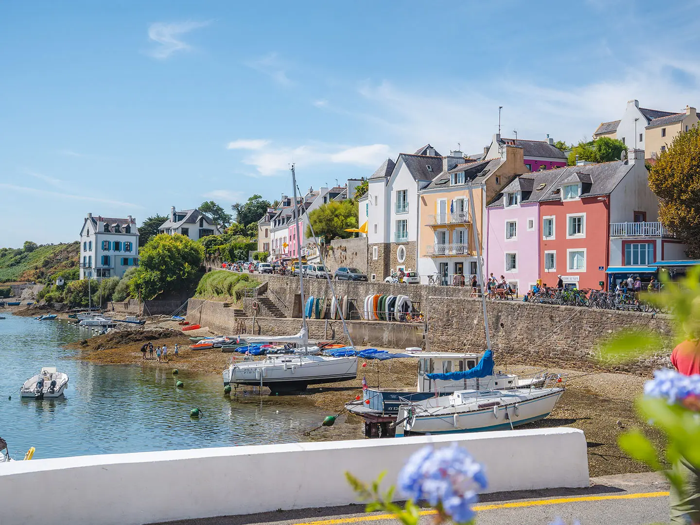
- Port de Sauzon: A colourful fishing harbour on the north coast and a useful rest or refreshment stop. Many walkers use it as an early staging point.
- Les Aiguilles de Port-Coton: Jagged sea stacks hammered by Atlantic surf and painted by Claude Monet in 1886. The clifftop approach is one of the signature views of the GR340.
- Grand Phare, Goulphar: A 19th-century lighthouse near Bangor, standing above the south-coast cliffs. It is a clear landmark on the wilder side of the island.
- Plage des Grands Sables: The island’s largest sandy beach, on the more sheltered eastern side. It makes a natural swimming or picnic break before the final return to Le Palais.
Challenges to expect
The GR340 is hard because of repetition, not altitude: short steep descents to coves and climbs back to the cliff path accumulate to about 2,800 m of ascent. Expect dirt and rocky coastal paths, sandy sections, minor road links and some narrow exposed clifftops. Atlantic weather can bring wind, mist and rain even in summer. Water, toilets and resupply are limited to villages, so carry enough between stops. For a very different mountain contrast, compare the Cirque de Gavarnie Trails.
HikeList Score
Tour de Belle-Île scored 84/100 on HikeList's trail-quality metrics.
See score breakdownHide breakdown
- Ideal length 85
- Balanced challenge 84
- Scenery & wildness 98
- Varied terrain 52
- Accommodation 75
- Food & support 88
- Path quality 98
- Season flexibility 89
Computed from length, challenge, scenery & wildness, terrain variety, accommodation, food & support, path quality and season flexibility.
 France
Show more data Show less
- Coastal
- Dirt
- Rocky
- Hotels
- Campsites
- Wild Camping Spots
- Family Friendly
- Pet Friendly
- Restrooms
- Water Sources
- Campsites
- Picnic Areas
Photos from hikers
Taken on the trail by people who've reviewed Tour de Belle-Île.
Start at Le Palais, the ferry port and main town, then follow the GR340 along the gentler north coast past the colourful harbour of Sauzon towards Pointe des Poulains, with the Vauban citadel behind you and the island’s exposed north-western headland ahead.
Continue from the lighthouse and Sarah Bernhardt site down the wild, Atlantic-facing west coast, passing Donnant beach and exposed clifftop sections before reaching the famous sea stacks of Les Aiguilles de Port-Coton.
A shorter but still undulating coastal stage from the Port-Coton cliffs towards the south coast, with the Grand Phare and Port Goulphar among the key landmarks before Herlin beach.
Follow the southern coastline eastwards to Locmaria, the island’s quiet southern commune and the turning point before the route begins to work north along the more sheltered east side.
Complete the loop from Locmaria back to Le Palais, passing the eastern side of Belle-Île and Plage des Grands Sables before returning to the ferry port.
Reviews
How would you rate Tour de Belle-Île?
Tap a star to start your review — you could be the first.