Toggenburg Panorama Trail
How would you rate Toggenburg Panorama Trail?
Tap a star to share your experience and help other hikers.
Toggenburg Panorama Trail: Route 48 Hiking Guide
HikeList Score
Toggenburg Panorama Trail scored 84/100 on HikeList's trail-quality metrics.
See score breakdownHide breakdown
- Ideal length 89
- Balanced challenge 80
- Scenery & wildness 98
- Varied terrain 71
- Accommodation 66
- Food & support 81
- Path quality 98
- Season flexibility 76
Computed from length, challenge, scenery & wildness, terrain variety, accommodation, food & support, path quality and season flexibility.
The Toggenburg Panorama Trail is the Toggenburger Hoehenweg, SwitzerlandMobility national hiking route 48: an 87 km, 5–6 day point-to-point high trail in north-eastern Switzerland. It runs from Wildhaus to Wil through the Toggenburg valley of Canton St. Gallen, with long views to the Churfirsten, Saentis/Alpstein, the Glarus Alps and Walensee. Rated hard here, it suits fit hikers comfortable with T2–T3 mountain paths, exposed sections and around 4,450 m of ascent.
Route Overview
The route is normally walked east to west, from Wildhaus at 1,098 m down to Wil SG in the Thur plain. Both ends are reachable by public transport from Zurich and St. Gallen, making this a practical point-to-point inn-to-inn hike. Official SwitzerlandMobility staging runs Wildhaus to Selunalp/Arvenbuel, then Tanzboden, Chruezegg, Muehlrueti/Hulftegg and Wil; many walkers split it into 6 days using mountain inns and Berggasthaeuser. The trail follows yellow Swiss waymarks with route number 48. If you are comparing Swiss multi-day routes, see the Alpine Pass Route or the shorter Davos to Arosa Panorama Trail.
Toggenburg history and route background
The Toggenburg valley is named after the medieval Counts of Toggenburg, an influential noble family who held the region from roughly the 12th to the 15th century. After the line died out in 1436, the area passed to the Abbey and Prince-Abbots of St. Gallen. The valley is also known for Swiss folk music, natural yodelling and the Klangwelt tradition. The Toggenburger Hoehenweg itself is a modern SwitzerlandMobility waymarked route linking alpine pasture paths along the valley’s western flank.
Notable highlights
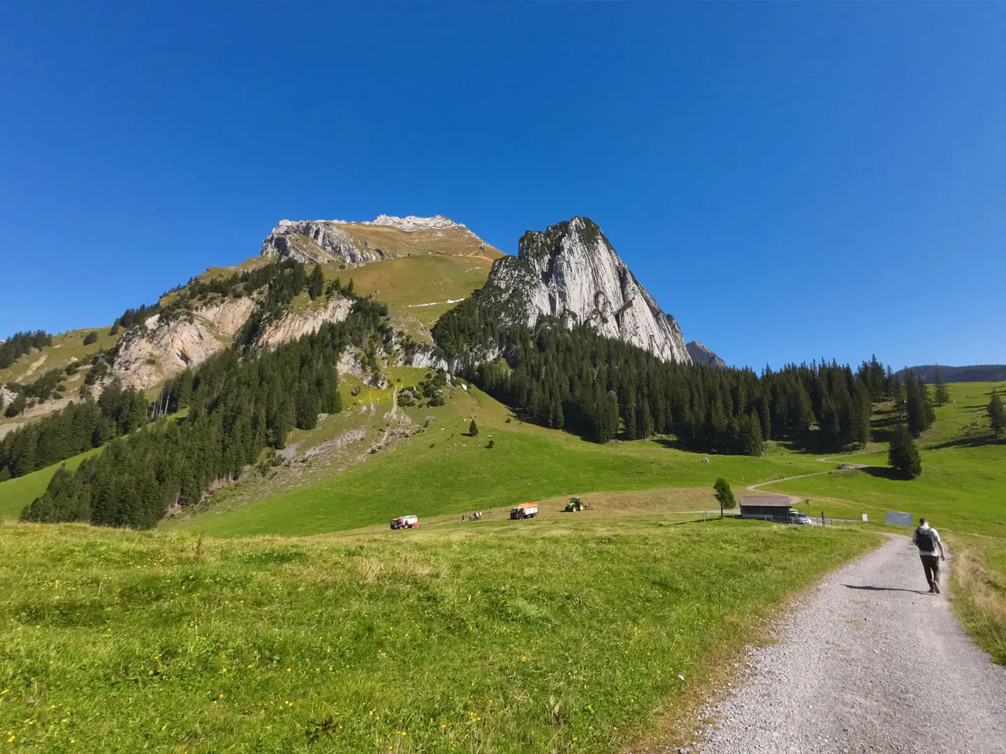
- The seven Churfirsten: A serrated row of limestone summits above Lake Walen, with Hinterrugg reaching 2,306 m. Their profile dominates much of the hike and gives the route its panorama character.
- The Tritt on the Leistchamm: The trail’s highest point at about 1,770 m and its main crux. This airy traverse requires sure-footedness and a head for heights, with views over the Walensee.
- Wildenmannlisloch cave: A prehistoric cave near Vordere Selunalp where Ice Age cave-bear bones and traces of Stone Age people have been found. It is one of the route’s most distinctive cultural stops.
- Klangweg and Sagenweg: The Sound and Legend trails above Wildhaus and Alt St. Johann use musical installations and local storyboards. They reflect Toggenburg’s strong folk-music identity.
- Saentis and the Alpstein: The 2,502 m Saentis, highest peak of the Alpstein massif, forms a major backdrop across the valley during the early stages.
- Schnebelhorn: At 1,292 m, this is the highest mountain in Canton Zurich. The route crosses it on the penultimate stage above Hulftegg before entering the rolling Zuercher Oberland.
Challenges to expect
Expect long mountain days, including an opening stage of about 21–22 km, around 4,450 m total ascent and exposed T2–T3 terrain. The Tritt on the Leistchamm is the key difficulty: do not attempt it in snow, ice or poor visibility. Higher pastures can hold snow into early summer, and rocky paths may be slippery when wet. For a glacier-view alternative, compare the Aletsch Glacier Panorama Trail.
HikeList Score
Toggenburg Panorama Trail scored 84/100 on HikeList's trail-quality metrics.
See score breakdownHide breakdown
- Ideal length 89
- Balanced challenge 80
- Scenery & wildness 98
- Varied terrain 71
- Accommodation 66
- Food & support 81
- Path quality 98
- Season flexibility 76
Computed from length, challenge, scenery & wildness, terrain variety, accommodation, food & support, path quality and season flexibility.
 Switzerland
Show more data Show less
- Mountainous
- Forest
- Dirt
- Gravel
- Rocky
- Hotels
- Huts
- Family Friendly
- Pet Friendly
- Restrooms
- Water Sources
- Picnic Areas
Photos from hikers
Taken on the trail by people who've reviewed Toggenburg Panorama Trail.
Start in Wildhaus and follow route 48 onto the high western side of the Toggenburg valley. The stage passes the Sound and Legend trail area, Alp Sellamatt and the Wildenmannlisloch cave near Vordere Selunalp before reaching the Arvenbuel/Amden area above Walensee.
Continue along alpine pastures and panoramic high ground, with views towards the Churfirsten, Saentis/Alpstein and the Glarus Alps. Tanzboden is a common overnight point, with mountain accommodation noted on the route.
The trail continues west along the Toggenburg high route towards Chruezegg. Terrain remains a mix of mountain paths, pastures, ridges and forested sections as the route gradually leaves the higher alpine character behind.
The shortest official stage crosses the Schnebelhorn, the highest mountain in Canton Zurich at 1,292 m. It marks the transition from the high Toggenburg into the gentler Zuercher Oberland near the St. Gallen/Zurich cantonal border.
The final stage descends through lower Toggenburg and the Thur plain to Wil SG. Terrain becomes more rolling and wooded, ending at a town with public transport connections.
Reviews
How would you rate Toggenburg Panorama Trail?
Tap a star to start your review — you could be the first.