Exe Valley Way
How would you rate Exe Valley Way?
Tap a star to share your experience and help other hikers.
Exe Valley Way: Estuary-to-Exmoor River Walk
HikeList Score
Exe Valley Way scored 91/100 on HikeList's trail-quality metrics.
See score breakdownHide breakdown
- Ideal length 89
- Balanced challenge 100
- Scenery & wildness 90
- Varied terrain 94
- Accommodation 100
- Food & support 81
- Path quality 80
- Season flexibility 89
Computed from length, challenge, scenery & wildness, terrain variety, accommodation, food & support, path quality and season flexibility.
The Exe Valley Way is an 84 km point-to-point walk in England, following the River Exe through Devon and onto Exmoor in Somerset. It runs from Starcross on the Exe Estuary to Exford, with an optional 12 km extension to Exe Head, the river’s source. Most hikers take 5–6 days. The route is moderate: largely valley paths, canal towpath, farmland and lanes, but with steep wooded climbs north of Tiverton and exposed moorland near the finish.
Route Overview
Walked south to north, the route starts at Starcross, where it meets the South West Coast Path, then follows the Exe Estuary and Exeter Ship Canal towpath into Exeter. It continues via Brampford Speke, Thorverton, Bickleigh, Tiverton, Bampton, Brushford and Hawkridge to Exford on Exmoor. The official Explore Devon stages split the walk into nine sections, but most people combine them into 5–6 walking days. Starcross and Exeter St Davids have railway stations, and buses serve many southern sections. For other easy waterside walking, compare the Ashby Canal Trail; for a longer coastal option, see the Anglesey Coastal Path.
River, canal and wool-town history
The Exe Valley Way was devised and waymarked by Devon County Council’s Explore Devon project with Exmoor National Park, linking the River Exe’s source country with the sea. Exeter has been a regional centre since Roman times and still has Roman walls, a medieval cathedral and a historic quay. The lower route follows the Exeter Ship Canal, which dates from the 1560s and includes England’s oldest pound lock. Tiverton grew wealthy on the medieval wool trade and has a Norman-founded castle.
Notable highlights
- Exe Estuary and Exminster Marshes: The southern end crosses estuary and marshland known for wading birds and wildfowl. It gives a level, open start with broad water views.
- Exeter and the historic Quay: The trail passes through Exeter, a cathedral city with Roman walls, a medieval cathedral and a revived quayside on the River Exe.
- Exeter Ship Canal towpath: A flat waterside section links the estuary with Exeter. The canal dates from the 1560s and is one of the easiest walking stretches of the route.
- Bickleigh: This mid-Devon village sits where the Exe valley narrows below Tiverton, with a well-known bridge, thatched cottages and Bickleigh Castle nearby.
- Tiverton: A practical midpoint for food and accommodation, Tiverton is a historic wool town on the Exe with a castle and access to the Grand Western Canal country park.
- Dulverton, Withypool and Exford: The northern end enters Exmoor, following the River Barle area and open moorland towards Exford, with a link to the Two Moors Way at Hawkridge.
Challenges to expect
Do not treat this as a flat river stroll. Meadows and woodland paths can be muddy after rain, and there are short busy-road sections in Exeter and Tiverton. North of Tiverton the valley sides become steeper, with strenuous climbs, and the Exmoor end is more exposed with sparser waymarking on open moor. If you want a more consistently upland walk, compare the Beacons Way.
HikeList Score
Exe Valley Way scored 91/100 on HikeList's trail-quality metrics.
See score breakdownHide breakdown
- Ideal length 89
- Balanced challenge 100
- Scenery & wildness 90
- Varied terrain 94
- Accommodation 100
- Food & support 81
- Path quality 80
- Season flexibility 89
Computed from length, challenge, scenery & wildness, terrain variety, accommodation, food & support, path quality and season flexibility.
 United Kingdom
 England
Show more data Show less
- Coastal
- River Valley
- Forest
- Moorland
- Farmland
- Paved
- Dirt
- Gravel
- Hotels
- Guesthouses
- Inns
- Campsites
- Family Friendly
- Pet Friendly
- Water Sources
- Campsites
- Picnic Areas
Download Our Full Guide to Exe Valley Way FREE!
Get our comprehensive guide to this hike for free. Save it for later reading or print out at home.

In these collections
Photos from hikers
Taken on the trail by people who've reviewed Exe Valley Way.
Exe Valley Way: The Complete Guide
 i
Image by Alan
i
Image by Alan The Exe Valley Way is a river journey with a clear beginning and end: from Starcross on the Exe Estuary to Exford on Exmoor, with the option to continue to Exe Head, the river’s source. It suits walkers who want a varied point-to-point trail rather than a high-level ridge route.
The southern stages are gentle and accessible, crossing estuary marshland, canal towpath and quiet Devon river country into Exeter and beyond. Exminster Marshes, Exeter’s quayside, Brampford Speke, Thorverton and Bickleigh give this half a practical, low-level walking rhythm.
North of Tiverton the route changes character. The path climbs through wooded valley sides towards Bampton, then becomes quieter and more exposed around Dulverton, Hawkridge, Withypool and Exford, where Exmoor navigation matters more.
This is not an extreme trail, but it is not a flat riverside stroll all the way. Expect 1,435 m of total ascent, muddier ground after rain, thinner transport near the finish and sparser waymarking on the moorland stages.
This guide covers stages, day planning, accommodation, food, transport, terrain and the common mistakes to avoid.
Stage-by-Stage Guide
The notes below use the common six-day walking structure for the Exe Valley Way. The official route is also split into shorter half-day sections, so these stages can be shortened or combined depending on fitness, daylight, accommodation and transport.
Stage 1: Starcross to Exeter — 13 km
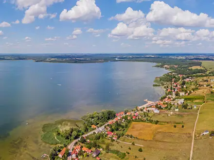
This is the easiest stage of the route: flat, open and straightforward underfoot. From Starcross, where the Exe Valley Way meets the South West Coast Path on the Exe Estuary, the route heads north past Powderham and the Exminster Marshes before joining the Exeter Ship Canal towpath into the city.
Surfaces are mostly paved or gravel shared-use path, canal towpath and a short section of very quiet road near Starcross. There are no stiles and no meaningful climbs, so this is the most accessible day of the whole walk.
Key landmarks include Powderham Castle and its deer park, the RSPB Exminster and Powderham Marshes, Turf Locks and the Exeter Ship Canal. The canal dates from the 1560s and has England’s oldest pound lock; the final approach into Exeter via the Quay is one of the most practical and enjoyable finishes on the route.
Food and drink are good for a rural waterside stage. The Turf Hotel at Turf Locks is a useful refreshment stop and is reached only on foot, by bike or by boat; the Double Locks Inn is another canalside option before Exeter. Exeter Quay and the city centre have cafés, pubs, restaurants and supermarkets.
Exeter is the best overnight base here, with the full range of hotels, B&Bs and hostels. Starcross has a pub and limited B&B options, but most walkers will find Exeter easier for accommodation and onward logistics.
Public transport is excellent by the standards of the route. Starcross has a railway station on the Riviera Line, with trains to and from Exeter St Davids, and buses 2/2B also link Starcross and Exeter. Exeter has extensive bus and rail connections.
Navigation is very simple: estuary path, canal towpath and the approach into Exeter Quay. The main points to watch are shared-use traffic on the path and normal care around road crossings and the short road section near Starcross.
Stage 2: Exeter to Bickleigh — 22 km
This is the longest stage in the six-day schedule and feels very different from the flat estuary walk. It starts from Exeter Quay and follows the Exe north, gradually leaving the city for field paths, farm tracks, quiet lanes and valley-side walking through mid-Devon.
The first part heads north from Exeter towards Cowley Bridge and Stoke Canon, then continues through Brampford Speke and Thorverton. Brampford Speke and Thorverton both make useful intermediate points, with village character and pub stops, but facilities are not continuous along the stage.
The section between Thorverton and Bickleigh is the crux of the day. The route climbs high onto the valley side, giving broad views back over the Exe valley, before descending steeply towards Bickleigh and Bickleigh Castle.
Underfoot, expect a mixture of riverside paths, field edges, rougher farm tracks, lanes and some road sections. Some roads have no pavement, particularly around the Exeter outskirts and the transition into the open valley, so traffic awareness is needed.
Bickleigh is a strong end point, with thatched cottages, the well-known bridge over the Exe, Bickleigh Mill and Bickleigh Castle nearby. Bickleigh Mill has food and accommodation, and the village has pubs and some B&B options, but beds should be booked ahead.
Food and water can be found at Brampford Speke, Thorverton and Bickleigh, but there are long enough gaps to justify carrying water and lunch from Exeter. Do not assume every village facility will be open when you arrive; this should be checked before travelling.
Public transport is still usable on this section. Buses 55 and 155 serve Stoke Canon and some points between Exeter and Tiverton, and Brampford Speke, Thorverton and Bickleigh are served by bus. There is also a regular bus link between Bickleigh and Tiverton.
Navigation is generally waymarked, but more care is needed than on Stage 1. The Thorverton-to-Bickleigh valley-side section has steeper ground, field paths and waymark-dependent junctions; follow the Exe Valley Way waymarks closely and carry mapping or a GPX file.
The main warnings are the length of the day, road sections without pavements, steep valley-side climbing and mud after rain. For many walkers this will feel like the first proper long-distance walking day of the route.
Stage 3: Bickleigh to Tiverton — 6.5 km
This is a short, attractive stage through wooded riverside country and is often treated as a half-day. Stronger walkers frequently combine it with the Exeter-to-Bickleigh stage, but it works well as a slower day if using Tiverton as a practical midpoint base.
From Bickleigh the route follows the east bank of the River Exe through oak woodland and farmland. It stays close to the river in places and includes a private suspension bridge section, a waterworks area, stiles and a ditch crossing.
The terrain is more enclosed than the previous day, with woodland paths, rougher field paths and some paved sections. Mud is common in wet weather, especially close to the riverside, and path edges can be less distinct after heavy rain.
The main highlight is the quiet woodland beside the Exe. In season, violets, early purple orchids and balsam can be seen along the damper wooded sections.
Food is available at the start in Bickleigh, including pubs and Bickleigh Mill, and Tiverton has full town facilities at the end. Tiverton offers supermarkets, cafés, pubs and restaurants, making it one of the easiest resupply points on the route.
Tiverton is also a sensible overnight stop, with hotels, B&Bs and pubs with rooms. It is the last larger town before the walk becomes hillier and more rural towards Bampton and Exmoor.
Public transport is straightforward compared with the northern stages. Regular buses connect Bickleigh and Tiverton, and Tiverton has good onward bus connections.
Navigation is relatively simple because the route is waymarked and broadly follows the river. The practical cautions are mud, stiles and care around field edges and the ditch crossing.
Stage 4: Tiverton to Bampton — 12.5 km
North of Tiverton the Exe Valley Way becomes noticeably hillier, quieter and more committing. This stage leaves the more settled lower valley and works through lanes, farmland, woodland and steeper valley sides towards Bampton on the edge of Exmoor National Park.
The walking is moderate but more strenuous than the distance suggests. Expect repeated ascents and descents, wooded valley sections, rougher ground after rain and some country lanes without pavements.
A useful landmark on the stage is Cove Bridge, an 18th-century stone bridge near Cove Cottage. The landscape feels increasingly enclosed and upland in character, with the wooded valley sides becoming steeper as the route heads north.
Bampton is an excellent end point before the harder Exmoor stages. It is an old wool town with a market square, church, pubs, shops and cafés, and it has Walkers Are Welcome status.
There are limited facilities between Tiverton and Bampton, so leave Tiverton with food and water for the day. Bampton has enough services for evening food and basic resupply, but opening times should be checked before relying on a specific shop or pub.
Accommodation in Bampton includes B&Bs and pub accommodation, including the Exeter Inn. It is a practical overnight stop before the route crosses towards Dulverton and the Exmoor fringe.
Bus 398 links Tiverton, Bampton and Dulverton, making this one of the last stages where public transport remains relatively useful. Road access exists along the valley, but the walking route uses a mix of paths and minor roads rather than one continuous roadside line.
Navigation needs more attention than on the lower valley stages. The route uses lanes and footpaths through farmland and woodland; OS Explorer 114 is the appropriate map for this section, and a GPX file is useful in poor weather or at unsigned field junctions.
The main warnings are steep wooded climbs, road walking without pavements and boggier rough sections after rain. This is the point on the trail where footwear, waterproofs and daylight planning start to matter more.
Stage 5: Bampton to Hawkridge — 17 km
This is the transition into Exmoor proper and one of the most important planning stages on the route. The trail crosses from Devon into Somerset, passes Exebridge, Brushford and Dulverton, then climbs towards Hawkridge, where it meets the Two Moors Way.
The first half crosses high farmland between the Batherm and Exe catchments, with broader views towards the Exmoor edge, then follows smaller valley country towards Brushford. Expect a mix of paved roads, rougher paths, gates and stiles.
Around Exebridge the route reaches the Devon-Somerset border area, where the Exe and Barle meet. Brushford has its medieval church, including a Lutyens chapel, before the route continues through fields and woods into Dulverton.
Dulverton is the key service point of the stage and a very practical overnight base. It has pubs, cafés, shops, accommodation and the Exmoor National Park Centre, and it marks a clear change from valley walking into more remote Exmoor terrain.
From Dulverton to Hawkridge the route leaves the River Exe and follows Barle country, with steeper wooded valleys and a more upland feel. The lower route option near Tarr Steps is well worth considering if time and energy allow; Tarr Steps is a prehistoric clapper bridge over the River Barle and one of Exmoor’s best-known landmarks.
Food and water are available in Bampton at the start and Dulverton part-way through the stage. Hawkridge has no facilities, so carry enough water and food from Dulverton for the final climb and any onward walking.
Accommodation planning is critical. Dulverton has the best choice of hotels, B&Bs and inns; Hawkridge is a tiny hamlet with no facilities, and walkers commonly overnight in Dulverton or continue beyond Hawkridge depending on their itinerary.
Bus 398 serves Tiverton, Bampton and Dulverton. There is no public transport to Hawkridge, so ending the day there requires a pre-arranged lift, a longer walk to accommodation, or a plan that uses Dulverton as the overnight stop.
Navigation becomes more demanding north of Dulverton. Waymarking is less consistent as the route approaches the open Exmoor sections, and OS Explorer OL9 plus a GPX file are strongly recommended.
The main warnings are remoteness after Dulverton, no services at Hawkridge, steeper climbs and greater exposure to wind and rain. Mobile signal can be limited on the Exmoor sections, so do not rely solely on online mapping.
Stage 6: Hawkridge to Exford — 13 km
The final stage of the main route is the most exposed and navigationally demanding. It leaves the enclosed valley character behind and crosses open Exmoor moorland via Withypool towards Exford.
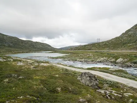
From Hawkridge, where the Exe Valley Way meets the Two Moors Way, the route heads through high open country towards Withypool Common and Withypool. The walking includes rough moorland paths, some lane walking and ground that can become wet or boggy in poor weather.
Withypool is the key intermediate place. It has the Royal Oak Inn, a shop/post office and a tearoom, making it the last reliable service point before Exford.
The route then continues across open moorland to Exford. This is classic Exmoor walking: broad, exposed, often quiet, and much more serious in mist, rain or strong wind than the southern sections of the Exe Valley Way.
Landmarks and highlights include Withypool Common, Withypool village, open moorland views, deer country and the arrival into Exford, where the River Exe runs through the village centre. Exford makes a satisfying main-route finish, with the village green and pubs close to the river.
Carry water and food from Withypool for the final moorland stretch. Exford has pubs and accommodation, including the Crown Hotel Exmoor and the Exmoor White Horse Inn, plus some B&B options.
Accommodation in Withypool is limited, and Exford accommodation should be booked ahead. Options are much thinner here than in Exeter, Tiverton or Dulverton.
Public transport is limited at this end of the route. There is no public transport to Hawkridge or Withypool, while bus 198 serves Exford. Check current timetables before building the end of the walk around a bus connection.
Navigation is the key issue. Waymarking is sparse in places on the open moorland between Hawkridge, Withypool and Exford; OS Explorer OL9 and a downloaded GPX file are strongly recommended, and mobile signal may be limited.
Do not attempt this stage in poor visibility without proper navigation equipment and the confidence to use it. The ground can be wet and boggy, facilities are sparse, and there is no easy public-transport escape between Hawkridge and Exford.
Optional Extension: Exford to Exe Head via Simonsbath — about 12 km
The main Exe Valley Way ends at Exford, but walkers wanting the source of the River Exe can continue to Exe Head. This adds about 12 km and is best treated as a separate full day rather than a casual add-on after finishing the main route.
From Exford the extension follows the Two Moors Way north towards Simonsbath, then continues for roughly 3 km to Exe Head on Dure Down. The source lies on high, open Exmoor moorland at over 440 m.
The terrain is exposed and navigation is more serious than on the lower river stages. Two Moors Way waymarkers help beyond Simonsbath, but the final approach to Exe Head is open moor with limited waymarking.
Simonsbath has accommodation, including The Simonsbath House Hotel, but it is a small village and options are limited. Food, transport and accommodation should be checked before travelling.
Carry full hillwalking navigation, waterproofs, food and water. In mist, heavy rain or strong wind, this extension should be approached as a moorland walk rather than a simple riverside finish.
Recommended Itinerary
The Exe Valley Way is usually most practical as a 5–6 day walk, with Exeter and Tiverton doing most of the logistical work in the first half and Dulverton or Exford anchoring the Exmoor end. The main planning decision is whether to overnight in smaller places such as Bickleigh and Hawkridge, or to reshape the stages around better-served stops such as Thorverton, Tiverton and Dulverton.
Distances on the Exmoor stages vary depending on the exact line used, especially around Hawkridge, Withypool and Exford. Check official mapping before booking accommodation or arranging luggage transfers.
Standard itinerary — 6 days
This version follows the main stage pattern in the route brief. It suits most walkers who are comfortable with one longer day out of Exeter and with limited services near the finish.
| Day | From | To | Approx. distance | Why this stage makes sense | Services/accommodation notes |
|---|---|---|---|---|---|
| 1 | Starcross | Exeter | 13 km / 8 miles | A straightforward opening day from the Exe Estuary into the city, using the level estuary, marsh and canal-side walking to ease into the route. | Starcross has limited accommodation, so many walkers start after arriving by rail. Exeter has the strongest accommodation choice on the route, plus food, shops and Exeter St Davids station. |
| 2 | Exeter | Bickleigh | 22 km / 14 miles | The longest day in the standard plan, continuing up the Exe valley via Brampford Speke and Thorverton before reaching the narrower valley around Bickleigh. | Thorverton has limited village accommodation and is a useful break point if this day feels too long. Bickleigh is very small; accommodation is limited, so book early or consider stopping elsewhere. |
| 3 | Bickleigh | Tiverton | 6.5 km / 4 miles | A deliberately short recovery stage after the long Exeter–Bickleigh day. It also leaves time for resupply and admin in Tiverton. | Tiverton is the best midpoint stop, with hotels, B&Bs, supermarkets and pub meals. It is the natural place to reset before the hillier northern half. |
| 4 | Tiverton | Bampton | 12.5 km / 8 miles | The route becomes quieter and hillier north of Tiverton, but this remains a manageable day before the more remote Exmoor approach. | Bampton has several B&Bs, pub options including The Quarrymans Rest, and a small-town feel. It is a sensible overnight before the Dulverton and Exmoor stages. |
| 5 | Bampton | Hawkridge | approx. 17 km / 10.5 miles | A tougher stage through the Exe valley fringe via the Exebridge, Brushford and Dulverton area, with more climbing and fewer easy exits. | Hawkridge is very limited for accommodation and services. Dulverton has far better options and is often the more practical overnight stop, even if it means reshaping the final stages. |
| 6 | Hawkridge | Exford | approx. 13–19 km / 8–12 miles; check official mapping before booking | A final Exmoor day, commonly involving open, quieter country and the Withypool area before Exford. Navigation and weather matter more here than on the southern stages. | Exford is a good finishing village with inns and B&Bs, including The Crown Hotel and The White Horse Inn. There is no railway at Exford, so onward transport needs arranging in advance. |
Slower itinerary — 7 days, with a better Exmoor service stop
This version suits walkers who prefer shorter days, want to avoid the 22 km Exeter–Bickleigh stage, or are booking accommodation in more practical overnight places. It also gives a cleaner split through Thorverton and Dulverton.
| Day | From | To | Approx. distance | Why this stage makes sense | Services/accommodation notes |
|---|---|---|---|---|---|
| 1 | Starcross | Exeter | 13 km / 8 miles | Keeps the first day simple and finishes in the route’s easiest city base. | Exeter has the best choice of beds, food and rail connections on the route. |
| 2 | Exeter | Thorverton | 16 km / 10 miles | Splits the long Exeter-to-Bickleigh section into a more comfortable valley day via Brampford Speke. | Thorverton is a small village with limited accommodation, including village B&B options and The Exeter Inn. Book before committing to this split. |
| 3 | Thorverton | Tiverton | 13 km / 8 miles, via Bickleigh | Avoids an overnight in very small Bickleigh while still giving time to pass through the village and continue to Tiverton. | Tiverton is the stronger overnight choice, with supermarkets, pubs, hotels and B&Bs. |
| 4 | Tiverton | Bampton | 12.5 km / 8 miles | A moderate day into quieter, hillier country without making the Exmoor approach too compressed. | Bampton is a practical small-town stop with several B&Bs and pub food. |
| 5 | Bampton | Dulverton | approx. 15 km / 9 miles, via Exebridge and Brushford | Replaces a remote Hawkridge overnight with a better-served Exmoor gateway town. | Dulverton has the best services in the northern half: multiple B&Bs and hotels, restaurants and shops. |
| 6 | Dulverton | Withypool or Hawkridge | approx. 13–15 km / 8–9 miles; check official mapping before booking | Breaks the Exmoor section into a manageable day and avoids a very long final push to Exford. | Withypool has limited but useful village accommodation, including The Royal Oak Inn. Hawkridge is more remote and has very limited services. |
| 7 | Withypool or Hawkridge | Exford | approx. 8–12 km / 5–7 miles; check official mapping before booking | Leaves a shorter final day across Exmoor country, useful if onward transport from Exford is awkward. | Exford has good finish accommodation for a small village, but no railway. Plan the exit before starting the walk. |
| Optional 8 | Exford | Exe Head extension | 12 km / 7.5 miles | Adds the source of the River Exe for walkers wanting the full river-source finish beyond the main Starcross-to-Exford route. | Transport and accommodation arrangements for this extension should be checked before travelling. |
Faster itinerary — 4 days for strong walkers
A 4-day crossing is possible but not the best choice for most walkers. It means repeated 25–30 km days, including long sections after Exeter and Tiverton, and it leaves little margin for poor weather on Exmoor.
| Day | From | To | Approx. distance | Why this stage makes sense | Services/accommodation notes |
|---|---|---|---|---|---|
| 1 | Starcross | Exeter | 13 km / 8 miles | A short first day is often preferable to forcing Starcross to Thorverton in one push, which would be about 29 km / 18 miles. | Exeter is the most reliable first overnight, with rail access and extensive accommodation. |
| 2 | Exeter | Tiverton | 28.5 km / 18 miles, via Thorverton and Bickleigh | A long but logical linking day that removes the need to find beds in smaller valley villages. | Tiverton has the services needed after a big day: accommodation, supermarkets and food. |
| 3 | Tiverton | Dulverton | 29.5 km / 18 miles | A demanding hillier day through the quieter northern half, finishing at the best-served Exmoor gateway town. | Dulverton is far more practical than smaller nearby settlements for food and beds. Book ahead. |
| 4 | Dulverton | Exford | approx. 19 km / 12 miles; check official mapping before booking | A final Exmoor stage to the main finish, still long enough to require good navigation and an early start in poor weather. | Exford has inns and B&Bs, but no railway. Public transport is limited at this end, and onward travel should be arranged in advance. |
Planning the Route
How many days to allow
Most through-walkers should plan the Exe Valley Way over 5–6 walking days. The route is not long by national-trail standards, but the northern half is slower than the lower Exe Valley, and the finish on Exmoor needs proper navigation and weather margins.
The official Explore Devon guide divides the route into 10 shorter half-day sections, which works well for leisure day walks or local section hiking. Through-walkers usually combine these into longer days, using the practical overnight bases at Exeter, Tiverton, Bampton, Dulverton and Exford.
A 4-day crossing is possible for fit walkers who are comfortable with long days and have accommodation or transport fixed in advance. It is less forgiving if weather turns on Exmoor, or if beds are not available in the small villages.
The route has two very different halves
Planning is easiest if the walk is treated as a lower-valley section followed by a hillier Exmoor approach.
| Section | Character | Planning implications |
|---|---|---|
| Starcross to Tiverton | Level estuary, canal towpath, river meadows, farmland and lanes | Easier pacing, more services, good rail and bus options, suitable for shorter days or section walks |
| Tiverton to Exford | Steep wooded climbs, quieter lanes and tracks, open Exmoor moorland near the finish | Fewer services, sparser transport, more important navigation, more exposed to poor weather |
The southern stages are forgiving: Exeter and Tiverton give plenty of choice for food, accommodation and onward travel. North of Bampton the route becomes more committing, with longer gaps between services and fewer easy exit points.
Sensible itineraries
The standard 6-day outline is a practical starting point, but it needs adapting around accommodation. In particular, Hawkridge is tiny and has no services, so it should not be treated as an overnight base unless a pick-up, transfer or off-route accommodation has been arranged.
| Day | Section | Approx. distance | Planning notes |
|---|---|---|---|
| 1 | Starcross to Exeter | 13 km | Straightforward first day with excellent services at Exeter |
| 2 | Exeter to Bickleigh | 22 km | Longer but still in the easier southern half; Bickleigh accommodation is limited |
| 3 | Bickleigh to Tiverton | 6.5 km | Very short as a standalone day; often combined or used as an easier recovery stage |
| 4 | Tiverton to Bampton | 12.5 km | The route becomes hillier north of Tiverton; Bampton has limited but useful accommodation |
| 5 | Bampton to Hawkridge | 17 km | Do not rely on Hawkridge for services; plan accommodation, taxi or onward walking carefully |
| 6 | Hawkridge to Exford | 13 km | Exmoor stage with sparser waymarking and more exposed ground |
For a 5-day itinerary, the short Bickleigh–Tiverton section is usually the one to absorb into another day. Combining it with either the approach from Exeter or the onward stage to Bampton makes the walking more efficient, but accommodation availability should decide the final plan.
Accommodation drives the schedule
The Exe Valley Way is not a route where any village can be assumed to have a bed. Daily stages are largely dictated by the real accommodation pattern, especially after Tiverton.
Exeter is the easiest first major base, with full city services and transport links. Starcross is the estuary start and has some B&B provision, but most walkers will find Exeter more practical for a first overnight stop or pre-walk night.
Bickleigh is attractive but has limited accommodation; the Fisherman’s Cot Inn is a known option, but availability should be checked before building an itinerary around the village. Tiverton is the key midpoint and a sensible place to pause, resupply and reset before the hillier northern half.
Bampton has limited but sufficient small-town provision, while Dulverton is a stronger Exmoor gateway base with a better accommodation choice, including hotels, pubs and B&Bs. Exford is small but set up for walkers, with options including the Crown Hotel, the White Horse Inn and Exford YHA.
Accommodation on Exmoor should be booked early, particularly in July and August, at weekends and around bank holidays. Exford and Dulverton are the most important places to secure before committing to dates.
Food and water planning
Food planning is simple in the southern half and more important in the northern half. Exeter, Tiverton and Bampton are the main practical resupply points.
North of Bampton, carry enough food and water for the day rather than relying on cafés or shops appearing at convenient intervals. The moorland stages have no reliable shop or café provision, and a missed lunch stop can become a long gap.
Navigation and maps
The route is waymarked in both directions, so either northbound or southbound walking is practical. The southern stages through the estuary, canal and lower valley are generally straightforward to follow.
Navigation becomes more important from the Exmoor approach onwards. Waymarking is sparser on the moorland finish, and mist, rain or low cloud can make open ground feel much less obvious than the map suggests.
Carry proper mapping, not just a phone. The most useful OS maps are:
- OS Explorer 114 — Exeter & Exe Valley
- OS Explorer OL9 — Exmoor
A downloaded GPX track is strongly recommended for the Exmoor stages, but it should supplement rather than replace map-and-compass competence. Walkers heading for Exe Head should be especially confident navigating open moorland.
Transport planning
Transport is easy at the southern end and progressively harder towards Exmoor. Starcross and Exeter St Davids have rail access, and Exeter is the obvious transport hub.
For section hiking between Starcross and Tiverton, public transport is useful. Bus routes 2, 2B, 55 and 155 connect places including Starcross, Exeter, Brampford Speke, Thorverton, Bickleigh and Tiverton, making day walks and returns relatively straightforward.
North of Bampton, public transport becomes much thinner. Bus 398 serves Bampton and Dulverton from Tiverton but is infrequent, while Withypool and Hawkridge have no bus service. Exford has limited access by bus 198 between Minehead and Dulverton.
Timetables should be checked before travelling, especially if finishing at Exford or shortening the walk at Dulverton. A taxi, support driver or pre-booked transfer may be the difference between a simple finish and a difficult exit.
Section hiking
The Starcross–Tiverton half is very suitable for section hiking. Rail at Starcross and Exeter, plus the bus links through the lower valley, make it possible to walk individual stages without needing a car at both ends.
The Tiverton–Exford half is much less convenient as a set of day walks. Bampton and Dulverton are manageable with planning, but Withypool, Hawkridge and the open moorland sections are awkward without a taxi, support driver or a route variation.
For experienced walkers, the Exmoor end can be combined with other paths. The route links with the Two Moors Way at Hawkridge, which gives options for longer moorland itineraries rather than a simple end-to-end crossing.
Shortening or extending the walk
Finishing at Dulverton is the most practical way to shorten the route while still reaching Exmoor. It avoids the more exposed final stages to Exford, though it also removes much of the moorland finish.
Extending from Exford to Exe Head adds about 12 km / 7.5 miles and turns the walk into a source-to-sea or sea-to-source journey, depending on direction. This is remote open Exmoor walking and should only be added with good weather, proper mapping and enough time in hand.
Walking southbound is equally valid because the route is waymarked both ways. It gives the more remote Exmoor navigation at the start and finishes with easier walking down the valley to the estuary.
Season and weather planning
The most comfortable walking seasons are April to June and September to October. These months usually give better walking conditions than high summer and reduce some accommodation pressure, though Exmoor weather can still change quickly.
July and August bring the busiest accommodation period, especially in Exmoor villages. Book well ahead if walking during school holidays.
Winter walking is possible on the lower valley sections, but the Exmoor stages can be wet, bleak and difficult to navigate. Inexperienced walkers should avoid committing to the moorland finish in poor winter conditions.
Luggage transfer and organised options
Independent walkers can use luggage transfer to make the hillier northern stages easier. Luggage Transfers Ltd operates on this route during the main walking season, but current operating dates and terms should be checked before booking.
Self-guided walking holiday operators also package the route with accommodation, and commonly operate between April and October. These can be useful where Exmoor accommodation, luggage movement and end-of-route transport are the main complications.
Planning priorities
For this route, sort the difficult logistics first:
- Accommodation — especially Dulverton, Exford and any night near Hawkridge or Withypool.
- End transport — Exford is not a place to leave until the last minute.
- Navigation — carry OS mapping and a GPX track for Exmoor.
- Food and water — plan for longer gaps north of Bampton.
- Weather — check the forecast before committing to the final moorland stages.
Permit planning is not a significant part of this itinerary; the real constraints are beds, transport, navigation and Exmoor conditions.
Towns, Villages and Overnight Stops
The Exe Valley Way is easiest to book from the larger service centres outwards. Exeter, Tiverton, Bampton, Dulverton and Exford are the key overnight bases; Starcross, Thorverton, Bickleigh and Withypool can also work, depending on your daily distances.
Facilities become noticeably thinner after Bampton. From Dulverton onwards, assume short opening hours, limited public transport and a need to book beds and evening meals in advance.
Starcross
Starcross is the southern trailhead on the west bank of the Exe Estuary, where the route meets the South West Coast Path. It is a practical start or finish point rather than a major overnight base.
The village has GWR rail access at Starcross station on the Exeter–Paignton line, with Exeter St Davids about 15 minutes away by train. Buses also run towards Exeter, with Sunday services typically less frequent; this should be checked before travelling.
Accommodation is limited but useful if starting early or finishing late. Options include the Driftwood Inn, which has en-suite letting rooms, and The Croft B&B near Cockwood Harbour, about a mile away.
Food and drink options include the Driftwood Inn and the Atmospheric Railway Inn opposite the station. Shops are minimal, so arrive with snacks and water or stock up in Exeter.
A summer ferry links Starcross with Exmouth across the estuary. It is not needed for the Exe Valley Way itself, but can be useful for walkers connecting with other estuary routes or making a wider trip.
Powderham
Powderham is passed early on the estuary section between Starcross and Exeter. It is best treated as a through-point rather than an overnight stop for the Exe Valley Way.
Do not rely on Powderham for trail logistics unless specific facilities have been checked in advance. Most walkers either start at Starcross and continue to Exeter, or use Starcross/Exeter for accommodation and transport.
Exminster Marshes
The route crosses the open, level Exminster Marshes on the approach to Exeter. This is a walking section rather than a place to base yourself overnight.
There are no major hiker services on the marsh section itself. Carry water and food from Starcross or Exeter, especially outside summer opening hours.
Exeter
Exeter is the most useful southern base on the route and the logical first overnight stop for many northbound walkers. The route approaches via the Exe Estuary and canal towpath, then passes the historic Quay before continuing north up the valley.
Accommodation is extensive, including city hotels, B&Bs, hostels and short-stay rentals. It is the easiest place on the route to find last-minute rooms, although weekends and university dates can still be busy.
Food, drink and resupply are excellent. The Quay and city centre have a wide choice of pubs, cafés and restaurants, and Exeter is the best place to buy maps, outdoor kit, stove fuel where available, and trail food before heading north.
Transport is strong. Exeter St Davids is the main intercity rail hub, with services towards London Paddington, Bristol, Plymouth and beyond; Exeter Central also serves the city. The bus network is useful for reaching villages on the southern half of the route.
Exeter is a good place to shorten, start or end a section hike. If accommodation further north is tight, it is often easier to use Exeter as the booking anchor and arrange onward stages from there.
Brampford Speke
Brampford Speke lies north of Exeter, above the River Exe on red sandstone cliffs. It is close enough to the city that most walkers continue beyond it, but it can be useful for a short first day after Exeter.
Facilities are limited. The Agricultural Inn serves food and drink, and there are small village facilities including a corner shop/tea room, but opening hours should be checked before depending on them.
Accommodation is not extensive, though Exe Valley Bed & Breakfast in the village can make Brampford Speke a practical stop for walkers wanting to split the Exeter-to-Bickleigh section. There is no railway station; bus links run back towards Exeter.
Thorverton
Thorverton is one of the most useful intermediate stops between Exeter and Bickleigh. It sits roughly halfway along that section and suits walkers who prefer shorter days or who are building a gentler itinerary.
The village is about a mile west of the River Exe, so allow for the short approach if staying overnight. Accommodation includes The Mitre Inn, which has B&B rooms and is well suited to walkers.
Food and drink options include The Thorverton Arms, and the village has useful local food sources including farm shops and Berry Dairy store. Check opening times before relying on them for evening meals or packed-lunch supplies.
There is no train station. Bus services connect back towards Exeter, but frequencies should be checked before planning a section-walk exit here.
Bickleigh
Bickleigh is a natural overnight or lunch stop at the end of the longer Exeter-to-Bickleigh stage. It is a small village, so book ahead rather than assuming a bed will be available.
The Fisherman’s Cot is the main food-and-drink stop, set beside the River Exe near the well-known bridge. The village has limited everyday facilities beyond the pub and nearby visitor-focused businesses.
Accommodation options are specific rather than plentiful. Exe Valley Glamping offers safari-style tents near the river, and Bickleigh Castle has accommodation suitable for groups.
Bickleigh also works as a useful place to split the route before the short onward stage to Tiverton. From here, the official route continues through oak woodland and along the riverbank towards the town.
Tiverton
Tiverton is the practical midpoint of the Exe Valley Way and one of the most important overnight stops. It is a proper service town and the best place to reset before the hillier northern half.
Accommodation includes hotels, B&Bs and guesthouses, with more choice than the villages either side. Pubs, restaurants, supermarkets, pharmacies, banks, outdoor shops and a post office make Tiverton a strong resupply point.
The Pannier Market adds useful local shopping, with general market days and smaller markets during the week; check current opening days before relying on it. The Grand Western Canal Country Park is close by and can be worth allowing time for if the walking schedule is relaxed.
Tiverton Parkway station is not in the town itself. It lies about 3 miles east at Sampford Peverell, with mainline GWR services, and local buses connect the station, Tiverton and Exeter.
Leaving Tiverton northbound, the character of the walk begins to change. Use the town to buy food for the next stage, confirm bookings in Bampton and Dulverton, and check onward transport if section hiking.
Bampton
Bampton is a small but well-equipped market town on the Devon/Somerset border and the last town with full services before the route reaches the more remote Exmoor section. It is a designated Walkers Are Welcome town and an excellent overnight stop.
Accommodation is relatively strong for a small town. Options include The Exeter Inn, The Ginger Peanut, Heron House, and self-catering properties such as Coombe Dene and Acer Cottage.
The Exeter Inn provides pub food and ales, and the town has cafés, eateries and independent shops. This is a sensible place to resupply before the climb towards Exmoor and the quieter stages beyond.
Bus links are more limited than in Exeter or Tiverton, mostly towards Tiverton. Public transport thins markedly north of here, so do not leave taxi arrangements, pick-ups or exit plans until the last minute.
Exebridge
Exebridge is a small hamlet on the Devon/Somerset border where the route crosses the Exe. It is useful as a break point rather than a main overnight base.
The Anchor Inn is the main facility and can work well for lunch or a rest stop. Other services are very limited, so walkers should not depend on Exebridge for shopping or accommodation without prior arrangements.
Brushford
Brushford is a small village between Exebridge and Dulverton. It is mainly a through-point on the route.
Facilities are limited, and Dulverton is the stronger target for beds, meals and supplies. If planning to stop in or near Brushford, accommodation and food should be arranged in advance.
Dulverton
Dulverton is the main service centre on the Exmoor section and one of the most useful overnight stops on the whole route. It sits where the River Barle meets the River Exe, in steep wooded valley country.
Accommodation includes The Lion Hotel, self-catering cottages, holiday lets and other nearby options. Book ahead, especially at weekends and during holiday periods.
Food options are good for a small town. Choices include Woods Bar and Restaurant, The Bridge Inn, Tarr Farm Inn, Tongdam Thai Restaurant, Mortimers, Tantivy Café, The Copper Kettle and The Lion Hotel Tap Bar.
Dulverton is also the last proper shopping stop before Exford. The town has more than 40 independent shops, including a butcher, greengrocer, delicatessen and a fishmonger on selected days outside the library; opening days should be checked before relying on them.
There is no railway station and public transport is limited. After Dulverton, onward public transport across Exmoor is very sparse, so taxis, pre-arranged lifts or walking the full stage are the realistic options.
Hawkridge
Hawkridge is a tiny moorland village above the Barle valley and an important route junction rather than a service centre. The Exe Valley Way meets the Two Moors Way here, making it useful for walkers linking routes.
Facilities are extremely limited. There is no pub and no shop, so carry food and water through this section.
Accommodation is limited but possible, including East Hollowcombe Farm, an 18th-century farmhouse B&B in the village. Because options are scarce, any overnight plan around Hawkridge needs to be booked well in advance.
Tarr Steps, the ancient clapper bridge over the River Barle, is accessible from the route near this part of Exmoor. If adding the detour, allow time and do not rely on Hawkridge itself for supplies afterwards.
Withypool
Withypool is a small Exmoor village between Hawkridge and Exford. It is a useful secondary overnight stop or refreshment point if you want to divide the final Exmoor section more gently.
The Royal Oak Inn is the main hub, with en-suite bedrooms, food and drink. Mole End B&B is another accommodation option, and Withypool Tea Rooms usually provide light meals and cream teas in the spring-to-autumn season.
The village also has a shop and post office, but opening hours can be limited. Do not arrive late assuming that food will be available.
Navigation becomes more important on the open moorland between Withypool and Exford. Waymarking can be sparse, so carry a map and GPS and avoid treating this section like the lower valley paths.
Exford
Exford is the northern end of the main Starcross-to-Exford route and the key final overnight stop. It is a small Exmoor village on the River Exe, with enough facilities for walkers finishing the route but little transport flexibility.
Accommodation includes The Crown Hotel, the White Horse Inn, B&Bs and self-catering options. The Crown and White Horse both serve food and are central to village life, making them practical choices for tired walkers.
Facilities include a village shop/post office, tea rooms and a garage. Stock is limited compared with Dulverton, so Exford should not be treated as a major resupply point unless needs are simple.
There is no railway station and no regular bus service. Taxis from places such as Taunton or Dulverton may be needed, and onward travel should be arranged before setting out on the final stage.
Exford is also the launch point for the optional continuation to Exe Head. If continuing, check the weather, carry navigation equipment and avoid starting late in poor visibility.
Simonsbath and Exe Head Extension
The optional extension beyond Exford continues via Simonsbath towards Exe Head, the source of the River Exe. This adds about 12 km / 7.5 miles and changes the route into a more exposed moorland finish.
Simonsbath is a small Exmoor village with limited facilities, including the Exmoor Forest Inn. It is the only named settlement on the extension before the source area.
Exe Head itself has no facilities. The extension is best tackled in clear weather with a map and GPS, as the moor is sparsely waymarked and the ground can be exposed and wet after rain.
Getting to the Start
The Exe Valley Way starts at Starcross on the west shore of the Exe Estuary, where the route meets the South West Coast Path. Starcross is unusually convenient for the start of a rural long-distance walk because it has both a railway station and regular bus links from Exeter.
Most walkers with public transport access should aim for Exeter first, then make the short final hop to Starcross. This is also the simplest approach for anyone staying in Exeter the night before: the first stage returns north through Exeter via the Exeter Ship Canal and Quay, so taking a morning train or bus out to Starcross and walking back into the city is a normal and practical way to begin.
By train
Starcross station is on the Exeter–Plymouth line, served by Great Western Railway local services between Exmouth and Paignton. Trains call at Starcross approximately hourly through the day, but exact times should be checked before travelling.
From Exeter St Davids, the train to Starcross is direct and takes about 12–16 minutes. Exeter St Davids is the key rail hub for this walk, with direct Great Western Railway services from London Paddington taking just over 2 hours at their fastest, and roughly hourly services from Bristol Temple Meads taking about 1 hour 15 minutes.
Travellers from Birmingham, Manchester and other northern cities can use CrossCountry services to Exeter St Davids, then change onto the local train to Starcross. Tickets and live times are available through GWR, National Rail or other rail booking platforms.
Starcross station is a small, unstaffed halt and has no station car park. If arriving by train, plan to start walking directly from the village rather than relying on station facilities.
By bus
Stagecoach South West route 2 runs between Exeter and Newton Abbot via Exminster, Dawlish and Teignmouth, stopping at Starcross. It is a frequent service, with buses around every 20 minutes on weekdays and around every 30 minutes on Sundays.
From Exeter Bus Station to Starcross, the journey takes approximately 25–36 minutes and passes through Exminster village. This is a useful option if arriving in Exeter by coach, or if the local train times do not suit.
Bus frequencies and stopping points can change, especially outside weekday daytime periods. This should be checked before travelling.
By car
Starcross sits on the A379 Exeter–Dawlish road, about 13 km / 8 miles south of Exeter city centre. From the M5, leave at junction 30 for Exeter and Dawlish, then follow the A379 south through Exminster to Starcross; the drive from the motorway junction takes about 15 minutes in normal conditions.
Parking is the main issue for car-borne walkers. There is no long-stay or designated car park at Starcross itself, and on-street parking in the village is limited. Leaving a vehicle in Starcross for several days is not a straightforward option.
The practical solution is usually to park in Exeter, where there are multiple city-centre long-stay car parks, then take the train or bus to Starcross for the start. Anyone booking through a walking-holiday operator should ask whether secure parking can be arranged as part of the package.
From the nearest airport
Exeter Airport is the nearest airport, about 5 miles east of Exeter city centre and roughly 11–12 miles from Starcross by road.
Stagecoach route 4/4A runs from Exeter Airport to Exeter St Davids station and the city centre, several times an hour on weekdays. The journey to St Davids takes around 20–25 minutes; the current fare should be checked before travelling. From Exeter St Davids, take the GWR train to Starcross, which takes about 12–16 minutes; allow about an hour overall including connection time.
A taxi direct from Exeter Airport to Starcross takes approximately 20–25 minutes. Apple Taxis Exeter is the official airport taxi operator and can be pre-booked or arranged at the Taxi Desk in Arrivals; expect a fare in the region of £30–£45, with the exact fare to be checked when booking.
International travellers may find better flight options into Bristol or London, then continue by train to Exeter St Davids. From Bristol Temple Meads the rail journey to Exeter St Davids is about 1 hour 15 minutes; from London Paddington the fastest trains take just over 2 hours.
Where to stay before starting
Starcross is a small village with limited accommodation, so it is not the easiest place to use as a pre-walk base. B&Bs do exist nearby, including The Croft Guest House about 1 mile from Starcross on the A379, overlooking Cockwood Harbour and the Exe Estuary.
Most walkers will find Exeter more practical for the night before the walk. The city has a much wider choice of hotels, guesthouses and B&Bs, and the short morning train or bus journey to Starcross is simple.
Staying in Exeter also works well with the route layout. After starting at Starcross, the first stage follows the estuary and canal north into Exeter, so anyone based there can begin the walk from the official start without awkward extra transfers at the end of the day.
Getting Home from the Finish
Exford is a small village in the heart of Exmoor National Park, not a transport hub. There is no railway station, bus services are sparse, and a same-day onward journey needs careful timing.
For most walkers, the simplest plan is to stay in Exford on the final walking day and leave the following morning. This is especially important if finishing late, arriving on a Saturday, or relying on public transport.
By train
There is no train station at Exford. The two most useful railheads are Taunton and Tiverton Parkway, both around 28–29 miles from Exford by road.
| Rail station | Best for | How to reach it from Exford | Notes |
|---|---|---|---|
| Taunton | London, Bristol, Exeter and wider national rail connections | Bus 198 to Dulverton, then Bus 25 to Taunton; or taxi direct | Served by Great Western Railway and CrossCountry. Public transport usually needs a half-day plan. |
| Tiverton Parkway | Fast trains to London Paddington and Exeter St Davids | Taxi is the practical option; public transport involves connections via Dulverton | Fast trains to Exeter St Davids take about 12 minutes; London Paddington is around 2 hours on the fastest services. |
Taunton is usually the better public-transport railhead because Dulverton has a bus link to Taunton. Tiverton Parkway can be quicker by taxi, particularly for walkers returning towards Exeter, London or the start at Starcross.
Minehead is sometimes tempting because Bus 198 runs there from Exford, but it does not have a regular national rail station. The West Somerset Railway is a heritage line, not a through rail connection for standard homeward travel, so walkers going via Minehead still need onward bus travel to Taunton.
By bus
The key service from Exford is Bus 198, operated by AtWest, running between Dulverton and Minehead. It stops in Exford at Park Street Bus Shelter and Melcombe House.
Bus 198 is limited: roughly twice daily, Monday to Saturday, with no Sunday service to rely on. Typical Exford departures are in the morning, and the Exford to Minehead journey takes about 46 minutes. The timetable varies slightly between term time and school holidays, so check AtWest before committing accommodation or train tickets.
The most useful public-transport strategy is:
- Bus 198 from Exford to Dulverton — a short hop, typically around 15–20 minutes.
- Bus 25 from Dulverton to Taunton — for national rail services from Taunton.
Bus 25 links Dulverton with Taunton and stops at Taunton Rail Station South Side. It operates Monday to Friday, with weekend arrangements requiring checking before travel.
In peak season, Route 401 can add options between Bampton, Dulverton, Winsford, Withypool, Exford, Simonsbath and Lynmouth. It only operates in August–September, so it should be treated as a seasonal extra rather than a core escape route.
Do not finish the walk assuming there will be an evening bus out of Exford. Missing one of the limited departures can mean paying for a taxi or staying an extra night.
By car/taxi
Taxis are often the most reliable way to leave Exford, particularly for groups, late finishes or Sunday departures. Book ahead rather than expecting a vehicle to be available at short notice in the village.
Useful local operators include:
| Operator | Area / use | Contact |
|---|---|---|
| Chris's Car, Bampton | Exmoor, Dulverton, Tiverton Parkway | 0777 360 0125 |
| Chris's Taxis, Minehead | Minehead area | 01643 706656 |
| Anchor Taxis, Minehead | Minehead area | 01643 70 42 40 |
| AVA Cab, Minehead | Minehead area | 01643 703333 |
| Airport Travel South West | Exmoor, Taunton, Minehead, Tiverton | Check current contact details before booking |
| Parkway Taxis | Tiverton Parkway, Dulverton, Exmoor area | Check current contact details before booking |
Typical taxi costs to budget for are about £60–80 from Exford to Tiverton Parkway, £60–75 from Exford to Taunton, and £15–20 from Exford to Dulverton. These are planning estimates only; confirm current prices before booking.
If a car has been left at Starcross, the return journey normally means either arranging a shuttle or taking a taxi to Taunton, then a train to Exeter St Davids and onward local rail to Starcross. Some walking-holiday and luggage-transfer companies may be able to arrange vehicle shuttles, but this should be organised in advance.
From the nearest airport
Exeter Airport is about 35 miles from Exford by road. Bristol Airport is about 60 miles away.
Neither airport is convenient from Exford by public transport. A realistic airport transfer normally means a pre-booked taxi, or first getting to Taunton or Exeter and continuing from there by bus or taxi.
Where to stay at the finish
Staying overnight in Exford is strongly recommended if using public transport. The village is small, services are limited, and the main buses leave in the morning rather than giving walkers much flexibility after a final day on the hill.
Exford has two walker-friendly pubs/hotels: The White Horse Inn, a 16th-century inn on the River Exe, and The Crown Hotel, a 17th-century coaching inn. Both suit a post-walk stop with food and accommodation, but rooms should be booked ahead, especially in the main walking season.
Avoid planning a Saturday finish with a Sunday public-transport departure unless a current timetable shows a workable service. Carry at least one taxi number as a backup before setting out on the final stage into Exford.
Which Direction Should You Walk?
The Exe Valley Way can be walked either way and is waymarked in both northbound and southbound directions. For most walkers, the better direction is south to north: Starcross to Exford, with the optional continuation to Exe Head if you want to reach the source of the River Exe.
This is also the standard direction. The official Explore Devon guide presents the route from the Exe Estuary to Exford on Exmoor, and most walking-holiday itineraries follow the same logic.
South to north: Starcross to Exford
South to north gives the cleanest journey and the easiest start. Starcross has a railway station on the Exeter–Plymouth line, with regular Great Western services to Exeter St Davids, and buses also run between Starcross, Exeter and Newton Abbot through the day. It is a straightforward place to reach without complicated rural transfers.
The walking also builds in the right order. The route begins with level estuary, marsh and canal-side walking into Exeter, then follows the valley north through Brampford Speke, Thorverton and Bickleigh. Tiverton makes a practical mid-route stop before the terrain becomes hillier and quieter towards Bampton, Dulverton, Hawkridge, Withypool and Exford.
This direction saves the harder ground for the second half of the walk. The steep wooded valley sides north of Tiverton and the more exposed Exmoor sections come after several easier days, which suits walkers who want to settle into the route before tackling the rougher and more remote stages.
The finish is also much stronger. Arriving in Exford after walking inland from the estuary feels like a proper long-distance end point, and the optional extension to Exe Head gives a clear final objective at the source of the river. In unsettled weather, south-westerly winds may also be more favourable on the exposed later stages, though this should be treated as a small advantage rather than a deciding factor.
The main drawback is transport from Exford. Exford is a small Exmoor village with limited public transport: the 198 bus links Dulverton and Minehead but runs infrequently, and demand-responsive local transport requires advance booking. A taxi to Minehead or Dulverton is often the most practical onward option, and all services should be checked before travelling.
North to south: Exford to Starcross
Walking north to south is perfectly possible, and the waymarking supports it. It may suit walkers who already have a lift, taxi, accommodation package or other transport arranged to Exford before starting.
The main disadvantage is that the awkward transport comes at the beginning. Reaching Exford by public transport can involve an infrequent bus, a pre-booked demand-responsive service or a taxi, which is a more fragile way to begin a multi-day walk than taking a train to Starcross.
The terrain is also front-loaded. Starting from Exford means beginning with the more remote Exmoor and upper-valley stages, then gradually descending towards Tiverton, Exeter and the estuary. Strong walkers may like getting the hardest days done early, but it is less forgiving for fit beginners or anyone carrying a full pack.
The finish at Starcross is convenient, with rail access for the journey home, but it is less dramatic than ending on Exmoor. The final day becomes a return to the busier, flatter estuary rather than a build-up to open moorland.
Direction comparison
| Direction | Main advantages | Main drawbacks | Best for |
|---|---|---|---|
| Starcross to Exford | Easy rail access at the start; natural estuary-to-moor progression; harder terrain later; stronger finish; option to continue to Exe Head | Transport from Exford needs planning | Most walkers |
| Exford to Starcross | Convenient rail finish at Starcross; hardest ground completed early | Difficult start logistics; exposed and hillier stages immediately; less satisfying finish | Walkers with transport to Exford already arranged |
Recommendation
Walk the Exe Valley Way south to north, from Starcross to Exford. It gives the best combination of simple starting logistics, sensible terrain progression and a more rewarding finish on Exmoor. The reverse direction is viable, but it is best reserved for walkers who have already solved the transport problem to Exford and are happy to tackle the hillier, more exposed sections at the start.
Accommodation Along the Route
The Exe Valley Way is practical as an inn-to-inn walk, but the accommodation pattern is uneven. The southern half from Starcross to Tiverton has the easiest logistics, with Exeter and Tiverton offering the strongest choice. North of Tiverton the route becomes quieter and beds are more thinly spread, especially around Hawkridge and the moorland approach to Exford.
For a 5–6 day itinerary, the most useful overnight bases are Exeter, Bickleigh or Tiverton, Bampton, Dulverton or Withypool, and Exford. Hawkridge is a route junction rather than a realistic overnight stop, so plan to continue to Withypool or use Dulverton as the practical base for that section.
Accommodation by place
| Place | Accommodation level | Best for | Notes |
|---|---|---|---|
| Starcross | Limited / effectively none for most walkers | Starting the route | Very small village. Most walkers travel in and continue to Exeter the same day, or stay in Exeter the night before. |
| Exeter | Good | First night, city hotels, easy rail access | Full range of hotels, B&Bs and guesthouses. Exeter St Davids station makes it the simplest access point on the route. Book ahead around university events, Exeter Chiefs fixtures and busy summer weekends. |
| Brampford Speke / Thorverton | None to very limited | Passing through | Small villages with no notable walker accommodation. Not practical as overnight stops for most itineraries. |
| Bickleigh | Limited | Splitting Exeter to Tiverton into shorter days | Options include Bickleigh Castle B&B, The Fisherman’s Cot and Henbere Farm B&B. Choice is small, so book ahead or continue to Tiverton for more beds. |
| Tiverton | Good | Mid-route base, rest day, resupply | Strong choice for a market town, including B&Bs, guesthouses, hotels, farm stays and self-catering near the canal. Good practical stop before the hillier northern half. |
| Bampton | Limited to moderate | Last reliable stop before the Exmoor stages | Small but walker-friendly Devon market town with B&B and Airbnb-style accommodation, cafés, restaurants and independent shops. No chain-hotel choice; book ahead. |
| Brushford / Exebridge | Very limited | Emergency or short-stage break | Tiny settlements around the Devon/Somerset border. Do not rely on finding a bed without arranging it in advance. Most walkers continue towards Dulverton. |
| Dulverton | Good for the Exmoor section | Best upper-valley base, resupply, flexible staging | Largest settlement on the Exmoor stages, with B&Bs, inns and guesthouses. Town Mills B&B and Nutsford House are among the named options. Shops, pubs and restaurants make it the most practical base before the final moorland stages. |
| Hawkridge | None | Route junction only | Tiny hamlet where the Exe Valley Way meets the Two Moors Way. Do not plan to overnight here; continue to Withypool or arrange accommodation around Dulverton. |
| Withypool | Limited but useful | Key moorland overnight stop | Genuine options include The Royal Oak Inn, Mole End B&B and Westerclose House Cottages. Book early in summer, as capacity is small. |
| Exford | Good for its size, but limited capacity | Route finish, final night, Exmoor stay | Main finish village with The Exmoor White Horse Inn and the Crown Hotel, plus village services. Popular with walkers, riders and Exmoor visitors, so summer and bank-holiday beds go quickly. |
| Simonsbath / Exe Head extension | Requires separate planning | Optional source-of-the-Exe extension | The main route finishes at Exford. Anyone continuing to Exe Head should plan accommodation and return transport separately. This should be checked before travelling. |
Best overnight strategy
A straightforward 6-day schedule usually works best with nights in Exeter, Bickleigh or Tiverton, Bampton, Dulverton or Withypool, and Exford. The awkward section is the upper route between Bampton, Dulverton, Hawkridge, Withypool and Exford, where there are fewer beds and less public transport back-up.
Independent walkers who prefer shorter days may use Bickleigh between Exeter and Tiverton. Those wanting more choice often continue the extra 6.5 km to Tiverton instead, as the town has a much broader range of accommodation and services.
Bampton is an important stop because it is the last reliable accommodation base before the route becomes more rural. Beyond Bampton, Dulverton is the strongest base, while Withypool is valuable for breaking the final Exmoor stage before Exford.
Booking pressure and seasonality
Book the Exmoor villages first. Withypool and Exford fill fastest, particularly in July, August, Easter and bank-holiday weekends. For peak summer or bank holidays, booking 3–6 months ahead is sensible; for Easter, aim to have plans in place by January, and for August by March.
Outside May to September, some smaller Exmoor B&Bs may reduce opening days or close for parts of the season. Dulverton is the most resilient year-round base on the northern half, but opening dates, food service and check-in arrangements should still be checked before travelling.
Exeter and Tiverton are much easier to book at shorter notice, though Exeter can be busy during university events, major rugby fixtures and summer weekends.
Luggage transfer and transfers
Luggage transfer can make the Exe Valley Way much easier, especially on the hillier Tiverton-to-Exford section. Luggage Transfers Ltd covers the full Starcross-to-Exford route, with prices from £23 per bag per day and a 20 kg allowance; current prices and operating dates should be confirmed before booking.
Self-guided walking packages are also available from operators such as Let’s Go Walking, typically with accommodation and luggage transfer included during the main walking season. This can be useful if the Exmoor stages are already busy or if matching short walking days to available beds is proving difficult.
Taxi transfers can help solve awkward gaps around Hawkridge, Withypool or Exford, but availability is limited compared with the southern towns. Any taxi-based plan should be arranged in advance rather than left until the walking day.
Camping
Camping is not the simplest way to walk this route. Dedicated campsites close to the main line are limited, and the upper Exmoor section is not a place to assume informal camping will be possible.
The main named option close to the route is Exe Valley Caravan Site at Bridgetown near Dulverton. It is an adults-only site with pitches along the River Exe and normally operates March to October. It is primarily caravan and motorhome-oriented, so tent-only walkers should call ahead to confirm pitch availability.
Wild camping on Exmoor requires landowner permission; it is not a general right. Anyone planning a camping itinerary should arrange every night in advance rather than relying on finding a pitch at the end of the day.
Camping and Wild Camping
The Exe Valley Way can work as a camping walk, but it is not evenly supplied with campsites from end to end. The northern half, especially around Dulverton and Exford, is the strongest area for tent camping, camping barns and bunkhouse-style stops. The southern half from Starcross to Tiverton is more inhabited and better suited to B&Bs, inns or city accommodation, unless a suitable campsite is arranged off-route.
For a lightweight itinerary, the most practical camping focus is the Exmoor end of the route: Bampton, Dulverton, Hawkridge, Withypool and Exford. This is also where distances, transport and food options become thinner, so pitches or bunk beds should be booked ahead rather than treated as a fallback.
Campsites and budget camping options
| Place | Option | What to know |
|---|---|---|
| Exford / Westermill | Westermill Farm | Seasonal tent camping in a private Exe valley setting near the northern finish. Around 60 unmarked tent pitches, family shower rooms, laundry and drying room. Fire pits are available in the furthest field beside the river, subject to site rules. |
| Exford | YHA Exford | Hostel less than 1 km from the finish, with dorms, private rooms, a restaurant, garden, 20 outdoor camping spaces and a bell tent. Useful for a mixed hostel/camping finish. |
| Bridgetown / Dulverton | Exe Valley Caravan Site | Adults-only site for ages 16+. Accepts tents, caravans and motorhomes. Beside the River Exe and a mill stream, with shower/toilet block, shop, WiFi and dog walk. Season usually runs from mid-March to mid-October; prices and dates should be checked before booking. |
| Dulverton area | Northcombe Camping Barns | Two converted bunk barns at Northcombe Farm, about 1 mile from Dulverton, sleeping groups of 16 and 26. Equipped with cooker, fridge, microwave, shower and WC. Particularly useful for groups. |
| Bridgetown / Dulverton | Exmoor Bunkbarn | Hostel-style bunkhouse at Week Farm, Bridgetown, sleeping up to 25 people in three bunk rooms. A good bad-weather or group alternative to camping on the Exmoor stages. |
The Exford and Dulverton-area options are the key camping and budget-accommodation anchors for most walkers. If using them as stage ends, check walking distances carefully against the chosen itinerary, as the official short stages and common 5–6 day itineraries do not always place overnight stops in the same villages.
Wild camping legality
There is no general right to wild camp in England. Land along the Exe Valley Way is privately owned, and camping without the landowner’s permission is trespass.
This also applies inside Exmoor National Park. Exmoor has no Dartmoor-style legal wild-camping provision; the National Park Authority advises that landowner permission is needed before setting up camp overnight, however remote a place appears.
The open moorland near Withypool, Exford and the optional Exe Head extension may look like obvious lightweight-camping country, but it is precisely where permission matters most. Any planned wild camp should be arranged with the relevant landowner or land manager in advance. If permission cannot be obtained, use a campsite, hostel or bunkhouse instead.
Practical reality on the Exmoor end
Low-profile overnight camping on open moorland is sometimes tolerated when walkers arrive late, stay one night only, leave no trace and move on early. This is tolerance, not a legal right, and it can be withdrawn by a landowner or ranger at any time.
Do not camp in enclosed fields with livestock, near farm buildings, beside houses, on access tracks, in nature reserves or in SSSIs without specific clearance. Spring lambing and calving make field-edge camping especially inappropriate.
Fires, stoves and wildfire risk
Open fires and barbecues are prohibited on open moorland within Exmoor National Park. Disposable barbecues, cigarette stubs and glass bottles are a particular wildfire risk, and moorland fires can spread extremely quickly.
Use a camping stove where permitted and keep it stable, contained and well away from dry vegetation. Outside formal campsites, do not light fires. At campsites that provide fire pits, such as Westermill Farm, follow the site’s own rules and any seasonal fire restrictions.
Water for campers
The route follows the River Exe for much of its length, so water is often physically close at hand. It should not be treated as automatically drinkable.
River and stream water should be filtered or treated before drinking, particularly through farmland and grazing country. Carry enough water between villages and campsites, and do not wash, cook or toilet close to the river or tributaries.
Leave No Trace essentials
Pack out all rubbish, food waste and hygiene products. Do not bury litter or leave bags for someone else to collect.
Keep any toilet stop well away from water, paths, buildings and livestock, and follow proper backcountry hygiene. Avoid camping on fragile vegetation, wet ground or visibly protected habitats.
For the Exe Valley Way, a responsible camping plan usually means booked campsites or bunkhouses on the Dulverton–Exford end, indoor accommodation on the more settled southern stages, and no unpermitted wild camping on Exmoor.
Food, Water and Resupply
The Exe Valley Way is straightforward for food and water in the south, but becomes much more committing after Bampton and Dulverton. Exeter, Tiverton and Dulverton are the key resupply points; Hawkridge has no visitor facilities, and the Exe Head extension crosses open moorland with no services beyond Simonsbath.
Do not rely on the River Exe as a drinking-water source. Much of the route passes through farmland, and untreated river or stream water is inadvisable because of agricultural runoff and livestock. On the estuary and canal sections, water is not suitable for drinking. If natural water is needed on Exmoor, filter or treat it.
| Section | Food availability | Water availability | Notes |
|---|---|---|---|
| Starcross to Exeter | Starcross has shops, pubs and a café. No facilities on Exminster Marshes. Double Locks pub is on the Exeter Ship Canal; Countess Wear has a pub; Turf Lock is seasonal. Exeter has full city facilities. | Fill up at Starcross or Exeter. Pub/café refills may be possible on the canal approach. | Easy stage for supplies, but the marshes themselves are service-free. Turf Lock should not be treated as a year-round food stop. |
| Exeter to Bickleigh | Exeter is the best resupply point on the route. Brampford Speke has The Agricultural Inn and limited village options. Thorverton has a pub and shops for refreshments. Bickleigh has Bickleigh Mill café/restaurant, a village pub and limited shops. | Carry water from Exeter and top up at pubs/cafés where open. | Do not leave Exeter short of food. Village stops are useful for meals or drinks, not major resupply. |
| Bickleigh to Tiverton | Short section. Bickleigh has limited food options; Tiverton has supermarkets, independent shops, cafés, pubs and restaurants. | Water available at Bickleigh businesses if open and fully available in Tiverton. | Tiverton is the main mid-route stock-up before the hillier upper stages. |
| Tiverton to Bampton | Tiverton has major food shops, including Morrisons and Lidl, plus bakeries, cafés and restaurants. Bampton has a strong range of independent shops, cafés, restaurants and pubs. | Fill in Tiverton; Bampton has public toilets and free water refills at local cafés and restaurants. | A light food carry is usually enough, but Bampton is the last reliable multi-option resupply town before Exmoor proper. |
| Bampton to Dulverton via Exebridge and Brushford | Stock up in Bampton. Exebridge has The Anchor Inn for food if timing suits, but no shops. Brushford has no significant walker facilities. Dulverton has a Co-op, independent food shops, cafés, pubs and restaurants. | Carry from Bampton. The Anchor Inn may be a refill stop when open; otherwise continue to Dulverton. | Carry lunch and snacks. Dulverton is a critical resupply point before the quieter Exmoor stages. |
| Dulverton to Exford via Hawkridge and Withypool | Dulverton is well supplied. Hawkridge has no shop, café or public toilets. Withypool has the Royal Oak Inn, a small village shop and tea rooms. Exford has pubs/hotels, tea rooms and a well-stocked community shop. | Fill in Dulverton. Carry enough for Hawkridge. Refill in Withypool if open, then carry to Exford. | This is the most important section for planning. Carry two days of food from Dulverton, using Withypool as a useful but limited mid-point stop. |
| Exford to Exe Head extension | Exford has basic supplies and meals. Simonsbath has the Exmoor Forest Hotel/Inn. Beyond Simonsbath there are no facilities. | Carry full water from Exford or Simonsbath. Natural moorland water must be treated. | The ground beyond Simonsbath is open and exposed. Carry all food needed for the extension. |
Main resupply points
Exeter is the best full resupply on the whole route. The path passes through Exeter Quay, where there are cafés, bakeries, pubs and restaurants, and the city centre has major supermarkets, takeaways and plenty of places to eat. For a northbound walk, this is the place to buy the next day’s lunch and any extra snacks for the Exeter-to-Bickleigh stage.
Tiverton is the main mid-route resupply between Exeter and Dulverton. It has large food shops, including Morrisons and Lidl, plus independent shops, bakeries, cafés, pubs and restaurants. Stock up here for the transition into the quieter upper valley and the Bampton stage.
Bampton is smaller but very useful. It has a butcher, greengrocer/local produce shop, bakery, cafés, restaurants and pubs including the Exeter Inn, The Swan and The Quarryman’s Rest. As a Walkers are Welcome town, it is one of the most hiker-friendly stops on the route, with public toilets and local cafés/restaurants offering free water refills.
Dulverton is the critical Exmoor resupply stop. It has a Co-op open seven days a week, independent food shops including a butcher, greengrocer and deli, cafés, pubs and restaurants, plus the Exmoor National Park Information Centre. Leave Dulverton with enough food and water to cover the more isolated stages through Hawkridge, Withypool and Exford.
Limited and no-service stretches
The lower route has frequent places to stop, but not continuous services. Exminster Marshes are open and facility-free, so food and water should be carried from Starcross or Exeter. Between Exeter and Bickleigh, Brampford Speke and Thorverton are useful refreshment stops, but they are not dependable resupply towns.
North of Bampton the gaps become more important. Exebridge has The Anchor Inn, but no shops, and Brushford should be treated as a pass-through village. Hawkridge is very isolated and has no visitor facilities; do not plan to buy food, refill water or use toilets there.
Withypool is the main service point between Hawkridge and Exford, with the Royal Oak Inn, a small village shop and tea rooms. It is still a small moorland village, so carry enough to continue if opening times do not match the walking day. Exford has enough for an overnight finish, with pubs/hotels, tea rooms and a community shop.
Water strategy
Carry normal day-walk water on the southern stages, but do not let the presence of the River Exe create a false sense of security. River, canal and estuary water should not be drunk untreated, and on the lowland farming sections it is better to use mains-water refills from towns, pubs and cafés.
The most important water carries are:
- Exeter to Bickleigh: carry enough between pub and village stops, especially if walking outside normal opening hours.
- Exebridge/Brushford to Dulverton: The Anchor Inn is the useful stop at Exebridge; after that, do not rely on facilities until Dulverton.
- Hawkridge to Withypool: carry water from Dulverton or a previous reliable refill point. Hawkridge has no facilities.
- Withypool to Exford: refill in Withypool if open, then carry enough across the moorland section to Exford.
- Exford to Exe Head: carry full water for the extension. Beyond Simonsbath, there are no facilities.
Moorland streams may be available on the Exmoor sections, but sheep grazing is common, so filtering or chemical/UV treatment is recommended if relying on natural sources.
Sunday and seasonal opening times
Rural Devon and Exmoor opening hours can be short, especially on Sundays and outside the main visitor season. Village shops and cafés at Brampford Speke, Thorverton, Withypool and Exford should be assumed to have limited hours unless checked before travelling.
Tiverton is a safer place for weekend resupply. Morrisons has shorter Sunday hours than weekdays, and Lidl and other shops should also be checked before relying on a late shop. Dulverton’s Co-op is open seven days a week, making it the most dependable upper-route resupply point.
The Royal Oak at Withypool is a valuable food stop, but meal times are limited and Sunday hours are shorter. Turf Lock near the lower route is seasonal and should not be built into a critical food plan. Current opening times should be checked before travelling, especially if walking long stages, arriving late, or planning around pub meals.
How much food to carry
For Starcross to Tiverton, one day’s lunch, snacks and water is usually enough, provided resupply is planned in Exeter and Tiverton. The route passes useful pubs and cafés, but village opening hours should not be the only lunch plan.
For Tiverton to Bampton, a light carry is normally sufficient, with food available at both ends. From Bampton to Dulverton, carry lunch and snacks, using The Anchor Inn at Exebridge as a bonus stop rather than the sole food plan.
From Dulverton to Exford, carry two days of food, even if planning to eat at Withypool. Withypool has useful services, but it is not a large resupply centre. For the Exe Head extension, carry all food needed from Exford, with Simonsbath as the only possible staffed stop before the open moorland to the river source.
Terrain, Conditions and Difficulty in Practice
The Exe Valley Way is not technically difficult, but it changes character sharply as it moves inland and uphill. The southern sections are mostly level estuary, canal and valley walking; the northern sections add steep wooded climbs, muddy field paths, narrow lanes and open Exmoor ground where waymarking is less reliable.
There is no scrambling and no sustained rocky ridge terrain. The real difficulty comes from cumulative distance, mud after rain, repeated stiles and gates, road awareness on narrow lanes, and navigation on the Exmoor finish.
Terrain by Section
| Section | Ground and conditions | Practical difficulty |
|---|---|---|
| Starcross to Exeter | Flat estuary path, Exminster Marshes, surfaced Exeter Ship Canal towpath and short urban/pavement sections | Easy underfoot in dry conditions, but Exminster Marshes can be waterlogged after heavy rain |
| Exeter to Tiverton | River-valley meadows, field edges, soft riverside paths, woodland tracks and quiet lanes | Mostly moderate; mud, uneven paths, stiles and farmland make it slower than the gradient suggests |
| Tiverton to Bampton | Farmland, woods, narrow lanes and steeper valley-side climbs | Noticeably harder; sustained climbing and lane walking require more care |
| Bampton / Exebridge to Dulverton | Hillier valley terrain, woodland, riverside sections and lanes | Moderate to hard in wet weather; boots are strongly recommended |
| Dulverton to Hawkridge, Withypool and Exford | Exmoor-style walking: open moor, grassy tracks, uneven and sometimes boggy ground | The most serious part of the route; exposed weather and reduced waymarking demand confident navigation |
| Exe Head extension | High, exposed moorland above 440 m, rough grass, heather and boggy ground | The most demanding navigation on the route; suitable for confident map readers only |
Estuary, Marshes and Canal Walking
From Starcross towards Exeter the walking is generally straightforward. The shared-use estuary path and Exeter Ship Canal towpath are flat and easy to follow, with the canal section surfaced in tarmac or compacted gravel.
Exminster Marshes are the main exception in this southern stretch. The reserve is wet grassland drained by dykes, and grass or earth paths can become waterlogged after heavy rain, especially in winter. In poor conditions this section can be slower than expected and, at times, difficult to pass.
Approaching Exeter, expect brief road and pavement walking. Around Cowley Bridge there is a short section with no footpath, so care is needed with traffic.
River Valley Paths, Farmland and Lanes
Between Exeter, Brampford Speke, Thorverton, Bickleigh and Tiverton the route follows a mix of riverside paths, field edges, woodland tracks and quiet country lanes. The gradient is still generally gentle, but the surface becomes more varied than the canal towpath.
Riverside and woodland paths can be muddy, particularly after rain and from autumn into early spring. Field margins may be uneven, churned by livestock or awkward after long wet spells.
Stiles and gates are common through the farmland sections. Several stiles occur on the Bickleigh to Tiverton stage alone, and progress can be slower with a large pack, tired legs or a dog.
The Climb North of Tiverton
North of Tiverton the Exe Valley Way becomes a hill walk rather than a simple river path. The stage towards Bampton includes strenuous climbs as the valley sides steepen, with a mix of tarmac lanes, field paths and woodland footpaths.
Some lanes are narrow and have no pavement. They are generally minor roads, but walkers still need to stay alert for farm vehicles and local traffic, particularly on bends and in enclosed lanes with high banks.
This is the point where footwear and pacing matter more. Light shoes may be fine on the estuary and canal in summer, but from Bampton onwards boots or robust walking shoes are the safer choice, especially after rain.
Exmoor: Exposure, Bog and Navigation
From Dulverton onwards the route becomes more remote and distinctly Exmoor in character. Around Hawkridge, Withypool and Exford there is open high ground, heather, grassy moorland tracks and sections where the path can be less obvious.
Waymarking continues in places, but named Exe Valley Way disc waymarkers are not present on the moorland section. A map and compass, or a reliable GPS used with proper map awareness, should be treated as essential rather than optional. OS Explorer OL9 is the relevant map for the Exmoor moorland end.
The high ground is exposed to wind, rain and low cloud. In clear summer weather the walking can feel straightforward; in poor visibility, the same ground becomes much more serious. Boggy patches are possible after rain and can be widespread in winter.
At Hawkridge the Exe Valley Way meets the Two Moors Way. The optional continuation towards Simonsbath and Exe Head uses Two Moors Way waymarkers for the Simonsbath to Exe Head section, but it is still rough, high and exposed moorland walking.
Mud, Waterlogging and Seasonal Conditions
Spring, summer and autumn are the most practical seasons for the route. Summer usually gives the driest ground and longest daylight, which is especially useful on the longer northern stages.
In wet periods, the muddiest sections are likely to be Exminster Marshes, the soft riverside paths between Exeter and Tiverton, woodland tracks north of Tiverton, and the Exmoor moorland finish. After prolonged rain, allow more time than the map distance suggests.
Winter is possible for experienced walkers, but it changes the route significantly. Marshland can be waterlogged, valley paths can be slippery, daylight is short, and the Exmoor end can be cold, boggy and difficult to navigate in mist.
Livestock, Stiles and Dogs
The route crosses working farmland for much of the middle distance between Exeter, Tiverton and Bampton, with cattle and sheep fields typical of Devon and Exmoor farming. Dogs should be kept on leads around livestock and under close control at all times.
Stiles, wooden gates, arrowed gates and fingerposts are part of the route. Gates become more common on the upper Exmoor sections, while stiles are more frequent through the lower farmland.
How Hard Is It in Reality?
For a fit walker in good weather, the southern half is easy to moderate. The towpath and estuary walking are accessible, and the central valley sections are manageable provided mud, stiles and uneven field paths are expected.
The route becomes genuinely moderate north of Tiverton. Climbing, narrow lanes and rougher woodland and farmland paths add effort, and the spacing of services and transport becomes less forgiving.
The Exmoor finish is the part that can push the route towards moderate-to-challenging. There is no technical climbing, but open moorland, boggy ground, reduced waymarking and fast-changing weather mean navigation skills are important, particularly if continuing to Exe Head.
Weather and Best Time to Walk
The Exe Valley Way is best treated as two different walks for weather planning. The lower route from Starcross through Exeter and Tiverton is sheltered, mild and often manageable in ordinary wet-weather kit. The northern stages towards Bampton, Dulverton, Hawkridge, Withypool and Exford are higher, wetter and more exposed, with the Exmoor finish requiring proper hill-walking layers and navigation in poor visibility.
Best months
The best all-round walking window is May to June and September to mid-October. These months usually give the best balance of reasonable ground conditions, useful daylight, less pressure on accommodation and fewer crowds than the school-holiday peak.
Mid-June to mid-September is the most reliable period for warmth and long days. July and August bring the warmest weather, the most open accommodation and long daylight, but the lower canal and riverside sections can be busier, and Exmoor has more ticks and biting insects.
| Season | What to expect | Practical verdict |
|---|---|---|
| March–May | Improving temperatures, April often the driest month, spring flowers and good birdwatching on Exminster Marshes. Upland ground can stay boggy into March and April. | Good from April onwards if prepared for wet moorland and cool starts. |
| June–September | Long days, warmest temperatures and generally the best walking conditions. Heather is usually at its best on Exmoor in late July and August. | Best for a first end-to-end walk, but book Dulverton and Exford accommodation early in July–August. |
| September–November | September and early October can be excellent. Rain increases from October, with muddier fields and wetter moorland. October brings the Exmoor red deer rut. | Good until mid-October; becomes progressively wetter and less predictable after that. |
| November–February | Wettest, shortest and most difficult period. Exmoor can be boggy, windy, mist-covered and cold, with possible snow on higher ground. | Avoid the moorland stages unless experienced in winter navigation and poor-weather hill walking. |
Rain, mud and flooding
Rain falls year-round in this part of south-west England, so waterproofs should be packed in every season. The Devon lowlands are relatively moderate for rainfall, while the higher Exmoor uplands receive substantially more, which is why the northern end of the route often feels much wetter underfoot.
The wettest months are typically October, November and December, while April is often the driest. After sustained rain, riverside meadows and farmland can become muddy or briefly impassable, especially on low-lying sections near Starcross and around Bampton and Exebridge.
Before setting out in winter or after heavy rain, check current flood alerts for the River Exe, the Upper River Exe from Exford to Exebridge, the River Barle and their tributaries. Flooding is most relevant to the valley paths rather than the high moor, but a flooded low-level section can disrupt a day’s plan just as much as bad weather on Exmoor.
Wind, fog and exposure on Exmoor
The final stages are the main weather hazard on the Exe Valley Way. Above Hawkridge, Withypool and Exford there is much less shelter, and the open moorland is exposed to prevailing westerly winds.
Wind is strongest in winter, and even summer winds can feel sharp on the moor. The higher Exmoor sections are commonly a few degrees cooler than the Devon lowlands, so a warm layer and windproof shell are sensible even when Exeter feels mild.
Mist and low cloud can make the sparsely waymarked moorland finish much harder to follow. In poor visibility, do not rely on waymarks alone: carry an OS map, compass and/or a reliable offline GPS route, and allow extra time for slower navigation.
Temperature and daylight
Summer daytime highs in the Devon lowlands are typically around 20°C in July and August, with the moorland stages cooler. Heat is rarely the main hazard on this route, but exposed field paths, lanes and the open moor can still feel hot in settled weather, so carry enough water between villages.
Winter temperatures are usually milder in the lower Exe valley, but wind-chill on Exmoor can be severe. Snow is rare in the valley but possible around Hawkridge, Withypool and Exford, and usually creates the biggest difficulty when combined with mist, boggy ground and short daylight.
Day length changes the character of the walk. Around the June solstice there are roughly 16½ hours of daylight, which gives generous margins for longer days. Around the December solstice there are only about 8 hours, so winter itineraries need shorter stages, early starts and no assumption that progress on wet moorland will be fast.
Trail surface by season
The Exeter Ship Canal towpath and other paved or firm sections near Exeter are the most dependable underfoot and can be walked in most seasons. They are still exposed to rain and wind, but the surface is less of a problem than on the rural northern stages.
Riverside meadows, field paths and farmland become muddy after rain and can be slow-going from October into early spring. Waterproof boots are more useful than trail shoes for a full-route walk outside high summer.
North of Tiverton, the wooded valley climbs can be steep and loose when wet. Take particular care on descents after rain, where leaves, mud and polished roots can make the path slippery.
The Exmoor section towards Exford is the least forgiving in bad weather. Expect bog, wet heath and exposed ground, especially from November to March; good waterproof boots, gaiters and a full waterproof layer are sensible in this section.
Accommodation and services by season
Accommodation is easiest to arrange in the main walking season, especially from late spring through September. July and August are the busiest months, and smaller places such as Dulverton and Exford can book up quickly, so reservations should be made well ahead for a continuous itinerary.
Spring is usually easier for booking, although some self-catering accommodation opens around Easter. In autumn, availability starts to narrow, and by November some village pubs and B&Bs near Exmoor reduce hours or close; Dulverton is generally the more reliable year-round base. Opening times and food availability should be checked before travelling outside the main season.
Ticks, insects and wildlife
Ticks are active from May to October, with the highest risk in summer. The main areas to take care are tall grass, bracken and moorland around the Exmoor stages; check skin and clothing after walking, especially after sitting in grass or brushing through vegetation.
Horseflies, often called clegs, can be irritating in July and August, particularly near livestock and on warmer moorland days. Long sleeves, insect repellent and prompt treatment of bites are useful on those stages.
In October, the Exmoor red deer rut can make the moor feel more intense than usual. Keep a respectful distance from deer, avoid getting between animals, and give stags plenty of space if they are active near the path.
Is the Exe Valley Way realistic in winter?
The lower sections from Starcross to Tiverton can be walked year-round in settled weather, provided flood alerts are clear and muddy field paths are expected. They are also the easiest parts to adapt as day walks because transport is better in the south.
A full winter end-to-end walk is a different proposition. The route is not high by mountain standards, but Exmoor’s combination of wind, bog, short daylight, sparse waymarking and poor visibility can turn the final stages into a serious navigation day. December to February is best left to walkers comfortable with winter hill conditions, flexible itineraries and the possibility of changing plans at short notice.
Safety Notes
The Exe Valley Way is not a high-mountain route, but it does have a clear safety split: the lower estuary, canal and river-valley stages are generally straightforward, while the northern stages into Exmoor are quieter, hillier and more exposed. The main risks are poor weather, flooding, patchy phone signal, road and lane walking, livestock, and navigation on open moorland.
Emergency help and phone signal
In an emergency in the UK, call 999 or 112 and ask for police, ambulance or fire as appropriate. On the Exmoor section, Exmoor Search and Rescue may be involved in call-outs, but emergency contact is still through 999/112.
Mobile signal is patchy across much of the route. It can be intermittent in the wooded and valley sections between Brampford Speke and Tiverton, and genuinely poor on the Exmoor stages around Hawkridge, Withypool and Exford.
Register for emergency SMS before the walk by texting REGISTER to 999 and replying Yes. Texts often get through where voice calls fail. A location app such as What3words can also help emergency services pinpoint your position, but it should not replace map-reading.
Download offline maps before setting off each day. Do not rely on a live data connection for navigation, accommodation details or bus information.
Remote and exposed sections
The most committing parts are Bampton to Hawkridge, Hawkridge to Exford, and especially the optional extension beyond Exford to Exe Head. These sections have sparse habitation, limited phone signal and no shops, so carry enough food and water for the full day.
Waymarking is less reliable on the open moor sections. A GPX file plus OS mapping is strongly recommended, particularly for the Hawkridge–Withypool–Exford section and the Exe Head extension. Relevant OS maps are OS Explorer 114: Exeter & the Exe Valley and OS Explorer OL9: Exmoor.
Mist can arrive quickly on Exmoor and make the landscape disorienting. The Exe Head extension crosses fully open moorland above 440 m and requires confident moorland navigation; in poor visibility, it is the section most likely to cause problems.
Solo walkers should leave a clear plan with someone reliable, including the intended finish and expected arrival time. This is especially important on Stages 5 and 6 and on the Exe Head extension.
Weather, cold and heat
Devon and Exmoor can receive heavy Atlantic rainfall at any time of year. Carry waterproofs on every stage, not only on the moorland days; valley paths and towpaths can still be exposed in wind-driven rain.
The open Exmoor stages can be windy and cold even in summer, and temperature drops quickly with height. Carry an insulating layer, hat or gloves in cooler conditions, and do not judge the final stages by the weather in Exeter or Tiverton.
Check the Met Office forecast the night before each stage, and check the forecast specifically for Exmoor before the final two stages. In warm weather, carry enough water between villages, as shops and pubs are sparse on the northern stages.
River, mud and flood conditions
Much of the route follows or stays close to the River Exe. Low-lying sections near the estuary, Stoke Canon and the Mid Devon floodplain can flood in winter or after prolonged rain.
The section through Stoke Canon is known to be affected by flooding, with a wet-weather diversion. This should be checked before travelling if recent rain or flood warnings are likely to affect the route.
After heavy rain, riverside paths can be muddy and slippery. Keep well back from river banks when the Exe is high, and do not attempt to cross flooded paths or swollen fords; use roads to bypass where needed.
Before riverbank stages, check the Environment Agency flood-warning service: check-for-flooding.service.gov.uk.
Road and lane walking
There are short road sections through Exeter and Tiverton, plus quiet lane walking between villages in Mid Devon, including around Thorverton, Bickleigh and Bampton. These are normal public roads, not traffic-free walking corridors.
On lanes, face oncoming traffic where there is no pavement. Walk in single file on blind bends, use verges where possible, and wear visible clothing in poor light or wet weather.
Livestock and dogs
The route crosses working farmland with sheep and cattle, particularly from Thorverton through to Bampton and across the Exmoor pastures. Move calmly through fields, give livestock space and never approach cows with calves.
Keep dogs on a lead near livestock. If cattle charge and you have a dog, release the lead rather than being pulled into danger; cattle are more likely to follow the dog, and the dog can be called back once the cattle have stopped.
On Exmoor Access Land, dogs must be kept on short leads between 1 March and 31 July to protect ground-nesting birds. Always close gates after passing through, as this is a working farm route for much of its length.
Before setting off each day
Before leaving accommodation or a transport stop, check:
- the day’s weather forecast, including wind and visibility for Exmoor stages;
- Environment Agency flood warnings where the route follows the River Exe closely;
- offline maps, GPX and battery level on your phone;
- that someone knows your planned route and expected finish time;
- food and water supplies, especially from Bampton northwards;
- whether any wet-weather diversion is needed around flood-prone sections;
- headtorch or torch, whistle, small first-aid kit and waterproof layers.
The international distress signal is six whistle blasts per minute or six torch flashes per minute. Stop for one minute, then repeat until there is a response.
Gear Recommendations
The Exe Valley Way does not need specialist expedition kit, but it does reward sensible wet-weather and navigation choices. The key gear issue is the route’s split character: easy, level estuary and canal walking in the south, then muddier field paths, steep wooded valley sides and more exposed Exmoor ground towards Hawkridge, Withypool, Exford and the optional Exe Head extension.
Footwear
Waterproof walking boots are the safest choice for the full Starcross-to-Exford route. The early towpath and lane sections can feel easy underfoot, but the northern half includes muddy field paths, slippery woodland tracks and boggier moorland, especially after rain.
A waterproof membrane such as Gore-Tex or equivalent is useful for Devon and Somerset conditions outside prolonged dry summer weather. Ankle support is also worthwhile on the steeper wooded climbs north of Tiverton and on uneven Exmoor ground.
Trail runners or lightweight walking shoes can work for the southern estuary and canal stages in dry summer conditions. They are less suitable for the full route unless you are comfortable with wet feet, mud and reduced ankle support on the Exmoor sections.
Break boots in before starting. Blisters on the first day are a common way to turn a moderate 5–6 day walk into an uncomfortable one.
Gaiters
Low gaiters are useful for muddy field paths, wet grass and early-morning dew through the valley and meadow sections. They also help keep grit and vegetation out of shoes on longer days.
Full gaiters are worth considering for spring, autumn and wet-weather Exmoor stages. The moorland around Hawkridge, Withypool and Exford can be boggy, and higher ground near Exe Head is marshy in places.
Gaiters and long trousers also give some protection against ticks, which are present in Devon and Somerset countryside and on Exmoor. A tick check at the end of each walking day is sensible.
Waterproofs and layers
A waterproof jacket is essential, not optional. The Exe Valley can be sheltered, but the open moorland near the finish gives little protection in wind and rain.
Choose a breathable waterproof shell if possible. Non-breathable jackets quickly become sweaty on the steeper wooded climbs north of Tiverton.
Carry a fleece or similar mid-layer even in summer if walking the Exmoor stages. Moorland above 400 m can feel cold in wind, rain or mist, particularly around the approach to Exford and the optional Exe Head extension.
For spring and autumn, add a warm hat and gloves. In high summer they may stay in the pack, but they are light insurance for poor weather on the higher ground.
Sun protection still matters. A hat, sunglasses and sunscreen are useful on the exposed estuary start, the canal sections in fine weather and the open moorland finish.
Navigation
Do not rely only on waymarks for the northern end of the route. The Exe Valley Way is waymarked in both directions, but waymarking is much more reassuring through the valley sections than across the more open Exmoor ground.
Carry proper mapping for the route:
| Map type | Sheets useful for this walk |
|---|---|
| OS Explorer | 114: Exeter & the Exe Valley; OL9: Exmoor |
| OS Landranger | 181: Minehead & Brendon Hills; 192: Exeter & Sidmouth |
OS Explorer 114 covers the Starcross-to-Tiverton part of the walk, while OL9 is the key map for Dulverton, Exford and the Exe Head area. A compass is strongly recommended for the Exmoor sections, especially in low cloud or poor visibility.
A GPX file on a phone or GPS device is a useful companion, but it should not replace paper mapping. Mobile signal can be patchy on Exmoor, and phone batteries drain faster when used for navigation.
Water and food carry
Water needs change along the route. The southern stages through Exeter, Tiverton and Bampton have better access to shops, pubs and cafés, so 1–1.5 litres is normally enough for many walkers in moderate conditions.
Carry more on the Exmoor approach. From Bampton towards Hawkridge and onwards through the quieter northern stages, services are much more limited; 2 litres from Bampton is sensible, especially in warm weather.
Food carry follows the same pattern. Light snacks may be enough on the canal and lower valley days, but the Exmoor stages need a packed lunch and emergency snacks. Hawkridge has no shop; Withypool has the Royal Oak Inn, and Exford is small, with the White Horse Inn a useful food and drink stop.
Opening times and food availability should be checked before travelling, particularly outside peak season.
Trekking poles
Trekking poles are not necessary for the flat estuary and canal stages, but they become more useful north of Tiverton. They help on steep, slippery wooded climbs and descents, and they are also useful for balance on boggy Exmoor ground.
Collapsible poles are the most practical option for inn-to-inn walkers. They can be packed away on lanes and towpaths, then used where the terrain becomes wetter or steeper.
Power and phone use
A power bank is recommended if using a phone for mapping, accommodation details, transport checks or emergency contact. This is especially important on the Exmoor sections, where signal can be patchier and navigation use can drain the battery quickly.
Keep the phone in a waterproof case or dry bag. A wet phone on the moorland finish is more than an inconvenience if it is also your navigation tool.
Sun, insects and ticks
Use sunscreen and a hat from May to September, particularly on the open estuary approach from Starcross, the canal towpath and the moorland finish. Valley woodland gives shade in places, but several sections are exposed in fine weather.
In summer, insect repellent is useful around long grass, bracken and moorland vegetation. DEET or an equivalent repellent is a practical choice.
Ticks are a real consideration on Exmoor and in Devon countryside. Wear long trousers where vegetation is high, consider gaiters, and check carefully at the end of each day.
Inn-to-inn walkers
Most walkers can complete the route with a 25–35 litre day pack if using accommodation each night. This should hold waterproofs, warm layer, food, water, navigation, power bank, first aid basics and spare socks.
Luggage transfer is available through walking-holiday and baggage-transfer operators, so there is usually no need to carry a full multi-day load unless preferred. Use dry bags or stuff sacks inside the main bag to keep clothing organised and protected between overnight stops.
Even with luggage transfer, do not send essential wet-weather kit ahead. Waterproofs, warm layer, map, compass, food, water and phone power should stay with you during the day.
Campers
Camping is possible, but it changes the character of the walk. A tent, sleeping bag, mat, stove and cooking kit add significant pack weight, and that weight is most noticeable on the steep wooded climbs north of Tiverton and the hillier Exmoor approach.
Campers should choose lightweight, reliable wet-weather kit rather than a bulky load. The route is not remote by mountain standards, but the northern stages are quiet enough that poor packing and heavy gear can make the walk unnecessarily hard.
Campsite locations and opening periods should be checked before travelling.
Fast and section hikers
Fast walkers and section hikers can go lighter, especially on the Starcross-to-Exeter, Exeter-to-Bickleigh and Tiverton-area valley sections. In dry summer conditions, trail runners or lightweight waterproof shoes may be adequate for these lower stages.
Do not under-pack for the Exmoor end. Solo or fast hikers still need a map, compass, waterproof jacket, warm layer, sufficient water and emergency food between Bampton, Hawkridge, Withypool and Exford.
A phone with GPX mapping is useful for speed, but navigation confidence remains important on the more open, sparsely waymarked moorland.
Budget and Costs
The Exe Valley Way is free to walk: there are no permits, trail fees or entry charges for the route itself. The real costs are accommodation, food, getting away from Exford at the end, and whether you use luggage transfer.
All figures below are approximate and in pounds sterling. Prices vary by season, room type and availability, so current rates should be checked before booking, especially in Dulverton, Exford and the smaller Exmoor villages.
Typical total costs
For the main Starcross-to-Exford route, most walkers should budget for 5–6 walking days, plus any extra nights before or after the walk. The estimates below assume the main route only, not the optional Exe Head extension.
| Style | What it usually means | Likely total per person |
|---|---|---|
| Budget | Camping where possible, carrying your own kit, shop lunches, one simple pub meal per day | £265–320 |
| Mid-range | B&Bs/guesthouses, mixed packed lunches and pub meals, independent booking | £575–700 without luggage transfer; £630–760 with shared luggage transfer |
| Comfortable | Better inns/guesthouses, more meals out, luggage transfer, more flexible transport | £825–1,075 |
| Self-guided package | Organised accommodation and luggage transfer, excluding meals and transport | Priced per person by the operator; add meals and transport on top. Request current prices before booking. |
Solo walkers should expect a higher per-person cost. Single occupancy commonly adds £20–40 per night, and organised package prices can rise sharply for solo travellers.
Accommodation costs
Accommodation is the biggest cost unless camping. Exeter and Tiverton have the widest choice; options become less flexible towards Dulverton, Hawkridge, Withypool and Exford.
| Accommodation type | Typical cost |
|---|---|
| Budget B&Bs in places such as Tiverton and Bampton | £25–40pppn at the lowest end |
| Mid-range B&B/guesthouse | £50–80pppn sharing twin/double |
| Exeter budget guesthouse or simple hotel | from about £50pppn |
| Exeter mid-range hotel | about £70–100pppn |
| Dulverton | budget rooms from around £26–40pppn, but many stays are closer to £80–130pppn |
| Exford | hotels from around £63pppn; The Exmoor White Horse Inn and The Crown Hotel are the main options |
| General Exmoor B&B average | roughly £120–150 per room |
Advance booking is strongly advisable in summer and at weekends. The Exmoor end of the route has fewer beds, fewer alternatives and less public transport, so leaving accommodation to the last minute can create expensive taxi problems.
Camping costs
Camping can reduce the cost significantly, but it needs more planning than on trails with frequent campsites. Simple tent pitches in Devon and Somerset are often around £10–15pp per night, while more serviced sites can be £20–30pp per night.
Around Dulverton, Exe Valley Caravan Site is on the River Exe, but prices are by enquiry. Other caravan and camping options around Dulverton can start from about £13 per night, depending on pitch type and season.
Wild camping is not a legal fallback on this route without permission, so campers should plan around official sites. Carrying camping kit also makes the hillier Tiverton-to-Exmoor stages more demanding.
Food and drink
Most B&Bs and self-guided packages include breakfast. Lunches and evening meals are normally extra.
| Food style | Daily estimate |
|---|---|
| Shop lunch or packed lunch, simple pub dinner | £25–35pp/day |
| Café lunch plus pub dinner | £35–55pp/day |
| Two meals out, snacks and drinks | £55–75pp/day |
As a guide, a pub or café lunch is usually £8–15, a pub main course £14–20, and drinks can add £5–10. Packed lunch supplies from village shops are typically £5–8.
The Exmoor stages have fewer food options than Exeter, Tiverton and Bampton. In Exford, The Crown Hotel and The Exmoor White Horse Inn are the main dinner choices, so booking a table can be sensible in busy periods.
Transport costs
Starcross is the easiest end of the route for public transport. The railway station at Starcross makes it straightforward to connect via Exeter.
| Journey | Typical cost |
|---|---|
| Exeter to Starcross by local train | about £6 |
| London Paddington to Exeter St Davids | advance fares from about £25; off-peak and anytime fares are considerably higher and should be checked before travelling |
| Taxi from Exford to Taunton station | about £55–80 per cab |
| Taunton to London by train | broadly similar to Exeter–London, around £25–90 depending on ticket type and booking time |
Exford has no direct rail connection. For walkers without a car at the finish, a pre-booked taxi to Taunton station is usually the simplest option, and the fare can be shared if walking as a pair or group. A taxi towards Tiverton with onward bus connections is another possibility, but practical timings and prices should be checked before travelling.
Luggage transfer
Luggage transfer is available on the Starcross-to-Exford route through Luggage Transfers Ltd. Prices start from £23 per day per item, up to 20 kg. Current operating dates and prices should be checked before booking.
For a five-day transfer, allow roughly £115 for one bag. Two walkers sharing one transferred bag would pay about £57.50 each. For a six-day itinerary, budget a little more.
This is often worthwhile on the northern half of the route, where the walking becomes hillier and services are more spread out. Campers usually carry their own kit, as transferring bulky camping gear can undermine the saving.
Self-guided package costs
Self-guided walking holidays are available for the Exe Valley Way. These are not guided group tours; they normally package accommodation, luggage transfer and route notes, while leaving the walking independent.
Let’s Go Walking lists a Starcross-to-Dulverton itinerary of 40 miles, based on guest houses, inns or small hotels with daily luggage transfer. The package includes B&B accommodation, luggage transfer and self-guided route notes; lunches, evening meals and transport to and from the route are extra.
Published prices vary by season, room type and occupancy, with single and solo travellers paying more, so current package prices should be requested directly from the operator. Prices for the full Starcross-to-Exford and longer Exe Head versions should also be confirmed before booking, along with deposits, balance dates and extra-night charges.
Luggage Transfer, Guided Tours and Support Services
Support services are useful on the Exe Valley Way mainly for inn-to-inn walkers and for the quieter northern stages from Bampton towards Exford. The southern half, especially Starcross, Exeter and Tiverton, is much easier to manage independently because rail and bus options are better and the walking is generally less remote.
Luggage transfer
Luggage Transfers Ltd covers the Exe Valley Way between Starcross and Exford, with options extending towards Exe Head via the Two Moors Way connection. This is the main practical service for walkers booking their own accommodation but not wanting to carry a full multi-day pack.
The service operates seasonally during the main walking season, with bags normally collected from accommodation in the morning and delivered later the same day. The stated weight limit is 20kg per item. Prices start from around £23 per bag per day, with higher charges possible where road transfers are longer or less direct; current operating dates and prices should be checked before booking.
If using luggage transfer, tell each accommodation when booking that couriered bags will be arriving and leaving. Bags usually need to be ready by 9:00am, so pack walking kit, waterproofs, medication, food and navigation tools separately before breakfast. Do not rely on seeing the main bag again until the end of the walking day.
Luggage transfer is most useful from Tiverton northwards, where stages become hillier and accommodation is more spaced out. Fit walkers using lightweight kit may not need it, but it can make the wooded climbs beyond Tiverton and the Exmoor approach much more manageable.
Self-guided walking holidays
Self-guided packages suit walkers who want the route planned but do not want to join a group. These trips usually include pre-booked accommodation, luggage transfer, route notes and telephone support, while leaving you to walk independently each day.
Let’s Go Walking offers Exe Valley Way itineraries in three lengths:
| Itinerary | Route | Typical trip length |
|---|---|---|
| 40 miles | Starcross to Dulverton | around a 7-day holiday |
| 52 miles / 84km | Starcross to Exford | around an 8-day holiday |
| 60 miles | Full route including Exe Head | around a 9-day holiday |
The 52-mile Starcross-to-Exford package matches the main Exe Valley Way. It is typically based on guest houses, inns or small hotels, with daily luggage transfer, waymarked route notes and seasonal phone support. Vegetarian, vegan and gluten-free diets can be accommodated when arranged in advance.
Prices vary by route length, room type and occupancy, with higher prices for single occupancy and solo travellers. A deposit is normally required with the balance due before departure; current dates, trip lengths, inclusions and prices should be checked directly with the operator when booking.
Discovery Walking Holidays also offers Exe Valley Way self-guided options in the 40, 52 and 60-mile formats, typically including B&B accommodation, daily luggage transfer and route notes. Check current pricing, availability and luggage limits directly before booking.
Self-guided packages are particularly helpful on the Exmoor end of the trail, where accommodation in places such as Dulverton and Exford can fill quickly in summer and public transport is thin. Independent walkers who are comfortable booking accommodation and transport separately may find a standalone luggage-transfer service more flexible.
Guided walking options
Regular fully guided Exe Valley Way holidays are not a standard feature of this route. The main walking-holiday options are self-guided rather than guide-led, so there is usually no leader walking with the group each day.
Walkers who want a guide for the whole route, or for the more exposed Exmoor sections near Hawkridge, Withypool, Exford and Exe Head, should arrange a bespoke local walking guide. Exmoor National Park lists walking guides, and any private arrangement should be checked for availability, route knowledge, insurance and whether luggage or transport support is included.
Taxis and local transfers
Taxis become more important north of Bampton, where public transport is much thinner and the route passes through smaller Exmoor settlements. They are useful for reaching accommodation off-route, returning to a parked car, shortening a stage, or leaving the trail from places such as Dulverton, Hawkridge, Withypool and Exford.
Book taxis ahead rather than assuming same-day availability, especially at weekends, during school holidays and in summer. This is particularly important if finishing in Exford or continuing to Exe Head, where onward travel needs more planning than at the railway-connected southern end.
For the lower route between Starcross, Exeter, Bickleigh and Tiverton, many walkers will not need paid support beyond normal public transport. For the Exmoor finish, a combination of pre-booked accommodation, luggage transfer and agreed taxi back-up is the safest planning approach.
Shorter Hikes and Best Sections
The Exe Valley Way is easy to break into shorter walks, especially between Starcross, Exeter and Tiverton where rail and bus links make linear days practical. North of Tiverton, and particularly around Dulverton, Hawkridge and Withypool, planning needs more care because public transport is much thinner and some finishes may need a taxi, lift or car shuttle.
The official Explore Devon guide divides the route into shorter half-day stages, so section-walking is very realistic. Timetables, weekend services and seasonal changes should be checked before travelling.
| Best for | Section | Approx distance | Why choose it | Transport notes |
|---|---|---|---|---|
| Best day walk | Starcross to Exeter | 13 km / 8 miles | Flat estuary, marsh and canal walking, with Exeter Quay as a strong finish | Train and bus links at Starcross and Exeter |
| Best beginner section | Starcross to Exeter | 13 km / 8 miles | Almost entirely level, straightforward underfoot and easy to shorten around Exeter | Best public-transport section of the route |
| Best weekend section | Exeter to Tiverton via Bickleigh | About 28.5 km / 18 miles | Two moderate days through river meadows, villages and the narrowing Exe valley | Buses serve Exeter, Thorverton, Bickleigh and Tiverton |
| Best 3–4 day section | Starcross to Bampton | About 54 km using the listed stage distances | Covers the estuary, Exeter, mid-Devon villages and the first approach to the Exmoor fringe | Rail at Starcross and Exeter; buses towards Tiverton and Bampton |
| Best scenery section | Thorverton to Tiverton via Bickleigh | About 13.7 km | Valley-side views, thatched villages, Bickleigh and wooded riverside walking | Bus access at Thorverton and Tiverton |
| Best Exmoor taster | Dulverton to Exford | About 30 km / 19 miles over 2 days | Moorland, the Barle country, Hawkridge and the wilder northern feel of the route | Limited services; plan taxi or car logistics carefully |
| Best village/accommodation section | Exeter to Tiverton | About 28.5 km / 18 miles | Strongest mix of places to stay, eat and break the walk | Good for section walkers without a car |
| Best camping-friendly section | Tiverton to Bampton | 12.5 km | Manageable day into the Exmoor fringe with campsite options around Bampton | Check campsite availability before travelling |
Best day walk: Starcross to Exeter
Starcross to Exeter is the most convenient single-day section and the best choice for a first taste of the route. It is about 13 km / 8 miles and usually takes around 2.5–3 hours at a steady walking pace, before allowing time for wildlife stops, pubs or Exeter Quay.
The walking is almost entirely flat. The route follows the Exe Estuary past Exminster Marshes, then uses the Exeter Ship Canal towpath into the city, giving wide open views, wading birds and wildfowl, with kingfishers possible around Turf Locks.
It is also the easiest section to organise without a car. Starcross and Exeter are on the Riviera Line, and buses also serve the Starcross and Exminster corridor. This is the section to choose for beginners, families, winter leg-stretching or a low-commitment day with a simple exit at either end.
Best weekend section: Exeter to Tiverton via Bickleigh
Exeter to Tiverton makes a practical two-day walk of about 28.5 km / 18 miles if split around Thorverton or Bickleigh. It gives a better feel for the Exe Valley Way than a single day, while still staying within the easier, better-connected southern half of the route.
The first part leaves Exeter for riverside meadows and farmland, passing Brampford Speke and Thorverton. North of Thorverton, the route becomes more scenic and more undulating, with valley-side walking before dropping towards Bickleigh.
Bickleigh to Tiverton is a short but rewarding continuation, with oak woodland, riverbank paths and a classic mid-Devon village setting around Bickleigh. Tiverton is the most useful finish in this part of the route, with accommodation, food shops and onward bus options.
Bus services on the Exeter–Tiverton corridor, including routes serving Thorverton and Bickleigh, make this one of the simpler weekend sections to plan. Current times should be checked before committing to a start or finish point.
Best 3–4 day section: Starcross to Bampton
Starcross to Bampton is the best shorter multi-day version for walkers who want the route’s full progression without committing to the Exmoor finish. Using the listed stage distances, it is about 54 km and covers the first four main stages: Starcross–Exeter, Exeter–Bickleigh, Bickleigh–Tiverton and Tiverton–Bampton.
This section starts with the easiest walking on the trail: estuary, marsh and canal towpath into Exeter. It then becomes more rural through Brampford Speke, Thorverton and Bickleigh, before reaching Tiverton and continuing through gentler farmland and valley country to Bampton.
It works well for a 3–4 day plan because the accommodation and transport options are still relatively strong. Exeter and Tiverton are the main practical bases, while Bampton has village services, places to stay and bus links back towards Tiverton and the wider network.
Best section for scenery: Thorverton to Tiverton via Bickleigh
Thorverton to Tiverton is one of the most rewarding scenic sections for a single day or an easy overnight. The Thorverton to Bickleigh part is about 7.2 km with around 264 m of ascent, climbing onto the valley side for views over the Exe Valley before descending back towards the river.
Bickleigh adds much of the character of this stretch: thatched cottages, the historic bridge, Bickleigh Castle nearby and a compact valley setting where the route feels more enclosed than on the open estuary. The onward 6.5 km to Tiverton continues through wooded and riverside country.
This section is a good choice when time is limited but scenery matters more than mileage. Thorverton and Tiverton have bus access, making it more practical than the hillier northern stages.
Best section for public transport: Starcross to Tiverton
The most public-transport-friendly part of the Exe Valley Way is the southern run from Starcross through Exeter to Tiverton. Starcross and Exeter St Davids have rail access, while buses serve Starcross, Exminster, Exeter, Brampford Speke, Thorverton, Bickleigh and Tiverton.
Useful corridors include routes 2/2B around Starcross and Exminster, 55/155 between Exeter and Tiverton, and 398 towards Tiverton, Bampton, Dulverton, Exebridge and Brushford. Services and route numbers can change, so this should be checked before travelling.
For section walkers, this southern half allows straightforward linear days without arranging a car shuttle. North of Dulverton and Hawkridge, do not assume the same flexibility; transport becomes much sparser and taxis or pre-arranged lifts are often more realistic.
Best village and accommodation section: Exeter to Tiverton
Exeter to Tiverton is the strongest stretch for walkers who want regular villages, pubs and accommodation options. It links Exeter with Brampford Speke, Thorverton, Bickleigh and Tiverton, giving several possible ways to split the distance.
Thorverton and Bickleigh are the most useful intermediate village stops for a relaxed two-day itinerary. Tiverton is the practical northern anchor for this section, with shops, accommodation and access to the Grand Western Canal country park.
This is also a sensible section for walkers testing kit or fitness before tackling the hillier stages beyond Tiverton. The walking is still moderate rather than difficult, but it is more varied than the flat Starcross–Exeter day.
Best Exmoor taster: Dulverton to Exford
Dulverton to Exford is the best shorter option for walkers who want the Exmoor character of the route without walking all 84 km from Starcross. It can be planned over two days, with a first day towards Hawkridge and a second day onwards to Exford.
This is a much more serious section than the estuary and canal stages. Expect hillier ground, quieter paths, exposed moorland and more reliance on navigation, especially in poor visibility.
The appeal is the wilder northern landscape around Dulverton, Hawkridge, Withypool and Exford, with links into the River Barle country and the Two Moors Way at Hawkridge. It suits fit walkers who are comfortable arranging their own logistics and carrying what they need between sparse services.
Public transport needs careful planning. Route 198 links Minehead, Dulverton and Exford, but services are limited and do not solve every intermediate start or finish; Hawkridge and Withypool should not be treated as dependable bus exits. This should be checked before travelling, and taxis or a car shuttle may be needed.
Best camping-friendly section: Tiverton to Bampton
Tiverton to Bampton is the most practical short section to consider if camping is part of the plan. It is a manageable 12.5 km day through farmland and valley country, finishing in Bampton on the edge of the more demanding northern half of the route.
Bampton has village services and campsite options in the area, making it a useful place to break the route before the quieter Exmoor stages. Availability, opening dates and booking requirements should be checked before travelling.
Wild camping should not be used as the default plan for the Exe Valley Way. Use established campsites or get landowner permission, and check current Exmoor National Park guidance if planning to camp on or near the moorland sections.
Highlights and Points of Interest
The Exe Valley Way is strongest when treated as a journey through changing river country, not just a point-to-point walk. The most rewarding places to slow down are the estuary and marshes near Starcross and Exminster, Exeter Quay, Bickleigh, Tiverton, Bampton, Dulverton, Withypool and the Exmoor finish around Exford and Exe Head.
Exe Estuary, Powderham and Exminster Marshes
The opening section from Starcross gives broad views across the Exe Estuary, with the South West Coast Path meeting the Exe Valley Way at the start. Powderham Castle is visible on the west bank of the estuary; the fortified manor was begun in 1390 by Sir Philip Courtenay and remains the seat of the Earls of Devon.
Exminster and Powderham Marshes are an RSPB reserve of wet grassland, dykes and ditches. There is no formal hide, so birdwatching is from the public footpaths and canal banks overlooking the marshes.
In winter, look for avocet, black-tailed godwit, lapwing, curlew, brent geese, shoveler, wigeon and teal. Spring and summer bring Cetti’s warbler, reed warbler, breeding lapwing and redshank, with passage waders such as dunlin and greenshank.
Turf Lock is a useful place to pause for estuary views. The lock and the Turf Lock Inn both date to 1825, when the canal was extended.
Exeter Ship Canal and Exeter Quay
The canal-side approach to Exeter is one of the easiest and most historically interesting parts of the route. The towpath gives flat walking beside one of England’s oldest artificial waterways, with nature reserves including Exe Reedbeds, Old Sludge Bed and River Exe Country Park in this southern corridor.
The Exeter Ship Canal was first constructed in the 1560s, with work beginning in 1564 and completion in 1566–67 under John Trew of Glamorgan. Its early pound locks were the first built in Britain, with vertical gates and capacity for boats of up to 16 tonnes.
Exeter Quay is worth extra time if the day’s mileage allows. The waterfront has the Custom House Visitor Centre and a revived quayside, while the city centre adds Roman and medieval history within walking distance.
Exeter Cathedral was begun by the Normans in 1114 on the site of a Saxon abbey, then rebuilt and expanded in the 13th and 14th centuries. It is notable for the longest unbroken stretch of Gothic vaulting in the world. Exeter’s Roman and medieval walls are also a major feature, with more than 70% still intact.
Thorverton to Bickleigh: valley views and thatched Devon
North of Exeter, the route leaves the flatter canal country for quieter river-valley walking through villages such as Brampford Speke and Thorverton. Between Thorverton and Bickleigh the path climbs high onto the valley side, giving some of the best views over the River Exe valley; on clear days there can be views back towards the sea.
Bickleigh is one of the most photogenic villages on the walk, with thatched cottages, narrow lanes and a narrow valley setting below Tiverton. The five-arch stone Bickleigh Bridge spans the River Exe between Bickleigh Mill and the Fisherman’s Cot pub; the present structure largely dates from the early 19th century after earlier bridges on the site, though its exact history should be checked before travelling.
Bickleigh Castle sits nearby on the banks of the Exe. Its history is traceable to the 7th century, with a surviving 12th-century three-storey gatehouse and a Norman chapel with Saxon Sanctuary; the main building was destroyed in the English Civil War.
Tiverton: castle, wool-town history and the Grand Western Canal
Tiverton is the main practical and historical midpoint of the Exe Valley Way. It is a historic wool town on the River Exe and a good place to allow time for food, supplies and overnight accommodation.
Tiverton Castle stands above the River Exe on a high cliff, with 900 years of architecture from medieval remains to later domestic buildings. The castle was dismantled after the English Civil War and converted into a country house in the 17th century; its three-acre walled garden has paths leading towards the river.
The Grand Western Canal Country Park is another reason to pause in Tiverton. Its towpath forms a linear nature reserve, with mallard, mute swans, moorhen, dragonflies, damselflies and kingfishers. Horse-drawn barge trips operate on the canal through Tiverton Canal Co, described as the last horse-drawn barge in Devon; opening times and trip details should be checked before travelling.
Bampton and the hillier Exmoor fringe
Beyond Tiverton the route changes character, with steeper wooded valley sides and quieter country through Bampton towards Exmoor. This is where the walk begins to feel less like a lowland river trail and more like an approach to upland Devon and Somerset.
Bampton is a small market town in the wooded valley of the River Batherm, an Exe tributary, at the edge of Exmoor National Park. King Henry III granted the town a charter for its annual fair in 1258, and Bampton Charter Fair has been held ever since.
St Michael and All Angels Church partly dates to the early 12th century and contains a Heritage & Visitor Centre. The town’s Norman motte is one of the best preserved in Devon and gives fine views.
Dulverton: gateway to the Exmoor stages
Dulverton sits between the rivers Barle and Exe at the southern edge of Exmoor National Park. It is one of the most useful overnight stops in the northern half of the route, with shops, pubs and accommodation.
The town also marks a clear shift in atmosphere. From here the walking becomes more rural and Exmoor-like, with sparser services and a stronger need to plan food, accommodation and onward transport.
Hawkridge, Withypool and the River Barle country
At Hawkridge the Exe Valley Way meets the Two Moors Way, a significant junction for walkers linking into a longer Dartmoor-to-Exmoor journey. The country around here is more exposed, and navigation becomes more important than on the lower river and canal sections.
Withypool is an attractive Exmoor village in the River Barle valley, below Withypool Hill and Winsford Hill. Both the Two Moors Way and the River Barle pass through or near the village, making it a natural stopping point on the final approach to Exford.
Refreshments are available in Withypool, but opening times in Exmoor villages can vary by season and day of week. This should be checked before travelling, especially if relying on a village stop for lunch or evening food.
Exford and the optional Exe Head extension
Exford is the official northern finish of the main Starcross-to-Exford route and a strong base for final-stage walking on Exmoor. The village sits in the upper Exe valley, where the river begins its moorland journey.
For many walkers, the most meaningful finish is the optional extension via Simonsbath to Exe Head. This adds about 12 km / 7.5 miles beyond Exford and reaches the marshy source of the River Exe high on Dure Down, at over 440 m.
Exe Head is a symbolic endpoint rather than a built attraction: the interest is in standing at the source after following the river inland from the estuary at Starcross. The higher, more open ground also makes this extension the most exposed part of the walk, so it suits walkers comfortable with moorland navigation and changeable weather.
Common Mistakes and Planning Tips
1. Leaving Exford transport until the end
The southern half is straightforward by comparison: Starcross and Exeter St Davids have rail access, and buses serve places such as Starcross, Exeter, Brampford Speke, Thorverton, Bickleigh, Tiverton and Bampton. North of Tiverton, public transport becomes much thinner.
Exford is not a place to reach late in the day and assume an easy onward connection. It is served by the 198 bus towards Dulverton and Minehead, and travel onwards to Taunton requires a transfer and can take around 2 hours 35 minutes. Withypool has no public transport, and the 401 bus through Bampton, Dulverton, Withypool, Exford, Simonsbath and Lynmouth runs only in August and September.
Fix: plan the finish before booking the walk. Either pre-book a taxi from Exford, stay overnight in Exford and leave the next morning, or build the route around current bus times. Seasonal Exmoor services should be checked before travelling.
2. Booking the easy accommodation first and the Exmoor beds last
Exeter, Tiverton, Bampton and Dulverton give the most flexibility for accommodation. The harder section is north of Dulverton, where Hawkridge, Withypool and Exford are small settlements with limited beds.
Hawkridge has very little accommodation on site. Withypool has limited options, mainly self-catering and the Royal Oak Inn, while Exford has more choice for the northern end but is still a small village. Summer weekends, bank holidays and school holidays can fill quickly.
Fix: secure the Exmoor-stage accommodation first, especially Dulverton, Hawkridge, Withypool and Exford. Do not assume a short mileage day will be easy to arrange if there is nowhere practical to stay at the end of it.
3. Treating the whole route as a gentle valley walk
The early route from Starcross through the Exe Estuary, Exeter and the canal-side sections can feel level and forgiving. That changes north of Tiverton.
From Tiverton towards Bampton, Dulverton, Hawkridge, Withypool and Exford, the route becomes hillier and quieter, with steep wooded climbs, farmland, lanes and open Exmoor moorland. The Exe Head extension adds a rougher, higher moorland finish that can be boggy and exposed in poor weather.
Fix: plan the Tiverton-to-Exford stages at a slower pace than the southern sections. Allow more time per kilometre, carry extra food and water, and make sure navigation skills are ready before reaching the Exmoor stages.
4. Relying on waymarks all the way to the finish
The Exe Valley Way is waymarked, but that does not remove the need to navigate. The named disc waymarks with the stylised V symbol are not present on the moorland section, and open Exmoor can be difficult in mist or poor visibility.
This matters most near the Exmoor finish and on the optional Exe Head extension. A phone-only approach is a weak plan here, especially if the weather turns or battery life drops.
Fix: carry proper mapping as well as any downloaded route file. OS Explorer OL9 is the key sheet for Exmoor, while OS Explorer 114 covers Exeter and the Exe Valley; Landranger sheets 181 and 192 are also useful for wider planning. Download a current GPX before setting off, but do not use it as the only navigation tool.
5. Underestimating water and food gaps north of Dulverton
The lower route has more obvious places to refuel, especially around Exeter, Bickleigh and Tiverton. Bampton and Dulverton are also practical resupply points.
Beyond Dulverton, services thin out sharply. Hawkridge and Withypool should not be treated as reliable shop stops, and the moorland sections are not places to run short of water.
Fix: stock up at Bampton or Dulverton before committing to the quieter Exmoor stages. North of Dulverton, carry at least 1.5–2 litres of water and enough food to finish the day without depending on a shop or pub being open.
6. Misreading the official 10 stages as a 10-day itinerary
The official Explore Devon guide divides the Exe Valley Way into 10 short stages. These are useful route sections, but they are not the only sensible way to plan the walk.
Most walkers completing the main Starcross-to-Exford route combine sections into a 5–6 day itinerary. Planning it as 10 separate days can create unnecessary accommodation and transport complications, especially where villages are small and services are sparse.
Fix: use the official stages for navigation and break points, then build days around realistic accommodation. A fit walker can usually plan full walking days of roughly 13–22 km on the main route, while shorter stages suit section-hiking or a deliberately slow trip.
7. Ignoring narrow lane walking
The route includes stretches of narrow Devon lanes where there may be no pavement or usable verge. This is not difficult walking in a technical sense, but it needs attention.
A particular pinch point is Cowley Bridge near Exeter, where there is a short section with no footpath. Walkers who are uncomfortable with this can avoid it by using the bus alternative to Cowley Chapel.
Fix: on lanes without a pavement, walk on the right-hand side to face oncoming traffic, step in early where visibility is poor, and avoid headphones. At Cowley Bridge, use the bus alternative if in any doubt.
8. Choosing footwear for the canal, not the whole route
The Exeter canal towpath and lower valley sections can make the walk feel like a light-shoe route. That impression does not hold after rain or on the hillier northern half.
Riverside paths, farmland north of Tiverton, wooded climbs and Exmoor moorland can become muddy or boggy. Autumn and winter conditions are particularly likely to make the middle and northern sections slower and messier.
Fix: wear waterproof boots with decent ankle support rather than trainers. Gaiters are useful in wet periods, and the moorland extension to Exe Head should be treated as rough ground rather than a dry path walk.
9. Assuming summer buses and village services run all season
Seasonality matters on this route. The 401 bus is an August and September service, and the Exmoor Explorer is seasonal. Small-village accommodation and hospitality can also be more limited outside the main walking season.
This is especially important for spring, autumn and any plan that finishes late in the day at Exford, Withypool or Simonsbath.
Fix: check transport, accommodation and opening days for the exact travel dates before committing. Do not use summer timetables as a basis for an April, October or midweek plan without checking them again before travelling.
10. Adding Exe Head without allowing for the extra commitment
The main route ends at Exford, but the optional extension to Exe Head adds about 12 km and takes the walk onto higher, more exposed moorland. It is a rewarding source-of-the-river finish, but it changes the day’s demands.
The ground near Exe Head can be boggy and rough, waymarking is less reliable, and poor visibility makes navigation harder. It should not be treated as a casual add-on after a full walking day.
Fix: decide in advance whether Exe Head is part of the itinerary. If it is, allow enough daylight, carry OS Explorer OL9, check the forecast, and avoid committing to it in mist or poor weather unless confident with map-and-compass navigation.
Final Advice
The Exe Valley Way is best suited to walkers who want a varied, manageable multi-day route rather than a hard upland challenge. The southern half from Starcross through Exeter towards Tiverton is a good fit for fit beginners, families and section-walkers, with easier terrain, rail access at Starcross and Exeter St Davids, and more frequent bus options through the lower valley.
The character changes north of Tiverton. Steeper wooded climbs, quieter lanes, sparser services and the Exmoor finish make the later stages more committing, especially between Dulverton, Hawkridge, Withypool and Exford. Walkers should be comfortable using an OS map and GPS track here, particularly in poor visibility.
The single most important thing to arrange in advance is transport from the finish. Exford has only limited bus provision, Hawkridge and Withypool have no public transport, and anyone continuing to Exe Head will be even more dependent on a booked taxi, a pre-arranged lift, or a carefully timed onward plan via Minehead or Dulverton. Do not leave this decision until the final day.
Accommodation also needs more care in the northern half. Tiverton, Bampton, Dulverton and Exford are the key planning points, but beds become much sparser on the Exmoor stages, so summer trips should be booked ahead rather than improvised.
For many walkers, the most rewarding part is the final transition from Devon’s river valley onto Exmoor: Dulverton, Hawkridge, Withypool and Exford feel quieter and wilder than the canal and farmland stages before them. The optional extension to Exe Head adds about 12 km / 7.5 miles and is worth considering if completing the journey to the River Exe’s source matters more than finishing conveniently in Exford.
As a full walk, the route works well over 5–6 days. As a section hike, it is easiest and most flexible south of Tiverton, where public transport gives far more options. North of Tiverton, treat it less like a casual valley walk and more like a short upland journey: carry proper waterproofs, use OS Explorer OL9, 114 and 110, keep a GPS file available, and avoid the Exmoor moorland section in poor winter visibility unless suitably experienced.
Starts at Starcross on the Exe Estuary, where the route connects with the South West Coast Path, then follows the estuary and canal towpath into Exeter.
Leaves Exeter and continues north through the lower Exe valley towards Brampford Speke.
A shorter valley stage following the Exe corridor through farmland and riverside paths.
Continues through mid-Devon countryside to Bickleigh, where the valley narrows below Tiverton.
A short section into Tiverton, a useful resupply and accommodation stop on the River Exe.
The route becomes hillier north of Tiverton, with wooded valley sides and more undulating walking towards Bampton.
A shorter stage continuing towards the Exmoor fringe and the River Barle area.
Climbs into steeper, wooded Exmoor-edge country and reaches Hawkridge, where the route links with the Two Moors Way.
A moorland finish across the upper Exe country to Exford. From here, walkers can add the optional extension to Exe Head.
Useful Links
Hand-picked external resources for planning and researching the Exe Valley Way — official trail sites, maps and GPX downloads, baggage transfer and local information. Each link opens in a new tab.
Official & reference
-
 Exe Valley Way – Explore Devon (official) exploredevon.info
The official page from Devon County Council's Explore Devon project, which devised and waymarks the route. Covers the full 84 km Starcross-to-Exford trail, its 10 stages, terrain, transport and a downloadable PDF guide.
-
 Exe Valley Way – LDWA Long Distance Paths ldwa.org.uk
The Long Distance Walkers Association's authoritative entry for the trail, with route description, statistics (84 km, 1,835 m ascent), an interactive map, OS map references and nearby accommodation. The Exe Head variant is listed too.
Maps & GPX
-
 Exe Valley Way – Walking Englishman (map & free GPX) walkingenglishman.com
A detailed walker's guide with an interactive map, free downloadable GPX route file and Google Earth KMZ, plus stage breakdown and OS Explorer map recommendations for navigating the whole route.
Planning & logistics
-
 Exe Valley Way luggage transfer – Luggage Transfers luggagetransfers.co.uk
An established South West baggage-transfer service covering the Exe Valley Way from Starcross to Exford (1 March–31 October), with a suggested 5-day itinerary. Lets you walk each stage carrying only a daypack.
-
 Exe Valley Way self-guided walking holiday – Let's Go Walking letsgowalking.co.uk
A self-guided package with hand-picked accommodation and daily luggage transfer, offered as 40-, 52- or 60-mile (to Exe Head) itineraries in either direction. Useful for hikers who want the logistics arranged for them.
Local area & national parks
-
 Visit Exmoor – official tourism site visit-exmoor.co.uk
The official tourism site for Exmoor National Park, where the trail finishes around Exford and Withypool. Covers accommodation, getting to the area, when to visit and other walking routes in the upland section of the trail.
External links are provided for convenience and are not affiliated with HikeList. Always check official sources for the latest trail conditions before you set out.
Reviews
How would you rate Exe Valley Way?
Tap a star to start your review — you could be the first.