Moray Coast Trail
How would you rate Moray Coast Trail?
Tap a star to share your experience and help other hikers.
Moray Coast Trail: Forres to Cullen on the Moray Firth
HikeList Score
Moray Coast Trail scored 85/100 on HikeList's trail-quality metrics.
See score breakdownHide breakdown
- Ideal length 78
- Balanced challenge 90
- Scenery & wildness 85
- Varied terrain 89
- Accommodation 83
- Food & support 87
- Path quality 87
- Season flexibility 100
Computed from length, challenge, scenery & wildness, terrain variety, accommodation, food & support, path quality and season flexibility.
The Moray Coast Trail is a 72 km waymarked coastal walk along the southern shore of the Moray Firth in north-east Scotland. It runs point to point from Forres to Cullen, usually walked in 3-5 days, with 4 days typical. The route is easy to moderate: mostly level, low-level walking on beaches, dunes, promenades, tracks, quiet roads and short clifftop sections. It suits hikers wanting coastal scenery, fishing towns, wildlife and straightforward logistics rather than a strenuous mountain trek.
Route Overview
Most walkers go west to east from Forres, though the trail is walkable in either direction. The route passes Kinloss, Findhorn, Roseisle Forest, Burghead, Hopeman, Covesea, Lossiemouth, Spey Bay, Garmouth / Kingston, Portgordon, Buckie, Findochty and Portknockie before finishing in Cullen, with an optional extension east to Sandend / Findlater Castle. Some sources treat Findhorn as the start of the waymarked coastal section, with the Forres-Findhorn link added via cycle route. Good public transport between towns makes section walking and returns practical. For other Scottish coastal routes, compare the Arran Coastal Way, Ayrshire Coastal Path and Assynt Coastal Path.
Pictish coast, herring towns and old railway lines
This coast has been settled since at least the Pictish era. Burghead was a major Pictish power centre, while Sueno's Stone near Forres records that early-medieval world in carved stone. From the 18th and 19th centuries, the herring boom shaped the planned fishertowns along the firth, including Burghead, Hopeman, Lossiemouth, Buckie, Findochty, Portknockie and Cullen. The modern Moray Coast Trail links those harbours, net stores and old fishing paths, also using former railway sections, including the Spey Viaduct route near Garmouth and Spey Bay.
Notable highlights
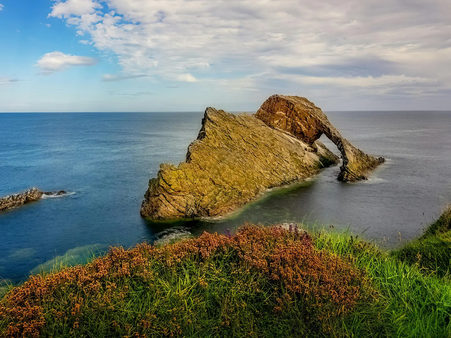
- Bow Fiddle Rock: A distinctive quartzite sea arch off Portknockie, named for its resemblance to the tip of a fiddle bow. It is one of the most recognisable coastal landmarks on the route.
- Cullen and Cullen Bay: The eastern trailhead is a harbour town overlooking a sandy bay, the Three Kings sea stacks and the arches of the Cullen railway viaduct. Cullen is also associated with Cullen skink, the smoked-haddock soup named after the town.
- Burghead Fort: A promontory site of the largest known Pictish fort in northern Britain and a likely royal centre of Fortriu. The rock-cut Burghead Well survives, and carved bull stones were found when the harbour was built.
- Sueno's Stone: Near Forres, this is the tallest surviving carved Pictish standing stone in Scotland, protected in an armoured-glass case. Its carvings include a Celtic cross and a large battle scene.
- Covesea Skerries Lighthouse: A white lighthouse near Lossiemouth, built in 1846 by Alan Stevenson and now deactivated. It is a clear landmark above the sands between Hopeman and Lossiemouth.
- Findhorn and Findhorn Bay: A sailing and watersports village beside a tidal bay and nature reserve rich in birdlife. The dunes and long beach east towards Roseisle give an early taste of the trail's coastal walking.
Challenges to expect
The walking is generally not strenuous, but expect long days on mixed surfaces: sand, rock, gravel, firm earth, promenade, pavement and quiet roads. Coastal weather can change quickly, and some facilities close from November to March. The route is normally fully waymarked, but the Spey Viaduct crossing near Garmouth / Spey Bay is closed after a partial collapse, forcing a lengthy inland diversion via Fochabers; check current updates before setting out.
HikeList Score
Moray Coast Trail scored 85/100 on HikeList's trail-quality metrics.
See score breakdownHide breakdown
- Ideal length 78
- Balanced challenge 90
- Scenery & wildness 85
- Varied terrain 89
- Accommodation 83
- Food & support 87
- Path quality 87
- Season flexibility 100
Computed from length, challenge, scenery & wildness, terrain variety, accommodation, food & support, path quality and season flexibility.
 United Kingdom
 Scotland
Show more data Show less
- Coastal
- Forest
- Estuary
- Sand
- Rock
- Dirt
- Gravel
- Paved
- Hotels
- Guesthouses
- Campsites
- Family Friendly
- Dog Friendly On Leash
- Restrooms
- Potable Water Sources
- Public Transport Access Points
Photos from hikers
Taken on the trail by people who've reviewed Moray Coast Trail.
The Moray Coast Trail begins in the historic market town of Forres, heading north through peaceful countryside and woodland tracks before arriving at the shores of Findhorn Bay. The route then follows the edge of the bay to the coastal village of Findhorn, passing saltmarshes and mudflats that are teeming with birdlife. This section is relatively flat and provides a gentle introduction to the trail, featuring scenic views across the estuary and opportunities for wildlife spotting.
Leaving Findhorn, the trail continues eastward along wide, sandy beaches and low dunes before cutting inland through forested plantations. The path follows the curve of the coast, with occasional detours to clifftop viewpoints overlooking the North Sea. The section ends at the historic fishing village of Burghead, known for its ancient Pictish fort and sweeping coastal vistas. Expect easy walking with a mix of forest, beach, and minor road sections.
This stage traverses some of the trail's most dramatic scenery, starting with a clifftop path from Burghead to Hopeman that offers panoramic sea views and passes by the colorful Hopeman Beach Huts. Beyond Hopeman, the route follows grassy paths above limestone cliffs, through caves and rock arches, and along quiet sands before reaching the vibrant town of Lossiemouth. This is a slightly longer and more varied section, with a blend of cliff walking, beaches, and harbour promenades.
Continuing east, this day’s walk features expansive beaches, shingle banks, and the crossing of the River Lossie. The route passes Covesea Lighthouse and continues through pine forests before reaching the mouth of the River Spey at Spey Bay. Watch for wildlife along the Moray Firth, including seals and bottlenose dolphins. The terrain is mostly flat, alternating between firm paths and shingle, while Spey Bay is notable for its wildlife reserve and visitor centre.
The final stage runs from Spey Bay to Cullen, following the shoreline past small fishing villages such as Portgordon, Buckie, and Portknockie. Expect a mix of quiet back roads, cliff-top trails, and beach walking, with highlights including Bow Fiddle Rock near Portknockie and the picturesque Cullen viaduct. This section offers a memorable finish, combining dramatic coastal geology with views of sandy bays and charming harbours before arriving in the historic village of Cullen.
Reviews
How would you rate Moray Coast Trail?
Tap a star to start your review — you could be the first.