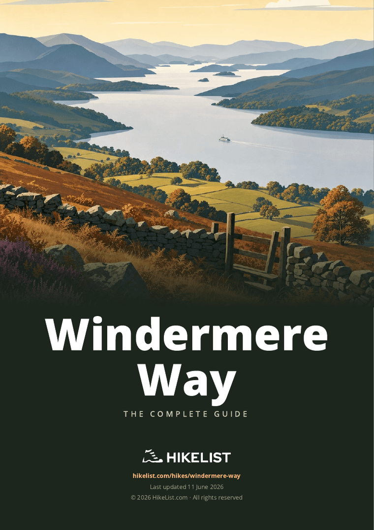
Windermere Way
How would you rate Windermere Way?
Tap a star to share your experience and help other hikers.
Windermere Way: A Complete Hiking Guide
HikeList Score
Windermere Way scored 89/100 on HikeList's trail-quality metrics.
See score breakdownHide breakdown
- Ideal length 78
- Balanced challenge 100
- Scenery & wildness 85
- Varied terrain 83
- Accommodation 100
- Food & support 88
- Path quality 98
- Season flexibility 89
Computed from length, challenge, scenery & wildness, terrain variety, accommodation, food & support, path quality and season flexibility.
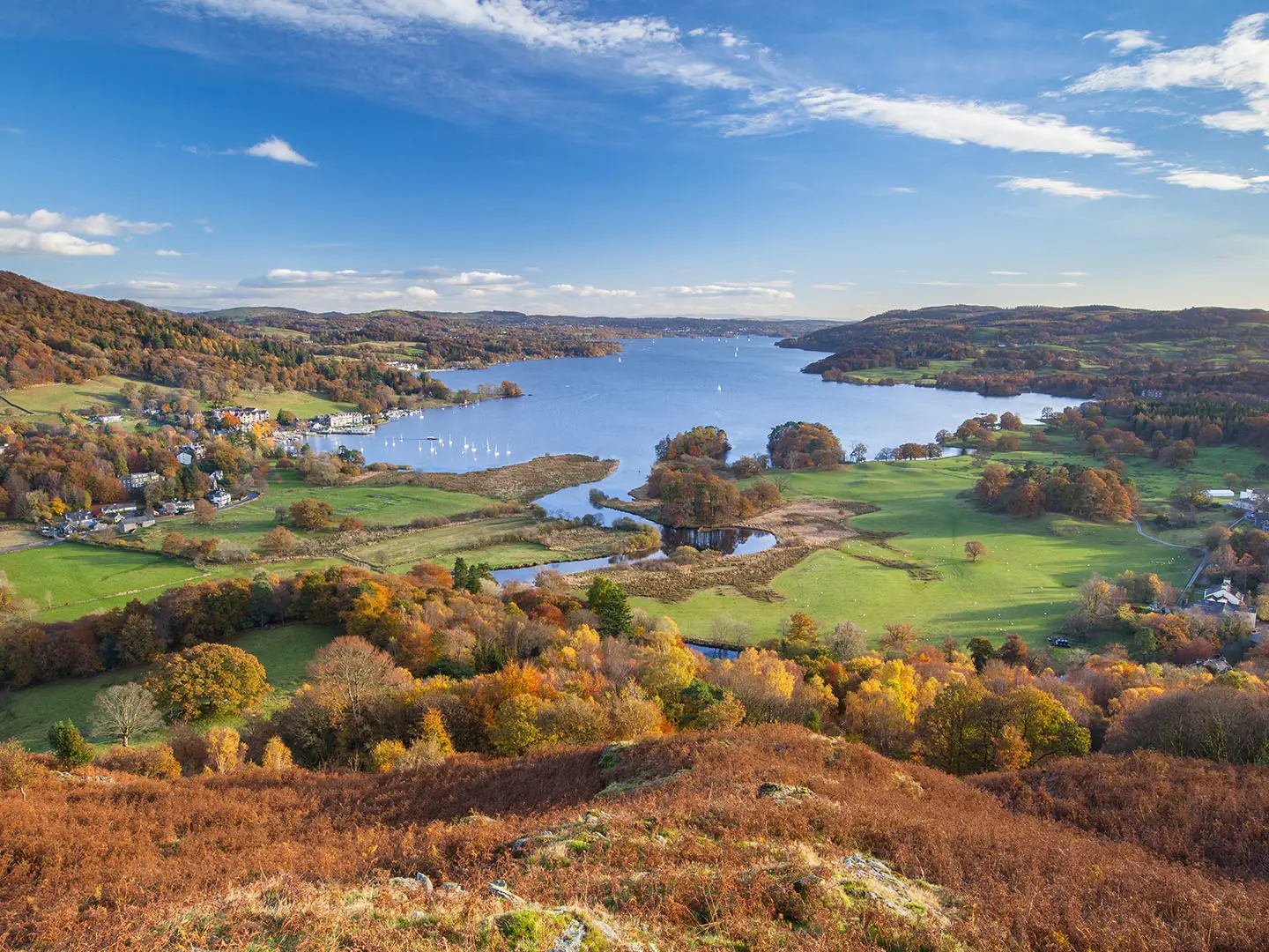
The Windermere Way is a 72 km (45 mile), usually 4-day, moderate loop around Windermere in the Lake District National Park: a practical Lake District hiking route in England. It suits walkers who want lakeshore woodland, pasture and short fell climbs without a high-mountain expedition. Starting and finishing at Bowness-on-Windermere, it links Orrest Head, Wansfell Pike, Ambleside, Loughrigg, Wray Castle, Claife Heights, Lakeside/Newby Bridge and Gummer's How. Expect good paths and bridleways, some road walking, rocky fell sections and about 2,400 m of ascent.
Route Overview
Most walkers start at Bowness-on-Windermere and walk either direction. A common 4-stage itinerary runs Bowness to Ambleside via Orrest Head and Wansfell; Ambleside to Far Sawrey/Ferry House via Loughrigg, Wray Castle and Claife Heights; Far Sawrey to Lakeside/Newby Bridge; then Newby Bridge to Bowness over Gummer's How and the eastern shore. The Windermere car ferry between Ferry Nab and Ferry House is the mid-lake crossing; lake steamers, buses and the ferry also make short day-walk versions easy. The route connects with the Dales Way at Bowness and the Cumbria Way at Skelwith Bridge, and pairs well with a summit day on the Old Man of Coniston in the next valley west.
History of the Windermere Way
The Windermere Way is a modern circular walk created in the early 2000s; the LDWA records it from 2003 with an accompanying map and guide. Its purpose is simple: to circumnavigate Windermere, England's largest natural lake, while taking in surrounding viewpoint fells. The landscape also carries strong literary and Victorian-tourism associations, from Wordsworth and Beatrix Potter to the arrival of the railway at Windermere in 1847, which opened the lake to many more visitors.
Notable highlights
- Orrest Head: A short climb above Windermere town with one of the Lake District's best-known panoramas. It was the viewpoint that inspired Alfred Wainwright on his first visit in 1930.
- Wansfell Pike / Wansfell (488 m): The route crosses the popular Wansfell Pike summit area above Ambleside and Troutbeck; the true Wansfell summit, Baystones, is the route's highest point. The reward is a long view down Windermere.
- Wray Castle and Claife Heights: Wray Castle is a mock-Gothic building on the quieter western shore with a Beatrix Potter connection. Claife Heights adds forest tracks, tarns and the historic Claife viewing station.
- Windermere Car Ferry: The chain ferry between Ferry Nab and Ferry House links the eastern and western shores at the lake's midpoint. It is useful for both the full route and shorter day-walk plans.
- Gummer's How (321 m): A rocky viewpoint fell above the southern end of Windermere. The climb is short but steep, with views back along the lake towards the central fells.
- Lakeside and the Windermere steamers: At the southern tip near Newby Bridge, the route reaches Lakeside pier. This is a practical transport point for the lake steamers and the Lakeside & Haverthwaite heritage railway.
Challenges to expect
This is moderate rather than easy because the loop gains about 2,400 m, with climbs over Orrest Head, Wansfell Pike, Loughrigg and Gummer's How. Surfaces are mostly paths, bridleways and forest tracks, but expect rougher rocky ground on the fell sections plus short road-walking stretches. Rainfall is high in the Lake District, and waymarking is not a substitute for a map or GPS on higher ground.
HikeList Score
Windermere Way scored 89/100 on HikeList's trail-quality metrics.
See score breakdownHide breakdown
- Ideal length 78
- Balanced challenge 100
- Scenery & wildness 85
- Varied terrain 83
- Accommodation 100
- Food & support 88
- Path quality 98
- Season flexibility 89
Computed from length, challenge, scenery & wildness, terrain variety, accommodation, food & support, path quality and season flexibility.
Show more data Show less
- Forest
- Grassland
- Mountainous
- Dirt
- Rocky
- Gravel
- Hotels
- Guesthouses
- Hostels
- Campsites
- Family Friendly
- Pet Friendly
- Restrooms
- Water Sources
- Campsites
- Picnic Areas
Download Our Full Guide to Windermere Way FREE!
Get our comprehensive guide to this hike for free. Save it for later reading or print out at home.
In these collections
Photos from hikers
Taken on the trail by people who've reviewed Windermere Way.
Windermere Way: The Complete Guide
 i
Image by James
i
Image by James The Windermere Way is a practical, satisfying circuit of England’s largest natural lake, starting and finishing at Bowness-on-Windermere. It suits walkers who want a multi-day Lake District route with lake shores, woodland, pasture and viewpoint fells rather than a high-mountain traverse.
The route turns north through Windermere, Orrest Head, Troutbeck and Wansfell towards Ambleside, then crosses Loughrigg and the quieter western side of the lake. Wray Castle, Claife Heights, Far Sawrey, Lakeside, Newby Bridge and Gummer’s How give the second half a more varied, less busy feel.
At around 66 km / 41 miles, it fits naturally into four stages, though strong walkers can compress it into three. The loop format, Windermere railway station, local buses, the lake ferry and Windermere Lake Cruises also make it unusually easy to shorten, split or turn into day walks.
This is still a proper Lakeland walk, with about 2,400 m of ascent and several short, steep climbs on rocky ground. Waymarking is incomplete, rain can make paths muddy, and the fell tops around Wansfell, Loughrigg and Gummer’s How need confident navigation in poor visibility.
This guide covers stages, day choices, accommodation, food, transport, terrain and common mistakes.
Stage-by-Stage Guide
The four stages below follow the natural split of the Windermere Way. Distances are approximate, as the exact line can vary slightly around Wansfell, Claife Heights and the lake-shore paths.
Stage 1: Bowness-on-Windermere to Ambleside — approx. 21 km
This is the longest day of the standard four-stage itinerary and gives the route its most immediate sense of scale. From Bowness-on-Windermere the walk heads up through Windermere town, climbs to Orrest Head, then continues towards Troutbeck before crossing the Wansfell ground above Ambleside.
The early section mixes town walking, paths and lanes before the short climb to Orrest Head. This is one of the classic Windermere viewpoints, with a broad panorama over the lake and towards the central fells, and it is worth allowing time here rather than treating it as a quick waymarker.
Beyond Windermere and Orrest Head the route becomes more rural, passing towards Troutbeck and then onto Wansfell / Wansfell Pike. The walking is not high-mountain in character, but it is proper fell terrain: rocky in places, exposed in poor weather and slippery after rain. Wansfell Pike, at 482 m, is the popular viewpoint above Ambleside; the true Wansfell summit, Baystones, is slightly higher at 488 m, but route descriptions vary over whether the line takes in the true summit or stays nearer the Pike.
Ambleside is the best-equipped overnight stop on the whole circuit after Bowness and Windermere. Food, resupply and accommodation are generally much easier here than on the quieter western and southern stages, but beds should still be booked ahead in busy periods.
Public transport is strong at both ends of the stage. Windermere railway station sits above Bowness, and regular buses on the Windermere–Bowness–Ambleside corridor make it straightforward to shorten the first day or return to a base. Waterhead pier near Ambleside also gives access to Windermere Lake Cruises services, subject to current timetables.
Navigation is usually manageable in good visibility, but the Windermere Way is only partially waymarked and should not be treated as a fully signed trail. Carry OS mapping or a reliable offline GPX, especially for the Wansfell section, where mist and rain can make path choices less obvious. Expect some road walking and take care on narrow lanes.
Food and water are easiest to organise at Bowness, Windermere and Ambleside. Do not rely on finding facilities between Windermere and Ambleside without checking opening times before setting out.
Stage 2: Ambleside to Far Sawrey / Ferry House — approx. 17 km
Stage 2 crosses the northern and western side of the circuit, leaving the busy Ambleside area for Loughrigg Fell, Loughrigg Tarn, Wray Castle and Claife Heights. It is shorter than Stage 1 but still has a distinctly Lakeland feel, with rocky low fell, woodland, tarnside walking and lake views.
From Ambleside the route heads towards the Skelwith Bridge area before climbing onto Loughrigg Fell. Loughrigg is low by Lake District standards but rougher than it looks on the map: expect rocky paths, short climbs, wet ground after rain and multiple path options around the fell. In poor visibility, careful navigation matters.
Loughrigg Tarn is one of the key landmarks on this stage, followed by the descent towards the western shore of Windermere. Wray Castle, the mock-Gothic National Trust mansion, marks a clear change in character as the route moves onto the quieter west side of the lake.
South of Wray Castle the walking continues through the Claife Heights area. This section is wooded and can be muddy, with forest tracks and paths giving periodic views back across Windermere. The Claife Viewing Station above the ferry is a useful landmark near the end of the stage.
Far Sawrey and Ferry House are much quieter than Ambleside. Accommodation and food options are thinner on this side of the lake, so overnight plans should be fixed before walking this stage. If staying near Ferry House, check exactly where the accommodation is in relation to the route, as small extra distances can matter at the end of the day.
The Windermere car ferry links Ferry House with Ferry Nab near Bowness and is the main escape or shortening option here. It is also useful for section-walkers based in Bowness or Windermere. The ferry can be affected by maintenance or service changes, so current operating times should be checked before relying on it.
Carry enough food and water from Ambleside unless specific stops have been planned. The western shore is quieter and less forgiving for casual resupply than the Ambleside–Windermere–Bowness side of the lake.
Stage 3: Far Sawrey / Ferry House to Lakeside / Newby Bridge — approx. 14 km
Stage 3 follows the quieter southern-western part of the circuit, continuing from Far Sawrey / Ferry House towards Cunsey, Finsthwaite, High Dam and the foot of Windermere. It is one of the more peaceful days, with woodland, tracks, minor roads and lower-level walking rather than the more open felltops of Stages 1 and 2.
The route passes through or near Cunsey and Finsthwaite before reaching the High Dam area. Paths and tracks here can be wet underfoot, particularly after prolonged rain, and woodland sections may hold mud for longer than the open fell paths.
High Dam is the main inland feature of the stage and makes a natural break in the day. From there the route continues towards Lakeside and Newby Bridge at the foot of Windermere, where the lake narrows towards the start of the River Leven.
Lakeside and Newby Bridge are useful planning points because they offer transport options as well as accommodation nearby. Lakeside has a steamer pier for Windermere Lake Cruises, and the Lakeside & Haverthwaite heritage railway is also associated with this end of the lake. Current operating days and times should be checked before building an itinerary around either.
Food and water are more limited than in Ambleside, Windermere or Bowness. Carry lunch and sufficient water from the start unless an open stop has been planned at the end of the stage. Accommodation on the quieter southern section should be booked ahead, especially in spring, summer and early autumn.
Navigation is generally less exposed than on Wansfell or Loughrigg, but the mix of woodland tracks, minor roads and paths still demands attention. Do not depend on continuous waymarking. Take particular care where the route uses or crosses minor roads, as verges can be narrow.
Stage 4: Newby Bridge to Bowness-on-Windermere — approx. 14 km
The final stage returns north to Bowness-on-Windermere via Gummer’s How, Storrs and the eastern side of the lower lake. Although the distance is modest, the climb to Gummer’s How gives the day a sharper start than the map distance might suggest.
Gummer’s How, at 321 m, is the main high point of the stage and one of the best viewpoints on the route. The ascent is short but steep and rocky in places, with a long view back up Windermere towards the higher central fells. In wet or windy weather it can feel exposed, so waterproofs and warm layers should still be close to hand even on a relatively short final day.
After Gummer’s How the route works back towards the lakeside and the Storrs area before returning to Bowness-on-Windermere. Expect a mixture of paths, tracks and some road walking rather than a continuous lakeshore promenade. Mud can be an issue after rain, particularly where paths pass through woodland or low-lying ground.
Bowness-on-Windermere has the strongest end-of-route facilities, with food, accommodation, buses, lake cruise piers and access back up to Windermere railway station. This makes the final day easy to combine with onward travel, though bus and train times should still be checked before committing to a tight connection.
Food and water are easiest at Newby Bridge or Bowness, with fewer guaranteed options on the walking line between them. Carry enough for the day rather than assuming a mid-stage stop will be open.
Navigation remains important to the finish. The route is only partially waymarked, and the final return into the busier Bowness area can involve path junctions, lanes and built-up edges where it is easy to drift off line. A map or offline GPS track is still useful right to the end of the loop.
Recommended Itinerary
The Windermere Way works best as a four-day circuit. The stages are uneven enough to feel like a proper multi-day walk, but each finishes at a logical overnight point with either accommodation, transport links or both.
Plan from your chosen map or GPX before booking beds. The core route is best treated as about 66 km / 41 miles, but some variants are closer to 72 km / 45 miles, so small differences in daily distance are normal.
Standard itinerary – 4 days
This is the most practical split for most walkers. It keeps the longest and highest northern section on Day 1, then uses shorter days for the quieter western and southern shore where services are thinner.
| Day | From | To | Approx. distance | Why this stage makes sense | Services/accommodation notes |
|---|---|---|---|---|---|
| 1 | Bowness-on-Windermere | Ambleside | 21 km | The longest stage takes in Windermere town, Orrest Head, Troutbeck and the Wansfell / Wansfell Pike section before dropping to the natural overnight stop at Ambleside. It is a full first day because of the ascent and rocky fell ground, not just the distance. | Bowness-on-Windermere, Windermere and Ambleside have the strongest choice of accommodation and food. Windermere railway station and the Bowness–Windermere–Ambleside bus corridor make this the easiest end of the route for arrivals, late starts and resupply. |
| 2 | Ambleside | Far Sawrey / Ferry House | 17 km | A varied crossing from the head of the lake over Loughrigg Fell, past Loughrigg Tarn and Wray Castle, then through Claife Heights towards the ferry. This is shorter than Day 1 but still has rougher ground and navigation points in woodland. | Ambleside is the best place to buy food before setting off. Accommodation is much thinner around Far Sawrey / Ferry House than at Ambleside or Bowness, so book ahead. The Windermere car ferry links Ferry House with Ferry Nab near Bowness, but its operation should be checked before travelling. |
| 3 | Far Sawrey / Ferry House | Lakeside / Newby Bridge | 14 km | A shorter rural day down the quieter western side and towards the foot of Windermere, passing through the Cunsey, Finsthwaite and High Dam area before reaching Lakeside / Newby Bridge. It gives useful breathing space after the two hillier northern stages. | Beds and services are more limited on this southern section, so do not leave accommodation to chance. Lakeside has the steamer pier and the Lakeside & Haverthwaite heritage railway; current timetables should be checked before relying on them. |
| 4 | Newby Bridge | Bowness-on-Windermere | 14 km | The final stage returns along the southern and eastern side of the lake, with the short, steep climb to Gummer's How as the main effort before the route comes back through Storrs to Bowness. The moderate distance leaves time for onward travel. | Bowness-on-Windermere and nearby Windermere have plentiful accommodation, food and onward transport. Windermere railway station is above Bowness, with bus links between Bowness, Windermere and Ambleside. |
Slower variant – 5 days
A slower plan suits walkers who want a weather buffer, a less rushed first Lake District multi-day walk, or time to use Ambleside and Bowness as practical bases. Because accommodation is not evenly spaced around the lake, the cleanest five-day version is usually the standard four walking days with an extra night rather than forcing an awkward split in the quieter west or south.
| Day | From | To | Approx. distance | Why this stage makes sense | Services/accommodation notes |
|---|---|---|---|---|---|
| 1 | Bowness-on-Windermere | Ambleside | 21 km | Complete the longest northern stage while fresh, taking in Orrest Head, Troutbeck and Wansfell / Wansfell Pike. | Strong accommodation and food options at both ends. |
| 2 | Ambleside | Ambleside | Rest / contingency day | Useful if the weather is poor on Wansfell or Loughrigg, or if you want a slower-paced trip without committing to uncertain intermediate accommodation. | Ambleside is the best place on the route for an extra night, resupply and transport options. |
| 3 | Ambleside | Far Sawrey / Ferry House | 17 km | Cross Loughrigg Fell and Claife Heights with fresher legs after the extra night. | Book ahead on the western shore. Check the Windermere car ferry if using it as part of the day’s logistics. |
| 4 | Far Sawrey / Ferry House | Lakeside / Newby Bridge | 14 km | Keep the quieter western and southern section as a manageable day rather than combining it with the final return to Bowness. | Accommodation around Lakeside / Newby Bridge is thinner than at the main northern towns, so reserve early. |
| 5 | Newby Bridge | Bowness-on-Windermere | 14 km | Finish over Gummer's How with enough time for a relaxed return to Bowness and onward travel. | Bowness and Windermere have the easiest end-of-walk transport and accommodation. |
For genuinely shorter walking days, use the Windermere car ferry, Windermere Lake Cruises steamers or the Bowness–Windermere–Ambleside bus corridor to break the circuit into day walks. Exact distances and timetables should be checked before travelling.
Faster variant – 3 days
A three-day Windermere Way is realistic for fit walkers who are comfortable with longer days, repeated ascent and carrying food between quieter service points. The most straightforward faster split keeps the first two standard stages intact, then combines the two shorter southern stages into one long final day.
| Day | From | To | Approx. distance | Why this stage makes sense | Services/accommodation notes |
|---|---|---|---|---|---|
| 1 | Bowness-on-Windermere | Ambleside | 21 km | This keeps the main northern fell section as a self-contained day rather than pushing beyond Ambleside after Wansfell. | Excellent accommodation and resupply at Ambleside. |
| 2 | Ambleside | Far Sawrey / Ferry House | 17 km | A solid but not excessive second day over Loughrigg Fell, past Wray Castle and through Claife Heights. | Book the western-shore overnight well ahead. The ferry crossing gives a useful escape option to Bowness if plans change, subject to operation. |
| 3 | Far Sawrey / Ferry House | Bowness-on-Windermere via Lakeside / Newby Bridge | 28 km | This combines the two 14 km southern stages, including the Lakeside / Newby Bridge section and the climb over Gummer's How. It is the crux of the fast itinerary because services are more spread out and the final climb comes late in the route. | Carry enough food and water for a long day. Lakeside / Newby Bridge is the main mid-stage service and transport point, with steamer links from Lakeside; current timetables should be checked before relying on them. |
Planning the Route
The Windermere Way is easiest to plan as a 4-day circuit, because the natural stopping places sit at Ambleside, Far Sawrey / Ferry House, and Lakeside / Newby Bridge. Fit walkers can compress it into 3 days, but that leaves less room for slow ground on the fell sections, ferry or steamer timing, and wet-weather delays.
The route is not a fully signed National Trail, so planning should start with a map or GPX rather than with waymarks alone. Use OS Explorer OL7 for detailed navigation, and check the exact line you intend to follow around Wansfell / Wansfell Pike, where route descriptions vary between the popular Wansfell Pike top and the higher Baystones summit.
Choosing a 3- or 4-day itinerary
| Plan | Best for | Practical notes |
|---|---|---|
| 4 days | Most walkers, first-time Lake District multi-day hikers, mixed-pace groups | Uses the natural stage pattern: Bowness-on-Windermere to Ambleside; Ambleside to Far Sawrey / Ferry House; Far Sawrey / Ferry House to Lakeside / Newby Bridge; Newby Bridge to Bowness-on-Windermere. Gives better time for Wansfell, Loughrigg and Gummer's How without rushing. |
| 3 days | Strong walkers travelling light | Achievable, but it means combining shorter southern or western sections and being more disciplined with accommodation and transport. Wet weather, muddy ground and road-walking fatigue can make the compressed plan feel harder than the distance suggests. |
| Section hikes | Day walkers based in Bowness, Windermere or Ambleside | Very practical because the lake has good transport options, including the Windermere branch railway, the 555/599 bus corridor between Windermere, Bowness and Ambleside, the Windermere car ferry, and Windermere Lake Cruises services between Bowness, Ambleside / Waterhead and Lakeside. Timetables should be checked before travelling. |
For most independent walkers, the 4-day version is the safest planning baseline. It keeps the longest day early, where services are strongest, and gives the quieter western and southern stages more margin.
Accommodation strategy
Book accommodation before committing to dates, especially if walking in spring, summer or autumn holiday periods. Bowness-on-Windermere, Windermere and Ambleside have the widest choice of hotels, guesthouses, B&Bs, hostels and campsites, while options are thinner around Far Sawrey, Ferry House, Lakeside and Newby Bridge.
The western shore and the foot of the lake need the most care. If accommodation is unavailable at Far Sawrey / Ferry House or Lakeside / Newby Bridge, the itinerary may need adjusting around the Windermere car ferry, lake steamers, or local transport back to a larger base. This should be checked before travelling.
A fixed-base approach is also workable. Staying in Bowness-on-Windermere, Windermere or Ambleside and using buses, steamers and the ferry can turn the circuit into separate day walks, but the first and last services of the day become part of the walking plan rather than an afterthought.
Food and water planning
Resupply is simplest at the northern end of the route, especially around Bowness-on-Windermere, Windermere and Ambleside. These are the best places to buy food before the quieter western and southern sections.
Do not assume frequent shops or cafés between the main settlements. Carry lunch, snacks and enough water for each day, particularly on the Far Sawrey / Ferry House to Lakeside / Newby Bridge stage and the Newby Bridge to Bowness-on-Windermere stage over Gummer's How and Storrs.
Natural water should not be relied on without treatment. In practice, most walkers should refill at accommodation, cafés or recognised services rather than planning the day around streams or tarns.
Navigation and route choice
Waymarking exists but is incomplete, using a yellow arrow encircled by the route name where present. Treat it as reassurance, not as the primary navigation system.
A map and GPS track are strongly recommended, especially on Orrest Head, Wansfell / Wansfell Pike, Loughrigg Fell, Claife Heights and Gummer's How. These are not high-mountain days, but the ground can be rocky, wet and confusing in poor visibility.
There is also a separate West Windermere Way promoted by the Lake District National Park on the western shore only, between Newby Bridge, Lakeside, Ferry House and Wray Castle. Do not confuse that route with the full Windermere Way circuit around the whole lake.
Transport and shortening the walk
Transport is one of the strengths of this route. Windermere railway station links to the Oxenholme branch from the West Coast Main Line, and regular buses on the 555/599 corridor connect Windermere, Bowness and Ambleside.
The Windermere car ferry between Ferry Nab and Ferry House is useful for both the full route and shorter variants. It can be suspended for maintenance, so current operating times should be checked before relying on it.
Windermere Lake Cruises services between Bowness, Ambleside / Waterhead and Lakeside make it relatively easy to shorten a day, return to the start, or split the circuit into sections. Steamer timetables vary by season and should be checked before booking accommodation around them.
Weather and timing
Spring, summer and autumn are the main walking seasons, but Lake District weather can change quickly at any time. Rain makes the woodland tracks, bridleways and rocky fell paths slower, and the exposed tops on Wansfell, Loughrigg and Gummer's How need proper waterproofs rather than town-walking clothing.
Build in extra time on the fell sections rather than planning only by distance. A short stage can still be tiring when it includes steep climbs, muddy ground, navigation stops and road walking.
What matters most before setting off
Prioritise these checks before finalising the route:
- Accommodation availability at Ambleside, Far Sawrey / Ferry House and Lakeside / Newby Bridge.
- Current Windermere car ferry operating times.
- Current Windermere Lake Cruises timetables if using steamers to shorten or link stages.
- Train and bus times for Windermere, Bowness and Ambleside.
- A reliable map or GPX for the full circuit, not just the western-shore West Windermere Way.
- Weather forecast and ground conditions, especially before Wansfell, Loughrigg Fell and Gummer's How.
The route does not demand expedition logistics, but it does reward careful organisation. The main risks to a smooth walk are not remoteness; they are incomplete waymarking, changeable weather, limited accommodation on the quieter shore, and assuming transport will be available without checking the current timetable.
Towns, Villages and Overnight Stops
The Windermere Way is easiest to plan around four overnight areas: Bowness-on-Windermere / Windermere, Ambleside, Far Sawrey / Ferry House, and Lakeside / Newby Bridge. Accommodation and services are strongest at the busy northern end of the lake and become thinner on the quieter western and southern sections, so the middle nights should be booked ahead.
For a four-day walk, the natural stops are Ambleside, Far Sawrey / Ferry House, and Lakeside / Newby Bridge before returning to Bowness-on-Windermere. Fit walkers compressing the route into three days usually need to be more careful about where they finish each stage, especially on the western shore.
Bowness-on-Windermere
Bowness-on-Windermere is the start and finish of the loop, by the lake near Bowness Bay and the steamer piers. It is the most convenient base for the first and final night, especially if arriving by public transport or planning to use Windermere Lake Cruises to adjust the walk.
Accommodation is plentiful compared with the quieter parts of the route, with a broad mix of hotels, guesthouses, B&Bs, hostels and campsites in the Bowness / Windermere area. It is also one of the best places on the circuit for evening food, cafés, shops and pre-walk supplies.
Transport is strong. Windermere railway station is up the hill in Windermere town, with onward buses linking Windermere, Bowness and Ambleside on the 555 / 599 corridor. Windermere Lake Cruises also run from Bowness to Ambleside Waterhead and Lakeside, making Bowness useful for day-walk variations, bad-weather escapes and returning to the start if a stage is shortened.
Windermere town
Windermere town sits just above Bowness and is usually passed early on an anticlockwise circuit before the climb to Orrest Head. It is a practical staging point rather than a separate overnight requirement, but it works well for walkers who want accommodation close to the railway station.
The town is part of the main Bowness / Windermere accommodation hub, so this is one of the easiest areas on the route for finding beds and food. It is also the logical place to buy last-minute supplies before leaving the busier eastern side of the lake.
Windermere station is the key rail access point for the whole route, on the branch line from Oxenholme on the West Coast Main Line. Buses on the Windermere–Bowness–Ambleside corridor make it straightforward to start from either Windermere town or Bowness Bay.
Troutbeck
Troutbeck is reached after the Orrest Head section and before the climb towards Wansfell / Wansfell Pike. It can break up the first day, but for most walkers it is a pass-through village rather than an overnight stop.
Do not assume the same level of services as Bowness, Windermere or Ambleside. Anyone planning to stop here overnight should book accommodation in advance and check current food options before relying on them.
Troutbeck is most useful as a pacing point on the first stage. If the weather is poor over Wansfell, it is also a sensible place to reassess timings before committing to the higher ground above Ambleside.
Ambleside
Ambleside is the natural first-night stop on the standard four-day itinerary, reached after the eastern-shore stage over Orrest Head, Troutbeck and Wansfell / Wansfell Pike. It sits at the head of Windermere, with Waterhead pier nearby.
This is one of the best-equipped places on the route. Accommodation is plentiful, including hotels, guesthouses, B&Bs and hostels, and it is a reliable resupply and evening-food stop before the quieter western side of the circuit.
Ambleside is also a strong transport point. Buses link it with Windermere and Bowness, and Windermere Lake Cruises operate to and from Waterhead. This makes Ambleside the easiest place to leave or rejoin the route at the northern end, or to shorten the circuit into separate day walks.
Skelwith Bridge area
The route passes near Skelwith Bridge between Ambleside and the Loughrigg / western-shore section. It is not one of the main overnight stops on the standard itinerary, but it can be useful when tailoring stages around Ambleside, Loughrigg Fell and Wray Castle.
Accommodation and services should be treated as limited compared with Ambleside. If planning to finish a day near Skelwith Bridge rather than continue towards Far Sawrey / Ferry House, book ahead and check food options before travelling.
This area is mainly useful for walkers who want a shorter second day or who are adapting the route in poor weather. It sits before the route moves onto Loughrigg Fell and towards the quieter western shore.
Wray Castle and Claife Heights
Wray Castle and Claife Heights are important route landmarks on the western side of Windermere, but they are not the main overnight bases for most walkers. This part of the circuit is more about woodland tracks, viewpoints and steady progress towards Far Sawrey / Ferry House.
Services are thinner on this side of the lake than in Bowness, Windermere and Ambleside. Carry enough food and water for the stage, and do not plan around finding frequent shops or cafés unless current opening details have been checked before travelling.
Claife Heights and the Claife Viewing Station are worth allowing time for, but they should be planned as route features rather than resupply points. The nearby ferry link at Ferry House is the key logistical connection.
Far Sawrey / Ferry House
Far Sawrey / Ferry House is the usual second-night area on a four-day anticlockwise walk. It sits around the mid-lake crossing point, where the Windermere car and passenger ferry links Ferry House on the west shore with Ferry Nab near Bowness.
Accommodation is more limited here than at Bowness, Windermere or Ambleside, so booking ahead is important. Food and evening arrangements should also be checked before committing to an overnight in this area.
The ferry is a major practical advantage. It allows walkers to cross to Bowness for transport or accommodation, split the loop into shorter walks, or abandon the western shore if conditions or timings deteriorate. Ferry operations can change and the service may be suspended for maintenance, so this should be checked before travelling.
Cunsey
Cunsey lies south of the ferry area as the route continues towards Finsthwaite, High Dam and Lakeside / Newby Bridge. It is a quiet route point rather than a primary overnight stop.
Do not rely on Cunsey for full walker services. For most itineraries, the practical choice is either to stay around Far Sawrey / Ferry House before this section or continue to Lakeside / Newby Bridge for the next overnight.
This part of the walk is useful for gauging progress on the quieter southern half of the circuit. Carry what is needed for the day rather than assuming frequent resupply.
Finsthwaite and High Dam
Finsthwaite and High Dam sit on the third stage between Far Sawrey / Ferry House and Lakeside / Newby Bridge. This is a quieter part of the route, with woodland, tracks and the approach to the foot of Windermere.
Accommodation and food options should be treated as limited unless booked and checked in advance. Finsthwaite can suit a tailored itinerary, but the standard four-day plan more commonly continues to Lakeside / Newby Bridge.
High Dam is a useful landmark, not a service point. Make sure the day’s food, water and onward accommodation are already sorted before leaving the ferry area.
Lakeside
Lakeside is at the foot of Windermere and is the main southern transport point on the route. It has the Lakeside steamer pier and access to the Lakeside & Haverthwaite heritage railway, making it useful for shortened walks and itinerary changes.
The Lakeside / Newby Bridge area is a natural third-night stop on the four-day itinerary. Accommodation exists in this southern area, but it is thinner than at Bowness / Windermere and Ambleside, so book ahead, especially in busy seasons.
Windermere Lake Cruises link Lakeside with Bowness and Ambleside Waterhead. Current steamer times should be checked before relying on them, particularly if using Lakeside as an escape point or as part of a section-walk plan.
Newby Bridge
Newby Bridge sits close to Lakeside at the foot of Windermere, where the route turns onto the final leg back towards Bowness via Gummer’s How and Storrs. It is the most practical southern overnight stop for many walkers.
This is a quieter base than the northern towns, so advance booking is sensible. It works well for the third night because the final day starts with access to the southern fell section rather than needing to add extra distance from farther away.
Newby Bridge is also a useful place to reassess the final day’s weather. The climb over Gummer’s How is short but steep and rocky, and conditions can feel more exposed than the low-level lakeside sections.
Storrs
Storrs lies on the final approach back to Bowness-on-Windermere. It is generally a pass-through area rather than a main overnight stop, unless accommodation has been specifically booked nearby.
Its main value is as a marker that the route is returning to the busier eastern shore. From here, Bowness is the practical end point for onward transport, food, accommodation and steamer connections.
Choosing overnight stops
| Itinerary style | Sensible overnight pattern | Practical notes |
|---|---|---|
| 4 days | Bowness-on-Windermere → Ambleside → Far Sawrey / Ferry House → Lakeside / Newby Bridge → Bowness-on-Windermere | Best fit for the natural stage split and the easiest way to avoid very long days. |
| 3 days | Bowness-on-Windermere → Ambleside or western-shore stop → Lakeside / Newby Bridge or another booked stop → Bowness-on-Windermere | Requires careful accommodation planning, especially on the quieter western shore. |
| Section-walking | Use Bowness, Windermere, Ambleside, Ferry House / Ferry Nab and Lakeside as access points | The ferry, buses and lake cruises make the loop unusually flexible for day sections. Check current timetables before travelling. |
Getting to the Start
The Windermere Way starts and finishes at Bowness-on-Windermere, by the lake near Bowness Bay and the steamer piers. Because it is a loop, the simplest plan is to arrive in Bowness, leave any spare luggage there if your accommodation allows, and return to the same place at the end of the walk.
By train
The nearest railway station is Windermere, on the branch line from Oxenholme on the West Coast Main Line. From Windermere station, Bowness-on-Windermere is a short onward walk downhill, or a local bus or taxi transfer.
For rail journeys from outside Cumbria, aim for Oxenholme first, then take the branch train to Windermere. Current train times, connection margins at Oxenholme and any rail replacement services should be checked before travelling.
By bus
Bowness is well served by local buses on the 555 / 599 corridor, linking Windermere, Bowness and Ambleside. This is useful both for reaching the start from Windermere station and for adjusting plans if starting from, or staying in, Ambleside.
Bus times vary by season and day of the week, especially outside the main visitor period. This should be checked before travelling, particularly if arriving late in the day or relying on a bus after the final stage.
By car
Drivers should aim for Bowness-on-Windermere and start near Bowness Bay. As the route returns to Bowness, driving is logistically straightforward, but parking needs more thought than navigation.
Plan parking before arrival, especially in busy holiday periods. Long-stay availability, overnight rules, charges and any restrictions should be checked before travelling; do not assume that a convenient short-stay visitor car park is suitable for a multi-day walk.
The Windermere car ferry links Ferry Nab with Ferry House, Far Sawrey and can be useful for local access or for changing plans around the middle of the route. It can be suspended for maintenance, so ferry operating times should be checked before travelling.
From the nearest airport
No airport is needed for the final approach to the trailhead: the practical public-transport target is Windermere railway station, then Bowness-on-Windermere by bus, taxi or on foot. If flying into the region, choose flights based on onward rail access to Oxenholme and Windermere rather than distance on a map alone.
Airport-to-rail connections, late arrivals and Sunday services should be checked before booking travel.
Where to stay before starting
The most convenient pre-walk bases are Bowness-on-Windermere and Windermere town. Bowness puts you closest to the lake start at Bowness Bay, while Windermere is closest to the railway station.
Accommodation is plentiful around Bowness and Windermere, with hotels, guesthouses, B&Bs, hostels and campsites in the wider area. It is still worth booking ahead in spring, summer, autumn weekends and school-holiday periods, when the northern end of Windermere is busy.
If staying in Ambleside before the walk, the 555 / 599 bus corridor provides a straightforward way back to Bowness or Windermere for the start. Current bus times should be checked before travelling.
Getting Home from the Finish
The Windermere Way is a loop, so the finish is back at Bowness-on-Windermere. That makes departure simpler than on a linear trail: walkers who started in Bowness return to the same town, with Windermere railway station a short walk uphill and regular buses linking Bowness with Windermere and Ambleside.
By train
The nearest railway station is Windermere, above Bowness-on-Windermere. It sits on the branch line to Oxenholme, where services connect with the West Coast Main Line for onward travel.
Allow time and energy for the walk from Bowness Bay / the steamer piers up to Windermere station, especially after a wet final day over Gummer’s How and Storrs. If finishing late, check the last train from Windermere before committing to travel the same evening.
Train times on the Windermere branch and onward connections at Oxenholme are timetable-dependent and should be checked before travelling.
By bus
Bowness, Windermere and Ambleside are linked by the main 555 / 599 bus corridor, making bus travel a practical option if staying locally or connecting to Windermere station. This is also useful if the finish accommodation is in Windermere rather than Bowness itself.
Although buses are a strong feature of the Windermere transport network, evening and seasonal timetables can affect the final connection after a long walking day. Check the current timetable before relying on a same-day departure.
By car/taxi
Because the route finishes where it starts, driving logistics are straightforward if parking has been arranged in or near Bowness-on-Windermere. There is no end-to-start transfer to organise.
If a car has been left elsewhere around the lake, the Windermere car ferry between Ferry Nab and Ferry House may help with a cross-lake return, and Windermere Lake Cruises also link Bowness, Ambleside (Waterhead) and Lakeside. Both are timetable-dependent; the ferry can be suspended for maintenance, so check before relying on it.
For a late finish, a pre-arranged taxi is safer than assuming there will be an easy onward connection. This should be checked before travelling.
From the nearest airport
There is no airport at the finish, and the practical exit from Bowness is normally by rail via Windermere and Oxenholme, or by bus within the Windermere and Ambleside area. Airport plans will depend on the chosen onward route from Oxenholme or other regional transport hubs.
Airport rail and transfer times should be checked before booking return flights, particularly if finishing the walk on the same day.
Where to stay at the finish
Bowness-on-Windermere and nearby Windermere have plentiful accommodation compared with the quieter western and southern parts of the circuit, including hotels, guesthouses, B&Bs, hostels and campsites in the wider area. Staying at the finish is sensible if the final stage runs long, the weather slows progress over Gummer’s How, or onward train and bus times do not line up well.
Bowness and Windermere are busy Lake District bases, so accommodation should be booked ahead in spring, summer, autumn weekends and holiday periods. If travelling home the next morning, staying in Windermere town can reduce the time needed to reach the railway station.
Which Direction Should You Walk?
Most walkers tackle the Windermere Way anticlockwise: Bowness-on-Windermere to Ambleside first, then down the quieter western side to Far Sawrey, Lakeside / Newby Bridge, and back to Bowness via Gummer’s How and Storrs.
Because this is a loop, there is no compulsory direction. Both ways work, but anticlockwise gives the neatest balance of transport, accommodation and scenery for a first full circuit.
Anticlockwise: the standard choice
Anticlockwise is the most natural four-day flow:
| Day | Typical stage | Why it works |
|---|---|---|
| 1 | Bowness-on-Windermere to Ambleside | A strong opening day with Orrest Head, Troutbeck and Wansfell / Wansfell Pike, ending in one of the best-served towns on the route. |
| 2 | Ambleside to Far Sawrey / Ferry House | A varied middle stage over Loughrigg Fell, past Loughrigg Tarn and towards Wray Castle and Claife Heights. |
| 3 | Far Sawrey / Ferry House to Lakeside / Newby Bridge | A quieter western and southern section through Cunsey, Finsthwaite, High Dam and the foot of the lake. |
| 4 | Newby Bridge to Bowness-on-Windermere | A satisfying final day over Gummer’s How, with a last high viewpoint before returning to Bowness. |
This direction puts the longest, hillier northern stage early, when legs are fresh, and lands you in Ambleside on the first night. That is useful for resupply, evening food and accommodation choice.
The scenery also builds well. You get early views from Orrest Head and Wansfell, then move into the rockier Loughrigg section and the quieter wooded western shore before finishing with the broad view from Gummer’s How back up Windermere.
Clockwise: perfectly possible, but less tidy
Walking clockwise reverses the usual rhythm. You leave Bowness towards Storrs, climb Gummer’s How early, then work round the foot and western side of the lake before reaching Ambleside later in the walk.
The main advantage is the finish. A clockwise circuit can make the final full stage from Ambleside to Bowness feel more dramatic, with Wansfell / Wansfell Pike and Orrest Head saved for the end rather than tackled on day one.
The drawback is accommodation flow. The quieter southern end around Lakeside / Newby Bridge and the western shore has thinner accommodation than Bowness / Windermere and Ambleside, so a clockwise itinerary needs careful booking from the start. This should be checked before travelling, especially in busy Lake District periods.
Are the climbs easier one way?
There is no clear “easy” direction. The route’s main climbs — Orrest Head, Wansfell / Wansfell Pike, Loughrigg Fell and Gummer’s How — are short by Lake District standards but can be steep, rocky and slippery after rain whichever way they are tackled.
Anticlockwise puts Wansfell early and Gummer’s How late. Clockwise does the opposite. Fit walkers may prefer to save Wansfell and Orrest Head for a strong finish, but most multi-day hikers will appreciate getting the bigger northern stage done first and finishing with the shorter southern return to Bowness.
Transport and escape options
Direction makes little difference to the main transport advantage: the route starts and finishes at Bowness-on-Windermere, close to Windermere town and its railway station. Buses on the Windermere–Bowness–Ambleside corridor also make the northern end flexible.
The Windermere car ferry between Ferry Nab and Ferry House, and Windermere Lake Cruises services between Bowness, Ambleside / Waterhead and Lakeside, are useful in either direction for shortening stages or returning to the start. Ferry and steamer times should be checked before travelling, as services and maintenance closures can affect plans.
Weather and wind
There is no reliable directional advantage for weather. The Lake District can be wet, windy and changeable, and the exposed tops are exposed whichever way the route is walked.
On a poor forecast, the practical decision is not clockwise versus anticlockwise, but whether to adjust the day over Wansfell, Loughrigg Fell or Gummer’s How, or use buses, steamers or the ferry to shorten the circuit.
Recommendation
Walk the Windermere Way anticlockwise unless there is a specific accommodation or transport reason to reverse it. It follows the most common stage pattern, gives an excellent first night in Ambleside, uses the route’s services efficiently, and finishes with the satisfying viewpoint of Gummer’s How before returning to Bowness-on-Windermere.
Accommodation Along the Route
The Windermere Way works well as an inn-to-inn walk, with the easiest overnight pattern following the natural four-stage split: Bowness-on-Windermere, Ambleside, Far Sawrey / Ferry House, Lakeside / Newby Bridge, then back to Bowness. Accommodation is strongest at the northern and eastern end of the lake, and noticeably thinner on the quieter western and southern sections.
Book ahead rather than treating this as a turn-up-and-find-a-room route. Bowness-on-Windermere, Windermere and Ambleside have the widest choice of hotels, guesthouses, B&Bs, hostels and other walker-friendly accommodation, but they are also busy Lake District bases in spring, summer, autumn, at weekends and during holiday periods.
The key planning pinch-points are Far Sawrey / Ferry House and Lakeside / Newby Bridge. These areas are useful stage ends, but the choice is more limited, so room availability may dictate whether you walk the route in three days, four days, or use transport to reach a wider accommodation base.
| Place | Accommodation level | Best for | Notes |
|---|---|---|---|
| Bowness-on-Windermere | Good | Start/finish nights; overflow base; walkers wanting the simplest logistics | Strong choice and close to the lake, Bowness Bay and the steamer piers. Windermere town and station sit just above Bowness, giving another practical accommodation area. |
| Windermere town | Good | Rail access; pre- or post-walk stays; alternative to Bowness | Useful if arriving by train on the Windermere branch from Oxenholme. Also linked with Bowness and Ambleside by the main bus corridor. |
| Troutbeck | Limited | Possible intermediate stop only if it fits your itinerary | Smaller than Windermere, Bowness and Ambleside. Do not rely on finding a room here without booking. |
| Ambleside | Good | Best first overnight on the standard anticlockwise route | The most convenient northern-stage stop, with a broad mix of accommodation and good resupply. Waterhead pier is nearby for lake transport. |
| Skelwith Bridge / Loughrigg area | Limited | Itinerary adjustments between Ambleside and the western shore | Accommodation choice is not comparable with Ambleside. Use this area only if it fits a pre-booked plan. |
| Wray Castle / Claife Heights | None | Daytime route landmarks, not overnight bases | Treat this as a walking section rather than an accommodation stop. Plan to continue to Far Sawrey / Ferry House, Ambleside, Bowness or another booked base. |
| Far Sawrey / Ferry House | Limited | Second overnight on a four-day itinerary; access to the Windermere car ferry | One of the main accommodation pinch-points. If rooms are not available, the Ferry House–Ferry Nab crossing can make Bowness a practical overflow base when the ferry is operating. Ferry running times and suspensions should be checked before travelling. |
| Finsthwaite / High Dam area | Limited | Quiet southern-western section planning | Do not assume accommodation or services will be available exactly where needed. Book in advance or continue to Lakeside / Newby Bridge. |
| Lakeside / Newby Bridge | Limited | Third overnight on a four-day itinerary; southern end of the lake | A useful stage end at the foot of Windermere, with access to Lakeside pier and the Newby Bridge area. Choice is thinner than Bowness or Ambleside, so reserve early. |
| Storrs | Limited | Final approach to Bowness if splitting the last day unusually | Better treated as part of the return leg to Bowness unless accommodation has already been arranged. |
| Fell and woodland sections: Orrest Head, Wansfell, Loughrigg Fell, Gummer's How | None | Walking sections only | These are exposed or rural route sections, not overnight stops. Build each day around the nearby towns and villages. |
Booking strategy
For a straightforward four-day walk, secure Ambleside first, then Far Sawrey / Ferry House, then Lakeside / Newby Bridge. Those middle and southern stops are the ones most likely to shape the itinerary.
For a three-day walk, the limited accommodation on the western shore may be less awkward because one of the shorter southern stages can be combined. This usually requires longer walking days and should still be planned around booked rooms rather than assumed availability.
If the western-shore stop does not work, the route’s transport links can help. The Windermere car ferry connects Ferry House with Ferry Nab near Bowness, and Windermere Lake Cruises link Bowness, Ambleside / Waterhead and Lakeside. These services are useful for returning to a larger accommodation base, but current timetables should be checked before booking a plan that depends on them.
Luggage transfer, taxis and inn-to-inn logistics
The route is suitable for inn-to-inn walkers carrying light overnight kit. If using luggage transfer, arrange it before committing to accommodation, especially for Far Sawrey / Ferry House and Lakeside / Newby Bridge, where options are thinner and not every property will suit bag-drop logistics. This should be checked before travelling.
Pre-booked taxi transfers can also solve awkward accommodation gaps, particularly if the preferred overnight stop is full. They are best treated as a planned part of the itinerary rather than a last-minute fallback after a long day. Availability should be checked before travelling.
Campers also have options in the wider Windermere area, but pitches should be booked ahead in the main walking season. Do not assume there will be a campsite at every natural stage end on the western and southern sides of the lake.
Camping and Wild Camping
The Windermere Way can be camped, but it is not a wilderness backpacking route. It circles a busy Lake District lake through towns, villages, woodland, pasture, visitor sites and fell access land, with plenty of private land and popular paths. Most camping itineraries work best by using established campsites and booking them around the natural overnight stops.
Camping is most straightforward at the busier northern and eastern end of the route, especially around Bowness-on-Windermere, Windermere and Ambleside, where visitor services are strongest. Options become thinner on the quieter western shore and around Lakeside / Newby Bridge, so these nights should be planned and booked ahead rather than left to chance.
How well does the route suit camping?
A camping kit is manageable on this route, but it makes the short fell climbs feel harder. The Windermere Way has around 2,400 m of ascent, including rocky and sometimes wet ground on Orrest Head, Wansfell / Wansfell Pike, Loughrigg Fell and Gummer’s How. A lightweight, weatherproof camping setup is a better fit than a heavy load.
The standard four-stage split gives sensible camping targets in broad terms: Bowness-on-Windermere or Windermere before starting, Ambleside after day 1, somewhere on or near the western shore after day 2, and Lakeside / Newby Bridge after day 3. The exact campsite locations may not sit neatly on the walking line, so check walking access, road sections and onward transport before booking.
Campsites and booking strategy
Use established campsites wherever possible. They provide legal pitches, toilets, washing facilities and a reliable base in an area where much of the land is privately owned or heavily visited.
A practical camping plan is:
| Route area | Camping practicality |
|---|---|
| Bowness-on-Windermere / Windermere | Best for start or finish logistics, with strong transport links and services nearby. |
| Ambleside | A natural first-night area on a four-day anticlockwise itinerary, with good resupply options. |
| Far Sawrey / Ferry House / western shore | Quieter and less flexible; book ahead and check the exact access from the route. |
| Lakeside / Newby Bridge | Useful for the southern end of the lake, but options are thinner than at the northern end. |
In spring and summer, and during school holidays, do not assume a pitch will be available on arrival. Confirm opening dates, current prices, arrival times and whether backpacking tents are accepted before booking.
Wild camping: legality and practical reality
Wild camping in England generally requires the landowner’s permission. The Windermere Way is within the Lake District National Park, but National Park status does not create a general legal right to camp wherever you like.
In practical terms, this route is poorly suited to casual wild camping. It passes close to settlements, farms, visitor attractions, roads, lakeshore paths and well-used viewpoints. Woodland around Claife Heights, visitor areas near Wray Castle, fell tops such as Loughrigg and Gummer’s How, and lakeside margins should not be treated as open camping ground without permission.
If permission is granted locally, any camp should be small, late-arriving and early-leaving, with no trace left behind. Do not camp in fields with livestock, block gates, pitch near houses, use visitor-site land as an informal campsite, or camp where signs prohibit it. Where local rules or land ownership are unclear, this should be checked before travelling.
Water and cooking
Do not rely on Windermere, tarns or streams as safe drinking water. The route passes obvious water features including Windermere, Loughrigg Tarn, High Dam and the River Leven area near Newby Bridge, but surface water should be treated and may still be unsuitable depending on location and conditions.
For a campsite-based itinerary, it is simpler and safer to fill up at accommodation, public facilities where available, cafés, shops or other staffed services. Carry enough water for the fell sections, especially between Ambleside and the western shore and on the Newby Bridge to Bowness-on-Windermere stage over Gummer’s How.
Use a stove only where it is permitted and safe to do so. Open fires are not appropriate on this route: they damage ground, create wildfire risk in dry spells, and are especially unsuitable in woodland, on fell tops and near visitor areas.
Leave No Trace essentials
The Windermere Way is a low-level Lakeland circuit, but it still crosses sensitive and heavily used countryside. Campers should keep impact minimal:
- use established campsites wherever possible;
- take all litter out, including food waste and tent-peg packaging;
- avoid disturbing livestock and keep gates as found;
- keep well away from houses, farms, paths and lakeshore recreation areas if camping with permission;
- do not light fires;
- use toilets at campsites and public facilities rather than relying on the route corridor;
- keep noise low, especially near villages and on the quieter western shore.
Seasonal considerations
Spring, summer and autumn are the main walking seasons, but Lake District weather can be wet at any time. Campsites may be saturated after prolonged rain, and fell paths can become muddy and slippery, particularly on the rocky climbs and descents.
Summer brings the best chance of long walking days, but also the greatest pressure on campsites around Windermere and Ambleside. Autumn can be quieter, though shorter daylight makes exact campsite distances and arrival times more important.
Food, Water and Resupply
The Windermere Way is not a remote food-carrying expedition, but it does have uneven resupply. Bowness-on-Windermere, Windermere and Ambleside are the dependable places to start with supplies, eat a proper meal and replace snacks. The western and southern parts of the circuit are quieter, with smaller settlements and fewer guaranteed options.
Do not plan each day around finding lunch at a specific village unless opening times have been checked. Rural Lake District cafés, pubs, village shops, pier facilities and visitor attractions can keep seasonal hours, and Sunday or evening availability may be reduced. This should be checked before travelling.
Practical food strategy
For a 3–4 day walk, most hikers should carry breakfast supplies if accommodation does not provide them, a packed lunch for each stage, and enough snacks for several hours of wet or slow going. This is especially important on the western shore and around the quieter southern end of the lake, where options are thinner than at Bowness, Windermere and Ambleside.
Ambleside is the key mid-route resupply point on the standard four-stage itinerary. It is the best place after leaving Bowness/Windermere to restock properly before the quieter western stages over Loughrigg Fell, Wray Castle, Claife Heights and Far Sawrey.
On the final half of the route, Lakeside and Newby Bridge are useful stopping and accommodation points, but should not be treated like major resupply towns. If walking from Far Sawrey / Ferry House to Lakeside / Newby Bridge, and then back to Bowness via Gummer’s How and Storrs, carry the food needed for the full day.
Water and refills
Reliable water is easiest at accommodation, cafés, pubs and larger settlements. Start each day with bottles filled, particularly before the fellier sections over Wansfell / Wansfell Pike, Loughrigg Fell, Claife Heights and Gummer’s How.
Natural water is present in the landscape — Windermere, tarns and wet upland ground are part of the route’s character — but it should not be drunk untreated. If taking water from streams, tarns or the lakeshore, filter or treat it, especially where livestock, paths or settlements are nearby.
In cool conditions, many walkers will be comfortable leaving each morning with around 1–2 litres, refilling where possible at stops. In warm weather, or if walking the route in three longer days, carry more and do not rely on finding an open café or shop between overnight stops.
| Section | Food availability | Water availability | Notes |
|---|---|---|---|
| Bowness-on-Windermere to Ambleside | Strong at the start in Bowness/Windermere and strong again in Ambleside. Do not rely on intermediate options unless checked. | Fill before leaving Bowness/Windermere; refill in Ambleside. | This is the longest standard stage at about 21 km and includes Orrest Head, Troutbeck and the Wansfell ground. Carry lunch and hill snacks from the start. |
| Ambleside to Far Sawrey / Ferry House | Strong at Ambleside; more limited once on the western side of the route. | Fill in Ambleside. Later refills depend on open businesses or accommodation. | Restock properly before leaving Ambleside. The route crosses Loughrigg Fell and passes Wray Castle and Claife Heights before Far Sawrey / Ferry House. |
| Far Sawrey / Ferry House to Lakeside / Newby Bridge | Limited compared with the north end of the lake; do not assume daytime food is available without checking. | Fill at accommodation before leaving; further refills depend on open services around the southern end. | A quieter stage through Cunsey, Finsthwaite, High Dam and towards Lakeside / Newby Bridge. Carry a full day’s food. |
| Newby Bridge to Bowness-on-Windermere | Some services may be available at Newby Bridge/Lakeside, but the walking line over Gummer’s How is not a resupply section. Strong food options return at Bowness. | Fill before leaving Newby Bridge/Lakeside; refill at the finish in Bowness. | Carry enough water for the climb over Gummer’s How and the return along the eastern side via Storrs. In warm weather this section can feel more exposed than its modest height suggests. |
Terrain, Conditions and Difficulty in Practice
The Windermere Way is moderate in the Lake District sense: never a high-mountain expedition, but much more than a lakeside stroll. The route mixes easy bridleways, woodland and forest tracks, pasture paths, gravel surfaces, minor roads and short rocky fell sections, with about 2,400 m of ascent over the full circuit.
The main difficulty is cumulative rather than technical. Several climbs are short and steep rather than long and sustained, and the repeated changes of surface can make the route feel more tiring than its modest maximum height suggests.
Underfoot: what to expect
Most of the route is on established paths, bridleways, forest tracks and minor roads. Good sections of walking come through lakeshore woodland, pasture and track-based terrain, especially where the route follows the quieter western and southern parts of the lake.
The rougher ground comes on the viewpoint fells: Orrest Head, Wansfell / Wansfell Pike, Loughrigg Fell and Gummer's How. These are low by Lakeland standards, but their paths can be rocky, uneven and slippery when wet. Boots or robust trail shoes with reliable grip are more useful than lightweight town-style footwear.
There is no scrambling on the standard route, and the exposure is mainly weather exposure rather than narrow-ridge exposure. In rain, wind or poor visibility, however, the open tops feel much more serious than their height suggests.
Climbs and descents
The route repeatedly climbs from lake-level settlements and wooded shorelines to low fells and viewpoints. Orrest Head gives an early taste of this: a relatively short climb above Windermere town, but enough to show that the circuit is not flat.
The most significant high ground is around Wansfell above Troutbeck and Ambleside. Wansfell Pike, at 482 m, is the popular rocky top with the classic view down Windermere; the true summit, Baystones, is 488 m and lies slightly to the north-east. Different route descriptions vary in whether the line reaches the true summit or tops out nearer Wansfell Pike, so the exact high-point experience may depend on the map or GPX being followed.
Loughrigg Fell is lower but rougher than its height implies, with rocky, many-topped ground between Ambleside, Loughrigg Tarn and the western shore. Gummer's How, above the southern end of Windermere, is another short, steep, rocky climb that can feel surprisingly hard late in the walk, especially if tackled after rain or at the end of a long day.
Descents need as much care as climbs. Wet rock, mud on worn paths and leaves in woodland can all make the downhills slower than expected, particularly from the fell sections back towards settlements and lakeside tracks.
Road walking and hard surfaces
The Windermere Way includes stretches of minor road as well as off-road paths and tracks. These are part of the practical character of the route, especially where the line links villages, ferry points, woodland tracks and access routes around the lake.
Road walking is not technically difficult, but it affects pacing and comfort. Hard surfaces can be tiring over consecutive days, and care is needed on narrow rural lanes where traffic may be occasional but close. High-visibility clothing or a bright pack cover is sensible in dull weather.
Mud, wet ground and Lake District weather
The Lake District has high rainfall, and this route should be planned as a wet-ground walk even outside poor weather. Woodland paths, pasture sections and lower tracks can become muddy after rain, while rocky tops become slippery rather than merely damp.
The western shore, Claife Heights area, Finsthwaite, High Dam and other wooded or track-based sections are not high or technically difficult, but they can still be slow when wet. Expect a mix of puddled tracks, greasy stones and soft ground after prolonged rain.
Waterproofs should be carried even on a favourable forecast. The route stays relatively low, but Wansfell, Loughrigg and Gummer's How are exposed enough for wind and rain to change the feel of the day quickly.
Stage-by-stage difficulty in practice
| Stage | Terrain character | Practical difficulty |
|---|---|---|
| Bowness-on-Windermere to Ambleside | Town and lakeside approaches, Orrest Head, Troutbeck and the Wansfell high ground | Usually one of the harder days because it combines the longest listed stage with the biggest-feeling fell section. Rocky ground and exposed conditions around Wansfell can slow progress. |
| Ambleside to Far Sawrey / Ferry House | Loughrigg Fell, Loughrigg Tarn, western-shore approaches, Wray Castle and Claife Heights | Shorter than the first stage but still distinctly Lakeland underfoot. Loughrigg is rocky and uneven; wooded tracks can be muddy after rain. |
| Far Sawrey / Ferry House to Lakeside / Newby Bridge | Quieter western and southern-side walking via Cunsey, Finsthwaite, High Dam and Lakeside | Generally lower and less exposed, but woodland, pasture and track sections can be wet. Navigation still matters because the full Windermere Way is only partially waymarked. |
| Newby Bridge to Bowness-on-Windermere | Southern end of the lake, Gummer's How, Storrs and the return to Bowness | The climb of Gummer's How is the main test: short, steep and rocky. It can feel harder than expected on tired legs before the final return northwards. |
Waymarking and navigation difficulty
The route is only partially waymarked, using a yellow arrow encircled by the route name where signs are present. It should not be treated like a fully signed National Trail.
A map and/or reliable GPS route is essential, particularly where tracks split in woodland, where minor-road sections link paths, and on open fell ground in poor visibility. The separate, officially waymarked West Windermere Way covers only the western shore and should not be confused with the full circuit of Windermere.
Fields, woodland and gates
The route passes through pasture and wooded country as well as open fell and lakeshore terrain. In pasture, assume livestock may be present, keep dogs under close control and leave gates as found.
Woodland sections can feel sheltered in wind but often hold water after rain. Wet leaves, tree roots and shaded rock can make these sections more slippery than their gradient suggests.
Seasonal conditions
Spring usually gives cooler walking conditions, but wet ground should still be expected. After periods of rain, lower fields, woodland tracks and rocky stepped sections can remain muddy or greasy.
Summer gives the longest daylight and often the easiest logistics, but paths around Bowness-on-Windermere, Windermere, Ambleside, Wray Castle, Ferry House, Lakeside and Newby Bridge can be busy. Warm weather does not remove the need for waterproofs, and the exposed tops still need proper clothing.
Autumn can be excellent for the route, but shorter days make pacing more important on the 21 km Bowness-to-Ambleside stage and on any three-day itinerary. Wet leaves, saturated ground and low cloud can make navigation and footing more demanding.
Winter is outside the main recommended season for most walkers on this circuit. The route is low compared with the central fells, but Wansfell, Loughrigg and Gummer's How can still be affected by poor visibility, cold wind, ice and very short daylight; this should be treated as a hillwalking decision rather than a simple lakeside walk.
Weather and Best Time to Walk
The Windermere Way is best planned as a spring, summer or autumn walk. It is a lower-level Lake District circuit rather than a high-mountain route, but the total ascent is still about 2,400 m and the route crosses exposed fell ground on Orrest Head, Wansfell / Wansfell Pike, Loughrigg Fell and Gummer’s How.
The main weather issue is rain. Lake District rainfall is high, and after wet weather the woodland paths, bridleways, forest tracks and rocky fell sections can become muddy, greasy and slower than the mileage suggests. Waterproofs, a reliable map or GPS, and footwear with good grip are sensible in every season.
Best season
Spring to autumn gives the most practical balance of daylight, accommodation choice and usable trail conditions. Summer gives the longest days, which helps if fitting the circuit into three days, but it is also the busiest period around Bowness-on-Windermere, Windermere and Ambleside.
Spring and autumn are often better for a quieter four-day itinerary, especially if using Ambleside, Far Sawrey / Ferry House, Lakeside or Newby Bridge as overnight stops. On the quieter western and southern parts of the lake, accommodation is thinner than around Bowness and Ambleside, so book ahead rather than assuming there will be space.
Rain, wind and poor visibility
Do not treat this as a simple lakeside stroll. Several sections climb onto open, rocky tops where wind, rain and hill fog can make navigation and footing more serious, particularly around Wansfell / Wansfell Pike, Loughrigg Fell and Gummer’s How.
Waymarking is incomplete, so poor visibility matters. Carry mapping for the whole loop and do not rely on following signs, especially where the route leaves roads, crosses bridleways or uses woodland and fell paths.
Trail surface by season
After rain, expect wet ground and mud in woodland, pasture and forest sections, with slippery rock on the fell tops. Minor road sections can feel exposed in bad weather and require care in low light or heavy rain.
In drier settled weather, the route is generally straightforward underfoot for a fit walker, but the short steep climbs still add up. The final section over Gummer’s How is only a modest height at 321 m, yet it is steep and rocky enough to deserve proper hill footwear.
Winter walking
The route is possible in winter for walkers with the right navigation skills, clothing and judgement, but it is not the best season for a first multi-day attempt. Short daylight, wet ground, cold wind and the possibility of poor visibility make the 3–4 day schedule less forgiving.
If snow, ice, strong wind or hill fog is forecast, be ready to alter the day, stay low, or use the excellent local transport options around Windermere, Ambleside, Lakeside and Bowness. Current ferry, steamer, bus and rail times should be checked before travelling, especially outside the main walking season.
Safety Notes
The Windermere Way is a moderate low-level Lakeland circuit, not a high-mountain route, but it still has real fell-walking hazards: incomplete waymarking, rocky tops, wet ground, exposed viewpoints, road sections and changeable Lake District weather. Treat each day as a proper hill walk, especially over Wansfell / Wansfell Pike, Loughrigg Fell, Claife Heights and Gummer's How.
Emergency help
In an emergency in the UK, call 999 or 112 and ask for Police, then Mountain Rescue if the incident is on the hill or away from road access. Give a clear location using an OS grid reference, GPS coordinates, named place, or nearby feature such as Wansfell Pike, Loughrigg Tarn, Wray Castle, Ferry House, High Dam, Lakeside or Gummer's How.
Mobile signal should not be assumed everywhere, particularly on the quieter western and southern sections. Carry a charged phone, a power bank, and an offline map or GPS file, but also carry a paper map and compass and know how to use them.
Navigation and route finding
The route is only partially waymarked with a yellow arrow encircled by the route name. It is not a fully signed National Trail, so do not depend on waymarks alone.
Navigation matters most where the route leaves the busier settlements and crosses fell or woodland ground: around Wansfell, Loughrigg Fell, Claife Heights, Finsthwaite / High Dam and Gummer's How. Mist, heavy rain or low cloud can make even modest tops confusing, and woodland tracks can be easy to misread.
Use OS Explorer OL7 or an equivalent detailed map. Check the line carefully before setting off each morning, especially if staying off-route overnight or using the ferry, steamer or buses to shorten a stage.
Weather exposure and underfoot conditions
The route has several short but steep fell climbs and exposed tops. Wansfell / Wansfell Pike, Loughrigg Fell and Gummer's How are all relatively low by Lake District standards, but they can still be windy, wet and cold when the lakeshore is sheltered.
High Lake District rainfall means paths can be muddy, greasy or waterlogged after rain. Rocky sections on the viewpoints and fell tops can become slippery, so footwear with good grip is important even in summer.
Carry waterproofs and warm layers in spring, summer and autumn. In hot weather, the climbs out of Windermere, Ambleside and Newby Bridge can feel much harder than their height suggests; carry enough water and plan breaks before the open climbs.
Road walking and traffic
The Windermere Way includes stretches of minor road as well as paths, bridleways and forest tracks. Take particular care where the route moves between settlements and lakeshore access points, and where lanes are narrow or have limited verges.
Walk facing oncoming traffic where there is no pavement, step in well on bends, and make yourself visible in poor light or wet weather. If walking in a group, move into single file before blind corners and when vehicles approach.
Lake, ferry and steamer safety
The route stays close to Windermere in several places and uses the lake transport network for shortening stages or returning to Bowness-on-Windermere. Keep children and dogs under close control near piers, jetties and lakeshore paths, especially in wet or windy conditions.
Do not treat the lake as a reliable water source without proper treatment. Cold water, boat traffic and steep or slippery access points can make swimming or entering the water hazardous; this route does not require any water crossing on foot.
If relying on the Windermere car ferry between Ferry Nab and Ferry House, or on Windermere Lake Cruises steamers, check current operating times before committing to the day’s plan. The ferry can be suspended for maintenance, and missed services may turn a short linking section into a much longer logistical problem.
Livestock, dogs and farmland
The circuit passes through pasture and rural lanes as well as woodland and fell ground. Keep dogs under close control around livestock and follow any local signs, especially during lambing or where cattle are present.
Close gates behind you unless clearly left open, avoid blocking farm access, and keep to the path line where it crosses enclosed land. Give cattle plenty of space and never get between cows and calves.
Solo walking
Solo hikers should leave a simple route plan with someone reliable, including the intended overnight stop and any planned use of ferry, steamer or bus links. Update that person if the day is shortened or the route is changed.
The busier northern end around Bowness-on-Windermere, Windermere and Ambleside has more people and services, while the western shore and southern section around Far Sawrey, Finsthwaite, Lakeside, Newby Bridge and Gummer's How are quieter. Carry enough food, water and clothing to cope with a slower day or a missed connection.
Daily checks before setting off
Before each stage, check:
- The weather forecast, especially wind, heavy rain, low cloud and temperature on the open tops.
- The map line for the day, including any woodland junctions, fell sections and road walking.
- Current ferry, steamer, train and bus times if using them as part of the plan.
- Whether the Windermere car ferry is operating if the day depends on the Ferry Nab–Ferry House crossing.
- Daylight hours, particularly in spring and autumn.
- Water and food supplies, as services are more limited away from Bowness-on-Windermere, Windermere and Ambleside.
- Phone battery, offline maps and a backup navigation method.
The main safety principle on the Windermere Way is simple: enjoy the flexibility of a lake circuit, but plan each stage as a self-contained hill day rather than a casual lakeside stroll.
Gear Recommendations
The Windermere Way is not a high-mountain expedition, but it is still a Lake District multi-day walk with about 2,400 m of ascent, exposed fell tops and wet ground after rain. Pack for changeable weather, imperfect waymarking and a mix of lakeshore paths, bridleways, forest tracks, minor roads and rocky fell sections.
Footwear
Choose footwear with a grippy sole that handles wet rock, mud and gravel. Lightweight walking boots or robust trail shoes both work, but the best choice is the one that gives secure footing on Wansfell, Loughrigg Fell, Gummer’s How and the rougher fell paths.
Waterproof footwear is useful in spring and autumn, and after prolonged rain, when fields, woodland tracks and bridleways can become muddy. On the other hand, there are enough firm tracks and stretches of road walking that very stiff mountain boots can feel excessive for many walkers.
Gaiters are optional rather than essential, but short gaiters can be helpful after rain or if walking through wet grass early in the day.
Waterproofs and warm layers
Carry a proper waterproof jacket every day, even in settled forecasts. The route stays relatively low by Lake District standards, but the tops of Orrest Head, Wansfell, Loughrigg and Gummer’s How are exposed enough for wind and rain to matter.
Waterproof trousers are strongly recommended for a multi-day itinerary. A wet morning on minor roads and bridleways can otherwise leave clothing soaked before the main climb of the day.
A light insulated layer or warm fleece should be in the pack year-round. Spring and autumn walkers should also carry a hat and gloves; summer walkers should still take a spare warm layer for windy summits and cool lake-edge evenings.
Navigation
Do not rely on waymarks alone. The Windermere Way is only partially waymarked, and it is not a fully signed National Trail.
A map and compass should be carried, with the route also loaded to a phone or GPS device if using digital navigation. OS Explorer OL7 covers the south-eastern Lake District at 1:25,000; Landranger sheets 90, 96 and 97 are also associated with the route.
A power bank is sensible on a 3–4 day walk, especially if using phone navigation, checking transport times, or taking steamer and ferry options to shorten stages. Keep a paper or offline backup available, as woodland, valley sides and bad weather can make phone-only navigation less dependable.
Water and food carry
Bowness-on-Windermere, Windermere and Ambleside are the easiest places for resupply. The western shore and the southern half around Far Sawrey, Lakeside and Newby Bridge are quieter, so do not plan each day around frequent shops or cafés unless they have been checked in advance.
Start each stage with enough water for several hours of walking, and carry more in warm weather or if taking a slower pace over Wansfell, Loughrigg or Gummer’s How. Most walkers should also pack lunch and emergency snacks rather than assuming food will be available exactly where the day’s route needs it.
If using accommodation meals or packed lunches, arrange them before setting off each morning. Opening hours and seasonal services around the lake can vary; this should be checked before travelling.
Trekking poles
Trekking poles are useful but not mandatory. They earn their place on the steeper climbs and descents over Wansfell, Loughrigg Fell and Gummer’s How, and they also help on muddy bridleways after rain.
Fast walkers and those with light packs may prefer to leave them behind. Campers or anyone carrying a heavier load will usually appreciate the extra stability.
Inn-to-inn hikers
Inn-to-inn walkers can keep the kit compact, but should still carry full waterproofs, warm layers, navigation, water and food for the day. The route’s reliable accommodation hubs are strongest around Bowness-on-Windermere, Windermere and Ambleside, while quieter areas need more advance planning.
A small day-to-day pack is enough if luggage transfer or public transport is being used, but do not strip the pack down to urban walking kit. The fell sections are short, yet rocky and exposed, and the route can feel much more committing in poor weather than its lake-circuit profile suggests.
Campers
Camping is possible in the wider accommodation mix, but campsites should be planned and booked ahead, especially on the quieter western and southern sections. Avoid assuming there will be a convenient pitch at the end of each natural stage.
Keep camping gear lightweight enough for repeated ascents, not just lakeside paths. A stable tent, warm sleeping bag, reliable sleeping mat, stove system, head torch and dry bags are the practical priorities.
Waterproof pack protection matters on this route. Use a pack liner or dry bags for sleeping kit and spare clothing, as prolonged Lake District rain can defeat a simple rain cover.
Fast and section hikers
Fast walkers and day-section hikers can go lighter, but should not treat the route like a signposted lakeside promenade. Carry waterproofs, a warm layer, navigation, food, water and a charged phone even on shorter sections.
The strong transport network around Windermere, Bowness, Ambleside, the ferry crossing and the lake steamers makes section walking practical. Timetables, ferry operation and any service suspensions should be checked before travelling, particularly if a return journey depends on them.
Sun, insects and seasonal extras
Sun protection is worth carrying in spring, summer and early autumn: exposed fell tops, open pasture and reflective light from the lake can make mild days feel stronger than expected. Pack sunglasses, sunscreen and a cap or brimmed hat in bright weather.
Insect repellent can be useful around woodland, tarns and still lakeside areas, particularly on warm, calm evenings. It is a small item and worth carrying if staying near the water or camping.
For autumn itineraries, add a head torch and allow for shorter daylight. In colder or unsettled spells, upgrade gloves, hat and spare insulation rather than relying on summer hill kit.
Budget and Costs
The Windermere Way is not an expensive route in terms of permits or specialist logistics, but it sits in one of the Lake District’s busiest visitor areas. Accommodation around Bowness-on-Windermere, Windermere and Ambleside can be the main cost, especially in weekends, school holidays and summer.
Because current room rates, campsite tariffs, ferry fares, steamer fares, parking charges and package prices change regularly, all figures below should be treated as planning allowances rather than fixed prices. Confirm current prices before booking.
Typical cost approaches
| Approach | What it looks like | Likely cost drivers |
|---|---|---|
| Budget | Hostels, camping where available, supermarket lunches, limited café stops, public transport to Windermere | Campsites/hostels, bus or rail fares, occasional ferry/steamer use |
| Mid-range | B&Bs or guesthouses, pub meals in the evening, cafés in Bowness/Windermere/Ambleside, some luggage transfer or taxis if needed | Accommodation in Ambleside and Bowness, meals out, local transport |
| Comfortable | Hotels or higher-end guesthouses, booked luggage transfer, flexible taxis, steamer shortcuts or rest-day travel | Peak-season rooms, taxis, packaged arrangements |
Accommodation
Accommodation is plentiful at the busy northern end of the lake, particularly around Bowness-on-Windermere, Windermere and Ambleside. It becomes thinner on the quieter western shore and around Lakeside / Newby Bridge, so these nights should be booked early if walking the route as a continuous 3–4 day hike.
For planning, allow broadly:
| Accommodation type | Planning allowance |
|---|---|
| Campsite pitch | Low-cost by Lake District standards, but tariffs vary by site and season |
| Hostel bed, including YHA-style accommodation where available | Budget to mid-range |
| B&B / guesthouse | Mid-range; often the best balance for this route |
| Hotel | Mid-range to comfortable, with strong seasonal variation |
Specific nightly prices should be checked before travelling. In peak periods, a “budget” trip can become noticeably more expensive if the only remaining rooms are in Bowness, Windermere or Ambleside hotels.
Food and drink
Bowness-on-Windermere, Windermere and Ambleside are the easiest places for meals, snacks and resupply. Lakeside / Newby Bridge is also a useful overnight area, but the quieter western side has fewer options, so carry lunch and emergency food rather than relying on finding cafés or shops exactly where needed.
A low-cost walker can keep food spend down by buying breakfasts, lunches and snacks in town before each stage. A mid-range budget should allow for café stops and pub meals, particularly in Ambleside or Bowness. Evening meals in popular Lake District villages can be a significant part of the daily spend, so check menus and opening days when booking accommodation.
Transport to and from the route
The loop starts and finishes at Bowness-on-Windermere, with Windermere railway station a short walk above Bowness. Trains reach Windermere via the branch line from Oxenholme on the West Coast Main Line, and regular buses on the 555/599 corridor link Windermere, Bowness and Ambleside.
Transport budgeting depends heavily on how far away the journey starts. Rail tickets to Windermere, bus fares between Windermere, Bowness and Ambleside, and any parking charges should be checked before travelling.
Driving can look cheaper for a group, but parking in the Bowness/Windermere area may add a notable cost over several days. Long-stay parking arrangements should be checked before relying on them.
Ferries, steamers and shortcuts
The Windermere car/passenger ferry between Ferry Nab and Ferry House is a practical part of route logistics and also useful for day-walk variants. Windermere Lake Cruises steamers run between Bowness, Ambleside / Waterhead and Lakeside, making it possible to shorten stages or return to the start if plans change.
These services are useful enough to deserve a small contingency in the budget, especially on a 3-day itinerary where a late finish, poor weather or tired legs may make a boat return attractive. Current ferry and steamer fares and timetables should be checked before travelling, as services can change and the ferry may be suspended for maintenance.
Taxis and luggage transfer
Local taxis are a useful backup if accommodation is not available exactly on the route, particularly around the quieter western and southern sections. They can also help recover from a missed ferry, a changed steamer plan or a shortened day.
Do not assume taxis will be immediately available in the smaller places on the western side of Windermere. Book ahead where possible and check the fare before committing.
Luggage transfer may be available through walking holiday operators or local providers, but details and prices vary. If carrying overnight gear is a concern, compare the cost of luggage transfer with booking a self-guided package, as the package may already include baggage movement between booked accommodation.
Self-guided and packaged trips
The Windermere Way is suitable for independent planning, but self-guided packages can make sense for walkers who want accommodation, baggage transfer and stage logistics arranged together. This is particularly useful in busy periods or when trying to secure overnight stops around Far Sawrey / Ferry House, Lakeside or Newby Bridge.
Package prices vary by season, accommodation standard, number of nights and whether luggage transfer is included. Confirm current prices before booking and check exactly which route variant, overnight stops and ferry or steamer arrangements are included.
Practical budgeting tips
- Book accommodation early on the western and southern sections, where choice is thinner.
- Carry packed lunches for the quieter stages rather than assuming regular food stops.
- Keep a contingency for ferry, steamer, bus or taxi use; these services make the route much easier to adapt.
- Check whether breakfast is included before comparing B&B, hotel and hostel prices.
- If walking in 3 days rather than 4, budget for more flexible transport or taxis, as the longer days leave less margin for delays.
- Confirm current prices before booking, especially in summer, at weekends and during school holidays.
Luggage Transfer, Guided Tours and Support Services
The Windermere Way is a short Lake District circuit rather than a heavily serviced National Trail, so support is best arranged before arrival rather than assumed en route. Bowness-on-Windermere, Windermere and Ambleside have the strongest base of accommodation and transport; options become thinner around Far Sawrey, Ferry House, Lakeside and Newby Bridge.
Luggage transfer
Most walkers can complete the route by carrying a light overnight pack, especially over a 3–4 day itinerary. The climbs over Orrest Head, Wansfell / Wansfell Pike, Loughrigg Fell and Gummer’s How are not high-mountain stages, but a heavy bag will still make the steep and rocky sections harder than they need to be.
If you want baggage moved between stops, arrange it in advance through your accommodation, a local taxi operator or a walking-holiday organiser. Do not rely on finding same-day luggage transfer once on the quieter western and southern sections of the lake. This should be checked before travelling.
Key points when arranging bag moves:
- Give exact accommodation names and postcodes, not just village names; places such as Far Sawrey / Ferry House and Lakeside / Newby Bridge are spread out.
- Check whether your accommodation will accept bags before check-in.
- Keep waterproofs, warm layers, food, water, map/GPS, phone power and medication with you; do not send essential hill gear in the transfer bag.
- Confirm the latest pick-up and drop-off times before booking.
Self-guided walking packages
A self-guided package can make sense if you want accommodation, daily route notes and baggage arrangements handled together. These packages typically suit walkers who are comfortable navigating independently but do not want to spend time stitching together bookings around the lake.
For this route, the most useful package features are luggage transfer, accommodation at Ambleside and around the quieter southern half, and clear instructions for using the Windermere car ferry or lake steamers if shortening a day. Current itineraries, prices and included services vary, so details should be checked before booking.
Independent booking is also straightforward for confident planners, particularly if staying in Bowness-on-Windermere, Windermere and Ambleside. The main extra care is on the western shore and around Lakeside / Newby Bridge, where accommodation choice is thinner and advance booking matters more.
Guided walking
A guide is not usually necessary for fit, map-competent walkers. The Windermere Way stays within a well-visited part of the Lake District and has useful transport links, but it is only partially waymarked and crosses exposed, rocky fell ground in places.
A guided day or private guide may be worthwhile if your group is new to Lakeland navigation, walking in poor weather, or wants support over the higher sections around Wansfell / Wansfell Pike, Loughrigg Fell or Gummer’s How. Availability, meeting points and costs should be checked before travelling.
Taxis, ferries and practical support
Local taxi transfers are useful for shortening stages, returning to a base, or avoiding a long walk with a full pack after an accommodation mismatch. Pre-booking is strongly advised for early starts, evenings, and pick-ups away from the main towns, especially around Far Sawrey, Ferry House, Lakeside and Newby Bridge.
The Windermere car ferry between Ferry Nab and Ferry House is part of the practical transport network around the route and is useful for linking the eastern and western shores. It can be suspended for maintenance, so check current running before relying on it.
Windermere Lake Cruises link Bowness, Ambleside / Waterhead and Lakeside, making them useful for shortening the circuit, recovering from a missed connection, or turning a section into a day walk. Timetables vary by season and should be checked before travelling.
Shorter Hikes and Best Sections
The Windermere Way is unusually easy to break into shorter walks because the lake has transport on both sides: Windermere railway station above Bowness, the 555/599 bus corridor between Windermere, Bowness and Ambleside, the Windermere car/passenger ferry between Ferry Nab and Ferry House, and Windermere Lake Cruises services linking Bowness, Ambleside Waterhead and Lakeside.
Check ferry and steamer timetables before building a day around them, especially outside peak season or when the ferry is closed for maintenance.
| Best for | Section | Approx distance | Why choose it | Transport notes |
|---|---|---|---|---|
| Best day walk | Lakeside / Newby Bridge to Bowness-on-Windermere | 14 km | A compact final stage with the climb over Gummer's How, long views back up Windermere and a clear finish in Bowness. | Lakeside has a steamer pier; Bowness has lake cruises and onward buses to Windermere station. Check current steamer times before relying on them. |
| Best weekend section | Bowness-on-Windermere to Far Sawrey / Ferry House via Ambleside | 38 km over 2 days | Takes in the route’s strongest northern highlights: Orrest Head, Troutbeck, Wansfell / Wansfell Pike, Ambleside, Loughrigg Fell, Wray Castle and Claife Heights. | Start from Bowness or Windermere station. From Ferry House, use the Windermere ferry to Ferry Nab for the Bowness side; this should be checked before travelling. |
| Best 3-day section | Bowness-on-Windermere to Lakeside / Newby Bridge via Ambleside and Far Sawrey | 52 km over 3 days | Covers most of the western and northern circuit while leaving only the final return to Bowness. A strong choice if time is limited but a proper multi-day walk is still wanted. | Start at Bowness/Windermere. Finish at Lakeside for the steamer back to Bowness, or use local arrangements from Newby Bridge; current services should be checked before booking accommodation. |
| Best for big views | Bowness-on-Windermere to Ambleside | 21 km | The most view-heavy single stage, linking Orrest Head with Troutbeck and the Wansfell high ground before dropping to Ambleside. | Strongest public transport of the route: Windermere railway station, buses between Windermere/Bowness/Ambleside, and lake cruises between Bowness and Ambleside Waterhead. |
| Best for quieter western-shore scenery | Ambleside to Far Sawrey / Ferry House | 17 km | A varied day over Loughrigg Fell and past Loughrigg Tarn, Wray Castle and Claife Heights, with a quieter feel than the Bowness and Ambleside end of the lake. | Ambleside is well served by buses and nearby Waterhead pier. Finish at Ferry House for the ferry to Ferry Nab on the Bowness side; check it is running. |
| Best for beginners | Far Sawrey / Ferry House to Lakeside / Newby Bridge | 14 km | One of the shorter official stages, with woodland, lanes, High Dam and a logical finish at the foot of the lake. It avoids the longest day, though map-reading is still needed because waymarking is incomplete. | Use the Windermere ferry for Ferry House/Ferry Nab access and Lakeside steamer services where useful. Both should be checked before travelling. |
| Best for villages and accommodation | Bowness-on-Windermere to Ambleside | 21 km | The simplest section to plan around services, with Bowness/Windermere at one end, Ambleside at the other and Troutbeck en route. | Best choice for walkers who want rail and bus access, food, accommodation and an easy bad-weather exit. |
| Best camping-friendly section | Bowness-on-Windermere / Windermere to Ambleside | 21 km | The northern end has the strongest spread of services, including campsites in the wider accommodation mix. | Exact campsite availability, opening dates and booking requirements should be checked before travelling. The quieter western shore and the Lakeside/Newby Bridge area have thinner provision, so do not leave this to chance. |
Practical section-hiking advice
The easiest sections to arrange independently are those that start or finish at Bowness, Windermere, Ambleside, Ferry House/Ferry Nab or Lakeside. These are the places where the route intersects with the main buses, lake cruises or the ferry.
For a one-day walk, avoid overcomplicating the logistics. Pick a stage with a clear return option: Bowness to Ambleside for buses and steamers, Lakeside to Bowness for the steamer link, or Ambleside to Ferry House if the Windermere ferry is definitely operating.
The western and southern parts of the circuit are quieter and better if the aim is woodland, lakeshore and a less built-up feel. They are also the sections where accommodation and onward transport need more care, especially around Far Sawrey, Lakeside and Newby Bridge.
Even on short sections, carry a map or GPS route. The Windermere Way is only partially waymarked, and the fell sections over Wansfell, Loughrigg Fell and Gummer's How can be wet, rocky and exposed in poor weather.
Highlights and Points of Interest
The Windermere Way is at its best when treated as more than a way of circling the lake. Several of its short fell climbs are worth allowing extra time for, and the northern and western shore sections pass through some of the most rewarding places to pause, resupply or shorten the walk by ferry or steamer.
Orrest Head
Orrest Head is the first major viewpoint if walking anticlockwise from Bowness-on-Windermere via Windermere town. The climb is short but important: it gives a classic panorama over Windermere towards the central fells, and is closely associated with Alfred Wainwright’s first inspirational visit to the Lake District in 1930.
It is worth taking the detour or lingering at the top in clear weather, especially if the higher fells ahead are clouded in. Underfoot, expect a more fell-like feel than the lakeshore paths below, with the possibility of wet ground after rain.
Troutbeck, Wansfell and Wansfell Pike
The route then works north through Troutbeck and climbs onto Wansfell above Ambleside. This is the highest and most strenuous part of the circuit, with a proper rocky fell feel despite its modest height by Lake District standards.
Wansfell Pike, at 482 m, is the top most walkers associate with the route and has the standout view south down the full length of Windermere. The true summit of Wansfell, Baystones, lies a little to the north-east at 488 m, though route descriptions vary on whether the line reaches it or stays nearer Wansfell Pike. If the weather is poor, navigation should take priority over summit-bagging.
Ambleside and Waterhead
Ambleside is the key northern stop on the Windermere Way. It is a practical place to overnight, eat, resupply and adjust plans before turning onto the western side of the lake.
Waterhead pier is nearby, making Ambleside one of the easiest places to connect the walking route with Windermere Lake Cruises. This is useful if weather, time or tired legs make it sensible to shorten a stage or return towards Bowness-on-Windermere.
Loughrigg Fell and Loughrigg Tarn
Between Ambleside and the quieter western shore, the route crosses Loughrigg Fell and passes Loughrigg Tarn. Loughrigg is not a high mountain, but its rocky, many-topped character makes it feel more rugged than the altitude suggests.
This is one of the most varied sections of the walk: fell paths, views back towards the head of Windermere, and the more intimate scenery around the tarn. It is a good place to allow spare time rather than treating the day as a simple transfer between overnight stops.
Wray Castle and the western shore
Wray Castle is a mock-Gothic Victorian mansion on the quieter western shore of Windermere. It is managed by the National Trust and has a family connection with the young Beatrix Potter.
For walkers, its main appeal is location: it marks a shift into a quieter side of the lake, away from the busier Bowness, Windermere and Ambleside corridor. The western shore is a good area to slow down, particularly if using Ferry House, Far Sawrey or Lakeside as stage points.
Claife Heights and Claife Viewing Station
Claife Heights brings wooded tracks, tarns and elevated ground above the lake. The Claife Viewing Station is a restored Georgian viewpoint built for early tourists to admire framed views of Windermere.
This is one of the most distinctive cultural stops on the circuit because it shows how long Windermere has been a destination for scenic walking and viewing. It also sits close to the ferry crossing, so it can be combined easily with a shorter day-walk using the ferry between Ferry House and Ferry Nab.
Windermere car ferry
The Windermere car ferry crosses between Ferry House, near Far Sawrey, and Ferry Nab, near Bowness-on-Windermere. The full route uses this mid-lake link, and it is also one of the best tools for turning the circuit into shorter sections.
The ferry is practical rather than just scenic: it can save a long road or lakeshore detour and gives access between the busier eastern shore and the quieter western side. Services can be affected by maintenance or operating changes, so this should be checked before travelling.
High Dam, Lakeside and Newby Bridge
The southern part of the route is quieter and more thinly serviced than the northern end, but it contains several worthwhile stopping points. The line passes through the Finsthwaite area and by High Dam before reaching Lakeside and Newby Bridge at the foot of Windermere.
Lakeside has a steamer pier and the Lakeside & Haverthwaite heritage railway, making it a useful transport point as well as a natural stage end. Newby Bridge marks the start of the River Leven and is one of the key places to plan accommodation carefully on the southern half of the walk.
Gummer’s How
Gummer’s How, at 321 m, is the final major viewpoint fell if walking anticlockwise. The climb is short, steep and rocky in places, and it comes after the quieter low-level southern shore section.
The reward is one of the best end-of-route views: a long look back up Windermere towards the higher central fells. In poor visibility it can feel exposed, but in clear weather it is one of the highlights most worth taking time over before the return towards Storrs and Bowness-on-Windermere.
Bowness-on-Windermere
Bowness-on-Windermere is both the start and finish of the loop, set by the lake near Bowness Bay and the steamer piers. It is the busiest and most convenient base on the route, with strong transport links through nearby Windermere station and regular bus connections towards Ambleside.
It is also the easiest place to build in an extra night before or after the walk. The steamer services from Bowness make it simple to revisit parts of the lake, shorten the circuit, or create day-walk options if the weather disrupts a multi-day plan.
Common Mistakes and Planning Tips
The Windermere Way is a friendly Lake District circuit, but it catches walkers out because it looks like a lakeside stroll while actually including around 2,400 m of ascent, several rocky fell sections and incomplete waymarking. The fixes are straightforward: book the thin sections early, carry proper navigation, and treat ferries, steamers and buses as useful backup rather than guaranteed rescue.
| Common mistake | Why it matters on this route | Better plan |
|---|---|---|
| Assuming the route is fully waymarked | The Windermere Way is only partially waymarked with a yellow arrow and route name. It is not a National Trail, and waymarks are incomplete. | Carry OS Explorer OL7 or a reliable digital map/GPX, and know the day’s line before leaving Bowness, Ambleside, Far Sawrey or Newby Bridge. |
| Treating it as a flat lake circuit | The route climbs Orrest Head, Wansfell / Wansfell Pike, Loughrigg Fell, Claife Heights and Gummer’s How. The total ascent is about 2,400 m, which is substantial over 66 km. | Plan stages by ascent and terrain, not just distance. A 14 km day over Gummer’s How or Loughrigg can feel very different from a level lakeside walk. |
| Leaving accommodation too late on the quieter side | Bowness, Windermere and Ambleside have the widest choice of hotels, guesthouses, hostels and campsites. Options are thinner around the western shore, Lakeside and Newby Bridge. | Book Far Sawrey / Ferry House and Lakeside / Newby Bridge accommodation early, especially in spring, summer, autumn weekends and school-holiday periods. |
| Planning a three-day itinerary without allowing for Lake District ground | Fit walkers can complete the route in three days, but that creates longer days over rougher and hillier sections. Wet ground and short winter-style daylight outside high summer can slow progress. | Use the four natural stages unless fitness, weather and accommodation all support a faster schedule: Bowness–Ambleside, Ambleside–Far Sawrey / Ferry House, Far Sawrey / Ferry House–Lakeside / Newby Bridge, then Newby Bridge–Bowness. |
| Relying on the Windermere car ferry without checking it is operating | The Ferry Nab–Ferry House crossing is useful for shortening or rearranging the route, but it can be suspended for maintenance and operating times change. | Check the current Westmorland and Furness Council ferry information before travelling, and have a land-based or steamer/bus fallback if a crossing is essential to the day’s plan. |
| Assuming steamers will always solve a late finish | Windermere Lake Cruises link Bowness, Ambleside / Waterhead and Lakeside, making the circuit easy to split into day walks, but timetables vary by date and season. | Check current steamer times before booking a point-to-point day. Do not plan the last miles of a stage around an unverified final sailing. |
| Forgetting that the finish is easy only because it is a loop | The route starts and ends at Bowness-on-Windermere, with Windermere railway station above the town and regular buses on the Windermere–Bowness–Ambleside corridor. This is convenient, but only if arrival and departure times are aligned. | For public transport, check Windermere branch trains, connections at Oxenholme, and current bus times before travelling. For a car-based trip, remember that busy Bowness parking can add time at the start and end. |
| Confusing the Windermere Way with the West Windermere Way | The West Windermere Way is a separate officially waymarked route along the western shore only, between the Newby Bridge / Lakeside area, Ferry House and Wray Castle. It is not the full circuit of the lake. | When downloading a GPX or booking accommodation, check that the route is the full Windermere Way loop via Bowness, Windermere, Troutbeck, Wansfell, Ambleside, Loughrigg, Far Sawrey, Lakeside, Newby Bridge and Gummer’s How. |
| Using distance figures too literally | The best-supported core distance is 66 km / 41 miles, while some descriptions give around 72 km / 45 miles. Variants, approach walks, accommodation detours and whether particular tops are included can change the total. | Budget time and energy for the higher figure if accommodation is off-route or if taking viewpoint detours. Do not base taxi, train or meal plans on a best-case mileage. |
| Misreading Wansfell as a single fixed summit point | Wansfell Pike is the popular viewpoint above Ambleside at 482 m, while Baystones is the true Wansfell summit at 488 m. Different route lines may not treat these exactly the same way. | Decide in advance whether the day’s line is aiming for Wansfell Pike, Baystones or the lower crossing used by a particular GPX. In poor visibility, follow the map rather than chasing summit names. |
| Underestimating wet and exposed sections | The route is lower than the major Lakeland mountain rounds, but Orrest Head, Wansfell, Loughrigg and Gummer’s How still have rocky, exposed ground. High Lake District rainfall can make paths muddy and slow. | Carry waterproofs, warm layers and footwear suitable for wet rock and mud. Check the forecast before the Wansfell, Loughrigg and Gummer’s How sections, not just before the start of the trip. |
| Assuming every named place has full resupply | Ambleside, Windermere and Bowness are the strongest resupply points. The quieter western and southern sections pass smaller places where services are more limited and opening times can vary. | Leave Ambleside and Bowness with enough food for the next stage, especially when walking towards Far Sawrey, Finsthwaite, Lakeside or Newby Bridge. Current shop, café and pub opening should be checked before travelling. |
| Treating road sections as incidental | The Windermere Way includes some minor road walking as well as paths, bridleways and forest tracks. These sections can be tiring after fell ground and need attention in poor light or rain. | Keep a small rear light or reflective item in the pack if walking late, and avoid overloading the final hour of the day with uncertain navigation and road walking. |
| Downloading an old or unsuitable GPX and following it blindly | The route is unofficial and only partially waymarked, and different versions may vary around Wansfell, Skelwith Bridge, Claife Heights and the southern end of the lake. | Compare the GPX with OS mapping before setting off. If the line does not match the planned overnight stops or transport points, amend the itinerary before the walk rather than improvising on the hill. |
Final Advice
The Windermere Way is best for walkers who want a proper multi-day Lake District route without committing to high mountain days. It suits fit first-time long-distance walkers, relaxed experienced hikers, and anyone who wants varied lake, woodland and low-fell walking with reliable escape options around Windermere.
The main planning point is not the distance, but the logistics on the quieter western and southern sections. Accommodation is plentiful around Bowness-on-Windermere, Windermere and Ambleside, but thinner around Far Sawrey, Lakeside and Newby Bridge, so book these nights early if walking the full circuit in sequence.
Navigation also deserves proper attention. The route is only partially waymarked and is not a National Trail, so carry OS mapping or a dependable GPS route rather than relying on signs. Expect wet ground, rocky short climbs and exposed tops on Wansfell, Loughrigg and Gummer’s How, even though the route stays relatively low by Lake District standards.
The most rewarding walking comes where the circuit leaves the lakeshore and gains height: Orrest Head, Wansfell / Wansfell Pike, Loughrigg Fell, Claife Heights and Gummer’s How all give the route its shape and sense of progress. These climbs are short, but they add up to about 2,400 m of ascent across the full walk.
As a full thru-hike, the Windermere Way works well over four days, with three days better left to stronger walkers comfortable with longer stages and repeated climbs. It is also an excellent section-hike because Windermere railway station, the 555/599 bus corridor, the Windermere car ferry and Windermere Lake Cruises make it unusually easy to split, shorten or recover a day.
Before travelling, check the Windermere car ferry, lake steamer, train and bus times, especially if using them to connect stages or return to Bowness-on-Windermere. The ferry can be suspended for maintenance, and relying on it without a current timetable can turn a straightforward walking day into a much longer one.
Leave Bowness-on-Windermere and head north via Orrest Head, Troutbeck and Wansfell Pike before descending towards Ambleside. This is the longest standard stage and includes one of the route's main fell climbs.
Walk from Ambleside over Loughrigg Fell and past Loughrigg Tarn, then continue towards Wray Castle and the wooded tracks of Claife Heights. The stage finishes around Far Sawrey / Ferry House on the western side of Windermere.
Follow the quieter western side of the lake through Far Sawrey and Cunsey towards Lakeside and Newby Bridge. This stage gives a more rural feel, with accommodation and transport planning more important than in Bowness or Ambleside.
Climb from the southern end of Windermere to Gummer's How, the main viewpoint on the southern half of the loop, then return along the Storrs and eastern shore area to Bowness-on-Windermere.
Useful Links
Hand-picked external resources for planning and researching the Windermere Way — official trail sites, maps and GPX downloads, baggage transfer and local information. Each link opens in a new tab.
Official & reference
-
 Windermere Way — LDWA Long Distance Paths ldwa.org.uk
The Long Distance Walkers Association's register entry for the route, giving the canonical 66 km/41 mile circuit, ~2,400 m of ascent, opening year (2003), waymarking and links to guidebooks and accommodation.
-
 Windermere Way — Wikipedia en.wikipedia.org
Concise overview of the 45-mile circuit of Windermere, its four day-stages, the summits it crosses (Wansfell, Loughrigg Fell, Gummer's How) and its connections to the Dales Way and Cumbria Way.
Maps & GPX
-
 Windermere Way — Walking Englishman (route, GPX & maps) walkingenglishman.com
Detailed free route guide broken into four sections, with a downloadable GPX file, Google Earth KMZ, interactive maps, the OS Explorer OL7 reference and full statistics for the loop.
Planning & logistics
-
 Windermere Ferry — Westmorland and Furness Council westmorlandandfurness.gov.uk
Official operator info and operating hours for the Ferry Nab to Ferry House (Far Sawrey) car/passenger ferry, the mid-lake crossing the Windermere Way uses to link its eastern and western shores.
-
 Windermere Lake Cruises — timetables windermere-lakecruises.co.uk
Official steamer and launch timetables between Bowness, Ambleside (Waterhead) and Lakeside — handy for shortening the loop into day-walks or returning to your start point by boat.
-
 Lake District Baggage Transfer lakedistrictbaggagetransfer.com
Walker-focused baggage-transfer service whose Central Lakes coverage includes Windermere, Ambleside and Troutbeck, so you can walk the route's stages carrying only a day sack.
Local area & national parks
-
 Explore Windermere and Ambleside — Lake District National Park lakedistrict.gov.uk
The national park authority's official guide to the Windermere and Ambleside area the loop circles — towns, attractions, visitor centres and planning information.
External links are provided for convenience and are not affiliated with HikeList. Always check official sources for the latest trail conditions before you set out.
Reviews
How would you rate Windermere Way?
Tap a star to start your review — you could be the first.