Suchá Belá Gorge Trail
How would you rate Suchá Belá Gorge Trail?
Tap a star to share your experience and help other hikers.
Suchá Belá Gorge Trail: Ladders and Waterfalls in Slovak Paradise
HikeList Score
Suchá Belá Gorge Trail scored 84/100 on HikeList's trail-quality metrics.
See score breakdownHide breakdown
- Ideal length 55
- Balanced challenge 100
- Scenery & wildness 98
- Varied terrain 71
- Accommodation 92
- Food & support 75
- Path quality 98
- Season flexibility 89
Computed from length, challenge, scenery & wildness, terrain variety, accommodation, food & support, path quality and season flexibility.
The Suchá Belá Gorge Trail is an 8.8 km, one-day loop in Slovak Paradise National Park, eastern Slovakia. Starting at Podlesok near Hrabušice, it climbs the park’s most famous ravine upstream on fixed ladders, rungs, chains, footbridges and catwalks before returning by forest paths. The route is moderate, with about 470 m of ascent, but it needs sure footing, reasonable fitness and a head for heights. It suits adventurous day hikers, not small children or dogs.
Route Overview
The standard loop starts and finishes at the Podlesok tourist and recreation centre, the western gateway to Slovak Paradise with paid car parks, campground, restrooms and an information point. The route is one-way through the gorge: you climb upstream past Misové, Okienkový, Korytový and Bočný waterfalls to the plateau around Suchá Belá záver / Pod Vtáčim hrbom, then descend through forest via Nad Podleskom. A longer 12.6 km variant continues to Kláštorisko before descending. For another Slovak Paradise ladder gorge, compare the Kláštorská Gorge Trail. For longer Slovak mountain walks nearby, see the Low Tatras Ridge Trail, the Demänovská Valley Circuit or the karst plateau of Muránska Planina.
History of the Suchá Belá gorge route
Suchá Belá was explored by walkers before the modern ladder route existed. An early exploratory hike led by Martin Róth reached the Misové waterfalls in 1900, a marked path to the falls was built in 1908, and the full gorge was first traversed in a winter crossing in 1910 by a group led by Alexander Mervay. The fixed ladders and walkways were later installed and maintained to make the ravine passable. The wider Slovak Paradise area became a national park in 1988.
Notable highlights
- Misové Waterfall (about 29.5 m): The gorge’s showpiece is a multi-tiered cascade climbed by a metal ladder bolted beside the water. It is also the main bottleneck, with long queues possible in peak summer.
- Okienkový Waterfall (about 12.5 m): Named for a small “window” eroded through the rock, this fall sits beside the route’s longest ladder, roughly 40 rungs and close to vertical.
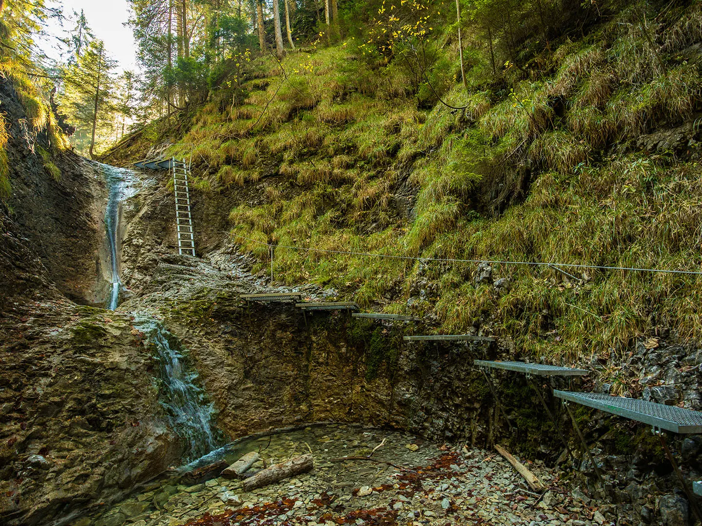
- The ladders and catwalks: Suchá Belá is known for its fixed gear: steel and wooden ladders, metal rungs, foot-ledges, chains, wooden footbridges and catwalks through the narrow ravine.
- Korytový and Bočný falls: Higher in the gorge, these smaller waterfalls — about 8.5 m and 8 m — add quieter, mossy sections after the busier lower cascades.
- Kláštorisko monastery ruins: On the longer loop, this forest clearing has ruins of a 14th-century Carthusian monastery and a mountain chalet, making it a useful rest stop.
- Karst gorge scenery: The route follows a clear stream through steep limestone walls before emerging onto a forested plateau typical of Slovak Paradise.
Challenges to expect
Expect wet rock, stream crossings, slippery steps and exposed ladder sections rather than long mileage. The gorge is climbed upstream only; you cannot descend it, so commit before entering. Summer queues, especially at Misové Waterfall, can be slow, so start early. Winter crossings are for experienced, equipped hikers because ladders ice over and crampons, with a mountain guide recommended, may be needed. Dogs are not allowed.
HikeList Score
Suchá Belá Gorge Trail scored 84/100 on HikeList's trail-quality metrics.
See score breakdownHide breakdown
- Ideal length 55
- Balanced challenge 100
- Scenery & wildness 98
- Varied terrain 71
- Accommodation 92
- Food & support 75
- Path quality 98
- Season flexibility 89
Computed from length, challenge, scenery & wildness, terrain variety, accommodation, food & support, path quality and season flexibility.
 Slovakia
Show more data Show less
- Mountainous
- Forest
- Rocky
- Boardwalk
- Dirt
- Hotels
- Huts
- Campsites
- Hostels
- Family Friendly
- Restrooms
- Campsites
- Picnic Areas
Photos from hikers
Taken on the trail by people who've reviewed Suchá Belá Gorge Trail.
Reviews
How would you rate Suchá Belá Gorge Trail?
Tap a star to start your review — you could be the first.