Conwy Mountain Circular
How would you rate Conwy Mountain Circular?
Tap a star to share your experience and help other hikers.
Conwy Mountain Circular: Mynydd y Dref Half-Day Loop
HikeList Score
Conwy Mountain Circular scored 83/100 on HikeList's trail-quality metrics.
See score breakdownHide breakdown
- Ideal length 55
- Balanced challenge 100
- Scenery & wildness 98
- Varied terrain 83
- Accommodation 91
- Food & support 54
- Path quality 98
- Season flexibility 89
Computed from length, challenge, scenery & wildness, terrain variety, accommodation, food & support, path quality and season flexibility.
The Conwy Mountain Circular is a 9 km moderate loop from Conwy in North Wales, climbing Mynydd y Dref on the edge of Eryri. It is a half-day walk, usually taking around 3–3.5 hours, with about 300 m of ascent to an open coastal ridge. Expect heather moorland, rocky and grassy paths, sea views over Conwy Bay, and the Iron Age hillfort of Castell Caer Seion. It suits walkers wanting a short mountain feel without committing to a full Eryri day.
Route Overview
The standard longer circular starts and finishes in Conwy town, commonly from Castle Square or the quay, with Conwy railway station and town car parks nearby. The route follows Wales Coast Path waymarks out of town, crosses the lower slopes and climbs onto the Conwy Mountain ridge, also using sections of the North Wales Path. Key points include Castell Caer Seion, open views towards the Great Orme, Anglesey and the Carneddau, and the Sychnant Pass side of the hill on longer variants. Descent is by mountain paths and broad tracks back towards Conwy. Shorter loops can start from small car parks on Sychnant Pass Road. For a nearby-style day walk, compare the Aber Falls Walk; for a much longer coastal objective, see the Anglesey Coastal Path.
Prehistoric hillfort above medieval Conwy
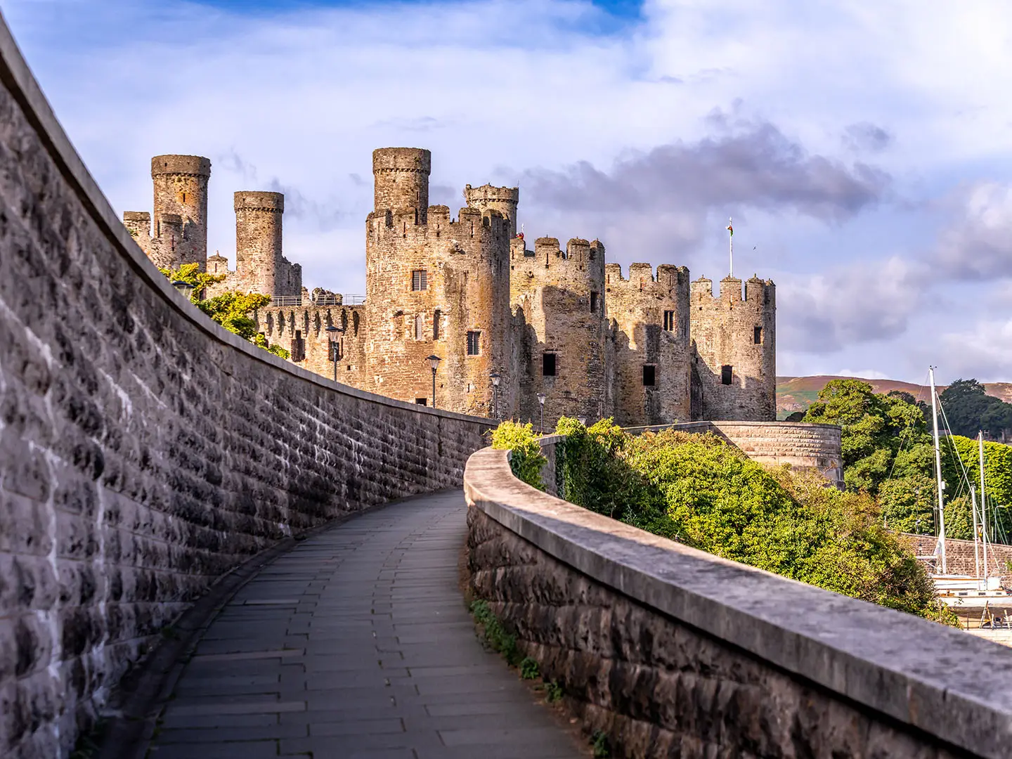
Conwy Mountain has a long human record: Neolithic hut circles and the Iron Age hillfort of Castell Caer Seion sit on the summit area. The fort is one of the larger examples in north-west Wales, with more than 50 hut circles and its own citadel. A small 1951 excavation found slingstones, querns, pestles and mortars, but no closely datable finds. Below the hill, Conwy is a medieval walled town built around Edward I’s castle, begun in 1283.
Notable highlights
- Castell Caer Seion hillfort: An Iron Age hillfort on the summit ridge, with hut circles, platform houses and a separate citadel. It gives the walk a clear archaeological focus, not just a viewpoint.
- Summit views over Conwy Bay: From the 244 m top, the coast, Conwy estuary, Great Orme, Anglesey and the Carneddau range come into view in clear weather.
- Heather, gorse and Carneddau ponies: Late summer brings purple heather and yellow gorse across the ridge. Free-roaming Carneddau ponies are sometimes seen nearby, so keep dogs under close control around ponies and sheep.
- Ancient volcanic ground: Conwy Mountain is the eroded remains of a volcano that erupted roughly 450 million years ago, adding geological interest to the rocky ridge.
- Sychnant Pass: A scenic pass west of the mountain and a useful alternative start point for shorter variants of the loop.
- Conwy town and castle: The usual start and finish is a UNESCO World Heritage medieval walled town with Edward I’s 13th-century castle and a harbour quay.
Challenges to expect
This is short, but not a town stroll. The climb is real, the ridge is exposed, and paths can be rocky, uneven, braided or boggy in places. Navigation is helped by Wales Coast Path and North Wales Path waymarks, but the open hillside has many paths, so carry a map or GPS. Wind and fast-changing coastal weather can make the 244 m summit feel more serious than its height suggests.
HikeList Score
Conwy Mountain Circular scored 83/100 on HikeList's trail-quality metrics.
See score breakdownHide breakdown
- Ideal length 55
- Balanced challenge 100
- Scenery & wildness 98
- Varied terrain 83
- Accommodation 91
- Food & support 54
- Path quality 98
- Season flexibility 89
Computed from length, challenge, scenery & wildness, terrain variety, accommodation, food & support, path quality and season flexibility.
 United Kingdom
 Wales
WalesShow more data Show less
- Mountain
- Coastal
- Moorland
- Dirt
- Rock
- Grass
- Hotels
- Hostels
- Guesthouses
- Family Friendly
- Pet Friendly
- None
Photos from hikers
Taken on the trail by people who've reviewed Conwy Mountain Circular.
Reviews
How would you rate Conwy Mountain Circular?
Tap a star to start your review — you could be the first.