Paiva Walkways (Passadiços do Paiva)
How would you rate Paiva Walkways (Passadiços do Paiva)?
Tap a star to share your experience and help other hikers.
Paiva Walkways: A Practical Guide to Passadiços do Paiva
HikeList Score
Paiva Walkways (Passadiços do Paiva) scored 72/100 on HikeList's trail-quality metrics.
See score breakdownHide breakdown
- Ideal length 55
- Balanced challenge 80
- Scenery & wildness 71
- Varied terrain 76
- Accommodation 74
- Food & support 68
- Path quality 92
- Season flexibility 89
Computed from length, challenge, scenery & wildness, terrain variety, accommodation, food & support, path quality and season flexibility.
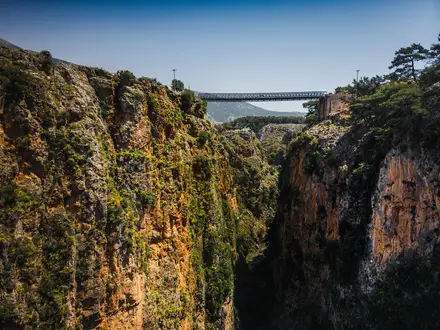
The Paiva Walkways are an 8.7 km linear boardwalk on the left bank of the Paiva River in Arouca, northern Portugal. This is a day walk, taking about 2.5 to 3 hours one way, with roughly 550 m of ascent. It is officially rated Hard/High because of steep gradients and long stairways, though fit walkers often find it moderate. Come for a managed gorge walk with dramatic river views, geology and the optional 516 Arouca Bridge.
Route Overview
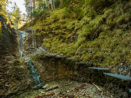
The route runs point-to-point between Areinho river beach, the south-eastern entrance, and Espiunca river beach, the north-eastern entrance. Areinho to Espiunca is the easier direction: you descend the 400+ steps early and then walk broadly downstream. Espiunca to Areinho is harder, climbing against the river and finishing on the monumental stairway. The path is a continuous suspended timber boardwalk with long flights of steps, passing the Vau area, Aguieiras Waterfall viewpoints and geosites in Arouca UNESCO Global Geopark. For more routes in the same landscape, see Arouca Geopark Trails; for another short boardwalk option, compare the Costa da Caparica Boardwalk.
History of the Paiva Walkways
The walkways were built by Arouca Municipality and inaugurated on 20 June 2015. They became popular almost immediately, drawing around 200,000 visitors in the first two and a half months. The route has won the World Travel Awards title of “World’s Best Adventure Tourism Attraction” multiple consecutive years. Wildfires have affected parts of the surrounding area in different years, leading to temporary closures and rebuilding. In spring 2021, the neighbouring 516 Arouca suspension bridge opened, extending the visitor experience.
Notable highlights
- Paiva Gorge (Garganta do Paiva): The boardwalk clings to this steep-sided river canyon for its full length, with rapids and clear pools below.
- Aguieiras Waterfall (Cascata das Aguieiras): A tall tributary waterfall near the Vau area and one of the route’s twelve listed geosites.
- Vau river beach (Praia Fluvial do Vau): A sandy river beach roughly midway along the walk, commonly used as a rest or swim stop.
- Gola do Salto: A Geopark site where the Paiva drops about 3–4 m, viewed from a dedicated boardwalk platform.
- 516 Arouca Bridge: A separate ticketed suspension bridge near the Aguieiras/Vau area, 516 m long and 175 m above the Paiva.
- The monumental stairway: The defining physical challenge at the Areinho end: 400+ wooden steps climbing or descending roughly 200 m above the river.
Challenges to expect
Expect more effort than the short distance suggests. The official rating is Hard/High because of steep gradients, over 400 steps at the Areinho stairway and long exposed sections of timber boardwalk. It is not wheelchair accessible. Summer can be hot and busy, and a daily visitor cap applies. Navigation is simple on the fixed boardwalk, but advance online ticketing is required.
HikeList Score
Paiva Walkways (Passadiços do Paiva) scored 72/100 on HikeList's trail-quality metrics.
See score breakdownHide breakdown
- Ideal length 55
- Balanced challenge 80
- Scenery & wildness 71
- Varied terrain 76
- Accommodation 74
- Food & support 68
- Path quality 92
- Season flexibility 89
Computed from length, challenge, scenery & wildness, terrain variety, accommodation, food & support, path quality and season flexibility.
 Portugal
Show more data Show less
- River Gorge
- Woodland
- Rocky Escarpment
- Wooden Boardwalk
- Wooden Steps
- Hotels
- Lodges
- Family Friendly
- Restrooms
- Picnic Areas
Photos from hikers
Taken on the trail by people who've reviewed Paiva Walkways (Passadiços do Paiva).
Reviews
How would you rate Paiva Walkways (Passadiços do Paiva)?
Tap a star to start your review — you could be the first.