Stubai High Trail
How would you rate Stubai High Trail?
Tap a star to share your experience and help other hikers.
Stubai High Trail: Stubaier Höhenweg Guide
HikeList Score
Stubai High Trail scored 76/100 on HikeList's trail-quality metrics.
See score breakdownHide breakdown
- Ideal length 99
- Balanced challenge 80
- Scenery & wildness 78
- Varied terrain 64
- Accommodation 49
- Food & support 65
- Path quality 98
- Season flexibility 76
Computed from length, challenge, scenery & wildness, terrain variety, accommodation, food & support, path quality and season flexibility.
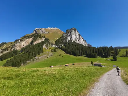
The Stubai High Trail (Stubaier Höhenweg) is an 80 km hut-to-hut loop in the Stubai Alps of Tyrol, Austria. It usually takes 7–8 days and is a hard alpine trek: expect narrow, steep, exposed paths, rocky ground, scree, boulder fields and several cable-secured sections. The route suits fit hikers with sure-footedness, a head for heights and previous alpine experience. It is not a technical climb and avoids glaciers, but it stays mostly between 2,000 m and 3,000 m.
Route Overview
The route forms a horseshoe-style loop around the Stubaital, using Neustift im Stubaital as the valley base. The trail proper runs between Starkenburger Hut and Innsbrucker Hut and can be walked in either direction; the standard high-level stages link Starkenburger Hut, Franz-Senn-Hut, Neue Regensburger Hut, Dresdner Hut, Sulzenau Hut, Nürnberger Hut, Bremer Hut and Innsbrucker Hut. Valley access is via Neustift, with Fulpmes, Neder and Ranalt also noted as access points; no specific public transport details are verified in this brief. If you are comparing Tyrolean hut treks, also look at the Eagle Walk (Adlerweg) or Austria’s longer Hohe Tauern Panorama Trail.
History of the Stubaier Höhenweg
The Stubaier Höhenweg links a chain of Alpine Club huts, many built by Austrian and German Alpine Club sections in the late 19th and early 20th centuries. Several huts are now over 100 years old and began as bases for early alpinists and shepherds. As alpine trekking grew, these huts were connected into a continuous waymarked high-level traverse. Today the route carries the Tyrolean mountain-trail quality seal and is one of the “Great Walks Tirol”.
Notable highlights
- Grawa Waterfall: A natural monument on the WildeWasserWeg near the Sulzenau approach, cited as the widest waterfall in the Eastern Alps at about 85 m wide with a roughly 180 m drop. It is fullest in early summer snowmelt.
- Dresdner Hut (Dresdner Hütte): A large, busy hut at about 2,302 m beneath the Stubai glacier ski area. The steepest official stage reaches the route’s 2,858 m high point soon after.
- Sulzenau Hut and Blue Lake (Blaue Lacke): The hut sits in a green glacial basin near a turquoise meltwater tarn fed by the receding Sulzenau glacier. It is one of the route’s most distinctive high-alpine settings.
- Grawagrubennieder pass: The highest col on the route, at roughly 2,880 m, between Nürnberger Hut and Bremer Hut. Expect cable-secured rocky terrain and wide Stubai Alps views.
- Franz-Senn-Hut (Franz-Senn-Hütte): A large, historic Alpine Club hut in the Oberbergtal and a busy mountaineering base, named after Alpine Club co-founder Franz Senn.
- Starkenburger Hut: A hut on the western flank of the Stubaital with views over the valley and the Kalkkögel limestone peaks, often called the “Dolomites of the North”.
Challenges to expect
This is a hard alpine route, not a valley walk. Expect long hut days, over 6,000 m total ascent, steep and exposed paths, rocky terrain, scree, boulder fields and residual snowfields early in the season. Several sections are secured with steel cables, so poor weather can make progress slower and more serious. Huts require advance booking in season. For another demanding Austrian high route, compare the Carnic High Trail.
HikeList Score
Stubai High Trail scored 76/100 on HikeList's trail-quality metrics.
See score breakdownHide breakdown
- Ideal length 99
- Balanced challenge 80
- Scenery & wildness 78
- Varied terrain 64
- Accommodation 49
- Food & support 65
- Path quality 98
- Season flexibility 76
Computed from length, challenge, scenery & wildness, terrain variety, accommodation, food & support, path quality and season flexibility.
 Austria
Show more data Show less
- Mountainous
- Rocky
- Rocky
- Dirt
- Huts
- Pet Friendly
- Restrooms
- Water Sources
- Shelters
In these collections
Photos from hikers
Taken on the trail by people who've reviewed Stubai High Trail.
Official stage from Starkenburger Hut to Franz-Senn-Hut, with about 690 m of ascent.
Official stage from Franz-Senn-Hut to Neue Regensburger Hut, with about 603 m of ascent.
The steepest official stage, with about 1,033 m of ascent. This section reaches the trail’s verified high point at 2,858 m.
Official stage from Dresdner Hut to Sulzenau Hut, with about 419 m of ascent.
Official stage from Sulzenau Hut to Nürnberger Hut, with about 461 m of ascent.
Official stage from Nürnberger Hut to Bremer Hut, with about 642 m of ascent.
Official stage from Bremer Hut to Innsbrucker Hut, with about 839 m of ascent.
Reviews
How would you rate Stubai High Trail?
Tap a star to start your review — you could be the first.