Brandnertal Valley Trails
How would you rate Brandnertal Valley Trails?
Tap a star to share your experience and help other hikers.
Brandnertal Valley Trails: Hiking the Rätikon from Brand
HikeList Score
Brandnertal Valley Trails scored 85/100 on HikeList's trail-quality metrics.
See score breakdownHide breakdown
- Ideal length 66
- Balanced challenge 100
- Scenery & wildness 98
- Varied terrain 71
- Accommodation 75
- Food & support 88
- Path quality 98
- Season flexibility 76
Computed from length, challenge, scenery & wildness, terrain variety, accommodation, food & support, path quality and season flexibility.
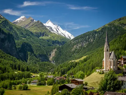
The Brandnertal Valley Trails are a network of roughly 400 km of marked hikes in southern Vorarlberg, western Austria, not one fixed long-distance trail. Routes run from Bürs, Bürserberg and Brand into the Rätikon mountains, with options from easy family walks to hut-to-hut tours and summit routes. Plan anything from a half-day outing to a 1–4 day alpine itinerary. Overall difficulty is moderate for typical mountain day hikes, but the network includes both easy valley walks and demanding high routes.
Route Overview
There is no single start or finish. The main hiking bases are Bürs at the valley entrance near Bludenz, Bürserberg on the Tschengla plateau, and Brand at the valley head above 1,000 m. From these villages, trails form loops, out-and-back summit walks and hut-to-hut links. The Lünersee is reached from above Brand by the paid Lünerseebahn cable car, while Niggenkopf is part of the Bürserberg lift area. Common objectives include the Bürser Schlucht, Natursprünge-Weg, Lünersee circuit, Heinrich-Hueter-Hütte, Schesaplana and the Rätikon High Trail. For longer Austrian alpine routes, compare the Eagle Walk, Karwendel Höhenweg or Carnic High Trail.
Walser settlement and early alpine tourism
Brand and the wider Brandnertal were settled from the 13th–14th centuries by Walser families migrating over the mountains from Goms in the upper Rhône valley of Valais, Switzerland. A charter dated 7 December 1347 granted the valley to the Walsers. For centuries, life centred on high-alpine farming and transhumance. Mountain tourism developed in the 19th century: the cart road from Bürs to Brand was built around 1820–1830, the Lindau–Bludenz railway opened in 1872, and the first Alpine Club hut at the Lünersee was built in 1870.
Notable highlights
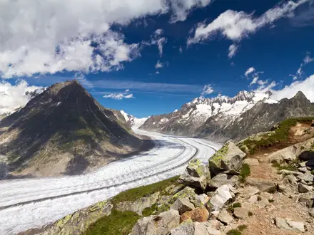
- Lünersee (~1,970 m): A turquoise reservoir beneath the Schesaplana, reached by the Lünerseebahn. The easy shoreline circuit is about 6 km and suits walkers wanting high-mountain scenery without a long climb.
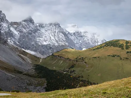
- Schesaplana (2,965 m): The highest summit of the Rätikon and the major objective above the valley. The classic ascent includes the rope-secured Böser Tritt and is a serious alpine hike.
- Zimba (2,643 m): A striking pyramid-shaped peak nicknamed the Montafoner Matterhorn. Its summit is a grade III rock climb, so most hikers admire it from valley routes or the Heinrich-Hueter-Hütte.
- Natursprünge-Weg (~4.7 km): An easy themed loop above Brand with eleven interactive stations developed with the inatura nature museum. It links the Panoramabahn and Dorfbahn stations and is well suited to families.
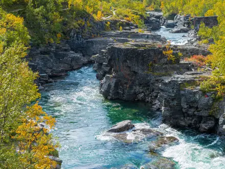
- Bürser Schlucht: A lower-valley gorge carved by the Alvier near Bürs. Seasonal footbridge paths make it one of the easier dramatic walks in the region.
- Rätikon High Trail (~45 km): A multi-day hut circuit starting and finishing at the Lünersee, with overnights in mountain huts and sections on the Swiss side.
Challenges to expect
Do not treat this as one signed 14.5 km trail: navigation depends on the route you choose. Terrain ranges from forest and gorge paths to rocky alpine tracks, rope-secured passages and summit climbs. High routes can hold snow into early summer, and the main hiking season is late June to late September or October. Cable cars are paid and seasonal; huts need booking for overnight tours.
HikeList Score
Brandnertal Valley Trails scored 85/100 on HikeList's trail-quality metrics.
See score breakdownHide breakdown
- Ideal length 66
- Balanced challenge 100
- Scenery & wildness 98
- Varied terrain 71
- Accommodation 75
- Food & support 88
- Path quality 98
- Season flexibility 76
Computed from length, challenge, scenery & wildness, terrain variety, accommodation, food & support, path quality and season flexibility.
Show more data Show less
- Mountainous
- Forest
- Dirt
- Rocky
- Gravel
- Hotels
- Huts
- Campsites
- Family Friendly
- Pet Friendly
- Restrooms
- Water Sources
- Campsites
- Shelters
- Picnic Areas
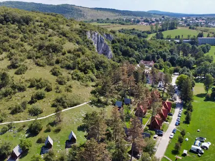
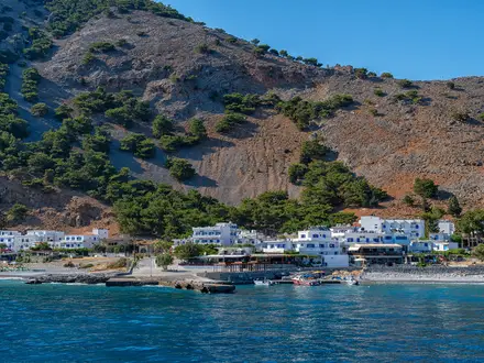
Photos from hikers
Taken on the trail by people who've reviewed Brandnertal Valley Trails.
Reviews
How would you rate Brandnertal Valley Trails?
Tap a star to start your review — you could be the first.