Eagle Walk (Adlerweg)
How would you rate Eagle Walk (Adlerweg)?
Tap a star to share your experience and help other hikers.
Eagle Walk (Adlerweg): Tyrol’s Flagship Hut-to-Hut Traverse
HikeList Score
Eagle Walk (Adlerweg) scored 83/100 on HikeList's trail-quality metrics.
See score breakdownHide breakdown
- Ideal length 68
- Balanced challenge 80
- Scenery & wildness 98
- Varied terrain 71
- Accommodation 83
- Food & support 88
- Path quality 98
- Season flexibility 76
Computed from length, challenge, scenery & wildness, terrain variety, accommodation, food & support, path quality and season flexibility.
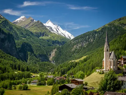
The Eagle Walk (Adlerweg) is Tyrol’s flagship long-distance hike in Austria: a 326 km, 24-stage, point-to-point hut-to-hut traverse from St. Johann in Tirol to St. Christoph am Arlberg. It is a hard alpine route, not a casual valley walk, with about 23,000 m of ascent and a 2,635 m high point in the Lechtal Alps. It suits experienced mountain walkers who are sure-footed, comfortable with exposure and able to handle long consecutive days on rocky, sometimes secured paths.
Route Overview
The main North Tyrol Adlerweg runs east to west, starting at St. Johann in Tirol in the Kitzbühel/Kaiser region and finishing at St. Christoph am Arlberg on the Arlberg Pass. The route skirts the Wilder Kaiser past Kufstein, crosses the Brandenberg Alps to Achensee, traverses the Rofan, then enters the Karwendel and Nordkette above Innsbruck, around the trail’s midpoint. It continues through the Wetterstein and Mieming ranges near Ehrwald before the demanding Lechtal Alps stages to the finish. Some valley descents use lifts, so budget for cable-car fares where relevant. If the Karwendel is your main focus, compare the Karwendel Höhenweg; for another Austrian long-distance option, see the Hohe Tauern Panorama Trail.
How the Adlerweg was created
The Adlerweg was conceived by Tirol Werbung, Tyrol’s regional tourist board, and opened in the mid-2000s to showcase the state as a long-distance hiking destination. It was redesigned in 2015/2016 and links existing mountain paths, mule tracks and Alpine Club hut routes into one waymarked traverse. Its name comes from the eagle: when plotted on a map, the stages resemble an eagle in flight, with the body and head over the Karwendel and Innsbruck.
Notable highlights
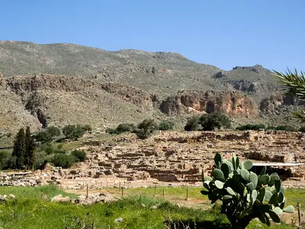
- Wilder Kaiser (Kaisergebirge): The opening stages skirt this jagged limestone massif above St. Johann in Tirol and Kufstein, giving an immediate Northern Limestone Alps feel.
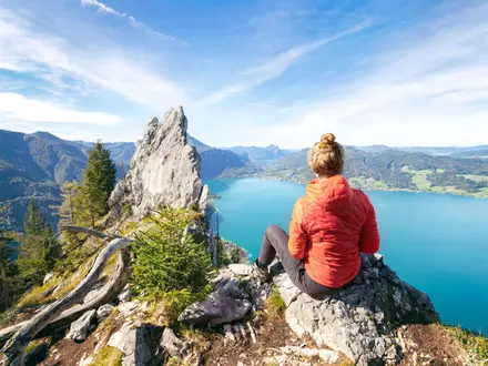
- Achensee: Tyrol’s largest lake is reached as the route crosses from the Brandenberg Alps into the Rofan, adding a rare lakeside contrast to the mountain stages.
- Karwendel and the Nordkette: The trail crosses Austria’s largest nature park and follows rugged limestone country above Innsbruck, the route’s roughly halfway point.
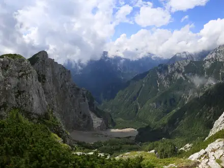
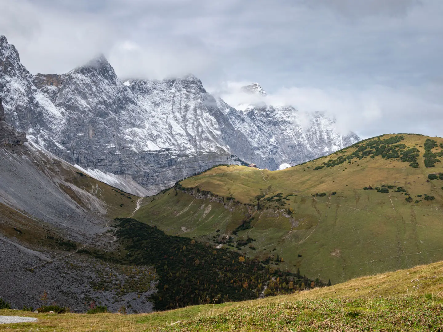
- Lechtal Alps high stages: Stages 19–24 are the crux, with exposed ridges, fixed cables and high passes, including the Grossbergspitze at 2,635 m.
- St. Christoph am Arlberg: The finish is at the historic Arlberg Pass hospice village, a high mountain saddle on Tyrol’s western edge.
- Alpine Club huts: Refuges such as Erfurter Hütte, Memminger Hütte and Ansbacher Hütte anchor the higher hut-to-hut stages with dormitory beds and half-board.
Challenges to expect
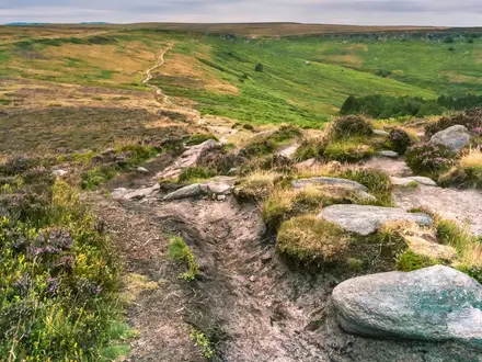
Expect hard alpine walking: rocky paths, scree, forest tracks, exposed ground and fixed-cable sections on the toughest stages. The Lechtal Alps stages are the main test and require surefootedness, a head for heights and settled mountain conditions. Snow can linger on high passes into early summer, while huts are most useful during the mid-June to mid-September season. For a different high-level Austrian challenge, compare the Carnic High Trail.
HikeList Score
Eagle Walk (Adlerweg) scored 83/100 on HikeList's trail-quality metrics.
See score breakdownHide breakdown
- Ideal length 68
- Balanced challenge 80
- Scenery & wildness 98
- Varied terrain 71
- Accommodation 83
- Food & support 88
- Path quality 98
- Season flexibility 76
Computed from length, challenge, scenery & wildness, terrain variety, accommodation, food & support, path quality and season flexibility.
Show more data Show less
- Mountainous
- Forest
- Rocky
- Dirt
- Gravel
- Huts
- Hotels
- Hostels
- Pet Friendly
- Restrooms
- Water Sources
- Campsites
- Shelters
In these collections
Photos from hikers
Taken on the trail by people who've reviewed Eagle Walk (Adlerweg).
Reviews
How would you rate Eagle Walk (Adlerweg)?
Tap a star to start your review — you could be the first.