St. Francis Way (Via di Francesco)
How would you rate St. Francis Way (Via di Francesco)?
Tap a star to share your experience and help other hikers.
St. Francis Way (Via di Francesco): La Verna to Rome
HikeList Score
St. Francis Way (Via di Francesco) scored 82/100 on HikeList's trail-quality metrics.
See score breakdownHide breakdown
- Ideal length 61
- Balanced challenge 80
- Scenery & wildness 74
- Varied terrain 100
- Accommodation 100
- Food & support 88
- Path quality 84
- Season flexibility 89
Computed from length, challenge, scenery & wildness, terrain variety, accommodation, food & support, path quality and season flexibility.
The St. Francis Way, or Via di Francesco, is a hard point-to-point pilgrimage across central Italy, running about 500 km from the Sanctuary of La Verna to Rome in 27-28 days. It suits experienced hikers who are comfortable with long Apennine stages, repeated steep ascents and descents, mixed surfaces and simple pilgrim logistics. The route crosses Tuscany, Umbria and Lazio via Assisi, linking major Franciscan sites rather than following an easy lowland path.
Route Overview
The classic route starts at the Sanctuary of La Verna near Chiusi della Verna in the Tuscan Apennines and finishes at Rome / St Peter's Basilica, Vatican City. Walkers generally head south through Pieve Santo Stefano, Sansepolcro, Citta di Castello, Gubbio and Valfabbrica to Assisi, then continue through Spello, Foligno, Trevi, Spoleto, the Valnerina, Piediluco, Poggio Bustone, Rieti, Greccio and the Monterotondo area into Rome. It is a one-way pilgrimage, not a loop. For shorter Italian walking ideas, compare the Chianti Trail, Crete Senesi Loop or the coastal Cinque Terre Coastal Trail.
Franciscan history of the Via di Francesco
The Via di Francesco is a modern long-distance pilgrimage built from historic Franciscan routes. It links places associated with St Francis of Assisi, who lived from 1181/82 to 1226, including La Verna, Assisi and the sanctuaries around Rieti. The classic line runs from La Verna, where Francis is said to have received the stigmata in 1224, through Assisi to Rome. A northern extension from Rimini to La Verna was inaugurated in 2013 for the 800th anniversary of Francis's journey there.
Notable highlights
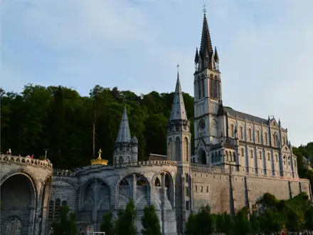
- Sanctuary of La Verna: A clifftop Franciscan sanctuary in the Tuscan Apennines and the classic starting point of the walk. It is associated with St Francis receiving the stigmata in 1224.
- Assisi and the Basilica of St Francis: Assisi is Francis's birthplace and burial place, and the emotional centre of the pilgrimage. The UNESCO-listed Basilica of St Francis contains Giotto's celebrated fresco cycle of his life.
- Gubbio: A preserved medieval Umbrian town linked to the legend of St Francis taming the wolf. Its steep stone streets and Palazzo dei Consoli make it one of the strongest urban stops on the route.
- Holy Valley of Rieti: Greccio, Poggio Bustone, Fonte Colombo and La Foresta form a cluster of Franciscan sanctuaries. Greccio is associated with Francis creating the first living Nativity scene in 1223.
- Spoleto and the Valnerina: Spoleto is a historic hill town known for the Ponte delle Torri aqueduct-bridge. South of Assisi, the route enters the wooded Nera river valley, or Valnerina.
- Eremo delle Carceri: A small forest hermitage above Assisi on Monte Subasio. It is a common optional side-trip for walkers with time and energy.
Challenges to expect
Expect hard walking rather than technical mountaineering. The route has repeated Apennine ascents and descents, mixed dirt, gravel, rocky and asphalt surfaces, and at least one very long northern stage of up to about 36-46 km. High summer can be hot in the valleys, while higher Apennine sections may hold snow in winter. Pilgrim accommodation is thinner than on the Camino de Santiago, so book ahead.
HikeList Score
St. Francis Way (Via di Francesco) scored 82/100 on HikeList's trail-quality metrics.
See score breakdownHide breakdown
- Ideal length 61
- Balanced challenge 80
- Scenery & wildness 74
- Varied terrain 100
- Accommodation 100
- Food & support 88
- Path quality 84
- Season flexibility 89
Computed from length, challenge, scenery & wildness, terrain variety, accommodation, food & support, path quality and season flexibility.
 Italy
ItalyShow more data Show less
- Mountainous
- Forest
- Valley
- Rural
- Urban
- Dirt
- Gravel
- Rocky
- Paved
- Convents
- Monasteries
- Hostels
- Farm Stays
- B&Bs
- Hotels
- Family Friendly
- Pet Friendly
- Restrooms
- Water Sources
- Campsites
- Shelters
In these collections
Photos from hikers
Taken on the trail by people who've reviewed St. Francis Way (Via di Francesco).
Begin your pilgrimage from the spiritual heights of the La Verna Sanctuary, descending through dense woodland and across creek beds to reach the charming town of Pieve Santo Stefano. The route is marked by forested paths, occasional rocky terrain, and provides an immediate immersion into the scenic mountains of Tuscany.
Today’s segment travels along the Tiber River valley, following a mix of country lanes and wooded trails. You arrive in Sansepolcro, famed for its Renaissance architecture and historical significance, with gentle elevation changes along the day’s walk.
Crossing the border into Umbria, this stretch moves from fields and farmlands into historic Città di Castello. The terrain is a gentle mix of gravel and paved surfaces, passing through small villages and olive groves en route to the medieval town center.
Climbing into the Umbrian hills, this day’s journey is both scenic and demanding, traversing woodlands and pastoral countryside to reach the elevated medieval village of Pietralunga. Expect some prolonged ascents and rewarding valley views.
Descend from Pietralunga through forested hills and small hamlets on your way to Gubbio, a highlight of the route with its striking medieval architecture and stunning hilltop location. The day is characterized by quiet rural settings.
Leaving Gubbio behind, travel a more remote route over rolling hills where pockets of forest give way to patches of open land. The stage concludes at Biscina, offering peace and panoramic vistas in the Umbrian countryside.
The trail threads its way through quiet forest, following gravel tracks and country lanes, with brief but steep ascents before the descent to Valfabbrica. Along the way, enjoy tranquil woods and scenic river crossings.
One of the most anticipated stages, this section leads you through scenic woodland trails and gentle hillsides into the sacred city of Assisi. The finish is marked by your first awe-inspiring sight of the Basilica of St. Francis across the valley.
Departing from Assisi, follow hillside paths across Monte Subasio to the attractive hillside town of Spello. This section features olive groves, far-reaching mountain views, and ancient Roman ruins along the route.
Continue along the valley with a short and mostly gentle walk to the bustling town of Foligno. The terrain is primarily flat, making this a less demanding day and allowing for exploration of Foligno’s vibrant historic center.
Traverse olive groves and vineyards as you climb toward the picturesque hilltown of Trevi. The route includes both paved and unpaved paths, with steady elevation gain offering wide views across the valley below.
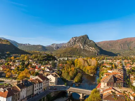
A longer walk on gentle terrain brings you alongside waterways and ancient Roman infrastructure into the city of Spoleto. This day combines stretches of open countryside with woodland sections and urban entry.
Leaving Spoleto, the trail winds into the Valnerina Valley, passing through secluded villages and lush forests. The walk to Ceselli is peaceful, with fewer urban encounters and plenty of opportunities to enjoy quiet nature.
Follow trails through the green heart of the Nera River Valley, visiting old abbeys and stone villages before finishing in Arrone. This section stays close to the river, with soft terrain and beautiful natural surroundings.
A gentle walk takes you past lakeside scenery and the Terni waterfalls as you travel toward Piediluco. This is a relatively easy day, with opportunities to visit the iconic Cascata delle Marmore, one of Europe’s highest manmade waterfalls.
The route becomes more mountainous as you enter Lazio, climbing steeply though forests with panoramic views of Lake Piediluco. After a demanding ascent, you’ll reach the tranquil Sanctuary of Poggio Bustone.
Descend into the Rieti plain, passing several Franciscan sanctuaries and rural hamlets before reaching the historic city of Rieti. The terrain alternates between woodland paths and quiet country roads.
Today’s stage follows the ancient Via Salaria, traversing rolling farmland, oak forests, and passing archaeological remains before arriving in the small hilltown of Poggio San Lorenzo.
Walk through classic Lazio landscapes of olive groves, cypress trees, and gentle ridges. The path is rural and crosses several historic villages before concluding at Ponticelli di Scandriglia.
Continue through hilly pastures and open countryside, occasionally walking on quiet local roads. The day ends in the historic town of Montelibretti, set in a region dotted with ancient castles and villas.
Wander through farmlands and rolling hills, blending rural landscapes with increasing signs of nearby Rome. Monterotondo welcomes you with historical sites and bustling piazzas.
This stage marks the transition from rural trails to the outskirts of Rome. Walk along quiet country paths that gradually lead into suburban neighborhoods before arriving at Monte Sacro, just north of the city center.
Follow urban paths and greenways as you cross into Rome proper, passing Roman aqueducts and city parks before reaching Stazione Tiburtina. This is a short but busy segment in preparation for the final approach.
Conclude your pilgrimage with a walk through Rome’s historic streets and bustling urban environment, culminating at the spiritual heart of Catholicism, St. Peter’s Basilica in Vatican City.
A suggested rest day or time for further exploration of Rome or Assisi, allowing hikers to recover, reflect, and immerse in the local culture and historical treasures.
For those starting or ending in Assisi, this optional day takes walkers up Monte Subasio to the hermitage of Eremo delle Carceri before returning to town; peaceful, forested paths offer contemplative solitude.
Some hikers choose the alternative Franciscan route linking the sanctuary of Greccio (site of the first Nativity scene) to Rieti, passing through the villages and forests of the Sabine hills.
This day can be used for shorter walks, local explorations in key towns, or logistical transfers between segments based on individual itinerary preferences.
Reviews
How would you rate St. Francis Way (Via di Francesco)?
Tap a star to start your review — you could be the first.