Main Sudetes Trail (Główny Szlak Sudecki)
How would you rate Main Sudetes Trail (Główny Szlak Sudecki)?
Tap a star to share your experience and help other hikers.
Main Sudetes Trail (Główny Szlak Sudecki): A Practical Hiking Guide
HikeList Score
Main Sudetes Trail (Główny Szlak Sudecki) scored 86/100 on HikeList's trail-quality metrics.
See score breakdownHide breakdown
- Ideal length 79
- Balanced challenge 84
- Scenery & wildness 78
- Varied terrain 94
- Accommodation 100
- Food & support 88
- Path quality 98
- Season flexibility 76
Computed from length, challenge, scenery & wildness, terrain variety, accommodation, food & support, path quality and season flexibility.
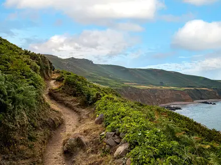
The Main Sudetes Trail — Główny Szlak Sudecki im. Mieczysława Orłowicza — is a 443 km red-waymarked thru-hike across the Sudetes in south-west Poland. It runs from Świeradów-Zdrój to Prudnik, usually west to east, and typically takes 16–20 days. The grade is hard because of the length and roughly 14,170 m of cumulative ascent, not because of technical ground: there is no climbing or scrambling required. It suits fit hikers who want a long, hut-and-town-supported mountain crossing.
Route Overview
This is a linear, point-to-point trail from Świeradów-Zdrój in the Jizera Mountains to Prudnik in the Opawskie Mountains foothills. Most hikers walk west to east, linking Szklarska Poręba, Karpacz, Krzeszów, the Wałbrzych area, Srebrna Góra, Polanica-Zdrój, Duszniki-Zdrój and Kudowa-Zdrój before the final approach to Prudnik. The route crosses the Jizera Mountains, Karkonosze, Rudawy Janowickie, Góry Kamienne, Góry Sowie, Góry Stołowe, Bystrzyckie Mountains, Śnieżnik Massif, Góry Złote and Góry Opawskie. For shorter comparisons, see the Karkonosze Ridge Trail or the Amber Trail.
History of the Główny Szlak Sudecki
The Główny Szlak Sudecki was conceived by Mieczysław Orłowicz, a key figure in Polish organised tourism, and the full name of the route honours him. It was laid out in 1947, shortly after the Second World War, and has been modified several times since. One major modern change was the move of the eastern terminus to Prudnik around 2009; earlier versions ended at Paczków. It is regarded as Poland’s second-longest waymarked mountain trail after the Main Beskid Trail.
Notable highlights
- Sněžka / Śnieżka (1,603 m): The highest summit of the Sudetes, the Karkonosze and the Czech Republic, sitting on the Polish-Czech border. The summit is known for the distinctive disc-shaped Polish meteorological observatory.
- Szczeliniec Wielki (922 m): The highest peak of the Table Mountains and a flat-topped sandstone massif. Hikers come for its rock labyrinth of fissures, stairways and named formations such as the Camel and the Monkey.
- Błędne Skały / Errant Rocks: A sandstone “rock city” in Stołowe Mountains National Park, at about 853 m. Its narrow passages and block formations make it one of the most distinctive sections of the Table Mountains.
- Wielka Sowa: The highest summit of the Owl Mountains, with a stone observation tower. It is a useful high point on the central part of the Sudetes crossing.
- Srebrna Góra fortress: A large 18th-century Prussian mountain fortress near the trail at a Sudetes pass. It adds a strong historical landmark to an otherwise ridge-and-valley walking section.
- Kłodzko region spa towns: Polanica-Zdrój, Duszniki-Zdrój and Kudowa-Zdrój give the trail regular town stops, accommodation and a different rhythm from the forested mountain sections.
Challenges to expect
Expect a hard long-distance walk rather than technical mountaineering. The cumulative ascent is substantial, and the route repeatedly drops into valleys before climbing into the next Sudetes range. Surfaces vary from forest paths and mountain ridges to tracks, sandstone plateaux and some asphalt or road walking. Summer gives the most reliable conditions; in winter, the Karkonosze can be closed by avalanche risk and the Table Mountains’ peat marshes are hazardous.
HikeList Score
Main Sudetes Trail (Główny Szlak Sudecki) scored 86/100 on HikeList's trail-quality metrics.
See score breakdownHide breakdown
- Ideal length 79
- Balanced challenge 84
- Scenery & wildness 78
- Varied terrain 94
- Accommodation 100
- Food & support 88
- Path quality 98
- Season flexibility 76
Computed from length, challenge, scenery & wildness, terrain variety, accommodation, food & support, path quality and season flexibility.
Show more data Show less
- Mountainous
- Forest
- Valleys
- Sandstone Plateaux
- Natural Trail
- Forest Tracks
- Asphalt/Road
- Huts
- Guesthouses
- Hostels
- Hotels
- Family Friendly
- Pet Friendly
- Restrooms
- Water Sources
- Campsites
- Shelters
- Picnic Areas
Download Our Full Guide to Main Sudetes Trail (Główny Szlak Sudecki) FREE!
Get our comprehensive guide to this hike for free. Save it for later reading or print out at home.
Photos from hikers
Taken on the trail by people who've reviewed Main Sudetes Trail (Główny Szlak Sudecki).
Main Sudetes Trail (Główny Szlak Sudecki): The Complete Guide
 i
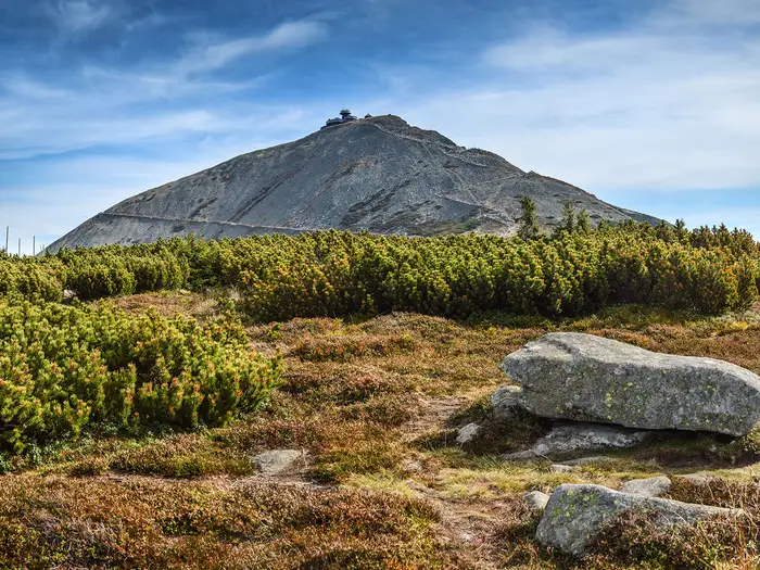
Image by ptk78
i
Image by ptk78 The Main Sudetes Trail is Poland’s long red-blazed crossing of the Sudetes, running for 443 km from Świeradów-Zdrój in the Jizera Mountains to Prudnik near the Czech border. It is a hut-and-town-supported mountain journey rather than a wilderness expedition, but its scale makes it a serious commitment.
The route strings together forested ridges, spa towns, high passes and old mountain settlements across Lower Silesia and into the Opole region. Its strongest days come in the Karkonosze, where the trail reaches Wielki Szyszak at 1,509 m and passes beneath Śnieżka, and later among the sandstone formations of the Góry Stołowe.
This is not a technical trail: there is no scrambling or climbing required. The challenge is the repeated rhythm of dropping into valleys, climbing into the next range and doing it again for 16–20 days, with roughly 14,170 m of cumulative ascent.
It suits fit, experienced walkers who are comfortable planning multi-day stages around PTTK huts, guesthouses, spa-town accommodation and Polish public transport. The red waymarks help, but weather on the Karkonosze ridge, boggy or rocky ground in places and long back-to-back days still demand proper mountain judgement.
This guide covers stages, day planning, accommodation, food, transport, terrain and the common mistakes to avoid.
Stage-by-Stage Guide
The stages below use a practical 20-day thru-hike rhythm of roughly 20–24 km per day. On the Main Sudetes Trail, the red waymarks are usually the organising principle, but daily planning should still be built around accommodation, hut opening times, food resupply and the weather forecast for the higher ridges.
Stage 1: Świeradów-Zdrój to Szklarska Poręba — 22 km
This first stage climbs straight out of Świeradów-Zdrój into the Góry Izerskie, so it is a real mountain day rather than a gentle warm-up. The red-blazed GSS heads towards Stóg Izerski, crosses the Izera plateau around Polana Izerska, then continues towards Schronisko Wysoki Kamień before dropping to Szklarska Poręba.
Underfoot, expect a mix of forest tracks, mountain paths and more open plateau walking. The Izera plateau can feel spacious and remote compared with the spa town start, and boggy or wet ground is possible in poor weather.
Food and water are straightforward at the start and finish, with Świeradów-Zdrój and Szklarska Poręba both being established resort towns. Between them, do not assume frequent shops; plan around any huts or staffed facilities only after checking current opening times.
Szklarska Poręba has the best end-of-day logistics on this stage, with accommodation, food and public transport. It is also a useful place to make any gear or food adjustments before the higher Karkonosze section.
Navigation is generally helped by the red waymarks, but mist on the Izera plateau can make the open sections harder to read. Carry an offline map/GPX and avoid treating the first day as a casual approach walk; there is already meaningful ascent and exposure to weather.
Stage 2: Szklarska Poręba to Schronisko Odrodzenie — 21 km
This is one of the major mountain stages of the whole GSS. From Szklarska Poręba the route climbs into the Karkonosze, passing the Kamieńczyk Waterfall area before reaching the high ridge around Szrenica and Hala Szrenicka, then continuing over the main ridge towards Wielki Szyszak and Schronisko Odrodzenie.
The terrain is higher, rockier and more exposed than Stage 1. This stretch includes the trail’s highest point actually on the GSS: Wielki Szyszak at 1,509 m.
The Karkonosze ridge is also one of the places where weather matters most. Wind, poor visibility and cold rain can make progress slow even in summer, and winter conditions bring serious hazards including avalanche risk on parts of the range.
Food and shelter are usually planned around Szklarska Poręba at the start, mountain huts such as Hala Szrenicka en route, and Schronisko Odrodzenie at the end. Hut opening, meal availability and prices should be checked before travelling, especially outside the main summer season.
There is little practical escape once committed to the ridge compared with the valley-town stages. Public transport is strongest back in Szklarska Poręba; at the hut end, onward options depend on descending from the ridge, so this should be checked before travelling.
Stage 3: Schronisko Odrodzenie to Karpacz via Przełęcz pod Śnieżką — 20 km
This stage continues along the high Karkonosze before descending to Karpacz. The key point is Przełęcz pod Śnieżką, the pass below Śnieżka, rather than the summit itself.
Śnieżka is the highest summit of the Sudetes at 1,603 m, but it is not on the main GSS line. A summit visit is an optional side trip and should only be added if time, weather and energy allow.
The walking remains exposed on the ridge, with rocky subalpine terrain before the route loses height towards Karpacz. In mist or high wind, stay disciplined with navigation and avoid being drawn onto side paths unless they are part of the planned route.
Food is available at Schronisko Odrodzenie if open, with full town services once in Karpacz. Carry enough water and snacks for the ridge section rather than relying on frequent resupply.
Karpacz has accommodation and is one of the main access points in the Karkonosze area. Public transport from the Karpacz area should be checked before travelling, particularly if using it as a section start or finish.
Stage 4: Karpacz to Janowice Wielkie — 22 km
After the intensity of the Karkonosze ridge, this stage drops into a more varied mid-mountain landscape. The route moves away from Karpacz through lower valleys and wooded hills towards the Rudawy Janowickie area.
Expect a mixture of forest paths, tracks, settlement walking and some harder surfaces. The day is still hilly, but the character is less exposed than the previous two Karkonosze stages.
Mysłakowice and Bukowiec lie on the broader route sequence through this part of the Sudetes, and they are useful reference points for judging progress between Karpacz and the Janowice Wielkie area. The walking has more villages and valley crossings than the high ridge days, but services between main settlements should not be assumed.
Karpacz is the reliable food point at the start; Janowice Wielkie is the planned end point for accommodation. Book or check lodging in advance, as the GSS does not always finish each day in a large resort town.
Public transport and road access are better in settled valleys than on the high ridges, but specific rail or bus times for Janowice Wielkie should be checked before travelling. Navigation is usually less exposed, yet junctions in forests and settlements can be easier to miss than a ridge path.
Stage 5: Janowice Wielkie to Kamienna Góra — 22 km
This is a connecting stage through the central Sudetes landscape of wooded ridges, valleys and small towns. It is less famous than the Karkonosze or Góry Stołowe sections, but it still adds meaningful ascent and descent to the cumulative fatigue of the route.
The terrain is mixed: forest tracks, natural paths, lanes and town approaches. After several days on trail, the challenge is often rhythm and foot management rather than any single technical obstacle.
Food and water should be planned from the start and finish settlements. Do not rely on a shop or café being available exactly when needed between them; carry a normal day’s supply.
Kamienna Góra provides the logical end-of-stage services. Accommodation and any local transport connections should be checked before travelling, especially if walking outside peak holiday periods.
Navigation is mainly about staying attentive through lowland and forest junctions. The red blazes remain the key guide, but road crossings and settlement edges are common places to drift off route.
Stage 6: Kamienna Góra to Krzeszów — 22 km
This stage leads to one of the major cultural landmarks on the GSS: Krzeszów Abbey, the large Baroque Cistercian monastery complex at Krzeszów. It is a useful change of pace after several mountain and forest stages.
The walking is generally lower and more settled than the Karkonosze, with a mix of tracks, paths, roads and village approaches. It is still part of a hard long-distance trail, so the day should not be dismissed as a rest stage.
Food is best organised in Kamienna Góra before departure and in Krzeszów at the end. Any intermediate services should be treated as a bonus unless checked in advance.
Krzeszów has accommodation possibilities on or near the route, but availability should be checked before committing to the stage. Road access is straightforward in settlement areas; public transport details should be checked before travelling.
The abbey area is a clear landmark, but the approach can involve less dramatic terrain where attention can drop. Keep checking the red waymarks through villages and on lane junctions.
Stage 7: Krzeszów to Sokołowsko / Głuszyca area — 23 km
This is a longer central-stage day, moving east from Krzeszów towards the Sokołowsko and Głuszyca area. It links the monastery landscape with the wooded hills that lead towards the Góry Sowie section.
Expect forested mid-mountain terrain, valley crossings and settlement walking. The path is not technical, but the repeated climbing and descending is exactly what makes the GSS hard over many consecutive days.
Food and water planning should be conservative. Start with supplies from Krzeszów and do not depend on frequent shops between villages unless current services have been checked.
The Sokołowsko / Głuszyca area gives a practical overnight target, but accommodation should be booked or at least checked ahead. Because this is listed as an area rather than a single fixed town stop, be clear exactly where the night’s lodging is in relation to the red-blazed trail.
Road access is present in the valleys, but public transport options vary by exact endpoint. This should be checked before travelling, particularly for section hikers ending here.
Stage 8: Sokołowsko / Głuszyca area to Walim — 21 km
This stage continues through the central Sudetes and towards the Góry Sowie. The official route sequence through this wider part of the trail includes Sokołowsko, Jedlina-Zdrój and then the Wielka Sowa area.
The day is mostly wooded hill walking with valley and resort-town interludes. Surfaces vary between forest paths, tracks, lanes and settlement sections.
Jedlina-Zdrój is a useful services reference on the wider route through this area. Even so, carry enough food and water to avoid depending on a specific café, shop or opening time.
Walim is the planned end point for this stage. Accommodation should be checked before travelling, and if staying outside the centre, allow for the extra walk to and from the trail.
Navigation can be more fiddly than on open ridges because of forest tracks and village roads. Keep a close eye on red blazes at junctions and do not assume the most obvious track is the GSS.
Stage 9: Walim to Wielka Sowa / Jugów — 22 km
This is the main Góry Sowie stage, with Wielka Sowa as the key objective. Wielka Sowa is the highest summit of the Owl Mountains and is topped by a stone observation tower with wide views over the central Sudetes.
The terrain is forested mountain walking, with a sustained climb to the summit area and then onward travel towards Jugów. The paths are not technical, but this is a proper ascent day and can feel demanding after the lower connecting stages.
Food and water should be taken from Walim, with any hut or summit-area services treated as dependent on current opening. Schronisko pod Wielką Sową is one of the PTTK hut options associated with this part of the route, but hut status and prices should be checked before travelling.
Accommodation can be planned around the Wielka Sowa / Jugów area, depending on the exact itinerary. Book ahead in summer, and make sure the chosen lodging does not add an awkward off-route finish after a long day.
In poor visibility, the summit area and forest junctions deserve care. The observation tower is a highlight in good weather, but the priority is reaching the overnight stop safely before dark.
Stage 10: Jugów to Nowa Ruda — 22 km
This stage leaves the immediate Wielka Sowa area and heads towards Nowa Ruda. It is a transition day from wooded hills into a more settled valley-town environment.
Expect mixed surfaces: forest paths and tracks early on, followed by more settlement and road approaches near Nowa Ruda. The walking is generally less exposed than the high western ranges, but the distance still makes it a full day.
Food and water should be carried from Jugów or the chosen overnight base. Nowa Ruda is the reliable end-of-day resupply point.
Nowa Ruda offers a practical overnight stop with town services. Public transport options should be checked before travelling if using it as a join or exit point.
Navigation issues are most likely at forest-track junctions and on the approach into town. Watch for red blazes where the route uses minor roads or changes direction through built-up areas.
Stage 11: Nowa Ruda to Polanica-Zdrój — 22 km
This stage takes the GSS towards the Kłodzko-region spa-town belt. Polanica-Zdrój is one of the route’s useful resort stops, with a very different feel from the forest and hut stages.
The walking remains a mix of wooded hills, tracks, valley sections and town approach. The broader route sequence through this central-eastern part of the GSS includes Wambierzyce before the Góry Stołowe highlights further on.
Food and water are best managed from Nowa Ruda and Polanica-Zdrój, with intermediate opportunities checked in advance. This is a good point in the trail to replenish properly before the sandstone terrain and national park sections ahead.
Polanica-Zdrój has accommodation and services typical of a spa town. The Kłodzko-region spa towns are among the more practical places on the GSS for rest, resupply and section access.
Public transport in the spa-town belt is better than in many small mountain villages, but live train and bus times should still be checked before travelling. Navigation is not technically hard, but town exits and minor-road sections need attention.
Stage 12: Polanica-Zdrój to Duszniki-Zdrój — 21 km
This is a spa-town-to-spa-town stage, moving between Polanica-Zdrój and Duszniki-Zdrój. It sits on the approach to the Góry Stołowe and is useful for positioning before the sandstone highlights around Błędne Skały and Szczeliniec Wielki.
Terrain is mixed and may include forest tracks, paths, lanes and resort-town walking. The day is more about steady progress and navigation than dramatic height gain.
Food is straightforward at both ends, and Duszniki-Zdrój is another strong resupply and accommodation point. Carry sufficient water and snacks between the towns rather than assuming continuous services.
Duszniki-Zdrój has accommodation and public transport potential as part of the Kłodzko-region spa network. Current transport times should be checked before travelling.
The navigation around the spa towns and Góry Stołowe approaches can be non-intuitive because there are many marked paths and local walking routes. Follow the red GSS markings carefully and keep an offline map to hand.
Stage 13: Duszniki-Zdrój to Kudowa-Zdrój via Błędne Skały and Szczeliniec Wielki — 24 km
This is one of the signature stages of the entire Main Sudetes Trail. It crosses the sandstone world of the Góry Stołowe, including Błędne Skały and Szczeliniec Wielki.
Błędne Skały is a distinctive rock city of narrow passages and giant blocks. Szczeliniec Wielki, at 922 m, is the highest peak of the Table Mountains and has a maze-like sandstone landscape of fissures, steps and named rock formations.
The terrain is much more intricate than a normal forest stage. Expect sandstone steps, rock passages, paths across plateau terrain and sections where wet stone can be slippery.
This stage sits within Stołowe Mountains National Park, so current access rules, fees and any seasonal restrictions should be checked before travelling. Peat areas in the Stołowe Mountains can be hazardous in poor conditions; stay on the marked route and do not improvise across sensitive ground.
Food and water should be planned carefully because the rock-labyrinth sections are not places to rely on resupply. Duszniki-Zdrój and Kudowa-Zdrój are the main service points, with Kudowa-Zdrój providing strong accommodation options at the end.
Public transport access is generally better at the spa-town ends than within the rock sections. This is a long 24 km day with slow terrain, so an early start is sensible, especially in peak season when popular rock areas may be busy.
Stage 14: Kudowa-Zdrój to Zieleniec / Schronisko Orlica — 21 km
This stage leaves Kudowa-Zdrój and heads towards the high resort area of Zieleniec and Schronisko Orlica. The route sequence through this part of the GSS includes lower settlements such as Dańczów and the Duszniki-Zdrój area before climbing towards Zieleniec.
The character changes from spa-town walking to higher wooded and upland terrain. Expect a mixture of lanes, forest paths and tracks, with a noticeable climb towards the end.
Kudowa-Zdrój is the best place to start fully supplied. Duszniki-Zdrój and Zieleniec may provide services depending on the exact line and timing, but opening times should be checked before relying on them.
Accommodation can be planned at Zieleniec or Schronisko Orlica. As with all mountain huts and resort accommodation on the GSS, booking ahead is sensible in summer and current opening should be checked before travelling.
Public transport is most useful at the spa-town end points; once committed to the climb to Zieleniec, exit options are more limited. Navigation requires care where the route threads through settlements and then into upland forest.
Stage 15: Zieleniec to Międzygórze — 23 km
This is a substantial mountain-linking stage towards Masyw Śnieżnika. From Zieleniec the GSS continues through upland and forested terrain, with Igliczna and Międzygórze as important reference points before the Śnieżnik massif proper.
The day is long enough to feel committing, especially after the Góry Stołowe stages. Underfoot, expect forest tracks, mountain paths and valley approaches rather than technical scrambling.
Food and water should be carried from Zieleniec unless specific intermediate services have been checked. Międzygórze is the practical end-of-day base before the next stage to the Śnieżnik hut and Przełęcz Śnieżnicka.
Accommodation in Międzygórze should be booked ahead during busy periods. It is an important staging point because the following day immediately returns to higher mountain terrain.
Public transport and road access for Międzygórze should be checked before travelling. Navigation is mostly standard mountain-route work, but forest junctions and any poor-weather upland sections still require a map or GPX.
Stage 16: Międzygórze to Lądek-Zdrój via Przełęcz Śnieżnicka — 22 km
This stage crosses the key Masyw Śnieżnika section of the GSS. The route reaches Schronisko na Śnieżniku and turns at Przełęcz Śnieżnicka, but it does not summit Śnieżnik itself.
Śnieżnik is therefore an optional side objective, not part of the main GSS line. Adding it increases the day and should depend on weather, daylight and the strength of the group.
The terrain is classic higher Sudetes walking: forested climbs, mountain paths and exposed-feeling upland sections around the hut and pass. Conditions can deteriorate quickly compared with the spa-town stages.
Food can be planned around Międzygórze, Schronisko na Śnieżniku if open, and Lądek-Zdrój at the end. Hut opening, food availability and prices in PLN should be checked before travelling.
Lądek-Zdrój is one of the best serviced spa-town stops on the eastern half of the GSS, with accommodation and resupply. Public transport options should be checked against current timetables.
Navigation is straightforward in good conditions but should not be underestimated near the pass in poor visibility. Be clear that the red-blazed GSS does not require the Śnieżnik summit, so avoid following summit-bound paths by mistake.
Stage 17: Lądek-Zdrój to Złoty Stok — 20 km
This stage begins the gentler eastern stretch of the Sudetes. From Lądek-Zdrój the trail heads towards Złoty Stok, a historic gold-mining town.
The walking is generally lower and more wooded than the western high ranges, with a mix of forest paths, tracks, lanes and settlement approaches. It is still hilly enough to matter after more than two weeks on trail.
Food and water are most reliably handled in Lądek-Zdrój and Złoty Stok. Carry enough for the full day unless specific intermediate services have been checked.
Złoty Stok gives a useful overnight stop and a change of character on the route, with its mining history and town setting. Accommodation should still be booked or checked ahead rather than assumed on arrival.
Road access is present at both ends, while public transport details should be checked before travelling. Navigation becomes less about high-mountain exposure and more about accurately following the red blazes through wooded hills and town edges.
Stage 18: Złoty Stok to Paczków — 22 km
This stage continues into the lower eastern part of the GSS. Paczków is historically important on the trail because it was the eastern terminus before the route was extended to Prudnik.
Expect a higher proportion of gentler terrain than in the Karkonosze, Góry Stołowe or Masyw Śnieżnika. Forest tracks, lanes, roads and settlement walking are all part of the likely mix.
Food and water should be taken from Złoty Stok, with Paczków as the main resupply point at the end. Intermediate services should be checked rather than assumed.
Paczków is a practical overnight town and a natural section break. Accommodation and public transport should be checked before travelling, particularly because some hikers still think of Paczków as the old finish rather than an intermediate point.
Navigation can feel less dramatic here, which makes complacency more likely. Keep following the red GSS markings and do not switch off on road or town sections.
Stage 19: Paczków to Głuchołazy — 23 km
This stage links Paczków with Głuchołazy, crossing the quieter eastern part of the route and passing through the Kałków area on the wider trail sequence. It is a long day, but the terrain is generally gentler than the high western mountains.
The walking is likely to include wooded hills, tracks, lanes and settlement sections. The challenge is maintaining pace and concentration after many accumulated days rather than overcoming technical ground.
Paczków and Głuchołazy are the main food and accommodation anchors. Do not rely on Kałków or smaller places for services unless current options have been checked.
Głuchołazy is one of the named intermediate towns with train and/or bus access on the GSS corridor, making it useful for section hikers. Live transport times should be checked before travelling.
Navigation remains important through lower country, especially where the route follows roads or passes through settlements. Road walking should be treated with normal care: stay visible, watch for traffic and do not assume drivers expect walkers.
Stage 20: Głuchołazy to Prudnik via Pokrzywna and the Góry Opawskie — 24 km
The final stage crosses the quiet, wooded Góry Opawskie before finishing in Prudnik. The route passes the Schronisko pod Kopą Biskupią area, Pokrzywna and Dębowiec before reaching the eastern terminus.
This is not a ceremonial stroll: at 24 km, it is one of the longer days in the 20-stage schedule. The hills are gentler than the Karkonosze, but there is still enough climbing, forest navigation and distance to make it a proper final stage.
Food should be carried from Głuchołazy. Schronisko pod Kopą Biskupią may be useful if open, but hut opening and meal availability should be checked before travelling.
Pokrzywna is a useful landmark in the Góry Opawskie, while Prudnik provides the end-of-trail town services. Prudnik has its own railway station, with onward train connections towards Opole and Wrocław.
Navigation through the final wooded hills deserves attention, particularly if fatigue is high. Stay with the red GSS markings all the way into Prudnik; the finish is only reached once the trail has fully left the Opawskie foothills and arrived in town.
Recommended Itinerary
The 20-day schedule below is the most practical starting point for independent walkers: it keeps most days around 20–24 km, uses regular towns or huts as overnight stops, and avoids making the exposed Karkonosze and Góry Stołowe days unnecessarily long. Distances are approximate; check official mapping before booking accommodation, especially where an overnight stop is in an area rather than a single named property.
Standard 20-day itinerary
| Day | From | To | Approx. distance | Why this stage makes sense | Services/accommodation notes |
|---|---|---|---|---|---|
| 1 | Świeradów-Zdrój | Szklarska Poręba | 22 km | A logical first day from the western terminus, climbing out of Świeradów-Zdrój towards Stóg Izerski and the Izera plateau before dropping to a major mountain town. | Świeradów-Zdrój and Szklarska Poręba both have town services and accommodation. Szklarska Poręba is one of the better places to make final food or kit adjustments before the Karkonosze ridge. |
| 2 | Szklarska Poręba | Schronisko Odrodzenie | 21 km | This is the first major high-mountain day, climbing from Szklarska Poręba past the Karkonosze highlights and onto the main ridge. It keeps the exposed ridge section split over two days rather than forcing a very long push to Karpacz. | Overnight is at a ridge hut, so booking ahead is important in summer. Check current PTTK hut opening, national-park rules and any seasonal closures before relying on this stage. |
| 3 | Schronisko Odrodzenie | Karpacz via Przełęcz pod Śnieżką | 20 km | A second high Karkonosze day, including the pass below Śnieżka. The main GSS does not summit Śnieżka, so the summit should be treated as an optional side trip, not part of the standard distance. | Karpacz has a wider choice of accommodation and food than the ridge huts. Bad weather on the ridge can slow this day significantly. |
| 4 | Karpacz | Janowice Wielkie, Rudawy Janowickie | 22 km | A useful transition from the Karkonosze into the lower but still hilly Rudawy Janowickie. It breaks the route before the next sequence of town-to-town stages. | Check accommodation in Janowice Wielkie before committing to this stop. Karpacz is the stronger resupply point at the start of the day. |
| 5 | Janowice Wielkie | Kamienna Góra | 22 km | A steady day through the central Sudetes foothill and valley terrain, keeping the daily distance close to the route average. | Kamienna Góra is a practical town stop, but current accommodation availability should be checked before booking the wider itinerary. |
| 6 | Kamienna Góra | Krzeszów | 22 km | This stage positions you at Krzeszów, one of the route’s major cultural landmarks, without creating an overlong day. | Krzeszów has the abbey complex directly on the route. Check local accommodation options in advance rather than assuming late availability. |
| 7 | Krzeszów | Sokołowsko / Głuszyca area | 23 km | A longer but manageable linking day into the next central Sudetes section. The destination is given as an area because accommodation choice may determine the exact stopping point. | Book the exact overnight stop before walking this stage. If accommodation is limited, check official mapping before adjusting the stage end. |
| 8 | Sokołowsko / Głuszyca area | Walim, Góry Sowie | 21 km | This keeps the approach to the Owl Mountains controlled, avoiding a single overlong push towards Wielka Sowa. | Walim makes a practical staging point for the Góry Sowie. Check current lodging and food availability before relying on it. |
| 9 | Walim | Wielka Sowa / Jugów | 22 km | The day is built around Wielka Sowa, the highest summit of the Owl Mountains, then descends towards Jugów. It is a natural mountain stage rather than a pure town-linking day. | Accommodation may be in or around Jugów or near the mountain section, depending on availability. Confirm the exact overnight location before setting out. |
| 10 | Jugów | Nowa Ruda | 22 km | A useful recovery in planning terms after the Góry Sowie, returning to a town stop while maintaining standard daily mileage. | Nowa Ruda is a sensible place for town services. Check accommodation and onward public transport only if using it as a section break. |
| 11 | Nowa Ruda | Polanica-Zdrój | 22 km | This stage moves into the Kłodzko-region spa-town sequence, where accommodation and food become easier to organise. | Polanica-Zdrój is one of the route’s spa-town stops and is useful for resupply, laundry and a more comfortable overnight. |
| 12 | Polanica-Zdrój | Duszniki-Zdrój | 21 km | A moderate stage between spa towns, setting up the Góry Stołowe section without making the sandstone-plateau day too long. | Duszniki-Zdrój has spa-town accommodation and services. Around the Góry Stołowe, check official mapping before booking, as route order and overnight choice matter. |
| 13 | Duszniki-Zdrój | Kudowa-Zdrój via Błędne Skały and Szczeliniec Wielki | 24 km | One of the most distinctive days on the trail, crossing the sandstone landscapes of the Góry Stołowe, including Błędne Skały and Szczeliniec Wielki. The distance is at the upper end of the standard plan and can be slow because of rock passages, steps and visitor traffic. | Kudowa-Zdrój has spa-town accommodation, but summer demand can be high. Check Stołowe Mountains National Park rules, fees and any access restrictions before this stage. |
| 14 | Kudowa-Zdrój | Zieleniec / Schronisko Orlica | 21 km | This day leaves the spa-town belt and climbs back towards higher ground, placing the overnight near Zieleniec or Schronisko Orlica for the next long mountain link. | Zieleniec and Schronisko Orlica are practical overnight options, but hut opening and prices should be checked before booking. |
| 15 | Zieleniec | Międzygórze, Masyw Śnieżnika | 23 km | A substantial linking day towards the Śnieżnik massif, ending in Międzygórze, which is the right staging point before the higher ground around Śnieżnik. | Międzygórze has accommodation, but book ahead in busy periods. Do not assume the main route includes the Śnieżnik summit; it reaches the hut area and pass, with the summit only as an optional addition. |
| 16 | Międzygórze | Lądek-Zdrój via Przełęcz Śnieżnicka | 22 km | This stage crosses the Śnieżnik massif section and descends to another major spa town. It is one of the key central-eastern mountain days. | The route uses the PTTK hut na Śnieżniku area and Przełęcz Śnieżnicka before Lądek-Zdrój. Lądek-Zdrój is a good rest, resupply and accommodation stop. |
| 17 | Lądek-Zdrój | Złoty Stok | 20 km | A slightly shorter day after the Śnieżnik section, entering gentler eastern Sudetes terrain. | Złoty Stok is a historic mining town with accommodation options to check before arrival. It is also a sensible place to slow the itinerary if fatigue is building. |
| 18 | Złoty Stok | Paczków | 22 km | A steady eastbound stage to Paczków, the former eastern terminus of the GSS and now an intermediate town on the extended route to Prudnik. | Paczków is a town stop; check current accommodation and food options before relying on a late arrival. |
| 19 | Paczków | Głuchołazy | 23 km | This stage links the lower eastern section towards the Opawskie Mountains foothills, setting up the final day to Prudnik. | Głuchołazy is served by train and/or bus and works well as a section break if needed. Book accommodation ahead in season. |
| 20 | Głuchołazy | Prudnik via Pokrzywna and the Góry Opawskie | 24 km | A full final day through the quiet wooded Góry Opawskie, passing the Pokrzywna area before finishing at the eastern terminus in Prudnik. | Schronisko pod Kopą Biskupią and Pokrzywna are useful reference points on the final mountain section. Prudnik has its own railway station for onward travel to Opole and Wrocław. |
Slower variant
A slower plan suits walkers who want to build in rest, allow for poor weather on the Karkonosze ridge, spend more time in the Góry Stołowe, or add optional side trips such as Śnieżka. Rather than increasing every day by a fixed amount, it is usually better to add one or more rest or short days at strong service stops.
Good places to slow down include Szklarska Poręba or Karpacz after the first Karkonosze stages, one of the Kłodzko-region spa towns such as Polanica-Zdrój, Duszniki-Zdrój, Kudowa-Zdrój or Lądek-Zdrój, and Głuchołazy before the final push to Prudnik. If splitting individual stages, check official mapping and accommodation before booking, as not every forest or ridge section has convenient lodging exactly where a shorter day would ideally end.
Faster variant
A 16–18 day schedule is only sensible for very fit long-distance walkers who are comfortable with repeated 25 km-plus mountain days, consecutive ascent, and less margin for weather delays. The best candidates for compression are the lower town-to-town stages, not the exposed Karkonosze ridge or the slow sandstone terrain of the Góry Stołowe.
Do not treat the faster plan as simply removing random overnight stops from the 20-day table. Before committing, build the itinerary from official mapping, check current hut and town accommodation, and make sure the resulting stage ends still have realistic places to sleep and eat.
Planning the Route
How many days to allow
Most walkers should plan the GSS as a 16–20 day walk, with daily stages typically falling around 22–25 km. The route is not technical, but the repeated pattern of dropping into valleys and climbing into the next Sudetes range makes aggressive scheduling harder than the map distance suggests.
A 20-day plan is the most forgiving standard approach. It keeps daily distances close to the natural accommodation hubs, gives more room for poor weather on the Karkonosze ridge and Stołowe Mountains, and reduces the risk of turning every town stop into a rushed resupply.
A 16-day crossing is better suited to fit, experienced long-distance walkers who are comfortable with sustained ascent and less flexibility. It leaves little spare time for bad weather, delayed transport, full huts or optional summit detours such as Śnieżka.
| Plan | Best for | Main trade-off |
|---|---|---|
| 16 days | Strong, efficient hikers with pre-booked accommodation | Long days, little margin for weather or logistics |
| 18 days | Fit walkers wanting a steady thru-hike | Still needs disciplined starts and bookings |
| 20 days | Most independent walkers | Better pacing and more natural town/hut stops |
| 20+ days | Walkers adding rest days, sightseeing or summit detours | More bookings to manage, but a much easier rhythm |
Let accommodation shape the stages
Daily stages are best planned around the established chain of PTTK mountain huts, spa towns and valley towns rather than by distance alone. The western and central mountains have useful huts such as Hala Szrenicka, Odrodzenie, na Szczelińcu, pod Wielką Sową and na Śnieżniku, while towns including Szklarska Poręba, Karpacz, Kudowa-Zdrój, Duszniki-Zdrój, Lądek-Zdrój, Złoty Stok, Paczków, Głuchołazy and Prudnik give regular chances to sleep indoors and resupply.
A tent is not essential for a normal GSS itinerary. The practical priority is booking the right beds in advance, especially in PTTK huts and popular spa towns during summer and holiday periods. Hut opening, availability and current prices in PLN should be checked before travelling.
Do not plan the route as if every stage can be adjusted easily on the day. Some sections offer several towns or guesthouses within reach, but others are more naturally fixed by hut locations, ridges, national-park terrain or the next valley settlement.
Break the route into planning blocks
The first major planning block is Świeradów-Zdrój to Karpacz, crossing the Izera plateau and the Karkonosze ridge. This is where weather and hut bookings matter most early on: the trail rises quickly from Świeradów-Zdrój towards Stóg Izerski, continues through the Szklarska Poręba area, then follows high, exposed ground over the Karkonosze, including Wielki Szyszak and Przełęcz pod Śnieżką.
From Karpacz through the Rudawy Janowickie, Krzeszów, Sokołowsko, Jedlina-Zdrój and the Góry Sowie around Wielka Sowa, the route becomes a repeated mix of wooded ridges, settlements and valley drops. Planning here is mainly about keeping stages realistic and using towns for food, laundry and recovery rather than assuming the easier-looking profile will feel easy after several days.
The Stołowe Mountains section around Wambierzyce, Skalne Grzyby, Błędne Skały, Szczeliniec Wielki, Kudowa-Zdrój and Duszniki-Zdrój needs a different mindset. Sandstone stairways, rock labyrinths, peat areas and national-park rules can slow progress, and poor visibility or wet ground can make navigation and footing more demanding.
The eastern half through Zieleniec, Międzygórze, the Masyw Śnieżnika, Lądek-Zdrój, Złoty Stok, Paczków, Głuchołazy, Pokrzywna and Prudnik has more town-to-town planning. The walking generally becomes gentler towards the Opawskie Mountains foothills, but the cumulative fatigue of the full crossing is usually the limiting factor by this point.
For accommodation planning, follow the official on-route sequence through Międzygórze, Schronisko na Śnieżniku, Przełęcz Śnieżnicka and Lądek-Zdrój. Międzylesie and Długopole-Zdrój are not on the official GSS and should not be treated as standard overnight stops unless deliberately leaving the route.
Shortening, extending and adding side trips
The GSS is straightforward to shorten because many intermediate towns have train and/or bus access. Szklarska Poręba, the Karpacz area, the Kłodzko-region spa towns, Kudowa-Zdrój, Lądek-Zdrój and Głuchołazy are all practical places to join, leave or split the route, subject to current timetables.
The most obvious extension is the optional out-and-back to Śnieżka from the pass below the summit. The main GSS does not go over Śnieżka, so this should be planned as extra time, ascent and exposure rather than counted as part of the standard route.
The Śnieżnik summit is also separate from the main line, which reaches the PTTK hut na Śnieżniku and turns at Przełęcz Śnieżnicka. Add summit detours only when weather, daylight and accommodation timing allow.
Section hiking
Section hiking is practical on this trail. The start at Świeradów-Zdrój is reached via regional train or bus connections through Jelenia Góra, while Prudnik has its own railway station with onward connections towards Opole and Wrocław. Live PKP, Koleje Dolnośląskie and bus times should be checked before committing to a section plan.
A sensible section strategy is to divide the route by transport towns rather than by mountain ranges alone. Szklarska Poręba, the Karpacz area, Kudowa-Zdrój, Duszniki-Zdrój, Lądek-Zdrój, Głuchołazy and Prudnik are more useful for logistics than remote passes or hut-only locations.
When section hiking, leave enough time at the end of each section to descend into a transport town if the final ridge or forest stretch takes longer than expected. Public transport frequency can be limited away from the main towns, so a missed connection may mean an extra night.
What needs the most planning
Accommodation is the main booking issue. The route has a good hut-and-town lodging network, but summer demand in huts and spa towns can be high, and small places may not have much spare capacity.
Food is manageable but should not be left to chance on high or forested stages. Use larger towns and spa towns for proper resupply, and carry enough food to cover each day’s walking plus a small reserve in case a hut meal, shop or bus connection does not work out.
Water is a daily planning matter rather than a specialist expedition problem. Start longer upland stages with enough water for the day, especially before the Karkonosze ridge, the Stołowe Mountains and hut-to-town stretches where services are less predictable.
Navigation is generally helped by the red GSS waymarks, but a map or offline navigation app is still important. The route crosses many other PTTK paths, forest tracks, towns and national-park paths, so it is easy to lose time by following the wrong marked trail or missing a turn in poor weather.
Weather deserves special attention in the Karkonosze and on other exposed high ground. Summer and autumn are the normal seasons, but wind, rain and poor visibility can still make ridge walking slow and serious. Winter conditions bring additional hazards, including avalanche risk on the Karkonosze ridge and difficult conditions in Stołowe peat areas.
National-park rules and fees matter more than any single long-distance trail permit. The route passes through Karkonosze National Park and Stołowe Mountains National Park, so current access rules, seasonal closures and any entry requirements should be checked before travelling.
Transport should be planned at both ends and for any bailout points. Świeradów-Zdrój is not a major mainline hub, so allow time for the regional connection via Jelenia Góra; at the finish, Prudnik is easier logistically because it has its own railway station.
Towns, Villages and Overnight Stops
Accommodation on the GSS is a practical mix of PTTK mountain huts, spa-town guesthouses, hostels, pensjonaty and hotels. A tent is not essential for most walkers, but the useful huts and popular spa towns can fill in summer and should be booked ahead.
For all huts, check current opening dates, bed availability and prices in PLN before committing to an itinerary. For minor villages, do not assume late-opening shops or frequent public transport unless checked in advance.
Świeradów-Zdrój
Świeradów-Zdrój is the western trailhead and the best place to spend the night before starting. It is a spa town in the Jizera Mountains, with the red-blazed GSS climbing from town towards Stóg Izerski and the Izera plateau.
Accommodation and food options are much better here than on the first high section, so arrive with the first day’s food sorted. It is also the place to make any last-minute kit or weather decisions before committing to the ridge and plateau.
Access is by regional Koleje Dolnośląskie train or bus via Jelenia Góra, with Wrocław the main gateway city. Live train and bus times should be checked before travelling.
Stóg Izerski, Polana Izerska and Schronisko Wysoki Kamień
These are early high-level points rather than full resupply stops. They are useful for pacing the opening day out of Świeradów-Zdrój, especially if weather or a late start makes the first section slower than expected.
Schronisko Wysoki Kamień is the key named hut-style stop in this early section. Treat hut services as mountain logistics rather than town services: opening, food availability and overnight places should be checked before relying on them.
There are no town shops on the Izera plateau section, so carry what is needed from Świeradów-Zdrój or Szklarska Poręba. Transport is not the reason to stop here; this is primarily a shelter, food and pacing point on foot.
Szklarska Poręba
Szklarska Poręba is the first major overnight and resupply town eastbound. It sits below the Karkonosze and works well as the end of the first day or as a staging point before the high ridge.
Expect the broadest accommodation choice so far, with hotels, guesthouses and hostels, plus town food options and shops. It is a sensible place to buy supplies before the exposed Karkonosze section.
Szklarska Poręba is one of the important intermediate towns served by train and/or bus, making it a practical joining, leaving or rest point. In summer, book accommodation early rather than assuming a same-day room.
Szrenica, Hala Szrenicka and Schronisko Odrodzenie
The climb out of Szklarska Poręba reaches the Karkonosze high ground, where hut stops become more important than towns. Hala Szrenicka and Schronisko Odrodzenie are the main named high-level accommodation points on this part of the route.
These huts are useful for splitting the Karkonosze traverse and avoiding an overlong day between Szklarska Poręba and Karpacz. They also put you close to the main ridge, where weather can change quickly and visibility can deteriorate.
Do not treat this section as a normal resupply stretch. Hut meals and beds should be booked or checked in advance, and walkers should carry enough food and weather protection in case conditions slow progress.
Karpacz
Karpacz is the main resort stop after the Karkonosze ridge and the pass below Śnieżka. It is one of the most useful accommodation towns on the western half of the trail.
The town is a good place to recover after the exposed high-ground section, dry kit, eat properly and resupply. It also works well if adding the optional out-and-back to Śnieżka, as the main GSS itself crosses Przełęcz pod Śnieżką rather than the summit.
The Karpacz area has public transport links, but current connections should be checked before planning a start, finish or rest day here. Accommodation demand can be high in the main hiking season.
Mysłakowice and Bukowiec
Mysłakowice and Bukowiec sit on the lower, more settled transition after the Karkonosze and before the Rudawy Janowickie. They are useful for walkers who want to shorten the Karpacz-to-Rudawy section or avoid pushing on to a larger stage town.
Accommodation and food options should be treated as local rather than guaranteed. If using either village as an overnight stop, book ahead and carry enough supplies to continue if services are limited.
Transport should be checked before travelling. These settlements are best viewed as itinerary-adjustment points rather than primary trailheads.
Rudawy Janowickie and Janowice Wielkie
The Rudawy Janowickie section gives a lower, forested and rocky contrast after the Karkonosze. Janowice Wielkie is a practical overnight hub used in many 20-day itineraries.
This is a sensible place to break the route between Karpacz and the Kamienna Góra area. Accommodation should be arranged in advance if walking in summer or arriving late in the day.
Food and shops are less dependable than in the larger spa towns, so do not leave resupply too late. Local transport details should be checked before using Janowice Wielkie as a start or exit point.
Kamienna Góra
Kamienna Góra is a practical valley-town overnight between the Rudawy Janowickie and the Krzeszów/Lubawka area. It works well for walkers following a steady 20-day schedule.
Use it as a service stop: accommodation, food and resupply are likely to be more straightforward here than in smaller villages either side. It is also a good place to reassess pace after the first mountain ranges.
Transport links are not one of the headline access points for the trail, so live local options should be checked before relying on them.
Lubawka
Lubawka is a useful intermediate town in the western-central part of the route, before the trail continues towards Krzeszów and the next settled valleys. It may suit walkers adjusting stage lengths rather than following the standard overnight pattern exactly.
It is more useful as a food, lodging or escape option than as a must-stop stage. Accommodation and transport should be checked before building a day around it.
If not staying, carry enough food and water through this transition, as the route repeatedly drops into valleys and climbs again rather than following one continuous service corridor.
Krzeszów
Krzeszów is an important on-route stop and a natural overnight between Kamienna Góra/Lubawka and Sokołowsko. The abbey complex is the main local landmark, but for hikers the key value is its position at a workable stage break.
Accommodation is more limited than in the resort towns, so booking ahead is sensible. Food options should be checked, particularly if arriving late.
Public transport should not be assumed without checking current times. Krzeszów is most useful as an overnight on a continuous walk rather than as a major access hub.
Sokołowsko and the Głuszyca area
Sokołowsko is on the official eastbound sequence after Krzeszów, with the Głuszyca area often used as a practical overnight zone for this part of the trail. This is a good place to split the long run between Krzeszów and the Góry Sowie.
Accommodation should be planned rather than left to chance. These are smaller settlements than the Kłodzko-region spa towns, so carry enough food to cover the next morning if shops or cafés are limited.
Transport options should be checked before treating the area as a start or exit point. It is primarily a staging area for walkers continuing into the Owl Mountains.
Jedlina-Zdrój
Jedlina-Zdrój is a spa-town stop on the central section, after Sokołowsko and before the Góry Sowie. It can be useful for walkers who want a more serviced overnight before heading towards Wielka Sowa.
As a spa settlement, it is more likely to offer accommodation and places to eat than the surrounding small villages. Book ahead in busy periods and do not assume late arrival will be easy.
If using Jedlina-Zdrój to join or leave the GSS, current public transport should be checked before travelling.
Walim, Wielka Sowa and Jugów
Walim and Jugów are practical lower-level bases around the Góry Sowie section, while Wielka Sowa is the major mountain objective between them. The PTTK hut pod Wielką Sową is the key named hut accommodation in this area.
Staying near or below Wielka Sowa can help manage the repeated ascent and descent through the central Sudetes. The summit area is not a resupply point, so carry food and water between settlements and huts.
Hut opening and availability should be checked before relying on a mountain overnight. Transport from the smaller settlements should also be checked in advance.
Nowa Ruda
Nowa Ruda is a useful valley-town overnight after the Góry Sowie and before the approach towards the Stołowe Mountains and Kłodzko-region spa towns. It is a practical place to reset after several hillier central stages.
Accommodation, food and resupply are the main reasons to stop. It is also a logical point to shorten or rearrange the itinerary if the earlier mountain stages have taken longer than planned.
Current public transport options should be checked before using Nowa Ruda as a section start or finish.
Polanica-Zdrój
Polanica-Zdrój is one of the Kłodzko-region spa towns used in many GSS itineraries. It makes a comfortable overnight around the western side of the Stołowe Mountains section.
Expect a better range of accommodation and food than in the small upland villages. It is a good place for a rest-style evening, laundry where available, and a proper resupply before continuing through the sandstone landscapes.
Transport in the Kłodzko-region spa towns is generally more useful than in the minor villages, but live train and bus details should be checked before travelling.
Wambierzyce, Skalne Grzyby and Szczeliniec Wielki
Wambierzyce sits on the official route before the sandstone features of the Stołowe Mountains. Skalne Grzyby, Błędne Skały and Szczeliniec Wielki are major trail features rather than normal resupply stops.
Schronisko na Szczelińcu is the key named hut accommodation associated with Szczeliniec Wielki. It can be valuable for splitting the Table Mountains section, but beds, food and access arrangements should be checked in advance.
The Stołowe Mountains include sandstone stairways, narrow passages and peat areas that can be awkward in poor weather. National-park rules, fees and any seasonal closures should be checked before relying on a specific line through this section.
Kudowa-Zdrój
Kudowa-Zdrój is one of the most useful spa-town stops on the whole route. It sits on the official sequence after the Stołowe Mountains highlights and before the onward route towards Dańczów, Duszniki-Zdrój and Zieleniec.
This is a strong overnight, resupply and recovery stop, with the accommodation depth of a resort town. Book ahead in summer, as spa towns attract non-hiking visitors as well as walkers.
Kudowa-Zdrój is served by train and/or bus and is one of the practical places to join or leave the GSS in sections. Check live services before fixing travel plans.
Dańczów
Dańczów is a small intermediate village between Kudowa-Zdrój and Duszniki-Zdrój. It is useful as a waypoint but should not be treated as a dependable full-service stop without checking ahead.
Carry food and water from the larger spa towns if passing through. Accommodation and public transport should be checked before planning to end a day here.
Duszniki-Zdrój
Duszniki-Zdrój is another key Kłodzko-region spa town and a practical overnight before the climb towards Zieleniec and Schronisko Orlica. It is one of the better places on the central-eastern trail for accommodation, meals and resupply.
The town works well for section hikers because it sits among the named spa and mountain access points on this part of the GSS. It is also a useful place to reassess weather before the higher ground ahead.
Duszniki-Zdrój is among the intermediate towns served by train and/or bus. Timetables should be checked before relying on it as a transport connection.
Zieleniec and Schronisko Orlica
Zieleniec and Schronisko Orlica form the main overnight option between Duszniki-Zdrój and the Śnieżnik/Międzygórze area. This is a high, mountain-style stop rather than a large town resupply.
It is useful for keeping daily distances manageable through the Orlické/Bystrzyckie-side uplands before the route continues east. Expect accommodation to be more dependent on hut or resort availability than on a broad town choice.
Check opening, beds and food before relying on Schronisko Orlica. Carry enough supplies from Duszniki-Zdrój or the previous spa-town stop to avoid being caught short.
Igliczna and Międzygórze
Igliczna is a route landmark above the Międzygórze area, while Międzygórze is the practical overnight village before or after the Masyw Śnieżnika section. It is a useful staging point before the trail reaches Schronisko na Śnieżniku and Przełęcz Śnieżnicka.
Międzygórze is the place to look for lodging and food rather than expecting services on the higher ground. Accommodation should be booked ahead if walking in the main summer season.
Transport should be checked before using Międzygórze as an access point. It is best treated as a mountain-base stop within a continuous itinerary.
Schronisko na Śnieżniku and Przełęcz Śnieżnicka
Schronisko na Śnieżniku is the key PTTK hut in the Śnieżnik massif. The GSS reaches the hut area and turns at Przełęcz Śnieżnicka, but the main trail does not go over the Śnieżnik summit.
This is one of the most useful high-level overnight stops on the eastern half of the route. It can shorten the Międzygórze-to-Lądek-Zdrój section and gives a mountain alternative to staying only in valley towns.
Book ahead and check food availability, especially in summer and at weekends. There are no normal town shops at the hut, and poor weather can slow the approach across the massif.
Lądek-Zdrój
Lądek-Zdrój is a major spa-town stop after the Śnieżnik massif. It is one of the best places on the eastern half for accommodation, food, resupply and recovery.
Use it to reset before the gentler but still long stages towards Złoty Stok, Paczków and the Opole-region end of the GSS. It is also a sensible place to break or restart a section hike.
Lądek-Zdrój is one of the named intermediate towns with train and/or bus access. Current public transport details should be checked before booking onward travel.
Złoty Stok
Złoty Stok is the main overnight between Lądek-Zdrój and Paczków. It marks the transition into a gentler eastern part of the Sudetes, though the route remains long and cumulative fatigue is often significant by this point.
The town is a practical food and accommodation stop, with its mining history as the main local landmark. For hikers, the priority is a confirmed bed and enough supplies for the next stage.
Transport options should be checked before using Złoty Stok as a start or finish point.
Paczków
Paczków is a substantial intermediate town and was the eastern terminus before the route was extended to Prudnik around 2009. It remains a useful overnight and resupply point before the final approach towards Głuchołazy and the Góry Opawskie.
Accommodation and food are the main reasons to stop. It also works as a psychological milestone: the old end of the trail is not the finish now, and there is still a significant distance to Prudnik.
Public transport should be checked before planning a section break here.
Kałków
Kałków is a small settlement on the eastern stretch between Paczków and Głuchołazy. It is more useful as a waypoint than as a planned full-service overnight.
Do not rely on accommodation, shops or transport here without checking first. Carry supplies from Paczków or continue to Głuchołazy for a more dependable service stop.
Głuchołazy
Głuchołazy is the last major town before the final wooded hills of the Góry Opawskie and the finish at Prudnik. It is one of the most practical late-route overnights.
Use it for food, lodging and a final resupply before Schronisko pod Kopą Biskupią, Pokrzywna and the last stage. It is also a sensible place to stop if weather or fatigue makes the final 24 km day to Prudnik unrealistic.
Głuchołazy is one of the intermediate towns served by train and/or bus. Check live services before using it as a section-hike access point.
Schronisko pod Kopą Biskupią, Pokrzywna and Dębowiec
These are the key final-stage places in the Góry Opawskie before Prudnik. Schronisko pod Kopą Biskupią is the named mountain hut, while Pokrzywna and Dębowiec are lower settlements on the approach to the finish.
They can be used to shorten the final day or to add a last mountain overnight, but services are more limited than in Głuchołazy or Prudnik. Hut opening, accommodation and food availability should be checked before relying on them.
Carry enough food and water for the final hills. This section is quieter and more wooded than the western high ranges, but it still comes at the end of a long, tiring trail.
Prudnik
Prudnik is the eastern terminus of the modern GSS. It is the correct finish point, not Paczków, following the route extension to Prudnik around 2009.
The town is the best place to book a final night, eat properly and organise onward travel. It also gives more certainty than trying to connect immediately from a small village at the end of a long walking day.
Prudnik has its own railway station, with PKP/Intercity and regional trains to Opole and Wrocław. Check current train times before booking accommodation or onward travel.
Getting to the Start
The western trailhead is in Świeradów-Zdrój, a spa town in the Góry Izerskie (Jizera Mountains). It is not a mainline rail hub, so most journeys involve travelling first to Jelenia Góra and then using a regional train or bus to Świeradów-Zdrój.
By train
For most walkers, the practical rail gateway is Wrocław, with onward travel towards Jelenia Góra and then a regional Koleje Dolnośląskie connection or local onward transport to Świeradów-Zdrój. Live times and interchange options change by season and day of week, so this should be checked before travelling.
Build in a buffer if arriving from outside Poland or from another region of the country. Missing the final regional connection can mean a late arrival in the mountains, which is a poor way to start a 16–20 day route with a first stage climbing out towards Stóg Izerski and the Izera plateau.
By bus
Świeradów-Zdrój can also be reached by bus via Jelenia Góra. This is useful if the rail timetable does not line up with your arrival, or if a bus gives a more direct final leg into the spa town.
Bus times in mountain and spa-town areas can be less frequent outside peak periods, at weekends, or late in the day. This should be checked before travelling, especially if planning to start walking the same afternoon.
By car
Driving to Świeradów-Zdrój is straightforward in planning terms but awkward logistically because the GSS is a point-to-point trail ending far away in Prudnik. Leaving a car at the start means returning across Poland by train and/or bus after finishing, rather than simply walking back to the vehicle.
Long-stay parking arrangements in Świeradów-Zdrój should be checked directly with accommodation providers or local car parks before committing to this option. For a full thru-hike, public transport is usually the cleaner solution unless someone is collecting the vehicle.
A taxi can be useful for the final approach if regional connections are limited or if arriving late into the Jelenia Góra area. Availability and fares should be checked before travelling rather than assumed on arrival.
From the nearest airport
For international arrivals, Wrocław is the main practical gateway city for this trail. From there, continue by public transport towards Jelenia Góra, then on to Świeradów-Zdrój by regional train or bus.
Do not plan a tight same-day airport-to-trailhead schedule unless the onward connections have been checked carefully. A safer plan is to arrive in Świeradów-Zdrój the evening before walking, then start the first stage fresh the next morning.
Where to stay before starting
The best pre-walk base is Świeradów-Zdrój itself. Staying in the start town removes the risk of a missed morning connection and lets you begin directly on the red-waymarked GSS as it climbs out towards Stóg Izerski.
As a spa town, Świeradów-Zdrój has visitor accommodation, but summer and holiday periods can be busy. Book ahead if starting in peak season, and check breakfast times if aiming for an early departure on the first day to Szklarska Poręba.
Getting Home from the Finish
The GSS finishes in Prudnik, in the foothills of the Góry Opawskie near the Czech border. Unlike the western trailhead at Świeradów-Zdrój, Prudnik has its own railway station, so the simplest exit is usually by train.
Finish-day plans should still be conservative. The final stage from Głuchołazy to Prudnik is a full walking day via Pokrzywna and the Góry Opawskie, so late arrivals can easily miss useful onward connections.
By train
Prudnik has a railway station served by PKP/Intercity and regional trains. The main onward directions for most hikers are Opole and Wrocław, both useful for long-distance Polish rail connections.
Check live train times before committing to a same-day departure, especially if finishing on a weekend, public holiday or late in the afternoon. If the day into Prudnik runs long, staying overnight is often the lower-risk option.
A practical finish plan is:
| Finish timing | Sensible onward plan |
|---|---|
| Morning or early afternoon arrival | Continue by train from Prudnik towards Opole or Wrocław, if the timetable works |
| Late afternoon arrival | Only book onward travel after checking current services from Prudnik |
| Evening arrival | Stay in Prudnik and travel the next morning |
By bus
Bus services may be useful for local movements around Prudnik and nearby towns, but rail is the clearer main exit from the trail because Prudnik has its own station. Bus times and routes are timetable-dependent and should be checked before travelling.
If using buses to connect from the finish, avoid building a tight plan around the last service of the day. The final walking stage is long enough that delays from weather, navigation or fatigue are realistic.
By car/taxi
If being collected by car, Prudnik is the natural pick-up point at the eastern terminus. It is much simpler to arrange collection in town than from the wooded Góry Opawskie section before the finish.
Taxis may be useful for a short local transfer from accommodation or the station, but availability should not be assumed late in the evening. Book ahead where possible, particularly if finishing outside normal daytime hours.
From the nearest airport
Prudnik is not an airport town, so plan the first leg of the journey by rail to a larger hub. Wrocław is the main gateway city for this trail, and Opole is also a key rail direction from Prudnik.
For flights, allow generous time between the Prudnik train journey and any onward airport transfer. Airport connection details, train times and same-day feasibility should be checked before booking non-refundable travel.
Where to stay at the finish
Staying in Prudnik is sensible if the final stage finishes late, if onward trains are sparse, or if a long international journey follows. It also gives a buffer after a 16–20 day crossing where minor delays are common.
Accommodation should be booked or at least checked before arrival, especially in the main summer and autumn walking season. If onward travel is important, choose somewhere that keeps the next morning’s transfer to Prudnik railway station straightforward.
Which Direction Should You Walk?
Standard direction: Świeradów-Zdrój to Prudnik
The GSS is normally planned west to east, from Świeradów-Zdrój in the Jizera Mountains to Prudnik in the Opawskie Mountains foothills. This is the cleanest way to follow the route’s stated start and finish, and it matches the usual west-to-east sequence of the Sudetes ranges.
The main drawback is that the hardest and highest mountain terrain comes early. Within the first few days the route crosses the Izera plateau, climbs into the Karkonosze (Giant Mountains), reaches the trail high point at Wielki Szyszak, and passes below Śnieżka at Przełęcz pod Śnieżką. Fit walkers may enjoy getting the big ridge days done while fresh, but it is a demanding opening if legs, pack weight or weather are not yet settled.
Transport also favours finishing eastbound. Świeradów-Zdrój is reached by regional train or bus via Jelenia Góra, with Wrocław as the main gateway, while Prudnik has its own railway station with trains towards Opole and Wrocław. That makes the end of a full thru-hike relatively straightforward: finish, shower, eat, and leave by train without needing to backtrack through a smaller mountain access town.
Scenically, west to east gives a strong opening and a quieter finish. The route begins with some of the most alpine-feeling ground on the whole trail, then moves through the central Sudetes, the Góry Stołowe (Table Mountains), Masyw Śnieżnika, Złoty Stok, Głuchołazy and the wooded Góry Opawskie before reaching Prudnik.
Reverse direction: Prudnik to Świeradów-Zdrój
Walking east to west is entirely practical, because the GSS is a waymarked point-to-point trail rather than a route with any technical one-way sections. The red blazes can be followed in either direction, and the same towns, huts and spa resorts can be used for accommodation.
The reverse direction has one clear logistical advantage at the start: Prudnik is on the railway network, so reaching the trailhead can be simple if travelling via Opole or Wrocław. The trade-off comes at the end, because leaving Świeradów-Zdrój generally involves regional transport via Jelenia Góra rather than stepping straight onto a main rail connection.
The scenery builds more gradually in this direction. The wooded eastern hills and lower country around Prudnik, Pokrzywna, Głuchołazy and Paczków come first, followed by the higher central ranges, the spa towns of the Kłodzko region, the sandstone terrain of Błędne Skały and Szczeliniec Wielki, and finally the Karkonosze and Izera Mountains. For walkers who like a route to finish with its biggest mountain scenery, this is the stronger emotional arc.
The main caution is physical. Reaching the Karkonosze at the end means saving some of the highest, most exposed walking for tired legs. If weather turns poor late in the trip, the final approach to Świeradów-Zdrój can feel less forgiving than the lower eastern finish into Prudnik.
Is one direction easier?
There is no major ascent advantage either way. The GSS repeatedly drops into valleys and climbs into the next Sudetes range, so the cumulative effort remains broadly the same whether walking eastbound or westbound.
The practical difference is where the hardest days fall. Westbound saves the Karkonosze for the finale; eastbound puts them in the first few days. Neither is automatically better, but this matters when planning rest days, hut bookings and contingency time for bad weather.
Prevailing wind is not a useful deciding factor for this trail. The more important weather issue is exposure on the Karkonosze ridge and hazardous conditions in the Stołowe peat areas in poor weather. Current national-park rules, seasonal closures and mountain forecasts should be checked before travelling.
Accommodation flow
Accommodation works in both directions. The route has PTTK mountain huts on higher sections and frequent guesthouses, hostels, pensjonaty and hotels in the spa and valley towns.
West to east has a neat early hut-and-ridge rhythm through the Karkonosze before dropping into a long sequence of towns and spa resorts. East to west can feel easier to start because the eastern end is gentler, but it also means trying to secure key Karkonosze hut or resort accommodation near the end of the walk, when flexibility may be lower.
In summer, huts and popular spa towns should be booked ahead whichever direction is chosen. Current hut opening, prices in PLN and booking rules should be checked before travelling.
Recommendation
For most walkers, the best direction is Świeradów-Zdrój to Prudnik. It follows the standard west-to-east line of the GSS, gives a simple rail exit from Prudnik, and gets the high Karkonosze ridge completed while legs and morale are still fresh.
Choose Prudnik to Świeradów-Zdrój if a gradual build-up to the biggest mountain scenery matters more than transport convenience at the finish, or if rail access to Prudnik makes the start significantly easier. Otherwise, the standard west-to-east direction is the more practical choice for a full thru-hike.
Accommodation Along the Route
The GSS is well suited to a hut-and-town itinerary. A tent is not essential for most walkers because the route regularly drops into towns, spa resorts and villages, while the higher sections have PTTK mountain huts (schroniska) in key positions.
The main planning issue is not whether accommodation exists, but whether it is in the right place for a 20–25 km mountain day. The western and central mountains need the most care because a late change can mean a long descent, a missed ridge stop or an awkward extra climb the next morning.
Booking strategy
Book the Karkonosze ridge huts and other PTTK huts ahead in summer, especially around Hala Szrenicka, Schronisko Odrodzenie, Schronisko na Szczelińcu, Schronisko pod Wielką Sową, Schronisko na Śnieżniku and Schronisko pod Kopą Biskupią. These are practical trail overnights rather than large town bases, so capacity is limited and current opening, room types and prices in PLN should be checked before booking.
The spa towns also need early attention in the main walking season. Świeradów-Zdrój, Szklarska Poręba, Karpacz, Polanica-Zdrój, Duszniki-Zdrój, Kudowa-Zdrój and Lądek-Zdrój usually give the strongest choice, but popular resort towns can fill in summer and around busy weekends.
Small villages and pass areas should not be treated as guaranteed last-minute stops. Where the itinerary relies on places such as Krzeszów, Sokołowsko, Walim, Jugów, Zieleniec, Międzygórze, Pokrzywna or Kałków, reserve ahead or identify a realistic fallback before committing to the day.
Does it work as an inn-to-inn walk?
Yes, but it is better described as an inn-and-hut walk. Walkers wanting private rooms every night may need to adjust stages, descend to larger towns, or use occasional transfers from the trail to accommodation.
Taxi transfers can help with awkward gaps in the lower and valley sections, particularly where the red trail passes through smaller settlements with limited beds. Do not rely on taxis as a solution for exposed high-ridge sections without arranging them in advance; this should be checked before travelling.
Luggage transfer is not an essential part of the standard GSS set-up, and no single route-wide service should be assumed. If walking with bags moved between hotels or guesthouses, arrange each section directly with accommodation providers or local transport operators; this should be checked before travelling.
Accommodation by place
| Place | Accommodation level | Best for | Notes |
|---|---|---|---|
| Świeradów-Zdrój | Good | Start night, late arrival, first resupply | Spa town at the western trailhead with the best place to settle logistics before climbing towards Stóg Izerski. |
| Stóg Izerski / Schronisko Wysoki Kamień | Limited | Shorter first stage or mountain-style stop | Useful only if it fits the itinerary. Check current hut opening and booking conditions before relying on it. |
| Szklarska Poręba | Good | Major overnight and resupply before the Karkonosze | One of the strongest accommodation hubs on the western route. Book ahead in summer. |
| Hala Szrenicka / Szrenica | Limited | High Karkonosze overnight | Practical for splitting the ridge, but hut capacity is finite. Reserve ahead rather than arriving late. |
| Schronisko Odrodzenie | Limited | Key Karkonosze ridge stop | A common strategic overnight between Szklarska Poręba and Karpacz. Treat it as a booked hut night, not a flexible town stop. |
| Wielki Szyszak / Przełęcz pod Śnieżką | None | Planning landmark only | These are high-route points, not overnight bases. Plan nights either in ridge huts or down in Karpacz. |
| Karpacz | Good | Recovery night after the Karkonosze, resupply | Large mountain resort with much more choice than the ridge huts. Useful for a rest or contingency night. |
| Janowice Wielkie / Kamienna Góra | Limited | Lower-stage overnights through the Rudawy Janowickie area | These are practical staging points, but do not assume the same breadth of choice as the spa towns. Check availability before fixing stages. |
| Krzeszów | Limited | Overnight near the abbey section | Useful for keeping the walking stages even. Book ahead because options are likely to be fewer than in larger towns. |
| Sokołowsko / Głuszyca area / Jedlina-Zdrój | Limited | Central Sudetes staging | These places help break up the long middle of the trail. Availability should be checked before travelling. |
| Walim / Jugów / Wielka Sowa | Limited | Góry Sowie section | Accommodation planning matters here, especially if using Schronisko pod Wielką Sową or nearby village stops. |
| Nowa Ruda / Polanica-Zdrój | Good | Town-based recovery and resupply | Polanica-Zdrój is one of the Kłodzko-region spa towns with stronger accommodation choice. |
| Wambierzyce | Limited | Stop before the Stołowe Mountains | Useful if matching a shorter day before the sandstone and plateau sections. Check availability in advance. |
| Skalne Grzyby / Błędne Skały | None | Day-route features | Do not plan these rock areas as overnight stops. Use surrounding towns, villages or the Szczeliniec area. |
| Szczeliniec Wielki / Schronisko na Szczelińcu | Limited | Stołowe Mountains hut night | A distinctive trail stop, but capacity and current arrangements should be checked before relying on it. |
| Kudowa-Zdrój | Good | Major spa-town overnight after the Stołowe Mountains | One of the best places on the route for accommodation choice, food and recovery. Summer booking is still advisable. |
| Duszniki-Zdrój | Good | Spa-town overnight and resupply | A strong base before or after the Zieleniec / Orlica section. |
| Zieleniec / Schronisko Orlica | Limited | High overnight between spa towns and the Śnieżnik approach | Useful for stage balance, but check current accommodation and hut availability before setting the itinerary. |
| Międzygórze / Schronisko na Śnieżniku | Limited | Masyw Śnieżnika section | Key accommodation area before the route turns towards Przełęcz Śnieżnicka and Lądek-Zdrój. Book hut space ahead. |
| Lądek-Zdrój | Good | Major spa-town stop before the eastern Sudetes | One of the strongest accommodation and recovery stops in the second half of the trail. |
| Złoty Stok | Good | Eastern-stage overnight | Practical town stop after Lądek-Zdrój and before the lower, gentler eastern stages. |
| Paczków | Good | Overnight on the extended eastern route | Former eastern terminus area and a useful staging town before continuing towards Głuchołazy. |
| Kałków | Limited | Possible minor-stage stop | Do not depend on last-minute beds without checking. Many walkers will plan around larger nearby overnight points instead. |
| Głuchołazy | Good | Resupply and final-section staging | One of the stronger eastern towns before the Góry Opawskie and the approach to Prudnik. |
| Pokrzywna / Schronisko pod Kopą Biskupią | Limited | Góry Opawskie overnight or final split | Useful if breaking the last stretch before Prudnik. Check hut opening and availability before travelling. |
| Prudnik | Good | Finish night and onward travel | Sensible place to stay after completing the route, especially before taking trains towards Opole or Wrocław. |
Practical accommodation tips
Keep the first three nights flexible only if the huts are already booked. The sequence from Świeradów-Zdrój through Szklarska Poręba, the Karkonosze ridge and Karpacz has little room for casual improvisation in poor weather or peak season.
In the middle of the route, the trail is more forgiving because it passes more towns and valley settlements. Even so, the repeated descents and re-climbs make off-route accommodation costly in time and energy, so check the actual location of each booking against the red trail rather than booking only by town name.
For the Stołowe Mountains, avoid planning a late arrival around Błędne Skały or Szczeliniec Wielki without a secured bed. The sandstone sections, stairways and plateau paths are not places to solve accommodation problems at the end of the day.
In the eastern stages, accommodation generally becomes more town-based again, with Złoty Stok, Paczków, Głuchołazy and Prudnik acting as practical anchors. Smaller places such as Kałków, Pokrzywna and Dębowiec should be treated as limited-planning points unless accommodation has been arranged in advance.
Camping and Wild Camping
A tent is not essential on the Main Sudetes Trail. The route is unusually well supported for a multi-week mountain crossing, with PTTK mountain huts on higher sections and regular spa, valley and resort towns such as Szklarska Poręba, Karpacz, Kudowa-Zdrój, Duszniki-Zdrój, Lądek-Zdrój, Złoty Stok, Głuchołazy and Prudnik.
Camping can still work for hikers who want lower costs, more flexibility or a less rigid hut-and-guesthouse itinerary. The trade-off is weight: the GSS has roughly 14,170 m of cumulative ascent and repeatedly drops into valleys before climbing again, so a full camping load makes the hardest days noticeably harder.
Campsites and planned camping
Do not assume there is a continuous chain of campsites directly on the red-blazed GSS. The safest way to plan a camping-based traverse is to identify official campsites or tent-friendly accommodation around the larger towns and resort areas, then book or call ahead before relying on them. This should be checked before travelling.
Where no campsite is available, it is usually more practical to use a guesthouse, hostel, hotel or PTTK hut for that night rather than force an unofficial camp. This is especially relevant in the high Karkonosze section, the Stołowe Mountains and around popular spa towns in summer, where pressure on accommodation and local rules can be stricter.
A mixed strategy suits the trail well: carry a lightweight shelter for selected nights, but use huts and towns for bad weather, laundry, charging devices and food resupply. Most walkers will find this more realistic than trying to camp every night.
Wild camping: legality and practical limits
Wild camping should not be treated as a default option on the GSS. The route crosses protected mountain areas, forested land, private land, resort zones and two national parks: Karkonosze National Park and Stołowe Mountains National Park. Camping rules can vary by land manager and protected area, and must be checked locally before pitching anywhere outside an official site.
The most sensitive sections are the Karkonosze ridge and the Stołowe Mountains. The Karkonosze section is high, exposed and weather-prone, while the Stołowe area includes sandstone formations, stairways, peat areas and heavily managed visitor zones around places such as Błędne Skały and Szczeliniec Wielki. These are not places to improvise a discreet camp.
If using a tent away from a formal campsite, only do so where it is clearly permitted. Avoid national park zones unless camping is explicitly allowed at a designated place, and never pitch on fragile peat, near sandstone features, on summits, on marked viewpoints, in meadows attached to villages, or on private land without permission.
Best and worst sections for camping logistics
| Section | Camping practicality | Planning notes |
|---|---|---|
| Świeradów-Zdrój to Karpacz via the Izera plateau and Karkonosze ridge | Low to moderate | Strong hut-and-town infrastructure, but exposed high ground and national park restrictions make wild camping a poor plan. Use huts or town accommodation unless an official campsite has been arranged. |
| Karpacz to the central Sudetes and Góry Sowie | Moderate | More forested and lower overall, with regular settlements. Camping may be more workable if official sites or landowner permission are arranged in advance. |
| Stołowe Mountains around Błędne Skały, Szczeliniec Wielki and Kudowa-Zdrój | Low | Protected sandstone and peat landscapes, tourist pressure and managed visitor areas make this a section for official accommodation rather than informal camping. |
| Zieleniec, Międzygórze, Masyw Śnieżnika and Lądek-Zdrój | Moderate | Mountain huts and spa-town accommodation are important fallbacks. Check hut opening and local rules before planning any tent night. |
| Złoty Stok to Paczków, Głuchołazy, Pokrzywna and Prudnik | Moderate | Gentler eastern terrain may be easier logistically, but private land and local restrictions still apply. Use official sites or ask permission. |
Water and camp routines
Plan water around towns, huts and serviced stops rather than assuming reliable natural water at every camp. The route crosses many ridges and plateaux, and some high or rocky sections are not convenient places to find water late in the day.
Any untreated stream or spring water should be filtered, boiled or chemically treated. Carry enough capacity to dry-camp if necessary, particularly if aiming for a legal campsite or permitted pitch away from a village.
Do not wash directly in streams, springs or peatland pools. Carry water away from the source, use biodegradable soap sparingly if at all, and keep food waste out of watercourses.
Fires, waste and Leave No Trace
Open fires are not appropriate on this trail. Forested terrain, protected areas, peat zones and popular mountain paths make campfires a high-impact choice, and local fire restrictions may apply. Use a stove only where it is safe and permitted.
Pack out all rubbish, including food scraps, tissues and used toilet paper. Burying waste is not acceptable in busy mountain areas, near huts, in national parks or close to water.
Choose durable surfaces where camping is permitted, arrive late, leave early, keep noise down and avoid visible pitches near paths, viewpoints, huts and villages. The aim is to leave no sign of the camp and avoid creating new informal tent spots.
Seasonal concerns
Summer and autumn are the normal camping seasons, but summer also brings the highest demand in huts, spa towns and popular mountain areas. Book key indoor nights ahead even if carrying a tent, especially around Szklarska Poręba, the Karkonosze ridge, Karpacz, Kudowa-Zdrój and Lądek-Zdrój.
Autumn can be quieter but colder, with shorter days and less margin for finding a legal pitch after dark. On the Karkonosze ridge and other high sections, wind and poor visibility can make camping uncomfortable or unsafe.
Winter camping is not a sensible default for the GSS. The briefed hiking season is summer to autumn, and winter conditions can bring avalanche risk on the Karkonosze ridge and hazardous conditions in the Stołowe peat areas.
Food, Water and Resupply
The GSS is a town-and-hut-supported mountain crossing, so it does not require a long wilderness food carry. The practical challenge is timing: the trail repeatedly climbs away from valleys into forest, ridge and national-park terrain where there may be no shop until the next overnight stop.
Most walkers should plan around daily resupply in towns and pre-booked accommodation, with enough food for the full walking day plus an emergency meal or high-calorie backup. Do not rely on finding food late in the evening, in small villages, or on high-ground sections unless the hut, guesthouse or shop has been checked in advance.
Where food is easiest
The most reliable food stops are the spa and valley towns used as stage bases: Świeradów-Zdrój, Szklarska Poręba, Karpacz, Polanica-Zdrój, Duszniki-Zdrój, Kudowa-Zdrój, Lądek-Zdrój, Złoty Stok, Paczków, Głuchołazy and Prudnik. These are the best places to plan proper meals and top up trail snacks.
Smaller overnight places such as Krzeszów, Sokołowsko, Walim, Jugów, Zieleniec, Międzygórze and Pokrzywna may work well for accommodation-based meals, but should not be treated as guaranteed full resupply points without checking current services. Rural opening hours can be short, and Sundays, public holidays and late arrivals need particular care.
PTTK huts and mountain accommodation are important on the higher sections, including places such as Hala Szrenicka, Schronisko Odrodzenie, Schronisko Orlica, Schronisko na Śnieżniku and Schronisko pod Kopą Biskupią. Current opening, food service and prices in PLN should be checked before relying on any hut for dinner, breakfast or packed food.
Water planning
The safest water plan is to refill from accommodation, huts, cafes and towns before each stage. Start each day with enough water for a 20–24 km mountain stage, and carry more on hot days, exposed ridge sections and national-park terrain where refill points are uncertain.
Natural water should not be treated as automatically drinkable. The route crosses forested hills, boggy Izera terrain and peat areas in the Stołowe Mountains, so any stream or spring water should be filtered, purified or otherwise treated before drinking. In dry weather, do not assume that minor water sources marked on maps will be usable.
Food and water by section
| Section | Food availability | Water availability | Notes |
|---|---|---|---|
| Świeradów-Zdrój to Szklarska Poręba | Good at both towns; limited once up on the Izera plateau unless using known mountain stops such as Stóg Izerski or Wysoki Kamień. | Refill before leaving Świeradów-Zdrój and again in Szklarska Poręba; treat natural water if used. | Carry lunch and snacks for the full day. The plateau can feel remote in poor weather, so do not depend on casual food stops. |
| Szklarska Poręba to Karpacz via the Karkonosze ridge | Strong food base at Szklarska Poręba and Karpacz; huts such as Hala Szrenicka and Odrodzenie may be useful, but current catering should be checked. | Fill up before the ridge and at confirmed huts/accommodation; exposed high ground is not a place to run short. | This is one of the least forgiving sections for poor planning because the route stays high and exposed around Wielki Szyszak and Przełęcz pod Śnieżką. |
| Karpacz to Krzeszów via Rudawy Janowickie, Janowice Wielkie and Kamienna Góra | Best resupply is in the stage towns, especially Karpacz and Kamienna Góra; smaller places may have limited hours. | Town and accommodation refills are the dependable option. | Carry enough food between overnight stops rather than assuming shops will appear in every village. |
| Krzeszów to Nowa Ruda / Polanica-Zdrój via Sokołowsko, Jedlina-Zdrój and Wielka Sowa | Mixed: accommodation-based meals may be available, but full resupply is better planned in larger valley towns. | Refill at lodgings and settlements; treat natural sources in the forested Góry Sowie area. | This central section has repeated climbs and descents, so carry enough calories for longer-than-expected days. |
| Polanica-Zdrój to Kudowa-Zdrój via Wambierzyce, Skalne Grzyby, Błędne Skały and Szczeliniec Wielki | Good at the spa towns; limited on the sandstone and forest sections between them. | Fill up in Polanica-Zdrój, Duszniki-Zdrój and Kudowa-Zdrój; treat any natural water, especially in peat or boggy areas. | The Stołowe Mountains are a poor place to improvise food and water because tourist facilities can be seasonal and opening hours vary. |
| Kudowa-Zdrój to Lądek-Zdrój via Zieleniec, Międzygórze and Masyw Śnieżnika | Good at Kudowa-Zdrój and Lądek-Zdrój; more limited between, with Zieleniec, Schronisko Orlica, Międzygórze and Schronisko na Śnieżniku useful only if current services are open. | Refill whenever leaving a settlement or hut; do not count on untreated mountain water. | This is a demanding multi-day block, so carry a buffer meal if accommodation food or shop access is uncertain. |
| Lądek-Zdrój to Prudnik via Złoty Stok, Paczków, Głuchołazy, Pokrzywna and the Góry Opawskie | Regular town resupply improves again at Złoty Stok, Paczków, Głuchołazy and Prudnik; Pokrzywna and Schronisko pod Kopą Biskupią should be checked before relying on them. | Town and accommodation refills are the main plan; treat natural sources in the wooded hills. | The terrain is gentler than the western high mountains, but the final days are still long enough to require a full-day food and water carry. |
Practical resupply routine
Buy breakfast, lunch food and snacks the evening before whenever possible, especially before leaving larger towns. This avoids losing time to late shop openings and protects against short rural hours.
For most stages, a sensible minimum is lunch, high-energy snacks, and one emergency meal that does not require cooking. On hut-to-hut or guesthouse plans, dinner and breakfast may be available at accommodation, but this should be checked when booking.
Petrol stations and convenience-style stops should not be built into the plan unless a specific on-route location and opening time has been checked. The safer approach is to treat named towns and confirmed accommodation as the resupply framework, then use any extra cafes or shops as a bonus.
Terrain, Conditions and Difficulty in Practice
What makes the GSS hard
The Main Sudetes Trail is hard because it is long, cumulative and repeatedly hilly, not because it involves scrambling or climbing. Across 443 km it gains roughly 14,170 m, and the route often drops into spa towns, valleys and road corridors before climbing back onto the next Sudetes ridge.
A typical 16–20 day schedule means many consecutive days of around 20–24 km. That is manageable on paper, but the repeated ascent, mixed surfaces and the need to keep navigating for two to three weeks make it a serious undertaking for fit, experienced walkers.
The trail is red-waymarked and uses established PTTK mountain paths, forest tracks and local walking routes. Even so, the difficulty in practice is consistency: wet forestry tracks, stone steps, rocky ridge paths, asphalt links and long valley approaches all add fatigue in different ways.
Main terrain types
| Terrain | Where it matters most | Practical effect |
|---|---|---|
| Forested mid-mountain ridges and valleys | Much of the route between the main ranges | Generally non-technical, but can be tiring after rain and repetitive over long days |
| Open, sometimes boggy plateau | Izera plateau after Świeradów-Zdrój / Stóg Izerski | Slower progress in wet conditions; keep to marked paths and expect exposed weather |
| Rocky subalpine ridge | Karkonosze between Szrenica / Hala Szrenicka, Wielki Szyszak and Przełęcz pod Śnieżką | The most exposed and weather-sensitive part of the trail; no scrambling, but care is needed in wind, poor visibility or winter conditions |
| Sandstone plateaux, stairways and rock passages | Góry Stołowe around Skalne Grzyby, Błędne Skały and Szczeliniec Wielki | Slow, stepped and rocky walking; narrow passages and stonework can bottleneck and become slippery when wet |
| Spa-town, village and road sections | Regularly throughout the route, especially on valley transitions | Easier navigation and resupply, but harder underfoot over a long day if carrying a full pack |
| Gentler wooded hills | Eastern end towards Głuchołazy, Pokrzywna and Prudnik | Less alpine in feel, but still part of a long-distance walk with cumulative fatigue |
Underfoot conditions
Expect a constant change of surface rather than a single consistent trail style. The GSS mixes natural mountain paths, forest roads, PTTK footpaths, sandstone steps, rocky upland tracks, asphalt streets and road links through towns and villages.
The forested sections are usually the easiest walking technically, but they can become muddy or greasy after rain. Long forest-track climbs can also feel monotonous, especially in the middle of the route where the trail repeatedly crosses from one range to the next.
The Stołowe Mountains are a different kind of slow terrain. Around Błędne Skały and Szczeliniec Wielki, the sandstone scenery brings steps, rock corridors and built path sections rather than fast ridge walking. This is not technical climbing, but it does interrupt rhythm and can be slippery in wet weather.
The Karkonosze ridge is the most serious high-ground terrain on the GSS. The route reaches Wielki Szyszak at 1,509 m, the highest point actually on the trail, and passes below Śnieżka at Przełęcz pod Śnieżką rather than summiting it. This section is exposed, rocky and far more affected by wind, cloud and seasonal conditions than the lower wooded hills.
Climbs, descents and daily effort
The route’s profile is rarely about one huge climb; it is about repeated re-climbing. A day may begin in a valley town or spa resort, rise into forest or open upland, then descend again to accommodation and services.
This pattern makes pacing important. Strong walkers can cover 22–25 km per day, but doing that for 16–20 days with a multi-day pack is a different challenge from a single long day walk.
Descents deserve as much attention as climbs. Long drops into towns such as Karpacz, Kudowa-Zdrój, Lądek-Zdrój or Złoty Stok can be tiring on knees and feet, especially after several days on mixed stone, track and asphalt.
Exposure and weather-sensitive sections
The Karkonosze are the main exposure concern. The ridge around Szrenica, Wielki Szyszak and Przełęcz pod Śnieżką is high by Sudetes standards and can be uncomfortable or unsafe in strong wind, poor visibility, heavy rain or winter conditions.
The Izera plateau is lower but open and sometimes boggy, so weather can still affect progress early in the route. The Stołowe peat areas and sandstone sections also become more awkward in poor conditions, particularly where paths are wet, stepped or narrow.
The Masyw Śnieżnika section near Międzygórze and Schronisko na Śnieżniku is another high, committing part of the walk, although the GSS turns at Przełęcz Śnieżnicka rather than going over the Śnieżnik summit. Any optional summit detours, including Śnieżka or Śnieżnik, add extra ascent and should be treated separately from the main trail day.
Seasonal conditions
Summer and autumn are the normal seasons for the full route. Summer gives the easiest logistics and longest daylight, but huts and popular spa towns can be busy, and hot valley walking can make road and town sections more tiring.
Autumn can be excellent for walking, with fewer crowds and cooler temperatures, but shorter days make the 20–24 km stages less forgiving. Wet leaves, muddy forest tracks and damp sandstone steps can also slow progress.
Winter changes the character of the route substantially. The Karkonosze ridge has avalanche risk, and peat marsh areas in the Stołowe Mountains can be hazardous; seasonal closures and national-park rules should be checked before travelling.
Navigation in practice
The red blaze is the core navigation aid, but a 443 km route still requires a proper map or offline mapping. The trail passes through many towns, road junctions and forest-track networks where a missed turn can cost time.
Navigation is most consequential in poor visibility on exposed high ground and in forested sections where several marked paths may meet. Do not rely only on following other walkers; some busy areas, especially around Karkonosze and the Stołowe Mountains, have many local day-walkers on different routes.
Fences, fields and access obstacles
This is primarily a mountain, forest, ridge and town-to-town route rather than a field-path walk. Stiles, livestock fields and farm gates are not the defining access issues on the GSS; the practical obstacles are more often weather, wet ground, rocky paths, steps, road walking and the cumulative ascent.
Where the route enters national-park areas such as Karkonosze and the Stołowe Mountains, stay on permitted marked paths and follow current local rules. Fees, closures and seasonal restrictions can change and should be checked before travelling.
Weather and Best Time to Walk
The GSS is best planned for summer or autumn. The route is not technical, but it spends enough time on exposed high ground, wet plateau, forest tracks and sandstone steps that weather has a direct effect on safety, pace and accommodation planning.
The most weather-sensitive part is the Karkonosze (Giant Mountains) ridge, including the section around Wielki Szyszak and Przełęcz pod Śnieżką. This is the highest and most exposed terrain on the trail, so wind, fog, heavy rain and sudden deterioration matter much more here than on the lower wooded stages.
Summer
Summer is the most straightforward season for a full 16–20 day crossing. It gives the best chance of open huts, long walking days and generally workable high-ground conditions.
It is also the busiest period. PTTK huts on the higher western and central sections, and guesthouses in spa towns such as Kudowa-Zdrój, Duszniki-Zdrój, Polanica-Zdrój and Lądek-Zdrój, should be booked ahead rather than left to chance.
Expect changeable mountain weather rather than settled lowland conditions. On exposed days in the Karkonosze, carry waterproofs, warm layers and the ability to navigate in cloud even if the valley forecast looks benign. Wet sandstone in the Góry Stołowe (Table Mountains), especially around Błędne Skały and Szczeliniec Wielki, can slow progress on steps, rock passages and narrow sections.
Autumn
Autumn can be an excellent time to walk the GSS, especially for hikers who prefer quieter accommodation stops and cooler walking conditions. The main trade-off is reduced daylight and a lower margin for long 22–25 km days with repeated climbs.
Plan more conservatively as the season advances. A stage that feels comfortable in summer can become tight if rain, fog or early darkness slows movement over the Izera plateau, the Karkonosze ridge, the Stołowe sandstone terrain or the higher ground around Masyw Śnieżnika.
Accommodation is still usable as part of a hut-and-town-supported walk, but opening times and services can vary outside the busiest period. Current PTTK hut opening, food availability and booking conditions should be checked before travelling.
Winter and snow conditions
The GSS is not a normal winter thru-hike. Winter conditions bring avalanche risk on the Karkonosze ridge, and the trail’s high, exposed sections can become serious mountain terrain rather than a waymarked walking route.
Snow, ice, fog and wind can make the red blazes hard to follow and can turn long linking stages into much slower days. The Stołowe Mountains peat areas are also specifically hazardous in poor winter or wet conditions.
A winter attempt should only be considered by hikers with appropriate winter mountain skills, equipment and current local information. Seasonal high-ground closures, Karkonosze and Stołowe national-park rules, and hut availability should be checked before travelling.
Weather hazards to plan around
| Hazard | Where it matters most | Practical response |
|---|---|---|
| Wind and exposure | Karkonosze ridge, especially around Wielki Szyszak and Przełęcz pod Śnieżką | Carry warm layers even in summer; avoid committing to exposed ridge sections in deteriorating weather. |
| Fog and poor visibility | Karkonosze, Izera plateau, higher ridges and forested sections | Do not rely only on waymarks; carry offline mapping and know the next descent or accommodation option. |
| Heavy rain | Whole route; especially sandstone and peat areas | Expect slower going on wet rock, steps and boggy ground; protect dry sleeping layers and electronics. |
| Slippery sandstone | Błędne Skały, Szczeliniec Wielki and other Góry Stołowe sections | Allow extra time and avoid treating these as fast mileage days in wet weather. |
| Snow and ice | Karkonosze, Masyw Śnieżnika and other higher sections | Check current conditions and seasonal restrictions; winter conditions require winter equipment and judgement. |
Daylight and daily distances
Most walkers take roughly 16–20 days, commonly walking around 22–25 km per day with substantial cumulative ascent. In summer this leaves more flexibility for long climbs, food stops and weather delays.
In autumn, shorter days make early starts more important. Build in slack for the longer or more complex sections, especially the high Karkonosze days and the Góry Stołowe stage through Błędne Skały and Szczeliniec Wielki.
Pre-trip checks
Before setting off, check current conditions and rules for the Karkonosze and Stołowe Mountains national parks, including any seasonal closures or access restrictions. PTTK hut opening times, booking requirements and prices in PLN should also be checked before travelling, particularly outside peak summer.
Safety Notes
The Główny Szlak Sudecki is not a technical mountain route, but it is a long, committing walk with repeated climbs, exposed high ground and many consecutive 20 km-plus days. Most incidents are likely to come from fatigue, poor weather, navigation errors, slips on wet rock or steps, or underestimating the distance between reliable shelter and services.
Emergency help and communication
112 is the key emergency number to know in Poland. Save it in advance, and also save any current Polish mountain-rescue contacts before travelling; this should be checked before travelling.
Do not assume continuous mobile signal. The route passes through many towns and spa resorts, but also long forested ridges, high Karkonosze ground, the Stołowe Mountains and the Masyw Śnieżnika, where reception may be unreliable in valleys, woods or bad weather.
Carry offline mapping and enough battery capacity for a full day. A paper map or independent navigation backup is sensible on a 443 km route, even though the GSS is red-waymarked.
Weather and exposure
The main weather concern is the open high ground, especially the Karkonosze ridge around Szrenica, Hala Szrenicka, Wielki Szyszak and Przełęcz pod Śnieżką. Wind, low cloud, heavy rain and sudden temperature drops can make this section much more serious than its non-technical character suggests.
The Izera plateau can be open and boggy, while the Stołowe Mountains include peat areas, sandstone steps, narrow rock passages and plateaux that are hazardous in poor visibility or wet conditions. Slow down on stone stairways and sandstone when wet, and avoid relying on fast guidebook times through labyrinth sections such as Błędne Skały and Szczeliniec Wielki.
Summer heat is also a real planning issue on long asphalt, forest-track and town-walking sections. Start early during hot spells, carry enough water between towns and huts, and avoid pushing a full 22–25 km stage if the day is becoming unsafe.
Winter is outside the normal recommended season for this route. The Karkonosze ridge has avalanche risk in winter conditions, and high-ground closures or national-park restrictions may apply; these should be checked before setting off.
Navigation and remoteness
The GSS is waymarked, but it crosses multiple Sudetes ranges, drops repeatedly into towns and uses a mix of mountain paths, forest tracks, roads and urban walking. Red blazes are helpful, not a substitute for knowing the next village, hut or exit point.
Navigation needs particular care in forests, on misty ridges, through spa towns where streets and paths intersect, and around the sandstone terrain of the Stołowe Mountains. If visibility deteriorates on the Karkonosze ridge or in the Stołowe plateaux, stay on the marked route and avoid optional detours.
Solo hikers should leave a daily plan with accommodation or a contact, especially before the longer mountain stages. The trail is supported by huts and towns, but some sections still involve several hours between reliable help, shelter or onward transport.
Roads, towns and mixed surfaces
The GSS includes some asphalt, road and town walking as well as mountain paths. Wear visible clothing in poor light, keep to pavements or verges where available, and take extra care when tired at the end of a long stage.
Hard surfaces also increase foot and knee strain over a multi-week walk. Blisters, sore tendons and fatigue can become safety issues if they reduce pace enough to leave you finishing after dark.
Water, food and daily reserves
The dense network of spa towns, valley towns and PTTK huts means this is not a wilderness route, but do not leave a town assuming water or food will appear at the right moment. Refill before longer forested or high-ground sections, especially in hot weather.
Natural water should not be treated as automatically safe to drink. Carry a treatment method if relying on streams or springs, and plan each day around known settlements, huts and shops rather than unmarked water sources.
What to check before setting off each day
Before leaving your accommodation, check:
- The day’s weather, especially wind, cloud, thunderstorms, heat and temperature on high ground.
- Current national-park rules, fees and any seasonal closures in Karkonosze National Park and Stołowe Mountains National Park.
- PTTK hut opening, meal availability and booking status where a hut is the planned stop.
- Realistic daylight for the stage, including cumulative ascent and slower terrain such as boggy plateau, sandstone steps or road walking.
- The next safe exit point if injury, storms or exhaustion make the planned stage unrealistic.
- Offline maps, phone battery, power bank, head torch and basic first-aid supplies.
- Live train or bus times if the day depends on public transport at the start, finish or an escape point; this should be checked before travelling.
Gear Recommendations
The GSS is hut-and-town supported, so gear should be chosen for a long mountain walk rather than a self-sufficient expedition. The main priorities are reliable wet-weather protection, footwear that can handle mixed surfaces, enough insulation for exposed ridges, and navigation that does not depend solely on red blazes.
Keep pack weight controlled. Over 443 km and roughly 14,170 m of cumulative ascent, unnecessary kit becomes a problem on the repeated valley descents and re-climbs.
Footwear
Use well-broken-in hiking shoes or lightweight boots with good grip. The trail mixes natural mountain paths, forest tracks, sandstone steps, boggy upland sections, asphalt and town walking, so footwear needs to be comfortable over long daily distances rather than built for technical scrambling.
Water-resistant footwear is useful on the Izera plateau, in wet forest sections and around the peat areas of the Góry Stołowe (Table Mountains). Fully rigid boots are not necessary for normal summer or autumn conditions, but flimsy road-running shoes are a poor choice for a multi-week crossing with repeated mountain days.
Pack spare socks and manage foot care carefully. The combination of hard surfaces through towns, wet uplands and long 20 km-plus days makes blisters more likely than on a short mountain day walk.
Waterproofs and warm layers
Carry a proper waterproof jacket and waterproof overtrousers. The Karkonosze (Giant Mountains) ridge is exposed, and poor weather on high ground can make even a non-technical path feel serious.
A warm mid-layer is needed even in summer, especially for early starts, hut stops and windy ridge sections around Wielki Szyszak, Przełęcz pod Śnieżką and Masyw Śnieżnika. In autumn, add a warmer insulated layer, gloves and a hat.
Avoid relying on an umbrella as primary rain protection. It may be useful in valley towns, but it is not adequate for exposed ridge weather.
Navigation
The GSS is red-waymarked, but a phone with offline mapping and a backup power source is strongly recommended. The route crosses many ranges, spa towns and forested sections, and a missed turning can cost time late in the day.
Carry either a paper map set or another independent backup if walking the full trail. This is particularly important in poor visibility on the Karkonosze ridge and in the more complex sandstone terrain around Błędne Skały and Szczeliniec Wielki.
Do not treat waymarking as a substitute for route planning. Check each day’s onward accommodation, exit options and public transport possibilities before setting out.
Water and food carry
The route regularly reaches towns, spa resorts, guesthouses and PTTK huts, so there is no need to carry several days of food. Most walkers should carry a full day’s food, plus emergency snacks, because services are not always on the high sections or open at the moment needed.
Carry enough water capacity for a full walking day between reliable resupply points, with extra in hot weather. Do not assume water will be available on every ridge, at every hut, or in every forest section; this should be checked locally each evening.
A lightweight water filter can be useful for hikers who prefer more flexibility, but it should not replace sensible planning around towns and huts.
Trekking poles
Trekking poles are strongly recommended for the full route. The GSS is not technical, but the repeated climbs and descents over nearly three weeks are hard on knees and ankles.
Poles are particularly useful on wet forest paths, long descents into valley towns, and stone or sandstone stairways in the Góry Stołowe. Choose collapsible poles if using public transport or staying in smaller guesthouses.
Power, documents and small essentials
A power bank is useful if navigation, bookings and transport checks are handled by phone. Many hikers will also want a waterproof phone pouch or dry bag for electronics.
Carry payment cards and some Polish złoty cash for smaller services, huts or local transport. Current hut prices, opening times and national-park fees should be checked before travelling.
A headtorch is necessary even when staying indoors. Late arrivals, early starts, hut dormitories and unexpected delays all make it a basic safety item.
Inn-to-inn and hut-to-hut hikers
For hikers using PTTK huts, guesthouses and hotels, a tent is not essential. This is the most practical way to walk the GSS, provided accommodation is booked ahead in summer and in popular spa towns.
Pack light: sleeping clothes, a small towel, basic toiletries and a compact spare layer are usually more useful than duplicate hiking outfits. A sleeping bag liner may be worth carrying for hut stays, but current hut requirements should be checked before travelling.
Campers
Camping gear is optional rather than necessary on the GSS. If carrying a tent, keep the setup light enough for repeated 20 km-plus mountain days with significant ascent.
Do not assume that wild camping is permitted on or near the route, especially in national-park areas such as Karkonosze and the Góry Stołowe. Current park rules and any designated camping options should be checked before travelling.
Campers should still plan around towns and huts for food, charging and weather breaks. A fully self-sufficient food carry is unnecessary for most of the route and adds avoidable weight.
Fast and section hikers
Fast hikers and section walkers can move lighter, but should not strip out weather protection. The exposed Karkonosze ridge, boggy uplands and forested mid-mountain terrain still require waterproofs, warm layers and reliable navigation.
For single-section attempts, choose pack size around the actual day’s logistics: public transport connection, accommodation, food availability and expected weather. Many intermediate towns are served by train and/or bus, but live times should be checked before relying on them.
A compact emergency kit, headtorch, power bank and spare warm layer remain sensible even on shorter sections. The route is well supported overall, but individual days can still feel remote once away from the valley towns.
Budget and Costs
Costs on the Main Sudetes Trail are paid in Polish złoty (PLN / zł). Current accommodation, food, transport and national-park fees should be checked before booking, especially for summer dates in the Karkonosze and the Kłodzko-region spa towns.
The main budget items are accommodation and food over a 16–20 day itinerary. Public transport access is usually the economical option; taxis, private rooms and restaurant meals are the extras that push the total up.
Budget styles
| Style | Best fit | How to keep costs down | Main compromises |
|---|---|---|---|
| Budget | Experienced walkers happy with simple lodging | Use dorms or basic rooms in PTTK schroniska, hostels and modest pensjonaty; buy food in towns; use trains and buses to reach Świeradów-Zdrój and leave from Prudnik | Less privacy, more dependence on hut availability, and fewer meal choices in high sections |
| Mid-range | Most independent hikers | Mix PTTK huts with private guesthouse rooms in towns such as Szklarska Poręba, Karpacz, Kudowa-Zdrój, Duszniki-Zdrój, Lądek-Zdrój and Głuchołazy; eat some hut/town meals; use public transport | Still needs advance booking in popular places and some flexibility where lodging is limited |
| Comfortable | Walkers wanting private rooms and easier logistics | Prioritise hotels, pensjonaty and private rooms in spa and valley towns; allow for restaurant meals, rest days and occasional taxis | More expensive, and not every high-mountain stop has hotel-style comfort |
Accommodation costs
Accommodation is the largest predictable cost. The GSS is well supported by PTTK mountain huts on the higher western and central sections, including areas around Hala Szrenicka, Odrodzenie, Szczeliniec Wielki, Wielka Sowa and Śnieżnik, plus guesthouses, hostels, pensjonaty and hotels in the towns.
Dormitory-style hut beds and basic hostel accommodation are usually the cheapest practical option. Private rooms in spa towns and popular mountain resorts cost more, and prices can rise in summer or around busy weekends.
A tent is not essential on this route. If planning to camp to reduce costs, do not assume there will be a convenient legal campsite at every stage end; campsite availability and local rules should be checked before travelling.
Food and resupply costs
Food costs depend heavily on how often you eat in huts and restaurants. The cheaper approach is to buy breakfast, lunch and snacks in towns, then use hut or town meals selectively where resupply is weaker or the stage is high.
The route regularly passes through service towns and spa resorts, so full expedition-style food carries are unnecessary. However, the Karkonosze ridge, Stołowe Mountains and Śnieżnik sections are not places to rely on finding a shop at short notice, so carry enough food for the day and an emergency margin.
Transport costs
The economical access plan is public transport. Świeradów-Zdrój is reached by regional train or bus via Jelenia Góra, with Wrocław the main gateway city; Prudnik has its own railway station with services towards Opole and Wrocław.
Many intermediate towns, including Szklarska Poręba, the Kłodzko-region spa towns, Kudowa-Zdrój, Lądek-Zdrój and Głuchołazy, have train and/or bus connections, which helps with section-hiking and bail-out plans. Live PKP, Koleje Dolnośląskie and bus times and fares should be checked before travelling.
Taxis, luggage transfer and packages
Local taxis are useful as a contingency if accommodation is off-route, a bus connection is missed, or a stage needs shortening. They should be treated as an occasional extra rather than a core transport plan, particularly in smaller valley settlements where availability may be limited.
Do not assume a route-wide luggage-transfer system on the GSS. Some accommodation providers or local taxi operators may be able to move bags between selected stops, but this needs arranging individually and should be checked before travelling.
Guided or self-guided packages are not required for the trail’s standard logistics, as the route is waymarked and supported by huts and towns. If using a package, compare exactly what is included: accommodation level, meals, bag transfer, transport to Świeradów-Zdrój, return from Prudnik, and any rest-day arrangements.
Extra allowances
Allow a separate margin for national-park and site fees where applicable, especially in the Karkonosze and Stołowe Mountains areas. Rules, access arrangements and fees for places such as Błędne Skały, Szczeliniec Wielki and Karkonosze high-ground sections can change, so check current information before setting out.
A sensible total budget should include at least one contingency night or taxi fund. Over a multi-week mountain crossing with repeated valley drops and high exposed sections, weather delays, full huts or a changed stage plan can otherwise become disproportionately expensive.
Luggage Transfer, Guided Tours and Support Services
Luggage transfer on the GSS
Do not plan the Main Sudetes Trail on the assumption that it has a single, established end-to-end baggage-transfer system. The route is a long Polish mountain traverse with a mixed accommodation pattern: PTTK huts on higher sections, then guesthouses, hostels, pensjonaty and hotels in spa and valley towns.
For most independent walkers, the most reliable approach is to carry a normal multi-day hiking pack and keep it light. A tent is not essential because the lodging network is dense, but booking accommodation ahead is important in summer, especially in huts and popular spa towns.
If luggage transfer is needed, arrange it locally stage by stage rather than expecting one courier to cover the full 443 km. Ask each accommodation whether it can help move a bag to the next town or whether it can call a local taxi. This should be checked before travelling, especially for hut-to-hut sections where vehicle access may be limited or impractical.
Where luggage support is most realistic
Bag movement is most realistic between larger towns and resort stops, where taxis and road access are more likely to be available. On this route, those include places such as Świeradów-Zdrój, Szklarska Poręba, Karpacz, Kudowa-Zdrój, Duszniki-Zdrój, Lądek-Zdrój, Złoty Stok, Głuchołazy and Prudnik.
It is less realistic to rely on luggage transfers over the high Karkonosze ridge, around exposed upland sections, or to and from mountain huts where access may depend on service roads, national-park rules or seasonal conditions. If a day ends at a schronisko rather than a town, carry everything needed for the night.
Self-guided packages
A self-guided package can suit walkers who want accommodation booked in advance and a fixed daily schedule, but still want to walk independently. On the GSS, expect any such arrangement to be more customised than on heavily packaged Western European trails.
A useful self-guided arrangement would normally include pre-booked accommodation, route notes or GPX files, advice on public transport, and possibly local taxi transfers where practical. Prices, inclusions and baggage arrangements vary, so check current details before booking.
Before paying for a package, clarify three points in writing:
- whether baggage transfer is included for every night or only between road-accessible towns;
- whether PTTK huts are booked directly or only suggested as overnight stops;
- what happens if poor weather or national-park restrictions affect the Karkonosze ridge or Stołowe Mountains sections.
Guided options
A fully guided end-to-end GSS trek is unlikely to be necessary for competent long-distance walkers who are comfortable with Polish mountain logistics, hut bookings and basic navigation. The route is waymarked with the red blaze and is not technical, but its length, ascent and repeated valley-to-ridge pattern make it a serious undertaking.
Guiding may be useful for walkers who want support on a shorter section rather than the whole trail. The Karkonosze, Góry Stołowe and Masyw Śnieżnika are the most obvious areas where a local mountain guide could add value, particularly in poor weather or for walkers unfamiliar with Polish and Czech border-area mountain rules. Availability, guiding qualifications, languages and rates should be checked before travelling.
Taxi and public-transport support
Local taxis are best treated as a backup or a pre-arranged stage tool, not as a guaranteed spontaneous service everywhere on the route. They are most useful for reaching off-route accommodation, shortening a day after bad weather, or connecting to a railway or bus-served town.
Public transport is the more dependable planning framework for section hikers. Świeradów-Zdrój is reached by regional train or bus via Jelenia Góra, with Wrocław the main gateway city, and Prudnik has its own railway station with trains towards Opole and Wrocław. Several intermediate towns, including Szklarska Poręba, the Kłodzko-region spa towns, Kudowa-Zdrój, Lądek-Zdrój and Głuchołazy, can be used to join or leave the trail by train and/or bus.
Live PKP, Koleje Dolnośląskie and bus times should be checked before relying on a connection, particularly at weekends, on public holidays and late in the day.
What to book ahead
Book accommodation first, then arrange any support around those stops. In summer and early autumn, reserve PTTK huts and popular spa-town accommodation well in advance.
If using taxis or luggage help, confirm the exact pick-up point, delivery address, phone number, payment method and latest arrival time. Carry enough equipment to be self-sufficient for the day even when a bag is being moved, including waterproofs, warm layers, food, water, navigation and any medication.
Shorter Hikes and Best Sections
The GSS is easy to break into shorter trips because it repeatedly drops into spa towns, valley towns and hut areas. Distances below are approximate; check live train, regional bus and hut information before fixing an itinerary.
| Best for | Section | Approx. distance | Why choose it | Transport notes |
|---|---|---|---|---|
| Best day walk | Duszniki-Zdrój to Kudowa-Zdrój via Błędne Skały and Szczeliniec Wielki | 24 km | The strongest one-day sample of the Góry Stołowe (Table Mountains): sandstone passages, rock labyrinths, stairways and two of the trail’s most distinctive landmarks. It is a long day rather than an easy stroll. | Duszniki-Zdrój and Kudowa-Zdrój are both Kłodzko-region spa towns with public transport. Walk either direction depending on the day’s connections. |
| Best weekend section | Szklarska Poręba to Karpacz via Hala Szrenicka, Wielki Szyszak, Schronisko Odrodzenie and Przełęcz pod Śnieżką | 41 km over 2 days | The classic high Karkonosze ridge traverse on the GSS, including the trail’s highest point at Wielki Szyszak and the pass below Śnieżka. This is the best short hit of high, exposed Sudetes walking. | Szklarska Poręba is a major trail access town with train/bus links. The Karpacz area is also served by public transport, but exact connections should be checked before travelling. Book the ridge hut in advance in summer. |
| Best 3-day mountain section | Świeradów-Zdrój to Karpacz via the Izera plateau, Szklarska Poręba and the Karkonosze ridge | 63 km over 3 days | This gives a compact version of the western GSS: the open, sometimes boggy Izera plateau, a proper mountain-town stop in Szklarska Poręba, then the high Karkonosze ridge. It is demanding but logistically clean. | Reach Świeradów-Zdrój by regional train or bus via Jelenia Góra. Leave from the Karpacz area by public transport; check current onward connections before booking. |
| Best section for scenery | Szklarska Poręba to Karpacz | 41 km | If scenery is the priority, the Karkonosze ridge is the standout. Expect the most open high-ground walking on the route, with exposure to poor weather and wind. | Strongest as a 2-day hut-supported trip. Check Karkonosze National Park conditions, rules and any seasonal closures before setting out. |
| Best for beginners to sample the GSS | Polanica-Zdrój to Duszniki-Zdrój | 21 km | A manageable single-stage introduction with town accommodation at both ends. It still has mountain walking, but the logistics are less committing than the ridge sections. | Both towns are in the Kłodzko spa region and are among the easier places to join or leave the route by public transport. |
| Best for public transport | Polanica-Zdrój to Kudowa-Zdrój via Duszniki-Zdrój and the Table Mountains | 45 km over 2 days | A practical short section using well-known spa towns as access points, with the option to include the Góry Stołowe highlights. It works well for walkers who want a short hut-free trip with town nights. | Polanica-Zdrój, Duszniki-Zdrój and Kudowa-Zdrój are all useful public-transport access towns. Check live rail and bus times before travelling. |
| Best for villages, spa towns and accommodation | Kudowa-Zdrój to Lądek-Zdrój via Duszniki-Zdrój, Zieleniec, Międzygórze and the Śnieżnik area | 66 km over about 3 days | A service-rich section with regular spa-town or village stops, plus access to the higher Masyw Śnieżnika around Międzygórze and Schronisko na Śnieżniku. Good for walkers who want mountain days without being far from beds and food. | Kudowa-Zdrój, Duszniki-Zdrój and Lądek-Zdrój are useful access points. Accommodation should still be booked ahead in summer and during busy spa periods. |
| Best quieter eastern finish | Lądek-Zdrój to Prudnik via Złoty Stok, Paczków, Głuchołazy, Pokrzywna and the Góry Opawskie | 89 km over 4 days | A lower, gentler-feeling finish with historic towns, the Złoty Stok mining area and the wooded Opawskie hills before Prudnik. It suits hikers who want the GSS atmosphere without the exposure of the Karkonosze. | Lądek-Zdrój, Głuchołazy and Prudnik are the strongest transport points in this section; Prudnik has its own railway station with onward trains to Opole and Wrocław. Connections for intermediate towns should be checked before travelling. |
Camping on shorter sections
Camping is not the natural strength of the GSS. The route is better planned around PTTK huts, guesthouses, hostels, pensjonaty and spa-town hotels, and a tent is not essential for completing or section-walking it.
If carrying a tent, do not assume it can be used wherever convenient, especially in national-park areas such as the Karkonosze and Góry Stołowe. Current camping rules, hut grounds, official sites and national-park restrictions should be checked before travelling.
Highlights and Points of Interest
The GSS has several clear “slow down” sections where it is worth building in extra time: the Karkonosze ridge, the Stołowe Mountains, the spa towns of the Kłodzko region, Masyw Śnieżnika and the quieter eastern hills around Góry Opawskie. The route also passes enough historic towns and resort stops that rest days can be planned without leaving the trail corridor.
Jizera Mountains: Świeradów-Zdrój to Szklarska Poręba
Świeradów-Zdrój makes a practical and attractive starting point, with the red GSS climbing from the spa town towards Stóg Izerski and the Izera plateau. This first section gives an immediate sense of the trail’s pattern: wooded climbing, open upland ground and a descent to a larger mountain town.
The Izera plateau around Polana Izerska can be open and sometimes boggy, so it is a memorable landscape but not a place to underestimate in poor weather. Schronisko Wysoki Kamień is one of the notable mountain stops before the descent into Szklarska Poręba.
Szklarska Poręba is one of the best places early on to pause, resupply or adjust kit before the higher Karkonosze section. The climb out of town passes Kamieńczyk Waterfall, the tallest waterfall in the Polish Karkonosze, set in a deep rocky gorge.
Karkonosze (Giant Mountains) ridge
The Karkonosze ridge is the high mountain highlight of the GSS. The trail follows the Polish–Czech border area for a stretch and shares part of the line with the Polish–Czech Friendship Trail, with exposed subalpine terrain that feels very different from the forested hills elsewhere on the route.
Wielki Szyszak, at 1,509 m, is the highest point actually on the GSS. This is an important distinction: the trail passes close to Śnieżka but does not cross its summit.
Śnieżka, at 1,603 m, is the highest summit of the Sudetes, the Karkonosze and the Czech Republic. The GSS crosses Przełęcz pod Śnieżką below the summit; an out-and-back to the top is the obvious optional side trip for walkers with time, energy and suitable weather.
This is also one of the sections where an extra day or a short stage can be worthwhile. Hala Szrenicka, Schronisko Odrodzenie and the Karpacz area give practical stopping points around the ridge, but hut availability and national-park rules should be checked before travelling.
Karpacz, Rudawy Janowickie and the transition east
Karpacz is a useful recovery and resupply stop after the Karkonosze ridge. It is also a good place to reassess the schedule before the route becomes a rolling sequence of lower ranges, valleys and towns.
East of Karpacz, the trail passes through the Rudawy Janowickie and towards places including Mysłakowice and Bukowiec. This part is less about single famous summits and more about the rhythm of the GSS: forest paths, village approaches, road sections and repeated climbs over successive Sudetes ranges.
Krzeszów Abbey
Krzeszów is one of the strongest cultural stops directly on the route. The Baroque Cistercian monastery complex is a major historical and architectural landmark and is worth allowing time for rather than treating the village as only an overnight halt.
For hikers moving quickly across the central Sudetes, Krzeszów is a natural place to slow the pace for a few hours. It also breaks up the long sequence of wooded ridges and valley towns with a substantial built heritage site.
Sokołowsko, Jedlina-Zdrój and Wielka Sowa
Sokołowsko and Jedlina-Zdrój sit on the central part of the trail before the route heads towards the Góry Sowie (Owl Mountains). These are useful overnight or rest stops where the walk shifts again from town-based logistics back into upland terrain.
Wielka Sowa is the highest summit of the Owl Mountains and one of the main central-Sudetes viewpoints on the GSS. Its stone observation tower gives wide views over the surrounding ranges in clear weather.
Góry Stołowe (Table Mountains): Skalne Grzyby, Błędne Skały and Szczeliniec Wielki
The Stołowe Mountains are one of the most distinctive sections of the whole trail. Unlike the long forested ridges elsewhere, this area is defined by sandstone plateaux, rock formations, steps, fissures and narrow passages.
Skalne Grzyby is part of this sandstone landscape and leads into the more famous rock areas of Błędne Skały and Szczeliniec Wielki. This is a section where progress can be slower than the map distance suggests, especially if time is taken to explore the formations properly.
Błędne Skały, also known as the Errant Rocks, is a sandstone “rock city” of narrow passages and large blocks in Stołowe Mountains National Park. It is one of the most memorable underfoot experiences on the GSS and worth timing for decent visibility and unhurried movement.
Szczeliniec Wielki, at 922 m, is the highest peak of the Stołowe Mountains. Its flat-topped sandstone massif includes fissures, stairways and named rock formations such as the Camel and the Monkey.
This is one of the best candidates for an extra half-day or short walking day. National-park rules, access arrangements and any seasonal restrictions should be checked before travelling.
Kłodzko-region spa towns
Polanica-Zdrój, Duszniki-Zdrój, Kudowa-Zdrój and Lądek-Zdrój give the middle and eastern parts of the GSS a very different character from the hut-based high mountain sections. They provide regular accommodation, food and transport options, and they are sensible places to plan rest days.
Kudowa-Zdrój is particularly useful around the Stołowe Mountains section, while Duszniki-Zdrój sits before the route turns towards Zieleniec and Schronisko Orlica. Lądek-Zdrój is a good pause after the Masyw Śnieżnika section and before the trail continues towards Złoty Stok.
Zieleniec, Międzygórze and Masyw Śnieżnika
The route from Duszniki-Zdrój towards Zieleniec and Schronisko Orlica brings the GSS back into higher, more open mountain country. It is a useful contrast after the sandstone terrain of the Stołowe Mountains.
Międzygórze is the key settlement before the Śnieżnik area. From here the trail reaches Schronisko na Śnieżniku and continues to Przełęcz Śnieżnicka.
As with Śnieżka, the main GSS does not go over the summit of Śnieżnik. The trail reaches the hut and turns at the pass, so the summit should be treated as an optional extension rather than part of the official line.
Złoty Stok, Paczków and the gentler eastern stretch
Złoty Stok marks a clear change in feel as the trail moves into the gentler eastern Sudetes. It is a historic gold-mining town, known for its old mine and mining museum, and is worth considering as more than just a night stop.
Paczków is important on the GSS because it was the former eastern terminus before the route was extended to Prudnik. For anyone interested in the development of the trail, it is a meaningful waypoint as well as a practical town stop.
Góry Opawskie, Pokrzywna and Prudnik
The final hills through the Góry Opawskie are quieter and more wooded than the famous western and central sections. The route passes the area around Schronisko pod Kopą Biskupią and Pokrzywna before the last approach to Prudnik.
This eastern end is less dramatic than the Karkonosze or Stołowe Mountains, but it gives the GSS a satisfying finish through lower, forested border-country terrain. Prudnik is the current eastern terminus and has its own railway station, making it a practical place to finish without needing a transfer back to a larger trail town.
Common Mistakes and Planning Tips
Treating the GSS as a simple ridge walk
The Main Sudetes Trail is not technically difficult, but it is not an easy linear hill path. The route repeatedly drops into valleys and climbs into the next Sudetes range, adding up to about 14,170 m of ascent over 443 km.
Fix: plan by ascent and accommodation, not by distance alone. A 22 km day through the Karkonosze, Góry Stołowe or Masyw Śnieżnika can feel very different from 22 km of lower forest track and town walking.
Assuming Śnieżka is on the main trail
A common planning error is to treat Śnieżka as the high point of the GSS. The trail crosses Przełęcz pod Śnieżką below the summit; the highest point actually on the trail is Wielki Szyszak at 1,509 m.
Fix: budget extra time and energy if adding Śnieżka as a side trip. Do the same for Śnieżnik: the GSS reaches the hut area and Przełęcz Śnieżnicka, but the summit itself is not part of the main line.
Leaving accommodation too late
The GSS has a useful mix of PTTK huts, guesthouses, hostels, pensjonaty and hotels, so a tent is not essential. That does not mean beds will always be available, especially in summer on the Karkonosze ridge and in popular spa towns such as Szklarska Poręba, Karpacz, Kudowa-Zdrój, Duszniki-Zdrój and Lądek-Zdrój.
Fix: book the key hut and town nights before starting, particularly Hala Szrenicka, Odrodzenie, huts around Szczeliniec Wielki / Góry Stołowe, Schronisko Orlica, Międzygórze / Schronisko na Śnieżniku and Schronisko pod Kopą Biskupią. Current opening, prices and booking rules should be checked before travelling.
Planning over-long days to fit a neat itinerary
Most walkers take roughly 16–20 days, often at about 22–25 km per day. Compressing the trail too aggressively can turn the route into a sequence of late finishes, missed meals and poor recovery.
Fix: build an itinerary around realistic daily ascent, daylight and lodging points. The western and central mountains deserve more conservative planning than the gentler eastern end towards Paczków, Głuchołazy, Pokrzywna and Prudnik.
Relying only on red waymarks
The GSS is red-blazed, but a 443 km trail crosses many towns, forest tracks, road sections and junctions with other PTTK trails. Waymarks reduce the navigation burden; they do not remove it.
Fix: carry an offline map or GPX track and know the next major place in the route sequence. Pay particular attention when leaving towns such as Szklarska Poręba, Karpacz, Kudowa-Zdrój, Lądek-Zdrój, Złoty Stok and Głuchołazy, where urban walking and multiple local paths can make errors more likely.
Using an outdated route line
The eastern terminus was extended from Paczków to Prudnik around 2009. Older descriptions, maps or GPX files may still treat Paczków as the end.
Fix: make sure the planned route continues through Kałków, Głuchołazy, Schronisko pod Kopą Biskupią, Pokrzywna and Dębowiec to Prudnik. Paczków is now an intermediate town, not the finish.
Underestimating the Karkonosze ridge weather
The Karkonosze section is the highest and most exposed part of the GSS, including Wielki Szyszak and the pass below Śnieżka. Poor visibility, strong wind and fast weather changes can make this section much harder than its distance suggests.
Fix: check the mountain forecast before committing to the ridge day, and keep a margin in the schedule for a slower crossing. In winter conditions the Karkonosze ridge can have avalanche risk and seasonal restrictions; current national-park advice and closures should be checked before travelling.
Treating the Góry Stołowe as an easy sightseeing day
The Stołowe Mountains section through Błędne Skały, Szczeliniec Wielki, sandstone steps and peat areas is slower than the map distance may imply. Narrow rock passages, stairways and wet ground can break rhythm, especially with a multi-day pack.
Fix: allow extra time between the Kłodzko-region spa towns and do not plan this section as a simple fast road-walk day. Current Stołowe Mountains National Park rules, access conditions and any fees should be checked before travelling.
Assuming every village solves food and water
The GSS passes many towns and villages, but not every small place should be treated as a reliable resupply stop. Opening hours, seasonal business and Sunday trading can affect what is available when you arrive.
Fix: resupply in larger, better-served places where possible: Szklarska Poręba, Karpacz, the Kłodzko-region spa towns, Lądek-Zdrój, Złoty Stok, Paczków, Głuchołazy and Prudnik are safer planning anchors than small villages. Carry enough food for the next hut or town, plus a reserve for a late finish.
Forgetting that transport is easy in sections but still needs planning
Świeradów-Zdrój is reached by regional train or bus via Jelenia Góra, with Wrocław the main gateway. Prudnik has its own railway station with trains towards Opole and Wrocław, and many intermediate towns have rail or bus options.
Fix: plan access and exit before booking accommodation, especially for section hikes. Live PKP, Koleje Dolnośląskie and bus times should be checked before travelling, as relying on a single late connection can make the first or last day unnecessarily stressful.
Carrying the wrong money expectations
This is a Polish route and costs are paid in Polish złoty, not euros. Huts, guesthouses, local transport and national-park fees should be budgeted in PLN.
Fix: carry a practical mix of payment options. Card use is common in larger towns, but smaller accommodation, huts or local services may require cash; current payment rules should be checked when booking.
Treating huts like hotels
PTTK mountain huts are part of the appeal of the GSS, but they are not the same as full-service town hotels. Availability, meal times, bedding arrangements and payment methods can vary.
Fix: contact huts in advance, especially on higher or more isolated sections such as the Karkonosze, Góry Stołowe, Masyw Śnieżnika and Góry Opawskie. Ask about beds, food, arrival times and accepted payment before committing to that stage.
Skipping recovery time entirely
The trail passes regular spa and valley towns, which makes the GSS easier to support than a remote wilderness route. It is still a multi-week mountain crossing, and small errors accumulate quickly after several consecutive big-ascent days.
Fix: use towns such as Polanica-Zdrój, Duszniki-Zdrój, Kudowa-Zdrój or Lądek-Zdrój as natural reset points for laundry, resupply, foot care and a shorter day if needed. A flexible 18–20 day schedule is usually more forgiving than forcing every day to the upper end of the distance range.
Final Advice
The Main Sudetes Trail is best suited to fit, experienced long-distance walkers who are comfortable with repeated ascent, mixed mountain and valley terrain, and two to three weeks of day-after-day walking. It is not technically difficult, but the length, cumulative climbing and exposed high sections make it a serious commitment rather than a casual hut-to-hut holiday.
The main planning priority is accommodation. The route has a good mix of PTTK mountain huts, spa-town guesthouses, hostels and hotels, so a tent is not essential, but summer demand can be high in places such as the Karkonosze, the Kłodzko-region spa towns and popular hut locations. Book the key high-level nights and busy resort stops ahead, and confirm current hut opening, prices in PLN and food availability before setting off.
The most rewarding walking comes where the trail feels distinctly mountainous: the Karkonosze ridge around Wielki Szyszak and Przełęcz pod Śnieżką, the sandstone passages of Błędne Skały and Szczeliniec Wielki in the Góry Stołowe, and the high hut approach around Masyw Śnieżnika. These sections also deserve the most weather respect; poor visibility, wind, snow patches or seasonal restrictions can change the character of the route quickly.
For strong walkers with enough time, the full west-to-east thru-hike from Świeradów-Zdrój to Prudnik gives the best sense of crossing the Sudetes range by range. For most hikers, however, the GSS also works very well as a section hike because towns such as Szklarska Poręba, Kudowa-Zdrój, Duszniki-Zdrój, Lądek-Zdrój, Głuchołazy and Prudnik give practical rail or bus access points. Splitting the route is a sensible choice if holiday time, weather windows or accommodation availability are limited.
Do not underestimate the logistics simply because the trail is waymarked and town-supported. Carry reliable mapping, allow margin for long descents and re-climbs, and check live PKP, Koleje Dolnośląskie and bus times before committing to a start or exit plan. Before travelling, also check current rules, fees and seasonal closures for Karkonosze National Park and Stołowe Mountains National Park.
Begin your hike in the spa town of Świeradów-Zdrój, following well-marked paths into the picturesque Izerskie Mountains. The route gradually ascends through dense spruce forests and mountain plateaus, offering expansive views as you progress toward the vibrant resort of Szklarska Poręba, nestled at the foot of the Karkonosze range.
Climb out of Szklarska Poręba into the heart of the Karkonosze Mountains, traversing scenic ridges and passing the lush Kamieńczyk Waterfall. Continue through subalpine landscapes, reaching the high mountain hut Schronisko Odrodzenie, a popular rest spot for hikers.
Ascend to Śnieżka, the highest peak of the Sudetes, with its sweeping panoramas and meteorological observatory. Descend along mountain ridges and forested trails, eventually reaching the lively mountain town of Karpacz, known for its alpine charm and wooden architecture.
Depart Karpacz and traverse rolling hills and quiet valleys through the Rudawy Janowickie. Pass through forested sections and rocky outcrops, with opportunities to explore castle ruins before arriving in the peaceful village of Janowice Wielkie.
The trail takes you along forest paths and streams, heading into more rural stretches of the Sudetes. Enjoy the mix of woodland, open landscapes, and occasional small settlements as you approach the town of Kamienna Góra.
Continue southeast, gradually ascending gentle slopes of the Sowie Mountains. Pass through fields and woodland until you reach the historic village of Krzeszów, home to a famous baroque monastery complex.
Travel through valleys and forested hills, entering deeper into the Sowie Mountains. The trail features historic remnants and natural viewpoints before reaching the town of Głuszyca.
Ascend one of the higher ridges in the Sowie Mountains, passing through dense forests. This undulating section features varied terrain and World War II history before you descend to Walim.
Follow ridge trails through the Sowie Mountains, enjoying panoramic viewpoints and quiet forests. The path approaches some of the region’s tallest peaks before descending toward the mountain settlement of Jugów.
Continue onwards, descending from the Sowie Mountains and entering rolling countryside. The route leads through peaceful woodland and farmland to the small town of Nowa Ruda.
From Nowa Ruda, the trail winds through forest and ridges, gradually leading into the popular spa town of Polanica-Zdrój. Expect a varied section with both hill climbs and easier paths as you approach more touristy surroundings.
Set out from Polanica-Zdrój, progressing through forest roads and lower mountainous terrain. This is a gentler section with access to amenities, ending in another of the Sudetes’ scenic spa towns, Duszniki-Zdrój.
Journey through the Stołowe Mountains, traversing iconic sandstone formations and unique geological features. Pass through Błędne Skały and climb to Szczeliniec Wielki before descending into the well-known spa town of Kudowa-Zdrój.
Depart Kudowa-Zdrój and follow paths along the edges of the Stołowe Mountains. This section features continued sandstone formations and forest landscapes, ending in the small town of Radków.
Follow quiet mountain paths and valleys through Bystrzyckie and Orlickie Mountains. Enjoy mixed woodland, occasional ridgelines, and tranquil rural settlements as you approach Międzylesie.
Ascend through forested slopes and meadows, traversing the gentle hills separating Bystrzyca Valley from the next region. Finish your day in the calm spa village of Długopole-Zdrój, known for its mineral waters.
Traverse the scenic lower slopes of the Eastern Sudetes, with a mix of forests, small hamlets, and parklands. Complete the day in Lądek-Zdrój, one of Poland’s oldest and most picturesque spa towns.
Make your way through forested hills and historical mining areas, as the route edges into regions influenced by centuries-old gold mining traditions. End in Złoty Stok, famed for its mining museum and old structures.
Continue eastward as you approach the Opawskie Mountains, traversing tranquil rural areas, lush forests, and gentle hills. Arrive in Pokrzywna, a quiet village in the Opawskie foothills.
Complete the final stretch through the Opawskie Mountains, crossing peaceful landscapes and wooded paths. Finish your journey in Prudnik, marking the end of the Main Sudetes Trail at the southeastern border of the Sudetes region.
Reviews
How would you rate Main Sudetes Trail (Główny Szlak Sudecki)?
Tap a star to start your review — you could be the first.