Pieterpad
How would you rate Pieterpad?
Tap a star to share your experience and help other hikers.
Pieterpad: A Complete Hiking Guide
HikeList Score
Pieterpad scored 71/100 on HikeList's trail-quality metrics.
See score breakdownHide breakdown
- Ideal length 64
- Balanced challenge 50
- Scenery & wildness 71
- Varied terrain 100
- Accommodation 92
- Food & support 54
- Path quality 84
- Season flexibility 63
Computed from length, challenge, scenery & wildness, terrain variety, accommodation, food & support, path quality and season flexibility.
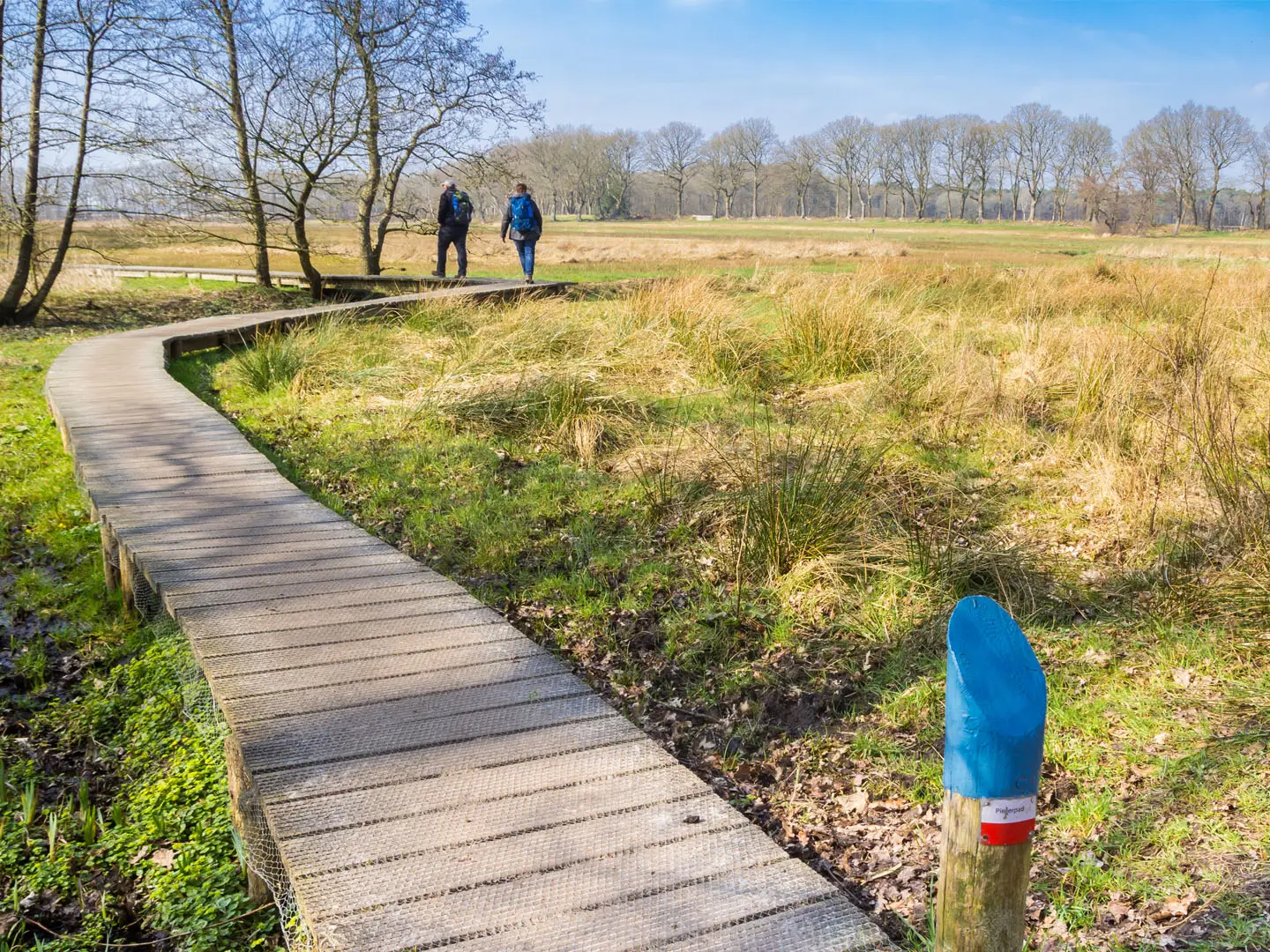
The Pieterpad is the classic long-distance walk across the Netherlands: 498 km from Pieterburen in Groningen to the Sint-Pietersberg south of Maastricht. Officially divided into 26 stages, it is an easy, well-waymarked point-to-point trail, suited to first-time thru-hikers, section walkers and anyone wanting a lowland route with reliable public transport. Expect flat-to-gently-rolling terrain, farmland, forest, heath, river dunes and only modest hills in the south.
Route Overview
Most walkers go southbound from Pieterburen, near the Wadden Sea, to the Sint-Pietersberg marl plateau above Maastricht. The route passes Winsum, Groningen, Zuidlaren, Rolde, Schoonloo, Sleen, Coevorden, Hardenberg, Ommen, Hellendoorn, Holten, Laren, Vorden, Zelhem, Braamt, Millingen aan de Rijn, Groesbeek, Gennep, Vierlingsbeek, Swolgen, Venlo, Swalmen, Montfort and Sittard. Vorden in the Achterhoek is the traditional halfway point. The Pieterpad is LAW 9, marked with Dutch white-and-red long-distance path stripes. Almost every stage start or finish has a train station or bus stop, so it works well in sections. For regional alternatives, see the Drenthepad, Achterhoekpad and Dutch Coastal Path.
History of the Pieterpad
The Pieterpad was the Netherlands’ first long-distance walking path. It was devised by two friends, Toos Goorhuis-Tjalsma in the north and Bertje Jens further south, who wanted to plot a scenic walking route between their home regions. Planning began in 1978 and the trail officially opened in 1983. Its name links Pieterburen with the Sint-Pietersberg, both named after Saint Peter. It has since become the country’s most popular long-distance trail.
Notable highlights
- Hunebedden of Drenthe: The route passes Neolithic megalithic dolmens built by the Funnelbeaker culture around 3,400 BC. They are the oldest monuments in the Netherlands and a distinctive feature of the Drenthe stages.
- Sallandse Heuvelrug National Park: One of the few hilly, heath-covered ridges in the country, with the Holterberg reaching about 75 m. Late summer brings purple heather, and the area is known for rare black grouse.
- City of Groningen: This lively northern university city is reached early on the walk. It is the largest settlement on the route and a practical resupply or rest stop.
- Maas river dunes near Venlo: In Limburg the trail follows sandy, forested inland river dunes along the Maas. This landscape feels markedly different from the northern farmland and Drenthe forests.
- Sint-Pietersberg finish: The Pieterpad ends on a marl plateau above Maastricht and the Maas valley. The plateau is known for centuries-old man-made quarry caves and gives the walk its southern namesake.
Challenges to expect
The Pieterpad is technically easy: navigation is straightforward, there are no sustained climbs, and the highest point is only 135 m. The real challenge is cumulative distance: long flat days, hard surfaces and repeated asphalt sections can be tiring on feet and joints. Weather exposure is possible in open farmland and polders. Accommodation should be planned ahead, as wild camping is not allowed.
HikeList Score
Pieterpad scored 71/100 on HikeList's trail-quality metrics.
See score breakdownHide breakdown
- Ideal length 64
- Balanced challenge 50
- Scenery & wildness 71
- Varied terrain 100
- Accommodation 92
- Food & support 54
- Path quality 84
- Season flexibility 63
Computed from length, challenge, scenery & wildness, terrain variety, accommodation, food & support, path quality and season flexibility.
 Netherlands
Show more data Show less
- Lowland
- Farmland
- Forest
- Heathland
- River Dunes
- Hills
- Field Paths
- Forest Tracks
- Country Lanes
- Paved
- B&Bs
- Hotels
- Campsites
- Homestays
- Family Friendly
- Pet Friendly
Photos from hikers
Taken on the trail by people who've reviewed Pieterpad.
Starting in Pieterburen, the trail leads hikers through the open landscapes and quiet villages of northern Groningen. This section passes through farmlands, along dikes, and enters the picturesque town of Winsum, known for its traditional Dutch architecture and windmills.
From Winsum, the trail continues south toward the city of Groningen. This leg takes hikers along rural roads, canal paths, and through small villages before reaching the vibrant university city characterized by its historic city center.
Leaving Groningen, the route crosses into the province of Drenthe. The trail meanders through scenic forests, lakes, and recreational areas, ending in Zuidlaren, a village known for its green surroundings and historic square.
This section passes heather fields, woodlands, and characteristic Drenthe villages. It features megalithic tombs (hunebedden) close to Rolde, and the countryside is dotted with traditional farms and pastures.
Today’s journey moves through tranquil forests and the Balloërveld nature reserve, eventually arriving in the peaceful hamlet of Schoonloo, nestled among lakes and woodland.
The route continues through the Drenthe countryside, passing bogs, peat meadows, and quiet farming villages before reaching Sleen, with its historic church and calm ambiance.
Heading toward Coevorden, this stage features more peatlands and rural terrain. The route ends in the fortified town of Coevorden, which boasts historical significance and a castle at its center.
Crossing into Overijssel, hikers encounter the Vechtdal landscape with its meandering river, parks, and rural scenery, concluding the day in the lively small city of Hardenberg.
The trail follows the Vecht River amidst woodlands and heath, with periodic river views and rolling terrain, ending in Ommen, a well-known base for hikers and canoeists.
After leaving Ommen, the trail gradually enters the Sallandse Heuvelrug National Park with its heathlands and woods, featuring more varied elevation and beautiful viewpoints before reaching Hellendoorn.
Continuing through the Sallandse Heuvelrug, hikers experience undulating landscapes, expansive heath, and forest trails before arriving in the village of Holten.
Today’s section covers farmland and small wooded areas, passing through rural settings and ending in the charming village of Laren, surrounded by fields and tranquility.
Moving further south, this stretch passes stately country estates and small rivers, offering peaceful countryside views, and finishes in Vorden, known for its castles.
Hikers encounter rolling farmland, wooded lanes, and streams as they head toward the pleasant village of Zelhem, an ideal spot to relax after a day’s walk.
This trajectory includes both wooded and agricultural landscapes, passing through the Achterhoek region before terminating in Braamt, a small quiet village.
A long segment, this leg includes forests, river landscapes, and the crossing of the Rhine. The route enters Gelderland’s floodplains and wetlands before reaching Millingen aan de Rijn at the edge of the river.
This section leads away from the rivers toward the undulating woodlands around Groesbeek, with vineyards and forested hills offering a taste of southern Dutch landscapes.
An area of rolling hills and forests, today’s route features some short, steep climbs before descending into the Maas valley and ending in the town of Gennep.
Moving into North Brabant, the trail follows riverbanks, passes through fertile agricultural landscapes, and ends at Vierlingsbeek, a peaceful rural settlement.
Today’s section enters Limburg, winding through forests, marshy areas, and small Limburg villages before arriving in Swolgen, known for its scenic walking routes.
The trail crosses a combination of forests, countryside, and the Maas river floodplains, concluding in the city of Venlo which is known for its bustling center and riverfront.
Today’s walk covers varied terrain including urban parks, natural reserves, and rural stretches before finishing in the village of Swalmen, close to the border with Germany.
The journey takes hikers past waterways, through woodlands, and by the historic Montfort Castle, ending the day in the small town of Montfort.
This section includes more agricultural land, minor elevation changes, and small villages, leading hikers into the historic town of Sittard with its atmospheric squares and churches.
As you move through South Limburg, expect gentle hills, patchwork farmland, and lovely ridges before reaching Strabeek, a quiet rural hamlet near Valkenburg.
The final day covers the rolling Limburg hills and passes through Valkenburg before reaching the end of the Pieterpad on Sint Pietersberg, above Maastricht, where hikers are rewarded with scenic views over the city and Maas valley.
Reviews
How would you rate Pieterpad?
Tap a star to start your review — you could be the first.