GR78 (Pyrenees Camino Route)
How would you rate GR78 (Pyrenees Camino Route)?
Tap a star to share your experience and help other hikers.
GR78 Pyrenees Camino Route: A Quieter Foothills Camino
HikeList Score
GR78 (Pyrenees Camino Route) scored 82/100 on HikeList's trail-quality metrics.
See score breakdownHide breakdown
- Ideal length 56
- Balanced challenge 100
- Scenery & wildness 65
- Varied terrain 100
- Accommodation 84
- Food & support 94
- Path quality 98
- Season flexibility 89
Computed from length, challenge, scenery & wildness, terrain variety, accommodation, food & support, path quality and season flexibility.
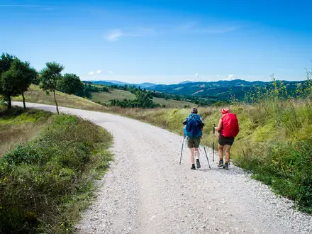
The GR78, officially the Chemin du Piémont Pyrénéen, is a waymarked Grande Randonnée and secondary Camino de Santiago route across southern France. From Carcassonne to Saint-Jean-Pied-de-Port it covers 500 km and takes about 30 walking days. This is a moderate point-to-point thru-hike: rolling Pyrenean foothills, vineyards, woods, valleys and frequent climbs rather than high-mountain terrain. It suits pilgrims and long-distance hikers who want a quieter alternative to the main Camino routes.
Route Overview
The route runs east to west from the UNESCO-listed medieval Cité of Carcassonne to Saint-Jean-Pied-de-Port in the Pyrénées-Atlantiques, where it meets the GR65 / Via Podiensis for the onward Camino. Key places in order include Montréal, Fanjeaux, Mirepoix, Pamiers, Le Mas-d’Azil, Saint-Lizier, Saint-Bertrand-de-Comminges and Valcabrère, Bagnères-de-Bigorre, Lourdes, Oloron-Sainte-Marie, L’Hôpital-Saint-Blaise and Mauléon-Licharre. It is a point-to-point walk, so plan separate start and finish logistics; no specific transport links are verified in this brief. Longer eastern variants are sometimes measured via the Canal du Midi; for a separate low-level option see the Canal du Midi Towpath. For more Pyrenean walking, compare the Cirque de Gavarnie Trails.
Pilgrimage history of the GR78
The GR78 follows a historic pilgrim corridor along the Pyrenean piedmont for travellers heading to Santiago de Compostela. It was not included in the famous 12th-century Guide du Pèlerin in the Codex Calixtinus, but it was genuinely used, with route knowledge passed on orally. The Fédération Française de la Randonnée later homologated it as the GR78. Along the way it links places associated with Cathar, Templar, Roman and Romanesque heritage.
Notable highlights
- Carcassonne: The trail leaves from the UNESCO World Heritage medieval Cité, known for its double ring of ramparts and towers. It is a memorable, historic start to the westbound walk.
- Mirepoix: A preserved 13th-century bastide with a central square lined by timber-framed houses and covered wooden arcades. It is one of the route’s best town stops for architectural character.
- Saint-Lizier: This small Ariège town is classified as a Grand Site and is UNESCO-listed as part of the Routes of Santiago. Its cathedrals, Roman ramparts and Romanesque cloisters make it a major heritage waypoint.
- Saint-Bertrand-de-Comminges and Valcabrère: A hilltop cathedral town built over a Roman city, paired with the Romanesque Basilica of Saint-Just de Valcabrère. Both are UNESCO-listed pilgrimage waypoints.
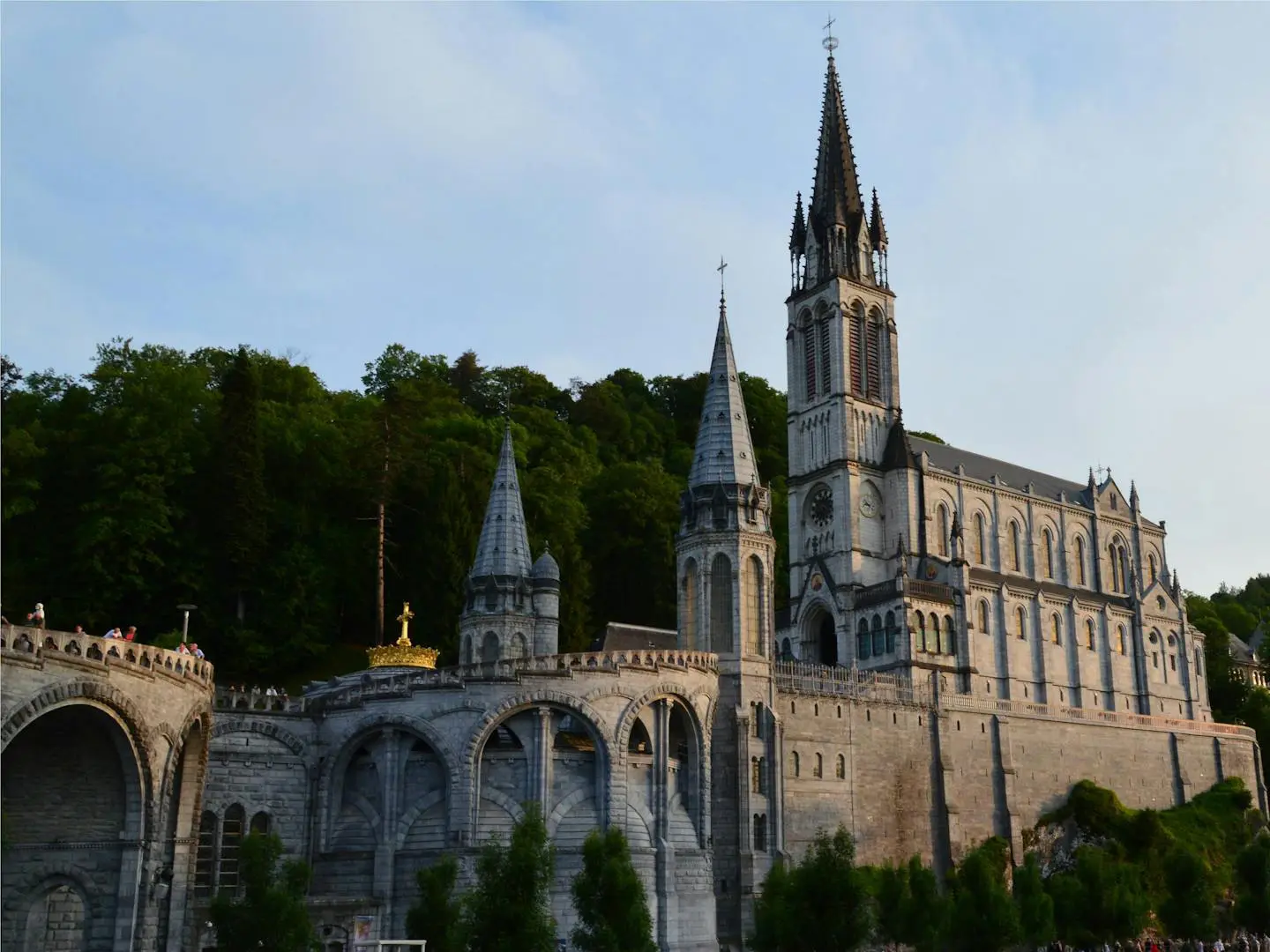
- Lourdes: One of the world’s major Marian sanctuaries, centred on the grotto linked to the 1858 apparitions. It is a significant pilgrim stop on the western half of the route.
- Pyrenean foothills landscape: Expect long views towards the Pyrenean chain across vineyards, oak woods and pastoral valleys, with lighter foot traffic than the busier Camino routes.
Challenges to expect
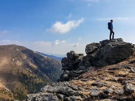
The GR78 is not a high-mountain route, but it is not flat: expect repeated climbs and descents, including some steep sections. The western and final third is the hilliest, with rougher goat-track sections on steep forested slopes. Waymarking uses standard red-and-white GR blazes, but accommodation is quieter and less commercialised than the main Caminos, so booking ahead is advisable. Higher sections are impractical roughly from November to March.
HikeList Score
GR78 (Pyrenees Camino Route) scored 82/100 on HikeList's trail-quality metrics.
See score breakdownHide breakdown
- Ideal length 56
- Balanced challenge 100
- Scenery & wildness 65
- Varied terrain 100
- Accommodation 84
- Food & support 94
- Path quality 98
- Season flexibility 89
Computed from length, challenge, scenery & wildness, terrain variety, accommodation, food & support, path quality and season flexibility.
Show more data Show less
- Foothills
- Agricultural Land
- Vineyards
- Forest
- River Valleys
- Pasture
- Country Lanes
- Quiet Byways
- Riverside Paths
- Forest Tracks
- Rough Footpaths
- GîTes D'éTape
- Chambres D'HôTes
- Hotels
- Religious/Parish Hostels
- Family Friendly
- Dog Friendly On Leash
- No Dogs Allowed
- Restrooms
- Potable Water Sources
- Non Potable Water Sources
- Established Campsites
- Shelters
- Picnic Areas
- Public Transport Access Points
Articles related to this hike
In these collections
Photos from hikers
Taken on the trail by people who've reviewed GR78 (Pyrenees Camino Route).
Beginning in the fortified city of Carcassonne, the GR78 heads southwest along country lanes, vineyards, and rolling farmland. Passing through small hamlets and village of Alairac, the route offers open views of the Malepère hills before reaching the historic bastide town of Montréal, renowned for its medieval architecture.
Leaving Montréal, the trail heads west through peaceful rural scenery, interspersed with woodland and open fields. The day includes gentle climbs and descents, with the path weaving through villages such as Fanjeaux before arriving at the medieval market town of Mirepoix, famous for its timber-framed arcades and lively square.
From Mirepoix, the route continues westward, traversing the Ariège countryside and occasionally passing through forests and small hamlets. The final stretch follows a mix of quiet byways and riverside paths, leading into the regional center of Pamiers, with its historic cathedrals and lively markets.
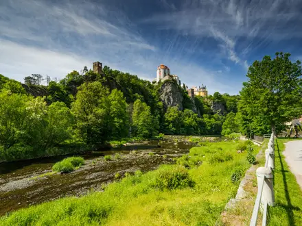
The trail exits Pamiers and follows the Ariège River upstream, passing through a tapestry of agricultural land, woods, and occasional hillside viewpoints. After several small villages, the path ascends gently towards Foix, crowned by its imposing medieval castle set against the backdrop of the Pyrenean foothills.
Departing Foix, hikers face a scenic but more challenging day as the trail rises and falls through rolling hills and forested stretches. This stage passes through rural villages and open meadows, ultimately reaching the UNESCO-listed town of Saint-Lizier, known for its Romanesque architecture and panoramic valley views.
A shorter section, this day leads gently out of Saint-Lizier through fertile valley floor, following quiet country roads and riverside trails to the lively market town of Saint-Girons. This area is dotted with orchards and traditional stone farmhouses, offering a relaxed experience between historic towns.
Heading deeper into the Pyrenean valleys, the trail leaves Saint-Girons, passing wooded ridges, streams, and stone hamlets. Climbing gently, the path follows ancient routes once used by pilgrims, culminating in the picturesque mountain village of Castillon-en-Couserans.
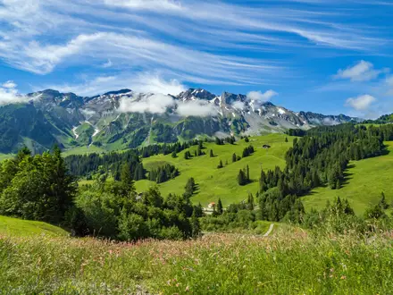
This section takes hikers along scenic, occasionally rugged mountain paths, with more pronounced elevation changes as the GR78 enters the heart of the Pyrenees. Forested ascents, open ridges, and isolated cattle pastures alternate, before a descent into the vibrant historic town of Arreau, nestled at the meeting of two valleys.
The route continues west from Arreau, weaving through mountain scenery and pastures, and occasionally joining forest roads. This day involves moderate climbs and passes several small Pyrenean villages, concluding at the spa town of Bagnères-de-Bigorre, known for its hot springs and Belle Époque charm.
Leaving Bagnères-de-Bigorre, the path rolls through green valleys and woodland, then rises to panoramic ridges with clear views of the central Pyrenees. Village stopovers, including Pouzac and Loucrup, punctuate the route before the legendary pilgrimage center of Lourdes is reached.
Setting out from Lourdes, the GR78 follows undulating terrain westward, passing through rural landscapes, quiet forests, and small mountain towns like Louvie-Juzon. The route leads gradually into the green valley surrounding Arudy, known for its stone architecture and rich pastoral setting.
From Arudy, the trail descends through wooded hills, open fields, and occasional vineyards, passing several Basque and Béarnaise villages. The day ends in Oloron-Sainte-Marie, a UNESCO World Heritage town at the confluence of the Aspe and Ossau rivers, boasting historic cathedrals and a lively old town.
Departing Oloron-Sainte-Marie, hikers cross a patchwork of rolling Basque countryside, passing isolated farmsteads, mixed woodland, and the charming village of L'Hôpital-Saint-Blaise. The route then enters Soule, one of the Basque provinces, finishing in Mauléon-Licharre, known for its strong Basque traditions and historic citadel.
The final stretch leads through the lush hills and vibrant villages of the Basque Country, with rolling terrain, occasional steeper ascents, and scenic ridge-top paths. The journey culminates at Saint-Jean-Pied-de-Port, the celebrated starting point of the Camino Francés, marked by cobbled streets and the iconic Porte St-Jacques.
Reviews
How would you rate GR78 (Pyrenees Camino Route)?
Tap a star to start your review — you could be the first.