Rondslottet Ascent
How would you rate Rondslottet Ascent?
Tap a star to share your experience and help other hikers.
Rondslottet Ascent: Rondane’s Highest Summit
HikeList Score
Rondslottet Ascent scored 71/100 on HikeList's trail-quality metrics.
See score breakdownHide breakdown
- Ideal length 55
- Balanced challenge 74
- Scenery & wildness 98
- Varied terrain 64
- Accommodation 49
- Food & support 65
- Path quality 98
- Season flexibility 63
Computed from length, challenge, scenery & wildness, terrain variety, accommodation, food & support, path quality and season flexibility.
The Rondslottet Ascent is a hard, single-day out-and-back hike in Norway, climbing to Rondslottet (2,178 m), the highest peak in Rondane National Park. The summit hike from Rondvassbu is about 13 km with roughly 1,100 m of ascent, crossing Vinjeronden before an exposed ridge to the top. It suits fit hikers comfortable on steep, rocky alpine terrain and short, non-technical scrambling. Most walkers add the 6 km gravel approach from Spranget to Rondvassbu, often by bike.
Route Overview
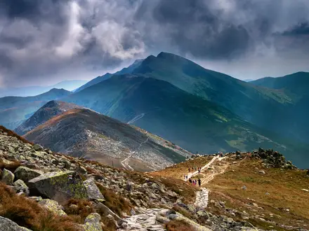
The mountain route starts and ends at Rondvassbu, the staffed DNT lodge beside Lake Rondvatnet. From the lodge, the waymarked trail climbs east into Rondholet, then up the steep ravine below the Storronden–Vinjeronden saddle. It reaches Vinjeronden (2,044 m), then follows the narrow exposed ridge to Rondslottet’s 2,178 m summit before returning the same way. Most parties first reach Rondvassbu from Spranget car park above Mysuseter/Otta via a 6 km gravel road, walked or cycled. For a longer Rondane hut-to-hut option, compare Dørålseter to Bjørnhollia; for other Norwegian summit days, see Galdhøpiggen Summit Trail or Glittertind Ascent.
Rondane, Rondslottet and the “Castle” Name
Rondane became Norway’s first national park in 1962 and was later expanded. Rondslottet means “Ronde castle” or “Ronde palace”: “rond” is the old name of the long, narrow Lake Rondvatnet, while “slott” means palace in Norwegian. The peaks are formed from ancient sandstone, later shaped into corries and ridges by ice-age glaciers. The wider Rondane landscape also inspired Henrik Ibsen’s Peer Gynt, with Rondvassbu long serving as the classic base for this ascent.
Notable highlights
- Rondslottet summit (2,178 m): The highest point in the Rondane range and one of its ten 2,000 m peaks. In clear weather, the summit gives wide views across Rondane, towards Jotunheimen and Dovrefjell.
- Vinjeronden (2,044 m): A compulsory subsidiary summit on the standard route. It marks the transition from steep climb to the airy connecting ridge.
- The summit ridge: The crux of the day: a short, exposed rocky scramble over crumbling sandstone. It is non-technical in dry conditions but can be treacherous when wet or snowy.
- Rondvassbu lodge and Lake Rondvatnet: The staffed DNT lodge is the natural base for the climb, set beside the long, narrow lake that gives the massif its name.
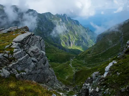
- Glacial corries and high walls: Ice-age glaciers carved deep cirques into Rondslottet, including a large north face; there are no active glaciers in Rondane today.
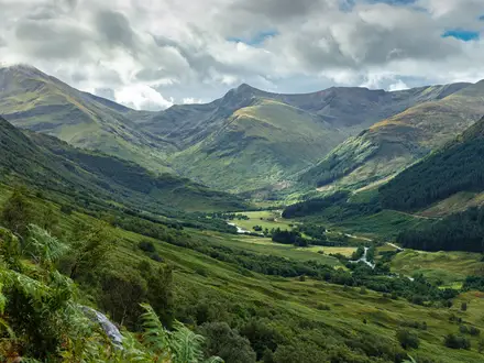
- Rondane National Park: Norway’s first national park protects a rounded high-alpine massif and important reindeer range.
Challenges to expect
Expect a hard alpine day on stony ground: scree, boulder fields, lichen-covered sandstone and an exposed ridge. The route is waymarked and non-glaciated, but the section between Vinjeronden and Rondslottet includes short scrambling moves and real exposure. Wet rock is slippery, snow can linger or return early above 2,000 m, and weather is colder and windier on the ridge. If you enjoy exposed ridges, Besseggen Ridge is a useful comparison.
HikeList Score
Rondslottet Ascent scored 71/100 on HikeList's trail-quality metrics.
See score breakdownHide breakdown
- Ideal length 55
- Balanced challenge 74
- Scenery & wildness 98
- Varied terrain 64
- Accommodation 49
- Food & support 65
- Path quality 98
- Season flexibility 63
Computed from length, challenge, scenery & wildness, terrain variety, accommodation, food & support, path quality and season flexibility.
 Norway
Show more data Show less
- Mountainous
- Alpine
- Rocky
- Gravel
- Huts
- Pet Friendly
- Water Sources
- Campsites
- Shelters
Photos from hikers
Taken on the trail by people who've reviewed Rondslottet Ascent.
Reviews
How would you rate Rondslottet Ascent?
Tap a star to start your review — you could be the first.