Mount Yotei Circuit
How would you rate Mount Yotei Circuit?
Tap a star to share your experience and help other hikers.
Mount Yotei Circuit: Ezo Fuji Summit Hike Guide
HikeList Score
Mount Yotei Circuit scored 69/100 on HikeList's trail-quality metrics.
See score breakdownHide breakdown
- Ideal length 55
- Balanced challenge 74
- Scenery & wildness 98
- Varied terrain 64
- Accommodation 49
- Food & support 45
- Path quality 98
- Season flexibility 76
Computed from length, challenge, scenery & wildness, terrain variety, accommodation, food & support, path quality and season flexibility.
Mount Yotei Circuit is best understood as a hard out-and-back summit climb on Yotei-zan (1,898 m) in south-west Hokkaido, Japan. The standard Makkari course is 13.4 km return with about 1,670 m of ascent and usually takes 8–10 hours in one long day. It suits fit hikers comfortable with relentless climbing, mud, loose volcanic rock and exposed summit weather. The “circuit” is not a 25 km base loop: the only real loop is the short ohachi-meguri crater-rim walk at the top.
Route Overview
Start and finish at the same trailhead. The best-supported headline route is the Makkari course, the most popular and most gradual ascent, with a free 100-space car park, toilets and a campground at the base. Other courses are Hirafu/Kutchan from Hangetsu-ko, Kyogoku and Kimobetsu. All climb through lower birch and conifer forest, pass ten numbered stations, then steepen above the 6th–7th station into loose volcanic rock near the rim. The summit circuit is the ohachi-meguri around Chichigama crater, adding roughly 60–80 minutes. For longer Japanese objectives, compare the Kamikochi to Mount Yari Trail, Kumano Kodo Nakahechi Route or Jomon Sugi Trail.
Ezo Fuji, Ainu heritage and a volcanic summit
Yotei-zan is nicknamed Ezo Fuji because its isolated, symmetrical cone resembles Mount Fuji. In Ainu tradition it was known as Makkarinupuri or Machineshiri, the “female mountain”, paired with nearby Shiribetsu-dake as the “male mountain”. Geologically, it is an active andesite-dacite stratovolcano; its last eruption is dated to around 1050 BC from the Hangetsu-ko parasitic cone. Mount Yotei is also one of Japan’s Nihon Hyakumeizan, the 100 Famous Japanese Mountains.
Notable highlights
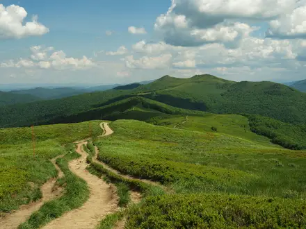
Ezo Fuji cone: Mount Yotei rises in isolation from the Kutchan plain, giving it the clean, Fuji-like outline that defines the hike from the start.
Chichigama crater rim: The summit caldera is about 700 m across and 200 m deep. Walking the jagged ohachi-meguri rim reaches the true 1,898 m high point.
Alpine flower belt: Above roughly 1,700 m, more than 100 alpine plant species bloom from early July to early August, adding interest to the exposed upper mountain.
Ten-station climb: The numbered gome stations make progress easy to track, but the gradient steepens noticeably above the 6th–7th station.
Yotei-zan emergency shelter: The unstaffed avalanche shelter near the 9th station is a fixed refuge point for bad weather, not a serviced mountain lodge.
Ainu cultural landscape: As Makkarinupuri, Yotei has Ainu significance and is understood in relation to Shiribetsu-dake across the valley.
Challenges to expect
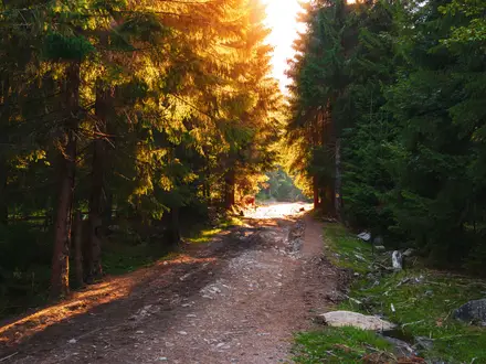
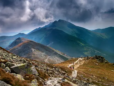
Expect a sustained ascent with almost no flat respite. The forest track can be muddy and slippery, while the upper mountain is exposed, cold and windy, with loose volcanic scree and rock underfoot. There are no reliable water sources above the trailhead, so carry all water. Higuma brown bears inhabit the lower forest; use a bear bell and make noise.
HikeList Score
Mount Yotei Circuit scored 69/100 on HikeList's trail-quality metrics.
See score breakdownHide breakdown
- Ideal length 55
- Balanced challenge 74
- Scenery & wildness 98
- Varied terrain 64
- Accommodation 49
- Food & support 45
- Path quality 98
- Season flexibility 76
Computed from length, challenge, scenery & wildness, terrain variety, accommodation, food & support, path quality and season flexibility.
 Japan
JapanShow more data Show less
- Mountainous
- Forest
- Dirt
- Rocky
- Campsites
- Campsites
Photos from hikers
Taken on the trail by people who've reviewed Mount Yotei Circuit.
Climb from the Makkari trailhead through forest to the numbered stations, with the gradient increasing above the 6th–7th station. Continue over loose volcanic rock to the crater rim, complete the optional ohachi-meguri around Chichigama, then descend the same route. Typical timing is about 4–5 hours up, 2.5–3 hours down, plus 60–80 minutes for the rim.
Reviews
How would you rate Mount Yotei Circuit?
Tap a star to start your review — you could be the first.