Rannoch Moor Trail
How would you rate Rannoch Moor Trail?
Tap a star to share your experience and help other hikers.
Rannoch Moor Trail: West Highland Way Crossing Guide
HikeList Score
Rannoch Moor Trail scored 84/100 on HikeList's trail-quality metrics.
See score breakdownHide breakdown
- Ideal length 55
- Balanced challenge 100
- Scenery & wildness 98
- Varied terrain 83
- Accommodation 83
- Food & support 74
- Path quality 98
- Season flexibility 89
Computed from length, challenge, scenery & wildness, terrain variety, accommodation, food & support, path quality and season flexibility.
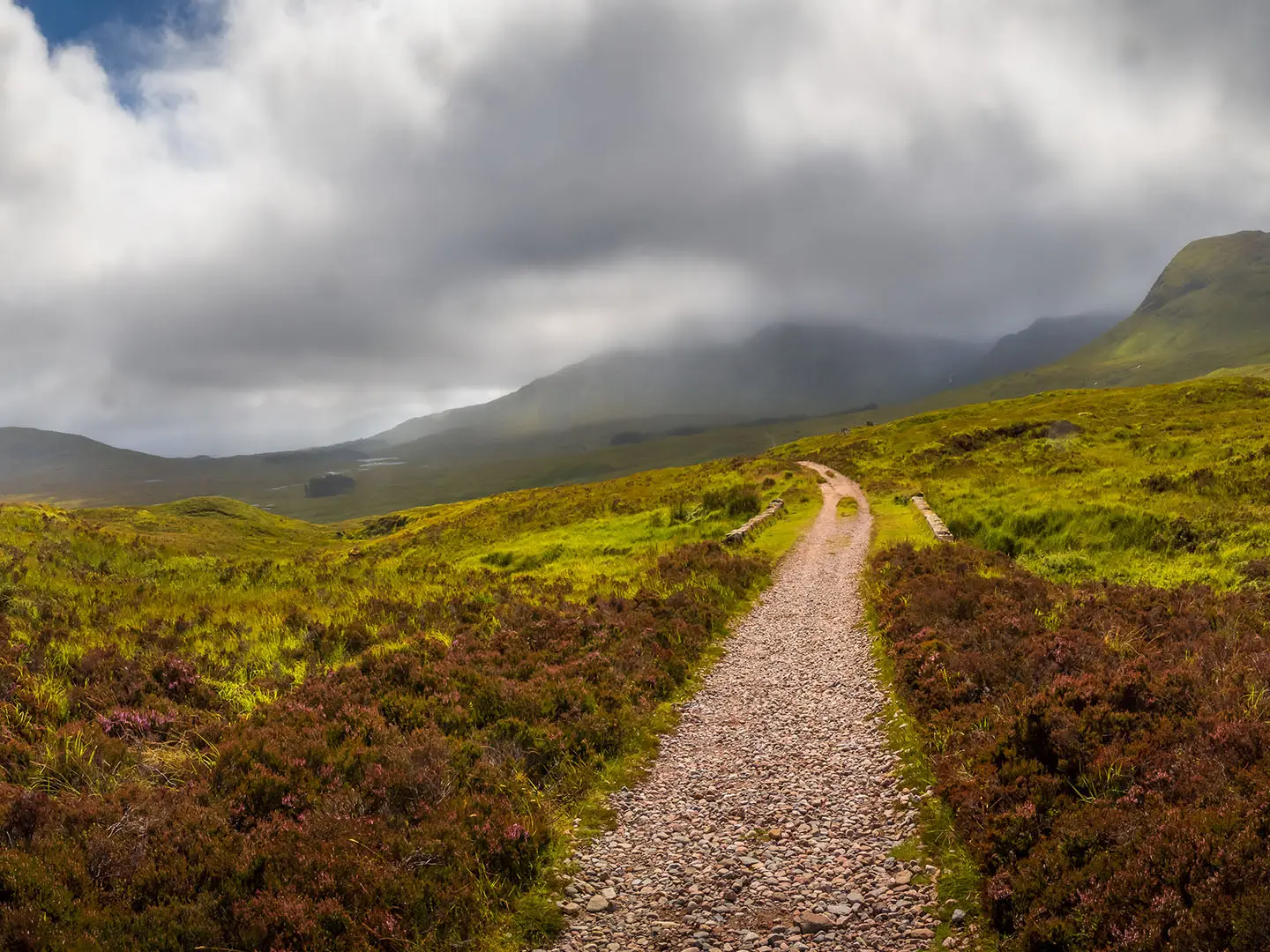
The Rannoch Moor Trail is best understood as the West Highland Way crossing from Bridge of Orchy to Kingshouse: a 19.4 km, 1-day, point-to-point walk across one of the wildest parts of the western Highlands in Scotland. It is moderate rather than technical, with 493 m of ascent, an old drove road underfoot and long exposure to Highland weather. It suits fit walkers who want a remote moorland stage without committing to the full West Highland Way.
Route Overview
Start at Bridge of Orchy and walk north via Inveroran, the Loch Tulla viewpoint and Forest Lodge before the route commits to open Rannoch Moor beneath the Black Mount. The path follows an old drove and military road, crossing hard cobbles, gravel and rocky sections through waterlogged peat country. Ba Bridge is roughly the halfway “point of no return”, with Ba Cottage ruins beyond, before the trail passes towards Blackrock Cottage, Glencoe Mountain Resort and Kingshouse Hotel near Glen Coe. Bridge of Orchy and Kingshouse are linked to wider travel by the West Highland Line railway and the A82. For other Scottish hill days, compare the Beinn Eighe Mountain Trail; for coastal alternatives, see the Arran Coastal Way or Assynt Coastal Path.
Drove Roads, Railways and Rannoch Moor
This crossing follows an old drove road and military road, once used by cattle drovers moving beasts across the moor towards Glencoe. The Black Mount section still has cobbles set into the old road. The West Highland Line was built across Rannoch Moor in the 1890s by floating the railway over deep peat on a raft of brushwood, tree roots and ash. The moor was also the centre of an icefield during the last glaciation and is still rising through post-glacial rebound.
Notable highlights
Black Mount: A range of Munros including Stob Ghabhar and Clach Leathad forming the western wall of the moor. The trail runs along its eastern foot, giving long views to the peaks.
Ba Bridge: A stone bridge over the River Ba near the centre of the crossing. It is traditionally treated as the remote point of no return and feels like one of the wildest places on the West Highland Way.
Loch Tulla viewpoint: An early high point above Inveroran with a broad view over Loch Tulla and the Black Mount. It is the last major panorama before the route commits to open moorland.
Lochan na h-Achlaise and Loch Ba: Moorland lochs scattered across Rannoch Moor. Lochan na h-Achlaise, backed by the Black Mount, is one of the classic photographed Highland views.
Kingshouse: A historic inn at the edge of Glen Coe beneath Buachaille Etive Mor. It marks the end of the moor crossing and a practical finish point for food, beds and onward travel.
Corrour and the Road to the Isles: The main alternative Rannoch Moor crossing links Corrour Station, the UK’s highest mainline station at 408 m, with Rannoch Station via Loch Ossian.
Challenges to expect
The gradient is not extreme, but the exposure is serious. Rannoch Moor is bleak in poor weather, rain is frequent year-round and there is little shelter once committed beyond Inveroran. The old road has hard cobbles and rocky sections that can be tiring underfoot, while the surrounding peat is waterlogged; stay on the path. Winter conditions can make this crossing dangerous.
HikeList Score
Rannoch Moor Trail scored 84/100 on HikeList's trail-quality metrics.
See score breakdownHide breakdown
- Ideal length 55
- Balanced challenge 100
- Scenery & wildness 98
- Varied terrain 83
- Accommodation 83
- Food & support 74
- Path quality 98
- Season flexibility 89
Computed from length, challenge, scenery & wildness, terrain variety, accommodation, food & support, path quality and season flexibility.
 United Kingdom
 Scotland
Show more data Show less
- Moorland
- Mountainous
- Wetlands
- Gravel
- Rocky
- Dirt
- Hotels
- Hostels
- Wild Camping Spots
- Family Friendly
- Pet Friendly
- Water Sources
- Campsites
In these collections
Photos from hikers
Taken on the trail by people who've reviewed Rannoch Moor Trail.
Reviews
How would you rate Rannoch Moor Trail?
Tap a star to start your review — you could be the first.