Sentier des Douaniers (Cap Corse)
How would you rate Sentier des Douaniers (Cap Corse)?
Tap a star to share your experience and help other hikers.
Sentier des Douaniers Cap Corse: Coastal Day Hike
HikeList Score
Sentier des Douaniers (Cap Corse) scored 78/100 on HikeList's trail-quality metrics.
See score breakdownHide breakdown
- Ideal length 55
- Balanced challenge 100
- Scenery & wildness 98
- Varied terrain 52
- Accommodation 66
- Food & support 74
- Path quality 98
- Season flexibility 89
Computed from length, challenge, scenery & wildness, terrain variety, accommodation, food & support, path quality and season flexibility.
The Sentier des Douaniers is a 19 km yellow-waymarked coastal footpath around the northern tip of Cap Corse in France. This point-to-point walk runs from Macinaggio to Centuri and is a long 1-day, moderate hike for fit walkers comfortable with heat, exposure and uneven ground. Expect beaches, rocky clifftop path, maquis scrub, Genoese towers and very little shade. If you are comparing French coastal walking, also see the Bordeaux to Arcachon Trail or the easier Canal du Midi Towpath.
Route Overview
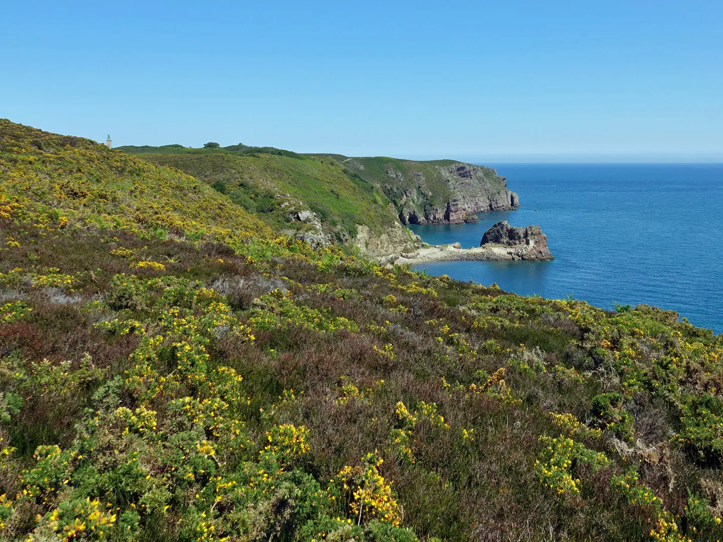
Start at Macinaggio port on the east coast of Cap Corse and follow the yellow coastal waymarks north via Plage de Tamarone, Plage des Iles, Baie de Santa Maria, Cala Genovese and Cala Francese, then round towards Tour d'Agnello, Barcaggio beach, Tollare and Centuri. The full official route is Macinaggio to Centuri, but many walkers stop at Barcaggio after the classic shorter section. In summer, a maritime shuttle links Barcaggio and Macinaggio, making that section practical as a one-way hike with a boat return. The full route is linear, so plan transport at Centuri or split the walk. For a mountain contrast in France, compare the Cirque de Gavarnie Trails.
Customs Officers, Genoese Towers and the Capandula Coast
The trail takes its name from the douaniers, customs officers who patrolled Corsica's coast on foot to deter smuggling. The watchtowers at Santa Maria and Agnello, plus the tower on the highest Finocchiarola islet, belong to the Genoese coastal defence system built in the 16th-17th centuries against Barbary pirate raids. As a marked hiking route, the sentier opened in 1993 and was fully waymarked by about 1998. Much of the Capandula coast is protected by the Conservatoire du littoral.
Notable highlights
- Tour and Chapelle Santa Maria: A ruined Genoese coastal watchtower stands beside the small Romanesque Chapelle Santa Maria de la Chiappella on the Baie de Santa Maria. It is one of the most distinctive historical stops on the east side of the route.
- Finocchiarola islands nature reserve: This small protected archipelago lies offshore from the path, opposite Plage des Iles. It is an important nesting site for Audouin's gull, and the highest islet carries a Genoese tower.
- Tour d'Agnello, Punta d'Agnello: A ruined Genoese tower on a rocky headland near the northern tip of Cap Corse. It is a classic photo stop, with views towards the Giraglia islet and lighthouse.
- Barcaggio beach: A wide sandy beach by the northernmost village of Cap Corse, backed by dunes. Cattle are known to graze and wander onto the sand.
- Plage de Tamarone: A long beach just north of Macinaggio in the protected Capandula area. It is a common swimming, picnic and access point before the path becomes wilder.
- Capandula protected coast: A protected stretch of maquis, dunes and coves managed by the Conservatoire du littoral. The absence of development is a major part of the walk's appeal.
Challenges to expect
The route stays low, but it is not a casual beach stroll. Expect repeated short climbs and descents, sandy stretches, uneven rocky and stony path, livestock barriers, strong sun and exposure. There are no water sources and very little shade, so carry enough water from the start. Summer can be very hot, and the path is not advised in strong wind because of fire risk. For a different inland option, see the Alsace Vineyard Trail.
HikeList Score
Sentier des Douaniers (Cap Corse) scored 78/100 on HikeList's trail-quality metrics.
See score breakdownHide breakdown
- Ideal length 55
- Balanced challenge 100
- Scenery & wildness 98
- Varied terrain 52
- Accommodation 66
- Food & support 74
- Path quality 98
- Season flexibility 89
Computed from length, challenge, scenery & wildness, terrain variety, accommodation, food & support, path quality and season flexibility.
 France
Show more data Show less
- Coastal
- Dirt
- Rocky
- Hotels
- Campsites
- Family Friendly
- Pet Friendly
- Water Sources
- Campsites
Photos from hikers
Taken on the trail by people who've reviewed Sentier des Douaniers (Cap Corse).
Follow the yellow-marked coastal path from Macinaggio port past Plage de Tamarone, Plage des Iles, Baie de Santa Maria, the Cala Genovese and Cala Francese beaches, Baie de Capandula/Capandola, Tour d'Agnello, Barcaggio beach and Tollare to Centuri. The full walk is officially 7-8+ hours, so start early and carry all water. If using the summer navette, the practical one-way option is the shorter Macinaggio-Barcaggio section with boat return.
Reviews
How would you rate Sentier des Douaniers (Cap Corse)?
Tap a star to start your review — you could be the first.