Päijänne-Ilves Trail
How would you rate Päijänne-Ilves Trail?
Tap a star to share your experience and help other hikers.
Päijänne-Ilves Trail: Lake Päijänne to Evo
HikeList Score
Päijänne-Ilves Trail scored 75/100 on HikeList's trail-quality metrics.
See score breakdownHide breakdown
- Ideal length 55
- Balanced challenge 90
- Scenery & wildness 78
- Varied terrain 100
- Accommodation 58
- Food & support 72
- Path quality 84
- Season flexibility 89
Computed from length, challenge, scenery & wildness, terrain variety, accommodation, food & support, path quality and season flexibility.
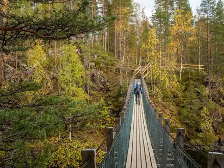
The Päijänne-Ilves Trail is a 13 km waymarked point-to-point day hike in Päijät-Häme, southern Finland. It links Padasjoki harbour on Lake Päijänne with Iso-Tarusjärvi in the Evo/Tarus recreation area, where it joins the wider Ilvesvaellus trail network. Allow 3–5 hours. Difficulty is moderate, mainly because of distance and occasional wet forest footing rather than ascent: the route gains only about 78 m. It suits hikers and Nordic walkers wanting a varied lowland route through villages, fields, forest, wetland and lakeshore.
Route Overview
Start at Padasjoki guest harbour / marina at Laivaranta on Lake Päijänne and walk inland towards Nyystölä, passing village lanes, open fields and the Cudgel War memorial area. The route continues through forest and wetland, including Frans Joosef Pond nature reserve, then reaches the Nuijamiehenkolo lean-to beside a stream at roughly 10 km. Near the end, an exceptionally large glacial erratic marks the approach to Iso-Tarusjärvi in the Tarus/Evo hiking area. This is a point-to-point connector, not a loop, so arrange a return plan from Taruksentie 290. For other Finnish forest routes, compare the Isojärvi National Park Trail and Nuuksio National Park Trail.
Cudgel War history on the Päijänne-Ilves Trail
The route’s main historical thread is the Cudgel War, or Nuijasota, the 1596–97 peasant uprising in then-Swedish Finland. The conflict was driven by heavy taxation, soldier billeting and wider power struggles between Duke Charles and King Sigismund. Near Nyystölä the trail passes a Cudgel War memorial, and the Nuijamiehenkolo rest area carries the same theme: nuijamies means “cudgel man”. The walking route itself is modern, created as a connector from Padasjoki and Lake Päijänne into the Evo/Tarus and Ilvesvaellus network.
Notable highlights
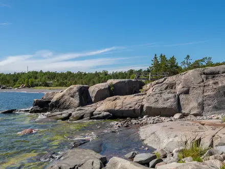
- Padasjoki harbour and Lake Päijänne: The trail starts at the guest marina on Lake Päijänne, Finland’s second-largest lake and the source of the Helsinki region’s drinking water.
- Cudgel War memorial near Nyystölä: A monument marking the 1596–97 peasant uprising known in Finnish as Nuijasota, tying the landscape to a turbulent period of Finnish history.
- Frans Joosef Pond nature reserve: A small protected pond and wetland area on the route, with bird-watching interest near Nyystölä.
- Nuijamiehenkolo lean-to: A traditional Finnish laavu beside a stream roughly 10 km from the start, with a campfire place and dry toilet.
- Great erratic boulder: An exceptionally large glacial erratic near the end of the trail, left by retreating Ice-Age glaciers.
- Iso-Tarusjärvi and Evo/Tarus: The finish sits by Lake Iso-Tarus, where the connector meets the wider Ilvesvaellus, or “Lynx Trek”, trail network.
Challenges to expect
The Päijänne-Ilves Trail is low and non-technical, but do not treat it as a paved stroll. Expect mixed surfaces: paved path, gravel and forest roads, field edges, narrow dirt trail and boardwalks. Wet sections can be muddy or slippery, so waterproof footwear is useful after rain. There is only one on-trail shelter, at Nuijamiehenkolo, so carry food, water and a return transport plan. For a longer Finnish classic, see the Hetta-Pallas Trail.
HikeList Score
Päijänne-Ilves Trail scored 75/100 on HikeList's trail-quality metrics.
See score breakdownHide breakdown
- Ideal length 55
- Balanced challenge 90
- Scenery & wildness 78
- Varied terrain 100
- Accommodation 58
- Food & support 72
- Path quality 84
- Season flexibility 89
Computed from length, challenge, scenery & wildness, terrain variety, accommodation, food & support, path quality and season flexibility.
 Finland
Show more data Show less
- Forest
- Wetland
- Farmland
- Lakeshore
- Paved
- Gravel
- Dirt
- Boardwalk
- Shelters
- Campsites
- Family Friendly
- Pet Friendly
- Restrooms
- Water Sources
- Campsites
- Shelters
- Picnic Areas
Photos from hikers
Taken on the trail by people who've reviewed Päijänne-Ilves Trail.
Reviews
How would you rate Päijänne-Ilves Trail?
Tap a star to start your review — you could be the first.