Oulanka National Park Trail
How would you rate Oulanka National Park Trail?
Tap a star to share your experience and help other hikers.
Oulanka National Park Trail: Karhunkierros Hiking Guide
HikeList Score
Oulanka National Park Trail scored 87/100 on HikeList's trail-quality metrics.
See score breakdownHide breakdown
- Ideal length 89
- Balanced challenge 100
- Scenery & wildness 98
- Varied terrain 83
- Accommodation 67
- Food & support 72
- Path quality 98
- Season flexibility 76
Computed from length, challenge, scenery & wildness, terrain variety, accommodation, food & support, path quality and season flexibility.
The Oulanka National Park Trail is the 82 km Karhunkierros, Finland’s best-known long-distance hiking trail, running through north-eastern Finland from Hautajarvi to Ruka. Allow 4-7 days for this moderate point-to-point trek through boreal forest, river gorges, wetlands and low fells. It suits fit hikers who want a well-marked wilderness route without technical mountain terrain, using free huts, campsites and lean-to shelters along the way.
Route Overview
Karhunkierros runs north-south from Hautajarvi in Salla to Ruka/Rukatunturi in Kuusamo. The recommended direction is Hautajarvi to Ruka: services, accommodation and meals are easier at the southern end, and the hardest fell climbs come late in the walk. The marked route is commonly split into three sections: Hautajarvi to Oulanka Visitor Centre (28 km), Oulanka Visitor Centre to Basecamp Oulanka (31 km), and Basecamp Oulanka to Ruka (23 km). Key places include Savilampi, Taivalkongas, Kiutakongas, Jussinkamppa, the Kitkajoki gorge, Jyrava, Myllykoski, Kontainen and Valtavaara. For comparison with other Finnish trails, see the Hetta-Pallas Trail and the Nuuksio National Park Trail.
History of Karhunkierros and Oulanka National Park
Oulanka National Park was established in 1956 and later enlarged in 1982 and 1989. Protection followed controversy in the early 1950s over plans to harness Kuusamo’s rapids for hydropower, helping preserve the free-flowing Oulankajoki and Kitkajoki. The Karhunkierros route was first marked in the mid-1950s, originally from Ristikallio towards Rukatunturi. The wider area has long been used for fishing, hunting and reindeer herding.
Notable highlights
- Kiutakongas Rapids: The signature rapids of the Oulankajoki, just below the Oulanka Visitor Centre, where the river runs through red-brown dolomite rock.
- Jyrava Waterfall: A powerful 9 m fall on the lower Kitkajoki, close to Siilastupa hut, where the river squeezes through a rock chute.
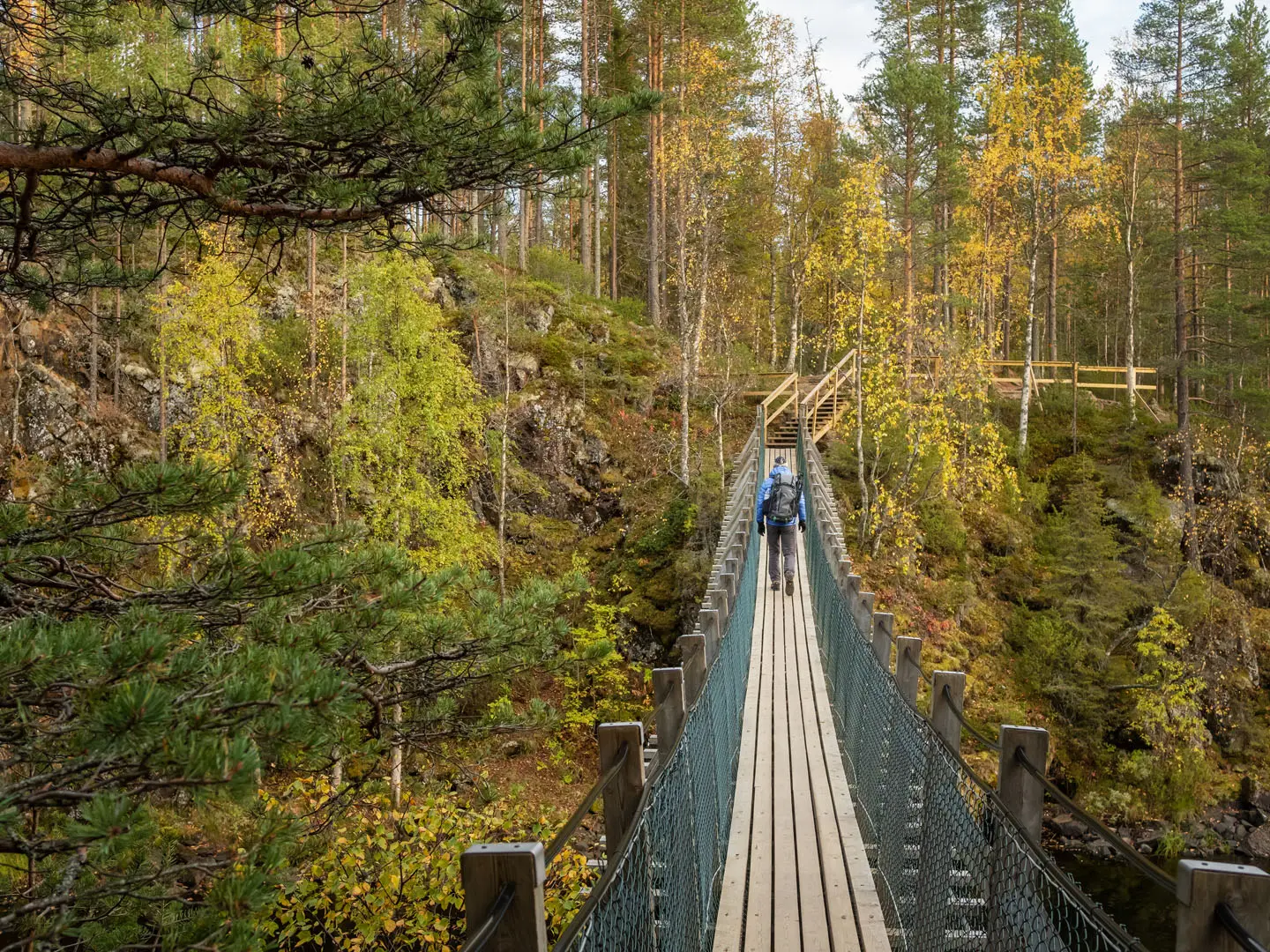
- Taivalkongas: A rocky rapid and river-crossing point with suspension bridges, a wilderness hut and a campsite.
- Ristikallio Cliffs: River-gorge cliffs in the northern part of the route, also used as an alternative start for a slightly shorter walk.
- Valtavaara fell: The trail’s high point at 492 m and the final major climb before Ruka, with open fell terrain above the treeline.
- Pieni Karhunkierros: A 12 km circular day route near Juuma sharing part of the main trail around the Kitkajoki gorge, Jyrava and Myllykoski.
Challenges to expect
The trail is well marked with orange blazes and signposts, but it is not flat. Expect rooted forest paths, rocky steps, boardwalks over mires, suspension bridges and several steep ascents and descents, especially over Vattuvaara, Iso Kumpuvaara, Kontainen and Valtavaara near the finish. Huts can fill in peak summer, so carry a tent. Late spring snowmelt and high river levels can make conditions unreliable.
HikeList Score
Oulanka National Park Trail scored 87/100 on HikeList's trail-quality metrics.
See score breakdownHide breakdown
- Ideal length 89
- Balanced challenge 100
- Scenery & wildness 98
- Varied terrain 83
- Accommodation 67
- Food & support 72
- Path quality 98
- Season flexibility 76
Computed from length, challenge, scenery & wildness, terrain variety, accommodation, food & support, path quality and season flexibility.
 Finland
Show more data Show less
- Forest
- River Valley
- Wetlands
- Dirt
- Rocky
- Boardwalk
- Huts
- Campsites
- Wild Camping Spots
- Family Friendly
- Pet Friendly
- Restrooms
- Water Sources
- Campsites
- Shelters
- Picnic Areas
Download Our Full Guide to Oulanka National Park Trail FREE!
Get our comprehensive guide to this hike for free. Save it for later reading or print out at home.

In these collections
Photos from hikers
Taken on the trail by people who've reviewed Oulanka National Park Trail.
Oulanka National Park Trail: The Complete Guide
 i
Image by Mazur Travel
i
Image by Mazur Travel Karhunkierros is Finland’s classic long-distance trail: an 82 km point-to-point walk from Hautajärvi near the Arctic Circle to Ruka in north-eastern Finland. It suits reasonably fit walkers who want a real Nordic backcountry route without technical mountain terrain.
The trail threads through Oulanka National Park on orange-blazed paths, linking pine and spruce forest, mires, river gorges and low rounded fells. Much of its character comes from the Oulankajoki and Kitkajoki, with rapids and waterfalls at Taivalköngäs, Kiutaköngäs, Jyrävä and Myllykoski.
This is not a high-altitude trek, but it is not flat or effortless. Expect rooted forest paths, rocky steps, long boardwalks, suspension bridges and the steepest climbing late in the route over Konttainen and Valtavaara before the finish at Ruka.
Accommodation is part of the experience: free, unlocked wilderness huts, lean-tos and campfire sites sit along the route, but they cannot be booked and may be full. A tent, stove and proper sleeping kit should be treated as essential rather than optional.
The main planning challenge is logistics rather than navigation: public transport exists at both ends, but the Karhunkierros bus is seasonal and timetables need checking before travelling. Most hikers take 4–5 days, with mid-June to late September the most reliable walking season.
This guide covers stages, daily planning, huts and camping, food, transport, terrain and the common mistakes to avoid.
Stage-by-Stage Guide
Distances on Karhunkierros are best treated as planning distances rather than exact daily totals: hut choice, short detours to viewpoints and whether you stop at Oulanka Visitor Centre, Juuma or Ruka will affect each day. The stages below follow the common five-day pattern using the hut and camping areas along the route.
All huts and shelters on the trail are free, unstaffed and first-come, so a tent remains essential. Carry food between service points, treat or filter natural water, and check seasonal bus timetables, trail closures, bridge status and water levels before travelling.
Stage 1: Hautajärvi to Savilampi / Taivalköngäs — approx. 15 km
The route starts at Hautajärvi, near the Arctic Circle on Road 950, and heads south on the orange-blazed Karhunkierros into Oulanka National Park. This first day gives a practical introduction to the trail: forest paths, roots, wet ground in places, boardwalks and river scenery rather than big climbs.
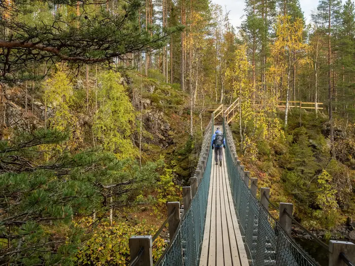
The main places on this section are Savinajoki, Savilampi and Taivalköngäs. Taivalköngäs is the key landmark: a rocky rapid and river crossing reached by suspension bridges, with an open wilderness hut and campsite area. The alternative Ristikallio start joins the main Karhunkierros in this northern section, so the trail may become noticeably busier from here in peak season.
Navigation is straightforward in normal visibility, with orange paint blazes and regular signposting, but the first day should still be walked with a map or offline route file. Boardwalks across wet ground can be slippery, and the forest path is often rooted and uneven under a full pack.
There are no reliable resupply options once you leave Hautajärvi. Carry food for the day and enough water capacity to manage between natural sources; river and lake water should be treated or filtered.
Hautajärvi is reached by road, with seasonal Karhunkierros bus connections from Kuusamo during the main hiking season. Savilampi and Taivalköngäs are wilderness overnight stops rather than service villages, so do not plan on road access or public transport from the end of the stage unless this has been checked before travelling.
Stage 2: Taivalköngäs to Kiutaköngäs / Oulanka Visitor Centre / Jussinkämppä — approx. 17 km
This stage continues through the river-and-forest heart of Oulanka National Park, moving from the Taivalköngäs area towards the Oulankajoki and the visitor centre zone. The walking remains non-technical, but the underfoot conditions vary constantly: dirt path, roots, rock, boardwalk and short steeper sections.
Ansakämppä is passed before the route reaches Kiutaköngäs, one of the signature features of the whole trail. Here the Oulankajoki surges through red-brown dolomite rock just below Oulanka Visitor Centre, making this one of the most memorable river sections of Karhunkierros.
Oulanka Visitor Centre is an important access and orientation point on the route, and the seasonal Karhunkierros bus serves it. If planning to leave, join or shorten the trail here, check current bus times carefully because the dedicated service is seasonal and infrequent.
Some hikers stop around Kiutaköngäs / Oulanka Visitor Centre, while others continue to Jussinkämppä to make the next day more manageable. Jussinkämppä is a wilderness overnight stop, so a tent should still be carried even if aiming for the hut.
Food should be carried for the stage and for the night unless services at Oulanka Visitor Centre have been checked in advance. Natural water is available in the wider river landscape, but it should be treated or filtered; do not assume hut water is potable.
Take care near rapids, rock edges and wet stone around Kiutaköngäs. Early-season snowmelt and high water can affect riverside sections and bridges, so current Oulanka National Park conditions should be checked before relying on this stage as planned.
Stage 3: Jussinkämppä to Siilastupa via Pähkänäkallio and the Kitkajoki gorge — approx. 17 km
This is one of the most dramatic and demanding days on the route. The trail leaves the Jussinkämppä area and works towards Pähkänäkallio, then descends into the Kitkajoki gorge before reaching the Siilastupa / Jyrävä area.
Pähkänäkallio and the Kitkajoki gorge provide some of the strongest scenery on Karhunkierros, with high river-canyon views and a steep descent off the Pähkänäkallio cliff. The walking is still a waymarked hiking trail, not a mountaineering route, but the terrain is more serious than the northern forest stages.
Expect rocky and rooted path, steps, steeper drops and sections that are slow when wet. The descent from Pähkänäkallio deserves particular care with a heavy pack, and wet rock or damp roots can make footing awkward.
The stage ends near Siilastupa, close to Jyrävä, a powerful waterfall on the lower Kitkajoki where the river is forced through a narrow rock chute. This is also part of the popular Pieni Karhunkierros day-hiking area, so the trail can feel busier near the major viewpoints and waterfall.
Carry food for the full day; this is not a resupply stage. Water can be taken from natural sources where appropriate, but it should be treated or filtered, and enough should be carried through the steeper gorge sections rather than relying on stopping at unsafe river edges.
Siilastupa is a wilderness overnight area, not a serviced village. There is no dependable public transport access at the hut itself; the next practical serviced access point on the route is Juuma, reached on the following stage. This should be checked before travelling if planning an exit here.
Stage 4: Siilastupa to Porontimajoki via Myllykoski and Juuma — approx. 17 km
This stage begins in one of the busiest and most photographed parts of Oulanka National Park. From the Siilastupa / Jyrävä area, the Karhunkierros shares ground with the Pieni Karhunkierros, the popular Little Bear’s Ring day loop near Juuma.
The main landmark is Myllykoski, a rapid with an old water mill, followed by the approach to Juuma. Expect more day walkers in this section, especially in July, August and the September ruska season, and allow time at narrow paths, bridges and popular photo points.
Juuma is the key practical point of the day. Paid services cluster around Juuma and the Basecamp Oulanka area, and the seasonal Karhunkierros bus serves Juuma, making it a useful joining, leaving or rest point. Opening times, accommodation availability and bus timetables should be checked before relying on them.
After Juuma, the route continues towards Porontimajoki and becomes more of a through-hike again. The terrain returns to forest, wet sections and uneven Nordic trail conditions, with boardwalk and rooted path where the ground demands it.
Food can potentially be managed around Juuma if services are open, but the safer plan is to carry enough to reach Porontimajoki and the next day’s finish at Ruka. Treat or filter natural water, and refill before leaving the Juuma area if conditions ahead are uncertain.
Porontimajoki is a wilderness stage end rather than a service centre, so hut space cannot be guaranteed and a tent is required. There is no reliable public transport from the Porontimajoki overnight area; Juuma is the practical access point for this stage.
Stage 5: Porontimajoki to Ruka via Konttainen and Valtavaara — approx. 16 km
The final stage is shorter on paper but contains the hardest climbing and descending of the route. From Porontimajoki, Karhunkierros heads towards Iso Kumpuvaara, then crosses the Konttainen and Valtavaara fells before dropping to Ruka.
This is the most fell-like section of the trail. The path becomes steeper, rockier and more exposed, with the final major climb to Valtavaara, the high point of the route at about 491–492 m. In clear weather, this open fell section gives the broadest views of the whole hike.
The terrain is still waymarked and non-technical, but it is a poor place to run short of energy, water or time. Rocky steps, steep climbs, descents and open ground above the treeline can feel much tougher in wind, rain or low cloud than the map distance suggests.
Navigation remains based on orange blazes and signposts, but visibility can matter more here than in the forested stages. Carry a map or offline GPS track and be prepared for slower progress over wet rock and uneven fell path.
There are no services between the Porontimajoki area and Ruka that should be relied on for food. Carry enough water for the fell section and do not assume convenient refills on the higher ground.
The route finishes at Ruka (Rukatunturi), where accommodation, food and other services are within walking distance. Ruka has bus links back to Kuusamo for onward coach, train-connection or flight travel, but schedules vary by season and should be checked before travelling.
Recommended Itinerary
Standard 5-day itinerary
The standard 5-day schedule is the best-balanced plan for most fit backpackers: long enough to keep the daily distances manageable, but still efficient for transport, food carry and hut-to-hut planning. It also keeps the hardest fell section over Konttainen and Valtavaara for the final day, when Ruka’s services are close beyond the finish.
| Day | From | To | Approx. distance | Why this stage makes sense | Services/accommodation notes |
|---|---|---|---|---|---|
| 1 | Hautajärvi | Savilampi / Taivalköngäs | 15 km | A steady first day from the Hautajärvi start, giving time to settle into the forest paths, boardwalks and river terrain without overcommitting on arrival day. Taivalköngäs is a logical early overnight point where the Hautajärvi and Ristikallio approaches meet. | Hautajärvi is reached by the seasonal Karhunkierros bus when running. Overnight options are wilderness-style: free, unbooked huts/camping areas and shelters, so carry a tent in case the hut is full. |
| 2 | Taivalköngäs | Kiutaköngäs / Oulanka Visitor Centre / Jussinkämppä | 17 km | This stage follows the Oulankajoki corridor towards Kiutaköngäs, one of the route’s key rapids, and gives the option to stop around the Oulanka Visitor Centre area or continue to Jussinkämppä for a more wilderness-based night. | The Oulanka Visitor Centre is a useful road-access point on the seasonal bus line. Do not rely on any changeable services without checking current opening times and transport before travelling. Jussinkämppä is an unstaffed wilderness stop. |
| 3 | Jussinkämppä | Siilastupa via Pähkänäkallio and the Kitkajoki gorge | 17 km | A strong central day through some of the most dramatic terrain on Karhunkierros, including the Pähkänäkallio area, the Kitkajoki gorge and the approach to Jyrävä. The walking is still non-technical, but the descents, roots, rocks and gorge-side paths make this feel more demanding than the distance suggests. | Siilastupa / Jyrävä is a popular area because the main trail overlaps with the Pieni Karhunkierros day loop near Juuma. Expect more walkers here and keep a tent option available. |
| 4 | Siilastupa | Porontimajoki via Myllykoski and Juuma | 17 km | This stage passes Myllykoski and Juuma, giving a practical break-point before returning to quieter forest and positioning well for the final fell day. It avoids making the last day too long before the climbs over Konttainen and Valtavaara. | Paid services cluster around Juuma, including Basecamp Oulanka and other accommodation in the area. Porontimajoki is again a wilderness-style overnight, with huts/shelters/camping first-come rather than bookable. |
| 5 | Porontimajoki | Ruka via Konttainen and Valtavaara | 16 km | The final day is short enough in distance but includes the route’s main fell climbs, including Konttainen and Valtavaara, the high point of the trail. Finishing in Ruka means there is no need to rush for a remote pick-up after the hardest terrain. | Ruka has services within walking distance at the finish. Buses run from Ruka to Kuusamo for onward travel, but seasonal timetables should be checked before travelling. |
Slower variant: 6–7 days
A 6- or 7-day schedule suits first-time hut-and-tent trekkers, walkers carrying heavier camping loads, groups that prefer shorter days, and anyone hiking in wet conditions when boardwalks, roots and rocky steps slow progress. It is also a sensible choice if time is wanted for Kiutaköngäs, Jyrävä, Myllykoski and the gorge viewpoints rather than treating them as brief stops.
The simplest way to slow the route down is to split one or two of the central stages at established huts, shelters or camping areas. Useful break points along the line of travel include Savinajoki, Savilampi, Taivalköngäs, Kiutaköngäs / Oulanka Visitor Centre, Jussinkämppä, Harrisuvanto, Siilastupa, Juuma and Porontimajoki.
Exact distances between these shorter stopping points should be checked on official mapping before fixing a food plan or booking any paid accommodation near Juuma or Ruka. The free wilderness huts cannot be booked, so the slower option still requires a tent and full overnight kit.
Faster variant: 4 days
A 4-day itinerary suits fit walkers who are comfortable with long back-to-back days on rough forest path, boardwalk, steps and short steep climbs. It is less forgiving in poor weather and leaves less flexibility if a hut is full, so it is best for hikers already used to carrying a full camping load efficiently.
One practical faster structure is:
| Day | From | To | Approx. distance | Why this stage makes sense | Services/accommodation notes |
|---|---|---|---|---|---|
| 1 | Hautajärvi | Kiutaköngäs / Oulanka Visitor Centre area | 28 km | Uses the official northern section as a long opening day and reaches a road-access point early in the route. | Long first day; check bus arrival time carefully. Overnight arrangements should be planned with a tent backup. |
| 2 | Kiutaköngäs / Oulanka Visitor Centre area | Juuma / Basecamp Oulanka area | 31 km | Covers the main central gorge and rapid section in one demanding day, including the approach towards the Kitkajoki, Jyrävä and Myllykoski areas. | Juuma has the best mid-route concentration of paid services, but availability and opening periods should be checked before booking. |
| 3 | Juuma / Basecamp Oulanka area | Porontimajoki or another suitable final-night stop before the fells | Check official mapping before booking | Positions the final night before Konttainen and Valtavaara so the last day into Ruka remains controlled. | Wilderness stops are first-come and unstaffed. Carry a tent rather than relying on hut space. |
| 4 | Porontimajoki | Ruka via Konttainen and Valtavaara | 16 km | Keeps the final fell crossings as a focused last stage, with Ruka’s accommodation, food and onward buses at the end. | Finish logistics are easiest at Ruka, but onward bus times to Kuusamo should still be checked in advance. |
Starting at Ristikallio instead of Hautajärvi shortens the full route by roughly 9 km, which can make a faster plan more manageable. It also skips the northernmost approach from Hautajärvi, so choose it only if the shorter distance is more important than walking the full 82 km Karhunkierros.
Planning the Route
Karhunkierros is best planned as a self-sufficient hut-and-tent trek rather than a village-to-village walk. The route is well marked, but the practical challenge is fitting daily distance around free wilderness huts, campsites, seasonal transport and changeable northern conditions.
The standard direction is Hautajärvi to Ruka. This keeps the route moving south towards the fuller services at Ruka and leaves the steepest fell section over Konttainen and Valtavaara until the final stage, when packs may be lighter. Despite the name “Bear’s Ring”, this is a point-to-point trail, not a loop.
How many days to allow
Most walkers should plan on 4–5 hiking days, with 5 days giving the most comfortable balance between distance, terrain and time at the river gorges. Faster hikers can complete the route in 3–4 nights, but that means longer days on rooted forest path, boardwalk and repeated short climbs rather than easy cruising.
A 6–7 day plan suits walkers who want shorter days, more time around Kiutaköngäs, Jyrävä, Myllykoski and Pähkänäkallio, or a wider weather margin. It can also make sense if travelling by the seasonal Karhunkierros bus, as public transport timings may dictate a late start or early finish.
The route is not technically difficult, but it is rarely fast underfoot. Boardwalks, wet ground, rocky steps, suspension bridges, steep river-bank descents and the final fells all reduce pace. Plan days by expected time on foot, not only by kilometres.
Stage planning and where days naturally fall
Daily stages are shaped mainly by the network of open wilderness huts, lean-tos, Lapp huts and campfire/camping sites. These are free and unbooked, so an itinerary should never depend on getting a sleeping space inside a hut.
A common 5-day structure follows the main hut-to-hut rhythm:
| Stage | Usual target area | Planning note |
|---|---|---|
| 1 | Hautajärvi to Savilampi / Taivalköngäs | A measured first day from the northern start, with river and forest terrain setting the pace. |
| 2 | Taivalköngäs to Kiutaköngäs / Oulanka Visitor Centre / Jussinkämppä | Useful section for linking the northern route with the Oulankajoki rapids area. |
| 3 | Jussinkämppä to Siilastupa via Pähkänäkallio and the Kitkajoki gorge | One of the more demanding planning days because of steep ground around Pähkänäkallio and the gorge. |
| 4 | Siilastupa to Porontimajoki via Myllykoski and Juuma | Passes the busy Pieni Karhunkierros area near Juuma, where the main route shares ground with day walkers. |
| 5 | Porontimajoki to Ruka via Konttainen and Valtavaara | The final fell stage includes the trail high point and should not be underestimated in poor weather. |
This is a practical structure rather than a rule. Strong walkers may combine stages, while slower walkers may split them where camping is available. Because hut places are first-come, the safest plan is to carry a tent and treat huts as a bonus, a cooking shelter or an emergency refuge rather than guaranteed accommodation.
Fast or slow: which is better?
A faster 4-day walk is realistic for fit hikers with light packs and efficient camp routines. It works best in stable summer conditions and with transport already fixed at both ends. The trade-off is less spare time for delays, wet boardwalks, busy huts or sightseeing at the major rapids.
A 5-day itinerary is the best default for most independent hikers. It gives enough time for the river-gorge sections without turning every day into a long push, while still keeping food carry manageable.
A slower 6–7 day itinerary is not wasted time here. The route links several distinct landscapes — Oulankajoki, Kitkajoki, mire crossings, forest and the southern fells — and a slower plan allows better use of campsites and huts if weather or river conditions are awkward.
Shortening the route
The main way to shorten Karhunkierros is to start at Ristikallio instead of Hautajärvi, reducing the walk by roughly 9 km. This cuts off part of the northern approach while still joining the main line early in the route.
The route can also be broken at places served by the seasonal Karhunkierros bus, including Hautajärvi, Ristikallio, the Oulanka Visitor Centre, Juuma and Ruka. The dedicated service runs mainly from mid-June to late September, and timetables should be checked carefully before booking accommodation or flights. This should be checked before travelling.
Leaving the trail early is more practical around the Oulanka Visitor Centre or Juuma than in the quieter forest sections. Do not assume there will be flexible daily transport from every hut or campsite.
Extending or adding side walks
The most obvious add-on is time around Pieni Karhunkierros, the popular Little Bear’s Ring near Juuma. It shares part of the main route past the Kitkajoki gorge, Jyrävä and Myllykoski, so many thru-hikers will already see some of its best-known sections.
For most hikers, extra time is better used as a buffer rather than adding distance. Weather, wet boardwalks, lingering early-season snow and high water after spring melt can all make a nominally moderate day slower than expected.
Section hiking
Section hiking is practical, but only with careful transport planning. The official longer sections link places on the bus route: Hautajärvi to the Oulanka Visitor Centre, the Oulanka Visitor Centre to the Basecamp/Juuma area, and the Basecamp/Juuma area to Ruka.
This makes weekend-style sections possible during the main bus season. Outside that period, public transport becomes much more limiting, and private transfers or extra nights near Kuusamo or Ruka may be needed. This should be checked before travelling.
Section hikers should also be aware that the character changes along the route. The northern and central parts are dominated by river gorges, forest and mires; the final approach to Ruka is more fell-like, with Konttainen and Valtavaara providing the biggest climbs.
Accommodation planning
There are no trail fees and the open wilderness huts, lean-tos and campfire sites are free. They are also unstaffed, unlocked and first-come, so they cannot be reserved.
Carry a tent, sleeping bag and stove even if planning to sleep in huts. In peak July–August and during the September ruska season, huts can fill, especially around the better-known sections near Juuma and the Pieni Karhunkierros loop.
Paid accommodation is concentrated around Juuma and at Ruka. These are useful for a mid-route reset, a pre-finish night, or a more comfortable final night before onward travel. Availability and current prices should be confirmed before booking.
Food and resupply
Plan to carry enough food for the full route unless a specific resupply has been arranged. The trail passes visitor and service areas, but the dependable planning model is self-sufficiency.
Juuma and Ruka are the main places to think about paid services. Ruka has full end-of-route services within walking distance; Juuma has services in the wider Basecamp/Juuma area. Any plan relying on buying meals or supplies en route should be checked before travelling.
A stove is part of the normal kit for this route. Huts and campfire sites are useful, but fire use and fuel availability should not be treated as the only cooking option.
Water planning
The route follows major rivers including the Oulankajoki and Kitkajoki and crosses wetland and lakeshore terrain, so water scarcity is usually less of a concern than treatment and access. Carry capacity for the day, but expect the main planning issue to be making water safe rather than hauling large amounts for long dry stretches.
Treat or filter natural water before drinking. Do not assume every hut or campsite has a guaranteed drinking-water point immediately beside it, especially if arriving late or in poor weather.
High rivers and spring melt can affect early-season conditions. River levels, bridge status and any trail closures should be checked on the official Nationalparks.fi information before setting out.
Navigation and route finding
Karhunkierros is well waymarked with orange blazes and 1 km signposts. In normal summer conditions, route finding is straightforward for a competent walker.
That does not remove the need for navigation backup. Carry an offline map or GPX and enough battery capacity, and know the order of key places such as Taivalköngäs, Kiutaköngäs, Jussinkämppä, Siilastupa, Juuma, Porontimajoki, Konttainen, Valtavaara and Ruka.
The main navigation risks are not complex junctions but distraction, poor visibility on the fells, snow or flood disruption early in the season, and busy day-walk areas near Pieni Karhunkierros where several paths meet.
Transport planning
Transport is one of the biggest planning constraints. There is no railway station or airport at either trailhead, so most itineraries work through Kuusamo.
The start at Hautajärvi is reached by road, with the seasonal Karhunkierros bus linking Kuusamo, Hautajärvi, Ristikallio, the Oulanka Visitor Centre, Juuma and Ruka during the main hiking season. The finish at Ruka has regular bus links for the short hop back to Kuusamo.
Do not book the walk around assumed daily buses without checking the current Matkahuolto timetable. The dedicated trail bus runs mainly from mid-June to late September, and services outside that window may not suit a through-hike. This should be checked before travelling.
Weather and seasonal margins
The best planning window is mid-June to late September. July and August are the busiest summer months, while September brings ruska colours and cooler conditions.
Early season can be unreliable because of lingering snow, wet ground and high water after the spring melt. Even in the main season, the route includes exposed fell ground on Konttainen and Valtavaara, where wind, rain and poor visibility matter more than the modest altitude suggests.
Build at least some flexibility into travel plans if possible. On this route, a conservative itinerary is often more useful than a technically ambitious one: the walking is not alpine, but the combination of remote forest, wet surfaces, unbooked huts and seasonal transport rewards careful planning.
Towns, Villages and Overnight Stops
Karhunkierros is not a village-to-village walk. Most nights are normally spent at free, unstaffed open wilderness huts, lean-tos or tent sites, with paid accommodation and fuller services mainly at Juuma and Ruka.
Huts are first-come, with no booking system, so a tent remains essential even on a short itinerary. Food planning should be conservative: unless stopping in Juuma or finishing in Ruka, treat the route as a wilderness trail with no reliable resupply.
| Place | Best use for hikers | Overnight options | Food / services | Transport |
|---|---|---|---|---|
| Hautajärvi | Start point | Trailhead only; accommodation nearby should be checked before travelling | Do not rely on trailhead resupply | Seasonal Karhunkierros bus via Kuusamo |
| Ristikallio | Alternative shorter start / access point | Wilderness-style planning | No resupply | Seasonal Karhunkierros bus |
| Savilampi / Taivalköngäs | First wilderness night | Free hut/camp-style stop at Taivalköngäs area | No shops or cafés | No regular trail transport at the overnight stop |
| Oulanka Visitor Centre / Kiutaköngäs | Mid-route access and information point | Better as a passage or logistics stop than a guaranteed overnight base | Any café/shop provision should be checked before travelling | Seasonal Karhunkierros bus |
| Jussinkämppä | Wilderness overnight after Oulanka | Free first-come hut/camping-style stop | No resupply | No practical public transport at the hut |
| Siilastupa / Jyrävä | Wilderness overnight near Kitkajoki | Free first-come hut/camping-style stop | No resupply | No practical public transport at the hut |
| Juuma | Main mid/late-route service stop | Paid services in the Juuma/Basecamp Oulanka area | Food and accommodation options should be checked before booking | Seasonal Karhunkierros bus |
| Porontimajoki | Last wilderness night before the fells | Free first-come hut/camping-style stop | No resupply | No practical public transport at the hut |
| Ruka | Finish and recovery night | Hotels and resort accommodation | Full services within walking distance | Regular buses to Kuusamo |
Hautajärvi (Salla) — start
Hautajärvi is the standard northern start of Karhunkierros, at the Hautajärvi nature hut / trail starting point near the Arctic Circle on Road 950. Orange waymarks lead south from here into Oulanka National Park.
It is primarily a start point rather than a convenient service village. Do not rely on buying food or gas at the trailhead; arrive with the first wilderness section already provisioned.
The seasonal Karhunkierros bus links Kuusamo with Hautajärvi during the main hiking season, typically mid-June to late September. Timetables are limited and seasonal, so the bus should be checked before travelling, especially for early summer, late September or a same-day arrival from a flight or coach.
Ristikallio — alternative start
Ristikallio is used as a shorter alternative start, reducing the full Hautajärvi–Ruka route by roughly 9 km. It also gives quicker access to the northern gorge scenery above the Oulankajoki.
This is useful for hikers with limited time or those arranging a 3–4 night itinerary, but it removes the opening section from Hautajärvi. It should still be treated as a wilderness start: carry food, shelter and overnight gear from the outset.
The seasonal Karhunkierros bus serves Ristikallio on the Kuusamo–Hautajärvi route. This should be checked before travelling, as missed connections can be difficult to solve without private transport.
Savilampi and Taivalköngäs
Savilampi / Taivalköngäs is the usual first-night area on a 5-day itinerary from Hautajärvi. Taivalköngäs is a practical wilderness stop beside a rocky rapid and suspension-bridge crossing, with an open wilderness hut and campsite.
This is a good place to stop if starting from Hautajärvi and keeping the first day moderate. Faster walkers may continue, but doing so creates a longer day before the Oulanka Visitor Centre and Jussinkämppä area.
There are no village services here. Accommodation is the standard Karhunkierros pattern: free, unstaffed and first-come, so late arrivals should be ready to pitch a tent.
Kiutaköngäs / Oulanka Visitor Centre
Kiutaköngäs and the Oulanka Visitor Centre sit around the route’s central northern access point. The rapids are one of the key places on the trail, and the visitor centre is a sensible place to check current trail information, bridge status and conditions before continuing.
For many end-to-end hikers, this is a daytime logistics stop rather than an overnight stop. If planning to break the walk here, accommodation and food options should be checked before travelling rather than assumed.
The seasonal Karhunkierros bus stops at the Oulanka Visitor Centre, making this one of the best places to start, leave or shorten a section hike. It is also a useful fallback point if weather, water levels or fitness make the full route unrealistic.
Jussinkämppä
Jussinkämppä is a common wilderness overnight after the Oulanka Visitor Centre on the standard north-to-south schedule. It positions hikers well for the next demanding section towards Pähkänäkallio, the Kitkajoki gorge and Jyrävä.
This is not a service stop. Expect no shops, cafés or paid accommodation; the practical overnight choice is the free first-come hut/camping system used throughout the route.
Because the following terrain includes steeper gorge walking and descents, stopping here helps avoid turning the Oulanka Visitor Centre–Siilastupa stretch into an unnecessarily long day. Carry enough food for the next stage and do not rely on hut space being available.
Siilastupa (Jyrävä)
Siilastupa is the main overnight stop around Jyrävä, the powerful waterfall on the lower Kitkajoki. It comes after the Pähkänäkallio and Kitkajoki gorge section and before Myllykoski and Juuma.
This is a strong stopping point on a 5-day itinerary, especially if the gorge section has been slow, wet or busy. The nearby trail also overlaps with the popular Pieni Karhunkierros day loop, so the area can feel less remote than the northern forest sections.
Overnight planning remains wilderness-based: free, unstaffed and first-come, with a tent needed as backup. There is no reliable resupply at the hut, so food for the night and the next day should already be carried.
Myllykoski and Juuma
Myllykoski is a landmark rapid and old mill on the Pieni Karhunkierros section, shortly before or around the Juuma service area depending on the day’s plan. Juuma is the most useful mid/late-route place for hikers wanting paid accommodation or a reset before the final fells.
Paid services cluster around Juuma, including the Basecamp Oulanka area and holiday-style accommodation. Exact room availability, meals, opening dates and any shop provision should be checked before booking, especially outside peak July–August dates.
The seasonal Karhunkierros bus serves Juuma, making it a practical access point for section hikers and for those ending the walk before the Konttainen–Valtavaara stage. It is also the main place to step off the trail before the final push to Ruka.
Porontimajoki
Porontimajoki is the usual final wilderness overnight before the southern fell section. It sits after Juuma and before the route climbs towards Iso Kumpuvaara, Konttainen and Valtavaara.
This stop works well for a 5-day schedule because it leaves a manageable final day over the highest and steepest terrain to Ruka. It also avoids tackling the Konttainen and Valtavaara climbs late in an already long day from Juuma.
There are no shops, cafés or transport links at Porontimajoki. Treat it as a remote hut-and-tent stop: arrive with food for dinner, breakfast and the final day to Ruka.
Ruka (Rukatunturi) — finish
Ruka is the practical southern finish of Karhunkierros, reached after the final climbs over Konttainen and Valtavaara. Unlike the wilderness stops, it is a resort village with services within walking distance of the trail end.
This is the easiest place to book a proper bed, shower, meal and onward transport after the walk. Hotels and other paid accommodation are concentrated here, but prices and availability should be checked before booking, particularly in busy holiday periods.
Regular buses run from Ruka to Kuusamo for onward coach, rail-linked or flight connections. If finishing late in the day, check the last bus in advance or plan a night in Ruka rather than assuming same-day onward travel.
Getting to the Start
Karhunkierros starts at Hautajärvi in Salla, by the Hautajärvi nature hut / Karhunkierros starting point on Road 950. There is no railway station or airport at the trailhead, so most journeys are built around Kuusamo, then a seasonal bus or pre-arranged road transfer to Hautajärvi.
Public transport is workable in the main hiking season, but it is not turn-up-and-go transport. Timetables, operating dates and same-day connections should be checked before travelling, especially outside mid-June to late September.
By train
There is no train service to Hautajärvi, Ruka or Kuusamo. The practical rail approach is to take an overnight train to Oulu or Kemijärvi, then continue by coach towards Kuusamo.
From Kuusamo, use the seasonal Karhunkierros bus where it is running, or arrange a taxi/private transfer to Hautajärvi. This should be checked before travelling, as a missed coach or poorly timed rail arrival can easily mean an overnight stop before reaching the trailhead.
By bus
In summer, the seasonal Karhunkierros bus operated through Matkahuolto links Kuusamo with the main access points on the trail, including Hautajärvi, Ristikallio, the Oulanka Visitor Centre, Juuma and Ruka. This is the key public-transport service for starting the full Hautajärvi-to-Ruka route.
The dedicated service runs mainly from mid-June to late September. Exact dates, stops, booking requirements and daily timings change, so this should be checked before travelling.
If the Hautajärvi bus timing does not work, the alternative Ristikallio start may be useful. It joins the main route farther south and makes the walk roughly 9 km shorter, but it is not the full 82 km Hautajärvi route.
Outside the bus season, or if connections do not line up, plan on a taxi or private transfer from Kuusamo, Ruka or another road-access point. Availability and cost should be confirmed in advance rather than left until arrival.
By car
Hautajärvi is reached by road, with the start at the nature hut / Karhunkierros starting point on Road 950. This is practical for drop-offs, private transfers or groups with two vehicles.
For a solo vehicle, remember that Karhunkierros is a point-to-point trail ending at Ruka, not back at Hautajärvi. A common solution is to leave the vehicle at the finish area or at pre-booked accommodation, then use the seasonal bus or a taxi transfer to the start; parking permission, security and long-stay arrangements should be checked before travelling.
Do not assume reliable long-stay parking at the Hautajärvi trailhead without checking current local arrangements. If driving to start and returning by public transport after the hike, also check that Ruka–Kuusamo and Kuusamo–Hautajärvi connections actually run on the day needed.
From the nearest airport
The most useful airport for the route is Kuusamo Airport, with flights mainly from Helsinki. From the airport, continue into Kuusamo and connect with the seasonal Karhunkierros bus to Hautajärvi, or arrange a taxi/private transfer.
This is often the simplest approach for hikers coming from outside northern Finland, but it still depends on matching flight arrivals to the limited onward transport. If arriving late in the day, plan for a night in Kuusamo or Ruka before transferring to Hautajärvi the next morning.
Where to stay before starting
The most straightforward pre-hike bases are Kuusamo and Ruka, because they have onward transport options and services useful for final food, fuel and gear checks. Ruka is also the finish of the walk, so it can work well if leaving luggage or arranging post-hike accommodation.
Staying closer to the route around the Oulanka Visitor Centre, Juuma or other trail access points can also make sense if using the Karhunkierros bus or shortening the route, but accommodation is more scattered and should be booked ahead in peak summer and autumn ruska season.
Avoid planning to arrive at Hautajärvi late and immediately walk a long first stage unless the transport timing, daylight and first night’s camping or hut plan are clear. The huts are free and first-come, but they cannot be booked, so carry a tent from the start.
Getting Home from the Finish
Karhunkierros finishes in Ruka (Rukatunturi), where shops, accommodation and other resort services are within walking distance of the trail end. This makes the finish much easier logistically than Hautajärvi, but onward travel still depends heavily on seasonal and infrequent public transport.
Plan the final day with the bus timetable in mind. The last stage over Konttainen and Valtavaara includes some of the route’s steepest ground, so it is unwise to assume a fast finish if connecting to same-day transport.
By train
There is no railway station at Ruka, Kuusamo or either Karhunkierros trailhead. To continue by train, first travel from Ruka to Kuusamo, then onward by coach towards a rail-connected town such as Oulu or Kemijärvi.
Overnight trains to Oulu or Kemijärvi are commonly used for access to this part of Finland, with coach connections onward to Kuusamo. The same pattern works in reverse after the hike, but train-and-coach timings must be matched carefully. This should be checked before travelling.
By bus
The main public-transport move from the finish is the short bus journey from Ruka back to Kuusamo. From Kuusamo, onward coach connections can be used for longer journeys within Finland, including links towards rail services.
In summer, the seasonal Karhunkierros bus operated through Matkahuolto connects key trail access points including Ruka, Juuma, the Oulanka Visitor Centre, Ristikallio, Hautajärvi and Kuusamo. It is mainly a mid-June to late-September service, so do not assume it runs outside the main hiking season.
Bus services are limited compared with urban areas, and evening options may be poor. Check the current Matkahuolto timetable before fixing accommodation, flights or trains, especially if finishing outside July–August or on a tight same-day connection.
By car/taxi
If a vehicle has been left at Ruka, the finish is straightforward: the trail ends in the resort village, with services close by. If the car is at Hautajärvi, Ristikallio, the Oulanka Visitor Centre or another access point, the seasonal Karhunkierros bus may be the simplest way to retrieve it during the operating period.
Taxis or private transfers may be useful for awkward arrival times, out-of-season finishes, or groups carrying heavy packs. They should be booked ahead rather than treated as a guaranteed turn-up option at the trail end, particularly late in the day.
From the nearest airport
Kuusamo Airport is the practical airport for Ruka and Karhunkierros, with flights mainly connecting via Helsinki. From Ruka, first travel to Kuusamo, then continue to the airport by the available local transport option for the date and flight time.
Flight schedules and ground transport vary by season. Allow a buffer after the hike rather than booking a tight departure immediately after the Valtavaara finish, particularly if the final day is wet, slow or outside the busiest summer period.
Where to stay at the finish
Staying overnight in Ruka is often the safest plan. The final Karhunkierros stage is not technically difficult, but it crosses the Konttainen and Valtavaara fells and can take longer than expected with a full pack, bad weather or tired legs.
Ruka is a ski resort village, so paid accommodation and services are available at the finish. This is also the best place to sort onward buses, dry gear, collect a vehicle or take an early connection to Kuusamo the next morning.
If finishing late in the day, assume that onward public transport may be limited and plan to stay in Ruka unless a current timetable proves otherwise.
Which Direction Should You Walk?
Karhunkierros is best walked north to south, from Hautajärvi to Ruka. Despite the name meaning “Bear’s Ring”, this is a point-to-point trail, not a loop, and the usual line starts near the Arctic Circle at Hautajärvi before finishing at the Ruka ski resort village.
The reverse direction is possible, but it is less natural for most independent hikers. The route is well waymarked, but the logistics, terrain progression and finish all work better towards Ruka.
Hautajärvi to Ruka: the Standard Direction
Starting at Hautajärvi gives the route a clear wilderness-to-services progression. The first days move through forest, rivers, mires and rapids around Savilampi, Taivalköngäs, Kiutaköngäs and Jussinkämppä, before the trail builds towards the Kitkajoki gorge, Juuma and the final fells.
This direction also puts the hardest sustained climbing late in the walk. Konttainen and Valtavaara come near the end, when legs are used to the terrain and food weight is usually lower. The final climb to Valtavaara, the trail’s high point at about 491–492 m, then gives a strong sense of arrival before dropping into Ruka.
Transport also suits this direction well. Most hikers reach the area via Kuusamo, use the seasonal Karhunkierros bus to get to Hautajärvi, then finish at Ruka where services are close together and regular buses run the short hop back to Kuusamo. The dedicated Karhunkierros bus is seasonal and mainly operates from mid-June to late September, so timetables should be checked before travelling.
Accommodation flow is straightforward in this direction too. The common hut-and-campsite rhythm runs naturally through Savilampi or Taivalköngäs, Kiutaköngäs or Jussinkämppä, Siilastupa, Porontimajoki and then Ruka. Huts are free and first-come, so this does not remove the need to carry a tent, but the spacing works well for a 4–5 day itinerary.
Ruka to Hautajärvi: When It Might Make Sense
Walking south to north can work if transport, accommodation or flights make Ruka the easier starting point. It also front-loads the biggest fell section, with Konttainen and Valtavaara tackled early while supplies are heaviest.
The main drawback is the finish. Hautajärvi is a trailhead rather than a resort village, so ending there leaves you more dependent on the seasonal bus and its timetable. Missing that connection is more awkward than finishing in Ruka, where onward services and accommodation are close at hand.
The scenery also feels less progressive in reverse. You begin with the open fell climax, then move into the river-and-forest sections, rather than letting the route build towards Valtavaara and Ruka.
Direction Comparison
| Factor | Hautajärvi → Ruka | Ruka → Hautajärvi |
|---|---|---|
| Usual direction | Standard and recommended | Possible, but less common for planning |
| Transport | Start with the seasonal bus to Hautajärvi; finish in serviced Ruka | Start in serviced Ruka; finish dependent on transport from Hautajärvi |
| Terrain progression | Rivers, gorges and rapids first; final fell climbs late | Biggest fell section comes immediately |
| Pack weight | Hardest climbs usually come with a lighter food load | Hardest climbs may come with a full pack |
| Finish | Strong finish over Valtavaara into Ruka | Quieter finish at Hautajärvi trailhead |
| Accommodation rhythm | Works naturally with the common hut/campsite stages | Still workable, but planning feels less intuitive |
There is no clear weather or prevailing-wind advantage to either direction. Conditions on the exposed fell tops around Konttainen and Valtavaara matter more than walking direction, so check the forecast and avoid treating the final section as automatically easy just because the elevations are modest.
Recommendation: walk Karhunkierros from Hautajärvi to Ruka. It gives the best logistical flow, the most satisfying scenery progression, a practical finish with services, and saves the toughest fell climbs for the end rather than the first day.
Accommodation Along the Route
Karhunkierros is primarily a hut-and-tent trek, not an inn-to-inn route. The core accommodation system is a chain of free, unlocked open wilderness huts (autiotupa), plus lean-to shelters (laavu), Lapp huts (kota) and designated campfire/camping sites.
The huts are unstaffed, cannot be booked and operate first-come, first-served. A tent, sleeping bag, sleeping mat and stove should be carried even if planning to sleep in huts every night, because space is never guaranteed.
Paid accommodation is concentrated around Juuma and at the finish in Ruka. Basecamp Oulanka is in the Juuma area, and Ruka has the broadest choice of services at the end of the walk. Away from these clusters, expect wilderness facilities rather than commercial accommodation.
Main accommodation pattern
| Place | Accommodation level | Best for | Notes |
|---|---|---|---|
| Hautajärvi | Limited / none on trail | Starting the route | The trail starts at the Hautajärvi nature hut / Karhunkierros starting point. Do not assume paid accommodation at the start itself; onward travel and any pre-hike overnight should be planned before arrival. |
| Savilampi / Taivalköngäs | Limited | First wilderness night | Typical first-night area on a 5-day itinerary. Taivalköngäs has an open wilderness hut and campsite, but all hut space is first-come. |
| Kiutaköngäs / Oulanka Visitor Centre | Limited | Resupply/logistics break or shorter sectioning | The visitor centre area is a useful route point, but the accommodation style on the trail remains wilderness-based. Any paid options nearby should be checked before travelling. |
| Jussinkämppä | Limited | Wilderness overnight after Oulanka Visitor Centre | A practical stopping point before the Pähkänäkallio and Kitkajoki gorge section. Carry a tent in case the hut is full. |
| Siilastupa / Jyrävä | Limited | Overnight near the Kitkajoki gorge and Jyrävä | Popular area close to major highlights and the Pieni Karhunkierros day loop. Expect more pressure in peak summer, at weekends and during September ruska. |
| Myllykoski / Juuma | Good nearby | Paid bed, food/service break, shorter itinerary | Juuma is the strongest mid-route accommodation/service area, with paid options including Basecamp Oulanka in the area. Book paid accommodation ahead, especially in July-August and September. |
| Porontimajoki | Limited | Final wilderness night before the fells | Good staging before Konttainen, Valtavaara and Ruka. This is still a self-sufficient overnight, not a serviced stop. |
| Ruka (Rukatunturi) | Good | Finish night, recovery, onward transport | The best choice of paid accommodation and services is at the trail end. Hotels and resort accommodation should be booked ahead in busy periods. |
Booking and hut etiquette
Free huts and shelters along Karhunkierros are not bookable. Arriving early improves the chance of a bunk or floor space, but no itinerary should depend on getting inside every night.
During July-August, September ruska and busy weekends, huts near the most popular sections can fill. The Juuma, Jyrävä and Myllykoski area is especially busy because the main trail overlaps with the Pieni Karhunkierros day circuit.
Paid accommodation at Juuma and Ruka should be reserved in advance. Prices, opening periods and availability change seasonally, so confirm current details before booking travel around them.
Can the route be walked inn-to-inn?
Karhunkierros does not work well as a pure inn-to-inn walk. The long middle sections are designed around open wilderness huts, shelters and camping rather than villages with regular lodgings.
A more comfortable version is possible by combining wilderness nights with paid accommodation around Juuma and a hotel or apartment in Ruka at the finish. Walkers who do not want to carry camping gear should choose a different route, shorten the hike into day sections, or arrange supported logistics in advance.
Luggage transfer, taxis and off-route overnights
Do not rely on luggage transfer as a standard part of this trail. Any baggage movement or taxi-based overnight plan should be arranged directly with a local operator before committing to an itinerary. This should be checked before travelling.
The seasonal Karhunkierros bus links key access points such as Hautajärvi, Ristikallio, the Oulanka Visitor Centre, Juuma and Ruka, which can help with section-hiking or shortening the route. Timetables are seasonal and infrequent, so accommodation plans should be built around the actual bus times rather than assumed daily flexibility.
Camping and Wild Camping
Karhunkierros is very well suited to camping, provided it is treated as a self-sufficient wilderness route rather than a hut-to-hut walk with guaranteed beds. The normal system is a mix of free, unlocked open wilderness huts (autiotupa), lean-to shelters (laavu), Lapp huts (kota), campfire sites and designated camping places.
There is no booking system for the free huts, and spaces are first-come, first-served. A tent should be carried even if the plan is to sleep in huts, because the route is popular in July, August and the September ruska season.
Where camping fits into the route
Most walkers use the hut and campsite network to break the trail into 4–7 days. The common overnight areas are around the same places used in the standard walking stages: Savilampi / Taivalköngäs, Kiutaköngäs / the Oulanka Visitor Centre area, Jussinkämppä, Siilastupa near Jyrävä, Porontimajoki and the final approach towards Ruka.
Taivalköngäs is specifically useful early in the walk, with an open wilderness hut and campsite by the rapids and suspension bridges. Later, Siilastupa near Jyrävä and the Juuma / Myllykoski area can be busy because this section overlaps with the popular Pieni Karhunkierros day loop.
Paid accommodation and more conventional services are concentrated around Juuma and at Ruka. These are useful if bad weather, wet gear or a late-season itinerary makes a roof preferable, but they should not be relied on as a substitute for carrying camping equipment through the national park sections.
Wild camping and restrictions
Much of the route runs through Oulanka National Park, so camping should be planned around the official huts, shelters, camping areas and campfire sites rather than treating the whole landscape as an unrestricted camp-anywhere area. Finland has broad outdoor-access traditions, but national parks can have stricter local rules for camping, fires and sensitive habitats.
If you intend to camp away from a marked overnight place, check the current Oulanka National Park rules before travelling. The safest and most responsible approach on Karhunkierros is to use the established overnight sites, especially in the river gorges, mire sections and around heavily used locations such as Kiutaköngäs, Jyrävä, Myllykoski and Juuma.
Water and cooking
The route follows and crosses major waterways including the Oulankajoki and Kitkajoki, and many overnight stops are close to rivers, rapids or smaller water sources. Even so, do not assume water will be immediately available at every rest point or on the higher fell sections towards Konttainen, Valtavaara and Ruka.
Carry enough water between known sources, especially before the final climbs. River and lake water should be treated, filtered or boiled before drinking.
A stove is part of sensible kit on this trail. Campfire sites exist along the route, but fires are subject to local rules and seasonal restrictions; current fire regulations and wildfire warnings should be checked before travelling. Never make new fire rings or light fires outside permitted places.
Practical camping notes
- Carry a tent even if planning to use huts: free huts cannot be reserved and may be full.
- Use existing tent areas and hardened ground where available; avoid damaging moss, lichen, mire edges and fragile riverbank vegetation.
- Expect wet ground after snowmelt, rain and high-water periods, particularly around mires, boardwalks and river sections.
- Keep food and rubbish securely packed; all waste must be carried out unless an official disposal point is available.
- Arrive early at popular hut and shelter areas in peak season, especially near Juuma and the Pieni Karhunkierros section.
- Be prepared for cool nights even in summer; the route is in north-eastern Finland on the edge of Lapland, and exposed camps near the fells can feel much colder than the forested river sections.
Karhunkierros is one of the better Finnish long-distance trails for a first hut-and-tent trek: the infrastructure is good, the route is well marked, and there are regular overnight options. The key is not to depend on any single hut, and to camp within the managed national-park system rather than improvising camps wherever the day happens to end.
Food, Water and Resupply
Karhunkierros is a wilderness hut-and-tent route, not a village-to-village walk. Food resupply is limited, and the free open wilderness huts, lean-tos and campfire sites do not provide meals, fuel or provisions. Plan to start from Hautajärvi with enough food for the whole trek unless you have deliberately built in a stop around Juuma or are finishing at Ruka.
Water is generally easier than food because the route follows or crosses the Oulankajoki, Kitkajoki, lakeshores and wetland areas. However, all natural water should be treated, filtered or boiled before drinking. Do not rely on huts having potable water available.
Food planning
There is no meaningful resupply at the Hautajärvi trailhead. Arrive with trail food already packed, including breakfasts, dinners, snacks and at least one spare meal in case weather, transport or hut crowding slows progress.
The main practical mid-route service area is around Juuma, where paid services and holiday accommodation cluster near the Pieni Karhunkierros section. Opening hours can be seasonal, and rural services may be limited outside the main summer period. This should be checked before travelling, especially if relying on a meal, a food top-up or accommodation there.
Ruka is the reliable end-point for full services, with shops, restaurants and accommodation within walking distance of the finish. It is sensible to treat Ruka as the place to recover, eat properly and connect onward rather than as part of the trail resupply plan.
For a typical 4–5 day hike, carry food for every walking day from the start. Faster hikers taking 3–4 nights still need full self-sufficiency, as there are long stretches through forest, river gorge and fell terrain with no shops or staffed huts.
Water planning
The river sections provide frequent opportunities to collect water, particularly along the Oulankajoki and Kitkajoki. Lakeshores and wetland areas also mean water is usually not the limiting factor on this route, but quality varies and treatment is recommended throughout.
Carry enough water to cover the dry gaps between reliable sources, steep climbs and camp. Around 1–2 litres is a practical working range for many walkers in normal conditions, with more needed in warm weather or if cooking away from a stream or lake. The final fell section over Konttainen and Valtavaara should be approached with bottles filled before the climb.
Do not assume water beside popular camps, huts or day-walk sections is safe untreated. Boiling is also useful because most hikers will already carry a stove for hot food and drinks.
| Section | Food availability | Water availability | Notes |
|---|---|---|---|
| Hautajärvi to Savilampi / Taivalköngäs | No trail resupply to rely on. Start with food already packed. | Natural water from rivers, lakeshores and wet ground is likely available, but should be treated. | The first stage is immediately self-sufficient wilderness walking; do not expect a shop at the start. |
| Taivalköngäs to Kiutaköngäs / Oulanka Visitor Centre / Jussinkämppä | No confirmed food resupply on the trail. Any visitor-centre services or seasonal facilities should be checked before travelling. | Good natural water access around the Oulankajoki corridor; treat or boil before drinking. | This is not a serviced hut stage. Carry all meals and snacks needed for the day and night. |
| Jussinkämppä to Pähkänäkallio, Kitkajoki gorge and Siilastupa | No resupply. | Frequent river-country water opportunities around the Kitkajoki, but treatment is still recommended. | A committing gorge section with steep ground; keep snacks accessible and do not wait until camp to eat properly. |
| Siilastupa / Jyrävä to Myllykoski, Juuma and Porontimajoki | Best chance of paid services around Juuma, but availability and opening hours are seasonal. This should be checked before travelling. | Natural water is available on the river sections; refill before leaving the busier Juuma/Pieni Karhunkierros area. | Juuma can be useful for a meal, accommodation or planned top-up, but should not be treated as guaranteed without checking current hours. |
| Porontimajoki to Konttainen, Valtavaara and Ruka | No resupply until Ruka. | Fill before the fell section; water may be less convenient on the climbs over Konttainen and Valtavaara. | Ruka has full services at the finish, but the final walking day still needs normal trail food and enough water for the climbs. |
Terrain, Conditions and Difficulty in Practice
Karhunkierros is best understood as a moderate wilderness trail rather than a hard mountain route. The waymarking is strong, the altitude is modest and there is no scrambling, glacier terrain or technical climbing, but the route is not a smooth forest walk: roots, rocks, boardwalks, steep river-gorge paths and the final fell climbs make daily progress slower than the 82 km distance might suggest.
The difficulty comes from repetition. Wet duckboards, uneven forest tread, rocky steps and short sharp ascents add up over several days, especially with a full camping pack. Huts are unstaffed and first-come, so most walkers carry tent, stove and sleeping kit, which makes the climbs over Pähkänäkallio, Konttainen and Valtavaara feel noticeably harder.
Underfoot: forest path, rock, roots and boardwalk
Much of the route is on boreal forest path through pine and spruce. Expect a natural surface: dirt, exposed roots, stones and worn rocky steps rather than graded track. In dry weather this is straightforward walking; after rain, roots and rock slabs can be slippery and require more care on descents.
Mires and wet ground are crossed on long sections of boardwalk. These duckboards are one of the defining surfaces of the trail and are much easier than wading through bog, but they can be narrow, uneven or slick when wet. They also slow overtaking and can make poles awkward, so build in time rather than planning on road-walking pace.
There are suspension bridges at river crossings, including around the gorge and rapid sections. These remove the need for river fords, but walkers uncomfortable with moving bridges should expect short exposed-feeling crossings above fast water.
Rivers, gorges and steep-sided sections
The Oulankajoki and Kitkajoki sections give the route much of its character, but they also create the most varied terrain. Around Taivalköngäs, Kiutaköngäs, Jyrävä, Myllykoski and the Kitkajoki gorge, the path is often rockier and more enclosed than the forest sections between huts.
Pähkänäkallio is one of the main effort points before the final fells. The route climbs to a high river-gorge viewpoint area and then includes a steep descent off the cliff section. This is not technical mountaineering, but it is exactly the kind of ground where tired legs, rain or a heavy pack can turn a short descent into slow work.
High rivers after snowmelt can affect conditions in the river corridors. Crossings are by bridges rather than fords, but high water, erosion, damaged structures or temporary closures can change what is passable. Current river levels, bridge status and trail notices should be checked before travelling, especially early in the season.
The final fells: Konttainen and Valtavaara
The hardest sustained walking comes late, between Porontimajoki and Ruka, where the trail crosses Konttainen and Valtavaara. Valtavaara is the high point at about 491–492 m and rises above the treeline, giving the route its most open fell terrain.
These hills are low by alpine standards, but they are a significant finish after several days on trail. Expect steeper rocky climbs and descents, more exposure to wind and weather, and less shelter than in the forest. In poor visibility the waymarks remain important, because open fell ground can feel less enclosed and less obvious than the wooded sections.
What makes it easier
Karhunkierros is easier than many long-distance wilderness routes because it is well marked with orange blazes and regular signposting. The route also links a chain of huts, lean-tos, Lapp huts and campfire/camping sites, so daily plans can be built around recognised stopping places rather than improvised wild camps.
There is no high-mountain terrain and no need for technical equipment in normal summer conditions. The main challenges are fitness, load weight, wet surfaces and the ability to manage several self-sufficient days between limited services.
The direction from Hautajärvi to Ruka helps many walkers pace the route well: the trail begins with forest, river and gorge walking, while the largest fell climbs arrive near the finish. That said, saving the hardest terrain for tired legs is not automatically easier, so the last day should not be underestimated.
What makes it harder
The trail is remote in feel even though it is popular. Once on route, there are long stretches where there are no staffed services, shops or road exits immediately beside the path. A problem with footwear, weather protection or food planning becomes more serious here than on a village-to-village route.
A full pack changes the grade. The physical trail may be moderate, but carrying a tent, sleeping bag, stove and food over roots, rocks and boardwalks increases fatigue and makes balance more important on wet timber and steep descents.
Hut uncertainty also affects difficulty. Open wilderness huts are free and unlocked, but cannot be booked; if a hut is full, camping is the fallback. This means a tent should be treated as essential equipment, not an optional comfort item.
Seasonal conditions
The best walking window is generally mid-June to late September. July and August are the peak summer months, while September brings the autumn ruska colours. Even in the main season, wet boardwalks, muddy forest sections and slippery rock should be expected after rain.
Early season is less reliable. Spring snowmelt can leave lingering snow, saturated ground and high rivers, making progress slower and increasing the chance of trail or bridge issues. Early-season conditions should be checked before travelling.
Autumn can be excellent, but days shorten and open sections such as Valtavaara become more exposed to cold wind. Later in the season, a conservative schedule and warmer clothing become more important than the route’s modest altitude might suggest.
Road walking, fields and barriers
Karhunkierros is primarily a forest, river and fell trail, not a road-walking route. There may be short service-area or access-road sections around places such as Hautajärvi, Juuma and Ruka, but road walking is not a defining difficulty of the hike.
Livestock fields, stiles, farm gates and fence navigation are not part of the practical challenge on this route. The main man-made features to think about are boardwalks, bridges, waymarks and hut/camp infrastructure, all of which belong to the trail’s wilderness-hiking character rather than agricultural access.
Weather and Best Time to Walk
The best window for Karhunkierros is mid-June to late September. This is when the trail is most realistically walked as a hut-and-tent trek, the dedicated seasonal Karhunkierros bus normally operates, and snowmelt problems are less likely than in spring.
July and August are the peak walking months. September is valued for the autumn ruska colours, especially through the forests, river gorges and the final fell section over Konttainen and Valtavaara, but conditions can feel more exposed on the open higher ground near Ruka.
Seasonal conditions
| Period | What to expect | Planning advice |
|---|---|---|
| Spring / early season | Snowmelt, high rivers and wet ground can make conditions unreliable. Lingering snow is possible after the thaw. | Not the safest default choice for a first Karhunkierros trek. Check river levels, snow conditions and any bridge or trail closures before travelling. |
| Mid-June to August | Main summer hiking season, with long daylight near the Arctic Circle. Paths, boardwalks, suspension bridges and huts see the most use. | Best all-round period for most walkers. Book paid accommodation near Juuma or Ruka early if using it, and check seasonal bus timetables carefully. |
| September | Autumn colour season, with quieter conditions than peak summer and cooler-feeling days. | A strong choice for experienced walkers carrying proper wet-weather and cold-weather layers. Daylight is shorter than midsummer, so avoid overlong stages. |
| October onward / winter | This is outside the normal walking season described for the route. Snow, cold and short daylight change the character of the trail completely. | Do not treat the 82 km summer route as a straightforward winter hike. Winter travel requires separate planning, suitable equipment and current local advice. This should be checked before travelling. |
Weather risks that matter on this trail
The route is not high alpine terrain, but it is still a northern wilderness walk. Rain can make rooted forest paths, rocky steps and steep descents slippery, particularly around Pähkänäkallio, the Kitkajoki gorge and the final climbs over Konttainen and Valtavaara.
Wet conditions also matter on the mire sections. The trail uses long boardwalks, but these can be slick after rain and should not be treated like dry path walking, especially with a full pack.
The open fell ground near Valtavaara is the most exposed part of the route. Even though the high point is only about 491–492 m, wind, low cloud or poor visibility can make the final approach to Ruka feel much more serious than the forested northern stages.
Daylight and daily timing
In midsummer, the northern location gives very long daylight, which helps with flexible hut-to-hut days and late arrivals at camp. By September, daylight is noticeably shorter, so the same itinerary needs more disciplined starts, especially on the longer stages around Jussinkämppä, Siilastupa, Porontimajoki and Ruka.
Do not plan stages assuming a guaranteed hut space. The free open wilderness huts are first-come, so a tent remains essential in every season, and arriving late can mean camping outside even in poor weather.
Transport and services by season
The walking season and transport season are closely linked. The dedicated Karhunkierros bus connecting Kuusamo, Hautajärvi, Ristikallio, Oulanka Visitor Centre, Juuma and Ruka runs mainly from mid-June to late September, so an early- or late-season crossing can be much harder to organise without private transport.
Paid services are concentrated around Juuma and at Ruka, with the free huts and shelters covering the wilderness sections. Opening times, bus timetables, trail conditions, bridge status and water levels should all be checked before travelling, especially outside July and August.
Safety Notes
Karhunkierros is well waymarked and not technical, but it is still a remote Nordic backcountry route. The main safety issues are weather, wet and uneven ground, river-gorge terrain, limited escape options between access points, and the need to be self-sufficient if huts are full.
Emergency help and mobile signal
In Finland, call 112 for emergency services. Mobile coverage should not be treated as guaranteed throughout the route, especially in forested sections, river gorges and lower ground away from Ruka, Juuma and the Oulanka Visitor Centre.
Carry an offline map, a charged phone, a power bank and a paper or backup navigation option. Leave a route plan with someone reliable, particularly if walking solo or outside the busiest July-August period.
Remote sections and exit planning
The route passes several huts and campfire sites, but these are not staffed and should not be viewed as rescue points. Between Hautajärvi, Taivalköngäs, the Oulanka Visitor Centre, Juuma and Ruka there are long forest and river sections where turning back may be as slow as continuing.
Plan each day around realistic distances, daylight and a fallback camping option. Huts are free and first-come, so a tent, sleeping bag and stove are part of the safety system, not optional extras.
Weather, cold and exposure
The best season is mid-June to late September, but conditions can still change quickly. Early season can be affected by lingering snow, snowmelt and high water, while September can bring cold nights and shorter daylight.
The final section over Konttainen and Valtavaara is the most exposed part of the trail. These low fells are not high mountains, but wind, rain, poor visibility and falling temperatures can make the last day harder than the map suggests.
Carry waterproofs, warm layers and enough food to be delayed. Check the weather forecast before leaving each overnight stop, especially before committing to the Pähkänäkallio/Kitkajoki gorge section or the Konttainen-Valtavaara crossing.
Wet ground, boardwalks and steep descents
Expect rooted forest path, rocky steps, wet duckboard, long boardwalks over mires and steep rocky climbs and descents. Slips are more likely after rain, during early-season melt, or when wooden surfaces are wet.
Take particular care around Pähkänäkallio, where the route drops steeply towards the Kitkajoki gorge, and on the final fell section near Konttainen and Valtavaara. Trekking poles can help on wet descents and on uneven boardwalk approaches.
Rivers, rapids and suspension bridges
Karhunkierros follows and crosses dramatic river terrain, including the Oulankajoki, Kitkajoki, Kiutaköngäs, Taivalköngäs, Jyrävä and Myllykoski. These are places to admire from the path and marked viewpoints, not places to enter the water.
Keep clear of wet rock edges, gorge drops and fast water, particularly during snowmelt or after heavy rain. Use the marked suspension bridges and do not attempt informal crossings; river levels, snowmelt timing and any bridge or trail closures should be checked before travelling.
Road sections and traffic
Road walking is not a major feature of Karhunkierros, but the start at Hautajärvi is near Road 950 and access points around the Oulanka Visitor Centre, Juuma and Ruka involve roads, car parks or bus stops. Take normal care around traffic, especially when arriving or leaving by the seasonal Karhunkierros bus.
Solo hiking
Solo hikers should be comfortable with unstaffed huts, camping alone and making conservative decisions in poor weather. The waymarking is good, but a solo walker still needs independent navigation, a backup shelter plan and enough food to sit out a delay.
Avoid pressing on late in the day just to reach a hut, as there may be no space inside. Camp at permitted sites and keep daily stages flexible enough to stop safely before fatigue becomes a problem.
What to check each day
Before setting off, check:
- the latest weather forecast, especially wind, rain and overnight temperatures;
- whether the next stage includes exposed fell ground, steep gorge terrain or long wet boardwalk;
- river levels and early-season snowmelt conditions where relevant;
- any trail, bridge or closure notices for Oulanka National Park;
- the location of the next reliable camping option if the hut is full;
- remaining food, fuel and battery power;
- onward bus times if exiting at the Oulanka Visitor Centre, Juuma or Ruka.
For current trail conditions, closures and official safety notices, check the Nationalparks.fi information for Karhunkierros and Oulanka National Park before setting out.
Gear Recommendations
Karhunkierros is not technically difficult, but it is a self-service Nordic trek: rooted forest paths, wet boardwalks, rocky steps, suspension bridges, river-gorge descents and the final open fell section over Konttainen and Valtavaara all reward practical, weatherproof kit. The free huts and shelters reduce exposure, but they are unstaffed, first-come and cannot replace a proper sleep system.
Footwear
Choose footwear for wet ground, roots and rock rather than for high mountains. A grippy sole matters on wooden boardwalks, rocky steps and the steeper descents around Pähkänäkallio, Kitkajoki gorge and the Valtavaara approach.
Lightweight boots are a sensible default if carrying camping gear. Trail shoes can work for experienced walkers with lighter packs, but they should drain or dry well and have enough grip for wet timber and rock.
Gaiters are useful in wet grass, mire-edge sections and after rain. Spare dry socks are worth carrying even on a hut-based itinerary, as long boardwalk sections and muddy forest paths can still leave feet wet by the end of the day.
Waterproofs and warm layers
Pack a proper waterproof jacket and waterproof trousers, not just a windshirt. The route is low by alpine standards, but the combination of northern latitude, forest shade, wet boardwalks, river valleys and exposed fell tops can make poor weather feel cold quickly.
A warm mid-layer or light insulated jacket is important for hut evenings, lunch stops and the open ground around Konttainen and Valtavaara. In September, add a warm hat and gloves; these are also sensible in summer if moving slowly, camping, or walking in prolonged rain.
Navigation and electronics
The trail is well marked with orange blazes and signposts, including 1 km markers, but navigation should not rely on waymarks alone. Carry an offline map on a phone or GPS device, plus a paper map or other independent backup for poor visibility, tired evenings and junctions with day loops such as Pieni Karhunkierros near Juuma.
A power bank is strongly recommended. The open wilderness huts are free and unstaffed, so charging should not be assumed, and a 4–7 day itinerary can drain a phone quickly if it is used for mapping, photos and transport planning.
Keep electronics waterproofed. River-gorge sections, wet camps and rain-soaked boardwalks make a dry bag or waterproof phone pouch more useful than it might look on a moderate forest trail.
Water and food carry
Do not plan this route like a staffed hut trek. The huts, lean-tos and campfire sites are free self-service shelters, not places to buy meals or supplies.
Carry enough food for the wilderness sections between planned service points. Paid services cluster around Juuma and at Ruka, and the Oulanka Visitor Centre sits on the route, but opening times, food availability and any resupply plan should be checked before travelling.
For water, carry enough capacity to cover each day’s walking and camps where supply is uncertain. The route follows the Oulankajoki and Kitkajoki corridors and passes lakeshore and wetland terrain, but any natural water used for drinking should be treated, and current local guidance should be checked before relying on it.
Camping and hut gear
A tent is essential, even if the plan is to sleep in huts. The open wilderness huts are unlocked and first-come, and popular stages such as Taivalköngäs, Jussinkämppä, Siilastupa and Porontimajoki can be busy in peak summer and during the September ruska season.
Bring a sleeping bag and sleeping mat suitable for cool Nordic nights. Hut space is not guaranteed, and lean-tos or tent sites can feel much colder than a sheltered indoor bunk.
Carry a stove and fuel rather than depending on fires. Campfire sites and shelters are part of the route infrastructure, but cooking plans should still work in wet weather or where fire use is restricted; current fire and park guidance should be checked before travelling.
Trekking poles
Trekking poles are useful rather than essential. They help with balance on long boardwalks, reduce strain on the rocky descents into the river gorges and make the final climbs and descents over Konttainen and Valtavaara easier with a multi-day pack.
Pole tips should be used carefully on wooden structures and suspension bridges. On narrow boardwalk, be ready to stow one or both poles when passing other walkers.
Sun and insect protection
Summer walkers should carry insect repellent, especially for forest, wetland and campsite evenings. A head net is a small, low-weight addition that can make still evenings around huts and shelters much more comfortable.
Sun protection is still relevant despite the forested character of the route. The river gorges, mires, lakeshores and open fell tops around Valtavaara can leave walkers exposed for longer than expected, so pack sunglasses, sunscreen and a brimmed cap or hat.
Seasonal extras
For mid-June starts, be prepared for wet ground, lingering snow patches after the spring melt and high water affecting conditions. This does not require technical winter equipment in normal summer hiking conditions, but it does favour waterproof footwear, warmer spare layers and a cautious schedule.
For July and August, prioritise insect protection, sun protection and a sleep system that still handles cool nights. For September, add warmer layers and gloves, and make sure a headtorch is packed as evenings lengthen.
Gear by hiking style
| Hiking style | Gear priorities |
|---|---|
| Hut-focused walkers | Still carry a tent, sleeping mat, sleeping bag, stove, full waterproofs and enough food for the section. Huts are free and first-come, not booked accommodation. |
| Campers | Bring a reliable shelter, warm sleep system, stove, dry bags and enough food capacity for 4–7 days or for the planned resupply gaps. Choose footwear that is comfortable under a heavier pack on roots, rocks and boardwalk. |
| Service-based / inn-to-inn walkers | A true inn-to-inn approach is limited because paid services mainly cluster around Juuma and Ruka. Even with paid nights arranged, carry emergency insulation, waterproofs, navigation, food and a contingency plan for delays; transport and accommodation availability should be checked before travelling. |
| Fast or section hikers | Do not strip the pack too far. Each section can still include remote forest, river-gorge terrain and steep climbs, so carry waterproofs, a warm layer, map, phone power, food, water capacity and a headtorch. Seasonal bus links are infrequent, so missed connections can turn a short day into a long wait. |
Budget and Costs
Karhunkierros can be a very low-cost trek once you reach the trail because there are no trail fees and the open wilderness huts, lean-tos, Lapp huts and campfire/camping sites are free to use. The main costs are getting to and from Kuusamo/Ruka, food for 4–7 days, and any paid accommodation before, after or around Juuma and Ruka.
All costs are in euros (€). Current transport fares, accommodation rates and seasonal service dates should be checked before booking.
Main cost drivers
| Cost item | What to expect |
|---|---|
| Trail access | No permit or trail fee is required. |
| On-trail accommodation | Free if using open wilderness huts, lean-tos and camping areas, but huts are first-come and not bookable, so a tent is still essential. |
| Paid accommodation | Concentrated around Juuma and at Ruka, with additional pre/post-trail options via Kuusamo. Prices vary strongly by season and comfort level. |
| Food | Most hikers should buy and carry the bulk of their food before starting. There are services at Ruka and some paid services around Juuma, but the route should not be planned around regular shop resupply unless current opening times have been checked. |
| Public transport | The seasonal Karhunkierros bus connects Kuusamo with Hautajärvi, Ristikallio, Oulanka Visitor Centre, Juuma and Ruka mainly from mid-June to late September. Timetables and fares must be checked carefully. |
| Taxis | Useful outside bus dates or for awkward connections, but likely to be one of the more expensive choices because the trailheads are remote. Availability and fares should be checked before travelling. |
| Luggage transfer | Not a core feature of this wilderness-style route. Plan to carry overnight gear unless arranging a private service in advance. This should be checked before travelling. |
| Guided or self-guided packages | Not necessary for navigation on the well-waymarked route, but some walkers may prefer a package for transport and accommodation logistics. Inclusions and current prices should be checked before booking. |
Budget approach
The cheapest way to walk Karhunkierros is to use public transport, camp or use the free huts, carry all food from the start, and avoid paid accommodation except where required by travel connections. This suits hikers who already own a tent, stove, sleeping bag and suitable wet-weather gear.
The on-trail accommodation cost can be €0, but this does not remove the need for self-sufficiency. Huts cannot be reserved, and in peak July–August or during the September ruska season, a tent is part of the safety plan rather than an optional comfort item.
A budget trip still needs a realistic allowance for travel to Kuusamo or Ruka, the seasonal bus to Hautajärvi or Ristikallio, trail food and possibly one night before or after the hike if flight, coach or bus times do not line up.
Mid-range approach
A mid-range plan usually keeps the wilderness section simple and inexpensive, but adds paid accommodation before and after the trail, or a night around Juuma if the itinerary is being split more gently. This is the most practical compromise for many independent hikers: carry camping gear, use the free huts and campfire sites, but avoid having to connect straight from a long journey onto the trail.
Paid accommodation is most relevant at the Ruka finish, around Juuma, and in Kuusamo for onward transport. Rates can vary by season, especially at Ruka, so current prices should be checked before booking.
Food costs are also higher on this style of trip if adding meals at paid accommodation or restaurants at the end. The remote middle of the route should still be treated as a carry-your-own-food section.
Comfortable approach
A more comfortable trip usually means paying for private rooms before and after the walk, using taxis where bus connections are awkward, and possibly arranging support through an operator rather than relying entirely on public transport. This reduces logistical friction but can quickly cost more than the trail itself, because the walking route has no accommodation fees.
Comfort is limited by the nature of the route. Karhunkierros is not a hut-to-hut trail with staffed lodges every night; the standard accommodation between road-access points remains free, basic and unstaffed. Even on a higher-budget trip, most walkers should still expect to carry core overnight and bad-weather equipment.
Where costs can catch hikers out
The biggest avoidable expense is poor transport planning. The dedicated Karhunkierros bus is seasonal and infrequent, so missing a connection can mean paying for a taxi or adding an unplanned hotel night.
Another common mistake is under-budgeting for buffer time. Early-season snowmelt, high water, trail or bridge closures, and poor weather can all affect plans in Oulanka National Park, so tightly booked onward travel leaves little room for adjustment.
Finally, do not treat the free huts as guaranteed beds. Their lack of cost is a major advantage of the route, but first-come use means the real budget should include carrying the gear needed to sleep outside safely.
Luggage Transfer, Guided Tours and Support Services
Karhunkierros is best treated as a self-supported wilderness walk rather than a serviced hut-to-hut route. The free open wilderness huts, lean-tos and campfire sites are unstaffed, first-come and not linked by a regular baggage service, so most walkers carry their full overnight kit, food and stove.
That does not mean support is impossible, but it works around the road-access points rather than the huts themselves. The practical planning choice is between carrying everything for the full trail, using public transport and taxis at roadheads, or building a less remote itinerary around paid accommodation near Juuma and Ruka.
Luggage transfer
There is no standard end-to-end luggage-transfer system built into Karhunkierros in the way common on some European inn-to-inn trails. Do not plan on sending a bag from hut to hut: places such as Savilampi, Taivalköngäs, Jussinkämppä, Siilastupa and Porontimajoki are wilderness stops, not staffed lodges.
If luggage support is needed, it is more realistic to split the trail around road-served points. The official broad sections run between Hautajärvi, the Oulanka Visitor Centre / Kiutaköngäs area, the Basecamp Oulanka / Juuma area and Ruka, all of which are better suited to transfers than the interior hut sites.
A supported itinerary might involve:
| Support point | How it can help |
|---|---|
| Hautajärvi or Ristikallio | Start-point drop-off, especially if the seasonal bus does not fit your schedule. |
| Oulanka Visitor Centre / Kiutaköngäs | Mid-route road access for resupply, exit or a shorter section walk. |
| Juuma / Basecamp Oulanka area | Paid accommodation and road access near the Pieni Karhunkierros section, useful for a lighter final approach to Ruka. |
| Ruka | Finish-point accommodation, onward buses to Kuusamo and luggage storage through booked accommodation where offered. |
Any private baggage movement between these road-access points should be arranged directly with accommodation providers or local taxi/private-transfer operators. This should be checked before travelling, especially outside the main mid-June to late-September hiking season.
Guided and self-guided packages
Karhunkierros is well waymarked with orange blazes and kilometre signposts, so a guide is not necessary for competent summer walkers who can navigate, manage hut etiquette and carry camping equipment. The main challenge is logistical rather than technical: seasonal transport, first-come huts, food planning, weather and long forest-and-fell days.
A guided option can still make sense for walkers who want local organisation, help with transport, or a less remote first experience of Finnish hut-and-tent trekking. Guided arrangements are most useful for groups, first-time Nordic trekkers, or anyone wanting interpretation of Oulanka National Park rather than simply a waymarked route to follow.
Self-guided packages, where available, are likely to focus on accommodation and transfers around Kuusamo, Juuma and Ruka rather than fully serviced wilderness nights. Typical inclusions to look for are start/end transfers, accommodation before or after the trail, route notes, map support and emergency contact arrangements. Exact inclusions, dates and prices vary and should be checked before booking.
Taxi transfers and public transport support
The seasonal Karhunkierros bus operated through Matkahuolto is the key support service for independent walkers. In the main hiking season it connects Kuusamo with Hautajärvi, Ristikallio, the Oulanka Visitor Centre, Juuma and Ruka, making it useful both for the full trail and for section hikes.
Timetables are seasonal and infrequent, so do not assume a same-day connection will work. Check the current Matkahuolto timetable before fixing flights, coaches or accommodation, particularly at the start and end of the season.
Taxis or private transfers are useful when:
- arriving in Kuusamo too late for the bus to Hautajärvi;
- starting from Ristikallio instead of Hautajärvi;
- exiting at the Oulanka Visitor Centre or Juuma;
- linking Ruka accommodation with Kuusamo transport outside bus times;
- creating a shorter section-walk itinerary rather than walking the full 82 km.
Pre-book taxis where possible. Distances in north-eastern Finland are large, services are limited, and a wilderness trailhead should not be treated like an urban taxi rank.
What support to book ahead
Book ahead for any paid accommodation at Juuma, Basecamp Oulanka or Ruka, especially in July-August and during the September ruska season. The wilderness huts cannot be booked, so a tent remains essential even if the itinerary is planned around hut locations.
Also arrange any private transfers before travelling if the bus timetable does not cover the planned start, finish or exit point. For most independent hikers, the most reliable support plan is simple: use the seasonal bus where possible, carry a full pack on the trail, and keep paid accommodation for the night before, the night after, or a planned break around Juuma.
Shorter Hikes and Best Sections
Karhunkierros is easy to shorten because several useful access points sit on the seasonal Karhunkierros bus route: Hautajärvi, Ristikallio, the Oulanka Visitor Centre, Juuma and Ruka. That makes it practical to walk the best river-and-fell sections without committing to the full 82 km.
The bus runs mainly from mid-June to late September and is infrequent, so do not build a tight itinerary around it without checking current Matkahuolto timetables. Outside the main season, short sections may require a taxi, lift or private transfer from Kuusamo or Ruka.
Best day walk: Pieni Karhunkierros from Juuma
| Start / finish | Approx. distance | Why do it | Transport notes |
|---|---|---|---|
| Juuma area loop | ~12 km | The best compact taste of Oulanka: the route shares part of the main Karhunkierros near the Kitkajoki gorge, Jyrävä and Myllykoski, with rapids, forest paths and suspension-bridge country in a single day. | Juuma is on the seasonal Karhunkierros bus between Kuusamo, the Oulanka Visitor Centre and Ruka. Timetables should be checked before travelling. |
Pieni Karhunkierros is the obvious choice if there is only one day available. It is popular and much shorter than the full trail, but it is still a real forest-and-gorge walk rather than a flat park path, with roots, rock and short steep sections.
Best weekend section: Oulanka Visitor Centre to Juuma
| Start / finish | Approx. distance | Why do it | Transport notes |
|---|---|---|---|
| Oulanka Visitor Centre to Juuma / Basecamp area | ~31 km | This is the strongest two-day sample of the trail, linking Kiutaköngäs, the Pähkänäkallio and Kitkajoki gorge area, Jyrävä and Myllykoski. It gives the classic river scenery without the longer northern approach or the final fell crossing to Ruka. | Both the Oulanka Visitor Centre and Juuma are served by the seasonal Karhunkierros bus. Paid services cluster around Juuma, but availability should be checked before booking. |
This section is well suited to a one-night backpacking trip using the route’s huts, shelters and camping places. Carry a tent even on a short itinerary, as the free open wilderness huts cannot be booked and may be full in peak season.
Best 3–5 day section: Oulanka Visitor Centre to Ruka
| Start / finish | Approx. distance | Why do it | Transport notes |
|---|---|---|---|
| Oulanka Visitor Centre to Ruka | ~54 km | The best shorter multi-day version if the aim is to keep the most varied terrain: Oulankajoki rapids, the Kitkajoki gorge, Myllykoski, Juuma, then the hillier southern approach over Konttainen and Valtavaara before finishing in Ruka. | The Oulanka Visitor Centre and Ruka are both on the seasonal bus route. Ruka has onward buses to Kuusamo and services within walking distance at the finish. |
This option cuts out the Hautajärvi approach but keeps much of the route’s most dramatic scenery. It is still a proper trek, with the hardest climbs saved for the final approach to Ruka.
Best section for scenery: Jussinkämppä to Siilastupa / Jyrävä
| Start / finish | Approx. distance | Why do it | Transport notes |
|---|---|---|---|
| Jussinkämppä to Siilastupa, via Pähkänäkallio and the Kitkajoki gorge | ~17 km | A concentrated scenic stage with the steep descent from Pähkänäkallio, the Kitkajoki gorge and the powerful Jyrävä waterfall near Siilastupa. | This is best treated as part of a through-walk rather than a simple public-transport day hike, as the hut-to-hut endpoints are not the main bus access points. Access should be planned via the Oulanka Visitor Centre and/or Juuma. |
For many walkers, this is the most memorable single stage of Karhunkierros. It is also one of the more physically demanding sections, so allow time for rougher ground and steep descent.
Best for beginners: Pieni Karhunkierros or Oulanka Visitor Centre to Juuma
| Option | Approx. distance | Why do it | Transport notes |
|---|---|---|---|
| Pieni Karhunkierros from Juuma | ~12 km | Best first taste of the trail with a loop format, no long backpacking commitment and major sights near Juuma. | Seasonal bus access to Juuma; check times carefully. |
| Oulanka Visitor Centre to Juuma | ~31 km | A good first overnight option for fit beginners who want huts, camping and the main river scenery without walking the full 82 km. | Seasonal bus access at both ends; accommodation around Juuma should be booked or checked in advance if not camping. |
Beginners should not underestimate the surface. Even short sections can include rooted forest path, rocky steps, boardwalks, suspension bridges and steep ground beside the gorges.
Best for public transport: Oulanka Visitor Centre to Juuma or Juuma to Ruka
| Start / finish | Approx. distance | Why do it | Transport notes |
|---|---|---|---|
| Oulanka Visitor Centre to Juuma | ~31 km | Strong scenery, two practical access points and no need to reach the more remote Hautajärvi start. | Both points are on the seasonal Karhunkierros bus route. |
| Juuma / Basecamp area to Ruka | ~23 km | A shorter southern section ending at the most convenient service base on the route, with the final climbs over Konttainen and Valtavaara. | Juuma and Ruka are on the seasonal bus route; Ruka has regular onward buses to Kuusamo. |
The Juuma to Ruka section is logistically convenient but physically harder than its distance suggests because it includes the final fell terrain. It is a good choice for walkers who want an easier exit at the end, not necessarily the easiest walking.
Best for villages, services and paid accommodation: Juuma to Ruka
| Start / finish | Approx. distance | Why do it | Transport notes |
|---|---|---|---|
| Juuma / Basecamp area to Ruka | ~23 km | The route’s most service-friendly short section, with paid accommodation options around Juuma and the full resort services of Ruka at the finish. It also includes the open fell views from Konttainen and Valtavaara. | Seasonal bus access to Juuma and Ruka; Ruka connects onward to Kuusamo. Confirm accommodation and transport before booking. |
This is the most practical section for hikers who do not want a fully remote start or finish. It still requires normal hiking kit and weather protection, as the trail crosses exposed fell ground before Ruka.
Best for camping and hut experience: Hautajärvi to Oulanka Visitor Centre
| Start / finish | Approx. distance | Why do it | Transport notes |
|---|---|---|---|
| Hautajärvi to Oulanka Visitor Centre | ~28 km | A good northern wilderness sample, with forest, river country, Taivalköngäs and the approach to Kiutaköngäs. It gives the hut-and-campfire rhythm of Karhunkierros without walking all the way to Ruka. | Hautajärvi and the Oulanka Visitor Centre are on the seasonal Karhunkierros bus route. Check current services before relying on them. |
The free huts, lean-tos and campfire sites make this a strong short backpacking option, but they are unstaffed and first-come. A tent, stove and sleeping bag remain essential.
Shorter full-trail alternative: Ristikallio to Ruka
| Start / finish | Approx. distance | Why do it | Transport notes |
|---|---|---|---|
| Ristikallio to Ruka | Roughly 73 km | The best option for hikers who want almost the whole Karhunkierros experience but need to cut about 9 km from the official Hautajärvi start. | Ristikallio and Ruka are on the seasonal Karhunkierros bus route. This should be checked before travelling. |
Starting at Ristikallio keeps the walk point-to-point and still finishes with the classic Konttainen and Valtavaara crossing into Ruka. It is shorter, but not a fundamentally easier route: the same hut system, camping expectations and final climbs still apply.
Highlights and Points of Interest
The strongest highlights on Karhunkierros are the river gorges, rapids, suspension bridges and the final open fells before Ruka. If adding extra time, the most rewarding places to slow down are around Kiutaköngäs, the Kitkajoki gorge and Juuma, or on the final Konttainen–Valtavaara section if the weather is clear.
Hautajärvi, Savilampi and Taivalköngäs
Hautajärvi is the northern starting point, by the Hautajärvi nature hut near the Arctic Circle on Road 950. It is primarily a trailhead rather than a place to linger, but it is worth allowing time to sort water, kit and onward timing before following the orange blazes south.
The first section gives a quick introduction to the character of Oulanka National Park: boreal forest, river corridors, mires and boardwalk. Savilampi and Savinajoki are useful early landmarks before the route reaches the more dramatic river terrain around Taivalköngäs.
Taivalköngäs is one of the first major highlights. The trail crosses the river area by suspension bridges, with a rocky rapid, open wilderness hut and campsite nearby. It is also an important route junction, where the Hautajärvi line and the shorter Ristikallio start come together.
Ristikallio and the Oulankajoki gorge
Ristikallio is known for high cliffs above the Oulankajoki and is one of the best viewpoints in the northern part of the route. It is also used as an alternative start for hikers wanting a slightly shorter Karhunkierros, cutting roughly 9 km from the full Hautajärvi-to-Ruka route.
For full-route walkers, Ristikallio is a worthwhile place to pause rather than simply pass through. The appeal here is the scale of the river gorge: forested slopes, rock walls and the Oulankajoki below, rather than a single summit viewpoint.
Kiutaköngäs and the Oulanka Visitor Centre
Kiutaköngäs is the signature rapid of the Oulankajoki and one of the most photographed natural features on the trail. The river surges through red-brown dolomite rock just below the Oulanka Visitor Centre, making this one of the easiest major highlights to reach and a sensible place to spend extra time.
The Oulanka Visitor Centre is also an important practical landmark on the route. If transport, trail conditions, bridge closures or water levels may affect the onward walk, this is the kind of place where current local information should be checked before continuing.
Pähkänäkallio and the Kitkajoki gorge
South of Jussinkämppä, the route enters one of its most dramatic walking sections around Pähkänäkallio and the Kitkajoki gorge. Expect more committing terrain than the gentler forest sections: the trail includes a steep descent from the Pähkänäkallio cliff and rougher, rockier riverside walking.
This is a section to take slowly, especially in wet conditions. It is one of the best parts of the trail for walkers who want canyon scenery, enclosed river views and a stronger sense of wilderness than the busier day-walk areas near Juuma.
Jyrävä and Siilastupa
Jyrävä is a powerful waterfall of about 9 m on the lower Kitkajoki, close to Siilastupa. The river is forced through a narrow rock chute here, making it one of the most impressive water features on Karhunkierros.
Siilastupa is a useful nearby hut landmark, so many hikers naturally reach this area at the end of a stage. If time allows, avoid rushing through Jyrävä late in the day; it is one of the places where a short stop adds real value to the route.
Myllykoski, Juuma and Pieni Karhunkierros
Myllykoski is a scenic rapid with an old water mill, close to Juuma. It is one of the most recognisable spots on the trail and also lies on the Pieni Karhunkierros, the popular Little Bear's Ring day loop.
Because the main Karhunkierros shares this area with a roughly 12 km day route, the paths around Jyrävä, Myllykoski and Juuma can feel busier than the remoter northern sections. That is not a reason to skip them: the concentration of rapids, bridges and gorge scenery makes this one of the most rewarding parts of the route.
Juuma is also a practical pause point. Paid services cluster around Juuma and the Basecamp Oulanka area, so it can suit hikers wanting a reset between the river-gorge stages and the final fell section.
Porontimajoki and Iso Kumpuvaara
After Juuma, the route becomes less about single famous rapids and more about steady forest-and-fell walking towards the southern high ground. Porontimajoki is a useful stage point before the final approach towards Iso Kumpuvaara, Konttainen and Valtavaara.
This part of the trail is worth respecting rather than treating as a walk-out. The terrain becomes hillier, and the final day contains some of the hardest climbs and descents of the whole route.
Konttainen, Valtavaara and the approach to Ruka
The Konttainen–Valtavaara section is the main high-level finish to Karhunkierros. Valtavaara, at about 491–492 m, is the trail’s high point and rises above the treeline, giving open fell views before the descent towards Ruka.
This is the best place on the route to allow extra time in clear weather. The final climb is harder than its modest altitude suggests, with steeper rocky ground, but it gives the route a proper mountain-style ending before reaching the services of Ruka.
Ruka (Rukatunturi)
Ruka is the southern finish and the easiest place on the trail to recover, eat properly and connect to onward transport via Kuusamo. It is a ski resort village rather than a traditional wilderness settlement, but for a long-distance walker its value is practical: accommodation, food and transport are within walking distance after the final descent.
Common Mistakes and Planning Tips
Mistake: treating Karhunkierros as a loop
Karhunkierros means “Bear’s Ring”, but the full 82 km route is a point-to-point trail from Hautajärvi to Ruka. Planning it as a circular walk leads to poor transport plans and unnecessary backtracking.
Fix: plan one-way logistics from the start. Most walkers go north to south, Hautajärvi to Ruka, finishing at the Ruka resort where onward buses to Kuusamo are easier to arrange.
Mistake: assuming the huts guarantee a bed
The open wilderness huts, lean-tos, Lapp huts and campfire sites are free, but they are not bookable and work first-come, first-served. In July, August and the September ruska season, popular huts and sites can be busy, especially around the Oulanka Visitor Centre, Jyrävä, Myllykoski, Juuma and the Pieni Karhunkierros section.
Fix: carry a tent, sleeping bag and stove even if the plan is to use huts. Treat huts as a useful backup or shared shelter, not as confirmed accommodation.
Mistake: underestimating the transport
There is no railway station or airport at Hautajärvi or Ruka. The seasonal Karhunkierros bus links Kuusamo with Hautajärvi, Ristikallio, the Oulanka Visitor Centre, Juuma and Ruka mainly from mid-June to late September, but services are infrequent and seasonal.
Fix: build the itinerary around transport first, then choose walking stages. Check the current Matkahuolto timetable before booking flights, trains or accommodation, and leave enough margin at Kuusamo for onward travel. This should be checked before travelling.
Mistake: starting at the wrong trailhead by accident
The full route starts at Hautajärvi, but there is also a shorter Ristikallio start that cuts roughly 9 km from the walk. Both are legitimate, but they produce different distances and stage plans.
Fix: decide in advance whether the goal is the full Hautajärvi–Ruka route or the shorter Ristikallio variant. Check that bus tickets, maps and GPX files all match the chosen start.
Mistake: planning stages only from the official section lengths
The official route can be described in longer sections, but many walkers naturally plan around the open wilderness huts and campfire sites. A stage that looks tidy on paper may put the hardest climbing late in the day or leave no good fallback if a hut is full.
Fix: plan each day around realistic stopping points such as Savilampi, Taivalköngäs, Jussinkämppä, Siilastupa, Porontimajoki and Ruka. Keep some flexibility, especially on the Pähkänäkallio–Kitkajoki gorge section and before the Konttainen–Valtavaara fells.
Mistake: thinking “moderate” means easy walking
Karhunkierros has no technical climbing and is well waymarked, but it is not a flat forest stroll. Expect roots, rock, stone steps, long boardwalks over mires, suspension bridges, steep descents into river gorges and the hardest climbs near the finish over Konttainen and Valtavaara.
Fix: keep daily distances conservative if carrying a full camping load. Footwear needs reliable grip on wet timber, roots and rock, and trekking poles can be useful on the steeper descents around Pähkänäkallio and the final fells.
Mistake: leaving the hardest day too late
The final approach to Ruka crosses Konttainen and Valtavaara, with the trail’s high point at about 491–492 m. It is one of the most strenuous parts of the route, despite being close to the finish.
Fix: do not treat the last day as a simple walk-out. Start early enough from Porontimajoki or the previous stopping point, keep food and water accessible, and allow time for slow going in poor weather on the open fell ground.
Mistake: relying only on the orange blazes
The trail is well marked with orange blazes and kilometre signposts, but the route also links with day loops such as Pieni Karhunkierros near Juuma. In poor visibility, fatigue or bad weather, relying only on paint marks is a weak navigation plan.
Fix: carry an offline map or GPX track and know the key order of places: Hautajärvi, Taivalköngäs, Kiutaköngäs, Jussinkämppä, Pähkänäkallio, Siilastupa, Myllykoski, Juuma, Porontimajoki, Konttainen, Valtavaara and Ruka. Make sure any downloaded GPX follows the chosen Hautajärvi or Ristikallio start.
Mistake: assuming every named place has services
Many names on the route are huts, rapids, rivers, cliffs or trail locations, not villages with shops. Services cluster around Juuma and at Ruka, with the Oulanka Visitor Centre on the route, but much of the trail is self-service wilderness.
Fix: carry enough food for the planned hut-to-hut sections and do not depend on buying supplies at every place name on the map. Opening times for visitor services and paid accommodation should be checked before travelling.
Mistake: ignoring early-season conditions
The best season is mid-June to late September. Spring snowmelt can leave high rivers, lingering snow and unreliable early-season conditions, which matter on a route shaped by the Oulankajoki, Kitkajoki, mires and suspension-bridge crossings.
Fix: avoid treating early June as guaranteed summer walking. Check current trail, water-level, snowmelt and bridge information via the official Nationalparks.fi pages before relying on a fixed itinerary.
Mistake: trusting ascent figures too precisely
The headline ascent figure of about 1,250 m is a useful planning guide, but GPS totals vary because the trail has many small undulations, boardwalk sections and short climbs that devices measure differently.
Fix: plan by terrain and stage difficulty rather than by ascent total alone. The Pähkänäkallio and Kitkajoki gorge section, followed later by Konttainen and Valtavaara, should be treated as the main physical tests of the walk.
Mistake: carrying town-hiking expectations into a wilderness route
Karhunkierros is popular and well signed, but it is still a Nordic backcountry trek. The huts are unstaffed, campfire sites are simple, and walkers are expected to be self-sufficient.
Fix: carry the core overnight kit: tent, stove, sleeping bag, weatherproof clothing, food, navigation and enough capacity to manage between services. Use the free hut and shelter network as part of the plan, but do not let it replace self-reliance.
Final Advice
Karhunkierros is best suited to reasonably fit hikers who want a well-waymarked Nordic wilderness trek but are prepared to be self-sufficient. The walking is not technical, yet the combination of rooted forest paths, wet boardwalks, suspension bridges, rocky river sections and the final climbs over Konttainen and Valtavaara makes it a real multi-day hike rather than an easy hut walk.
The single most important planning point is not the route-finding; it is logistics. Huts, lean-tos and campfire sites are free and unbooked, so carry a tent and do not build an itinerary that depends on getting a hut place. Public transport also needs attention, especially the seasonal Karhunkierros bus via Kuusamo, Hautajärvi, Ristikallio, the Oulanka Visitor Centre, Juuma and Ruka. Timetables, snowmelt conditions, water levels and any bridge or trail closures should be checked before travelling.
The route works best as a full north-to-south thru-hike from Hautajärvi to Ruka. This direction keeps the finish practical, puts the more demanding fell terrain near the end, and gives a strong progression from the Oulankajoki and Kitkajoki river gorges to the open summit area of Valtavaara. Faster walkers can compress the trail, but most hikers will get more from it by allowing enough time for the gorge sections around Kiutaköngäs, Pähkänäkallio, Jyrävä and Myllykoski.
Section hiking is still a sensible option if time, weather or transport are limiting factors. The Oulanka Visitor Centre, Juuma and Ruka make useful access points, and the Pieni Karhunkierros area gives a short but impressive taste of the Kitkajoki gorge, Jyrävä and Myllykoski. However, the full 82 km line gives a better sense of the changing landscape than isolated day walks.
Treat the trail as popular but still remote. In July, August and the September ruska season, huts and campsites can be busy; outside the main summer window, lingering snow, high water and colder conditions can make the route more committing. Start with realistic daily stages, keep spare capacity for wet ground and slow boardwalk sections, and finish with enough energy for the Konttainen–Valtavaara crossing into Ruka.
Reviews
How would you rate Oulanka National Park Trail?
Tap a star to start your review — you could be the first.