Musala Peak Trail
How would you rate Musala Peak Trail?
Tap a star to share your experience and help other hikers.
Musala Peak Trail: Hike to the Balkans’ Highest Summit
HikeList Score
Musala Peak Trail scored 80/100 on HikeList's trail-quality metrics.
See score breakdownHide breakdown
- Ideal length 55
- Balanced challenge 100
- Scenery & wildness 98
- Varied terrain 64
- Accommodation 66
- Food & support 81
- Path quality 98
- Season flexibility 76
Computed from length, challenge, scenery & wildness, terrain variety, accommodation, food & support, path quality and season flexibility.
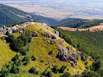
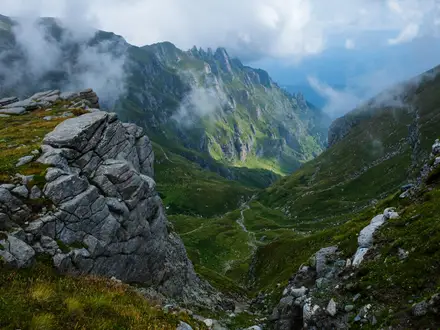
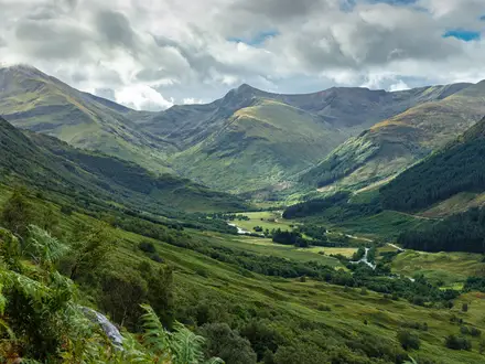
The Musala Peak Trail is a 13 km gondola-assisted out-and-back day hike in Rila National Park, Bulgaria. It climbs from the Yastrebets upper gondola station above Borovets to Musala summit at 2,925 m, the highest point in Bulgaria and the Balkan Peninsula. In summer this is a moderate high-mountain walk rather than a technical climb, but it suits fit hikers comfortable with altitude, exposed weather and a steep rocky finish.
Route Overview
Start in Borovets resort and take the Yastrebets gondola to the upper station at about 2,369 m. From there, follow the waymarked path, part of the European long-distance route E4, towards Musala hut at 2,389 m and the Musala lakes group. The route continues past Icy Lake and the Everest / Ledeno Ezero shelter at 2,709 m before the final steeper rocky climb to Musala summit and the Environmental Observatory. Return the same way to the gondola. If you are comparing Bulgarian mountain days, the Cherni Vrah Summit Trail is another summit objective, while the Bezbog to Popovo Lake Trail focuses on Pirin lake scenery.
Musala history and name
The name Musala comes from Arabic via Ottoman Turkish, meaning “near God” or “place for prayer”. Bulgaria’s first high-mountain weather station opened on the summit on 2 October 1932, and the site was re-opened in 1999 as the Bulgarian Academy of Sciences “Musala” Environmental Observatory. A separate cosmic-ray station built in 1960 with the Hungarian Academy of Sciences operated muon experiments until it was destroyed by an electrical fire in 1983.
Notable highlights
- Musala summit (2,925 m): The highest point in Bulgaria and the whole Balkan Peninsula. The summit is topped by the Bulgarian Academy of Sciences Environmental Observatory, with wide views across Rila, Pirin and the Rhodope ranges in clear weather.
- Yastrebets gondola: This lift from Borovets reaches roughly 2,369 m in about 25 minutes. It removes around 1,000 m of forest climbing and makes Musala realistic as a summer day hike.
- Musala hut (2,389 m): A traditional mountain lodge rebuilt in 2020, with about 130 beds and food available by pre-order. It is the usual first rest stop, about 3 km from the gondola.
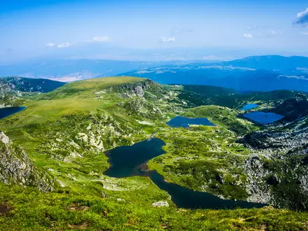
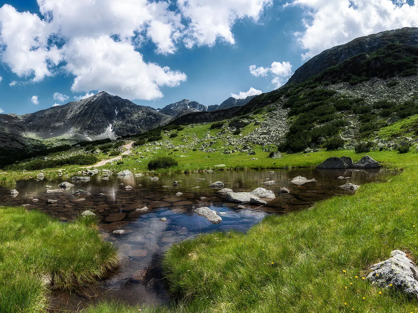
- Icy Lake / Ledenoto Ezero (2,709 m): One of the seven Musala lakes and the highest and deepest lake in Rila and on the Balkans. It sits below the final climb, beside the Everest / Ledeno Ezero shelter.
- Everest / Ledeno Ezero shelter (2,709 m): A small pyramid-shaped metal shelter with about 30 places on the shore of Icy Lake. It is the last refuge before the summit section.
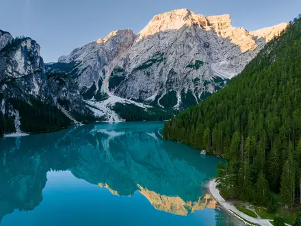
- Rila National Park: Bulgaria’s largest national park, protecting glacial lakes, Macedonian pine and Bulgarian fir. The Iskar, Maritsa and Mesta rivers rise near the mountain.
Challenges to expect
The standard summer route is moderate, but Musala is high, exposed and weather-prone. Expect a stony track to Musala hut, then dirt and grassy alpine ground, with a steeper rocky final section above the Everest / Ledeno Ezero shelter. Summit temperatures are cool even in summer, and snow can persist outside the main season. For a longer Balkan mountain undertaking, compare the Central Balkan Ridge Trail.
HikeList Score
Musala Peak Trail scored 80/100 on HikeList's trail-quality metrics.
See score breakdownHide breakdown
- Ideal length 55
- Balanced challenge 100
- Scenery & wildness 98
- Varied terrain 64
- Accommodation 66
- Food & support 81
- Path quality 98
- Season flexibility 76
Computed from length, challenge, scenery & wildness, terrain variety, accommodation, food & support, path quality and season flexibility.
Show more data Show less
- Mountainous
- Forest
- Dirt
- Rocky
- Huts
- Hotels
- Family Friendly
- Pet Friendly
- Restrooms
- Water Sources
- Shelters
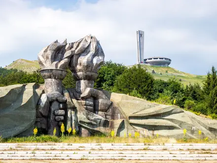
Photos from hikers
Taken on the trail by people who've reviewed Musala Peak Trail.
Reviews
How would you rate Musala Peak Trail?
Tap a star to start your review — you could be the first.