Mount Hakkoda Snow Route
How would you rate Mount Hakkoda Snow Route?
Tap a star to share your experience and help other hikers.
Mount Hakkoda Snow Route: Hakkoda Traverse to Sukayu Onsen
HikeList Score
Mount Hakkoda Snow Route scored 78/100 on HikeList's trail-quality metrics.
See score breakdownHide breakdown
- Ideal length 55
- Balanced challenge 100
- Scenery & wildness 98
- Varied terrain 94
- Accommodation 58
- Food & support 52
- Path quality 98
- Season flexibility 76
Computed from length, challenge, scenery & wildness, terrain variety, accommodation, food & support, path quality and season flexibility.
The Mount Hakkoda Snow Route is an 11.6 km, one-day point-to-point traverse in the northern Hakkoda Mountains of Aomori Prefecture, Tohoku, Japan. Starting from the Hakkoda Ropeway Summit Park Station, it crosses volcanic peaks and high wetlands to Sukayu Onsen. In summer and autumn it is a moderate mountain hike with no technical climbing on the standard route. Despite the name, this is not a casual winter snow walk: deep-winter Hakkoda is avalanche backcountry for guided ski or snowshoe parties with full equipment.
Route Overview
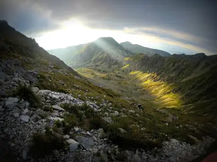
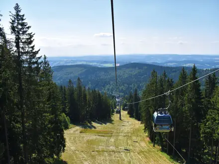
The route runs one way from Hakkoda Ropeway Sancho Koen / Summit Park Station, reached by a roughly 10-minute cable-car ride up Mount Tamoyachi, to Sukayu Onsen at the south foot of the range. From the Tamoyachi wetland near the ropeway top station, the trail continues through the northern Hakkoda high country via Mount Akakuradake, Mount Idodake, the Odake-hinan-goya emergency shelter and Mount Odake, the 1,585 m range high point. The descent crosses the Kami-Kenashitai and Shimo-Kenashitai wetlands on boardwalk before finishing at the hot spring. For longer Japan plans, compare the Tohoku coast on the Michinoku Coastal Trail or the alpine Kamikochi to Mount Yari Trail.
Hakkoda history and the 1902 winter disaster
The Hakkoda Mountains are an active volcanic complex of fourteen stratovolcanoes within Towada-Hachimantai National Park, with the last eruption recorded around 1550. Sukayu Onsen dates to 1684 and remains the classic finish for the traverse. The range is also known for the 1902 Hakkoda disaster, when an Imperial Japanese Army winter march was caught in a blizzard and 199 of 210 soldiers died — a stark reason to treat Hakkoda’s winter conditions with real caution.
Notable highlights
- Mount Odake summit (1,585 m): The highest point in the Hakkoda range and the main objective of the traverse. In clear weather it gives broad views over Aomori city, Mutsu Bay, Mount Iwaki and the surrounding peaks.
- Snow monsters (juhyo): Aomori-fir trees coated in rime ice by midwinter monsoon snow. They are the reason this route is branded a “snow” route, but January to February conditions belong to serious backcountry travel.
- Sukayu Onsen: A historic hot-spring inn founded in 1684, known for its large mixed-bathing cypress Sennin-buro. It is the traditional hot-bath finish after the descent.
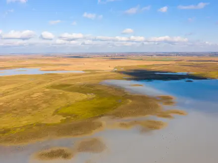
- Kenashitai wetlands: The Kami-Kenashitai and Shimo-Kenashitai high bogs are crossed on boardwalk near the end of the hike. Expect alpine flowers in summer and strong autumn colour in season.
- Tamoyachi wetland and Hakkoda Ropeway: The walk begins beside this high marsh after the ropeway ride up Mount Tamoyachi, giving quick access to the upper Hakkoda terrain.
- 1902 Hakkoda snow march: The disaster remains central to Hakkoda’s mountain history and underlines how quickly winter weather here can become lethal.
Challenges to expect
Expect exposed volcanic terrain, rocky and dirt paths, wetland boardwalks, cliff-edge sections and sudden weather changes. The route descends about 700 m to Sukayu Onsen, so trekking poles are useful. Facilities are limited to emergency huts with toilets. In winter this same terrain is avalanche country; a 2007 avalanche killed two people, so go only with a guide, beacon and full avalanche kit. For a lower-altitude forest contrast, see the Jomon Sugi Trail.
HikeList Score
Mount Hakkoda Snow Route scored 78/100 on HikeList's trail-quality metrics.
See score breakdownHide breakdown
- Ideal length 55
- Balanced challenge 100
- Scenery & wildness 98
- Varied terrain 94
- Accommodation 58
- Food & support 52
- Path quality 98
- Season flexibility 76
Computed from length, challenge, scenery & wildness, terrain variety, accommodation, food & support, path quality and season flexibility.
 Japan
JapanShow more data Show less
- Mountainous
- Volcanic
- Forest
- Wetland
- Rocky
- Dirt
- Boardwalk
- Hot Spring Inn
- Mountain Huts
- Family Friendly
- Restrooms
- Shelters
Photos from hikers
Taken on the trail by people who've reviewed Mount Hakkoda Snow Route.
Ride the Hakkoda Ropeway to Sancho Koen / Summit Park Station on Mount Tamoyachi, then traverse the northern Hakkoda high country past Tamoyachi wetland, Mount Akakuradake, Mount Idodake and Odake-hinan-goya emergency shelter. Continue to Mount Odake summit at 1,585 m before descending through the Kami-Kenashitai and Shimo-Kenashitai wetlands to finish at Sukayu Onsen. Allow about 5 hours of walking, or 6–7 hours including rests.
Reviews
How would you rate Mount Hakkoda Snow Route?
Tap a star to start your review — you could be the first.