Kamikochi to Mount Yari Trail
How would you rate Kamikochi to Mount Yari Trail?
Tap a star to share your experience and help other hikers.
Kamikochi to Mount Yari Trail: Yarisawa Route Guide
HikeList Score
Kamikochi to Mount Yari Trail scored 79/100 on HikeList's trail-quality metrics.
See score breakdownHide breakdown
- Ideal length 70
- Balanced challenge 80
- Scenery & wildness 88
- Varied terrain 100
- Accommodation 58
- Food & support 72
- Path quality 98
- Season flexibility 76
Computed from length, challenge, scenery & wildness, terrain variety, accommodation, food & support, path quality and season flexibility.
The Kamikochi to Mount Yari Trail is the classic Yarisawa Route to Yarigatake, a 3,180 m peak in the Northern Japan Alps of Japan. This 35.6 km out-and-back hike usually takes 3 days and is rated hard: the valley approach is straightforward, but the upper mountain is steep, rocky and exposed. It suits fit hikers with alpine hut experience who are comfortable with a short ladder-and-chain summit scramble.
Route Overview
Start and finish at Kamikochi Bus Terminal in Nagano Prefecture, walking out and back via Kappa Bridge, Myojin, Tokusawa, Yokoo, Yarisawa Lodge, Babadaira, Tenguhara and Yarigatake Sanso. The first section follows the Azusa River on a near-level forest path before the route turns up the Yarisawa valley and climbs into rockier alpine terrain. Yarigatake Sanso, directly below the summit, is the usual base for the final ascent of Yarinohosaki. Kamikochi is reached by bus or taxi only; private cars are banned beyond Sawando and Hirayu. If comparing other Japan routes, see the Kumano Kodo Nakahechi Route or Mount Asama Trail.
Mount Yari history
Mount Yari was first climbed on 28 July 1828 by the Buddhist priest Banryu, who founded a temple or place of worship on the mountain. Banryu’s Cave on the route is named after him. Yarigatake is also one of Fukada’s 100 Famous Japanese Mountains, and its sharp, spear-like profile gives it both its name — yari means “spear” — and the nickname “Matterhorn of Japan”. The route lies within Chubu-Sangaku National Park.
Notable highlights
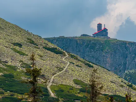
Yarigatake summit pinnacle (Yarinohosaki, 3,180 m): The spear-shaped summit of Mount Yari, reached by a short, near-vertical scramble using fixed ladders and chains. It is Japan’s fifth-highest mountain and a major objective in the Northern Japan Alps.
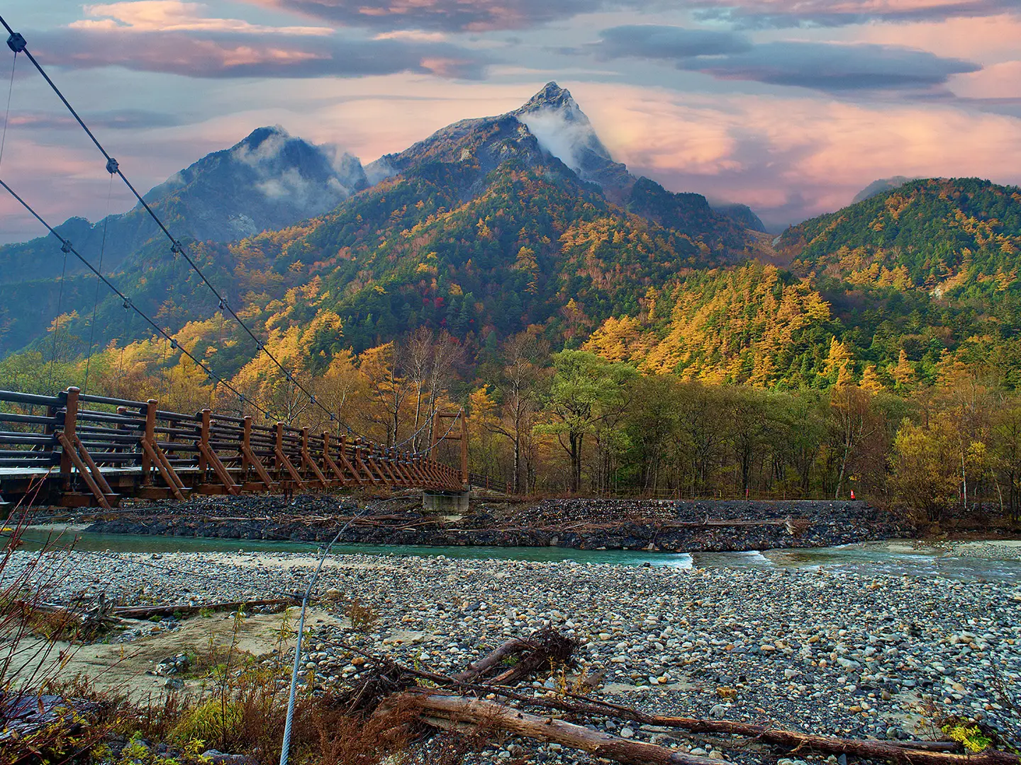
Kappa Bridge and the Azusa River: The iconic suspension bridge at Kamikochi marks the start and finish of the hike. It crosses the clear Azusa River and gives a classic view towards the Hotaka peaks.
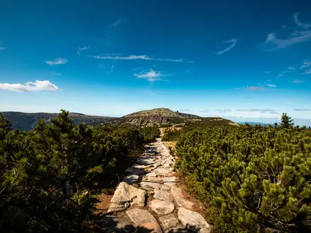
Yarisawa valley approach: A long, gentle approach beside a mountain river, with forest, wooden bridges and gradually opening alpine scenery. It is non-technical, but its length adds to the overall difficulty.
Yarigatake Sanso: A large mountain hut directly below the summit ridge. It is the standard overnight base for the summit push and rents climbing helmets for the exposed final scramble.
Banryu’s Cave: A rock shelter named after Banryu, the priest linked with the first recorded ascent of Mount Yari in 1828.
Challenges to expect
Expect a long approach, 1,680 m of ascent and a steep upper climb to Yarigatake Sanso. The final roughly 200 m to the summit is exposed, near-vertical and protected by fixed ladders and chains; helmets are recommended. The main season is mid-July to early October. Outside this period, snow cover means winter mountaineering skills and equipment are required. For a very different long-distance option, compare the Michinoku Coastal Trail.
HikeList Score
Kamikochi to Mount Yari Trail scored 79/100 on HikeList's trail-quality metrics.
See score breakdownHide breakdown
- Ideal length 70
- Balanced challenge 80
- Scenery & wildness 88
- Varied terrain 100
- Accommodation 58
- Food & support 72
- Path quality 98
- Season flexibility 76
Computed from length, challenge, scenery & wildness, terrain variety, accommodation, food & support, path quality and season flexibility.
Show more data Show less
- Mountainous
- Forest
- River Valley
- Alpine
- Dirt
- Gravel
- Rocky
- Scree
- Bare Rock
- Ladders And Chains
- Huts
- Campsites
- Family Friendly
- Restrooms
- Water Sources
- Campsites
- Shelters
In these collections
Photos from hikers
Taken on the trail by people who've reviewed Kamikochi to Mount Yari Trail.
Leave Kamikochi Bus Terminal, cross the Kappa Bridge area and follow the Azusa River valley through Myojin, Tokusawa and Yokoo. Many 3-day plans continue to Yarisawa Lodge for the first night; Yokoo is an alternative overnight stop.
Climb steadily up the Yarisawa valley, passing Babadaira and Tenguhara as the forest thins and the terrain becomes steeper, rockier and more alpine. Overnight at Yarigatake Sanso, the hut directly below the summit.
Make the short, exposed ladder-and-chain ascent to Yarinohosaki, the summit pinnacle of Mount Yari, then descend the same Yarisawa Route back past Yarigatake Sanso, Yarisawa Lodge, Yokoo and the Azusa River valley to Kamikochi Bus Terminal.
Reviews
How would you rate Kamikochi to Mount Yari Trail?
Tap a star to start your review — you could be the first.