Mont-Saint-Michel Bay Circuit
How would you rate Mont-Saint-Michel Bay Circuit?
Tap a star to share your experience and help other hikers.
Mont-Saint-Michel Bay Circuit: Guided Bay Crossing
HikeList Score
Mont-Saint-Michel Bay Circuit scored 77/100 on HikeList's trail-quality metrics.
See score breakdownHide breakdown
- Ideal length 55
- Balanced challenge 90
- Scenery & wildness 78
- Varied terrain 77
- Accommodation 83
- Food & support 81
- Path quality 92
- Season flexibility 63
Computed from length, challenge, scenery & wildness, terrain variety, accommodation, food & support, path quality and season flexibility.
The Mont-Saint-Michel Bay Circuit is a 14 km guided barefoot crossing of the Bay of Mont-Saint-Michel in France, usually completed in 5–6 hours as a one-day walk. This is not a conventional waymarked trail: it crosses tidal sand, mudflats, quicksand and river beds to Mont-Saint-Michel and back. Difficulty is moderate because the ground is flat but unstable, the tide timing is strict, and an accredited guide is mandatory. It suits hikers wanting a distinctive coastal day walk rather than a self-led hike.
Route Overview
Most full crossings depart from Bec d'Andaine at Genêts, the classic historic departure point, or from the Pointe du Grouin du Sud near Vains/Saint-Léonard. The guided route crosses the open bay floor to Mont-Saint-Michel, fords the Sée and Sélune at low tide, then returns across the sands. Treat it as an out-and-back tidal crossing, not a continuous marked loop. One-way crossings with bus return are shorter at about 6–7 km, while the full circuit is 14 km. If you are building a Normandy walking trip, pair it with the D-Day Beaches Circuit, or look further south to the Bordeaux to Arcachon Trail and the Châteaux of the Loire Circuit.
Pilgrims, tides and the return of the island
Pilgrims have crossed these sands for over a millennium to reach the abbey of Saint-Michel-au-péril-de-la-mer, “Saint Michael in peril of the sea”. Genêts was the traditional starting point for the crossing. More recently, hydraulic works from 2009–2015, including a new Couesnon dam and the 2014 footbridge, restored tidal flushing around the Mont, allowing it to become an island again at high spring tides.
Notable highlights
- The barefoot crossing: Walking from the coast to the abbey over wet sand, mud and cold river fords is the defining experience. The surface makes the day more demanding than the flat profile suggests.
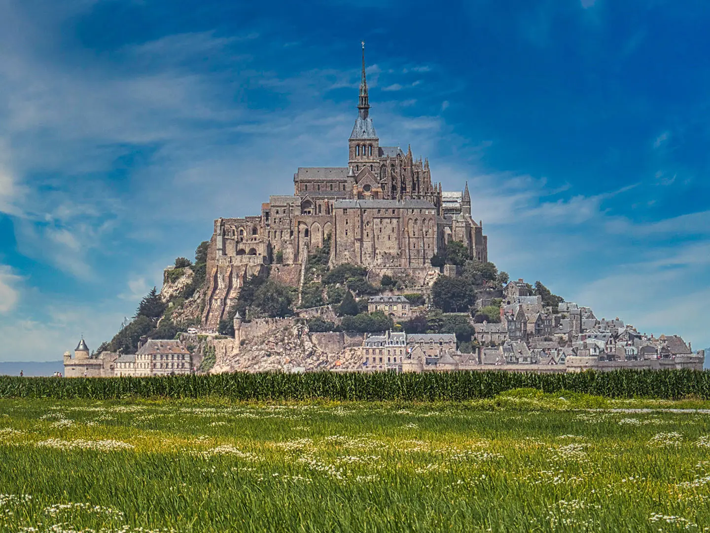
- Mont-Saint-Michel abbey: The Benedictine abbey crowns the island rock and is the focal point of the crossing. The rock and bay are a UNESCO World Heritage Site.
- Quicksand demonstration: Guides deliberately take walkers to safe patches of sables mouvants so you can feel the sediment liquefy underfoot and understand the bay’s main hazard.
- Europe’s great tides: The bay has one of Europe’s largest tidal ranges, exposing wide sand flats at low water before the tide returns quickly across the foreshore.
- Tombelaine islet: This smaller granite rock and bird reserve north of the Mont is included on some longer guided outings across the sands.
Challenges to expect
The main difficulty is not climbing but exposure to a tidal environment. Expect barefoot walking over wet sand, silt, mudflats, shallow channels, soft sediment and quicksand. The Sée and Sélune are forded at low tide, and the incoming tide can move faster than a person can escape soft sand. Never attempt the crossing alone: an accredited guide is required. In winter, water shoes are advised.
HikeList Score
Mont-Saint-Michel Bay Circuit scored 77/100 on HikeList's trail-quality metrics.
See score breakdownHide breakdown
- Ideal length 55
- Balanced challenge 90
- Scenery & wildness 78
- Varied terrain 77
- Accommodation 83
- Food & support 81
- Path quality 92
- Season flexibility 63
Computed from length, challenge, scenery & wildness, terrain variety, accommodation, food & support, path quality and season flexibility.
 France
Show more data Show less
- Coastal
- Tidal Flats
- Wet Sand
- Silt
- Mudflats
- Shallow Tidal Channels
- Hotels
- Guesthouses
- Campsites
- Family Friendly
- Pet Friendly
- Restrooms
- Water Sources
- Picnic Areas
Photos from hikers
Taken on the trail by people who've reviewed Mont-Saint-Michel Bay Circuit.
Reviews
How would you rate Mont-Saint-Michel Bay Circuit?
Tap a star to start your review — you could be the first.