La Roche-en-Ardenne Circuit
How would you rate La Roche-en-Ardenne Circuit?
Tap a star to share your experience and help other hikers.
La Roche-en-Ardenne Circuit: Promenade de Borzée Loop Guide
HikeList Score
La Roche-en-Ardenne Circuit scored 83/100 on HikeList's trail-quality metrics.
See score breakdownHide breakdown
- Ideal length 55
- Balanced challenge 100
- Scenery & wildness 98
- Varied terrain 83
- Accommodation 66
- Food & support 88
- Path quality 98
- Season flexibility 89
Computed from length, challenge, scenery & wildness, terrain variety, accommodation, food & support, path quality and season flexibility.
The La Roche-en-Ardenne Circuit is a 14 km, one-day waymarked loop in the Belgian Ardennes, starting and finishing in La Roche-en-Ardenne, Wallonia. Signed as the Promenade de Borzée with red-diamond waymark no. 6, it links the River Ourthe, Maboge and Borzée through wooded Ardennes hills. Expect a moderate walk rather than a technical hike: roughly 460 m of ascent, muddy or rocky sections after rain, and steady climbs out of the Ourthe valley.
Route Overview
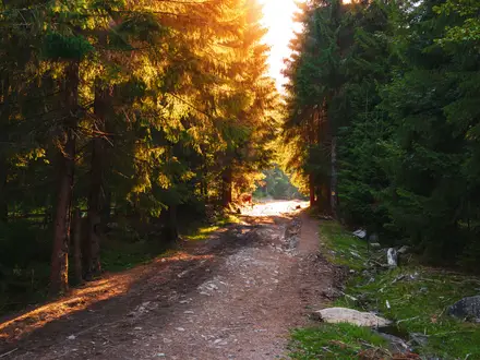
This is a loop, so no shuttle or point-to-point transport is needed. The conventional start and finish is the Maison du Tourisme on Quai de l’Ourthe in La Roche-en-Ardenne. Follow the local red diamond no. 6 waymarks out of town, descending towards the Ourthe and the riverside hamlet of Maboge, then climbing through forest towards Borzée before returning to La Roche. The route’s character is classic Ardennes: river-valley paths, forest tracks, gravel and dirt, with some rockier stretches and viewpoints such as Crestelles. For longer Belgian options, compare the GR 126 Semois and Meuse rivers route or the history-focused Battle of the Bulge Trail.
La Roche-en-Ardenne: Castle, War and the Ourthe
La Roche-en-Ardenne developed below its castle on a rocky spur in a bend of the Ourthe. The fortified site has roots in a Celtic oppidum and Roman camp, with the first medieval castle built around 844 by Adelard, Count of La Roche. The stronghold was later enlarged, damaged by fire in 1721 and dismantled under Joseph II of Austria. During the Battle of the Bulge in 1944–45, La Roche was heavily fought over and bombed; tank monuments in town commemorate that period.
Notable highlights
La Roche-en-Ardenne Castle (Château féodal): The ruined hilltop fortress dominates the town at the start and finish. It is visible from parts of the loop and gives clear context to La Roche’s defensive position above the Ourthe.
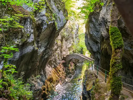
River Ourthe and valley: The route drops to and follows the Ourthe, then climbs back above it. These descents and climbs create much of the walk’s scenery and its moderate effort.
Maboge: This small riverside hamlet on the Ourthe is a useful natural pause point on the loop. The area is also known for canoeing and riverside camping.
Borzée: The wooded hamlet gives the Promenade de Borzée its name. It sits on the forested heights between Maboge and La Roche.
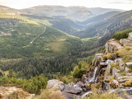
Forest viewpoints over the Ourthe: Viewpoints such as Crestelles look back over the meandering river, La Roche and the castle ruins amid Ardennes forest.
Battle of the Bulge tank memorials: An American M4A1 Sherman and a British M10 Achilles stand in La Roche as reminders of the fighting and destruction in winter 1944–45.
Challenges to expect
The main challenge is the repeated climb out of the Ourthe valley: around 460 m of ascent over a short day-walk distance. The route is not technical, but forest paths, dirt tracks and rocky sections can become muddy or slippery after rain. Waymarking is local red diamond no. 6, so check junctions carefully. Spring to autumn is best; winter walking is possible but wetter and less reliable. For a gentler cultural focus, see the Abbey Trail of Wallonia.
HikeList Score
La Roche-en-Ardenne Circuit scored 83/100 on HikeList's trail-quality metrics.
See score breakdownHide breakdown
- Ideal length 55
- Balanced challenge 100
- Scenery & wildness 98
- Varied terrain 83
- Accommodation 66
- Food & support 88
- Path quality 98
- Season flexibility 89
Computed from length, challenge, scenery & wildness, terrain variety, accommodation, food & support, path quality and season flexibility.
 Belgium
Show more data Show less
- Forest
- Hills
- River Valley
- Dirt
- Gravel
- Rocky
- Hotels
- Campsites
- Family Friendly
- Pet Friendly
- Restrooms
- Water Sources
- Campsites
- Picnic Areas
Photos from hikers
Taken on the trail by people who've reviewed La Roche-en-Ardenne Circuit.
Reviews
How would you rate La Roche-en-Ardenne Circuit?
Tap a star to start your review — you could be the first.