Elbe River Source Trail
How would you rate Elbe River Source Trail?
Tap a star to share your experience and help other hikers.
Elbe River Source Trail: Day Hike to the Labe Source
HikeList Score
Elbe River Source Trail scored 82/100 on HikeList's trail-quality metrics.
See score breakdownHide breakdown
- Ideal length 55
- Balanced challenge 100
- Scenery & wildness 98
- Varied terrain 71
- Accommodation 66
- Food & support 88
- Path quality 98
- Season flexibility 89
Computed from length, challenge, scenery & wildness, terrain variety, accommodation, food & support, path quality and season flexibility.
The Elbe River Source Trail is a 14 km, one-day, moderate out-and-back walk in the Krkonoše Mountains of north Bohemia, Czechia. Starting and finishing in Špindlerův Mlýn, it climbs into Krkonoše National Park to Pramen Labe, the symbolic source of the Elbe. It suits hikers who want high-mountain scenery without a multi-day commitment: the walking is mostly on marked, well-built paths, but the exposed Labská louka plateau demands proper layers and weather awareness.
Route Overview
The classic route starts in Špindlerův Mlýn and follows waymarked paths towards the high Labská louka plateau, passing Zlaté návrší, Vrbatova bouda, Pančava Waterfall, Labská bouda and finally Pramen Labe. Most walkers return the same way, making it an out-and-back; loop variants return via the green plateau trail or the blue trail through Labský důl. The Medvědín cable car can shorten the approach when operating roughly July to October. For a longer ridge outing in the same range, compare the Krkonoše Traverse, while Černá Hora to Pec pod Sněžkou is another Krkonoše day hike.
The Elbe Source and Its Mountain History
The Elbe, or Labe in Czech, rises on Labská louka in the Krkonoše and flows about 1,094 km through Bohemia and Germany to the North Sea. Because the true spring lies in a fragile protected mire, visitors are directed to a symbolic stone wellhead. In 1968, a nearby wall was set with mosaic coats of arms of 26 cities along the river. The source has drawn tourists since the 19th century, when Labská bouda was already a key mountain stop.
Notable highlights
- Pramen Labe (Source of the Elbe, 1,387 m): A circular stone wellhead marks the symbolic source on Labská louka. The real spring lies about 300 m west in a fenced protected mire, so hikers must stay at the monument.
- Wall of 26 coats of arms: This low stone wall beside the source carries mosaic coats of arms of cities along the Elbe, including places downstream in Germany such as Dresden, Magdeburg and Hamburg.
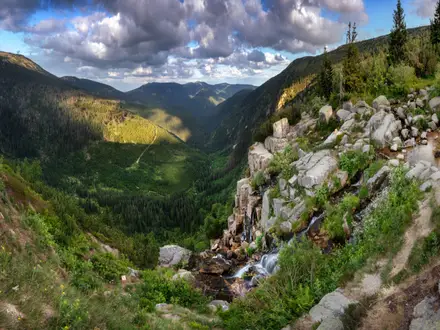
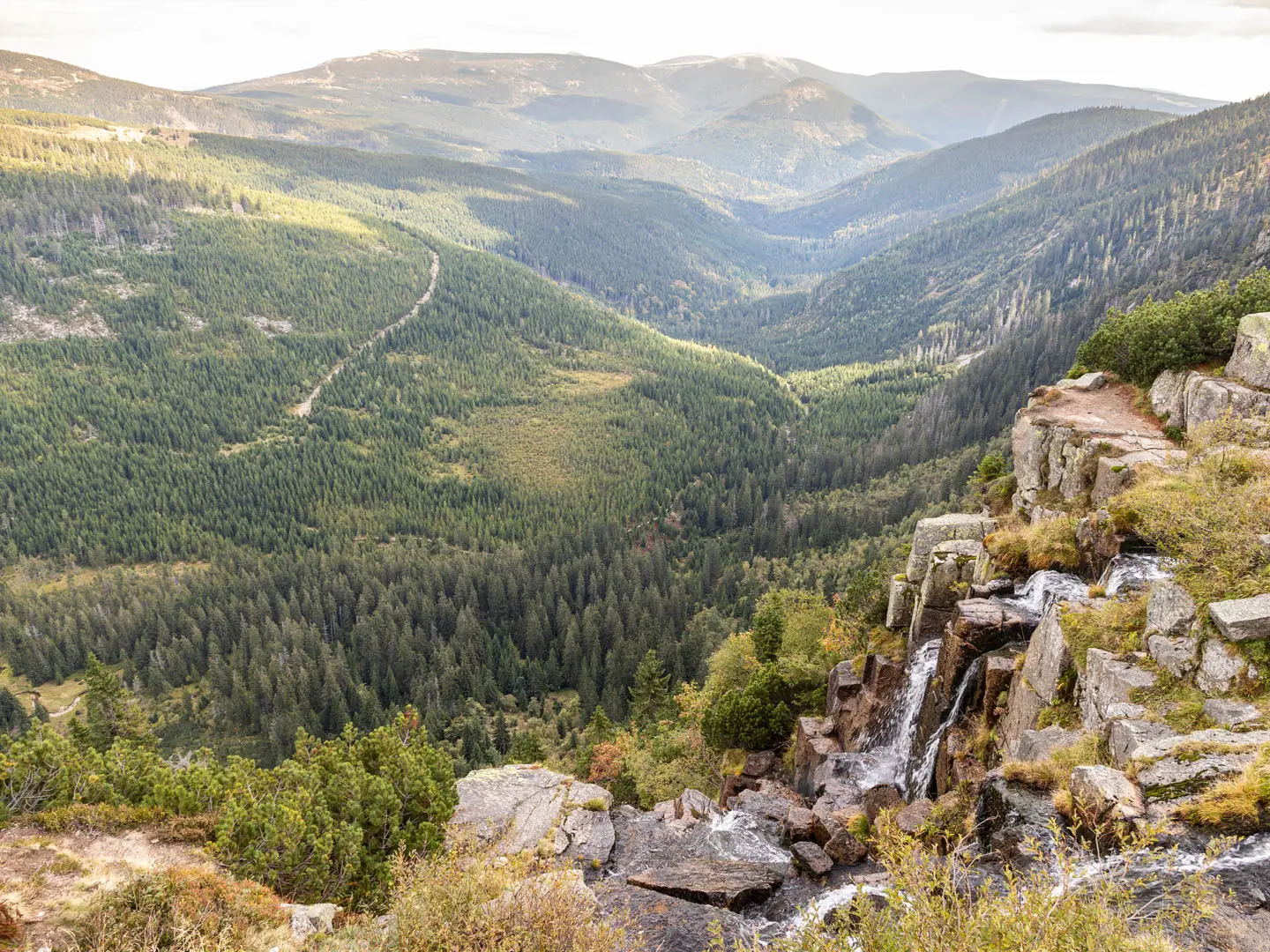
- Pančava Waterfall (Pančavský vodopád, 148 m): The highest waterfall in the Czech Republic drops in stages into Labský důl. It is viewed from a ridge platform near Labská bouda and is strongest during spring snowmelt.
- Labský Waterfall: A short detour below Labská bouda leads to this roughly 35 m fall, where the young Elbe spills towards the head of the glacial Labský důl valley.
- Labská bouda: A large mountain lodge near the source, useful for food, shelter and a weather break. Its historic predecessor was linked to early tourism around the Pančava falls.
- Zlaté návrší and Vrbatova bouda: The route crosses this high plateau area around 1,400 m, with broad Krkonoše ridge views, refreshments at Vrbatova bouda and memorials to Bohumil Hanč and Václav Vrbata.
Challenges to expect
This is the easy end of moderate, but not a casual town walk. Expect about 450 m of ascent, changing mountain weather, fog, wind and possible afternoon storms on the exposed plateau. Much of the surface is gravel or well-built path, with rockier sections near the source and on the optional Labský důl descent. Carry water, layers, rain protection and offline navigation. For a steeper forest-and-waterfall route elsewhere in Czechia, see the Bílá Opava Valley Path.
HikeList Score
Elbe River Source Trail scored 82/100 on HikeList's trail-quality metrics.
See score breakdownHide breakdown
- Ideal length 55
- Balanced challenge 100
- Scenery & wildness 98
- Varied terrain 71
- Accommodation 66
- Food & support 88
- Path quality 98
- Season flexibility 89
Computed from length, challenge, scenery & wildness, terrain variety, accommodation, food & support, path quality and season flexibility.
 Czechia
Show more data Show less
- Mountainous
- Forest
- Gravel
- Dirt
- Rocky
- Hotels
- Huts
- Family Friendly
- Pet Friendly
- Restrooms
- Water Sources
- Campsites
- Picnic Areas
Photos from hikers
Taken on the trail by people who've reviewed Elbe River Source Trail.
Reviews
How would you rate Elbe River Source Trail?
Tap a star to start your review — you could be the first.