Jura Crest Trail
How would you rate Jura Crest Trail?
Tap a star to share your experience and help other hikers.
Jura Crest Trail: Route 5 Across the Swiss Jura
HikeList Score
Jura Crest Trail scored 88/100 on HikeList's trail-quality metrics.
See score breakdownHide breakdown
- Ideal length 87
- Balanced challenge 100
- Scenery & wildness 66
- Varied terrain 100
- Accommodation 92
- Food & support 88
- Path quality 98
- Season flexibility 89
Computed from length, challenge, scenery & wildness, terrain variety, accommodation, food & support, path quality and season flexibility.
The Jura Crest Trail is a 310 km point-to-point thru-hike across the Swiss Jura mountains in Switzerland, from Dielsdorf near Zurich to Nyon on Lake Geneva. Also signed as national hiking Route 5, the Jura-Höhenweg is usually walked in about 14 days and is graded moderate: there is no technical climbing, but long daily distances, repeated climbs and exposed limestone ridges demand fitness. It suits hikers who want a classic Swiss ridge walk without high-Alpine glacier terrain.
Route Overview
The standard direction is east to west, starting at Dielsdorf and finishing in Nyon. The route follows the Jura arc roughly parallel to the French border, linking the Lägern ridge, Brugg, Staffelegg, Hauenstein, Balsthal, Weissenstein, Biel/Bienne, Chasseral, Vue des Alpes, Creux du Van, Sainte-Croix, Vallorbe, Lac de Joux, Mont Tendre, Saint-Cergue and La Dôle. It is an end-to-end trail, not a loop, but rail and bus access at both ends and many stage points make section hiking practical. For shorter route ideas, see the Chasseral Ridge Walk and Creux du Van to Noiraigue.
Switzerland’s Oldest Long-Distance Hiking Route
The Jura Crest Trail is regarded as Switzerland’s oldest long-distance hiking route, with waymarking along the Jura crest beginning as early as 1905. It later became national hiking Route 5 on the SwitzerlandMobility network. The trail is more than a scenic traverse: it links German-speaking Aargau and Solothurn with French-speaking Neuchâtel and Vaud, following the Jura arc between Switzerland and France.
Notable highlights
- Mont Tendre (1,679 m): The highest point of the Jura range and the summit climax of the trail. The broad grazed crest gives wide views over Lake Geneva towards the Mont Blanc massif.
- Creux du Van: A natural limestone amphitheatre about 1.4 km wide, with cliffs roughly 150–160 m high around a grassy basin. It is one of the trail’s best-known landmarks; a shorter option is the Creux du Van Circular Trail.
- Chasseral (1,606 m): The highest summit of the Bernese Jura, marked by a telecoms tower. It gives a major panorama over the Three Lakes region and the Alps.
- Weissenstein: A belvedere ridge above Solothurn reached by gondola. It is a classic viewpoint on the eastern half of the Jura Crest Trail.
- Lac de Joux and Le Pont: The trail passes Le Pont on the shore of Lac de Joux before climbing towards Mont Tendre. The lake sits high in a karst valley.
- La Dôle (1,677 m): A prominent dome near the western end, topped by a weather radar. From here the route drops towards Lake Geneva and Nyon.
Challenges to expect
The Jura Crest Trail is non-technical, but it is not easy. Expect sustained walking days, some stages up to about 32 km, and major climbs of up to about 1,700 m on the hardest sections. Wet limestone can be slippery, and open ridges are exposed to wind, heat and poor visibility. Higher accommodation may only operate from June to late September. For a more Alpine Swiss traverse, compare the Alpine Pass Route (Route 6).
HikeList Score
Jura Crest Trail scored 88/100 on HikeList's trail-quality metrics.
See score breakdownHide breakdown
- Ideal length 87
- Balanced challenge 100
- Scenery & wildness 66
- Varied terrain 100
- Accommodation 92
- Food & support 88
- Path quality 98
- Season flexibility 89
Computed from length, challenge, scenery & wildness, terrain variety, accommodation, food & support, path quality and season flexibility.
 Switzerland
Show more data Show less
- Mountain Ridges
- Limestone Plateaux
- Pasture
- Forest
- Gorges
- Footpaths
- Forest Tracks
- Grassy Trails
- Gravel
- Farm Lanes
- Limestone
- Hotels
- Guesthouses
- Mountain Inns
- Campsites
- Family Friendly
- Pet Friendly
- Restrooms
- Water Sources
- Campsites
- Shelters
- Picnic Areas
Download Our Full Guide to Jura Crest Trail FREE!
Get our comprehensive guide to this hike for free. Save it for later reading or print out at home.
In these collections
Photos from hikers
Taken on the trail by people who've reviewed Jura Crest Trail.
Jura Crest Trail: The Complete Guide
 i
Image by Horizon
i
Image by Horizon The Jura Crest Trail is Switzerland’s great limestone ridge walk: a 320 km traverse from Dielsdorf near Zurich to Nyon on Lake Geneva (Lac Léman). It follows SwitzerlandMobility national hiking Route 5 along the Jura arc, moving from German-speaking into French-speaking Switzerland as the crest rolls west and south-west.
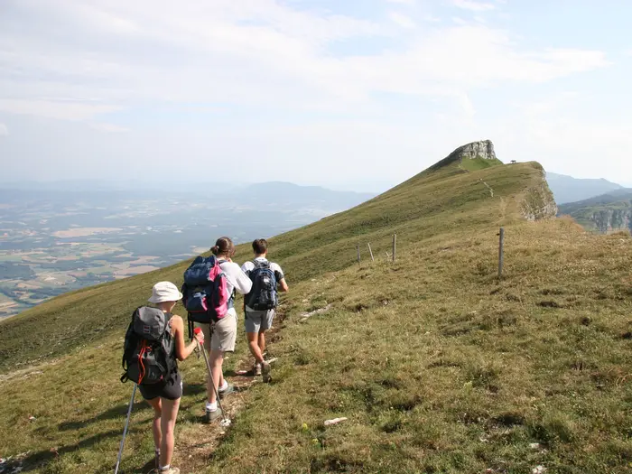
This is not high-Alpine mountaineering. The appeal is steadier and more spacious: grazed ridges, beech and pine forest, karst plateaux, dry-stone walls, mountain inns and long views across the Swiss Plateau to the Alps.
The route links many of the Jura’s best viewpoints, including Weissenstein, Chasseral, Creux du Van, Le Chasseron, Mont Tendre, Col du Marchairuz and La Dôle. Mont Tendre is the high point at 1,679 m, with the final stages dropping through pasture and vineyards towards Nyon and Lake Geneva.
The walking is technically straightforward and well waymarked, but it still asks for proper hill fitness. Expect long days, repeated climbs, exposed crest sections, slippery limestone in wet weather and some limited seasonal accommodation on the higher ridges.
This guide covers stages, itinerary choices, accommodation, food and water, transport, terrain, seasonality and the common planning mistakes on the Jura Crest Trail.
Stage-by-Stage Guide
The stage notes below follow the official 16-stage structure for SwitzerlandMobility national hiking Route 5, the Jura-Höhenweg / Chemin des Crêtes du Jura. Distances are approximate and should be paired with the SwitzerlandMobility map and the SBB timetable when booking accommodation or arranging section starts.
Stage 1: Dielsdorf to Brugg — approx. 24 km
The trail starts directly from Dielsdorf railway station and climbs almost immediately towards the Lägern ridge, the sharp eastern spur of the Jura above greater Zurich. This is a strong opening day: wooded limestone crest walking, views back towards Zurich, then a progression through Regensberg and Baden before finishing in Brugg.
Underfoot, expect a mix of footpath, forest track and limestone ridge path. The Lägern is one of the more defined crest sections early on, so wet limestone and tree roots can make the going slower than the distance suggests.
Food and water are easiest to organise at the start and in the larger valley settlements, especially Baden and Brugg. Do not rely on frequent water on the ridge; carry enough from Dielsdorf or top up where services are clearly available.
Brugg is one of the better overnight stops on the eastern half of the route, with hotels and guesthouses in the town. It also has rail access, making this an easy stage to use as a section-hike start or finish.
Navigation is straightforward if Route 5 waymarks are followed carefully from the station and through the built-up areas. The main warning is the exposed, sometimes narrow character of the Lägern ridge: take particular care in rain, wind or poor visibility.
Stage 2: Brugg to Staffelegg — approx. 20 km
This stage leaves the valley town environment of Brugg and returns to the rolling Jura pattern of wooded slopes, farm tracks and crest-side pasture. It is less about a single famous summit than about settling into the repeated climb-and-descend rhythm that defines the route.
Terrain is mostly non-technical, but the surfaces vary between forest paths, gravel and grassy tracks. Limestone can be polished and slippery when wet, especially where the path is shaded by beech and pine forest.
Stock up in Brugg before leaving. Food, water and accommodation at Staffelegg or immediately around the stage end should not be assumed without checking before travelling.
Public transport and road access for the end of the stage should be checked in the SBB timetable before committing to a same-day onward journey. If accommodation is not available at the stage end, plan a transfer or adjust the stage split in advance.
Route 5 waymarking is generally reliable, but forest junctions need attention. Carry an offline map or the SwitzerlandMobility app, as this is the kind of stage where a missed turning can add unnecessary distance late in the day.
Stage 3: Staffelegg to Hauenstein — approx. 23 km
The third stage continues west through a quieter Jura landscape of forested crests, open grazing land and small pass settlements. It is a physical day rather than a technical one, with distance and repeated height gain doing most of the work.
Paths are typically a mix of footpaths, forestry tracks, farm tracks and grassy crest sections. After rain, expect mud in woodland and slippery limestone where rock is exposed.
Services between Staffelegg and Hauenstein are limited compared with the valley towns. Carry lunch and sufficient water from the start unless a definite open service has been planned; crest water availability should be checked before relying on it.
Accommodation and onward transport around Hauenstein should be arranged ahead. This should be checked before travelling, especially outside the main summer walking season.
Navigation is usually uncomplicated on the signed national route, but mist or low cloud can make open pasture sections feel less obvious. Watch for livestock and close gates where required.
Stage 4: Hauenstein to Balsthal — approx. 17 km
This is a shorter official stage, useful after the longer previous day. The route continues over Jura hill country before descending towards Balsthal, one of the more practical service stops on this part of the trail.
The walking remains typical of the northern Jura: forest, grazing land, limestone paths and farm or gravel tracks. Although the distance is moderate, the day still includes ascent and descent, so it should not be treated as a flat recovery walk.
Balsthal is a better place to resupply than the smaller pass settlements before it. Carry enough water from Hauenstein, particularly in warm weather, as open crest sections can be exposed to sun and wind.
Hotels and guesthouses are available in Balsthal, and it is one of the named intermediate public transport hubs for the route. That makes it a sensible place to end a short section or to build in flexibility.
Follow Route 5 carefully on the descent into town, where waymarks can be easier to miss than on open ridge. Wet limestone, forestry mud and grazing cattle are the main practical issues rather than any technical difficulty.
Stage 5: Balsthal to Weissenstein — approx. 21 km
From Balsthal the route climbs back to one of the classic Jura viewpoints: Weissenstein, the belvedere ridge high above Solothurn. The reward for the ascent is a broad panorama across the Swiss Plateau, the Mittelland, towards the Alps.
This is a proper hill day with sustained climbing from the valley. Expect a mix of forest paths, pasture tracks and open crest walking, with the final high ground more exposed to wind and weather.
Buy food in Balsthal and carry enough water for the climb. Weissenstein has mountain accommodation and is served by a gondola, but opening times, operating dates and meal availability should be checked before travelling.
Staying on or near the crest makes sense here, but summit and ridge accommodation is seasonal and limited. Book ahead, especially from June to September and at weekends.
Navigation is generally simple on the waymarked route, but the climb out of Balsthal should be taken steadily. In poor weather, the open ridge near Weissenstein can feel much more exposed than its altitude suggests.
Stage 6: Weissenstein to Frinvillier — approx. 24 km
This is a long crest stage linking Weissenstein with Frinvillier, close to Biel/Bienne. It continues the high Jura pattern of forest, pasture and limestone ridge walking, with broad views when the weather is clear.
The day is not technically difficult, but 24 km over undulating terrain can feel demanding with a multi-day pack. Expect a varied surface: grassy paths, farm tracks, gravel sections and woodland paths.
Start with full water unless a definite open service has been planned on the route. Food and accommodation are more dependable at the ends of the stage than on the crest, but mountain and farm-restaurant opening dates vary.
Frinvillier, also signposted Frinvilier, sits near Biel/Bienne, one of the important transport hubs on the route. Accommodation can also be considered in or around the Biel/Bienne area, but this should be booked and checked against onward transport before travelling.
This is a stage where consistent attention to Route 5 signs matters, especially through forest and pasture junctions. Expect the language and place-name environment to begin shifting as the route moves towards the bilingual and French-speaking Jura.
Stage 7: Frinvillier to Chasseral — approx. 17 km
The route climbs from Frinvillier to Chasseral, the highest summit of the Bernese Jura at 1,606 m. The summit is easy to recognise by its tall telecoms tower and gives one of the major panoramas of the whole trail, over the Three Lakes region and towards the Alps.
Although the distance is shorter, this is a significant ascent stage. The terrain moves from lower wooded slopes to more open high-Jura pasture and crest walking, with the upper section exposed to wind, sun and fast-changing weather.
Carry food and water from Frinvillier unless a specific open stop has been planned. Chasseral has mountain accommodation and food options in season, but these are seasonal and should be booked or checked ahead.
Public transport from a high summit endpoint is less straightforward than from valley towns. If not staying on Chasseral, onward connections or transfers should be checked before travelling.
Navigation is uncomplicated in clear weather because the summit is so prominent, but mist can reduce visibility quickly on the broad crest. Treat Chasseral as a mountain stage: waterproofs, warm layers and sun protection all matter.
Stage 8: Chasseral to Vue des Alpes — approx. 20 km
This stage stays high on the Jura crest, continuing west from Chasseral towards Vue des Alpes. It is classic ridgeway walking: open grazing land, forest sections, dry-stone walls and long views when the cloud is above the summits.
The path is mostly non-technical, but the exposure is real. Wind, low cloud and wet limestone can make progress slower, and in hot weather the open ridges offer little shade.
Food and water should be planned carefully. Start from Chasseral with enough to be independent for the day unless definite open services have been checked; do not assume water is available on the crest.
Accommodation and transport at Vue des Alpes should be checked before travelling. If a suitable overnight is not available, arrange a transfer or adapt the itinerary rather than arriving late without a plan.
Waymarking follows Route 5, but open pasture and forestry tracks create many possible-looking lines. Use the map at junctions and avoid following vehicle tracks unless they match the signed route.
Stage 9: Vue des Alpes to Noiraigue — approx. 22 km
From Vue des Alpes the route crosses the Tête de Ran area and then drops towards Noiraigue. It is another substantial Jura day, moving between high crest, forest and lower valley terrain.
Expect mixed surfaces: grassy ridge paths, forest tracks, gravel and limestone underfoot. The descent towards Noiraigue can be harder on tired legs than the profile might suggest, particularly after rain.
Carry food and water from the start unless a known open stop has been built into the day. Noiraigue is a more practical valley endpoint for food, overnight planning and onward transport than the preceding high crest stops.
Noiraigue gives useful access for section hiking and sits within reach of the wider Neuchâtel transport area. Exact connections should be checked in the SBB timetable before travelling.
Navigation is usually simple on the signed route, but take care in forested sections and where tracks cross. Poor visibility on the Tête de Ran area can make the broad terrain less intuitive.
Stage 10: Noiraigue to La Combaz — approx. 17 km
This is one of the signature stages of the Jura Crest Trail, climbing from Noiraigue to the Creux du Van. The limestone amphitheatre is about 1.4 km wide and ringed by cliffs roughly 150–160 m high, making it one of the most dramatic landmarks on Route 5.
The stage combines a climb from the valley with exposed cliff-rim and crest walking. Underfoot, expect forest paths, limestone, pasture and open tracks; the terrain is not technical, but the setting demands care.
Stock up in Noiraigue before starting. Services at La Combaz and on the crest are limited and seasonal, so food, water and any overnight arrangement should be checked before travelling.
Accommodation near La Combaz should be booked in advance or backed up with a clear transfer plan. This is especially important outside the main June to September walking period.
The key warning is the cliff edge at Creux du Van: stay well back from the rim, especially in wind, rain, mist or when stopping for photographs. Navigation follows the waymarked route, but do not shortcut near the amphitheatre edge.
Stage 11: La Combaz to Sainte-Croix — approx. 14 km
This shorter stage continues through high Jura pasture and forest towards Sainte-Croix, also signposted Ste-Croix. It gives a useful lighter day after the Creux du Van section and before the climb to Le Chasseron.
The terrain is generally straightforward, with grassy paths, farm tracks and woodland sections. Limestone remains slippery when wet, and cattle may be present in the grazed areas.
Food and water at La Combaz should not be relied on without checking. Sainte-Croix is a valley town with hotels and guesthouses, making it one of the more practical overnight stops in the western half of the route.
Public transport options around Sainte-Croix should be checked in the SBB timetable. For section hikers, it is a better access point than many of the high crest endpoints.
Navigation is easy in principle but can be fiddly through pasture boundaries and forest tracks. Close gates, keep to the signed line and be aware that signage and place names are now firmly in the French-speaking part of the Jura.
Stage 12: Sainte-Croix to Ballaigues — approx. 18 km
This stage climbs above Sainte-Croix to Le Chasseron, a broad grassy summit at 1,607 m with wide views over Lac de Neuchâtel and the Alpine chain. It is one of the major western-Jura viewpoint days.
The route uses open summit pasture, limestone paths, woodland and farm tracks. The summit area can be very exposed, so windproof and waterproof layers should be accessible even in settled weather.
Sainte-Croix is the sensible place to buy food before setting out. Water and refreshments on the high ground should be checked before relying on them, particularly early or late in the season.
Accommodation at Ballaigues or nearby should be arranged ahead. If continuing towards the Vallorbe area for services or transport, check connections and walking or transfer logistics before travelling.
Route 5 waymarking should be followed carefully over and away from Le Chasseron, where broad grassy ground can make informal trods tempting. In mist, use the map rather than relying on distant landmarks.
Stage 13: Ballaigues to Le Pont — approx. 19 km
The route now moves towards the Vallorbe area and the high karst valley of Lac de Joux. The stage finishes at Le Pont on the lake shore, a distinctive change of character after many days of ridge and forest.
Terrain remains varied: forest, farm tracks, limestone paths and valley-side walking. Karst landscapes can be dry underfoot and water may be less obvious than expected, so do not treat map streams or ponds as guaranteed drinking sources.
Food and water should be planned from Ballaigues, with more dependable services around the Vallorbe and Le Pont areas than on the intervening upland. Check opening hours before relying on any single stop.
Le Pont is one of the named transport hubs for the route and works well for section-hiking or a rest stop. Accommodation in or around the Lac de Joux area should still be booked ahead in the main season.
Navigation is not difficult if the Route 5 signs are followed, but take care where local paths and tracks branch near settlements and the lake. The route is still a hill walk, not a lakeside promenade for the whole stage.
Stage 14: Le Pont to Col du Marchairuz — approx. 24 km
This is one of the biggest and most important stages of the whole trail. From Le Pont and Lac de Joux, the route climbs to Mont Tendre, at 1,679 m the highest summit of the Jura range and the high point of the Jura Crest Trail, before continuing towards Col du Marchairuz.
Expect a long day on open grazed crest, limestone, forest and farm tracks. The views from Mont Tendre can reach over Lake Geneva to Mont Blanc, but the same exposed position means the summit can be windy, cold or disorientating in poor visibility.
Carry enough food and water from Le Pont to be self-sufficient unless specific open mountain services have been checked. Mountain inns and farm-restaurants around Mont Tendre and Col du Marchairuz are seasonal and limited, so do not depend on them without a booking or current opening information.
Col du Marchairuz has traditional high-Jura accommodation, but it should be booked well ahead. Public transport from the pass is not something to improvise at the end of a long day; check the SBB timetable before travelling.
Navigation over broad pasture and crest ground requires care in mist. This stage also needs respect for weather exposure, cattle, dry-stone walls and the cumulative fatigue of a 24 km mountain day.
Stage 15: Col du Marchairuz to Saint-Cergue — approx. 17 km
The route continues through the Parc Jura vaudois landscape of open pasture, forest and long western Jura ridges. After the previous day, the shorter distance makes this a more manageable stage, but it still stays in exposed hill country.
Paths are generally easy underfoot: grassy crest tracks, forest paths and farm or gravel tracks. In wet weather, limestone and mud can slow progress, while in hot weather the open pasture sections are exposed to sun.
Use Col du Marchairuz services only if they are open and booked or checked in advance. Saint-Cergue, also signposted St-Cergue, is the practical end point for food, accommodation and onward planning before the final stage.
Accommodation in Saint-Cergue should be reserved ahead during the main walking season. Public transport options should be checked in the SBB timetable, particularly if using the town as a section break.
Route-finding is generally straightforward, but pasture junctions and forest tracks still require attention. Give livestock plenty of space, especially cows with calves, and keep to the waymarked line.
Stage 16: Saint-Cergue to Nyon — approx. 26 km
The final stage is also the longest official day, crossing La Dôle before descending to Nyon on Lake Geneva, Lac Léman. La Dôle, at 1,677 m and topped by a weather radar, is the last major summit and the final grand viewpoint of the route.
The day begins with high Jura walking over pasture and limestone, then gradually leaves the crest for lower slopes, vineyards and the descent to the lakeside. The contrast between open mountain ground and the finish at Nyon railway station is one of the defining features of the route.
Start from Saint-Cergue with enough food and water for a long day, as services on the high ground should not be assumed. Nyon has the practical advantages of a lakeside town and a main-line railway station for onward travel.
Nyon is on the Geneva–Lausanne rail line, with Geneva around 15 minutes away by train. If staying after the hike, book accommodation in advance, especially in busy summer periods around Lake Geneva.
Navigation remains on Route 5, but the descent off La Dôle needs attention where mountain paths give way to lower tracks, lanes, pasture and vineyard country. The main warnings are fatigue, a long descent on tired legs, slippery limestone if wet and full exposure to sun or wind on the final high ridge.
Recommended Itinerary
Standard 16-day itinerary
This is the cleanest itinerary for most walkers because it follows the official SwitzerlandMobility Route 5 stage structure from Dielsdorf to Nyon. It keeps the daily distances broadly consistent while still including several high, exposed crest days where accommodation and water need to be checked before travelling.
| Day | From | To | Approx. distance | Why this stage makes sense | Services/accommodation notes |
|---|---|---|---|---|---|
| 1 | Dielsdorf | Brugg | 24 km | A strong opening day over the Lägern ridge, leaving the Zurich edge quickly and reaching a useful lowland town for the first night. | Dielsdorf has rail access from Zurich by S-Bahn. Brugg is a practical service town and transport hub. |
| 2 | Brugg | Staffelegg | 20 km | A moderate follow-on stage that starts the repeated Jura pattern of climbing away from valley services towards the crest. | Staffelegg is a smaller stage point; accommodation and onward transport should be checked before travelling. |
| 3 | Staffelegg | Hauenstein | 23 km | Keeps momentum across the northern Jura without creating an overlong day before the Balsthal section. | Hauenstein is a pass/stage point rather than a major town. Book ahead and check current transport options. |
| 4 | Hauenstein | Balsthal | 17 km | A shorter day after two longer stages, useful for recovery and resupply before the climb towards Weissenstein. | Balsthal is one of the better intermediate hubs on the route, with public transport links and valley services. |
| 5 | Balsthal | Weissenstein | 21 km | A classic crest stage, climbing to one of the major Jura viewpoints above the Swiss Plateau. | Weissenstein has high-level accommodation options, but mountain inns are seasonal and should be booked well ahead. |
| 6 | Weissenstein | Frinvillier | 24 km | A full ridge-and-descent day that carries the route west towards the Biel/Bienne area and the linguistic transition of the trail. | Frinvillier is close to the Biel/Bienne area, but exact overnight logistics should be checked before booking. |
| 7 | Frinvillier | Chasseral | 17 km | A shorter distance but a significant mountain day, ending high on the Bernese Jura at Chasseral. | Chasseral is a summit/crest overnight, so book early and check opening dates, weather and water availability. |
| 8 | Chasseral | Vue des Alpes | 20 km | Continues along the high Jura with big views and a logical crest-to-pass progression. | Vue des Alpes is a pass stage point; services can be limited outside the main season. This should be checked before travelling. |
| 9 | Vue des Alpes | Noiraigue | 22 km | A varied day across forest, crest and descent, positioning you below the Creux du Van section. | Noiraigue is a useful valley stop. Public transport options should be checked through SBB. |
| 10 | Noiraigue | La Combaz | 17 km | Keeps the Creux du Van area manageable rather than forcing it into a very long day. | La Combaz is a small high-level stage point; accommodation and meals must be arranged in advance. |
| 11 | La Combaz | Sainte-Croix | 14 km | The shortest official stage, giving a lighter day into a proper town after several crest-based nights. | Sainte-Croix (Ste-Croix) is a practical overnight and resupply stop before Le Chasseron. |
| 12 | Sainte-Croix | Ballaigues | 18 km | A compact but scenic Jura stage over the Le Chasseron area, avoiding an excessive carry-on to Le Pont. | Ballaigues is a smaller overnight stop; check accommodation before committing to this stage split. |
| 13 | Ballaigues | Le Pont | 19 km | Brings the route to Lac de Joux and sets up the major Mont Tendre crossing the next day. | Le Pont is on Lac de Joux and is a useful transport-linked staging point. |
| 14 | Le Pont | Col du Marchairuz | 24 km | One of the key high-Jura days, crossing Mont Tendre, the highest point of the whole Jura range at 1,679 m. | Col du Marchairuz has a mountain-inn style overnight option. Book ahead and check water on the crest before relying on it. |
| 15 | Col du Marchairuz | Saint-Cergue | 17 km | A shorter western-crest day after Mont Tendre, keeping distance sensible before the final push to Nyon. | Saint-Cergue (St-Cergue) is a practical final-night stop with onward transport options to check via SBB. |
| 16 | Saint-Cergue | Nyon | 26 km | A long but fitting final day over La Dôle and down through pasture and vineyards to Lake Geneva (Lac Léman). | Nyon finishes beside the railway station and has excellent rail links, including towards Geneva. |
Slower variant: 17-18 days
A slower schedule suits walkers who want more recovery time, prefer shorter days with a heavier pack, or are booking high-level accommodation where weather flexibility matters. The safest way to slow the route without inventing awkward stage breaks is to keep the official 16 stages and add one or two extra nights at useful service points.
Good places to add time include Brugg or Balsthal early on, the Biel/Bienne/Frinvillier area before Chasseral, Noiraigue before Creux du Van, Sainte-Croix before Le Chasseron, Le Pont before Mont Tendre, or Saint-Cergue before La Dôle and the descent to Nyon. These stops make most sense because they sit near transport or town services rather than on the more exposed crest.
If splitting an official stage into two shorter days, use SwitzerlandMobility mapping and the SBB timetable together before booking. Accommodation between the named stage points can be sparse on the crest, and seasonal Berggasthäuser or métairies should not be assumed to be open.
Faster variant: 14-15 days
A faster itinerary suits fit walkers who are comfortable with long Jura days, repeated ascent and limited flexibility around accommodation. It is usually better to compress the shorter central-western stages than to rush the biggest exposed summit days blindly.
| Variant | How to compress the standard itinerary | Approx. distance impact | Who it suits | Booking cautions |
|---|---|---|---|---|
| 15 days | Combine Noiraigue to La Combaz and La Combaz to Sainte-Croix into one long Noiraigue to Sainte-Croix day. | About 31 km for the combined day | Strong walkers who want to remove the shortest official stage while still keeping Mont Tendre and La Dôle as separate days. | Check daylight, weather, food and water before committing. Accommodation at La Combaz is then bypassed, but Sainte-Croix must be booked. |
| 14 days | Use the 15-day compression above, then also combine Sainte-Croix to Ballaigues and Ballaigues to Le Pont. | About 37 km for the Sainte-Croix to Le Pont combined day | Very fit walkers travelling light, with proven ability on long hilly days. | This creates a demanding day after Sainte-Croix and leaves little margin for poor weather. Check official mapping before booking. |
Combining high stages such as Frinvillier-Chasseral-Vue des Alpes or Col du Marchairuz-Saint-Cergue-Nyon produces very long exposed days and is not the most forgiving way to save time. If the aim is a 14-day finish, plan around confirmed accommodation first, then use SBB transport options as a backup for shortening or exiting stages if conditions deteriorate.
Planning the Route
The Jura Crest Trail is best planned around stages and overnight stops, not just the headline distance. The official Route 5 structure uses 16 stages from Dielsdorf to Nyon, with days ranging from moderate valley-to-ridge walks to longer crest days of around 24–26 km.
Most walkers should allow 16 days on trail if following the standard stage pattern. Fit walkers can reduce this to about 14–15 days by combining shorter stages, but the repeated ascents and exposed limestone ridges make an over-compressed itinerary less forgiving in poor weather.
Choosing an itinerary length
| Itinerary style | Time on trail | Best for | Main planning issue |
|---|---|---|---|
| Fast traverse | 14–15 days | Strong walkers comfortable with long days and limited margin | Combining stages without creating very long ridge days or missing accommodation |
| Standard Route 5 itinerary | 16 days | Most fit long-distance hikers | Booking the recognised stage ends, especially high crest accommodation |
| Relaxed itinerary | 17–18 days | Walkers wanting shorter days, weather flexibility or rest time | Finding sensible extra stops; not every crest section has many options |
| Section hike | Any length | Walkers using Swiss public transport to split the trail | Matching stage starts/finishes with SBB/PostBus connections |
A 16-day plan is the cleanest way to organise the route because it follows the SwitzerlandMobility stage structure. It also fits the natural rhythm of the trail: a climb from town or pass, a long section along the crest, then a descent or high overnight stop.
A faster schedule is possible, particularly where shorter stages sit next to one another, but the route is not a flat waymarked stroll. The cumulative ascent is the limiting factor, and wet limestone, wind or heat on the open crests can slow progress considerably.
Accommodation drives the schedule
Daily stages are strongly shaped by where beds exist. Valley towns such as Brugg, Balsthal, Biel/Bienne, Sainte-Croix, Vallorbe, Le Pont and Nyon are the easiest places for normal hotel and guesthouse logistics, while crest locations such as Weissenstein, Chasseral, Mont Tendre and Col du Marchairuz rely more on mountain inns and traditional Jura farm-restaurants.
The high-level accommodation is one of the pleasures of the route, but it is also the main constraint. Mountain inns and métairies are seasonal, places can be limited, and opening dates should be checked before travelling. Summit-night stays should be booked well ahead, especially in the main summer walking season.
Avoid assuming that every stage end has multiple alternatives. Places such as Staffelegg, Hauenstein, Vue des Alpes, La Combaz and Col du Marchairuz need more careful checking than larger towns, particularly if arriving late or walking outside peak season.
Section hiking and shortening the route
The Jura Crest Trail is unusually practical as a section hike. Both ends are on the rail network, and intermediate access is strong by Swiss standards: Brugg, Balsthal, Biel/Bienne, Neuchâtel, Vallorbe and Le Pont are useful hubs for starting, stopping or rejoining the route.
This also makes it easy to shorten a full traverse if weather, injury or time becomes a problem. Use the SBB timetable alongside the SwitzerlandMobility route information when choosing bail-out points; transport frequency and last connections should be checked before committing to a late finish.
For a shorter multi-day trip, choose a coherent block rather than cherry-picking isolated summits. The central and western sections around Chasseral, Creux du Van, Sainte-Croix, Lac de Joux, Mont Tendre, Col du Marchairuz and La Dôle contain many of the highest and most characteristic Jura crest landscapes, but they also include exposed high ground and seasonal accommodation.
Food and water planning
Food planning is straightforward in valley towns but less so on the crest. Carry enough food for the walking day and do not rely on finding shops or cafés between stage ends unless they have been checked in advance.
Water needs particular attention on the limestone sections. Karst terrain and open grazed ridges can mean long dry stretches, especially in warm weather, so water availability on the crest should be checked before travelling. Starting high, dry stages with spare capacity is sensible.
Accommodation bookings often solve part of the food problem, as mountain inns and farm-restaurants may provide meals. Meal times, packed lunches and drinking water should be confirmed when booking, rather than assumed on arrival.
Navigation and route finding
The trail is waymarked as SwitzerlandMobility national hiking Route 5, using the names Jura-Höhenweg in German-speaking areas and Chemin des Crêtes du Jura in French-speaking areas. The waymarking is a major advantage, but it is not a substitute for route planning.
Carry the SwitzerlandMobility route on a phone or GPS and have an offline map available. Forest paths, pasture tracks, dry-stone walls and cattle enclosures can make junctions less obvious, and visibility can disappear quickly on exposed ridges.
The route is technically easy and avoids glacier travel or scrambling, but the limestone underfoot can be slippery when wet. Sections such as the Lägern ridge, the high crests around Chasseral, Creux du Van, Mont Tendre and La Dôle deserve proper hill-walking judgement in bad weather.
Weather and seasonal timing
For most walkers, the best planning window is June to late September. The wider walking season can run from late spring into autumn, but high crest sections and mountain accommodation are more reliable in the main summer period.
The Jura is lower than the Alps, but the route is still exposed. Wind, storms, low cloud, heat and sudden temperature changes all matter on the broad ridges and open pasture. Build at least some flexibility into the schedule if aiming to include the major viewpoints rather than simply complete the distance.
In early or late season, check both the route conditions and the opening dates of crest accommodation before booking a fixed itinerary. Snow, closed inns or limited services can make a stage awkward even when the valley towns are fully accessible.
Transport planning
Public transport is one of the route’s biggest logistical strengths. Dielsdorf is reached from Zurich by S-Bahn S15 in about 23 minutes, and Nyon is on the main Geneva–Lausanne line, about 15 minutes by train from Geneva.
For the rest of the trail, the practical approach is to plan each stage with the SBB timetable and the SwitzerlandMobility stage information open together. This is especially useful if using public transport to reach non-town stage points, skip a section in bad weather, or divide the trail into separate trips.
If walking a fixed 16-day itinerary, transport mainly matters at the start, finish and possible bail-out points. If section-hiking, it becomes central to the plan: choose stages that end where onward rail or PostBus connections are realistic, not just where the map looks convenient.
Towns, Villages and Overnight Stops
Accommodation on the Jura Crest Trail alternates between practical valley towns and much more limited high-crest stops. The valley towns are where most walkers should plan laundry, fuller food resupply and easier transport; the ridge inns and farm-restaurants are mainly for atmosphere, views and avoiding extra descent.
Book high-level accommodation well ahead, especially around Weissenstein, Chasseral, Mont Tendre and Col du Marchairuz. Mountain inns and métairies can be seasonal, may have limited beds, and should not be treated as guaranteed walk-in options. Opening dates, meals and water availability on the crest should be checked before travelling.
Dielsdorf
Dielsdorf is the official start of SwitzerlandMobility national hiking Route 5, with the trail leaving from Dielsdorf railway station before climbing towards the Lägern ridge. It is mainly a starting point rather than a destination to build time around.
Dielsdorf is easy to reach from Zurich by S-Bahn S15, taking about 23 minutes, with Zurich Airport also close. Most walkers can overnight in the Zurich area and travel out in the morning, but an early start is useful because the first official stage continues all the way to Brugg.
Start with food and water for the day rather than assuming useful services immediately on the ridge. Once the path rises towards Lägern and Regensberg, the day becomes much more like hill walking than suburban access.
Lägern Ridge, Regensberg and Baden
The Lägern ridge is the first real crest of the trail, rising almost immediately beyond Dielsdorf. Regensberg sits early on this opening section and can be useful as a short pause, but it is not normally a main overnight stop on a full-route itinerary.
Baden lies on the first day before the route continues to Brugg. It can be a practical alternative stopping point if the full Dielsdorf–Brugg stage feels too long, but current accommodation and onward transport should be checked before travelling.
This early section is a good reminder that the Jura Crest Trail is not a flat valley walk. Even before the bigger western summits, the route uses narrow limestone ridges and gains height quickly.
Brugg
Brugg is the first official stage finish in the 16-stage itinerary and one of the more useful early overnight stops. As a valley town, it is better suited to hotels, guesthouses, food resupply and general admin than the smaller pass settlements that follow.
It is also one of the named intermediate public transport hubs on the route, making it a sensible place to start, stop or adjust a section hike. If the first day from Dielsdorf is too long, Brugg is still the point where many walkers will want to reset before heading into the next Jura ridges.
Staffelegg
Staffelegg is the official end of the Brugg–Staffelegg stage. It is best treated as a pass-stage logistics point rather than a full-service town.
Accommodation, meals and transport at or near Staffelegg should be checked before travelling. If planning a continuous end-to-end itinerary, do not assume the same range of evening food or supplies here as in Brugg or Balsthal.
Hauenstein
Hauenstein is another official stage endpoint on the eastern Jura section, reached after the Staffelegg–Hauenstein stage. It works as a natural overnight division in the official itinerary, but it is not one of the larger service centres on the trail.
Check current accommodation and food options before committing to a night here. Hikers using public transport to section-walk this part should also check the SBB timetable in advance, as smaller stage points need more careful timing than the main rail towns.
Balsthal
Balsthal is an important practical stop before the climb to Weissenstein. It is one of the valley towns on the route where hotels and guesthouses are part of the normal accommodation mix.
It is also named as an intermediate transport hub, so it is useful for joining or leaving the trail. For walkers carrying only limited food, Balsthal is a sensible place to restock before the more exposed crest section towards Weissenstein.
Weissenstein
Weissenstein is a classic high Jura overnight, reached from Balsthal and sitting on the belvedere ridge above Solothurn. It is also served by a gondola, which can be useful for non-walking companions or for changing plans, though current operation should be checked before relying on it.
Accommodation here is in the mountain-inn style rather than a broad town choice. Book ahead, confirm meal arrangements, and check whether the inn is open for the season.
There are no town-style resupply options on the ridge. Staying here is worthwhile for the panorama and for keeping the route high, but it requires more planning than a valley overnight.
Frinvillier (Frinvilier) and Biel/Bienne
Frinvillier is the official stage finish after the long Weissenstein–Frinvillier stage. Biel/Bienne lies near this part of the route and is the more useful service base for many walkers.
Biel/Bienne is one of the major intermediate hubs and has the advantage of valley-town accommodation such as hotels and guesthouses. It is also a practical place for food, transport connections and itinerary adjustments before the trail climbs towards Chasseral.
The route crosses towards the French-speaking part of Switzerland around this wider section, so expect place names and signing to increasingly use French forms, including Chemin des Crêtes du Jura alongside the German Jura-Höhenweg.
Chasseral
Chasseral is the official stage finish after Frinvillier and one of the most prominent summit stops on the Jura Crest Trail. At 1,606 m, it is the highest summit of the Bernese Jura and is easily recognised by its telecoms tower.
This is a high, exposed place to spend the night, with mountain accommodation rather than town services. Beds, meals, opening periods and water should be checked before travelling, especially outside the main June to late September hiking season.
Stopping on Chasseral keeps the itinerary on the crest and gives excellent access to the next ridge day towards Vue des Alpes. In poor weather, however, the exposure can make a summit overnight and next-morning start much less forgiving.
Vue des Alpes and Tête de Ran
Vue des Alpes is the official stage endpoint after Chasseral, with Tête de Ran nearby on the crest section. This is another high-pass style stop rather than a large settlement.
Use it as a planned overnight only after checking current accommodation, meal availability and public transport. It can be a useful place to break the long central Jura traverse, but it should not be approached with the same expectations as Biel/Bienne, Neuchâtel or Vallorbe.
Noiraigue
Noiraigue is the official stage finish before the trail climbs to the Creux du Van area. It is a particularly useful overnight because it positions walkers well for one of the best-known limestone features on the route.
Accommodation and food options should be checked before travelling. For transport, use the SBB timetable rather than assuming frequent connections at smaller stops.
Many walkers will prefer to sleep here rather than push tired legs onto the exposed Creux du Van rim late in the day. It is a practical place to regroup before a scenic but weather-dependent crest stage.
Creux du Van, Le Soliat and La Combaz
The route from Noiraigue to La Combaz passes the Creux du Van, a huge limestone amphitheatre with cliff rims roughly 150–160 m high, and continues by Le Soliat. This is one of the most memorable sections of the entire trail, but it is not a place to rely on town facilities.
La Combaz is the official stage endpoint. Treat it as an isolated high-country stop: book accommodation in advance, confirm evening meals, and check water availability before setting out from Noiraigue.
This is a section where weather matters. The cliff-rim and pasture terrain can be exposed to wind, sun and rain, and wet limestone can be slippery underfoot.
Sainte-Croix (Ste-Croix)
Sainte-Croix is one of the most useful overnight towns in the western half of the route. It is the official stage finish after La Combaz and comes before the climb over Le Chasseron.
As a valley town, it offers a more reliable accommodation base than the crest farms and passes, with hotels and guesthouses part of the normal route accommodation mix. It is a good place to wash kit, buy food and reset before continuing into the Vaud Jura.
Public transport should be checked through SBB if joining, leaving or shortening the route here. Sainte-Croix is also a sensible contingency stop if weather on the higher crest is poor.
Le Chasseron
Le Chasseron is a major summit above Sainte-Croix rather than the official stage finish. The route crosses this grassy Jura high point on the way towards Ballaigues.
It is worth treating as a hill stage, not a service stop. Carry enough water and food from Sainte-Croix unless current options on the mountain have been checked before travelling.
The summit is exposed and gives wide views over Lac de Neuchâtel and the Alpine chain in clear weather. In cloud or wind, navigation remains waymarked but the day can feel much more serious.
Ballaigues and Vallorbe
Ballaigues is the official stage finish after Sainte-Croix. Vallorbe lies near the route and is the more important logistics name for many walkers, with hotels and guesthouses in the valley-town accommodation mix.
Vallorbe is also one of the named public transport hubs, making this area useful for section-hiking or for a planned restock. If staying in Ballaigues itself, check current accommodation and meal options before booking.
This is a practical transition point before the trail reaches Le Pont and Lac de Joux. It is a good place to make sure the next two days are properly arranged, because the route soon returns to higher, more open Jura country.
Le Pont and Lac de Joux
Le Pont is the official stage finish on the shore of Lac de Joux, the large lake set high in a karst valley. It is one of the key overnight stops before the climb to Mont Tendre, the highest point of the whole Jura range.
Le Pont is also named as an intermediate transport hub, so it is useful for starting or ending a section. Accommodation and food should still be booked and checked in advance, especially in busy holiday periods or outside the main walking season.
For full-route walkers, this is a sensible place to prepare for one of the most important high-level stages of the trail. Start the next day with sufficient water, as the Mont Tendre crest is open, grazed limestone country.
Mont Tendre and Col du Mollendruz
Mont Tendre, at 1,679 m, is the high point of the Jura Crest Trail and the highest summit in the Jura range. The official Le Pont–Col du Marchairuz stage crosses this broad grazed crest, with Col du Mollendruz also on this western Jura section.
Mountain accommodation is part of the wider Mont Tendre crest area, but summit-area stays are limited and seasonal. Book well ahead, confirm meals, and check water before relying on any high-level stop.
Some walkers use accommodation on or near the crest to split the long day between Le Pont and Col du Marchairuz. That can make the stage more relaxed, but it requires firmer planning than staying in a valley town.
Col du Marchairuz
Col du Marchairuz is the official stage finish after the Mont Tendre day and one of the classic high Jura pass overnights. It sits in the Parc Jura vaudois area, among open pasture and forest.
There is mountain-inn accommodation at the pass, but capacity and seasonality matter. Reserve in advance, confirm evening food and breakfast, and do not assume nearby alternatives if it is full.
This is a strong place to stop because it avoids a long descent and keeps the final western ridge sequence efficient. It is also a point where weather exposure, cattle pastures and limited water need to be taken seriously.
Saint-Cergue (St-Cergue)
Saint-Cergue is the official stage finish before the final long day to Nyon. It is the last major overnight stop before La Dôle and the descent towards Lake Geneva (Lac Léman).
Use Saint-Cergue to set up the final stage properly: check the forecast, carry enough water, and allow for the 26 km official day to Nyon. Accommodation and transport should be checked before travelling, particularly if arriving late or walking outside the main season.
It is also a useful bail-out or joining point for walkers completing only the western end of the Jura Crest Trail. The SBB timetable is the right tool for current public transport options.
La Dôle
La Dôle is not normally an overnight stop, but it is the key summit on the final stage from Saint-Cergue to Nyon. At 1,677 m, it is one of the last great viewpoints of the route and is topped by a weather radar.
Treat this as an exposed hill section before the long descent. There are no town-style services on the summit, so food, water and weather protection should be sorted before leaving Saint-Cergue.
Nyon
Nyon is the official finish, reached after the descent from La Dôle through pasture and vineyards to the northern shore of Lake Geneva (Lac Léman). The trail finishes beside Nyon railway station, which makes onward travel straightforward.
Nyon is on the main Geneva–Lausanne line and is about 15 minutes by train from Geneva, with Geneva Airport also convenient via the wider rail network. It is an easy place to end the walk without needing private transfers.
If staying after the hike, book accommodation in advance and confirm current prices, as Switzerland is expensive and popular lakeside towns can be costly. For many walkers, Nyon is best used as a clean, simple finish point with immediate rail access rather than as a logistical complication.
Getting to the Start
The Jura Crest Trail starts directly at Dielsdorf railway station in canton Zürich. This is one of the easiest long-distance trailheads in Switzerland: arrive by public transport, step out at the station, then follow the SwitzerlandMobility national hiking Route 5 waymarks west/south-west towards the Lägern ridge.
By train
Train is the simplest and most practical way to reach the start. Dielsdorf is served by Zurich S-Bahn line S15, with a journey time of about 23 minutes from Zurich.
Use the SBB timetable for live connections, platform details and any service changes. This should be checked before travelling, especially for early starts, Sundays and public holidays.
Most walkers arriving from elsewhere in Switzerland will route via Zurich and then continue by S-Bahn to Dielsdorf. The trail begins at the station itself, so there is no separate trailhead transfer to arrange.
By bus
Bus is not normally needed for the start because the route begins at Dielsdorf railway station. If staying outside Dielsdorf or arriving from a nearby village, local bus links may be useful, but current routes and frequencies should be checked in the SBB timetable before travelling.
For late arrivals, check onward options carefully. Swiss local transport is reliable, but evening and weekend frequencies can be reduced on some local services.
By car
Driving to Dielsdorf is possible, but it is usually less convenient than taking the train. The Jura Crest Trail is a point-to-point walk finishing far away in Nyon on Lake Geneva (Lac Léman), so leaving a vehicle at the start creates a long return journey at the end of the hike.
Long-stay parking arrangements at or near Dielsdorf station should not be assumed. This should be checked before travelling. For most itineraries, public transport is the cleaner solution: arrive at Dielsdorf by train and return home from Nyon by rail.
From the nearest airport
Zurich Airport is the most convenient airport for the start. It is close to the Zurich rail network, and Dielsdorf is reached via the Zurich S-Bahn system.
Check the SBB timetable from Zurich Airport to Dielsdorf for the best current connection. If arriving late in the evening, allow for reduced onward services and consider staying near Zurich, Zurich Airport or Dielsdorf before starting the walk.
Where to stay before starting
The most practical pre-trail bases are Dielsdorf, Zurich or the Zurich Airport area. Staying in Dielsdorf gives the simplest morning start; staying in Zurich gives more accommodation choice and still leaves only a short S-Bahn journey to the trailhead.
An early start is sensible. The first official stage from Dielsdorf to Brugg is about 24 km, and the route climbs onto the Lägern ridge soon after leaving the station. If relying on breakfast, supplies or water before the first climb, check local opening times before travelling.
Getting Home from the Finish
By train
The Jura Crest Trail finishes in Nyon, beside the railway station, so leaving the route by public transport is straightforward. Nyon is on the main Geneva–Lausanne rail line, making the train the default option for almost all onward journeys.
Geneva is about 15 minutes away by train, with onward connections to Geneva Airport and the wider Swiss rail network. Lausanne is in the opposite direction on the same main line. Exact departure times, platform information and any evening-service gaps should be checked in the SBB timetable before the final day.
If finishing late after the long final stage from Saint-Cergue (St-Cergue) over La Dôle and down to Nyon, check the last useful trains before committing to an onward journey the same night. The practical fallback is to stay in Nyon rather than rush the descent or rely on a tight connection.
By bus
For leaving Nyon itself, the train is usually simpler than the bus. Local buses may be useful for short transfers within Nyon or to nearby communities, but they are not the main way to reach Geneva, Lausanne or the airport.
Use the SBB timetable for bus as well as rail connections, as Swiss journey planners integrate local public transport. Evening and weekend services should be checked before travelling.
By car/taxi
Nyon is a practical place for pick-up by car because the route finishes in the town by the station rather than at a remote pass. If arranging a lift, use the railway station area as the obvious meeting point, but allow time for the final descent from La Dôle, which can take longer than expected after two weeks of walking.
A taxi can be used for local transfers from Nyon, particularly if accommodation is away from the station or if arriving late with tired legs and a full pack. Availability and prices should be checked before travelling, especially for late-evening arrivals.
Leaving a car at the start in Dielsdorf is usually less convenient than using public transport, because this is a point-to-point traverse across northern and western Switzerland. If a car has been left near the start, plan the rail journey from Nyon back across the Swiss network using SBB rather than assuming a direct connection.
From the nearest airport
Geneva Airport is the natural airport for the finish. Nyon is on the main line towards Geneva and is about 15 minutes by train from Geneva and its airport, making same-day onward travel possible if the final walking day finishes early enough.
Do not book a flight too tightly after the final stage. The last day from Saint-Cergue (St-Cergue) to Nyon is long, crosses La Dôle, and then descends through pasture and vineyards to Lake Geneva (Lac Léman); weather, fatigue and slower-than-planned descent can all affect arrival time. For early flights, staying overnight in Nyon or near Geneva Airport is the safer plan.
Where to stay at the finish
Nyon is the most convenient overnight stop at the end of the Jura Crest Trail because the trail finishes in the town beside the station. Staying here removes pressure from the final day and gives easy rail access the following morning towards Geneva, Geneva Airport or Lausanne.
Accommodation should be booked ahead in busy periods, especially in summer and at weekends around Lake Geneva (Lac Léman). If Nyon is full or prices are high, onward stays along the Geneva–Lausanne rail line are practical, but the exact options and train times should be checked before committing.
Which Direction Should You Walk?
The Jura Crest Trail is normally planned east to west, from Dielsdorf to Nyon, following SwitzerlandMobility national hiking Route 5 across the Jura arc. This is the natural direction of the official 16-stage sequence and the cleanest way to use the trail’s signed identity as the Jura-Höhenweg / Chemin des Crêtes du Jura.
Walking the route in reverse is entirely possible, but it changes the feel of the walk. The logistics still work well, but the scenery, effort profile and finish are less satisfying for most long-distance walkers.
Standard direction: Dielsdorf to Nyon
Starting at Dielsdorf railway station is very convenient if arriving via Zurich: the S-Bahn S15 reaches Dielsdorf from Zurich in about 23 minutes. The trail begins immediately with the rise onto the Lägern ridge, so there is no long approach or dead mileage before the first proper crest walking.
The east-to-west direction also gives the best sense of progression. The route starts on the wooded limestone ridge above greater Zurich, then works through the German-speaking Jura, crosses towards the bilingual Biel/Bienne area, and continues into the French-speaking Jura of Neuchâtel and Vaud.
The major summits and landmarks build well in this direction: Weissenstein, Chasseral, Creux du Van, Le Chasseron, Lac de Joux, Mont Tendre, Col du Marchairuz and La Dôle all come as part of a long westward progression towards Lake Geneva. The final descent from La Dôle through pasture and vineyards to Nyon gives the trail a clear end point beside Lake Geneva (Lac Léman) and the railway station.
Transport at the finish is excellent. Nyon sits on the main Geneva–Lausanne line, with Geneva about 15 minutes away by train, making onward travel simple after the final stage.
Reverse direction: Nyon to Dielsdorf
The reverse direction is logistically viable because both ends and many intermediate stage points are connected to the Swiss rail and PostBus network. Starting from Nyon is especially easy for walkers flying into Geneva.
The main drawback is the opening effort. Instead of finishing with the long descent from the high Jura towards Lake Geneva, reverse walkers start by climbing away from Nyon towards La Dôle and Saint-Cergue. That is a substantial way to begin a two-week trail before the legs have settled into the rhythm of repeated Jura ascents.
The scenic progression is also less strong in reverse. The Lake Geneva finale becomes the opening day, and the walk ends at Dielsdorf railway station on the edge of greater Zurich rather than at a lakeside town. Dielsdorf is a practical finish, but it is less memorable than arriving at Nyon after crossing the full length of the crest.
Climbs, weather and accommodation
There is no major technical advantage either way. The Jura Crest Trail is a physically demanding walking route in both directions, with about 13,800 m of total ascent and repeated climbs to exposed limestone ridges. The official figures for ascent and descent are very similar, so direction does not remove the sustained hill effort.
Weather exposure matters more than direction. The open crests can be affected by sun, wind and sudden changes in conditions, and wet limestone can be slippery whichever way the route is walked. No reliable route-specific wind advantage should drive the decision; check forecasts frequently and be prepared to alter plans on high sections.
Accommodation planning is generally easier if following the official westbound stage order, especially where the route uses mountain inns, Berggasthäuser and métairies on or near the crest. Reverse itineraries are possible, but summit-night stays are limited and seasonal in either direction, so opening dates and availability should be checked before travelling.
Recommendation
For most walkers, the best direction is Dielsdorf to Nyon. It follows the standard Route 5 stage sequence, starts with easy Zurich access, gives a stronger east-to-west scenic build-up, and finishes with the most satisfying descent to Lake Geneva and onward rail connections from Nyon.
Walk the route in reverse only if Geneva/Nyon is a significantly better starting point for travel plans or accommodation availability. Otherwise, the traditional westbound direction is the better choice.
Accommodation Along the Route
The Jura Crest Trail is very workable as an inn-to-inn hike, but the accommodation pattern is uneven. Valley towns and rail hubs give the easiest nights; crest-top passes and farm-restaurant areas are more limited, more seasonal and more exposed to weekend demand.
Plan the route by securing the scarce high-level nights first, then filling in the easier town nights. The main places to prioritise are Weissenstein, Chasseral, Vue des Alpes / Tête de Ran, La Combaz, the Mont Tendre area if breaking the Le Pont–Col du Marchairuz stage, and Col du Marchairuz.
Mountain accommodation on the Jura crest is typically in Berggasthäuser or, in the French-speaking sections, métairies and farm-restaurants. These are part of the character of the route, but capacity is limited and opening can be seasonal, especially outside the June to late September main walking period. Opening dates, meal availability and current prices should be checked before booking.
Best overnight bases
For the most straightforward logistics, use the larger towns whenever they fit the stage plan. Brugg, Balsthal, Biel/Bienne, Sainte-Croix, Vallorbe and Nyon are the strongest planning anchors, with rail or PostBus access making them useful for restocking, rest days, late arrivals and section-hiking.
The awkward nights are the pass and crest stops. Staffelegg, Hauenstein, Weissenstein, Chasseral, Vue des Alpes, La Combaz and Col du Marchairuz should not be treated like town stops with a wide choice of beds. If accommodation is full, the practical solution is usually to use the SBB timetable and nearby public transport to sleep lower down or in a larger town, then return to the route the next morning.
| Place | Accommodation level | Best for | Notes |
|---|---|---|---|
| Dielsdorf / Zurich access | Good nearby | Pre-walk night, late arrivals | Dielsdorf is reached by S-Bahn from Zurich, so many walkers use Zurich-area accommodation rather than needing a bed at the exact start. Local availability should be checked before travelling. |
| Brugg | Good | First proper overnight, resupply, transport | One of the easier early-stage bases, with rail access and town services. |
| Staffelegg | Limited | Official stage stop, keeping daily distances even | Treat as a pass/crest stop rather than a town base. Book early or plan a public-transport workaround. |
| Hauenstein | Limited | Official stage stop between Staffelegg and Balsthal | Accommodation choice should be checked before travelling; do not assume flexible late booking. |
| Balsthal | Good | Town night before the climb to Weissenstein | A useful valley base with stronger services than the crest stops either side. |
| Weissenstein | Limited / seasonal | Crest-top night, classic Jura panorama | One of the key high-level stays. Book well ahead, especially for summer weekends. |
| Frinvillier (Frinvilier) / Biel/Bienne | Good nearby | Flexible overnight after Weissenstein, access to larger-town services | Frinvillier is close to Biel/Bienne, which gives a stronger accommodation and transport fallback. |
| Chasseral | Limited / seasonal | High summit night, avoiding a drop off the crest | A prime mountain-inn style stop with limited capacity. Check opening dates before relying on it. |
| Vue des Alpes / Tête de Ran | Limited | Pass/crest overnight between Chasseral and Noiraigue | Useful for keeping the official stage rhythm, but options are not comparable with valley towns. Book ahead. |
| Noiraigue / Neuchâtel access | Limited locally; good nearby | Creux du Van stage logistics, public-transport fallback | Noiraigue is a practical route point; Neuchâtel is a stronger nearby hub if a wider choice is needed. |
| La Combaz | Limited | Overnight between Creux du Van and Sainte-Croix | A small high-Jura stop where booking ahead matters. This should be checked before travelling. |
| Sainte-Croix (Ste-Croix) | Good | Town night, resupply, recovery after the Creux du Van / Chasseron section | One of the more useful bases in the French-speaking part of the route. |
| Ballaigues / Vallorbe | Limited locally; good nearby | End of the Sainte-Croix–Ballaigues stage, transport fallback | Vallorbe is the stronger nearby hub and may be useful if Ballaigues accommodation is full. |
| Le Pont / Lac de Joux | Limited | Lakeside stop before Mont Tendre | A key staging point before the long high section towards Col du Marchairuz. Book before committing to the next day’s plan. |
| Mont Tendre area | Limited / seasonal | Splitting the Le Pont–Col du Marchairuz section | The brief high-point area can help shorten the long traverse, but crest accommodation is scarce and seasonal. This should be checked before travelling. |
| Col du Marchairuz | Limited / seasonal | High pass night, Parc Jura vaudois section | A classic high-Jura overnight but not a place to leave unbooked. Secure this night early. |
| Saint-Cergue (St-Cergue) | Limited | Final overnight before La Dôle and Nyon | Useful for positioning before the last long day. Accommodation and transport times should be checked before travelling. |
| Nyon | Good | Finish night, onward rail travel | The trail ends by the railway station on the Geneva–Lausanne line, making onward travel simple and giving wider accommodation options along the lake corridor. |
Booking strategy
For a 14–16 day itinerary, book all high-crest and pass nights before arranging the easier town nights. The route is popular at well-known viewpoints such as Weissenstein, Chasseral, Creux du Van, Mont Tendre, Col du Marchairuz and La Dôle, and nearby accommodation can tighten at weekends and in the main summer season.
If walking outside the core June to late September period, be especially cautious with mountain inns and farm-restaurants. The official walking window extends more widely, but high crest sections and summit accommodation are much more dependable in the main season. This should be checked before travelling.
Luggage transfer, taxis and transport workarounds
The Jura Crest Trail is easier than many long-distance routes to adapt because both ends and many intermediate points are connected to the Swiss rail and PostBus network. If a crest stop is full, the best workaround is often to leave the route by public transport, sleep in a larger base such as Brugg, Balsthal, Biel/Bienne, Neuchâtel, Vallorbe or Le Pont, and return the next morning.
Independent walkers should not assume a route-wide luggage-transfer service unless it has been arranged in advance through an accommodation provider or walking-holiday operator. Taxis can solve awkward accommodation gaps, but availability and cost vary by area and should be checked before travelling.
Camping
Some campsites exist along the route corridor, but camping is not the simplest default strategy for the Jura Crest Trail. The high crest stages are better planned around booked inns, farm-restaurants and valley accommodation, with campsites used only where their location and opening dates fit the itinerary. Campsite rules and availability should be checked before travelling.
Camping and Wild Camping
Camping is possible on a Jura Crest Trail itinerary, but this is not a route where a tent automatically makes logistics easier. The official stages frequently finish at valley towns, passes or crest locations where hotels, guesthouses, Berggasthäuser and métairies are the normal accommodation pattern, while higher camping options are limited and seasonal.
A camping-based traverse needs more planning than an inn-to-inn walk. Expect longer carries between suitable stopping points, fewer reliable water sources on the limestone crest, and the need to descend or adjust stages to reach legal campsites or approved overnight spots.
Campsites on or near the route
There are some campsites along the wider Jura Crest Trail corridor, but they should be treated as fixed planning points rather than assumed at every stage end. The most practical camping nights are likely to be around larger towns, valleys and lake areas rather than on the exposed crest itself.
Useful places to investigate when building a camping itinerary include Brugg, Balsthal, the Biel/Bienne area, Noiraigue, Sainte-Croix (Ste-Croix), Vallorbe, Le Pont and Lac de Joux, Saint-Cergue (St-Cergue), and Nyon. Exact campsite locations, opening dates and booking requirements should be checked before travelling.
Because public transport access is excellent, it is also realistic to leave the crest at the end of a stage, camp in a nearby valley or town, and return by train or PostBus the next morning. This can be more reliable than trying to force a tent night onto a high pass or summit section.
Wild camping: legality and practical reality
Do not assume that wild camping is permitted along the Jura Crest Trail. The route crosses several Swiss cantons and many communes, passes through working pasture, forest, karst landscape and sensitive areas such as the Parc Jura vaudois around the Col du Marchairuz, so local rules can change from place to place.
Wild camping rules, bivouac tolerance, fire restrictions and protected-area limits must be checked locally before relying on them. If permission is needed, ask the landowner or the relevant local authority rather than pitching first and hoping it is acceptable.
In practical terms, much of the crest is also poorly suited to discreet low-impact camping. The route uses open grazed ridges with cattle, dry-stone walls, farm tracks and exposed limestone pasture, where flat, sheltered, lawful tent spots may be scarce and water may be absent.
Best use of a tent on this trail
A tent works best as part of a flexible mixed itinerary, not as the only accommodation plan. Many walkers will find it more practical to combine campsites in the lower sections with booked mountain inns or valley accommodation on the higher crest stages.
The most challenging sections for a camping-only approach are the high ridge stages around Chasseral, Creux du Van, Le Chasseron, Mont Tendre, Col du Marchairuz and La Dôle. These areas are exposed to wind and weather, and water availability on the crest should be verified before setting out.
Where camping is used, plan stages around confirmed legal sites or approved overnight locations. Avoid building an itinerary that depends on finding an informal pitch late in the day.
Water, food and carrying weight
The Jura limestone landscape includes karst plateaux and dry crest sections, so streams and springs should not be assumed on high ground. Water availability on the crest should be checked before travelling, especially before longer stages such as Le Pont to Col du Marchairuz or Saint-Cergue to Nyon.
A camping kit adds weight to an already physical route with repeated climbs and about 13,800 m of total ascent. Keep the load disciplined, and avoid carrying unnecessary food where resupply in towns or villages is available.
Leave No Trace and campsite behaviour
Camp only where it is legal and permitted. Keep well away from livestock, gates, farm buildings, dry-stone walls and water points used by cattle.
Use established campsites wherever possible. If a legal bivouac is allowed, arrive late, leave early, keep the pitch small, and remove every trace of the stay.
Fires should not be relied on and may be restricted, particularly in dry forest and pasture conditions. Use a stove only where permitted, follow any local fire bans, and never scar turf or limestone ground.
Seasonal considerations
The best camping season broadly matches the best walking season: June to late September for the higher crest sections. Earlier or later trips can bring colder nights, unsettled weather and fewer open accommodation options.
Campsites, mountain inns and crest accommodation may not operate throughout the full official walking window. Opening dates should be checked before booking transport or committing to a camping-heavy itinerary.
Food, Water and Resupply
Food and water planning on the Jura Crest Trail is generally straightforward in the valley towns, but less forgiving on the high crest. The route repeatedly climbs away from settlements onto exposed limestone ridges, pasture and forest, where cafés, farm-restaurants and mountain inns may be seasonal, closed on rest days, or some distance apart.
Plan around proper resupply in the larger towns and transport hubs, and treat crest accommodation as something to book and check in advance rather than a guaranteed walk-in food stop. Switzerland is expensive, so budget in CHF for meals, packed lunches and snacks.
Food resupply
The easiest resupply points are the larger towns and valley settlements on or near the route: Dielsdorf, Baden, Brugg, Balsthal, Biel/Bienne, Noiraigue, Sainte-Croix (Ste-Croix), Vallorbe, Le Pont, Saint-Cergue (St-Cergue) and Nyon. These are the logical places to restock snacks, lunch food and trail basics before returning to the crest.
Smaller stage points and passes such as Staffelegg, Hauenstein, Weissenstein, Chasseral, Vue des Alpes, La Combaz, Mont Tendre, Col du Marchairuz and La Dôle should not be treated like full resupply stops. Some have mountain inns, farm-restaurants or seasonal services, but opening days and meal availability can change. This should be checked before travelling.
For most walkers, the safest routine is to carry breakfast or an early snack, a full packed lunch, and enough high-energy food to finish the day even if a planned café or inn is closed. On longer or more remote crest days, carry an extra emergency meal or substantial snack.
Sunday closures and short rural opening hours matter in Switzerland, especially outside larger towns. If a key resupply falls on a Sunday or public holiday, buy food the day before or arrange a packed lunch through accommodation.
Water
Water is less predictable on the crest than the map may suggest. The Jura is limestone country, with karst plateaux, open pasture and long ridges where surface water can be limited, especially in dry summer weather.
Refill whenever there is a reliable opportunity in towns, accommodation, restaurants or mountain inns. Do not assume that every ridge section will have a usable fountain or stream, and check water availability before committing to high stages such as Chasseral, Creux du Van, Le Chasseron, Mont Tendre, Col du Marchairuz and La Dôle.
Natural water should be treated cautiously. Much of the route crosses grazed pasture with cattle, so any untreated source should be filtered, purified or avoided unless clearly marked as drinking water.
As a practical baseline, start ordinary stages with enough water for several hours of walking and exposed crest stages with a more conservative load. In hot weather, on the long climbs and on open ridges, many walkers will want at least 2 litres at the start of the day, more if no confirmed refill exists before the next overnight stop.
Section-by-section planning table
| Section | Food availability | Water availability | Notes |
|---|---|---|---|
| Dielsdorf to Brugg | Good at the start and finish; Baden and Brugg are the key practical resupply points. | Best refilled in settlements before and after the Lägern ridge section. | Do not start from Dielsdorf without food for the day, as the route climbs quickly onto the ridge. |
| Brugg to Balsthal via Staffelegg and Hauenstein | Good in Brugg and Balsthal; limited between the smaller pass and village stops. | Refill in Brugg and Balsthal; check any intermediate options locally. | Carry a full day’s lunch and snacks rather than relying on food at Staffelegg or Hauenstein. |
| Balsthal to Frinvillier (Frinvilier) via Weissenstein | Balsthal is the main resupply point; Weissenstein has mountain-inn style services but seasonal hours must be checked. | Refill before climbing from Balsthal and again where accommodation or restaurants allow. | This is typical Jura crest walking: food may exist on the ridge, but it should be planned, not assumed. |
| Frinvillier to Vue des Alpes via Chasseral | Food is more limited on the high ground; Chasseral and Vue des Alpes may have services, but check opening times. | Carry enough water from the start unless a refill has been confirmed. | Chasseral is an exposed summit stage, so poor weather or closures can quickly make this a self-sufficient day. |
| Vue des Alpes to Noiraigue | Food availability improves again at Noiraigue; options on the crest are more limited. | Start with sufficient water for the ridge and forest sections; refill in Noiraigue. | Noiraigue is a useful reset point before the Creux du Van stage. |
| Noiraigue to Sainte-Croix (Ste-Croix) via Creux du Van, La Combaz and Le Chasseron area | Noiraigue and Sainte-Croix are the reliable planning points; intermediate farm-restaurant or mountain services may be seasonal. | Water on the limestone crest should not be relied on without checking. | Carry lunch, snacks and enough water for a long exposed day around the Creux du Van and higher pasture. |
| Sainte-Croix to Le Pont via Ballaigues and Vallorbe area | Better resupply in Sainte-Croix and around the valley settlements; Le Pont is the next key stop by Lac de Joux. | Refill in towns and accommodation; check options between Ballaigues, Vallorbe and Le Pont. | This is a good section to restock before the higher Mont Tendre and Col du Marchairuz stages. |
| Le Pont to Col du Marchairuz via Mont Tendre | Limited on the crest; Le Pont is the place to stock up before climbing. Col du Marchairuz has a mountain inn, but booking and opening dates must be checked. | Treat this as a potentially dry high-stage unless water has been confirmed. | Mont Tendre is the high point of the whole Jura range; carry a full day’s food and a conservative water supply. |
| Col du Marchairuz to Saint-Cergue (St-Cergue) and Nyon via La Dôle | Food may be available at Col du Marchairuz and Saint-Cergue; Nyon has full end-of-route services. | Refill at accommodation and settlements; check water before the La Dôle section. | The final descent reaches vineyards and then Nyon, but the high ground before it still needs proper food and water planning. |
Terrain, Conditions and Difficulty in Practice
The Jura Crest Trail is not technically hard in an Alpine sense. It is a waymarked white/red mountain hiking route with no glacier travel and no scrambling, and most of the walking is on footpaths, forest and farm tracks, grassy crest paths and gravel.
The challenge is cumulative rather than technical: about 320 km, roughly 13,800 m of ascent, repeated climbs onto the Jura crests, and long days that often finish only after one more ridge, pass or forested descent. Fit hillwalkers should find the terrain straightforward, but underestimating the daily effort is the most common planning mistake.
Underfoot: paths, tracks, grass and limestone
Expect a varied but generally walkable surface. The route alternates between open grazed ridges, beech and pine forest, karst plateaux, farm tracks and gravel sections, with tarmac mainly around towns, villages, passes and access points rather than as the dominant surface.
Limestone is a key feature of the trail. It gives the Jura its dry-stone walls, karst plateaux and cliff rims, but it can also be polished, uneven and slippery when wet. Good soles matter more than heavy mountaineering boots; footwear should cope with wet limestone, grassy descents and long gravel-track days.
Muddy ground is not the defining difficulty of the Jura Crest Trail, but pasture and forest tracks can become soft after rain. The more consistent issue is traction: wet grass on sloping pasture and wet limestone both require care, especially on descents late in a long day.
Ridges, exposure and cliff-edge terrain
The trail repeatedly follows high Jura crests rather than staying in valleys. Many ridges are broad and grassy, but some sections feel more exposed because there is little shelter from sun, wind or incoming weather.
The Lägern ridge rises immediately from Dielsdorf and gives the route an early taste of sharper wooded limestone crest walking. Later, the open summits around Chasseral, Le Chasseron, Mont Tendre and La Dôle are broad rather than technical, but they are fully exposed in poor weather.
Creux du Van is the most obvious cliff-edge feature on the route: a vast limestone amphitheatre ringed by cliffs around 150–160 m high. The walking here does not require climbing skills, but the cliff rim demands sensible spacing, care in wind and strict attention in mist or rain.
Climbs and descents: what makes it tiring
The Jura mountains are lower than the Alps, with the route topping out at Mont Tendre, 1,679 m, but the walking is rarely flat for long. The physical rhythm is crest-after-crest: descend to a pass, village or valley, then climb again to the next ridge.
The official stages include several days in the 20–24 km range, plus a final stage to Nyon of about 26 km. On paper the gradients are usually manageable; in practice, the repeated ascent and descent across 14–16 walking days is what makes the route demanding.
Stages such as Balsthal to Weissenstein, Frinvillier to Chasseral, Noiraigue towards Creux du Van, Le Pont to Col du Marchairuz via Mont Tendre, and Saint-Cergue to Nyon over La Dôle all need hill fitness. They are not technical mountain days, but they should not be treated as simple lowland walking.
Pasture, livestock and field boundaries
Much of the high Jura is grazed pasture, often with cattle and dry-stone walls. Keep to the marked line, close any gates or barriers encountered, and give livestock plenty of room, especially where the path narrows or passes close to animals.
The open pasture sections are attractive walking in settled weather, but they can be slower than expected when the ground is wet, rutted or crossed by farm tracks. In poor visibility, broad grassy crests can also feel less obvious than forest paths, so waymarks and map position need regular attention.
Forest, gorges and sheltered sections
Forest walking is frequent, particularly through beech and pine sections between the open ridges. These sections provide welcome shelter from wind and sun, but they can hold moisture after rain and make roots, limestone and compacted tracks slippery.
The route also includes more dramatic limestone terrain, including gorges and cliff-rim landscapes. These are still hiking terrain rather than scrambling terrain, but they add short sections where footing and concentration matter more than on broad farm tracks.
Seasonal conditions
The practical hiking season is late spring to autumn, with the high crest sections generally best from June to late September. Although the official window is often given as March to October, early and late season conditions on the higher ridges and at mountain inns can be much less straightforward. This should be checked before travelling.
In summer, heat and sun exposure can be a bigger issue than cold. Long open ridges, dry pasture and limited shade on the crests make water planning important; water availability on the crest should be checked before relying on it.
In wet weather, the route becomes noticeably harder without becoming technically difficult. Limestone slabs, grassy slopes, forest roots and farm tracks all lose grip, and exposed ridges such as Chasseral, Mont Tendre and La Dôle can be unpleasant in strong wind or low cloud.
Autumn can bring cooler, clearer walking, but shorter daylight increases the pressure on long stages. Mountain inns and higher accommodation are seasonal and limited, so opening dates and overnight options should be checked before travelling.
Difficulty in practical terms
| Factor | What it means on this trail |
|---|---|
| Technical difficulty | Generally easy mountain hiking; no glacier travel or scrambling. |
| Physical difficulty | Sustained: about 320 km and roughly 13,800 m of ascent over repeated ridge stages. |
| Navigation | Well waymarked as SwitzerlandMobility national hiking Route 5, but mist, forest junctions and broad pastures still require map/app awareness. |
| Exposure | Mainly weather exposure on open ridges, plus cliff-edge caution at places such as Creux du Van. |
| Underfoot | Mostly paths, grass, gravel, forest and farm tracks; limestone can be slippery when wet. |
| Main hazards | Fatigue, wet limestone, wind on the crests, sun exposure, livestock fields and long gaps between reliable services on higher sections. |
Overall, the Jura Crest Trail suits walkers who are comfortable with consecutive hill days rather than those seeking technical mountaineering. The route is forgiving because public transport access is excellent at many stage points, but the walking itself still demands proper pacing, weather judgement and enough fitness to climb back onto the crest day after day.
Weather and Best Time to Walk
The best period for a full Jura Crest Trail traverse is June to late September. The route is officially a spring-to-autumn trail, but the high crest sections, exposed limestone ridges and seasonal mountain accommodation make early summer to early autumn the most reliable window.
The trail is not high-Alpine, but it repeatedly reaches exposed Jura summits above 1,500 m, including Chasseral, Le Chasseron, Mont Tendre and La Dôle. Weather can change quickly on the crest, and there are long stretches where wind, rain, sun or fog are felt more strongly than in the valley towns.
Seasonal planning
| Period | Practical verdict | What to expect |
|---|---|---|
| March–April | Possible only for selected lower sections | The official season may begin early, but a continuous traverse is often impractical because higher ridges and passes can still be affected by snow, ice or closed seasonal accommodation. This should be checked before travelling. |
| May | A cautious shoulder-season option | Lower and mid-level stages may be pleasant, but the higher crests can still be variable. Mountain inns may not all be open, so do not plan summit-night stays without checking directly. |
| June | One of the best months | Long daylight, greener pastures and generally better conditions on the high ridges. Still pack warm and waterproof layers for exposed summits. |
| July–August | Reliable for access, but hotter and busier | Best for accommodation availability and full-route logistics, but open ridges can be hot in sun and there is little shade on some crest sections. Afternoon storms are a planning risk in settled summer weather patterns. Start early on long stages. |
| September | Often the best balance | Good for a full traverse, with cooler walking temperatures and fewer crowds than high summer. Days are shorter, so the longer official stages require disciplined starts. |
| October | Late-season, weather-dependent | Fine autumn days can be excellent, but cold, fog, wind and early snow become more likely on the high crest. Some mountain accommodation may close for the season. This should be checked before travelling. |
| November–February | Not suitable for a normal thru-hike | The Jura Crest Trail should not be treated as a standard winter long-distance walk. Snow, ice, short daylight and closed crest accommodation make a continuous Dielsdorf–Nyon itinerary unrealistic for most hikers. |
Weather hazards that matter on this route
Wind and exposure are a constant consideration. Much of the route follows open grazed ridges and broad summit crests, so there is often little shelter once committed to a high section. A calm forecast in a valley town such as Brugg, Balsthal, Noiraigue, Sainte-Croix or Nyon can still mean a cold wind on the ridge above.
Rain makes the limestone slippery. The trail is technically straightforward, but wet limestone, grassy descents and forest paths can become slick. This matters particularly on exposed crest sections and around cliff-rim terrain such as Creux du Van, where poor visibility and slippery ground demand extra care.
Fog and low cloud can make navigation harder. Route 5 is well waymarked, but the Jura has broad pastures, dry-stone walls, farm tracks and open karst terrain where mist can make the next marker harder to spot. Carry an offline map or the SwitzerlandMobility route on a charged device, and do not rely only on distant visual landmarks.
Summer heat is possible on exposed ridges. The route is not consistently shaded, and long days over open pasture can feel hotter than the elevation suggests. Carry enough water between services, especially on crest stages where farms and mountain inns may be seasonal.
Thunderstorms are a serious summer planning issue. The high ridges, summits and passes are poor places to be during lightning. On days with an unstable forecast, start early, avoid lingering on exposed summits such as Chasseral, Mont Tendre or La Dôle, and be prepared to shorten a stage using the rail or PostBus network where practical.
Accommodation and seasonal services
The weather window is closely tied to accommodation. Valley towns such as Brugg, Balsthal, Biel/Bienne, Sainte-Croix, Vallorbe, Le Pont, Saint-Cergue and Nyon are generally easier to plan around, but mountain inns and traditional Jura farm-restaurants on or near the crest are more seasonal and limited.
Summit or pass stays around places such as Weissenstein, Chasseral, Mont Tendre and Col du Marchairuz should be booked well ahead in the main season and checked carefully in the shoulder months. Opening dates can affect stage design as much as the weather forecast.
Daylight and itinerary timing
June and July give the most forgiving daylight for the official 16-stage itinerary. This is useful because several stages are around 20–26 km and include repeated climbing, not just distance.
By September and especially October, shorter days make early starts more important. A late start combined with fog, wet limestone or an unexpected accommodation closure can quickly turn a moderate stage into a poor decision.
Winter realism
A winter traverse is not a normal version of the Jura Crest Trail. The route crosses high Jura ridges and passes, and the standard waymarked hiking line is planned as a spring-to-autumn walking route rather than a winter trekking itinerary.
Experienced winter walkers may be able to use public transport for individual lower sections in suitable conditions, but a full Dielsdorf to Nyon crossing in winter requires different planning, equipment and judgement. For most hikers, plan the full trail between June and late September.
Safety Notes
The Jura Crest Trail is non-technical, well waymarked and avoids glacier terrain, but it is still a long mountain route with exposed ridges, sustained daily ascent and some remote crest sections. Treat it as a hill-walking journey, not a lowland stroll.
Emergency planning and communication
Save the relevant Swiss emergency numbers before starting; this should be checked before travelling. The European emergency number is 112, but hikers should also carry the current local numbers used in Switzerland for medical rescue and police assistance.
Do not rely on mobile signal being available everywhere. The route crosses forest, high pasture, limestone ridges and more isolated sections between accommodation points, so carry an offline map or the SwitzerlandMobility route downloaded in advance, plus a charged power bank.
Solo walkers should leave each day’s intended destination with accommodation staff or a trusted contact. The excellent rail and PostBus network gives useful bail-out options at hubs such as Brugg, Balsthal, Biel/Bienne, Neuchâtel, Vallorbe, Le Pont and Saint-Cergue (St-Cergue), but transport times should be checked before committing to a shortened day.
Weather, exposure and navigation
The open Jura crests are fully exposed to sun, wind, rain and fast weather changes. Chasseral, Le Chasseron, Mont Tendre, Col du Marchairuz and La Dôle all sit high enough for conditions to feel much colder and windier than in the valley towns.
Carry waterproofs and warm layers even in summer, and start early on hot days. Long exposed ridges can mean several hours with little shade, while forested and limestone sections can become slippery after rain.
The trail is signed as SwitzerlandMobility national hiking Route 5, Jura-Höhenweg / Chemin des Crêtes du Jura, but mist, snow patches early or late in the season, and junctions on farm tracks can still cause mistakes. Check the route line each morning on SwitzerlandMobility and carry a backup navigation method.
Limestone ridges, cliffs and wet ground
Much of the trail is on limestone: grassy crest paths, karst plateaux, forest tracks and gravel. Limestone can be polished and slippery when wet, especially on descents and in wooded sections.
Take particular care around cliff rims and viewpoints, including the Creux du Van amphitheatre. Stay back from unfenced edges, keep control of poles and packs in wind, and avoid stepping backwards while taking photos.
Livestock and pasture
The route crosses broad grazed pastures with cattle and dry-stone walls. Move calmly through herds, give animals space, and do not walk between cows and calves.
Close gates as found and keep to the marked line across pasture. Dogs, where taken, should be under close control; local restrictions and accommodation rules should be checked before travelling.
Water, heat and daily supplies
Water planning matters on the crest. Mountain inns, Berggasthäuser and métairies can be seasonal, and water availability on high sections should be checked before relying on it.
Carry enough for the full day, especially on hot stages over open ridges such as Weissenstein, Chasseral, Mont Tendre and La Dôle. The limestone landscape can be dry underfoot, and natural water sources should not be assumed safe or available.
Roads, towns and access points
Most of the route uses footpaths, forest and farm tracks, grassy crest paths and gravel, but short road or lane sections may occur around towns, passes and access points. Use pavements or verges where available, face traffic where appropriate, and take extra care in poor visibility.
When shortening a day, avoid improvised road walks if a marked path or public transport option is available. Check SBB and SwitzerlandMobility before leaving the crest, as the nearest road is not always the most practical exit.
What to check each morning
Before setting off, check:
- the day’s SwitzerlandMobility Route 5 stage and any diversions;
- the weather forecast for both the valley and the high crest;
- SBB/PostBus options for the next realistic bail-out point;
- opening status of mountain inns, farm-restaurants and booked accommodation;
- water availability on the crest;
- total ascent and likely time needed for the stage;
- daylight, especially outside midsummer.
Gear Recommendations
The Jura Crest Trail is technically straightforward, but the kit choice should reflect the real challenge: long days, repeated ascent, exposed limestone ridges, open pasture, forest tracks and changeable crest weather. Pack for a sustained mountain walking route rather than a valley-to-valley sightseeing trail.
Footwear
Choose footwear with reliable grip on wet limestone, grass and gravel. Lightweight hiking boots or robust trail shoes both suit the route, provided they are comfortable for consecutive 17–26 km days and repeated climbs.
Ankle support is a personal choice, but cushioning and sole grip matter more than heavy mountaineering stiffness. The route has no glacier travel or scrambling requirement, so alpine boots are unnecessary for normal summer conditions.
Waterproofs and Warm Layers
Carry a proper waterproof jacket throughout the season. The Jura ridges are exposed to wind and weather, especially around Weissenstein, Chasseral, Creux du Van, Mont Tendre, Col du Marchairuz and La Dôle.
A lightweight waterproof overtrouser is sensible for multi-day walkers, particularly outside high summer. Add a warm mid-layer and a windproof or insulated layer for summit stops, early starts and cooler evenings at mountain inns or high passes.
Navigation and Electronics
The trail is waymarked as SwitzerlandMobility national hiking Route 5, also signed as the Jura-Höhenweg / Chemin des Crêtes du Jura. Waymarking is a major strength of the route, but do not rely on signs alone in mist, forest junctions or bad weather.
Carry offline mapping on a phone and keep the SwitzerlandMobility route available for reference. A small power bank is strongly recommended on a 14–16 day traverse, especially if using the phone for navigation, accommodation details and SBB transport checks.
A paper map or printed stage notes are useful backup for longer crest stages and for section hikers planning bail-outs to rail or PostBus connections.
Water and Food Carry
Water planning needs more attention on the open crest than the technical difficulty suggests. Some stages cross long pasture and limestone sections where services may be limited or seasonal, and water availability on the crest should be checked before travelling.
Carry enough water capacity for a full day between reliable refill points, with extra capacity in hot weather. A collapsible bottle or bladder is useful because some days pass through towns and villages, while others spend longer on ridges and high pasture.
Food carry should be flexible. Towns such as Brugg, Balsthal, Biel/Bienne, Sainte-Croix, Vallorbe, Le Pont, Saint-Cergue and Nyon offer better resupply opportunities, but summit accommodation and farm-restaurants can be seasonal and limited. Carry lunch and emergency snacks even when planning to eat at a mountain inn.
Trekking Poles
Trekking poles are highly useful on this route. They reduce fatigue across the repeated climbs and descents and help on wet grass, slippery limestone and long gravel or farm-track sections.
They are especially worthwhile for walkers carrying camping gear or tackling combined stages with a heavier pack.
Sun, Wind and Insect Protection
The open Jura crest gives little shade in places, so pack sun cream, sunglasses and a cap or brimmed hat. Wind can be just as important as sun exposure on the higher ridges, making a light wind layer valuable even in settled weather.
Insect repellent is useful in warm conditions through pasture, forest and around grazing areas. Long trousers or light gaiters can also help where grass is damp or paths are narrow through vegetation.
Seasonal Extras
The best high-crest walking season is generally June to late September, but conditions can still feel cool and exposed at altitude. A warm hat, light gloves and an extra insulating layer are sensible in spring, autumn and any unsettled forecast.
Outside the main summer period, check the opening dates of mountain inns and high accommodation before committing to a stage plan. The official route window extends more broadly, but the high sections are more dependable in the main walking season.
Kit by Hiking Style
| Hiking style | Route-specific kit priorities |
|---|---|
| Inn-to-inn hikers | Keep the pack light but not minimal: waterproofs, warm layer, offline navigation, power bank, full-day water capacity, lunch and emergency food. Do not assume every crest inn or farm-restaurant is open without checking ahead. |
| Campers | Add a compact shelter, sleep system and cooking setup suited to cool, windy ridge conditions. Some campsites exist, but campsite availability and any legal overnight options should be checked before travelling. Expect a heavier pack and use poles to manage the repeated ascent. |
| Fast or section hikers | Trail shoes can work well if grip is strong on wet limestone. Carry less spare clothing but keep waterproofs, warm layer, water capacity, snacks, offline maps and a power bank. Public transport access makes light section-hiking practical, but missed connections or weather changes still require self-sufficiency. |
Budget and Costs
Switzerland is a comparatively expensive hiking country, so the Jura Crest Trail should be budgeted in CHF and priced carefully before booking. The main cost drivers are accommodation, restaurant meals on the crest, and any extra transport used to shorten stages or leave the route.
Exact prices change by season, canton, booking platform and room type. Check current accommodation rates, meal prices and SBB fares before committing to an itinerary.
Main budget choices
| Approach | How it usually works on this route | Cost control |
|---|---|---|
| Budget | Use campsites where they fit the stage plan, simple rooms or dorm-style accommodation where available, and carry food bought in towns. | Lowest realistic approach, but not always possible on the high crest because accommodation is seasonal and limited. |
| Mid-range | Mix valley hotels and guesthouses with mountain inns or farm-restaurants on the crest. Eat breakfast/dinner at accommodation and carry packed lunches. | The most practical independent option for many walkers. Book crest nights early. |
| Comfortable | Private rooms where available, more hotel nights in towns, regular restaurant meals, possible rest days, and occasional taxis or luggage support. | Convenience rises quickly in cost; check all inclusions before booking. |
Accommodation costs
Accommodation is the largest expense. The route uses a mix of valley towns such as Brugg, Balsthal, Biel/Bienne, Sainte-Croix, Vallorbe, Le Pont and Nyon, plus higher mountain accommodation around places such as Weissenstein, Chasseral, Mont Tendre and Col du Marchairuz.
Valley towns give more flexibility for price and room type. Crest accommodation is more limited, often seasonal, and should be booked well ahead, especially if the itinerary depends on sleeping high rather than descending to a transport-served settlement.
Some campsites exist, but the Jura Crest Trail is not best planned as a guaranteed campsite-to-campsite traverse unless each night has been checked. If considering camping outside formal campsites, local rules and land access should be checked before travelling.
Food and drink
Food costs depend heavily on whether meals are taken in accommodation, mountain inns and farm-restaurants, or whether lunches and snacks are carried from valley stops. Budget-conscious walkers should plan food around the larger towns and transport hubs rather than relying on every crest section having open services.
Mountain inns and farm-restaurants are useful but should not be treated as always-open resupply points. Opening dates and meal availability on the higher Jura crest should be checked before travelling, particularly outside the main June to late September walking season.
Water can also affect spending and logistics. The Jura has limestone and karst terrain, and water on the crest should be checked before relying on it; carrying enough for exposed ridge stages may be more important than trying to buy drinks en route.
Transport to and from the trail
Public transport keeps access costs manageable. Dielsdorf is reached from Zurich by S-Bahn S15 in about 23 minutes, and Nyon is on the main Geneva–Lausanne line, about 15 minutes by train from Geneva.
Intermediate hubs such as Brugg, Balsthal, Biel/Bienne, Neuchâtel, Vallorbe and Le Pont make section-hiking and bail-outs straightforward. Use the SBB timetable for current connections and fares, especially where a stage end depends on PostBus services rather than a rail station.
A private airport transfer is normally unnecessary for this route because both ends connect well by train. Budget separately for any local transport used to skip a stage, descend from bad weather, or reach accommodation away from the official line.
Taxis, luggage transfer and packages
Taxis should be treated as a contingency rather than part of the core plan. They may be useful after a missed connection, a late finish, bad weather on an exposed ridge, or accommodation that sits away from public transport, but prices vary and should be checked locally before relying on them.
A route-wide luggage-transfer system should not be assumed. If using a self-guided walking package, check whether luggage transfer, accommodation, meals, route notes, public transport and emergency support are included or charged separately.
Guided or self-guided packages can simplify bookings on a route with seasonal mountain inns, but they reduce flexibility and usually cost more than arranging hotels, inns and transport independently. Compare the package itinerary with the official Route 5 stages so that long days, high crest nights and transport connections are clear before paying a deposit.
Luggage Transfer, Guided Tours and Support Services
The Jura Crest Trail is unusually practical to walk independently because both ends and many intermediate stage points sit on the Swiss rail and PostBus network. Most walkers do not need a guide, a support vehicle or a full tour package, provided accommodation is booked sensibly and the SBB timetable is used for access, rest days and bail-out options.
Support becomes more useful if you want to walk with only a daypack, have limited time to organise accommodation, or prefer not to manage the language change from German-speaking to French-speaking Switzerland. It is also worth considering for walkers combining stages into a faster 14-day schedule, where long days and repeated climbs make a heavy pack more wearing.
Luggage transfer
No single route-wide luggage-transfer system should be assumed for the whole Jura Crest Trail. The practical approach is to arrange baggage movement through accommodation, local taxis, or a walking-holiday package where available. This should be checked before travelling.
Luggage transfer is easiest between valley towns and transport hubs such as Brugg, Balsthal, Biel/Bienne, Neuchâtel, Vallorbe, Le Pont, Saint-Cergue and Nyon. It can be less straightforward for crest accommodation, especially seasonal Berggasthäuser / métairies around places such as Weissenstein, Chasseral, Mont Tendre and Col du Marchairuz.
If arranging luggage stage by stage, confirm the following before booking:
| Check | Why it matters on this route |
|---|---|
| Whether the accommodation will receive and hold luggage | Small mountain inns may have limited staffing or seasonal opening patterns. |
| Whether bags can be moved to the next night’s stop | Some high-crest stages are not as logistically simple as valley-to-valley transfers. |
| Bag size and weight limits | Local transfers may not accept large suitcases or multiple heavy bags. |
| Delivery deadline | A late-arriving bag can be a real problem at isolated crest accommodation. |
| What happens if weather forces a route change | The open limestone ridges are exposed, and transport-based escape plans are useful. |
Even with luggage support, carry a proper daypack with waterproofs, warm layers, water, food, navigation and any essentials that cannot be separated from you. The Jura is lower than the Alps but the ridges are exposed to wind, heat and fast-changing weather.
Self-guided packages
Self-guided walking holidays are the most natural supported format for this trail. Where offered, they typically bundle accommodation reservations, route information, luggage transfer where possible, and local contact support, while leaving you to walk independently each day.
This suits hikers who want the Swiss logistics handled in advance, especially for the limited and seasonal high accommodation on the crest. It is also useful if travelling in the main summer season, when summit-night stays and popular mountain inns should be booked well ahead.
Check current itineraries carefully before booking. Some packages may use shortened sections, valley overnights, transfers around awkward accommodation gaps, or a 14- or 15-day structure rather than the official 16 SwitzerlandMobility stages.
Guided tours
A guide is not normally necessary for competent hillwalkers. The Jura Crest Trail is a waymarked white/red mountain hiking route, signed as SwitzerlandMobility national hiking Route 5, with no glacier travel or scrambling.
Guided walking can still make sense for groups, less experienced walkers, or anyone wanting interpretation of the Jura landscape, villages and linguistic divide. It can also reduce planning stress on a long point-to-point route where accommodation and transport need to line up over two weeks or more.
If booking a guided option, check exactly what is included: accommodation standard, meals, baggage arrangements, daily distances, contingency plans for poor weather, and whether the itinerary follows the crest throughout or uses transfers.
Taxi transfers and public transport support
Public transport is the main support tool on the Jura Crest Trail. Dielsdorf is reached from Zurich by S-Bahn, Nyon is on the Geneva–Lausanne rail line, and intermediate hubs such as Brugg, Balsthal, Biel/Bienne, Neuchâtel, Vallorbe and Le Pont make section-hiking and bail-out planning realistic.
Taxis are best treated as a backup or a targeted logistics tool rather than the basis of the trip. They can be useful for reaching accommodation away from the trail, shortening a day after bad weather, or moving luggage where an inn cannot arrange it. Availability, prices and booking conditions vary by canton and village; confirm current details before relying on a taxi transfer.
For independent walkers, the strongest support plan is simple: book key mountain accommodation early, keep the SBB timetable to hand, and know the nearest transport-connected town for each stage. That gives far more flexibility than carrying an over-complicated private-transfer schedule across the full 320 km route.
Shorter Hikes and Best Sections
The Jura Crest Trail is unusually easy to section-hike because many official stage points sit on, or close to, the Swiss rail and PostBus network. For short trips, plan around the official Route 5 stage points where possible, then check live connections in the SBB timetable and route details on SwitzerlandMobility before booking.
Distances below use the official stage distances or simple combinations of official stages.
| Best for | Start → End | Approx. distance | Why choose it | Transport notes |
|---|---|---|---|---|
| Best single day walk | Noiraigue → La Combaz | 17 km | The most direct way to sample the Creux du Van section, with the limestone amphitheatre as the main objective. | Noiraigue and La Combaz are official stage points; onward transport from La Combaz should be checked before travelling. |
| Best public-transport day | Dielsdorf → Brugg | 24 km | Starts directly from Dielsdorf railway station, crosses the Lägern ridge and passes Regensberg and Baden before finishing at Brugg. | Dielsdorf is reached by S-Bahn S15 from Zurich in about 23 minutes; Brugg is a major intermediate rail hub. |
| Best weekend section | Frinvillier → Vue des Alpes | 37 km over 2 stages | A compact high-Jura weekend taking in Chasseral, the highest summit of the Bernese Jura, with broad views over the Three Lakes region and the Alps. | Frinvillier, Chasseral and Vue des Alpes are official stage points; exact rail/PostBus links and seasonal services should be checked before travelling. |
| Best 3-day section | Le Pont → Nyon | 67 km over 3 stages | A strong final section: Lac de Joux, Mont Tendre, Col du Marchairuz, Saint-Cergue, La Dôle and the descent to Lake Geneva. | Le Pont and Nyon are good transport anchors; Nyon is on the Geneva–Lausanne rail line, about 15 minutes from Geneva by train. |
| Best scenery | Le Pont → Saint-Cergue | 41 km over 2 stages | Crosses the high Vaud Jura via Lac de Joux, Mont Tendre and the Col du Marchairuz, with open pasture, forest and long Alpine views. | Le Pont is an intermediate hub; Saint-Cergue is an official stage point. Check SBB/PostBus timings, especially outside the main summer season. |
| Best for beginners | La Combaz → Sainte-Croix (Ste-Croix) | 14 km | The shortest official stage listed here and a sensible first taste of Route 5, provided the weather is settled and transport works. | Both ends require timetable planning; this should be checked before travelling. |
| Best for villages and accommodation | Balsthal → Frinvillier | 45 km over 2 stages | Combines a valley-town start, a classic crest stop at Weissenstein and a descent towards the Biel/Bienne area. | Balsthal and Frinvillier are official stage points; Weissenstein accommodation is seasonal and should be booked well ahead. |
| Best camping-based option | Ballaigues → Le Pont | 19 km | A manageable stage ending at Le Pont on Lac de Joux, useful if building a trip around established valley or lakeside camping rather than remote crest camping. | Campsite availability, rules and opening dates should be checked before travelling; do not assume camping is possible on the open crest. |
Best single day walk: Noiraigue to La Combaz
For one standout day, the Noiraigue to La Combaz stage is the most obvious choice because it includes the Creux du Van, one of the trail’s defining landmarks. The day is still a proper mountain-hiking stage: expect limestone underfoot, exposure on the crest and changeable weather even outside the Alps.
This is not the simplest transport day because La Combaz is not one of the route’s major rail hubs. Plan the exit carefully in the SBB timetable before committing to the walk.
Best weekend: Frinvillier to Vue des Alpes
Frinvillier to Vue des Alpes gives a strong two-day sample of the central Jura crest. The first stage climbs to Chasseral, and the second continues along high open country towards Vue des Alpes.
This works well for walkers who want a short trip that feels like the main trail rather than a valley-side substitute. Accommodation on or near the crest should be booked in advance, and seasonal opening dates should be checked.
Best 3-day section: Le Pont to Nyon
Le Pont to Nyon is the strongest short version of the western end of the trail. It includes Lac de Joux, the climb to Mont Tendre, the Col du Marchairuz, Saint-Cergue, La Dôle and the final descent to Lake Geneva.
This is a demanding three-day section, especially with the 24 km Le Pont to Col du Marchairuz stage and the 26 km Saint-Cergue to Nyon finish. It suits fit walkers who want the route’s highest summit and a proper point-to-point finale.
Best section for public transport: Dielsdorf to Brugg
Dielsdorf to Brugg is the easiest official-stage choice to organise from Zurich. The route starts at Dielsdorf railway station, reached by S-Bahn S15 from Zurich in about 23 minutes, and ends at Brugg, one of the trail’s useful intermediate hubs.
At 24 km it is a long day, so it is better for fit day hikers than casual walkers. The reward is immediate Jura ridge walking on the Lägern, with Regensberg and Baden providing useful intermediate landmarks.
Best section for beginners: La Combaz to Sainte-Croix
La Combaz to Sainte-Croix is the shortest official stage in this list at about 14 km. It is a better introduction than the longer crest days if you want to test the waymarking, terrain and weather exposure before committing to a bigger section.
Short does not mean risk-free. The Jura crest can be windy and exposed, limestone can be slippery when wet, and transport at the start and finish should be checked before travelling.
Best for villages and accommodation: Balsthal to Frinvillier
Balsthal to Frinvillier is a practical two-stage section for walkers who want a mix of valley services and a high-Jura overnight. The natural split is Weissenstein, one of the classic belvedere ridges above the Swiss Plateau.
This section is also useful for walkers who prefer not to carry camping gear. Book Weissenstein or other crest accommodation ahead, especially in the main summer walking season.
Camping-based short hikes
Camping is possible in places along the wider route, but the Jura Crest Trail is not best treated as a wild-camping traverse of the open crest. The practical approach is to build stages around established campsites near towns, valleys or lakes, then use public transport to adjust the walking day.
Ballaigues to Le Pont is a manageable 19 km stage that finishes at Lac de Joux and can work well as part of a camping-based plan. Campsite locations, rules and seasonal opening dates should be checked before travelling.
Highlights and Points of Interest
The Jura Crest Trail is strongest as a sequence of ridge viewpoints rather than a route built around single towns. If you have spare time, it is usually best spent on the high crests — Weissenstein, Chasseral, Creux du Van, Le Chasseron, Mont Tendre, Col du Marchairuz and La Dôle — where clear weather can make a major difference to the day.
Eastern Jura: Lägern, Regensberg and the first ridge walking
The trail begins with one of its sharpest openings: the Lägern ridge rises almost immediately beyond Dielsdorf and Regensberg. This narrow wooded limestone crest is the easternmost spur of the Jura and gives early views back over Zurich.
Regensberg sits close to the opening section and is worth allowing time for if the first day is being kept shorter. The route then continues west through the lower Jura towards Baden and Brugg before the longer crest-and-pass rhythm becomes more pronounced.
Weissenstein: the classic Solothurn belvedere
Weissenstein is one of the first major high viewpoints of the traverse. The ridge stands above Solothurn and gives a broad panorama across the Swiss Plateau (Mittelland) towards the Alps.
It is also a practical place to slow the schedule, as there is mountain accommodation on or near the crest and the area is served by a gondola. Opening dates and overnight availability should be checked before travelling, especially outside the main summer season.
Chasseral and the Three Lakes panorama
Chasseral, at 1,606 m, is the highest summit of the Bernese Jura and one of the most recognisable points on the route, marked by its tall telecoms tower. In clear weather, the views take in the Three Lakes region and the Alpine chain.
The approach from Frinvillier (Frinvilier) and the onward route towards Vue des Alpes keep the walk high and exposed. This is a good section to plan around the forecast rather than treating it as just another transit day.
Creux du Van: the great limestone amphitheatre
Creux du Van is one of the defining natural landmarks of the whole Jura Crest Trail. The route reaches it above Noiraigue, where a vast natural limestone amphitheatre, about 1.4 km wide, is ringed by cliffs roughly 150–160 m high.
The cliff rim is a highlight, but it is also exposed and deserves care in wind, poor visibility or wet conditions. If building in a shorter day, Noiraigue to La Combaz is one of the most obvious places to allow unhurried time for the viewpoint.
Sainte-Croix and Le Chasseron
Sainte-Croix (Ste-Croix) is a useful town stop before the route climbs to Le Chasseron. At 1,607 m, Le Chasseron is a broad grassy Jura summit with wide views over Lac de Neuchâtel and the Alpine chain.
This section marks the route’s shift deeper into French-speaking Switzerland, with the trail signed as the Chemin des Crêtes du Jura as well as national Route 5. The change in language, place names and mountain-inn culture is part of the trail’s character rather than a separate attraction.
Lac de Joux, Le Pont and the high karst valley
Le Pont, on the shore of Lac de Joux, is one of the most distinctive valley stops on the trail. The lake sits high in a karst valley and makes a strong contrast with the dry limestone ridges and pasture above.
This is a good place to pause before the climb to Mont Tendre. It also works well for section-hikers, as Le Pont is one of the intermediate places with public-transport access.
Mont Tendre: the high point of the Jura
Mont Tendre, at 1,679 m, is the highest summit of the entire Jura range and the high point of the Jura Crest Trail. The summit is a broad grazed crest rather than an alpine peak, but the sense of height comes from the open skyline and long views.
In good conditions, this is one of the best places on the route for views over Lake Geneva (Lac Léman) to Mont Blanc. Because the crest is open and exposed, it is worth saving time here only if the weather is settled.
Col du Marchairuz and the Parc Jura vaudois
Col du Marchairuz is a traditional high Jura pass set among pasture and forest on the western crest. It lies within the Parc Jura vaudois landscape and has mountain-inn accommodation, making it a natural overnight point between Mont Tendre and Saint-Cergue (St-Cergue).
The surrounding terrain is classic high Jura: grazed ridges, dry-stone walls, forest edges and limestone underfoot. Accommodation and meal availability at the pass should be checked before travelling, particularly early or late in the season.
La Dôle: the final great summit before Lake Geneva
La Dôle, at 1,677 m, is the last major viewpoint before the descent to Nyon. Its rounded dome and weather radar make it easy to identify on the western end of the trail.
This is the final place where the route feels fully on the high crest before it drops through pasture and vineyards towards Lake Geneva. On a clear day, it is worth leaving enough time for the summit rather than rushing the long final stage.
Nyon and Lake Geneva (Lac Léman)
The trail finishes at Nyon beside the railway station on the northern shore of Lake Geneva. The town has Roman origins and gives the route a clear lakeside ending, with the Alps and Mont Blanc across the water in good visibility.
Nyon is also the easiest place to add a recovery night after the walk. Its position on the Geneva–Lausanne rail line makes onward travel simple, especially for walkers flying from Geneva.
Best places to allow extra time
| Place | Why spend longer here? | Practical note |
|---|---|---|
| Weissenstein | Early major Alpine panorama above the Swiss Plateau | Mountain accommodation is seasonal; check opening dates |
| Chasseral | Highest summit of the Bernese Jura; Three Lakes and Alps views | Best appreciated in clear weather |
| Creux du Van | The trail’s most dramatic limestone landmark | Cliff rim needs care in wind, mist or wet conditions |
| Sainte-Croix / Le Chasseron | Useful town stop followed by a broad 1,607 m summit | Good point to break the route before continuing west |
| Le Pont / Lac de Joux | Lakeside setting in a high karst valley | Useful transport-accessible stop before Mont Tendre |
| Mont Tendre | Highest point of the entire Jura range | Exposed crest; views depend heavily on weather |
| Col du Marchairuz | High pass in the Parc Jura vaudois with mountain-inn character | Book ahead and check seasonal opening |
| La Dôle | Final major summit and viewpoint before Nyon | Do not underestimate the long descent to the lake |
Common Mistakes and Planning Tips
| Common mistake | Practical fix |
|---|---|
| Planning from the rounded 310 km figure and squeezing the route into too few days | Use the official Route 5 figure of about 320 km and the 16-stage structure as the safest baseline. Strong walkers can combine stages, but the route still includes about 13,800 m of ascent and repeated crest climbs, so a 14-day plan needs genuine hill fitness and early starts. |
| Treating the Jura Crest Trail as “easy” because it is not high-Alpine | It is technically straightforward, but not physically light. Plan for long days on white/red mountain hiking paths, exposed limestone ridges, repeated climbs and descents, and slippery rock when wet. Good footwear, sun protection, warm layers and wet-weather kit all belong in the pack. |
| Leaving mountain accommodation too late | Book crest accommodation well ahead, especially for summit or pass nights around Weissenstein, Chasseral, Mont Tendre and Col du Marchairuz. Higher Berggasthäuser and métairies are limited and seasonal; opening dates should be checked before travelling. |
| Assuming every stage end has the same level of services | Treat the larger valley towns and transport hubs — Brugg, Balsthal, Biel/Bienne, Neuchâtel, Vallorbe, Le Pont, Saint-Cergue (St-Cergue) and Nyon — as the main places for flexible resupply and itinerary changes. Smaller cols, crest settlements and mountain inns should not be relied on without checking food, accommodation and opening times in advance. |
| Underestimating water and food on the crest | The Jura is limestone and includes karst plateaux and long grazed ridges, so do not assume regular water on high sections. Check water availability before relying on it, and leave valley towns or confirmed inns with enough food and drink for the next crest stage. |
| Relying only on waymarks | Route 5 is well signed, but cloud, forestry tracks, pasture crossings and multiple local paths can still make navigation untidy. Use the SwitzerlandMobility route as the planning reference, carry offline mapping, and check current stage details before setting out. |
| Ignoring the weather because the highest point is “only” 1,679 m | The open ridges around Chasseral, Le Chasseron, Mont Tendre, Col du Marchairuz and La Dôle are exposed to sun, wind and fast-changing weather. Check the forecast before exposed crest days and be ready to use public transport from intermediate hubs if conditions make a high section unwise. |
| Planning over-long linked stages without bail-out awareness | Combining official stages can work, but several days are already around 20–26 km before any extra distance is added. Build in realistic ascent, daylight and fatigue margins, and use the SBB timetable to identify sensible rail or PostBus exits at places such as Brugg, Balsthal, Biel/Bienne, Noiraigue, Sainte-Croix, Vallorbe, Le Pont and Saint-Cergue (St-Cergue). |
| Forgetting that the route crosses the language border | Expect German place names and Jura-Höhenweg signage in the eastern sections, then French names and Chemin des Crêtes du Jura signage further west. The consistent identifier is SwitzerlandMobility national hiking Route 5, so follow the green/white “5” as well as the local place names. |
| Treating the finish as a remote logistics problem | Nyon is not difficult to leave from: it is on the main Geneva–Lausanne rail line and is about 15 minutes by train from Geneva. For a full traverse, plan the end-to-end rail connections through SBB rather than building the itinerary around a car left at one end. |
| Starting too early or too late in the season without checking the high sections | The broad season is late spring to autumn, but the best window for the high crest and mountain-inn logistics is generally June to late September. Outside that period, check trail conditions, accommodation opening dates and transport before committing to a stage plan. |
| Using old stage notes or GPX files without cross-checking | The official stage structure, accommodation availability and transport options are the moving parts that matter most. Cross-check any downloaded route file or guidebook itinerary against SwitzerlandMobility for the current Route 5 line and SBB for live public transport planning. |
Final Advice
The Jura Crest Trail is best suited to walkers who want a sustained Swiss mountain journey without high-Alpine technical ground. The walking is generally straightforward and well waymarked as Route 5, but the accumulated distance, repeated ascent and exposure on limestone ridges make it a route for hikers with good hill fitness rather than casual sightseeing walkers.
The main planning priority is accommodation on the high crest. Valley towns such as Brugg, Balsthal, Biel/Bienne, Sainte-Croix, Vallorbe, Le Pont, Saint-Cergue and Nyon give useful flexibility, but the more memorable summit and pass nights around Weissenstein, Chasseral, Mont Tendre and Col du Marchairuz are limited and seasonal. Book these well ahead, and check opening dates, transport links and water availability before travelling.
The most rewarding sections are the long open ridges where the Jura feels distinct from the Alps: Chasseral, Creux du Van, Le Chasseron, Mont Tendre, Col du Marchairuz and La Dôle. These are also the places where weather matters most. Limestone can be slippery when wet, the crests are exposed to wind and sun, and poor visibility can turn an otherwise easy path into a tiring day.
As a full thru-hike, the route works well for anyone with two to three weeks and the appetite for a continuous crossing from German-speaking into French-speaking Switzerland. As a section hike, it is even more forgiving: the Swiss rail and PostBus network makes it practical to join, leave or shorten the route at many points, with Dielsdorf and Nyon especially easy to access by train.
For most walkers, June to late September is the safest planning window for the higher stages and mountain inns. The official season is broader, but early or late trips need more checking and more flexibility. Treat the SwitzerlandMobility route page and SBB timetable as essential final checks, then plan conservatively enough to enjoy the crests rather than simply chase the next booking.
Begin the Jura Crest Trail by leaving the outskirts of Zurich in Dielsdorf and heading west. The route travels along meadows and low forests, passing through small villages and offering early views of the Jura ridges. Finish at the historic spa town of Baden.
This stage leads west from Baden, climbing into denser forest areas along the Jurahöhenweg. Expect undulating terrain, mixed woodland, and periodic distant views as you progress to the pass at Staffelegg.
A relatively wooded section with moderate elevation gain, passing through quiet rural landscapes and several small hamlets. The trail follows ridge paths with brief open clearings before descending to the Hauenstein area.
This stretch brings the first extended ridge walks of the Jura Crest Trail, with superb views over the Swiss Plateau. The route descends through forest and farmland towards the town of Balsthal.
From Balsthal, ascend to the panoramic summit of Weissenstein, one of the highest points along the trail. The demanding climb is rewarded with sweeping alpine views and a mountain-top lodge.
Follow the crest through high meadows and forests, passing the Balmberg and taking in far-ranging views. Continue past Obergrenchenberg and descend to the pass at Vue des Alpes, a well-known Jura landmark.
Traverse forested paths and open ridges, continuing towards the remarkable Creux du Van amphitheater. The landscape is wild and remote here, gradually descending to the village of Noiraigue.
Ascend from Noiraigue and skirt the edge of the Creux du Van, enjoying dramatic limestone cliffs and expansive vistas. Continue through woodland terrain and rolling pastures to reach Sainte-Croix, known for its music box tradition.
The route weaves through picturesque countryside and into pine forests, with occasional stretches along rocky paths. Arrive in Vallorbe, a town famous for its caves and trout rivers.
Begin the day with a gentle climb from Vallorbe into the Vallée de Joux. The trail hugs lakes and meadows, with superb views across Lac de Joux. End at the lakeside village of Le Pont.
Hike along the shores of Lac de Joux before climbing towards Mont Tendre, the highest point in the Swiss Jura. Remote and rugged, this area offers pristine nature and panoramic Alpine views.
Descend from Mont Tendre across lush alpine pastures, traverse through fragrant pine forests, and gradually make your way to Col du Marchairuz, a traditional Jura pass with accommodation options.
Follow scenic ridgeline paths overlooking both the Jura and the Alps, passing farmhouses and pastures on your way to the lively village of St-Cergue, close to Lake Geneva.
Climb out of St-Cergue into one of the most dramatic ridge sections, culminating at La Dôle. Here, the views over Lake Geneva and Mont Blanc are especially impressive on clear days.
Descend from the heights of La Dôle towards Nyon, passing through alpine pastures and vineyards. The final approach brings you down to the northern shore of Lake Geneva, where the Jura Crest Trail concludes in the charming lakeside town of Nyon.
Reviews
How would you rate Jura Crest Trail?
Tap a star to start your review — you could be the first.