E4 Trail (Crete Section)
How would you rate E4 Trail (Crete Section)?
Tap a star to share your experience and help other hikers.
E4 Trail Crete Section: Crete’s Strenuous West-to-East Traverse
HikeList Score
E4 Trail (Crete Section) scored 79/100 on HikeList's trail-quality metrics.
See score breakdownHide breakdown
- Ideal length 83
- Balanced challenge 56
- Scenery & wildness 74
- Varied terrain 100
- Accommodation 92
- Food & support 81
- Path quality 84
- Season flexibility 76
Computed from length, challenge, scenery & wildness, terrain variety, accommodation, food & support, path quality and season flexibility.
The E4 Trail Crete section is a 320 km point-to-point hike across Greece, from Kissamos in the west to Kato Zakros in the east. Most hikers take two to three weeks; a 16-day traverse is a realistic fast itinerary. This is a strenuous route for experienced, self-sufficient walkers: expect rough limestone terrain, gorges, remote coastline, high mountain sections, patchy water and navigation that needs a map or GPS.
Route Overview
The main line runs west to east from Kissamos / Kastelli-Kissamos in Chania prefecture to Kato Zakros in Lassithi prefecture, beside a major Minoan palace site. It links Elafonissi, Paleochora, Sougia, Agia Irini Gorge, Omalos, Samaria Gorge, Agia Roumeli, Loutro, Chora Sfakion, Aradena Gorge, Anopoli, Askifou, the White Mountains, Nida plateau, Anogeia and Archanes. Mountain and coastal variants split in several places, so GPS totals vary. South-coast logistics may involve small ferries around Agia Roumeli, Loutro and Chora Sfakion. For context, see the wider E4 European Long-Distance Trail Greek section; shorter related options include Agios Pavlos to Agia Roumeli and the Aradena Gorge Trail.
History and Route Background
The E4 is part of the European long-distance path network coordinated by the European Ramblers' Association. Crete forms the southernmost arm of the pan-European E4, which continues across the continent towards Greece and Cyprus. The first organised mapping and signage of the full Cretan crossing was carried out by Cretan cartographer Giorgis N. Petrakis. The route deliberately links Crete’s gorges, high mountains, villages and archaeological landscapes, finishing at the Minoan palace site of Kato Zakros.
Notable highlights
- Samaria Gorge (about 16 km): A major national-park gorge descending from the Omalos plateau to Agia Roumeli on the Libyan Sea. It is known for sheer limestone walls and the rare kri-kri, the Cretan wild goat.
- White Mountains / Lefka Ori (Pachnes 2,453 m): Crete’s most remote high-mountain section, with rocky limestone terrain and more than 50 peaks above 2,000 m. This is one of the most committing parts of the E4 crossing.
- Mount Psiloritis / Ida (2,456 m): The highest mountain on Crete, crossed by the E4 via the Nida plateau, though walkers often pass below or around the actual summit rather than climbing it. In myth it shelters the cave where Zeus was raised.
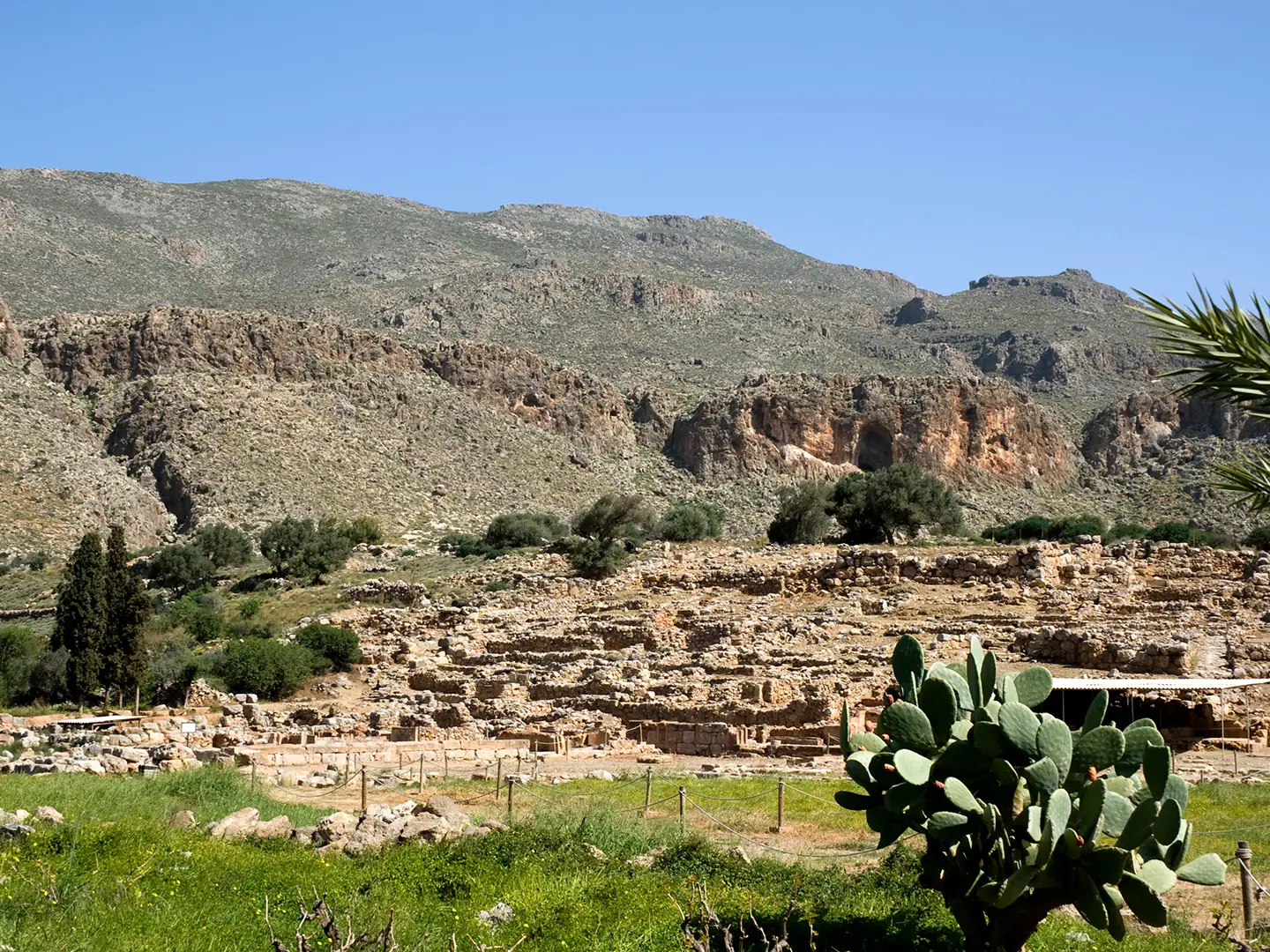
- Kato Zakros: The eastern terminus of the trail and the site of a major Minoan palace. It is reached through the Valley of the Dead, named for burial caves in the gorge cliffs.
- Elafonissi: A pink-tinged sand lagoon and protected nature reserve near the western end of the route. It marks one of the most distinctive coastal landscapes on the traverse.
- Aradena Gorge: A dramatic Sfakian gorge near Anopoli, crossed by a high steel bridge and descending on steep rock-cut paths towards the Libyan Sea coast.
Challenges to expect
Expect a hard, self-reliant crossing: rough footpaths, mule tracks, dirt roads, rocky karst ridges, deep gorges and exposed high plateaus. Waymarking exists but is inconsistent or faded in remote areas, so carry a map or GPS track. Water can be patchy, summer heat is severe, and high mountains may hold snow into spring. There is no continuous hut network, so accommodation and resupply need planning.
HikeList Score
E4 Trail (Crete Section) scored 79/100 on HikeList's trail-quality metrics.
See score breakdownHide breakdown
- Ideal length 83
- Balanced challenge 56
- Scenery & wildness 74
- Varied terrain 100
- Accommodation 92
- Food & support 81
- Path quality 84
- Season flexibility 76
Computed from length, challenge, scenery & wildness, terrain variety, accommodation, food & support, path quality and season flexibility.
Show more data Show less
- Mountainous
- Coastal
- Gorges
- High Plateaus
- Rocky Ridges
- Rocky
- Dirt
- Gravel
- Paved
- Hotels
- Guesthouses
- Mountain Refuges
- Wild Camping Spots
- Pet Friendly
- Water Sources
- Campsites
- Shelters
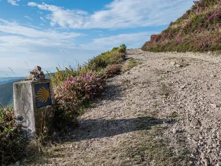
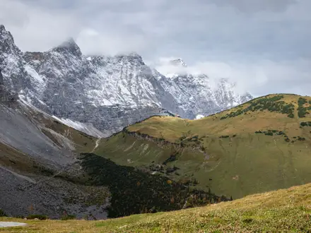
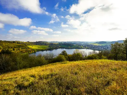
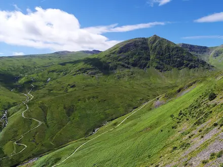
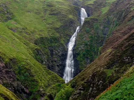
Photos from hikers
Taken on the trail by people who've reviewed E4 Trail (Crete Section).
Begin at Kastelli-Kissamos on Crete’s northwest coast and follow trails along the sea and up into low hills. The route passes through agricultural areas, olive groves, and small villages before winding its way to the renowned Elafonissi Beach. The final stretch follows the coastline with views of turquoise water.
Hike from the pink sands of Elafonissi along rugged coastline, with numerous beach stretches and scenic sea cliffs. Pass through remote bays and small inland settlements before entering Paleochora, a lively seaside town popular among travelers.
Depart Paleochora following a beautiful coastal path, passing rocky outcrops and lush vegetation. The route includes a mix of narrow trails and wider dirt tracks, leading to the tranquil seaside village of Sougia, known for its pebble beach and clear waters.
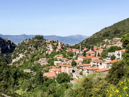
Climb inland from Sougia and enter the green corridor of the Agia Irini Gorge, famous for its lush scenery and cooling shade. After exiting the gorge, continue ascending through pine forests and mountain villages to reach the high plateau at Omalos.
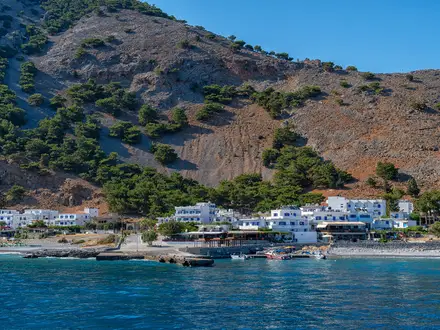
Descend into the renowned Samaria Gorge, traversing its full length between high cliffs and alongside a lively stream. This dramatic section ends at Agia Roumeli, a remote seaside village only accessible by foot or boat.
Follow the undulating southern coastline east from Agia Roumeli, crossing small beaches and remote headlands. Enjoy sweeping sea views as you eventually descend to the car-free village of Loutro, nestled in a sheltered bay.
Continue along rugged cliffside trails above the sea, passing through villages like Finikas and Likos. The day concludes with a descent into Chora Sfakion, renowned for its ties to Crete’s resistance history.
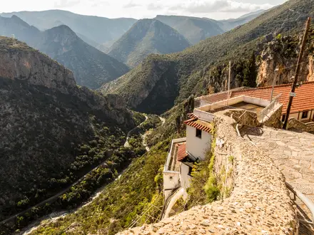
Ascend sharply from Chora Sfakion to the ancient village of Anopoli. The route traverses the impressive Aradena Gorge with its dramatic bridge and sheer rock walls. Reach Anopoli, a historic Cretan mountain village.
Trek through the wild and remote heart of the Lefka Ori (White Mountains), gaining elevation as you travel across high terrain. The route offers impressive alpine views before descending to the plateau village of Askifou.
Walk east through rural valleys and hills, passing small villages, vineyards, and olive groves. Arrive in Argyroupoli, known for its springs and lush greenery.
Journey into central Crete, with the scenery gradually transitioning from rolling farmland to foothills of Mount Psiloritis. Pass through diverse rural landscapes and approach the base of the mountain at Fourfouras.
Ascend towards the Nida Plateau, tackling challenging elevation gain on rocky and wild terrain. This high-mountain landscape offers dramatic views and is a launching point for reaching Mount Psiloritis’ summit.
Descend from the uplands of Nida Plateau down to the legendary village of Anogeia. The route winds through mountain meadows and patches of forest, with panoramic countryside views.
Follow undulating trails through interior Crete, traversing agricultural valleys and crossing through several small villages. Archanes, your destination, is an attractive town surrounded by vineyards.
Journey eastward through Crete’s less traveled interior, weaving through hills, fields, and remote villages. The day ends near Zakros, close to the island’s eastern edge and gateway to the final Minoan sites.
Complete the final leg on a short but rugged path, descending the scenic Gorge of the Dead en route to the archaeological remains of Kato Zakros. Celebrate at the finish near the site of the ancient Minoan palace and the Libyan Sea.
Reviews
How would you rate E4 Trail (Crete Section)?
Tap a star to start your review — you could be the first.