Gran Paradiso Trek
How would you rate Gran Paradiso Trek?
Tap a star to share your experience and help other hikers.
Gran Paradiso Trek: High-Level Hut-to-Hut in Aosta Valley
HikeList Score
Gran Paradiso Trek scored 78/100 on HikeList's trail-quality metrics.
See score breakdownHide breakdown
- Ideal length 85
- Balanced challenge 74
- Scenery & wildness 98
- Varied terrain 71
- Accommodation 49
- Food & support 72
- Path quality 98
- Season flexibility 63
Computed from length, challenge, scenery & wildness, terrain variety, accommodation, food & support, path quality and season flexibility.
The Gran Paradiso Trek is a 55 km, 5-day hard hut-to-hut trek in Gran Paradiso National Park, in the Graian Alps of north-west Italy. It crosses the high valleys of Valsavarenche, Val di Rhêmes and the Valle di Cogne / Valnontey, linking rifugi beneath the 4,061 m Gran Paradiso massif. Expect big daily climbs, rocky alpine paths, scree, high cols and some steep or cabled sections. It suits fit hikers with mountain experience who want a compact high-Alpine trek without crossing borders.
Route Overview
The route is best understood as a linear high-level traverse through the western valleys of Gran Paradiso National Park, rather than a single fixed circuit. The classic Valsavarenche-based version uses Pont as the practical trailhead, while broader traverses run from the Valgrisenche or Val di Rhêmes side towards Cogne. Both ends are reachable by bus from Aosta. The trek largely follows the corridor of the Alta Via 2 inside the park, crossing high cols such as Col di Entrelor and Col Lauson, then linking places including Rifugio Vittorio Emanuele II, Rifugio Federico Chabod, Rifugio Savoia, Rifugio Vittorio Sella, the Nivolet basin and Valnontey. Like the Dolomites' Alta Via 1, it is a hut-to-hut high-level route, but stays within a single national park and reaches higher, wilder passes.
Gran Paradiso National Park and the Alpine Ibex
Gran Paradiso is Italy’s oldest national park, established in 1922 after King Victor Emmanuel III gave the state the former royal hunting reserve. That reserve had protected the area since 1856 and was crucial to saving the Alpine ibex, which had been hunted to near-extinction elsewhere in the Alps. Park rangers, known as guardaparco, helped the ibex population recover, and the historic mule tracks and protection paths they used now form much of the walking network.
Notable highlights
- Gran Paradiso massif (4,061 m): The trek circles beneath this glaciated peak, the park’s namesake and a major landmark throughout the route. Its summit is a separate glacier mountaineering objective, not part of the standard walking trek.
- Alpine ibex and chamois: Gran Paradiso National Park was created to protect the Alpine ibex, and hikers commonly see ibex, chamois, marmots and golden eagles on the high meadows and ridgelines.
- Rifugio Vittorio Emanuele II: This historic hut above Pont in Valsavarenche is a classic overnight stop and a main base for the Gran Paradiso summit route.
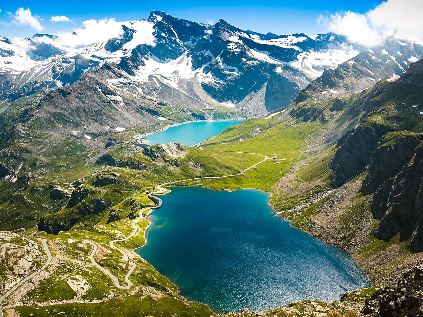
- Nivolet basin and high-altitude lakes: The route can pass the broad glacial upland around the Rosset and Leità lakes, an open alpine area above 2,500 m.
- Valnontey and the Paradisia botanical garden: Above Cogne, Valnontey gives access to the Paradisia alpine garden, known for displaying high-mountain flora of the Alps.
- Hut-to-hut rifugio experience: Nights in mountain refuges with dormitory bunks and half-board are the standard way to link the stages across the park.
Challenges to expect
This is hard mountain walking: expect around 4,500 m of total ascent, sustained altitude, rough rocky paths, scree, grassy pastures and steep sections near high passes. Snow patches can linger into early summer, especially on the highest cols. Navigation is helped by CAI red-and-white waymarks and Alta Via 2 markings, but weather can change quickly. Book rifugi ahead in July and August; wild camping is restricted inside the national park.
HikeList Score
Gran Paradiso Trek scored 78/100 on HikeList's trail-quality metrics.
See score breakdownHide breakdown
- Ideal length 85
- Balanced challenge 74
- Scenery & wildness 98
- Varied terrain 71
- Accommodation 49
- Food & support 72
- Path quality 98
- Season flexibility 63
Computed from length, challenge, scenery & wildness, terrain variety, accommodation, food & support, path quality and season flexibility.
 Italy
ItalyShow more data Show less
- Mountain
- Alpine
- Rock
- Dirt
- Scree
- Mountain Huts
- Pet Friendly
- Restrooms
- Water Sources
- Campsites
- Shelters
In these collections
Photos from hikers
Taken on the trail by people who've reviewed Gran Paradiso Trek.
The trek begins in the mountain village of Cogne, a picturesque alpine hub. The trail follows the tranquil Valnontey River, winding through meadows and larch forests towards Valnontey. Along the way, trekkers pass rustic hamlets, scenic farmland, and have sweeping views of the nearby glaciers. The day is moderate, allowing time for acclimatization and immersion in the valley’s natural beauty.
Leaving Valnontey, the trail climbs into higher alpine terrain, ascending steadily through coniferous woodland and then onto rugged, rocky slopes. The ascent rewards with majestic glacier views and the chance to spot alpine wildlife, including ibex and marmots. The day concludes at Rifugio Sella, a high mountain hut offering shelter and stunning vistas over the cirque below.
Today’s section includes a challenging ascent to the Col Loson, the trek’s highest regular pass. Expect snowfields even in summer and breathtaking 360-degree alpine views from the top. The descent is long and steep, leading into lush Val Savarenche and finally reaching the small settlement of Eaux Rousses, ideal for rest and resupply.
From Eaux Rousses, the trail continues up the Val Savarenche. The route climbs steadily through pine forests and alpine meadows before breaking out above the treeline. It then steepens on approach to Rifugio Vittorio Emanuele II, the historic hut that serves as a base for summit attempts. The hut location offers impressive views and a unique refuge atmosphere.
The final stage is the most demanding, beginning with a pre-dawn ascent towards the Gran Paradiso summit. This segment involves glacier crossing, rocky ridges, and an exhilarating push to 4,061 meters, often requiring crampons and a head for heights. After reaching the summit, the descent retraces steps to Rifugio Vittorio Emanuele II and then follows the trail down to the village of Pont, where the trek concludes.
Reviews
How would you rate Gran Paradiso Trek?
Tap a star to start your review — you could be the first.