GR223 (Cotentin and Bessin Trail)
How would you rate GR223 (Cotentin and Bessin Trail)?
Tap a star to share your experience and help other hikers.
GR223 Cotentin and Bessin Trail: Normandy’s Coastal Thru-Hike
HikeList Score
GR223 (Cotentin and Bessin Trail) scored 81/100 on HikeList's trail-quality metrics.
See score breakdownHide breakdown
- Ideal length 70
- Balanced challenge 90
- Scenery & wildness 71
- Varied terrain 83
- Accommodation 83
- Food & support 88
- Path quality 98
- Season flexibility 89
Computed from length, challenge, scenery & wildness, terrain variety, accommodation, food & support, path quality and season flexibility.
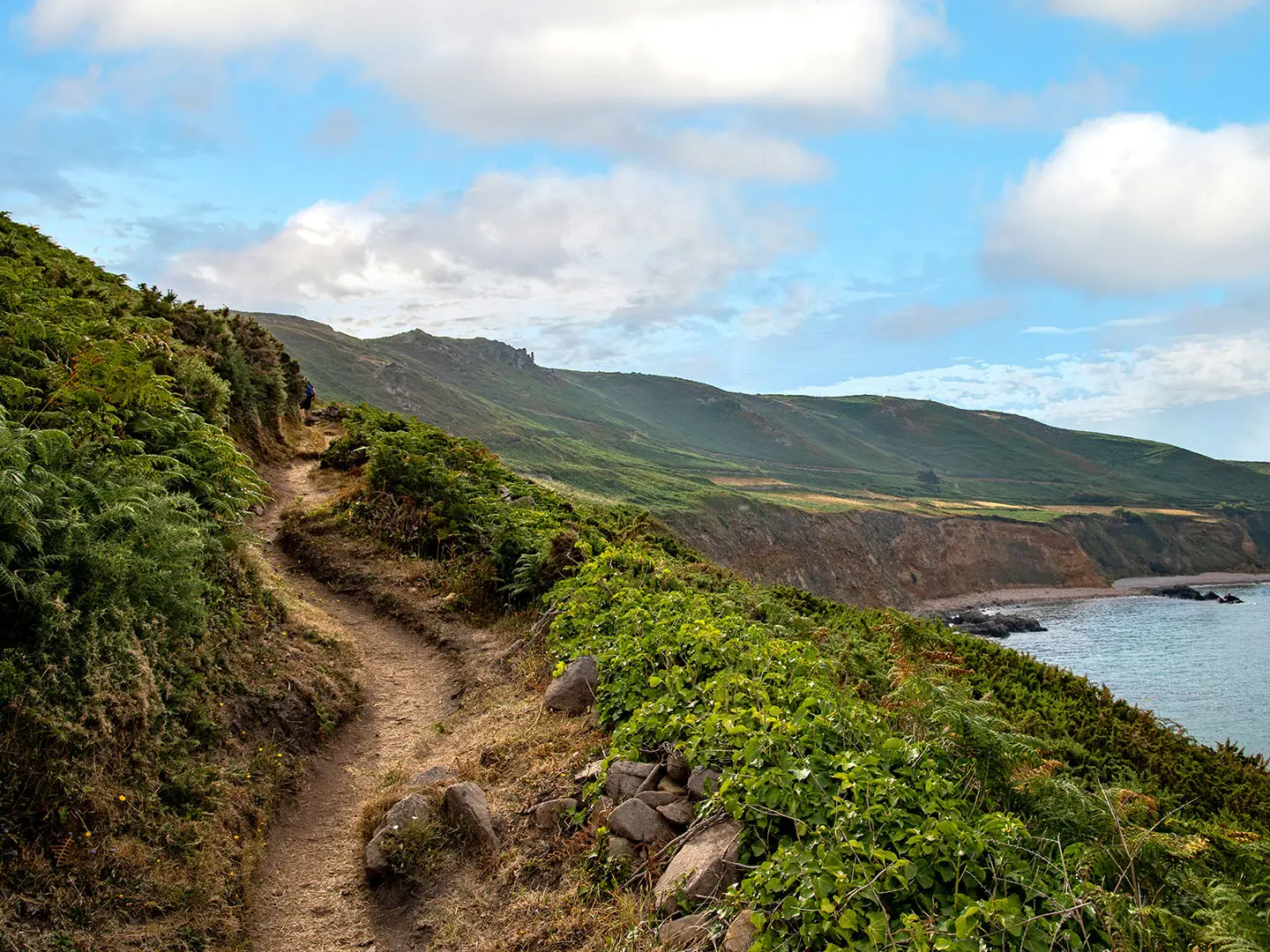
The GR223 Cotentin and Bessin Trail is a 446 km, roughly 23-day coastal hike around the Cotentin Peninsula in Normandy, north-west France. This moderate point-to-point route follows the red-and-white GR223 “sentier des douaniers” from the Carentan / Baie des Veys area to Mont-Saint-Michel, tracing cliffs, dunes, beaches, oyster ports and marshland. It suits walkers who want a long but non-technical coastal trail, with village accommodation and frequent weather exposure from the English Channel.
Route Overview
This listing covers the Manche-department “Tour du Cotentin” section of the GR223, not the full Honfleur-to-Mont-Saint-Michel GR223. Walkers start around Carentan / Baie des Veys, near the Cotentin-Bessin marshes, then follow the coast past Utah Beach, Saint-Vaast-la-Hougue, Barfleur, Gatteville lighthouse, Cherbourg, Cap de la Hague, Carteret, Portbail, Coutainville, Regneville-sur-Mer and Granville before finishing at Mont-Saint-Michel, where the GR223 meets the GR34. It is a linear route, so plan start and finish transport rather than a loop. If your focus is Normandy’s wartime coast, compare the D-Day Beaches Circuit; for another French coastal walk, see the Bordeaux to Arcachon Trail.
Customs Paths, D-Day Coast and Norman Ports
The GR223 follows the “sentier des douaniers”, the coastal patrol path used by customs officers from the late 18th and 19th centuries to deter smuggling. Around the Cotentin it also passes a dense chain of historic places: Utah Beach and the Baie des Veys near the D-Day theatre, medieval maritime ports such as Barfleur and Saint-Vaast-la-Hougue, Vauban’s defensive towers after the Battle of La Hougue, Cherbourg’s great naval harbour, and the abbey island of Mont-Saint-Michel.
Notable highlights
- Nez de Jobourg and Cap de la Hague: The wild north-western tip of the Cotentin has heather-clad cliffs rising to about 128 m, with views towards the Channel Islands and the Raz Blanchard tidal race below.
- Gatteville Lighthouse: Near Barfleur, this granite lighthouse is one of France’s tallest at 75 m, with its well-known 365 steps, 52 windows and 12 storeys.
- Saint-Vaast-la-Hougue and Tatihou: An oyster-farming port and tidal island guarded by UNESCO-listed Vauban towers. Tatihou can be reached on foot at low water.
- Barfleur: A granite-built former port classed among “Les Plus Beaux Villages de France”, with strong medieval maritime associations.
- Cherbourg: The Cotentin’s main port, known for its vast artificial harbour and the Cité de la Mer maritime museum.
- Mont-Saint-Michel finish: The route ends at the UNESCO-listed island abbey in its tidal bay; the bay crossing is famous but should only be done with an accredited guide.
Challenges to expect
The GR223 is not technical, but it is long, coastal and exposed. Expect wind, rain and fast-changing Channel weather, plus sandy beach sections, dunes, marshy lowlands and steeper cliff walking around Cap de la Hague. Tide tables matter on beach and bay sections, especially near Mont-Saint-Michel. Navigation is helped by standard GR red-and-white blazes, but carry mapping and the FFRandonnée topo-guide.
HikeList Score
GR223 (Cotentin and Bessin Trail) scored 81/100 on HikeList's trail-quality metrics.
See score breakdownHide breakdown
- Ideal length 70
- Balanced challenge 90
- Scenery & wildness 71
- Varied terrain 83
- Accommodation 83
- Food & support 88
- Path quality 98
- Season flexibility 89
Computed from length, challenge, scenery & wildness, terrain variety, accommodation, food & support, path quality and season flexibility.
 France
Show more data Show less
- Coastal
- Cliffs
- Beach
- Dirt
- Sand
- Gravel
- Hotels
- Guesthouses
- Campsites
- Family Friendly
- Pet Friendly
- Restrooms
- Water Sources
- Campsites
- Picnic Areas
Photos from hikers
Taken on the trail by people who've reviewed GR223 (Cotentin and Bessin Trail).
Reviews
How would you rate GR223 (Cotentin and Bessin Trail)?
Tap a star to start your review — you could be the first.