Peelpad
How would you rate Peelpad?
Tap a star to share your experience and help other hikers.
Peelpad: A Complete Hiking Guide
HikeList Score
Peelpad scored 79/100 on HikeList's trail-quality metrics.
See score breakdownHide breakdown
- Ideal length 66
- Balanced challenge 90
- Scenery & wildness 71
- Varied terrain 100
- Accommodation 66
- Food & support 88
- Path quality 87
- Season flexibility 89
Computed from length, challenge, scenery & wildness, terrain variety, accommodation, food & support, path quality and season flexibility.
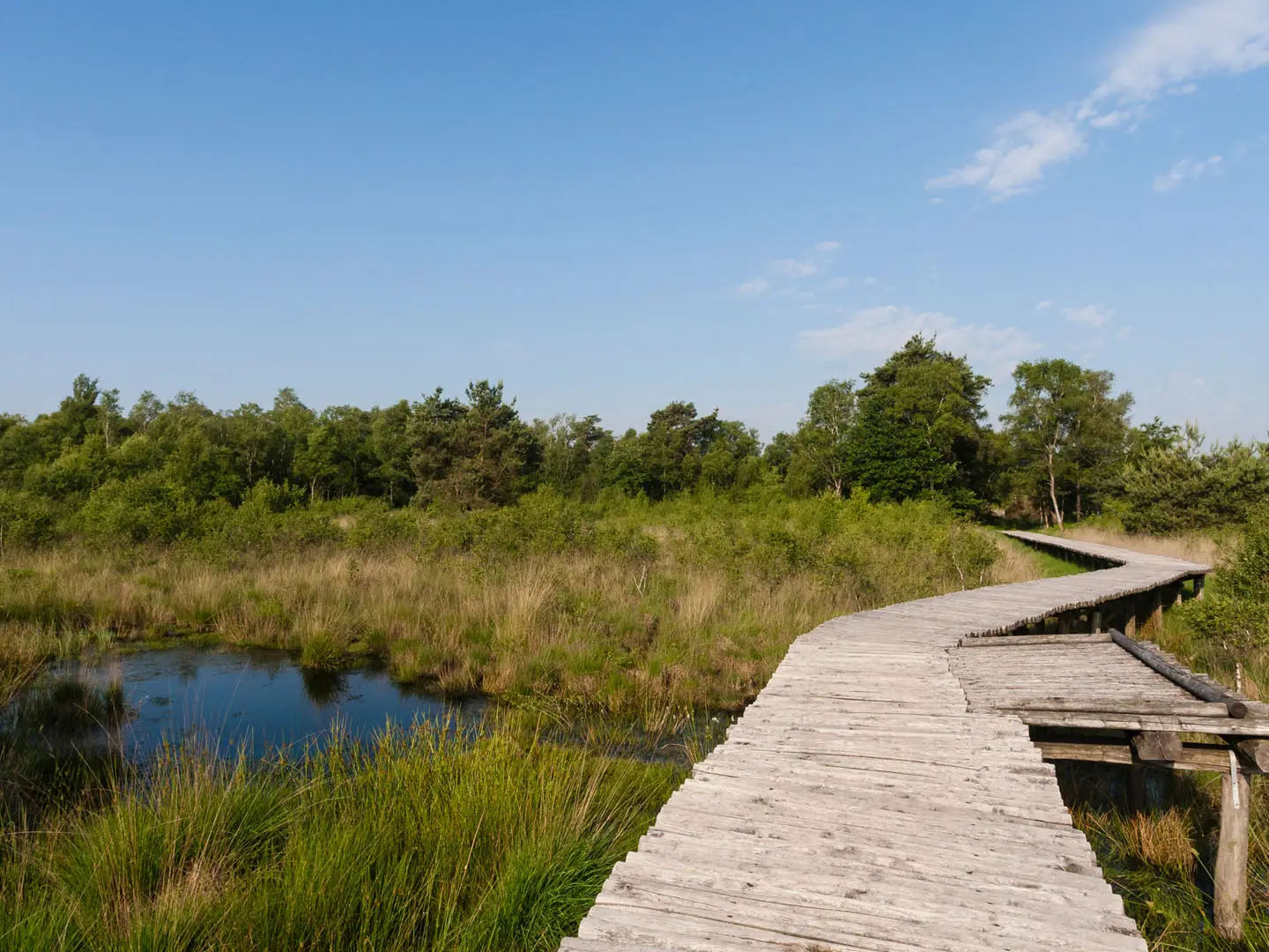
The Peelpad is a 415 km waymarked Dutch streekpad through De Peel, the historic peatland region on the North Brabant–Limburg border in the Netherlands. It is normally walked from Weert to Grave over 25 day stages. The walking is flat and technically easy, but the full distance, long unpaved sections and wet peat ground make it easy to moderate overall. It suits hikers who want lowland nature, village-to-village logistics and a strong peatland-history theme rather than mountain terrain.
Route Overview
The route is a point-to-point walk from Weert (Limburg) north to Grave (North Brabant). It passes places including Stramproy, Tungelroy, Meijel, Ospeldijk, Griendtsveen, Helenaveen, Sevenum, Venray, Overloon, De Rips, Langenboom and Grave. The Peelpad is structured as 25 stages, with each stage starting and ending near a village bus stop, so it works well as a full thru-hike or as separate day walks using public transport. Expect yellow-red streekpad waymarking in both directions. For nearby lowland walking, compare the Brabantse Kempen Trail or the De Meinweg National Park Trail.
Peat, canals and the making of De Peel
De Peel was once a wild, near-impassable raised bog of more than 30,000 hectares, with peat built up over thousands of years. Local peat cutting for fuel began in the early Middle Ages, while large-scale commercial extraction ran from the mid-19th century and peaked around 1850–1930. Drainage canals were dug for turf transport, and industrial digging largely destroyed the bog. The Peelpad links the surviving high-moor remnants, former peat-colony villages and canal landscapes that still show this history.
Notable highlights
- Nationaal Park De Groote Peel: One of the largest surviving raised-bog remnants in the region, with peat pools, reedbeds and waterbirds. It is a key wildlife and birdwatching section near Ospeldijk and Meijel.
- Griendtsveen and Helenaveen: Former peat-colony villages built around 19th-century turf extraction. Helenaveen is a protected village scene, and the straight canals and workers’ settlements make the industrial peat history easy to read on foot.
- Deurnese Peel and Mariapeel: Protected raised-bog reserves crossed by log and plank bridges over wet ground. These sections give some of the clearest remaining views of the restored bog landscape.
- Kruispeel and the Peel fens: Kruispeel is a peat-cut lake preserving low and high moor, while pools such as Kleine IJzeren Man, Zwanenven, Geurtsven and Eendenven show the watery heath-and-marsh character of De Peel.
- Heusden castle ruin: A ruined castle on the route through the central Peel. It adds a built-heritage stop among the farmland, villages and bog remnants.
- Tungelroyse Beek and Loobeek stream valleys: Restored meandering lowland streams with greener, flower-rich banks. These beekdalen provide softer walking between the wetter peat and heath sections.
Challenges to expect
There is no significant ascent, but do not underestimate the distance: 415 km over 25 stages is still a substantial walk. About 80% is unpaved, with sand, heath and forest tracks plus plank bridges over boggy sections. Peat ground can be wet in winter and after rain, so waterproof footwear helps. Navigation is generally straightforward on yellow-red waymarks, but carry a map or GPX for village exits and farmland tracks. If you like flat Dutch long-distance paths, the Drenthepad is a useful comparison.
HikeList Score
Peelpad scored 79/100 on HikeList's trail-quality metrics.
See score breakdownHide breakdown
- Ideal length 66
- Balanced challenge 90
- Scenery & wildness 71
- Varied terrain 100
- Accommodation 66
- Food & support 88
- Path quality 87
- Season flexibility 89
Computed from length, challenge, scenery & wildness, terrain variety, accommodation, food & support, path quality and season flexibility.
 Netherlands
Show more data Show less
- Lowland
- Peatland
- Heathland
- Wetland
- Forest
- Farmland
- Unpaved
- Sand
- Forest Tracks
- Plank Bridges
- Paved
- Hotels
- Campsites
- Family Friendly
- Pet Friendly
- Restrooms
- Water Sources
- Campsites
- Picnic Areas
Photos from hikers
Taken on the trail by people who've reviewed Peelpad.
Reviews
How would you rate Peelpad?
Tap a star to start your review — you could be the first.