Alta Via dei Monti Liguri
How would you rate Alta Via dei Monti Liguri?
Tap a star to share your experience and help other hikers.
Alta Via dei Monti Liguri: Liguria’s High Ridge Traverse
HikeList Score
Alta Via dei Monti Liguri scored 85/100 on HikeList's trail-quality metrics.
See score breakdownHide breakdown
- Ideal length 75
- Balanced challenge 80
- Scenery & wildness 88
- Varied terrain 100
- Accommodation 92
- Food & support 81
- Path quality 92
- Season flexibility 76
Computed from length, challenge, scenery & wildness, terrain variety, accommodation, food & support, path quality and season flexibility.
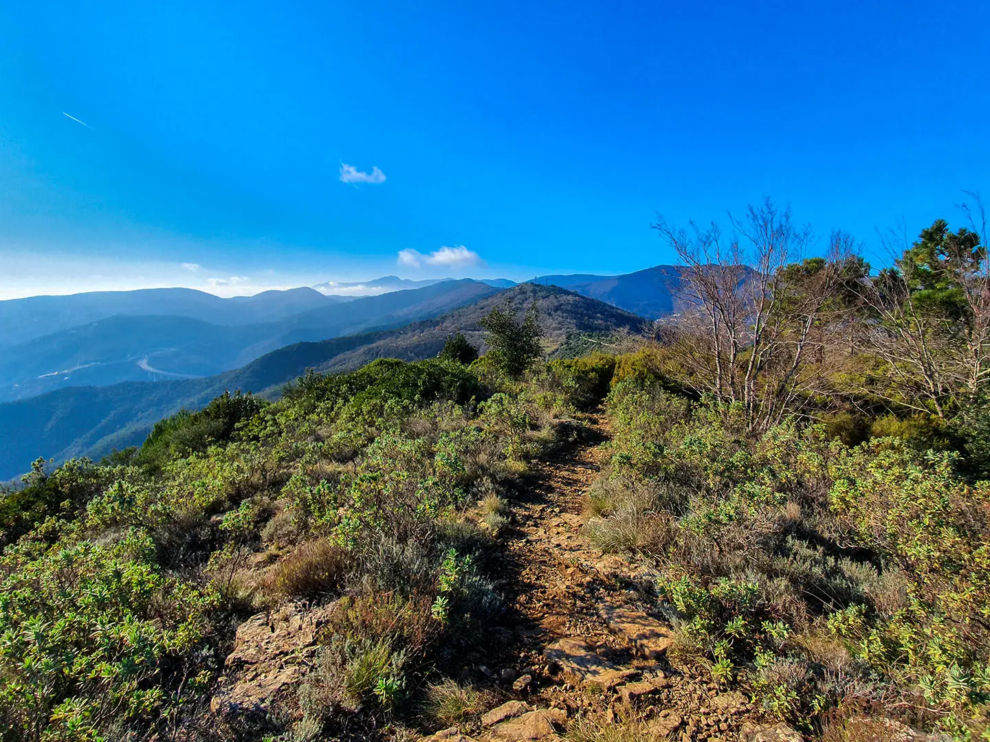
The Alta Via dei Monti Liguri is a 440 km point-to-point thru-hike across Liguria in Italy, usually taking about 20 days. It runs from Ventimiglia near the French border to Ceparana near Tuscany, following the high watershed between the Ligurian Sea and the Po valley. With about 20,000 m of ascent, 43–44 official stages and long sections above 1,000 m, this is a hard route for experienced hikers who want a quieter alternative to better-known Italian mountain trails.
Route Overview
The route is normally described west to east, starting in Ventimiglia in the Province of Imperia and finishing at Ceparana, in the comune of Bolano, Province of La Spezia. It can also be walked east to west or broken into sections. Key areas include the Colle di Tenda area and Alpi Liguri, Monte Saccarello, Colle del Melogno, Monte Beigua, Passo del Faiallo, Capanne di Marcarolo, Monte Antola, the Aveto valley, Passo del Bocco, Colle di Cento Croci and Val di Vara. Plan access and exit logistics carefully: this is a long point-to-point traverse, not a loop. For coastal contrast, compare it with the Cinque Terre Coastal Trail, and for Italy's better-known high routes see the Dolomite classics Alta Via 1 and Alta Via 2.
History of the Alta Via dei Monti Liguri
The Alta Via dei Monti Liguri was officially established in 1983 through collaboration between the Centro Studi Unioncamere Liguri, the Club Alpino Italiano and the Federazione Italiana Escursionismo. Its roots go back to post-war FIE reports that had already mapped a similar line between Colle del Giovo and Colle Cento Croci. The project aimed to revive inland mountain communities that had been losing population as Liguria’s coastal economy expanded.
Notable highlights
- Monte Saccarello (2,201 m): The highest peak in Liguria and the route’s high point, on the Italy–France border. A bronze Cristo Redentore statue stands on a sub-peak, with views towards the French Alps and the Ligurian Sea.
- Beigua UNESCO Global Geopark: The Beigua massif is known for ancient ophiolite rocks, fossil-bearing outcrops and wide coast-to-Alps viewpoints. It is also an important raptor migration corridor.
- Monte Antola: A classic Ligurian Apennine ridge section with beech forest and late-spring wild daffodils. A managed refuge near the summit serves hot meals.
- Old mule tracks and military roads: Long stretches use historic mulattiere and former military roads along the Alpine–Apennine watershed, often through chestnut and beech woods.
- Sea-and-mountains traverse: The route links the western and eastern ends of the Ligurian Riviera while staying high on the crest, with the Mediterranean on one side and the Alps or Apennines on the other.
Challenges to expect
Expect a demanding cumulative load: 440 km, about 20,000 m of ascent and many days on exposed ridges. The western Ligurian Alps include rocky alpine sections, while lower areas use woods, mule tracks and former military roads. Water is not always reliable and some sources dry out in summer. Western sections can hold deep snow and avalanche risk in winter, so this is not recommended as a winter thru-hike.
HikeList Score
Alta Via dei Monti Liguri scored 85/100 on HikeList's trail-quality metrics.
See score breakdownHide breakdown
- Ideal length 75
- Balanced challenge 80
- Scenery & wildness 88
- Varied terrain 100
- Accommodation 92
- Food & support 81
- Path quality 92
- Season flexibility 76
Computed from length, challenge, scenery & wildness, terrain variety, accommodation, food & support, path quality and season flexibility.
 Italy
ItalyShow more data Show less
- Mountainous
- Ridgeline
- Forest
- Alpine
- Mountain Footpaths
- Old Mule Tracks
- Former Military Roads
- Alpine Meadows
- Rocky Sections
- Huts
- Hotels
- Farm Stays
- B&Bs
- Wild Camping Spots
- Pet Friendly
- Water Sources
- Campsites
- Shelters
Photos from hikers
Taken on the trail by people who've reviewed Alta Via dei Monti Liguri.
Reviews
How would you rate Alta Via dei Monti Liguri?
Tap a star to start your review — you could be the first.