Fimmvörðuháls Trail
How would you rate Fimmvörðuháls Trail?
Tap a star to share your experience and help other hikers.
Fimmvörðuháls Trail: Skógar to Þórsmörk Across Iceland’s Volcanic Pass
HikeList Score
Fimmvörðuháls Trail scored 75/100 on HikeList's trail-quality metrics.
See score breakdownHide breakdown
- Ideal length 55
- Balanced challenge 84
- Scenery & wildness 78
- Varied terrain 100
- Accommodation 58
- Food & support 72
- Path quality 98
- Season flexibility 76
Computed from length, challenge, scenery & wildness, terrain variety, accommodation, food & support, path quality and season flexibility.
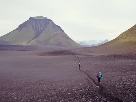
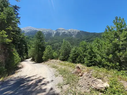
The Fimmvörðuháls Trail is a 25 km point-to-point hike in southern Iceland, crossing the high pass between Eyjafjallajökull and Mýrdalsjökull. Most hikers complete it in one hard 8–10 hour day from Skógar to Þórsmörk/Básar, though huts near the pass allow a two-day crossing. Expect around 1,000 m of climbing, lingering snowfields, volcanic ash and lava, fast-changing weather and a steep descent into Goðaland. It suits fit hikers with mountain-weather judgement.
Route Overview
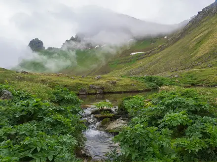
Start at Skógar, beside Skógafoss on the south-coast Ring Road, then climb beside the Skógá river canyon past its chain of waterfalls and cascades. The route continues onto barren volcanic ground between Eyjafjallajökull and Mýrdalsjökull, passing the Baldvinsskáli and Fimmvörðuskáli huts near the high point. North of the pass, the trail crosses the area around the Magni and Móði craters before dropping sharply through Goðaland, including the narrow Kattarhryggur ridge, to Þórsmörk, typically finishing at Básar. This is a point-to-point route, so arrange Þórsmörk highland bus transport in season or combine it with a longer trek. For other Icelandic volcanic terrain, compare the Askja Trail or the shorter Hverfjall Crater Loop.
History of the Fimmvörðuháls Crossing
Fimmvörðuháls means roughly “Five Cairns Ridge” or “Five Cairns Pass”, after the stone cairns that historically marked this high crossing between the south coast and Þórsmörk. The route gained worldwide attention in March 2010 when an effusive eruption opened on the pass. That eruption formed the Magni and Móði craters and immediately preceded the explosive Eyjafjallajökull eruption, which disrupted air travel across Europe.
Notable highlights
- Skógafoss: The trail starts beside this well-known south-coast waterfall, giving an immediate landmark and a clear beginning to the climb out of Skógar.
- Skógá river canyon: The first section follows the river past a celebrated chain of waterfalls and cascades, commonly counted as Skógafoss plus roughly 20–25 more.
- Eyjafjallajökull and Mýrdalsjökull: The pass threads directly between these glacier-capped volcanoes; Eyjafjallajökull is known for the 2010 eruption, while Mýrdalsjökull caps the larger Katla volcano.
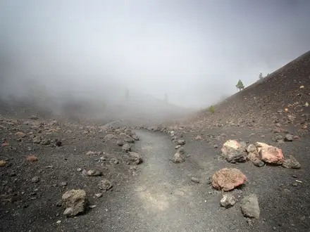
- Magni and Móði craters: These craters formed during the 20 March 2010 eruption and are named after the sons of Thor; the surrounding lava field is Goðahraun.
- Goðaland and Kattarhryggur: The descent into Þórsmörk shifts from barren pass to green, mossy terrain, with the narrow Cat’s Spine ridge adding exposure before Básar.
- Básar, Þórsmörk: The usual finish is at this Þórsmörk hub, where huts and campsites make it a practical end point or link-up for longer routes such as hikes in more remote Icelandic landscapes like the Hornstrandir Trek.
Challenges to expect
This is a hard mountain crossing despite the moderate distance. Expect sustained ascent from Skógar, exposed ground near the pass, snowfields that can remain into summer, volcanic ash and lava underfoot, and steep eroded paths on the Goðaland descent. Weather can change quickly at altitude, so navigation and timing matter. There is no resupply on the trail; huts are for booked accommodation, not a substitute for carrying essentials.
HikeList Score
Fimmvörðuháls Trail scored 75/100 on HikeList's trail-quality metrics.
See score breakdownHide breakdown
- Ideal length 55
- Balanced challenge 84
- Scenery & wildness 78
- Varied terrain 100
- Accommodation 58
- Food & support 72
- Path quality 98
- Season flexibility 76
Computed from length, challenge, scenery & wildness, terrain variety, accommodation, food & support, path quality and season flexibility.
 Iceland
Show more data Show less
- Mountainous
- Volcanic
- Glacial
- River Canyon
- Rocky
- Grassy
- Lava
- Ash
- Snowfields
- Eroded Paths
- Huts
- Campsites
- Pet Friendly
- Restrooms
- Water Sources
- Campsites
- Shelters
In these collections
Photos from hikers
Taken on the trail by people who've reviewed Fimmvörðuháls Trail.
Reviews
How would you rate Fimmvörðuháls Trail?
Tap a star to start your review — you could be the first.