Shiretoko Peninsula Trail
How would you rate Shiretoko Peninsula Trail?
Tap a star to share your experience and help other hikers.
Shiretoko Peninsula Trail: Real Shiretoko Traverse Guide
HikeList Score
Shiretoko Peninsula Trail scored 78/100 on HikeList's trail-quality metrics.
See score breakdownHide breakdown
- Ideal length 63
- Balanced challenge 80
- Scenery & wildness 98
- Varied terrain 94
- Accommodation 58
- Food & support 65
- Path quality 98
- Season flexibility 76
Computed from length, challenge, scenery & wildness, terrain variety, accommodation, food & support, path quality and season flexibility.
The Shiretoko Peninsula Trail should be planned as the real Shiretoko Traverse (知床縦走): a hard, roughly 25 km point-to-point ridge route in Hokkaido, Japan. It runs from Iwaobetsu Onsen to Kamuiwakka Falls via Rausu-dake and Iō-zan, usually over 2 days with one backcountry camp. This is for experienced, self-sufficient hikers comfortable with scrambling, dwarf-pine, lingering snow, exposed volcanic ground and serious brown-bear country — not a walk to Cape Shiretoko or the Shiretoko Five Lakes.
Route Overview
Start at Iwaobetsu Onsen, by Kinoshita Hut and the Rausu-dake trailhead on the Utoro side, 13 km east of the Shiretoko World Heritage Center. The traverse climbs Rausu-dake (1,661 m), then follows the peninsula spine over Mitsumine, Sashirui-dake, Okkabake-dake and Chienbetsu-dake to Iō-zan / Mt Io. Descend the Iō-zan trail to finish at the Kamuiwakka Falls bus stop. It is a point-to-point route with no escape routes once committed to the ridge. If comparing Japanese hikes, see the Kamikochi to Mount Yari Trail or the Michinoku Coastal Trail.
Ainu Meaning and World Heritage Status
Shiretoko comes from the Ainu “sir etok”, meaning “the end of the earth”, and the Ainu have long regarded the peninsula as sacred. The Shiretoko Peninsula was inscribed as a UNESCO World Heritage Site in 2005 for its biodiversity and the link between its marine and land ecosystems, shaped by seasonal sea ice in the Sea of Okhotsk — the lowest-latitude seasonal sea ice in the Northern Hemisphere.
Notable highlights
Rausu-dake (1,661 m): The peninsula’s highest peak is the first major climb of the traverse. The final pitch is a hands-and-feet scramble, with clear-day views towards the Sea of Okhotsk, Kunashir and the disputed Kuril Islands.
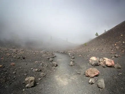
Volcanic ridge to Iō-zan: The route follows a wild alpine ridgeline through dwarf-pine and volcanic peaks. Near Iō-zan, the terrain shifts to bare, sulphurous yellow-white volcanic ground.
Kamuiwakka Falls: The traverse finishes near this sulphurous warm-water cascade on the Utoro coast. Its name comes from the Ainu for “water of the gods”.
Brown-bear country: Shiretoko has one of Japan’s densest Ezo brown-bear populations. Ezo deer and red foxes are also commonly seen, but food storage and bear-aware behaviour are essential.
Sea of Okhotsk setting: The peninsula sits beside the Sea of Okhotsk, whose seasonal drift sea ice helps support the World Heritage ecosystem.
True backcountry remoteness: Once on the ridge there is no resupply, little signal and no easy exit, making this one of Japan’s more committing multi-day mountain routes.
Challenges to expect
Expect long, hard days with steep ascent, scrambling on Rausu-dake, dwarf-pine bushwhacking, volcanic boulder fields and snow-filled gullies that can linger into early August. Weather can turn quickly, with fog, wind and cold even in summer. There is limited or no phone/GPS signal on higher ground, no resupply and no escape route, so full self-sufficiency is required. For a different remote-feeling Japan hike, compare the Jomon Sugi Trail.
HikeList Score
Shiretoko Peninsula Trail scored 78/100 on HikeList's trail-quality metrics.
See score breakdownHide breakdown
- Ideal length 63
- Balanced challenge 80
- Scenery & wildness 98
- Varied terrain 94
- Accommodation 58
- Food & support 65
- Path quality 98
- Season flexibility 76
Computed from length, challenge, scenery & wildness, terrain variety, accommodation, food & support, path quality and season flexibility.
 Japan
JapanShow more data Show less
- Mountainous
- Forest
- Alpine
- Volcanic
- Dirt
- Rocky
- Scree
- Campsites
- Huts
- Water Sources
- Campsites
- Shelters
Photos from hikers
Taken on the trail by people who've reviewed Shiretoko Peninsula Trail.
Reviews
How would you rate Shiretoko Peninsula Trail?
Tap a star to start your review — you could be the first.