Sunnmøre Alps Traverse
How would you rate Sunnmøre Alps Traverse?
Tap a star to share your experience and help other hikers.
Sunnmøre Alps Traverse: Slogen and Patchellhytta Hut Hiking Guide
HikeList Score
Sunnmøre Alps Traverse scored 78/100 on HikeList's trail-quality metrics.
See score breakdownHide breakdown
- Ideal length 66
- Balanced challenge 80
- Scenery & wildness 98
- Varied terrain 89
- Accommodation 58
- Food & support 65
- Path quality 98
- Season flexibility 76
Computed from length, challenge, scenery & wildness, terrain variety, accommodation, food & support, path quality and season flexibility.
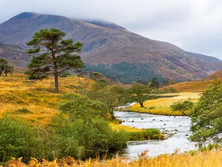
The “Sunnmøre Alps Traverse” is not an official waymarked trail, but a useful shorthand for hard hut-to-hut walking in the Sunnmøre Alps of western Norway, centred on Slogen, Patchellhytta and Hjørundfjorden. Treat the 25 km / 2–3 day figure as a short planning template, not a fixed traverse. It suits experienced mountain hikers comfortable with steep fjord-to-summit climbs, rocky terrain, exposure near Slogen’s summit and changeable snow conditions outside the main summer window.
Route Overview
There is no verified point-to-point route from Urke or Øye to Barstadvik or Standal. Plan this instead as a flexible hut network using Øye, Urke, Brunstad or Stranda/Liaseter as access points, with Patchellhytta as the high base below Slogen. The most concrete documented multi-day option is the Slogenrunda loop from Brunstad via Velleseter and Patchellhytta, about 28.3 km over 3–4 days. A shorter 2-day version can link Øye with Patchellhytta, then climb Slogen and descend. For comparison with other Norwegian mountain routes, see Besseggen Ridge, Galdhøpiggen Summit Trail and the longer Hardangervidda Traverse.
Mountaineering heritage in the Sunnmøre Alps
The Sunnmøre Alps became known to mountaineers in the late 19th and early 20th centuries, when British and Norwegian climbers were drawn to Slogen and neighbouring peaks. Slogen became an icon of early Norwegian alpinism. DNT Sunnmøre later built and maintains the self-service huts and waymarked paths that make modern hut-to-hut walking possible, including Patchellhytta, Velleseter and Tyssenaustet. The area’s history is one of peak ascents and hut links, not one single historic traverse.
Notable highlights
- Slogen (1,564 m): The signature summit above Hjørundfjorden and the realistic high point of this trip. The upper section is rocky, airy and partly exposed, with major fjord views from the top.
- Patchellhytta: A self-service DNT lodge in Habostaddalen below Slogen and Smørskredtind. It is the natural high base for Slogen and the hub for the Slogenrunda.
- Hjørundfjorden: A steep-sided fjord in the Sunnmøre Alps where climbs often begin near sea level. This is what gives the area its unusually direct fjord-to-summit character.
- Slogenrunda loop: The genuine documented multi-day route in this massif: about 28.3 km over 3–4 days from Brunstad via Velleseter and Patchellhytta, with about 1,665 m ascent.
- Gullmorbreen: A small glacier section crossed on the Brunstad–Patchellhytta leg of the Slogenrunda. Conditions can be snow-covered or icy early in the season.
Challenges to expect
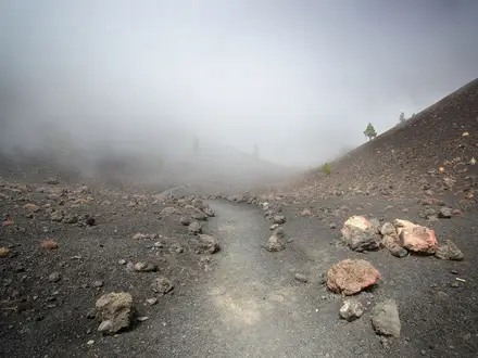
Expect steep, sustained climbs from fjord level, tree roots on lower forest paths, then rocky mountain path, boulder fields, scree and seasonal snow. The Slogen summit section is airy and partly exposed, so a head for heights matters. Waymarking is strongest on popular DNT lines but can be rougher or fainter away from them. Outside mid/late June to early October, snow and ice make the upper ground hazardous.
HikeList Score
Sunnmøre Alps Traverse scored 78/100 on HikeList's trail-quality metrics.
See score breakdownHide breakdown
- Ideal length 66
- Balanced challenge 80
- Scenery & wildness 98
- Varied terrain 89
- Accommodation 58
- Food & support 65
- Path quality 98
- Season flexibility 76
Computed from length, challenge, scenery & wildness, terrain variety, accommodation, food & support, path quality and season flexibility.
 Norway
Show more data Show less
- Mountainous
- Forest
- Alpine
- Rocky
- Dirt
- Scree
- Snow
- Huts
- Wild Camping Spots
- Pet Friendly
- Water Sources
- Campsites
- Shelters
Photos from hikers
Taken on the trail by people who've reviewed Sunnmøre Alps Traverse.
Reviews
How would you rate Sunnmøre Alps Traverse?
Tap a star to start your review — you could be the first.