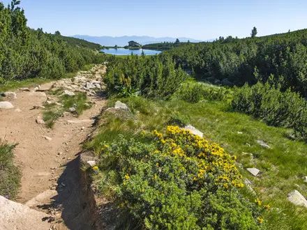
Cirque de Gavarnie Trails
How would you rate Cirque de Gavarnie Trails?
Tap a star to share your experience and help other hikers.
Cirque de Gavarnie Trails: Easy Pyrenees Day Walk
HikeList Score
Cirque de Gavarnie Trails scored 77/100 on HikeList's trail-quality metrics.
See score breakdownHide breakdown
- Ideal length 55
- Balanced challenge 64
- Scenery & wildness 98
- Varied terrain 71
- Accommodation 75
- Food & support 88
- Path quality 98
- Season flexibility 89
Computed from length, challenge, scenery & wildness, terrain variety, accommodation, food & support, path quality and season flexibility.
The Cirque de Gavarnie Trails are an easy 8 km out-and-back day walk in the Hautes-Pyrénées, south-western France, inside Pyrenees National Park. Starting in Gavarnie village, the classic chemin principal follows the Gave de Gavarnie to the Hôtellerie du Cirque at the foot of the vast glacial amphitheatre. With about 230 m of ascent and a wide gravel valley track, it suits most walkers, families and hikers wanting a short route into the Pyrénées–Mont Perdu UNESCO World Heritage Site.
Route Overview
Start and finish in Gavarnie village, using the paid roadside or car-park options before walking the main valley track south beside the Gave de Gavarnie. The route passes Notre-Dame du Bon Port church, continues towards the Pont de Nadau stone bridge, and then opens out beneath the Cirque de Gavarnie. The usual turnaround is the Hôtellerie du Cirque at about 1,570 m, where you get head-on views of the cirque walls and the Grande Cascade. The optional continuation to the waterfall foot is steeper and looser. For other French walking ideas, compare this with the Chartreuse Trail GR9 segment, Ballons des Vosges Park trails or the flatter Canal du Midi towpath.
Gavarnie, Pyrénéisme and the UNESCO Cirque
Gavarnie was a crossing point for trade and pilgrim routes between France and Aragon, and Notre-Dame du Bon Port preserves traces of an old hospice. In the 19th century the village became closely linked with Pyrénéisme — the culture of climbing, writing and feeling the Pyrenees — through figures such as Count Henry Russell, Louis Ramond de Carbonnières and Franz Schrader. Victor Hugo visited in 1843 and called the cirque “the Colosseum of nature”. The cirque became part of the Pyrénées–Mont Perdu UNESCO World Heritage Site in 1997, extended in 1999.
Notable highlights
- Cirque de Gavarnie: A vast horseshoe-shaped glacial amphitheatre with stepped limestone walls rising up to about 1,500 m. It is the main reason for the walk and part of the Pyrénées–Mont Perdu UNESCO landscape.
- Grande Cascade de Gavarnie: At about 422 m, it is the highest waterfall in mainland France. The main path gives clear views, while the optional final approach to its foot is steeper and on loose shale.
- Hôtellerie du Cirque: A historic mountain inn at about 1,570 m and the standard turnaround point. It gives the most accessible close-up view of the cirque walls on the classic route.
- Pont de Nadau: A traditional stone bridge on the valley approach, marking the transition from the village-edge walk into the broader mountain setting.
- Brèche de Roland: A dramatic natural gap on the France–Spain frontier above the cirque. It is not on the main day walk, but it is an important landmark for longer high routes.
- Pyrenean wildlife and meadows: The pine forest and alpine meadows may hold marmots, isard and martagon lilies along and above the valley.
Challenges to expect
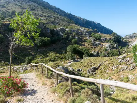
The main Gavarnie path is easy, broad and generally gentle, but it is still a mountain valley route. Expect gravel, dirt and some rocky sections, with snow or ice possible early or late in the May–October season. The optional climb from the Hôtellerie du Cirque towards the Grande Cascade is noticeably steeper and crosses loose shale. The village is largely closed to daytime traffic in season, so plan around paid parking.
HikeList Score
Cirque de Gavarnie Trails scored 77/100 on HikeList's trail-quality metrics.
See score breakdownHide breakdown
- Ideal length 55
- Balanced challenge 64
- Scenery & wildness 98
- Varied terrain 71
- Accommodation 75
- Food & support 88
- Path quality 98
- Season flexibility 89
Computed from length, challenge, scenery & wildness, terrain variety, accommodation, food & support, path quality and season flexibility.
 France
Show more data Show less
- Mountainous
- Forest
- Gravel
- Dirt
- Rocky
- Hotels
- Huts
- Campsites
- Family Friendly
- Pet Friendly
- Restrooms
- Water Sources
- Campsites
- Picnic Areas
In these collections
Photos from hikers
Taken on the trail by people who've reviewed Cirque de Gavarnie Trails.
Reviews
How would you rate Cirque de Gavarnie Trails?
Tap a star to start your review — you could be the first.