Madonie Mountains Loop
How would you rate Madonie Mountains Loop?
Tap a star to share your experience and help other hikers.
Madonie Mountains Loop: Pizzo Carbonara Hiking Guide
HikeList Score
Madonie Mountains Loop scored 76/100 on HikeList's trail-quality metrics.
See score breakdownHide breakdown
- Ideal length 55
- Balanced challenge 80
- Scenery & wildness 85
- Varied terrain 83
- Accommodation 75
- Food & support 81
- Path quality 80
- Season flexibility 89
Computed from length, challenge, scenery & wildness, terrain variety, accommodation, food & support, path quality and season flexibility.
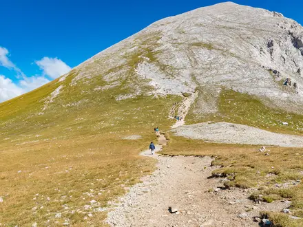
The Madonie Mountains Loop is best understood as the roughly 8 km Pizzo Carbonara circuit from Piano Battaglia in northern Sicily, Italy, not a formal long-distance trail. This hard half- to full-day loop climbs to Pizzo Carbonara, the highest summit in the Madonie and Sicily’s second-highest peak after Etna. It suits confident mountain hikers: the karst plateau has sinkholes, limestone outcrops, faint cairn-marked lines and no continuous path, so clear weather and navigation skills matter.
Route Overview
The signature loop starts and ends at Piano Battaglia, a ski and hut hamlet on the SP54 at about 1,600 m. From there it climbs onto the open limestone plateau to Pizzo Carbonara (1,979 m), then returns via the secondary tops of Pizzo Scalonazzo, Pizzo Antenna and Pizzo della Principessa, with a short road section near the finish. Castelbuono, Petralia Sottana, Petralia Soprana, Polizzi Generosa, Isnello, Collesano and Cefalù are useful Madonie bases, but they are not all stops on one loop. For other Italian mountain and island walking ideas, compare the Gran Paradiso Trek or the Aeolian Islands Trek.
Madonie history and geopark context
The Madonie have been crossed and settled by Greek, Roman, Arab and Norman civilisations, whose traces remain in hill-town castles, churches and old mule tracks. The area is protected as the Parco Naturale Regionale delle Madonie, officially created on 9 November 1989, covering about 162 km² across 15 municipalities in the province of Palermo. It is also the Madonie UNESCO Global Geopark, recognised for carbonate geology and endemic species including the rare Sicilian fir.
Notable highlights
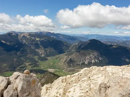
- Pizzo Carbonara (1,979 m): The roof of the Madonie and Sicily’s second-highest mountain after Etna. In clear weather the broad summit gives views across the island’s interior, the Tyrrhenian coast and Mount Etna.
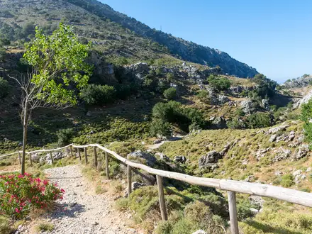
- Piano Battaglia and the karst plateau: The loop’s high trailhead at about 1,600 m. Above it, the limestone tableland is broken by dolines, rock outcrops and open pasture, making navigation a core part of the walk.
- Giant Holly Trail, Piano Pomo (Sentiero degli Agrifogli Giganti, N1): A separate classic roughly 8 km loop from Rifugio Crispi above Castelbuono. It visits a grove of more than 300 giant holly trees, some up to 20 m tall and centuries old.
- Abies nebrodensis (Sicilian fir): One of the rarest conifers on Earth, surviving only as a few dozen wild trees on Madonie slopes. It is an emblem of the park’s endemic flora.
- Castelbuono and the Castello dei Ventimiglia: A main gateway town for Madonie walkers, built around the 14th-century Ventimiglia castle. It is also known for Manna ash harvesting and Fiasconaro panettone.
Challenges to expect
The official park grade for the Piano Battaglia–Pizzo Carbonara route is EE, for expert hikers. Expect faint cairn-marked lines rather than a continuous trail, plus sinkholes, limestone slabs and exposed open ground above the treeline. Do not rely on poor-visibility navigation. Summer can be hot and dry, winter snow affects the high ground, and there are no staffed high mountain refuges on the summit loop itself.
HikeList Score
Madonie Mountains Loop scored 76/100 on HikeList's trail-quality metrics.
See score breakdownHide breakdown
- Ideal length 55
- Balanced challenge 80
- Scenery & wildness 85
- Varied terrain 83
- Accommodation 75
- Food & support 81
- Path quality 80
- Season flexibility 89
Computed from length, challenge, scenery & wildness, terrain variety, accommodation, food & support, path quality and season flexibility.
 Italy
ItalyShow more data Show less
- Mountainous
- Forest
- Karst
- Rocky
- Dirt
- Paved
- Huts
- Hotels
- Campsites
- Pet Friendly
- Water Sources
- Campsites
- Shelters
Photos from hikers
Taken on the trail by people who've reviewed Madonie Mountains Loop.
Reviews
How would you rate Madonie Mountains Loop?
Tap a star to start your review — you could be the first.