Camino Francés (Rioja Segment)
How would you rate Camino Francés (Rioja Segment)?
Tap a star to share your experience and help other hikers.
Camino Francés Rioja Segment: Logroño to Grañón
HikeList Score
Camino Francés (Rioja Segment) scored 79/100 on HikeList's trail-quality metrics.
See score breakdownHide breakdown
- Ideal length 70
- Balanced challenge 100
- Scenery & wildness 58
- Varied terrain 100
- Accommodation 100
- Food & support 54
- Path quality 76
- Season flexibility 89
Computed from length, challenge, scenery & wildness, terrain variety, accommodation, food & support, path quality and season flexibility.
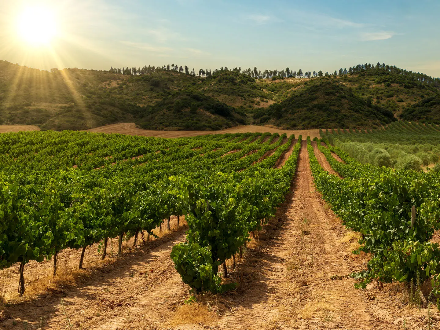
The Camino Francés Rioja Segment is a 62 km, 3-day, moderate section of the GR-65 through La Rioja in northern Spain. It follows the most-walked Camino de Santiago route east to west from Logroño to Grañón, crossing vineyards, farmland, low hills and pilgrim towns. It suits walkers who want a short, well-waymarked Camino section with strong albergue infrastructure, rather than a remote mountain trek. For the complete route, see the Camino de Santiago: Camino Francés.
Route Overview
This is a point-to-point pilgrim route, walked east to west towards Santiago de Compostela. The direct La Rioja crossing starts in Logroño, where the Camino enters over the Puente de Piedra across the Ebro, then runs via Navarrete, Nájera, Azofra, Cirueña and Santo Domingo de la Calzada to Grañón, the last La Rioja village before Castilla y León. The three standard walking days are Logroño–Nájera, Nájera–Santo Domingo de la Calzada and Santo Domingo–Grañón. Waymarking is generally straightforward with GR-65 signs, yellow arrows and scallop-shell markers. If comparing Camino approaches, the Camino Aragonés and Camino del Norte offer different Spanish Camino experiences.
Medieval Pilgrimage Through La Rioja
The Camino Francés has carried pilgrims to the shrine of Saint James at Santiago de Compostela since the medieval period, flourishing from the 11th–12th centuries. In La Rioja, the route is closely tied to Santo Domingo de la Calzada, who built a causeway, bridge over the Oja, pilgrim hospital and church to make the road safer. The region also lay on the medieval frontier between Navarre and Castile, leaving a trail of Romanesque churches, monasteries and old pilgrim hospitals.
Notable highlights
- Logroño: Capital of La Rioja, entered by pilgrims over the Puente de Piedra across the Ebro. The route passes the Church of Santiago el Real, with Calle Laurel’s tapas bars close by.
- Navarrete: A hilltop town known for red-clay pottery and the Baroque Church of the Assumption. The Romanesque portal from the ruined San Juan de Acre pilgrim hospital was rebuilt at the cemetery gateway.
- Nájera: A former royal capital of the Kingdom of Navarre on the Najerilla river. The Monastery of Santa María la Real contains the royal pantheon of Navarrese monarchs and a Gothic cloister below red sandstone cliffs.
- Rioja vineyards: Much of the walk passes through DOCa Rioja wine country, with vineyards, family bodegas and open agricultural tracks shaping the landscape.
- Santo Domingo de la Calzada: A classic pilgrim town centred on the legacy of its namesake saint. Its cathedral keeps a live white cockerel and hen, linked to the town’s medieval miracle legend.
- Grañón: The final La Rioja village on the route, known for its welcoming parish pilgrim hostel in the Church of San Juan Bautista.
Challenges to expect
The walking is not technically difficult: terrain is mostly flat to gently rolling, with modest cumulative ascent. The main challenges are long daily distances, hard paved or compacted surfaces, and exposed tracks with little shade. Summer heat can make dehydration a serious risk, while shoulder-season rain can turn the red clay sections muddy. Navigation is usually easy thanks to GR-65 waymarking, yellow arrows and scallop-shell markers.
HikeList Score
Camino Francés (Rioja Segment) scored 79/100 on HikeList's trail-quality metrics.
See score breakdownHide breakdown
- Ideal length 70
- Balanced challenge 100
- Scenery & wildness 58
- Varied terrain 100
- Accommodation 100
- Food & support 54
- Path quality 76
- Season flexibility 89
Computed from length, challenge, scenery & wildness, terrain variety, accommodation, food & support, path quality and season flexibility.
 Spain
SpainShow more data Show less
- Farmland
- Vineyards
- Rolling Hills
- Cereal Fields
- Urban Edges
- Paved
- Asphalt
- Gravel
- Compacted Dirt
- Clay
- Albergues
- Hostels
- Guesthouses
- Hotels
- Family Friendly
- Pet Friendly
Articles related to this hike
In these collections
Photos from hikers
Taken on the trail by people who've reviewed Camino Francés (Rioja Segment).
Leave Logroño after crossing the Ebro-side city section and continue west through vineyards, farmland and low hills. The route passes Navarrete, with the notable rise of Alto de San Antón above it, before continuing towards Nájera on the Najerilla river.
Walk from Nájera through open Rioja countryside via Azofra and towards Cirueña. This stage reaches the segment’s high ground near Alto de la Cruz before descending towards Santo Domingo de la Calzada, one of the key pilgrim towns of La Rioja.
A short final La Rioja stage from Santo Domingo de la Calzada to Grañón. The village marks the western edge of La Rioja on the Camino Francés before the route continues into Castilla y León.
Reviews
How would you rate Camino Francés (Rioja Segment)?
Tap a star to start your review — you could be the first.