Epynt Way
How would you rate Epynt Way?
Tap a star to share your experience and help other hikers.
Epynt Way: A Complete Hiking Guide
HikeList Score
Epynt Way scored 81/100 on HikeList's trail-quality metrics.
See score breakdownHide breakdown
- Ideal length 66
- Balanced challenge 100
- Scenery & wildness 66
- Varied terrain 100
- Accommodation 83
- Food & support 74
- Path quality 98
- Season flexibility 89
Computed from length, challenge, scenery & wildness, terrain variety, accommodation, food & support, path quality and season flexibility.
The Epynt Way is a 64 km permissive, waymarked circular bridleway around the Sennybridge Training Area on the Mynydd Epynt plateau in Powys, mid-Wales. It usually takes 2–3 days and is a moderate upland walk: exposed moorland, boggy sections, stream fords, steep valleys and no facilities on the route. It suits self-sufficient walkers with confident navigation, especially in mist. The route is also open to horse riders and mountain bikers, and sits outside the Brecon Beacons National Park.
Route Overview
There is no single fixed start or finish. LDWA gives a notional start/end at Pentre Dolan Honddu, near Upper Chapel and Builth Wells, while the Epynt Way Visitor Centre on the B4519 between Upper Chapel and Garth is a common access point. The loop follows the outer boundary of SENTA around Mynydd Epynt, between the Usk Valley, Irfon Valley and Wye Valley. Expect plateau-edge tracks, forestry, river valleys and short road sections, with notable points including Garth Viewpoint, Capel y Babell and the Drovers Arms. For a higher-profile Bannau Brycheiniog traverse, compare the Beacons Way; for coastal walking, see the Anglesey Coastal Path; and for a shorter Welsh day out, the Aber Falls Walk.
Mynydd Epynt and the lost community
Mynydd Epynt was a Welsh-speaking upland farming community until 1940, when the War Office requisitioned the area for an artillery training range. To create SENTA, 54 homes were vacated and 219 people were forced to leave, after a final St David’s Day gathering at Capel y Babell. Cilieni primary school, chapels, the church and the Drovers Arms closed. The Epynt Way was created by the Ministry of Defence in 2004 to restore public access around the range perimeter while live firing continues inside.
Notable highlights
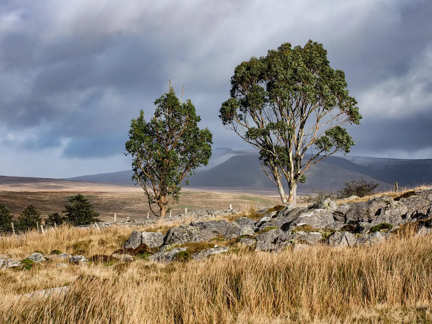
- Mynydd Epynt plateau & escarpment: The route circles a broad 400–450 m upland plateau with a steep northern escarpment. In clear weather, the edges give long views towards the Brecon Beacons, Black Mountains, Cambrian Mountains and Carmarthen Fans.
- Sennybridge Training Area boundary: The whole circuit follows the perimeter of an active military training area. It is designed to keep walkers outside the impact area, but firing and military events can close access.
- Garth Viewpoint: The highest accessible ground on the route at about 458 m. It has picnic benches, an interpretation board and wide views across mid-Wales.
- Capel y Babell and the lost community: This chapel was the spiritual centre of the cleared Welsh-speaking community. The 1940 St David’s Day service is remembered as the community’s farewell before eviction.
- Drovers Arms: A now-derelict drovers’ inn linked with historic hill farming and droving routes across the mountain. It remains one of the most evocative human landmarks in the SENTA landscape.
- Red kites & waxcap grassland: Red kites are commonly seen over the moor, while unimproved acid grassland produces brightly coloured waxcap fungi in autumn.
Challenges to expect
This is a remote upland circuit with no facilities or accommodation on the route, so carry food, water and bad-weather kit. Navigation can be difficult in mist or fog despite waymarking, and the path is not shown on standard OS mapping. Expect bog after rain, exposed winds, stream fords, steep valley sections and closures for live firing, military operations, motor events or forestry work.
HikeList Score
Epynt Way scored 81/100 on HikeList's trail-quality metrics.
See score breakdownHide breakdown
- Ideal length 66
- Balanced challenge 100
- Scenery & wildness 66
- Varied terrain 100
- Accommodation 83
- Food & support 74
- Path quality 98
- Season flexibility 89
Computed from length, challenge, scenery & wildness, terrain variety, accommodation, food & support, path quality and season flexibility.
 United Kingdom
 Wales
WalesShow more data Show less
- Upland Moorland
- Blanket Bog
- Grassland
- Forest
- River Valleys
- Grass
- Moorland Tracks
- Gravel
- Forestry Tracks
- Boggy Ground
- Minor Road
- B&Bs
- Inns
- Wild Camping
- Family Friendly
- Dog Friendly On Leash
- Non Potable Water Sources
- Picnic Areas
Photos from hikers
Taken on the trail by people who've reviewed Epynt Way.
Reviews
How would you rate Epynt Way?
Tap a star to start your review — you could be the first.