World Heritage Trail Wachau
How would you rate World Heritage Trail Wachau?
Tap a star to share your experience and help other hikers.
World Heritage Trail Wachau: A Two-Week Danube Loop
HikeList Score
World Heritage Trail Wachau scored 85/100 on HikeList's trail-quality metrics.
See score breakdownHide breakdown
- Ideal length 89
- Balanced challenge 100
- Scenery & wildness 71
- Varied terrain 89
- Accommodation 74
- Food & support 88
- Path quality 84
- Season flexibility 89
Computed from length, challenge, scenery & wildness, terrain variety, accommodation, food & support, path quality and season flexibility.
The World Heritage Trail Wachau, or Welterbesteig Wachau, is a 180 km loop through the UNESCO-listed Wachau in Lower Austria. Starting and finishing in Krems an der Donau, it usually takes 12–14 days across 14 stages. The overall grade is moderate, but the full route has around 6,000 m of ascent, including demanding climbs to vineyard ridges, forested hills and the Jauerling. It suits hikers who want cultural towns, Danube views and guesthouse comfort rather than a remote mountain-hut trek.
Route Overview
This is a circular route, not just a Krems-to-Melk point-to-point. From Krems an der Donau it follows the north bank through Stein, Dürnstein, Weißenkirchen and Spitz an der Donau, then turns inland via the Spitzer Graben, Mühldorf, Jauerling, Maria Laach, Aggsbach Markt and Emmersdorf. The return crosses the south-bank side through Melk, Dunkelsteinerwald, Schönbühel, Aggsbach Dorf, Aggstein, Rossatz, Göttweig, Mautern and back to Stein/Krems. Trains, regional buses, ferries and Danube boats make it easy to shorten stages or walk only one bank. If comparing Austrian long-distance walks, see the Donausteig (Danube Trail) and Dachstein Rundwanderweg.
Wachau UNESCO Landscape and Trail History
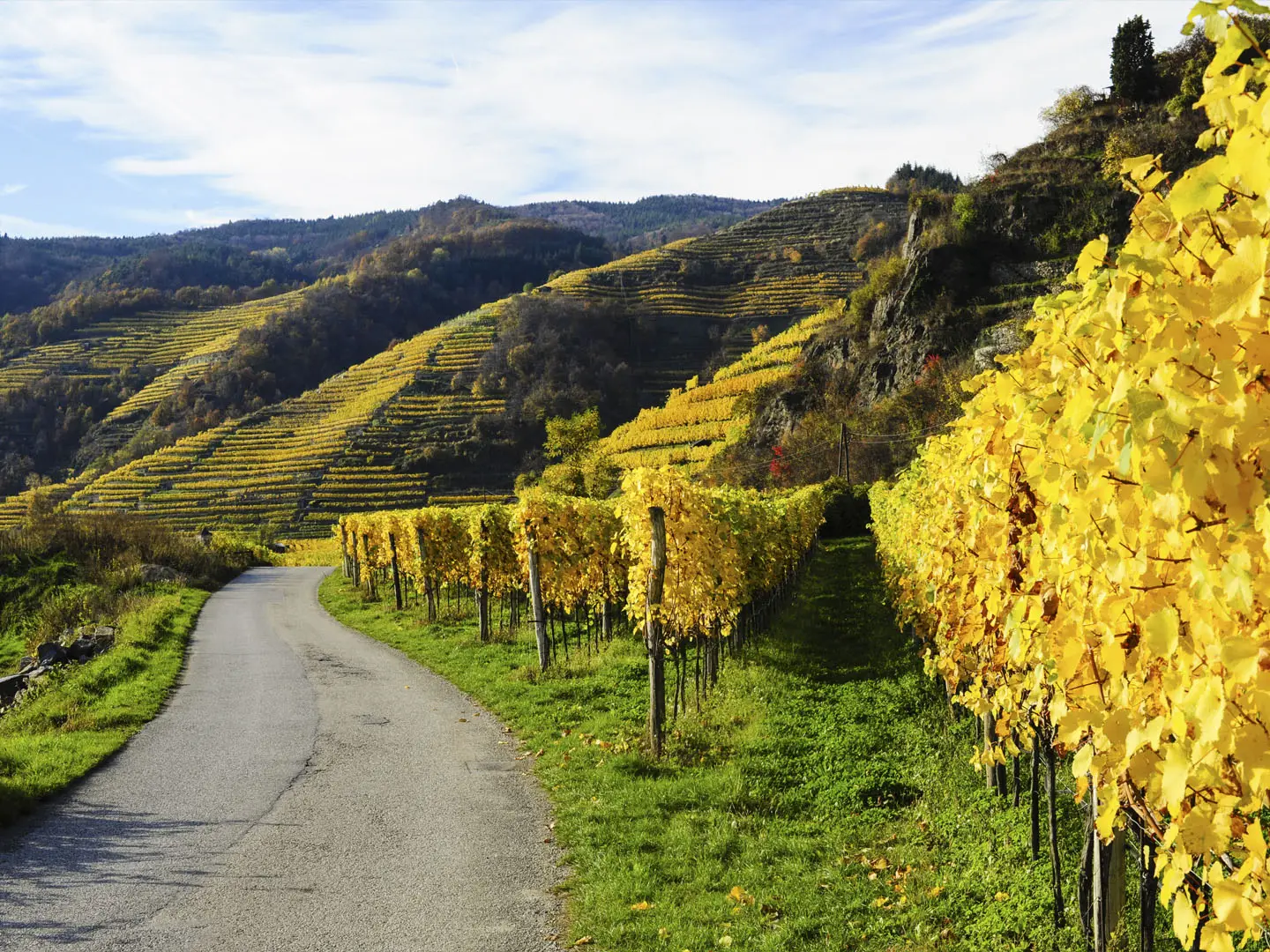
The Wachau is a UNESCO World Heritage cultural landscape, inscribed in 2000, along the Danube between Melk and Krems. The valley has been settled since prehistory and is known for its river towns, abbeys, castles and terraced vineyards. The Welterbesteig Wachau was officially opened on 26 May 2010 to link these cultural landmarks on foot, creating a waymarked circuit through both banks of the Danube and the inland hills around the Jauerling.
Notable highlights
- Melk Abbey (Stift Melk): A vast Baroque Benedictine monastery on a rock bluff above the Danube, known for its ornate church, terrace and historic library.
- Dürnstein castle ruins: Hilltop ruins above Dürnstein where King Richard the Lionheart of England was held captive in 1192–93 after the Third Crusade.
- Jauerling: At about 959 m, the highest mountain on the Danube and the highest point of the route, with a lookout tower giving views over the Wachau, Dunkelsteinerwald and towards the Alps.
- Aggstein castle ruins: A 12th-century clifftop fortress above the south bank, formerly a control point for river shipping and linked with the robber baron Jörg Scheck von Wald.
- Göttweig Abbey (Stift Göttweig): A hilltop Benedictine abbey on the south bank, part of the World Heritage landscape, with broad views over the Danube valley and Krems.
- Spitz an der Donau and Wachau vineyards: A wine village below the terraced Tausendeimerberg, surrounded by vineyards known for Grüner Veltliner and Riesling and by Heuriger wine taverns.
Challenges to expect
The trail is moderate rather than technical, but the full loop is a stamina test: around 6,000 m of cumulative ascent over hilly vineyard, forest, rocky, gravel and paved sections. Summer heat can exceed 30°C, with limited shade on vineyard stages. Waymarking is strong — a white stylised W in a circle and yellow signs — but carry maps for variants and transport exits. For a different Austrian option, compare the Eagle Walk (Adlerweg).
HikeList Score
World Heritage Trail Wachau scored 85/100 on HikeList's trail-quality metrics.
See score breakdownHide breakdown
- Ideal length 89
- Balanced challenge 100
- Scenery & wildness 71
- Varied terrain 89
- Accommodation 74
- Food & support 88
- Path quality 84
- Season flexibility 89
Computed from length, challenge, scenery & wildness, terrain variety, accommodation, food & support, path quality and season flexibility.
 Austria
Show more data Show less
- Forest
- Hilly
- Vineyard
- Dirt
- Gravel
- Rocky
- Paved
- Hotels
- Guesthouses
- Family Friendly
- Pet Friendly
- Restrooms
- Water Sources
- Campsites
- Picnic Areas
In these collections
Photos from hikers
Taken on the trail by people who've reviewed World Heritage Trail Wachau.
Reviews
How would you rate World Heritage Trail Wachau?
Tap a star to start your review — you could be the first.