Via Transilvanica
How would you rate Via Transilvanica?
Tap a star to share your experience and help other hikers.
Via Transilvanica: Romania’s Cross-Country Thru-Hike
HikeList Score
Via Transilvanica scored 79/100 on HikeList's trail-quality metrics.
See score breakdownHide breakdown
- Ideal length 52
- Balanced challenge 84
- Scenery & wildness 82
- Varied terrain 100
- Accommodation 83
- Food & support 81
- Path quality 84
- Season flexibility 89
Computed from length, challenge, scenery & wildness, terrain variety, accommodation, food & support, path quality and season flexibility.
The Via Transilvanica is Romania’s first major long-distance trail: a roughly 1,400 km point-to-point route from Putna in Bucovina to Drobeta-Turnu Severin on the Danube. Most hikers take 45–60 days on foot. It is hard because of its length, cumulative ascent and repeated long days, not because it is technical or alpine. It suits experienced walkers who want a cultural thru-hike through villages, forests, farmland, Saxon heritage towns and low mountain terrain. See more routes in Romania.
Route Overview
The trail runs diagonally north-east to south-west, starting at Putna Monastery in Suceava County and finishing at Drobeta-Turnu Severin in Mehedinți County, on the Danube near the Iron Gates. It crosses 10 counties, more than 400 communities, and seven named regions: Bucovina, Highlands / Ținutul de Sus, Terra Siculorum, Terra Saxonum, Terra Dacica, Terra Banatica and Terra Romana. Key places include Sucevița, Vatra Moldoviței, Sovata, Odorheiu Secuiesc, Sighișoara, Viscri, Alba Iulia, the Hunedoara/Corvin Castle region, Sarmizegetusa, Tismana and Ponoarele. For higher Carpathian walking, compare the Carpathian Ridge Trail or the shorter Bucegi Plateau Circuit.
History of the Via Transilvanica
Conceived as Romania’s answer to the Camino de Santiago, the Via Transilvanica was created by the Bistrița-based NGO Tășuleasa Social to connect rural communities, support local economies and showcase around 2,000 years of Transylvanian and Romanian history. Volunteers built and marked the route in stages from 2018 to 2022. The full official route was inaugurated at Alba Iulia on 8 October 2022. It is also known as The Road that Unites — Drumul care unește.
Notable highlights
- Painted Monasteries of Bucovina: UNESCO-listed monasteries such as Sucevița and Moldovița are known for vivid 15th–16th century exterior frescoes, close to the trail’s northern start.
- Sighișoara: A UNESCO-listed medieval Saxon citadel with its landmark Clock Tower, and one of the best-known historic towns on the route.
- Viscri and the Saxon fortified churches: Viscri’s whitewashed fortified church is part of the Saxon village landscape the trail passes through, giving this section a strong cultural focus.
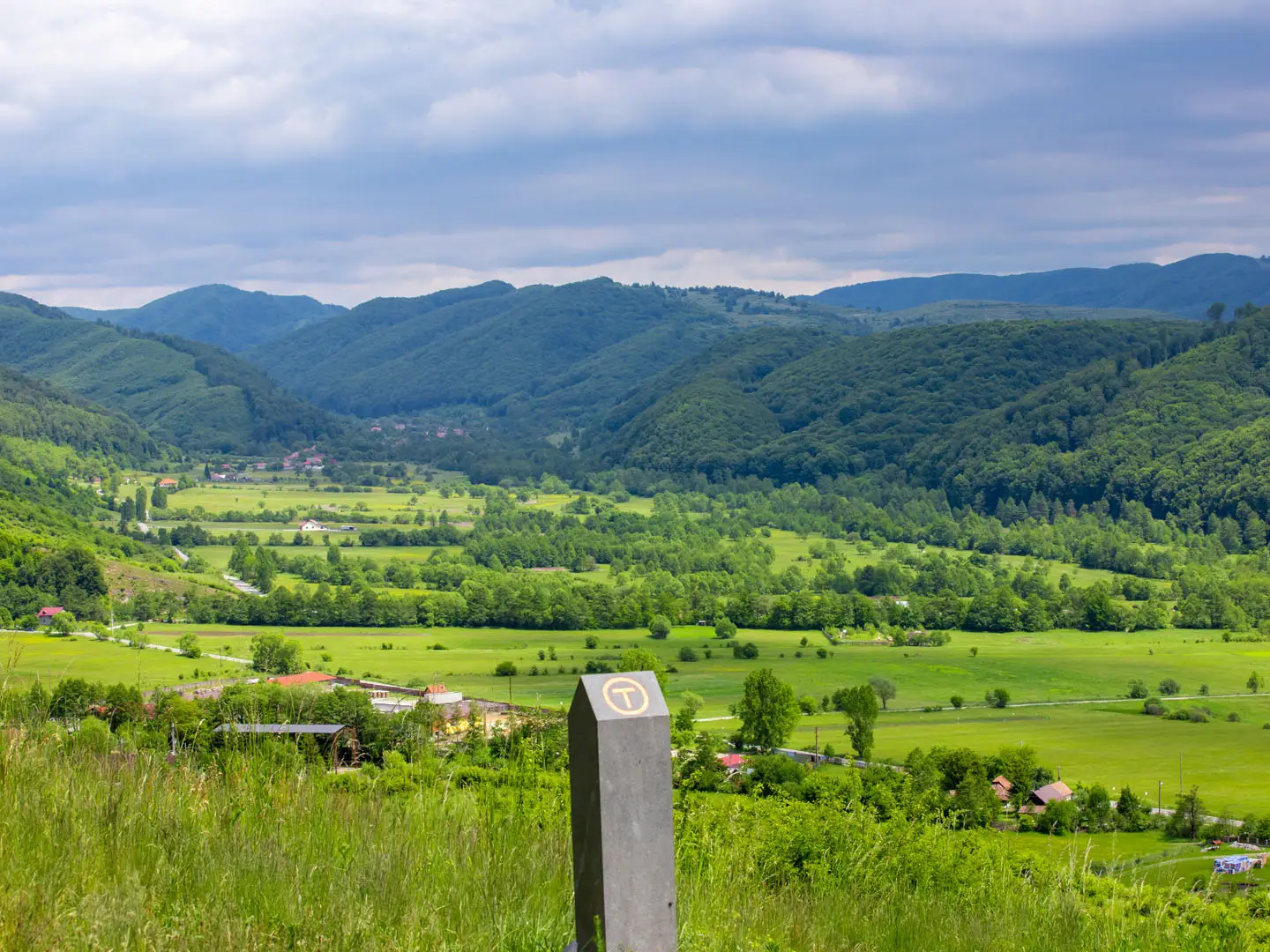
- Carved andesite kilometre stones: More than 1,400 individually sculpted milestones, each around 260 kg, mark the route roughly every kilometre and turn the walk into a public artwork.
- Corvin Castle region: The route passes the Hunedoara area, associated with Corvin Castle, a large Gothic castle and one of Romania’s major heritage sights.
- Iron Gates and the Danube finale: The trail ends at Drobeta-Turnu Severin on the Danube, near the Iron Gates gorge on the Serbian border.
Challenges to expect
Expect a hard, sustained journey rather than a technical mountain route. The main challenge is consistency over 1,400 km and around 32,000 m of ascent. Stages can vary from easy village walking to remote 30 km+ days. Forest roots, mud, boggy meadows, farm tracks, tarmac and rocky limestone sections all appear. Summer thunderstorms are common, while spring can leave lingering snow at altitude. If you want a shorter mountain objective, consider the Bâlea Lake to Bâlea Waterfall route.
HikeList Score
Via Transilvanica scored 79/100 on HikeList's trail-quality metrics.
See score breakdownHide breakdown
- Ideal length 52
- Balanced challenge 84
- Scenery & wildness 82
- Varied terrain 100
- Accommodation 83
- Food & support 81
- Path quality 84
- Season flexibility 89
Computed from length, challenge, scenery & wildness, terrain variety, accommodation, food & support, path quality and season flexibility.
 Romania
Show more data Show less
- Forest
- Meadows
- Farmland
- Villages
- Mountain
- Dirt
- Gravel
- Paved
- Rocky
- Guesthouses
- Hotels
- Monasteries
- Family Friendly
- Pet Friendly
- Water Sources
- Campsites
- Shelters
In these collections
Photos from hikers
Taken on the trail by people who've reviewed Via Transilvanica.
Begin the trek at Putna, home to the famous Putna Monastery. Journey through rolling hills and forests north of the Eastern Carpathians, concluding the day in Sucevita, renowned for its painted monastery and green landscapes.
Hike southward through forested terrain via scenic valleys, passing the famous black pottery workshops of Marginea. This stage features moderate climbs and stunning Bucovina countryside.
Travel along country roads and woodland paths between northern Bucovina villages. The route is dotted with traditional homesteads and several river crossings as you approach the village of Horodnic de Sus.
Navigate through a mix of rolling farmland and pockets of forest. The stage concludes at Vatra Moldoviței, another site known for its UNESCO-painted monastery boasting vibrant medieval frescoes.
Hike a scenic forest and riverside trail toward Moldovița, following stretches of the Moldovița River and passing rural villages. There's a gentle climb through forested hills before reaching the day's finish.
Rise steadily through woodland and pastoral valleys, with some sections on quiet rural roads. Arrival in Ciumârna offers panoramic views and the chance to experience traditional Bucovinian hospitality.
Today’s path winds through dense forests and grassy plateaus, eventually descending toward the resort town of Vatra Dornei. Expect rewarding mountain views and ample wildlife sightings.
Leave Vatra Dornei following the Dorna River downstream, traversing a blend of valleys, woodland and mountain foothills. Friendly villages and scenic agricultural areas characterize the approach to Panaci.
Cross into rolling uplands, ascending through mixed forest and open farmland. The day ends in the quiet village of Bilbor, known for its clear mountain springs and pastoral charm.
Make a long traverse over forested ridges and remote valley paths. This is a wilder section of the trail with limited services, leading to Lunca Bradului, set amid the Eastern Carpathians.
Continue south through dense pine forests, gently climbing before descending toward the thermal spa town of Toplița. Enjoy distant mountain vistas and tranquil woodland scenery.
Head through rolling hills and forest trails dotted with meadows. The stretch to Sărmaș is relatively gentle, with plenty of opportunities to spot local wildlife.
Descend into lower basins along rivers and through peaceful mixed woodland before entering Subcetate. Expect a tranquil rural setting for the evening.
Travel alongside the Mureș River through agricultural terrain and charming villages, reaching the larger town of Reghin, known for its violin-making tradition and lively atmosphere.
Leave behind urban Reghin and hike into the scenic Gurghiu hillsides, passing vineyards, orchards, and small villages with traditional architecture.
Follow a mix of shaded woodland trails and open countryside as you approach the spa town of Sovata, famous for its salt lakes and therapeutic springs.
Transition from forest to rural valleys, exploring trails that pass through salt-rich soils and into the mining village of Praid, home to a famous underground salt mine.
A short day of gentle walking through undulating terrain, passing handicraft markets and rural settlements before arriving in Corund, a hub for Szekler ceramics.
Navigate west through hilly meadows and small forest patches to the cultural town of Odorheiu Secuiesc, a center of the Szekler (Hungarian) community in Romania.
Journey southwest through farmland, wooded streams, and fortified villages on the approach to the medieval citadel of Sighișoara, a highlight of the route.
Continue south through open landscapes and small hamlets, ending in Saschiz, famed for its UNESCO-protected fortified church and blue pottery.
Travel cross-country between signature UNESCO Saxon villages, concluding the day in Viscri, where the fortified white church and heritage homes are must-sees.
Cross open, hilly farmland and small woods en route to Rupea, where an imposing hilltop fortress overlooks the surrounding Saxon countryside.
Travel on a mix of rural byways and grassy lanes past historic Saxon villages, ending the day in Homorod, known for its ancient fortified church.
Enjoy a scenic walk through farmland and river valleys to Racoș, famous for its basalt columns, volcanic crater, and emerald lakes.
Head west, passing through rolling Carpathian foothills and dense woodlands, to the town of Baraolt, a gateway community to the region’s protected forests.
This section crosses remote woodlands, open fields, and riverbanks, finishing in Augustin, a peaceful rural settlement at the edge of the Harghita Mountains.
Hike through agricultural plains and streams, with gentle elevation changes, arriving in Racoșu de Sus amidst classic Transylvanian countryside.
A day of easy walking through tranquil villages and sprawling meadows, culminating in the town of Hoghiz near the Olt River.
Today’s route traces the edge of the Făgăraș foothills and meanders into the lively city of Făgăraș, famous for its medieval fortress surrounded by a moat.
Walk south along quiet country roads through villages, farmlands, and pine forests, arriving at the mysterious cave monastery of Șinca Veche.
Climb into the hills of Poiana Mărului, traversing high pastures and pine woods. Enjoy broad Carpathian views along this quieter stretch.
Descend through beech forests and rugged terrain with mountain outlooks, reaching Zărnești, gateway to the Piatra Craiului National Park.
Journey into the Carpathian foothills and highland meadows, following waymarked paths toward the mountain village of Moieciu de Sus.
Hike through high-altitude pastures, experiencing panoramic views of the Bucegi and Piatra Craiului mountains. Fundata is one of Romania’s highest inhabited villages.
Descend to Bran through a mix of forests and pastures, passing iconic vistas of Bran Castle, a landmark linked to the Dracula legends.
Continue across hills and forests to the medieval walled town of Râșnov, home to a well-preserved hilltop fortress and lively town square.
Ascend into alpine forests and traverse the scenic Bucegi foothills, with fresh mountain air guiding you into the mountain resort town of Predeal.
Short but steep, this stage crosses the woods and follows the Prahova Valley, concluding in the mountain town of Azuga, a popular ski resort.
Trek along trails with impressive mountain backdrops, skirting the Bucegi Plateau and finishing at Bușteni, known for its striking views of Caraiman Peak.
Follow scenic forest and park trails south to Sinaia, site of the lavish Peleș Castle and regal mountain gardens, with possibilities for sightseeing.
Descend through beech and fir forests along the Prahova Valley. This relatively easy stretch concludes in the market town of Comarnic.
Undulating through wooded hillsides, the route passes rural homesteads before arriving in Breaza, known for its air quality and village charm.
Travel through transitions between hilly forests and residential outskirts, ending in Câmpina, a town with parks and Art Nouveau heritage.
A diverse stage that alternates between forest, orchard, and open ridge, culminating at the salt-mining town of Slănic with its famous underground salt mine.
Roam through hilly farmlands, orchards, and scattered woodland patches before entering the tranquil village of Aluniș.
Climb into higher foothills with captivating ridge views and small wooded glades. The stage concludes in the rural village of Cislău.
Wind through rolling forests and valleys, sometimes following riverbanks, arriving in Nehoiu, a small town at the edge of the Buzău Mountains.
Today’s trek hugs the valley floor, tracing riverbanks and forested escarpments to Siriu, a scenic lakeside village in the Buzău region.
Ascend and descend wooded ridges then enter the sprawling basin of Întorsura Buzăului, with sweeping valley views and quiet farmland.
Follow paths through pine forests and fens, crossing quiet countryside before arriving at the spa town of Covasna, famed for its therapeutic mineral springs.
The trail leads through patchworked farmland and Szekler settlements, ending in the historic market town of Târgu Secuiesc, with characteristic walled courtyards.
Continue walking through rural villages framed by scenic meadows and groves en route to Brețcu, set in the foothills near the former Hungarian border.
Venture over the Carpathian watershed, hiking through dense pine forests and open pastures. The day’s trek ends in the tranquil village of Teliu.
Retrace trails through wooded valleys, high pastures, and river crossings back into the region around Întorsura Buzăului, completing a mountain circuit.
Descend steadily along wooded ridges and open country, passing scattered farmsteads en route to the village of Ploștina.
Quiet rural landscapes dominate this section, as the trail slowly approaches the western foothills of the Southern Carpathians. End the day in Tismana, near its iconic monastery.
Traverse forested hills and unique karst landscapes, ending in Ponoarele, a village noted for its natural stone bridge and cave systems.
Walk over open highland and down through oak groves, nearing the Danube basin and southernmost stretches of the trail at Hinova.
The final stage leads through gentle countryside heading to Drobeta-Turnu Severin on the Danube, where the Via Transilvanica officially ends at the historic fortress and riverside park.
Reviews
How would you rate Via Transilvanica?
Tap a star to start your review — you could be the first.