GR6
How would you rate GR6?
Tap a star to share your experience and help other hikers.
GR6: Atlantic to Alps Hiking Guide
HikeList Score
GR6 scored 84/100 on HikeList's trail-quality metrics.
See score breakdownHide breakdown
- Ideal length 52
- Balanced challenge 100
- Scenery & wildness 81
- Varied terrain 100
- Accommodation 92
- Food & support 81
- Path quality 98
- Season flexibility 89
Computed from length, challenge, scenery & wildness, terrain variety, accommodation, food & support, path quality and season flexibility.
The GR6 is a waymarked Grande Randonnée crossing southern France from the Arcachon Basin on the Atlantic coast to Saint-Paul-sur-Ubaye in the southern Alps. The full route is approximately 1,360 km, usually walked in about 50–65 days. It is moderate overall: easier through the Gironde and Périgord, then progressively harder across the Massif Central, Provence and the alpine Ubaye finish. It suits experienced long-distance hikers who can plan multi-week accommodation, resupply and seasonal mountain conditions.
Route Overview
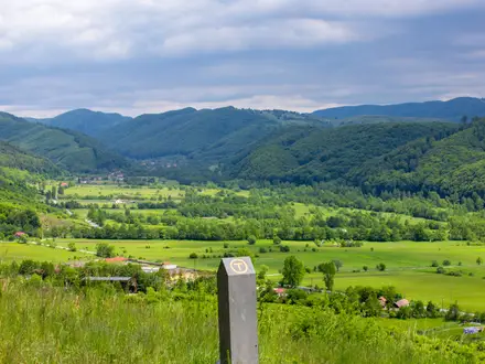
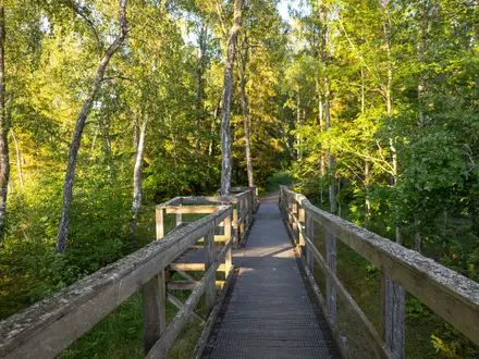
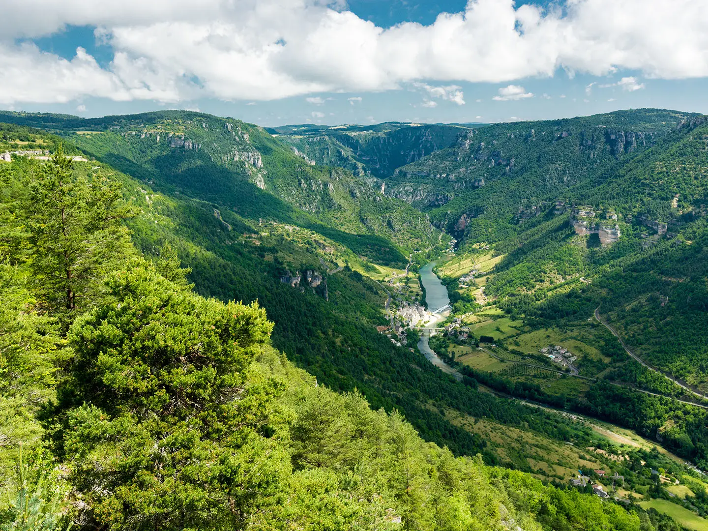
This is a linear west-to-east trail. The usual full traverse starts at the Arcachon Basin in Gironde, though some staged sources begin inland at Langon, and finishes around Saint-Paul-sur-Ubaye / Fouillouse beneath the Col de Vars. The GR6 threads Gironde vineyards, the Périgord Noir, Quercy, Figeac, Conques, the Aubrac, the Cévennes around Mont Aigoual, the Luberon, Vaucluse mountains and the Ubaye Alps. It is waymarked throughout with white-and-red GR blazes. For a shorter Atlantic-side walk, see the Bordeaux to Arcachon Trail; for an easier southern France journey, compare the Canal du Midi Towpath.
GR6 History and Context
The GR6 is part of France’s national Grande Randonnée network, the long-distance footpaths developed and maintained by the Fédération Française de la Randonnée Pédestre. Its importance is geographic rather than tied to a single documented founding date: it links the Atlantic at Arcachon with high alpine terrain near Saint-Paul-sur-Ubaye, joining many of southern France’s major landscapes and heritage areas in one continuous waymarked route.
Notable highlights
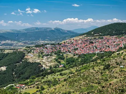
- Vézère Valley and Périgord Noir: In the Dordogne, the GR6 shares ground with the GR36 through a UNESCO World Heritage landscape of prehistoric sites and painted caves near Les Eyzies. Sarlat-la-Canéda adds a dense medieval townscape of honey-coloured stone.
- Rocamadour: This clifftop pilgrimage village in the Lot is stacked above the Alzou gorge, with sanctuaries built into the limestone setting. It is also associated with the Santiago pilgrimage network.
- Conques and the Aubrac: The route crosses Figeac and Conques, a Romanesque abbey-village on the Compostela routes, before reaching the open volcanic Aubrac plateau. Expect exposed, windswept walking here.
- Cévennes and Mont Aigoual: In the Gard, the GR6 climbs into granite-and-schist Cévennes country around Mont Aigoual, with deep valleys, chestnut woods and national park terrain.
- Colorado Provençal and the Luberon: Around Rustrel and the Pays d’Apt, the trail enters ochre quarry landscapes of red and orange cliffs, then continues through lavender plateaux and perched villages of the Luberon Regional Natural Park.
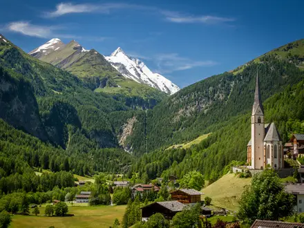
- Ubaye and the Col de Vars: The eastern end climbs into serious southern-Alps terrain above the upper Ubaye valley. The high point is near the Col de la Pare at around 2,655 m, with Fouillouse and the Col de Vars close to the finish.
Challenges to expect
The main challenge is scale: roughly 1,360 km and about 34,800 m of ascent demand careful staging. Accommodation and resupply are good in many towns but can be sparse on remote causses and in the high mountains. Heat and exposure matter in Provence and on limestone plateaux, while the Ubaye passes can hold snow into early summer and from autumn. If you want a shorter mountain-focused comparison, see the Chartreuse Trail (GR9 Segment).
HikeList Score
GR6 scored 84/100 on HikeList's trail-quality metrics.
See score breakdownHide breakdown
- Ideal length 52
- Balanced challenge 100
- Scenery & wildness 81
- Varied terrain 100
- Accommodation 92
- Food & support 81
- Path quality 98
- Season flexibility 89
Computed from length, challenge, scenery & wildness, terrain variety, accommodation, food & support, path quality and season flexibility.
Show more data Show less
- Coastal
- Forest
- Vineyards
- Limestone Plateau
- Volcanic Plateau
- Mountainous
- Alpine
- Footpaths
- Forest Tracks
- Farm Tracks
- Plateau Paths
- Rocky Paths
- Gites
- B&Bs
- Hotels
- Campsites
- Pet Friendly
- Water Sources
- Campsites
- Shelters
Photos from hikers
Taken on the trail by people who've reviewed GR6.
Reviews
How would you rate GR6?
Tap a star to start your review — you could be the first.