Via degli Dei (Path of the Gods - Bologna to Florence)
How would you rate Via degli Dei (Path of the Gods - Bologna to Florence)?
Tap a star to share your experience and help other hikers.
Via degli Dei: Bologna to Florence on the Path of the Gods
HikeList Score
Via degli Dei (Path of the Gods - Bologna to Florence) scored 90/100 on HikeList's trail-quality metrics.
See score breakdownHide breakdown
- Ideal length 89
- Balanced challenge 84
- Scenery & wildness 88
- Varied terrain 100
- Accommodation 100
- Food & support 88
- Path quality 92
- Season flexibility 76
Computed from length, challenge, scenery & wildness, terrain variety, accommodation, food & support, path quality and season flexibility.
The Via degli Dei is a waymarked 130 km point-to-point hike across the Tuscan-Emilian Apennines from Bologna to Florence in Italy. Most walkers take 5–6 days. It is hard rather than technical: expect around 5,000 m of cumulative ascent, repeated steep climbs and descents, rocky or muddy paths, and some hot exposed sections. It suits fit hikers who want a classic Italian cammino with forests, ridges, Roman road paving, Apennine villages and a finish in Piazza della Signoria.
Route Overview
The classic direction is south-bound from Bologna’s Piazza Maggiore to Florence’s Piazza della Signoria, though it can be walked in reverse. From Bologna the route climbs under the Portico di San Luca to the Sanctuary of San Luca, drops towards the Reno valley and Sasso Marconi, then rises over Monte Adone to Monzuno and Madonna dei Fornelli. It crosses the Apennine watershed via Monte dei Cucchi, Monte Gazzaro and Passo della Futa before descending through the Mugello to San Piero a Sieve, Bivigliano, Monte Senario, Fiesole and Florence. For other Italian walking ideas, compare the Chianti Trail, Crete Senesi Loop or the longer Alta Via dei Monti Liguri.
History of the Via degli Dei
The Via degli Dei follows an old Apennine crossing used since Etruscan times and later formalised by the Romans as the Flaminia Militare in 187 BC, linking Bononia — modern Bologna — with the Arno valley. Sections of Roman paving still survive near the watershed. The modern waymarked trail was created in the early 1990s by Bologna walking groups and is now one of Italy’s best-known cammini. Its name comes from peaks along the route associated with Roman deities, including Monte Adone and Monte Venere.
Notable highlights
- Sanctuary of San Luca and Bologna’s portico: The walk begins with the climb through the Portico di San Luca, roughly 3.8 km long and lined by 666 arches, to the hilltop basilica above Bologna.
- Flaminia Militare Roman road: Near the Apennine watershed, the route follows surviving slabs of the Roman road commissioned in 187 BC by consul Gaius Flaminius.
- Monte Adone (~654 m): An early panoramic high point on the Contrafforte Pliocenico, with sandstone pinnacles and views back towards the Bologna plain.
- Monte Gazzaro (1,125 m): The highest point of the Via degli Dei, marked by the Croce di Monte Gazzaro and ridge views across the Emilian and Tuscan slopes.
- Passo della Futa and the Gothic Line: The route crosses the Apennines at this road pass, near a German military cemetery and remains of WWII Gothic Line defences.
- Mugello and San Piero a Sieve: The descent into the Mugello passes Medici-linked country, including the Fortress of San Martino, before the final approach towards Fiesole and Florence.
Challenges to expect
The main challenge is sustained effort over several days: around 130 km with roughly 5,000 m of ascent, long 20–25 km stages, and repeated steep climbs and descents. Surfaces include woodland paths, dirt roads, rocky or slabbed sections and mud after rain. Water and shade can be limited in places. Summer heat can be draining; winter can bring mud, snow on higher ridges and short daylight.
HikeList Score
Via degli Dei (Path of the Gods - Bologna to Florence) scored 90/100 on HikeList's trail-quality metrics.
See score breakdownHide breakdown
- Ideal length 89
- Balanced challenge 84
- Scenery & wildness 88
- Varied terrain 100
- Accommodation 100
- Food & support 88
- Path quality 92
- Season flexibility 76
Computed from length, challenge, scenery & wildness, terrain variety, accommodation, food & support, path quality and season flexibility.
 Italy
ItalyShow more data Show less
- Low Mountain
- Forest
- Ridge
- River Valley
- Woodland Paths
- Dirt Forest Roads
- Grassy Tracks
- Paved Roads
- Roman Paving
- B&Bs
- Agriturismi
- Hotels
- Hostels
- Rifugi
- Parish Hostels
- Family Friendly
- Pet Friendly
- Restrooms
- Water Sources
- Campsites
- Shelters
Download Our Full Guide to Via degli Dei (Path of the Gods - Bologna to Florence) FREE!
Get our comprehensive guide to this hike for free. Save it for later reading or print out at home.
In these collections
Photos from hikers
Taken on the trail by people who've reviewed Via degli Dei (Path of the Gods - Bologna to Florence).
Via degli Dei (Path of the Gods - Bologna to Florence): The Complete Guide
 i
Image by IBRESTER
i
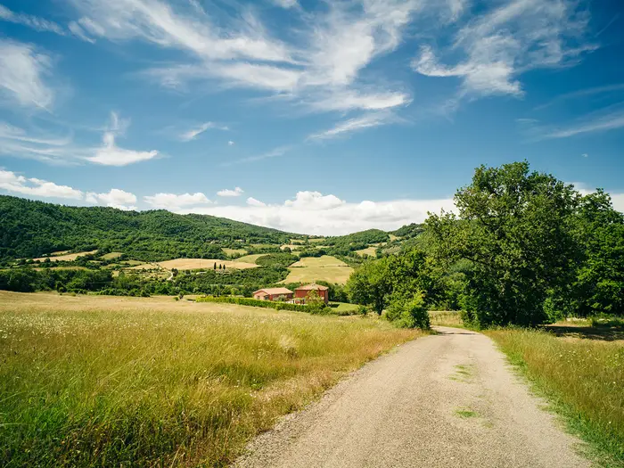
Image by IBRESTER The Via degli Dei is a classic Italian cammino linking Bologna and Firenze across the Tuscan-Emilian Apennines. It starts in Piazza Maggiore, climbs past the Portico di San Luca, then works south through river valleys, forested ridges and old mountain villages to finish in Piazza della Signoria.
Its appeal is the mix: two major art cities at either end, but several days of quiet low-mountain walking in between. The route passes places such as Monte Adone, Monzuno, Madonna dei Fornelli, Passo della Futa, Monte Gazzaro, San Piero a Sieve, Bivigliano and Fiesole.
This is a well-waymarked trail, with CAI white-red markings and Via degli Dei signage, and it suits reasonably fit walkers who want a first serious Apennine trek. The surviving slabs of the Flaminia Militare near the watershed give the walk a clear historical thread without making it feel like a museum route.
Do not underestimate it because it is popular and non-technical. Expect long 18–28 km days, repeated steep climbs and descents, hot or exposed sections, limited water on the higher ground, and mud or snow on the ridges outside the main spring and autumn seasons.
This guide covers stages, walking days, accommodation, food, transport, terrain and the common planning mistakes to avoid.
Stage-by-Stage Guide
Distances on the Via degli Dei vary slightly by variant, accommodation location and the exact line taken through Bologna and Firenze. The notes below follow the six HikeList stages from Bologna Piazza Maggiore to Firenze Piazza della Signoria; use the official GPX track, CAI white-red waymarks and Via degli Dei / VD signs for navigation on the ground.
Stage 1: Bologna Piazza Maggiore to Sasso Marconi / Badolo — approx. 21 km
The route leaves Bologna from Piazza Maggiore and immediately gives this first day an unusual start: a long urban-to-hill transition through the Portico di San Luca to the Santuario della Madonna di San Luca on Colle della Guardia. This is a steady climb rather than a remote mountain section, but it is still a real walking day once the route leaves the city and drops towards the Reno valley.
After San Luca, the route continues towards Casalecchio di Reno and then on towards Sasso Marconi and Badolo. Underfoot expect a mix of paved city walking, surfaced link sections, tracks and rural paths; the day is less wild than the later Apennine stages, but it is not just a city stroll.
The major highlight is the Portico di San Luca itself, with its long covered climb and views back over Bologna from the hill. The character changes after the sanctuary, as the city edge gives way to river-valley and foothill walking.
Food and water are easiest to manage at the Bologna end and in the settlements passed during the day, especially Casalecchio di Reno and Sasso Marconi. Do not assume every rural stretch has an open bar or fountain; refill before leaving larger places and check current water-point information before travelling.
Sasso Marconi is one of the better-served intermediate stops, with accommodation and a railway station. Badolo is a smaller hill settlement used by walkers, but beds are more limited; book ahead if ending there, especially in spring, autumn and at weekends.
Public transport back-up is strongest around Bologna, Casalecchio di Reno and Sasso Marconi. Sasso Marconi has rail access, which makes this one of the easiest stages to shorten or use as a section-walk entry point.
Navigation is generally straightforward out of Bologna, but take care not to relax too much in the built-up sections where signs can be easier to miss among street furniture and junctions. Heat can be a factor on exposed urban and foothill stretches, so start early in warm weather and carry enough water beyond the city.
Stage 2: Sasso Marconi / Badolo to Monzuno — approx. 18 km
This stage is where the Via degli Dei starts to feel more like an Apennine crossing. From the Sasso Marconi / Badolo area the route works through the foothills towards Brento and the Monte Adone area before continuing to Monzuno.
The terrain is more rugged than Stage 1, with woodland paths, dirt tracks, rural lanes and steeper ground around the Contrafforte Pliocenico. Monte Adone, passed below the summit, is the key landmark of the day, known for its sandstone pinnacles and wide views back across the Bologna plain.
Paths can be muddy after rain, particularly on woodland and clay-rich tracks. In dry weather, exposed sections around the ridges and open ground can become hot, so water management matters even though this is not the longest stage.
Brento and Monzuno are the main service points named on this stage. Food, water and opening hours should be checked before relying on any single stop, particularly outside the main walking season or late in the day.
Monzuno is a well-used walker stop and a practical end point, with accommodation in and around the village. As with the rest of the route, the available bed stock is not large enough to leave booking until arrival in busy periods.
Road access is available at the villages, and local buses serve parts of the Apennine communities, but services are not as flexible as the rail-linked valley towns. This should be checked before travelling if using Monzuno as a start, finish or bail-out point.
Waymarking is normally clear, but the combination of paths, forest roads and village lanes means a GPX track is useful for confirming turns. Allow time for the climb and descent around Monte Adone; it is a scenic section, but it should not be treated as an easy half-day if carrying a full pack.
Stage 3: Monzuno to Madonna dei Fornelli — approx. 20 km
From Monzuno the route climbs deeper into the Tuscan-Emilian Apennines, moving away from the Bologna foothills towards the higher forested ground around Madonna dei Fornelli. This is a sustained hill stage rather than a technically difficult one.
Expect mixed Apennine walking: woodland paths, dirt forest roads, grassy tracks and occasional surfaced links near settlements. The day has repeated climbing and descending, so the distance can feel harder than the number suggests.
The landscape becomes quieter and more upland in character as the route approaches Madonna dei Fornelli. This village is one of the classic Via degli Dei hubs, geared towards walkers and positioned before the high watershed stage.
Food and water planning should become more conservative from here onwards. Monzuno and Madonna dei Fornelli are the key dependable planning points for the stage; any intermediate fountains, bars or seasonal facilities should be checked before travelling.
Madonna dei Fornelli has walker-focused accommodation, including small hotels, B&Bs, agriturismi, hostels and similar options in the wider area. It is a popular overnight stop before the highest section, so advance booking is strongly advised.
Public transport options are more limited than in the valleys, with access mainly by local road and bus rather than rail. Anyone planning to leave or join the route here should check current bus times before travelling.
Navigation remains based on CAI white-red marks and Via degli Dei signage, but forest roads can create tempting wrong turns. Keep the GPX available and watch junctions carefully, particularly in poor visibility, after logging or where temporary diversions are in place.
Stage 4: Madonna dei Fornelli to Passo della Futa — approx. 18 km
This is the high watershed stage and one of the most important days of the route. From Madonna dei Fornelli the Via degli Dei climbs through beech forest towards Monte dei Cucchi, Pian di Balestra and Cima delle Banditacce, crossing the highest ground of the walk before descending towards Passo della Futa.
The stage includes the Flaminia Militare, the surviving stone slabs of the Roman military road built in 187 BC. These sections are a major highlight, but they can be uneven, slippery when wet and slower than a normal forest track.
Although the HikeList page high point is Monte Gazzaro at 1,125 m, the route also crosses higher ground here around Monte dei Cucchi and Cima delle Banditacce, reaching roughly 1,200 m. Treat this as the main upland stage: weather, temperature and visibility can be very different from the valleys.
Food and water are limited on the high forest and ridge sections. Leave Madonna dei Fornelli with enough water and food for the full day, and check current water-point availability before setting out.
Passo della Futa is the practical end point for this stage, with accommodation usually taken at or near Passo della Futa / Monte di Fò. Beds on and near the watershed are limited, so this is one of the least forgiving places to arrive without a booking.
Road access is available at Passo della Futa, a historic Apennine road pass close to the large German military cemetery and remains associated with the Gothic Line. Public transport options are not as straightforward as the rail valleys; any bus-based plan should be checked before travelling.
Navigation is usually well signed, but this is a stage where a GPX track and offline mapping are especially useful. Snow is possible on the higher ridges in winter, mud can linger after rain, and forest conditions can make waymarks harder to spot, so do not rely on signs alone in poor weather.
Stage 5: Passo della Futa to San Piero a Sieve — approx. 22 km
From Passo della Futa the route crosses the southern half of the Apennine section, passing Monte di Fò and climbing towards Monte Gazzaro before descending through Passo dell'Osteria Bruciata and Sant'Agata into the Mugello. This is another demanding day, with a significant climb followed by a long descent.
Monte Gazzaro is the landmark summit of the stage, marked by the Croce di Monte Gazzaro and known for views across both Apennine slopes. The ridge and summit area are not technical in normal conditions, but they are exposed enough to feel serious in poor weather.
After Monte Gazzaro the route turns towards Passo dell'Osteria Bruciata, a historic crossing above the Mugello, then continues down towards Sant'Agata and San Piero a Sieve. Underfoot expect woodland paths, tracks, some rougher hill sections and easier valley approaches as the route loses height.
Water and food should again be planned carefully at the start of the day. Services become more useful once the route reaches the Mugello settlements, but the higher section from Passo della Futa over Monte Gazzaro should be treated as relatively committing.
San Piero a Sieve is a strong overnight stop, with accommodation in the town and surrounding Mugello area. It is also one of the route's most useful transport points because it has a railway station.
The station at San Piero a Sieve makes this a good place to pause, leave the route or join for the final stage towards Florence. Local transport times and current rail arrangements should still be checked before travelling.
Navigation is generally straightforward if following the waymarks and GPX, but take care around ridge paths, forest junctions and the descent towards the Mugello. In wet weather, the downhill sections can be slippery and tiring, especially late in the day when legs are already fatigued.
Stage 6: San Piero a Sieve to Firenze Piazza della Signoria — approx. 31 km
The final HikeList stage is the longest and should be planned carefully. It links San Piero a Sieve with Firenze via Bivigliano, Monte Senario, Vetta le Croci and Fiesole before dropping to Piazza della Signoria in the historic centre.
The first part leaves the Mugello and climbs back into hill country towards Bivigliano and Monte Senario. The route then works through Vetta le Croci and on to Fiesole, where the final approach changes character from rural and hill walking to the descent into Florence.
This is a varied day underfoot, with tracks, paths, forest and hillside sections, surfaced links and urban walking at the Firenze end. The accumulated distance is the main difficulty; even fit walkers may prefer to split it, commonly using Bivigliano, Monte Senario or Vetta le Croci as part of a shorter final approach where accommodation and transport plans allow.
Fiesole is the major highlight before the finish, a hilltop town above Florence with Roman and Etruscan heritage and views over the city. From there the route descends towards the Arno basin and finishes in Piazza della Signoria beside Palazzo Vecchio.
Food and water options improve as the route approaches larger settlements, especially Fiesole and Florence, but the earlier hill section should still be started with enough supplies. Do not rely on every village facility being open at the exact time needed; check accommodation, food and water plans before setting out.
San Piero a Sieve has rail access, while Florence is exceptionally well connected by national and high-speed rail from Firenze Santa Maria Novella. Fiesole also gives practical road and public transport access above the city, though current local services should be checked before relying on them.
Accommodation is abundant in Florence compared with the mountain villages, but prices and availability vary sharply with season and events. If splitting the stage before Florence, book Bivigliano or other hill accommodation in advance, as capacity is far more limited than in the city.
Navigation becomes more complex near settlements because the route mixes paths, roads and urban approaches. Keep following the Via degli Dei signage and GPX all the way to Piazza della Signoria; it is easy to lose concentration after Fiesole, but the walk is not finished until the descent into central Firenze is complete.
Recommended Itinerary
Standard 6-day itinerary
This is the most practical HikeList itinerary for fit walkers who want full walking days without turning the Via degli Dei into an endurance push. Distances are approximate: use the official GPX or current mapping before booking accommodation, especially where you choose between Sasso Marconi and Badolo, or between Passo della Futa and Monte di Fò.
| Day | From | To | Approx. distance | Why this stage makes sense | Services/accommodation notes |
|---|---|---|---|---|---|
| 1 | Bologna, Piazza Maggiore | Sasso Marconi / Badolo | ~21 km | A logical opening day out of Bologna, taking in the Portico di San Luca, Santuario di San Luca and the descent towards the Reno valley. Ending around Sasso Marconi or Badolo keeps the first day substantial but not excessive. | Sasso Marconi is the more practical service hub and has a station. Badolo is smaller and puts you closer to the next Apennine section, but beds should be booked ahead. |
| 2 | Sasso Marconi / Badolo | Monzuno | ~18 km | This stage moves into more typical Apennine walking, with the route passing Badolo, Brento and below Monte Adone before continuing to Monzuno. It is shorter on paper than some later days, but the climbing makes it a real mountain stage. | Monzuno is a common overnight stop with walker-focused hospitality. If starting from Badolo rather than Sasso Marconi, check the exact day distance against the official route. |
| 3 | Monzuno | Madonna dei Fornelli | ~20 km | A steady linking day to the small mountain village that acts as the gateway to the highest forest and watershed section of the Via degli Dei. This positioning avoids making the following day too long. | Madonna dei Fornelli is geared to walkers, with lodging and food options, but it is still a small village. Book well ahead in spring, autumn and at weekends. |
| 4 | Madonna dei Fornelli | Passo della Futa | ~18 km | One of the key mountain days, crossing the high Apennine ground around Monte dei Cucchi, Pian di Balestra and Cima delle Banditacce, with stretches of the Flaminia Militare stone road. The distance is moderate, but the terrain, altitude and limited water make it demanding. | Accommodation is limited around Passo della Futa / Monte di Fò, so secure a bed before committing to this stage plan. Carry plenty of water for the high forest and ridge sections. |
| 5 | Passo della Futa | San Piero a Sieve | ~22 km | A strong but well-balanced day over Monte Gazzaro and Passo dell'Osteria Bruciata before descending through Sant'Agata into the Mugello and San Piero a Sieve. It shifts the route from high Apennine terrain into the Tuscan side of the walk. | San Piero a Sieve is a more useful valley base and has a station, making it a practical place to pause, resupply lightly or leave the route if needed. |
| 6 | San Piero a Sieve | Florence / Firenze, Piazza della Signoria | ~31 km | The longest day of this itinerary, continuing via Bivigliano, Monte Senario, Vetta le Croci and Fiesole before the final descent into Florence. It suits fit walkers who are comfortable with a long final push. | Consider splitting this day if 31 km at the end of the walk is too much. Florence has extensive accommodation, but the intermediate hill villages have more limited capacity and should be booked in advance if used. |
Slower variant: 7 days
A 7-day itinerary suits walkers who prefer shorter stages, want more margin in hot weather, or are carrying full kit. The most useful place to add a night is near the final approach to Florence, splitting the long San Piero a Sieve to Firenze stage around Bivigliano, Vetta le Croci or Fiesole depending on accommodation availability.
This variant also works well if accommodation availability forces a different stop around Sasso Marconi / Badolo or Passo della Futa / Monte di Fò. Do not assume every small village has spare beds: the mountain settlements and watershed stops are the limiting factor on this route.
Faster variant: 5 days
A 5-day Via degli Dei is possible for strong, experienced walkers who are comfortable with repeated 25 km-plus days, significant ascent and limited recovery time. It is not the best choice for a first long-distance walk, especially in warm weather or if carrying a heavy pack.
The faster version usually depends on where accommodation is available rather than on neat equal-distance stages. Before booking, check the official GPX, current lodging, water availability and any diversions, because combining stages can create very long days between small mountain villages.
Planning the Route
The Via degli Dei is easiest to plan around accommodation hubs rather than equal daily distances. The villages and passes naturally dictate the stages: Sasso Marconi or Badolo, Monzuno, Madonna dei Fornelli, Passo della Futa or Monte di Fò, San Piero a Sieve, then the final approach through Bivigliano, Monte Senario, Vetta le Croci and Fiesole into Firenze.
Most walkers should allow six days. A five-day itinerary is possible for strong walkers, but it leaves little margin for heat, mud, transport delays or a slower high-level day on the Apennine watershed. Seven days is often the more comfortable choice if you want shorter days, more time in Bologna and Firenze, or a split final approach via Bivigliano or Vetta le Croci.
Choosing a pace
| Pace | Best for | Planning implications |
|---|---|---|
| 5 days | Fit, experienced walkers travelling light | Requires longer combined days and careful booking, especially through the mountain villages. Less forgiving in hot weather or after rain. |
| 6 days | Most reasonably fit walkers | The most practical balance for the route, using the main village hubs and keeping most days around the 18–22 km range, except the longer final stage if walked in one push. |
| 7 days | Slower walkers, hot-weather trips, or anyone wanting more margin | Allows a shorter finish by breaking the San Piero a Sieve to Firenze approach around Bivigliano or Vetta le Croci, subject to available beds. |
The official route is commonly described in six walking stages, but those stage splits do not always match the most convenient overnight pattern for every walker. HikeList’s six-day version uses practical village hubs, while the official splits group some days differently, including a longer Badolo to Madonna dei Fornelli section and a split between San Piero a Sieve, Bivigliano or Vetta le Croci, and Firenze.
Stage planning and overnight stops
| Stage | Usual overnight target | Key planning issue |
|---|---|---|
| Bologna to Sasso Marconi / Badolo | Sasso Marconi or Badolo | The day starts in the city, climbs via the Portico di San Luca and Santuario di San Luca, then leaves the urban area. Decide early whether to stop lower in Sasso Marconi or continue towards Badolo. |
| Sasso Marconi / Badolo to Monzuno | Monzuno | A shorter stage on paper, but still hilly. Monte Adone and the Contrafforte Pliocenico make this more than a simple transfer day. |
| Monzuno to Madonna dei Fornelli | Madonna dei Fornelli | Accommodation should be booked ahead. Madonna dei Fornelli is a key walker hub before the highest forest and watershed section. |
| Madonna dei Fornelli to Passo della Futa | Passo della Futa / Monte di Fò | One of the most important days to prepare properly: higher ground around Monte dei Cucchi and Cima delle Banditacce, stretches of Flaminia Militare paving, forest, mud risk after rain and limited water. |
| Passo della Futa to San Piero a Sieve | San Piero a Sieve | Includes Monte Gazzaro and Passo dell’Osteria Bruciata before the descent towards Sant’Agata and the Mugello. Do not underestimate the accumulated descent. |
| San Piero a Sieve to Firenze | Firenze, or split before the city | The full stage to Piazza della Signoria is long. Many walkers planning a more relaxed schedule should look at breaking the approach around Bivigliano or Vetta le Croci. |
Beds are limited in the smaller mountain villages and around the watershed. Spring and autumn are the prime seasons, and weekends can book out early, so accommodation is the first thing to fix before committing to flights or trains.
A credenziale is useful if you plan to use pilgrim or parish hostels, as some accommodation is linked to the pilgrim system. It does not replace booking: always reserve beds in advance and check opening dates, arrival times and payment arrangements directly with the accommodation.
Where the route is least flexible
The least flexible section is the central Apennine crossing between Madonna dei Fornelli, Passo della Futa, Monte di Fò and San Piero a Sieve. This is where accommodation is more limited, water is scarcer, and weather has a bigger effect on the day.
Do not plan this part as if there will always be an easy bailout. Local buses serve some villages, but mountain services can be limited and timetables change. This should be checked before travelling.
The final approach from San Piero a Sieve to Firenze is also worth planning carefully. Walking it in one day gives a big finish into Piazza della Signoria, but splitting it makes sense for many hikers, especially in hot weather or if arriving in Firenze with onward travel the same evening.
Section hiking and shortening the walk
Section hiking is practical because both ends have excellent rail access, and some intermediate valley towns are connected by public transport. Bologna Centrale and Firenze Santa Maria Novella are linked by frequent high-speed trains, usually taking around 35–40 minutes, which makes the point-to-point logistics straightforward.
Sasso Marconi and San Piero a Sieve have stations, so they are the most useful intermediate access points for shortening or splitting the route. Other villages rely more on local buses, which makes them less dependable for tight schedules. Train and bus times should be checked before travelling.
If time is short, it is generally better to shorten the walk at a transport-connected point than to force overlong mountain stages. The central section over Madonna dei Fornelli, the Flaminia Militare, Passo della Futa and Monte Gazzaro is a major part of the route’s character, so cutting only the city approaches may be preferable if logistics allow.
Direction of travel
The classic direction is Bologna to Firenze. This gives the ceremonial start in Piazza Maggiore, the climb through the Portico di San Luca, the gradual crossing of the Apennines and a strong finish through Fiesole into Piazza della Signoria.
The route can also be walked from Firenze to Bologna. Transport works equally well in either direction, but accommodation and stage spacing still need the same advance planning.
Navigation and route variants
The trail is waymarked with white-red CAI marks and dedicated Via degli Dei / VD signage. Even so, carry the official GPX track or use the Walk+ app, with an offline map as backup. Forest roads, grassy tracks, old stone paving and village link sections can be confusing in poor weather or low light.
Distance figures vary slightly depending on exact start and finish points and variants such as the Galliano option. If using luggage transfer, booked accommodation, or public transport connections, work from the same GPX and stage plan throughout rather than mixing several distance tables.
Water, food and daily supplies
Water planning matters more than on many lowland Italian walks. The high forest and ridge sections can be water-scarce, especially between Madonna dei Fornelli, the watershed, Passo della Futa and the following high ground. Carry enough for the full day and check current water-point availability before setting out.
Food planning is straightforward in the main villages but should not be left to chance on the higher days. Buy snacks and lunch supplies before leaving larger stops such as Bologna, Sasso Marconi, Monzuno, Madonna dei Fornelli and San Piero a Sieve, especially if walking outside the busiest season.
Weather and seasonal planning
Spring and autumn are the best seasons for most walkers. They avoid the worst summer heat while usually giving more reliable conditions than winter on the higher Apennine ridges.
In hot weather, the exposed sections and long asphalt or dirt-road links can feel much harder than the distance suggests. Early starts, extra water and a realistic finish time are important.
After rain, expect mud on woodland and field paths. In winter and early spring, snow is possible on the higher ground around Monte dei Cucchi, Cima delle Banditacce, Passo della Futa and Monte Gazzaro, and conditions should be checked before relying on standard walking times.
Luggage transfer and booking order
Luggage transfer is available on the route, with operators such as Appennino Slow offering baggage transport services. Coverage, prices, cut-off times and accepted accommodation should be checked before booking.
A sensible booking order is:
- Choose a 5-, 6- or 7-day schedule.
- Secure accommodation in the smaller places first: Madonna dei Fornelli, Passo della Futa / Monte di Fò and any Bivigliano or Vetta le Croci stop.
- Then book easier transport-linked stops such as Bologna, Sasso Marconi, San Piero a Sieve and Firenze.
- Add luggage transfer only after accommodation is fixed.
- Download the GPX, check water points, and re-check transport times and any diversions shortly before departure.
Towns, Villages and Overnight Stops
Accommodation planning is one of the main constraints on the Via degli Dei. Bologna and Firenze have extensive choice, but the small Apennine villages and watershed stops have limited beds, especially around Madonna dei Fornelli, Passo della Futa and Monte di Fò. Book well ahead in spring, autumn and at weekends.
The usual overnight pattern is Bologna before the start, then Sasso Marconi or Badolo, Monzuno, Madonna dei Fornelli, Passo della Futa or Monte di Fò, San Piero a Sieve, and Florence after finishing. Bivigliano or Vetta le Croci can be used to split the long final day.
A pilgrim credential, the credenziale, is useful because it gives access to some pilgrim and parish hostels. Opening periods, check-in arrangements, meal availability and luggage-transfer acceptance should be checked before travelling.
| Place | Typical role on the route | Accommodation outlook | Transport usefulness |
|---|---|---|---|
| Bologna | Start city and pre-walk night | Very wide choice | Major rail hub; airport via Marconi Express |
| Sasso Marconi | Common first overnight | Mixed local accommodation | Station on the valley line |
| Badolo | Alternative first overnight / higher trail position | Limited village options | Less flexible than Sasso; check buses |
| Monzuno | Main Apennine overnight | Good hiker stop, but book ahead | Local bus links should be checked |
| Madonna dei Fornelli | Key mountain village | Important walker accommodation hub; limited beds | Check buses and onward logistics |
| Passo della Futa / Monte di Fò | Watershed overnight | Limited pass/rural accommodation | Check access and pick-up arrangements |
| San Piero a Sieve | Main Mugello overnight | Better valley-base option than the high villages | Station on the valley line |
| Bivigliano / Vetta le Croci | Optional final-stage split | Useful if avoiding a 31 km final day | Check buses before relying on them |
| Fiesole | Final approach above Florence | Possible stop, though many continue to Florence | Local transport to/from Florence should be checked |
| Firenze | Finish city and post-walk night | Very wide choice | Major rail hub; airport tram to Firenze SMN |
Bologna
Bologna is the official start, with the route beginning at Piazza Maggiore in the historic centre. Most walkers stay here the night before so they can start early and clear the city approach before the heat of the day.
Accommodation choice is far broader than anywhere else on the route, from hotels and hostels to apartments and guesthouses. It is also the best place to buy any missing kit, snacks or trail food before setting out.
Bologna Centrale is on the high-speed rail line, with frequent Frecciarossa and Italo trains to Firenze Santa Maria Novella taking roughly 35–40 minutes. Bologna Marconi Airport is linked to Bologna Centrale by the Marconi Express people-mover, making the city a practical start point for international walkers.
Santuario della Madonna di San Luca and Casalecchio di Reno
The first hours out of Bologna climb through the Portico di San Luca to the Santuario della Madonna di San Luca on Colle della Guardia, then continue towards the Reno valley and Casalecchio di Reno. These are route landmarks rather than normal overnight stops for a through-hike.
They are useful for pacing the first day: once past the sanctuary, the walk has properly left the city behind and begins to feel more like an Apennine crossing. Do not treat this opening section as a gentle urban warm-up only; it already adds climbing before the longer approach to Sasso Marconi or Badolo.
Sasso Marconi
Sasso Marconi is one of the standard first-night stops and sits in the Reno valley after the first day out of Bologna. It is the more practical option if transport flexibility matters, because Sasso Marconi has a station.
Accommodation is part of the route’s mixed network of B&Bs, small hotels, hostels and agriturismi, but availability should still be booked in advance. Food and resupply options are more dependable here than in the smaller high villages, though opening hours should be checked before relying on a late arrival.
Sasso Marconi is also a useful section-hiking access point. Walkers who want to shorten or skip the urban exit from Bologna can use the valley transport links, but any change to the official route should be planned carefully against the GPX.
Badolo
Badolo is an alternative first-stage stopping point beyond Sasso Marconi and is commonly used when splitting the opening part of the route. It places you better for the next day’s climb towards Brento, Monte Adone and Monzuno, but it has fewer services than Sasso Marconi.
Beds in and around Badolo are limited compared with the cities and valley towns. Book before committing to this stage split, especially if walking at a weekend or during the main spring and autumn seasons.
Badolo is less useful than Sasso Marconi for rail-based section walking. Local bus options may be possible, but timetables and stop locations should be checked before travelling.
Brento and Monte Adone
Brento sits on the approach to Monte Adone, one of the notable early high points of the Via degli Dei. This is mainly a walking-stage area rather than a main overnight hub.
The section is important because it moves the route from valley walking into the Contrafforte Pliocenico landscape, with steeper paths and more exposed terrain. Carry enough water and food for the day rather than assuming frequent services between Badolo, Brento and Monzuno.
Any accommodation or meal stop around Brento should be booked directly and checked for current opening. This is not a place to leave overnight logistics vague.
Monzuno
Monzuno is one of the most important Apennine stops on the route and is often used as the second overnight in a six-day itinerary. It sits after the Monte Adone section and before the onward walk to Madonna dei Fornelli.
The village is known as a welcoming hiker stop, with food and lodging available, but it is still a small mountain community rather than a large service town. Accommodation should be reserved in advance, and evening meals should be arranged or checked when booking.
Monzuno is a sensible place to reset after the first more rugged stages. It also helps avoid making the Badolo to Madonna dei Fornelli stretch too long for walkers following a more comfortable six-day plan.
Madonna dei Fornelli
Madonna dei Fornelli is a key mountain village on the Via degli Dei and one of the most important overnight stops. It is the gateway to the highest forest and watershed section, including Monte dei Cucchi, Pian di Balestra, Cima delle Banditacce and the Flaminia Militare Roman road slabs.
The village is geared to walkers, with food and lodging available, but beds are limited and demand can be high. This is one of the places where booking ahead matters most.
Plan the next day carefully from here. The stage towards Passo della Futa is one of the more remote-feeling parts of the route, with high beech forest, ridge ground and limited water, so carry enough water and food before leaving the village.
Passo della Futa and Monte di Fò
Passo della Futa is the historic Apennine road pass and a major staging point between Madonna dei Fornelli and San Piero a Sieve. Monte di Fò, nearby on the route corridor, is commonly used as an overnight alternative around this part of the crossing.
Accommodation here is more limited than in the larger towns, and the pass-area location means bookings should be treated as essential rather than optional. Check whether meals are available at the accommodation, as there may not be multiple fallback options within easy walking distance.
This is a practical stop for breaking the route before the southern high section over Monte Gazzaro and Passo dell’Osteria Bruciata. It also gives time to visit the area around the Futa Pass German war cemetery and the Gothic Line remains, if that fits the day’s timing.
Transport around the pass is not as straightforward as the valley towns. Any bus, taxi, luggage-transfer or pick-up arrangement should be checked before travelling.
Sant’Agata
Sant’Agata lies on the descent from Passo dell’Osteria Bruciata towards San Piero a Sieve and the Mugello. For most through-walkers it is a daytime waypoint rather than the main overnight stop.
It can be useful as a break point after the Monte Gazzaro and Osteria Bruciata section, particularly in hot weather or if the descent has been slow. Do not assume services will be open at the time you arrive; food, water and opening hours should be checked in advance.
Walkers using Sant’Agata to alter the stage plan should confirm accommodation and onward transport before committing. San Piero a Sieve is the stronger logistical base in this part of the route.
San Piero a Sieve
San Piero a Sieve is the main Mugello valley stop and a standard overnight before the final approach to Florence. It is more practical than the high villages for transport, because it has a station.
Accommodation options are part of the route’s wider mix of B&Bs, small hotels and guesthouses, and it is a sensible place to recover after the pass and ridge stages. It is also a useful resupply point before the long final day towards Bivigliano, Vetta le Croci, Fiesole and Firenze.
The town sits in Medici country, near the Fortezza di San Martino and the castles of Trebbio and Cafaggiolo, but the main planning value is logistical. If time or weather forces a change, San Piero a Sieve is one of the better places to pause, exit or restart the walk by public transport.
Bivigliano
Bivigliano is the main practical place for splitting the long San Piero a Sieve to Firenze stage. This is especially useful for walkers who do not want a final day of around 31 km or who are carrying a full pack.
Accommodation should be booked before relying on Bivigliano as an overnight stop. It is smaller than San Piero a Sieve and Firenze, so capacity is limited and a same-day search is risky in busy periods.
Using Bivigliano changes the rhythm of the end of the hike, turning the final approach into a shorter day over Monte Senario, Vetta le Croci and Fiesole. Local bus options may help with section plans, but current timetables should be checked before travelling.
Monte Senario and Vetta le Croci
Monte Senario and Vetta le Croci sit on the final approach between Bivigliano and Fiesole. They are important waypoints for walkers splitting or pacing the last stage, but they are not the main accommodation hubs of the route.
Treat this section as part of the final walking day rather than a guaranteed service corridor. Carry food and water from San Piero a Sieve or Bivigliano, depending on the stage split, and check any intended café or meal stop before relying on it.
Vetta le Croci can be used as a practical break point in some itineraries, especially where local transport or accommodation has been arranged. This should be checked before travelling.
Fiesole
Fiesole is the hilltop town above Florence and the last major place before the descent to Piazza della Signoria. Many walkers pass through and continue to Firenze the same day, but it can also work as a final overnight if accommodation in Florence is expensive or if a shorter finishing day is preferred.
The town is useful for food, rest and regrouping before the urban descent into Florence. It also offers a clear psychological marker: once Fiesole is reached, the Apennine crossing is effectively complete and the route drops towards the Arno and the city centre.
Local transport between Fiesole and Florence may be useful for non-walkers, bad weather, late arrivals or section-hiking, but current services should be checked before relying on them.
Firenze (Florence)
The trail finishes in Firenze at Piazza della Signoria, beside the Palazzo Vecchio. Most walkers stay at least one night after finishing, both to avoid rushing the final descent and to make onward rail travel simple.
Accommodation choice is extensive, but Florence is busy and prices can rise sharply in peak periods. Booking ahead is still sensible, particularly if arriving at the weekend or during major travel seasons.
Firenze Santa Maria Novella is on the high-speed rail line, with frequent services back to Bologna Centrale in roughly 35–40 minutes. Florence Amerigo Vespucci Airport is linked to Firenze SMN by tram line T2, making Firenze a straightforward finish point for onward travel.
Getting to the Start
By train
For the usual south-bound walk, travel to Bologna Centrale and start from Piazza Maggiore in Bologna’s historic centre. Bologna is on Italy’s high-speed Alta Velocità rail network, so it is one of the easiest Italian trailheads to reach without a car.
The most useful onward/return link is Bologna Centrale ⇄ Firenze Santa Maria Novella (Firenze SMN), served by frequent Frecciarossa and Italo trains taking roughly 35–40 minutes. This makes the point-to-point logistics straightforward: walk to Florence, then return to Bologna by train if needed.
Allow enough time on arrival in Bologna to get from Bologna Centrale to Piazza Maggiore, especially if starting the first stage the same day. Local transport, taxis and central accommodation can all work, but current urban transport options and train times should be checked before travelling.
By bus
Buses are generally a secondary option for reaching the start because Bologna has such strong rail links. They are more useful for short local transfers within the city, or for connecting between accommodation and the historic centre before starting.
If using a city bus to reach Piazza Maggiore or to position yourself near the first section towards the Portico di San Luca, check the current route, stop location and ticketing before travelling. Local bus timetables can change, and the first walking day is long enough that a delayed start is worth avoiding.
By car
Driving is possible, but it is rarely the simplest option for this route. The Via degli Dei is a point-to-point walk from Bologna to Firenze, so leaving a car at the start means returning from Firenze SMN to Bologna Centrale by train after finishing.
If arriving by car, arrange parking before the trip rather than looking for it on the morning of departure. Long-stay parking availability, central access rules and hotel parking arrangements should be checked before travelling.
A practical approach is to stay in Bologna the night before, leave the car in pre-arranged parking, walk to Florence, then take the high-speed train back to Bologna. For walkers on a tight schedule, a taxi between parking or accommodation and Piazza Maggiore may be simpler than trying to navigate the city with a full pack.
From the nearest airport
The nearest airport for the start is Bologna Guglielmo Marconi Airport (BLQ). It is linked to Bologna Centrale by the Marconi Express people-mover, making it a convenient fly-in option for walkers starting in Bologna.
From Bologna Centrale, continue to Piazza Maggiore by local city transport, taxi or by positioning yourself in central accommodation the night before. Marconi Express operating times, flight arrivals and onward city transport should be checked before travelling.
Florence Amerigo Vespucci Airport (FLR) is more relevant if combining the hike with travel from the finish or if flying into Florence first. FLR is linked to Firenze SMN by tram line T2, and Firenze SMN has fast rail connections to Bologna Centrale.
Where to stay before starting
The most convenient pre-walk base is central Bologna, close enough to reach Piazza Maggiore without a complicated morning transfer. This is especially useful if beginning the full first stage to Sasso Marconi / Badolo, as the route starts immediately from the city centre before heading out towards the Portico di San Luca and the Santuario della Madonna di San Luca.
Staying near Bologna Centrale can also work well if arriving late by train or from the airport, but allow time in the morning to reach the official start at Piazza Maggiore. If using luggage transfer, pilgrim-hostel accommodation or a credential arrangement from day one, organise those details before arrival rather than at the start line.
Bologna has far more accommodation choice than the smaller Apennine villages later on the route, but weekends and busy travel periods can still push prices up. Book the pre-walk night early if starting in spring or autumn, when the Via degli Dei is most popular.
Getting Home from the Finish
The Via degli Dei finishes in Florence (Firenze) at Piazza della Signoria, in the historic centre beside Palazzo Vecchio. For most walkers, onward travel is straightforward: head across the city centre to Firenze Santa Maria Novella (Firenze SMN), the main station for high-speed and regional trains.
By train
Firenze SMN is the key departure point after finishing the trail. Bologna Centrale is directly linked to Firenze SMN by frequent Frecciarossa and Italo high-speed trains, with typical journey times of roughly 35–40 minutes, so returning to the start city is simple if luggage, accommodation or onward transport is in Bologna.
This is the easiest option for most point-to-point logistics. If finishing in time for an evening train, it is perfectly realistic to return to Bologna the same day, but current train times and seat availability should be checked before committing to non-refundable accommodation or flights.
Regional trains also make Firenze SMN useful for onward travel within Tuscany and beyond, but exact routes and timings are timetable-dependent. Allow extra margin if the final stage from San Piero a Sieve to Florence has taken longer than expected, as it is a long last day.
By bus
Local buses operate in and around Florence, and may be useful for short movements within the city or from the Fiesole side before the final descent. For leaving Florence after completing the route, however, rail is usually the more practical choice because Firenze SMN has fast, frequent onward connections.
Bus routes, stops and evening frequencies change over time and should be checked before travelling, especially if finishing late or staying outside the historic centre.
By car/taxi
A car is not needed to leave the finish. If a vehicle has been left in Bologna, the fastest practical return is normally by train from Firenze SMN to Bologna Centrale rather than by road transfer.
Taxis are useful for tired walkers moving between Piazza della Signoria, accommodation, Firenze SMN or Florence Airport. If arranging a private pick-up, agree a clear meeting point in advance; the finish is in the busy historic centre, where access and stopping points may be awkward. This should be checked before travelling.
From the nearest airport
Florence Amerigo Vespucci Airport (FLR) is the nearest airport for the finish. It is linked to Firenze SMN by tram line T2, making it convenient for flights out after the walk.
Bologna Marconi Airport (BLQ) is also practical because Bologna Centrale and Firenze SMN are connected by fast high-speed trains. From Bologna Centrale, the Marconi Express people-mover links to the airport.
For same-day flights, build in a generous buffer. The last stage into Florence is long, and heat, mud, navigation delays or a slow descent from Fiesole can easily make a tight airport connection stressful.
Where to stay at the finish
Staying overnight in Florence is the safest plan if the final walking day is long, if transport connections are late in the day, or if flights are booked for the following morning. It also avoids rushing the final descent from Fiesole into Piazza della Signoria.
Florence has far more accommodation choice than the small Apennine villages along the route, but it is a major visitor city and rooms can still book out or become expensive in busy periods. Book ahead for spring and autumn, weekends and holiday periods.
If returning to Bologna the same evening, choose a finish-day plan that leaves enough time to reach Firenze SMN, collect any stored luggage if needed, and board the train without relying on the final departure of the night.
Which Direction Should You Walk?
The Via degli Dei is normally walked southbound from Bologna to Florence (Firenze). This is the classic direction: Piazza Maggiore, the Portico di San Luca, the Apennine crossings, the Mugello, Fiesole and finally Piazza della Signoria.
It can be walked in reverse, but most independent hikers should choose Bologna to Florence unless accommodation availability or travel plans make the opposite direction more convenient.
Bologna to Florence: the standard direction
Southbound gives the route its best natural progression. You leave Bologna on foot from Piazza Maggiore, climb through the Portico di San Luca to the Santuario di San Luca, then move gradually from city edge into the Reno, Setta and Savena valleys before reaching the higher Apennine sections around Madonna dei Fornelli, Monte dei Cucchi, Pian di Balestra and Passo della Futa.
The second half then feels like a proper crossing into Tuscany: Monte Gazzaro, Passo dell’Osteria Bruciata, Sant’Agata, San Piero a Sieve, Bivigliano, Monte Senario and Fiesole, before the final descent into Florence. Finishing in Piazza della Signoria gives the walk a strong psychological end point, especially after several days of forest, ridges and small mountain villages.
This direction also suits the usual accommodation rhythm. The common overnight hubs — Sasso Marconi or Badolo, Monzuno, Madonna dei Fornelli, Passo della Futa or Monte di Fò, San Piero a Sieve and Bivigliano/Vetta le Croci — are arranged around the southbound stage pattern most walkers use.
Florence to Bologna: when the reverse makes sense
Walking northbound is perfectly feasible. The waymarking and GPX route can be followed in either direction, and transport at both ends is excellent, with Bologna Centrale and Firenze Santa Maria Novella linked by frequent high-speed trains taking roughly 35–40 minutes.
The reverse direction may be useful if beds are unavailable in the standard southbound sequence, if flights or trains work better into Florence, or if section-walking from the Tuscan side is more convenient. San Piero a Sieve and Sasso Marconi also have stations, so shorter sections can be arranged from either end where public transport timings fit. This should be checked before travelling.
The main drawback is the feel of the journey. Starting in Florence means leaving one of the route’s strongest finish points on day one, climbing out towards Fiesole and the northern Tuscan hills rather than ending with the descent into the city. The final approach to Bologna is still rewarding, especially via the Santuario di San Luca and the Portico di San Luca, but most walkers find Florence the more satisfying finish.
Are the climbs easier one way?
There is no genuinely “easy” direction. The route is a hard Apennine crossing with long days, repeated climbs and descents, and roughly several thousand metres of cumulative ascent depending on measurement method.
Southbound has a useful sense of build-up: the early stages out of Bologna lead progressively towards Monzuno, Madonna dei Fornelli and the higher watershed, rather than beginning with the long Tuscan approach straight out of Florence. Northbound simply reverses the effort — steeper descents become climbs, and climbs become descents.
The final southbound day from San Piero a Sieve to Florence is long if walked in one stage, so some hikers split it around Bivigliano or Vetta le Croci. In reverse, that same section becomes a demanding opening day unless the itinerary is adjusted.
Weather and exposure
There is no strong reason to choose direction based on prevailing wind. The more important planning factors are season, heat, mud, water and possible snow on the higher ridges out of season.
In either direction, the higher forest and ridge sections around Madonna dei Fornelli, Monte dei Cucchi, Pian di Balestra, Passo della Futa and Monte Gazzaro need early starts in warm weather and enough water between reliable resupply points. Water-point availability should be checked before travelling.
Recommendation
Walk Bologna to Florence unless there is a specific logistical reason not to. It is the traditional and most common direction, fits the usual stage flow, builds naturally into the Apennines, and gives the route its strongest finish: the descent from Fiesole into Florence and the arrival at Piazza della Signoria.
Accommodation Along the Route
The Via degli Dei is a practical inn-to-inn walk, but it is not a route where beds can always be found at short notice. Bologna and Firenze have the depth of accommodation expected of major cities, while the Apennine villages and watershed stops rely on a much smaller mix of B&Bs, agriturismi, small hotels, ostelli, rifugi and parish or pilgrim hostels.
Booking ahead is strongly recommended, especially in spring and autumn, at weekends, and for any night in Madonna dei Fornelli, Passo della Futa, Monte di Fò, Bivigliano or other small mountain settlements. These are the pressure points on the route: there may be only a small number of suitable walker-friendly beds, and the next realistic stop can be a long way on tired legs.
A credenziale can be useful because some pilgrim or parish hostels may require it or give priority to walkers carrying one. Hostel opening dates, check-in arrangements and whether a credenziale is needed should be checked before travelling.
Best overnight stops
Most walkers use a village-hub pattern built around Sasso Marconi or Badolo, Monzuno, Madonna dei Fornelli, Passo della Futa or Monte di Fò, San Piero a Sieve, and then either Bivigliano/Vetta le Croci or Firenze depending on how the final stage is split.
Sasso Marconi and San Piero a Sieve are the easiest intermediate bases because they sit in valley towns with rail access. They are useful if the walk needs to be shortened, restarted, or linked with public transport.
Monzuno and Madonna dei Fornelli are classic Apennine walking stops with services geared to Via degli Dei walkers. They are also places to book early, because they sit at natural stage ends and become busy when many walkers are moving on the same schedule.
Passo della Futa and Monte di Fò are the most sensitive accommodation points. This watershed area is a logical stop between Madonna dei Fornelli and the Mugello, but choice is more limited than in the towns, and a full night here can disrupt a six-day plan if no bed is available.
Accommodation by place
| Place | Accommodation level | Best for | Notes |
|---|---|---|---|
| Bologna | Good | Pre-walk night, late arrival, travel logistics | The official start is Piazza Maggiore. Staying centrally makes the first morning straightforward before heading towards the Portico di San Luca. |
| Sasso Marconi | Good | First overnight stop, section-walking, public transport access | A practical first-stage base with a station. Useful if skipping a night in the smaller hillside hamlets. |
| Badolo | Limited | A quieter first-night stop closer to the hills | Works for walkers following the official-style first stage, but beds are fewer than in Sasso Marconi. Book ahead. |
| Brento / Monte Adone area | Limited | Breaking up the early Apennine section | Suitable only if accommodation is arranged in advance. Do not assume a bed will be available on arrival. |
| Monzuno | Good | Main overnight hub between Sasso Marconi/Badolo and Madonna dei Fornelli | A popular walking stop with hospitality geared to the route. Weekend and high-season pressure can be significant. |
| Madonna dei Fornelli | Good but finite | Key stop before the highest forest and Roman-road section | One of the most important booking points on the route. It is a small mountain village, so availability can disappear quickly. |
| Pian di Balestra / Cima delle Banditacce / Monte dei Cucchi | None | Not an overnight base | High forest and ridge walking rather than a service hub. Plan to sleep before or after this section, normally Madonna dei Fornelli and Passo della Futa/Monte di Fò. |
| Passo della Futa | Limited | Watershed overnight before descending towards the Mugello | A strategic but capacity-limited stop. Book early and check current opening arrangements before relying on it. |
| Monte di Fò | Limited | Alternative or companion stop to Passo della Futa | Useful if Passo della Futa is full or if the day’s stage is adjusted. Availability should be checked before travelling. |
| Sant'Agata | Limited | Possible stop on the descent towards San Piero a Sieve | Can help shorten the day from Passo della Futa, but should not be treated as a guaranteed accommodation hub without a booking. |
| San Piero a Sieve | Good | Main Mugello overnight, section access, recovery after the high ground | A strong practical base with a station and better onward options than the smaller mountain stops. |
| Bivigliano | Limited | Splitting the long final approach to Firenze | Useful for avoiding an overlong San Piero a Sieve to Firenze day. Book ahead, especially if walking at the same time as other cammino groups. |
| Vetta le Croci | Limited | Final-stage split before Fiesole and Firenze | Treat as a small stopping area rather than a town with broad choice. This should be checked before travelling. |
| Fiesole | Limited to moderate | Last short overnight before descending into Firenze | A possible final halt above the city if the last day is being split. Firenze offers far more choice. |
| Firenze | Good | Finish night, rail connections, onward travel | The trail finishes at Piazza della Signoria. Booking ahead is still sensible because city accommodation can be expensive or busy in peak periods. |
Booking strategy
For a normal six-day itinerary, book the mountain middle of the route first: Monzuno, Madonna dei Fornelli, Passo della Futa or Monte di Fò, and Bivigliano if using it. Bologna, Sasso Marconi, San Piero a Sieve and Firenze generally offer more flexibility, but the whole route is easier once every overnight stop is fixed.
Avoid building a plan that depends on simply walking on to the next village if a bed is full. On this route, the next accommodation may mean another long climb, a road transfer, or an unrealistic end to an already hard day.
If a natural stop is full, luggage transfer or a pre-arranged taxi transfer can solve the gap by moving you to accommodation off the line and returning you the next morning. Companies such as Appennino Slow offer luggage transfer on the Via degli Dei, and accommodation providers may be able to advise on local taxi options. Current transfer coverage, pick-up rules and booking deadlines should be checked before travelling.
Does it work for inn-to-inn walkers?
Yes. The Via degli Dei is well suited to walkers who want a bed each night rather than camping, and the established network of B&Bs, agriturismi, ostelli, rifugi and small hotels is one reason the route is popular.
The main limitation is capacity, not suitability. A comfortable inn-to-inn trip depends on booking early, carrying the credenziale where hostel access may depend on it, and keeping the daily stages realistic for the available beds rather than forcing accommodation to fit an over-ambitious schedule.
Camping and Wild Camping
The Via degli Dei is not best planned as a classic campsite-to-campsite walk. Most hikers use B&Bs, agriturismi, small hotels, ostelli, rifugi and parish or pilgrim hostels in places such as Sasso Marconi, Monzuno, Madonna dei Fornelli, Passo della Futa/Monte di Fò, San Piero a Sieve and Bivigliano.
Camping can be possible as a personal style of travel, but it needs more advance checking than accommodation-based walking. Do not assume there will be convenient campsites at each normal stage end, and do not build an itinerary around camping unless current campsite locations, opening dates and access rules have been checked before travelling.
Wild camping rules and practical reality
Wild camping should not be treated as a default option on this route. The Via degli Dei crosses a mix of farmland, forest tracks, village edges, Apennine passes and privately managed land, and local rules can vary between municipalities, provinces and regions as the trail passes from Emilia-Romagna into Tuscany.
If considering a tent outside an official campsite or established accommodation, permission should be sought from the landowner or from the place providing services nearby. Where rules are unclear, they must be checked locally before pitching. Camping discreetly without permission is not something to rely on for a multi-day itinerary.
The least appropriate areas for camping are the urban start and finish around Bologna and Florence, village centres, farmland, signed private land, and sensitive or heavily used sections such as around Monte Adone, the Flaminia Militare slabs, Passo della Futa, Monte Gazzaro, Fiesole and the approaches to Firenze.
Where camping makes most sense
If carrying camping gear, the most practical approach is to use recognised campsites or accommodation that explicitly allows tents, where available. The villages and stage hubs are the places to investigate first, especially Sasso Marconi/Badolo, Monzuno, Madonna dei Fornelli, Passo della Futa/Monte di Fò, San Piero a Sieve and Bivigliano.
The high Apennine section between Madonna dei Fornelli, Pian di Balestra, Cima delle Banditacce, Passo della Futa and Monte Gazzaro is attractive on paper, but it is not an easy place to improvise. Water is limited, weather can change quickly, and snow or mud can affect the higher ridges outside the main season.
For most walkers, a lighter pack and booked beds make the route safer and more enjoyable. Camping gear adds weight on a route already demanding because of long 18–28 km stages, repeated steep climbs and descents, and limited water on the high forest sections.
Water, food and stove use
Water planning is the main camping issue on the Via degli Dei. The route has reliable services in towns and villages, but the higher forest and ridge sections can be water-scarce, so do not depend on finding water near a potential pitch.
Carry enough water from the last known village or service point, especially between Monzuno, Madonna dei Fornelli, the watershed, Passo della Futa and the descent towards Sant'Agata and San Piero a Sieve. Water-point availability should be checked before travelling.
Open fires should be avoided. In hot, dry weather the Apennines can be fire-prone, and local fire restrictions may apply. If using a stove, keep it small, stable and away from dry grass or leaf litter, and check any local restrictions before relying on it.
Leave No Trace expectations
Any permitted camping should be low-impact: arrive late, leave early, keep noise down, and leave no visible trace. Pack out all rubbish, including food scraps and toilet paper.
Do not camp on Roman road remains, cultivated land, village greens, track junctions, viewpoints, or beside religious sites and monuments. Use toilets in villages and accommodation wherever possible; if none are available, human waste must be buried well away from paths, water sources and buildings.
Seasonal considerations
Spring and autumn are the best seasons for the Via degli Dei, but they are also popular, so any campsite or tent-friendly accommodation should be booked or checked well ahead. Weekends can be especially busy in the smaller mountain villages.
Summer camping can be uncomfortable because some sections are hot, exposed and dry, while water is limited on the higher ground. Winter camping is a poor fit for most walkers because snow is possible on the higher ridges and mud can make the forest tracks harder work.
Food, Water and Resupply
The Via degli Dei is not a wilderness trek, but it does have several long rural and high-forest sections where food and water cannot be assumed. Bologna, Sasso Marconi, Monzuno, Madonna dei Fornelli, San Piero a Sieve, Fiesole and Firenze are the most useful resupply points; the smaller passes and hamlets should be treated as places to stay or eat only if arrangements have been checked in advance.
Plan each walking day with lunch already in the pack unless there is a known open bar, café or shop on that specific stage. Italian rural opening hours can be short, with afternoon closures, seasonal variation and reduced Sunday or public-holiday service. This should be checked before travelling, especially outside the main spring and autumn walking seasons.
Food resupply
Bologna and Firenze have full city services, so start the walk with snacks, lunch supplies and any specialist food already bought. Sasso Marconi and San Piero a Sieve are the most practical intermediate resupply towns because they sit in the valleys and have transport links as well as accommodation.
Monzuno and Madonna dei Fornelli are key walker stops, but they are still small Apennine villages. Do not arrive late expecting a full choice of shops or meals without having checked accommodation meals, local restaurants or opening hours.
The watershed section between Madonna dei Fornelli, Pian di Balestra, Cima delle Banditacce, Passo della Futa and Monte di Fò is the section where self-sufficiency matters most. Carry a full lunch, snacks and enough water before leaving Madonna dei Fornelli.
On the southern half, the descent from Passo della Futa over Monte Gazzaro and Passo dell’Osteria Bruciata towards Sant’Agata and San Piero a Sieve is another stage where food should be carried from the start. The final day from San Piero a Sieve to Firenze is long in the HikeList 6-day schedule, so it is worth carrying enough food to avoid depending on a mid-stage stop.
Water
Water is the main practical constraint on the Via degli Dei. The route has village fountains, accommodation refills and café/bar stops in settled areas, but the higher forest and ridge sections can be water-scarce, particularly in warm weather.
A typical starting load should be at least 2 litres per person, with more on hot days and on the high stages from Madonna dei Fornelli to Passo della Futa and from Passo della Futa to San Piero a Sieve. Many walkers will be more comfortable carrying 2.5–3 litres on these sections if temperatures are high or if reliable water points have not been checked.
Do not rely on streams or unmarked natural sources. If natural water is used, it should be filtered or treated, but the safer plan is to refill from accommodation, public fountains and staffed businesses where available. Current water-point availability should be checked before travelling, as fountains and seasonal sources may be dry or turned off.
| Section | Food availability | Water availability | Notes |
|---|---|---|---|
| Bologna → Sasso Marconi / Badolo | Excellent at the start in Bologna; useful resupply at Sasso Marconi. Limited once the route has left the city and climbed towards the hills. | Easy to start full in Bologna; refill opportunities are more limited after leaving the urban area. | Buy the first day’s lunch before leaving Bologna unless a specific stop has been checked. The climb via the Portico di San Luca is exposed in hot weather. |
| Sasso Marconi / Badolo → Monzuno | Food is best organised at the start or in Monzuno. Do not rely on finding frequent open services between smaller places such as Badolo, Brento and the Monte Adone area. | Carry enough from the start; refill only where confirmed in villages or accommodation. | A full packed lunch is sensible. This stage crosses rural Apennine terrain with long gaps between dependable services. |
| Monzuno → Madonna dei Fornelli | Monzuno and Madonna dei Fornelli are the key service points. Mid-stage options should not be assumed. | Start full in Monzuno and refill at the end in Madonna dei Fornelli. | Madonna dei Fornelli is geared to walkers, but beds and meals should still be booked ahead in busy periods. |
| Madonna dei Fornelli → Passo della Futa / Monte di Fò | Limited. Carry lunch and snacks from Madonna dei Fornelli. Services around Passo della Futa or Monte di Fò depend on what is open and booked. | One of the most important water-carry sections. The high forest and watershed around Monte dei Cucchi, Pian di Balestra and Cima delle Banditacce can be water-scarce. | Start with plenty of water. This is the main high-level stage, with the Flaminia Militare slabs and Apennine watershed; do not count on casual resupply. |
| Passo della Futa / Monte di Fò → San Piero a Sieve | Limited until the route descends towards Sant’Agata and San Piero a Sieve. Carry food from the start. | Carry enough for the climb and ridge over Monte Gazzaro and the descent past Passo dell’Osteria Bruciata. Refill where confirmed in settlements. | Another long, exposed-feeling day in warm weather. San Piero a Sieve is the main practical resupply point at the end of the stage. |
| San Piero a Sieve → Firenze via Bivigliano, Monte Senario, Vetta le Croci and Fiesole | Good at the start in San Piero a Sieve and at the finish in Firenze; Fiesole is the most useful late-stage town. Mid-stage food should be checked rather than assumed. | Start full in San Piero a Sieve. Refill where confirmed in villages, accommodation or staffed services; do not rely on natural sources. | This is the longest HikeList day at about 31 km. Carry enough food and water to complete the stage comfortably if intermediate stops are closed. |
Terrain, Conditions and Difficulty in Practice
The Via degli Dei is not technically difficult, but it is physically hard in practice. The route is a repeated sequence of Apennine climbs and descents, with long walking days, limited water on the higher sections, and enough asphalt, mud, heat and uneven stone to punish poor pacing or overloaded packs.
Expect roughly 3,800–5,000 m of cumulative ascent depending on how it is measured. That matters more than the modest altitudes: the trail repeatedly drops into valleys and climbs back to ridges, so fatigue builds across the week rather than arriving in one single mountain day.
Underfoot: tracks, forest paths, asphalt and Roman stone
Most of the walking is on low-mountain terrain: woodland paths, field edges, dirt forest roads, grassy tracks, farm tracks and short road or asphalt link sections. The route is well waymarked with CAI white-red markings and Via degli Dei / VD signage, but the surfaces change often enough that footwear and foot care matter.
The Flaminia Militare section near the watershed between Pian di Balestra and the Emilia–Tuscany border is one of the most distinctive parts of the walk. The surviving Roman stone slabs are historic rather than technical, but they can be uneven, tiring underfoot and slippery when wet.
There is some asphalt, especially on access sections into and out of towns, villages and passes. This is not a road-walk overall, but hard surfaces can still aggravate feet late in the day, particularly on a 5–6 day schedule.
Climbs, descents and the hardest walking
The difficulty comes from sustained effort rather than exposure or scrambling. There are no technical mountain sections in normal conditions, but the route includes steep climbs and descents through the Tuscan-Emilian Apennines, with long days commonly around 18–28 km and a longer final push if walking San Piero a Sieve to Firenze in one stage.
The higher central section from Madonna dei Fornelli towards Monte dei Cucchi, Pian di Balestra, Cima delle Banditacce and Passo della Futa is usually the most mountain-like part of the route. This is where the trail reaches its highest ground, around Cima delle Banditacce at roughly 1,204 m, despite Monte Gazzaro at 1,125 m being the most prominent named summit of the southern half.
Monte Gazzaro and the crossing towards Passo dell'Osteria Bruciata add another demanding ridge-and-descent stage before the route drops towards Sant'Agata and San Piero a Sieve. By this point, accumulated fatigue is often more important than the height of any single climb.
Mud, heat, snow and seasonal conditions
After rain, woodland paths, grassy tracks and dirt roads can become muddy. The route is not primarily a boggy trail, but wet clay, leaf litter and churned forest tracks can slow progress and make descents more tiring.
In warm weather, the open ridges, meadows and exposed link sections can be hot and shadeless. Water is scarce on parts of the higher forest and ridge stages, so the harder days should be treated as water-planning days rather than simply distance-planning days.
Winter changes the character of the walk. Snow is possible on the higher ridges and passes, particularly around the central Apennine watershed and the Monte Gazzaro area, and mud can persist in shaded woodland. In those conditions the route may require winter judgement rather than ordinary cammino pacing.
Spring and autumn are the most practical seasons for most walkers, but neither is automatically easy. Spring can bring mud after rain; autumn days can be shorter; and popular accommodation periods mean walkers may have less flexibility to shorten or rearrange stages at short notice.
Stage-by-stage terrain feel
| Section | Terrain and practical difficulty |
|---|---|
| Bologna to Sasso Marconi / Badolo | Starts urban from Piazza Maggiore, then climbs to the Portico di San Luca and Santuario di San Luca before moving into hill and valley terrain. The early ascent is straightforward but sets the tone: this is a walking route with climbing from the first day, not a flat approach. |
| Sasso Marconi / Badolo to Monzuno | More rural Apennine terrain, with climbs towards the Monte Adone area and village-to-village walking through paths, tracks and some road links. The sandstone landscape around Monte Adone is a highlight, but the route remains non-technical. |
| Monzuno to Madonna dei Fornelli | A sustained approach into the higher Apennines. The difficulty is the steady gain, forest walking and the need to arrive with enough energy for the more remote watershed stage that follows. |
| Madonna dei Fornelli to Passo della Futa | One of the key mountain stages, crossing the highest ground via Monte dei Cucchi, Pian di Balestra and Cima delle Banditacce, with forest, ridge terrain and the Flaminia Militare stone slabs. Expect uneven footing, possible mud, fewer services and more exposure to weather. |
| Passo della Futa to San Piero a Sieve | A demanding descent-stage by way of Monte di Fò, Monte Gazzaro, Passo dell'Osteria Bruciata and Sant'Agata. The climbing is still significant, but the long descent towards the Mugello can be just as hard on knees and feet. |
| San Piero a Sieve to Firenze | A long final day if walked in one, passing through Bivigliano, Monte Senario, Vetta le Croci and Fiesole before descending into Firenze. The terrain becomes more settled near the city, but the distance and final descent make this a serious finishing stage rather than a ceremonial stroll. |
What makes it easier or harder
The route feels easier for walkers who travel light, book stages that avoid very long final days, and start early on hot or water-scarce sections. Luggage transfer can reduce the physical load, but the walking itself still includes repeated climbs, rough paths and long descents.
It feels harder when accommodation availability forces uneven stages, when rain turns forest tracks muddy, or when heat makes exposed ridges and asphalt links slow. The waymarking and village infrastructure make the Via degli Dei approachable, but they do not remove the need for proper mountain-walking fitness, reliable footwear, sun protection and enough water capacity.
Weather and Best Time to Walk
The Via degli Dei is best planned for spring or autumn. These seasons give the most workable balance of walking temperatures, daylight and open accommodation, while avoiding the worst of the summer heat and the higher risk of winter snow on the Apennine watershed.
This is not a high-alpine route, but it is still a serious low-mountain crossing. The trail reaches Monte Gazzaro at about 1,125 m and crosses even higher ground around Monte dei Cucchi, Pian di Balestra and Cima delle Banditacce, where conditions can be noticeably colder, wetter and windier than in Bologna or Firenze.
Seasonal conditions
| Season | What to expect | Planning advice |
|---|---|---|
| Spring | Generally one of the best times to walk. Woodland paths, forest roads and field tracks may be muddy after rain, especially on the Apennine stages. | Book beds early, particularly in small villages such as Monzuno, Madonna dei Fornelli and around Passo della Futa / Monte di Fò. Carry waterproofs and avoid assuming water points will always be reliable. |
| Summer | Heat is the main issue. Some sections are exposed and shadeless, and water can be scarce on the high forest and ridge stages. | Start early, carry plenty of water, and be realistic about long days such as San Piero a Sieve to Firenze. Heat can make the 18–28 km stages feel much harder than the distance suggests. |
| Autumn | Another prime season, with generally more comfortable walking conditions than summer. Rain can make woodland paths and the ancient stone slabs of the Flaminia Militare slippery. | Accommodation is in demand in autumn high season and at weekends, so book ahead. Pack for cool mornings and unsettled weather on the watershed. |
| Winter | Snow is possible on the higher ridges, especially around the Madonna dei Fornelli to Passo della Futa section and the Monte Gazzaro area. Mud, cold rain and short daylight make the route much more committing. | Winter is not the normal choice for this cammino unless you are equipped for snow, navigation in poor visibility and flexible stage changes. Check accommodation opening and current trail conditions before travelling. |
Heat, water and exposed sections
Summer heat is the most common reason the Via degli Dei feels harder than expected. The route has long climbs and descents, and some hot, exposed sections with limited shade. Water is also scarce on parts of the higher forest and ridge sections, so do not rely on frequent refills between villages.
The most important planning point is to carry enough water for the full stage, especially between Madonna dei Fornelli and Passo della Futa, and over the Passo della Futa to San Piero a Sieve stage via Monte Gazzaro and Passo dell’Osteria Bruciata. Water-point availability should be checked before travelling.
Rain, mud and underfoot conditions
After rain, expect mud on woodland paths, field tracks and dirt forest roads. The surviving Roman road slabs of the Flaminia Militare near the watershed can also be slippery when wet, so footwear with reliable grip matters more than lightweight city trainers.
Bad weather is most consequential on the higher Apennine stages, where mist, low cloud or cold wind can make navigation and temperature management more difficult. The route is waymarked with CAI white-red marks and Via degli Dei signage, but a GPX track or the official navigation app is still sensible in poor visibility.
Snow and winter realism
Snow on the higher ridges is possible in winter, particularly around the Apennine watershed between Madonna dei Fornelli, Monte dei Cucchi / Cima delle Banditacce, Passo della Futa and Monte Gazzaro. These sections are not technically alpine in normal conditions, but snow can hide the path, slow progress and turn a long stage into a much more serious day.
A winter crossing is therefore only realistic with the right equipment, short-day planning and the willingness to alter or abandon stages if conditions deteriorate. Accommodation and services in small mountain villages may also be more limited outside the main walking seasons. This should be checked before travelling.
Daylight and stage timing
The Via degli Dei is commonly walked in 5–6 days, with repeated 18–28 km stages and about 5,000 m of cumulative ascent by the route’s official figure. In winter and the darker shoulder periods, late starts leave little margin for mud, navigation delays or slower descents.
The final HikeList stage from San Piero a Sieve to Firenze is especially long at about 31 km. In hot weather, start early to avoid the worst afternoon heat; in short-day conditions, consider whether your itinerary needs to be split or adjusted.
Accommodation seasonality
Spring and autumn are the best walking seasons, but also the busiest periods for beds in the small villages and on the watershed. Places such as Madonna dei Fornelli, Passo della Futa / Monte di Fò and Bivigliano have limited capacity compared with Bologna or Firenze.
Book well ahead for weekends and peak walking periods. Seasonal opening of hostels, rifugi and parish accommodation should be checked before travelling, especially outside spring and autumn.
Safety Notes
The Via degli Dei is a well-waymarked, non-technical Apennine walk, but it is still a hard multi-day route with long stages, repeated climbs and descents, and some isolated forest and ridge sections. Most safety issues come from heat, poor water planning, tiredness on long days, mud or snow out of season, and short stretches on asphalt or minor roads.
Emergency help
Italy uses 112 as the single European emergency number. Save it before starting, and keep your accommodation details and the next village or pass written down somewhere accessible in case a phone battery fails.
Mobile coverage should not be treated as guaranteed in the higher wooded sections of the Appennino Tosco-Emiliano. Download the official GPX track, save offline maps, and carry a power bank; the free Walk+ app and the CAI white-red / Via degli Dei waymarks are useful, but navigation should not depend on a live data connection.
Remote and higher sections
The most committing parts of the walk are the higher Apennine stages around Madonna dei Fornelli, Monte dei Cucchi, Pian di Balestra / Cima delle Banditacce, Passo della Futa, Monte Gazzaro and Passo dell’Osteria Bruciata. These sections include forest tracks, open ridges, old stone paving and longer distances between reliable services.
Start early on the longer days, especially if walking the 5–6 day schedule. A late start can turn a straightforward stage into a tiring finish on descent, asphalt or woodland tracks in poor light.
Weather, heat and cold
Spring and autumn are the best seasons, but conditions can still change quickly on the watershed. The route reaches around 1,200 m on the Madonna dei Fornelli to Passo della Futa stage, and snow is possible on the higher ridges in winter; mud after rain can also slow progress on woodland and field paths.
In warm weather, the exposed ridges, meadows and asphalt links can become hot and tiring. Carry sun protection, start early, and do not underestimate how much water is needed between villages.
Water and dehydration
Water planning is one of the main practical safety points on this route. Some high forest and ridge sections are water-scarce, and fountains or businesses should not be assumed to be available or open without checking locally.
Fill up whenever leaving a village such as Monzuno, Madonna dei Fornelli, Passo della Futa / Monte di Fò, Sant’Agata, San Piero a Sieve or Bivigliano. Water-point availability should be checked before setting off each day, particularly in hot weather and on the Madonna dei Fornelli–Passo della Futa and Passo della Futa–San Piero a Sieve stages.
Road walking and traffic
The Via degli Dei is mainly on paths, forest roads, tracks and old paving, but it also uses asphalt link sections and passes through villages, road passes and the approaches to Bologna and Florence. Stay alert on narrow roads, especially near bends, in poor visibility or at the start and end of the day.
Use the pavement where there is one, walk facing traffic where appropriate, and carry a small light or reflective item if there is any chance of finishing late. Do not assume drivers expect walkers on rural road sections.
Navigation and waymarks
The trail is well marked with CAI white-red signs and dedicated Via degli Dei / VD signage, but junctions in woodland, farmland and village outskirts still require attention. Old Roman road slabs, forest tracks and local paths can make the line feel less obvious in places.
Carry the official GPX track and check it at junctions rather than waiting until you are clearly off route. Trail diversions, forestry work and local path closures should be checked before travelling and again locally if conditions look unusual.
Solo hiking
Solo walkers can complete the route safely with normal long-distance walking precautions, but the higher wooded stages should be treated as mountain terrain rather than a city-to-city stroll. Tell accommodation where you are heading next, keep a realistic pace, and avoid pushing on late if tired or if the weather deteriorates.
A pilgrim credential, booking details, cash/card, ID, offline map and emergency contact information should be kept easy to reach. If walking outside the main spring and autumn seasons, be more conservative with stage lengths and daylight.
Check before setting off each day
Before leaving accommodation, check:
- the day’s distance, ascent and expected walking time;
- current weather, especially heat, thunderstorms, wind, snow or heavy rain;
- water availability on the next stage;
- whether the next accommodation is expecting you and open;
- any local trail diversions or access issues;
- phone battery, offline maps and GPX track;
- enough food for the day, especially on high or rural sections;
- daylight remaining if starting late.
The route is popular and generally straightforward for fit walkers, but its safety margin depends on good daily logistics: enough water, early starts, working navigation and respect for the Apennine weather.
Gear Recommendations
The Via degli Dei is a well-waymarked cammino, not a technical mountain route, but the kit should still be chosen for sustained Apennine walking. Expect long 18–28 km days, repeated climbs and descents, dirt forest roads, muddy woodland paths after rain, asphalt link sections and rough stone slabs on the Flaminia Militare near the watershed.
Pack light where possible. The route’s difficulty comes from cumulative effort over several days, so unnecessary weight is felt quickly on the climbs to places such as Monte Adone, Madonna dei Fornelli, Monte Gazzaro and the final approach towards Fiesole.
Footwear
Trail shoes or lightweight walking boots with a grippy sole are the best choice for most hikers. The route mixes sterrate, field paths, woodland tracks, asphalt and ancient stone paving, so pure road-running shoes are a poor compromise, especially in wet conditions.
Waterproof footwear is useful in spring and autumn if rain is forecast, particularly for muddy forest sections and the higher beech woods around the Apennine watershed. In hot, dry weather, breathable trail shoes may be more comfortable, provided they still have enough grip and underfoot protection.
Avoid starting in new footwear. The combination of long daily distances, stone slabs and repeated descents is hard on feet, so carry blister treatment and enough spare socks to keep feet dry.
Waterproofs and Warm Layers
Carry a proper waterproof jacket even in the main walking seasons. The route reaches high ground around Monte dei Cucchi, Cima delle Banditacce, Passo della Futa and Monte Gazzaro, where conditions can be much cooler and wetter than in Bologna or Firenze.
A light insulated layer or warm fleece is sensible for spring and autumn, especially for early starts, exposed ridges and village evenings on the watershed. Add hat and gloves outside the warmer months.
Waterproof trousers are a judgement call in stable summer weather, but they are useful in prolonged rain or if walking when the higher forest tracks are muddy. A pack liner or dry bags are recommended, as wet spare clothing is hard to dry quickly when moving accommodation each day.
Navigation and Electronics
The Via degli Dei is marked with white-red CAI waymarks and dedicated Via degli Dei / VD signage, but navigation should not rely on waymarks alone. Carry the GPX track offline on a phone or GPS device, and download maps before leaving each overnight stop.
The official GPX track and the Walk+ app are the key digital navigation aids. A paper map or printed stage notes are a useful backup if a phone fails or the battery runs down.
A power bank is strongly recommended. Long days, GPS tracking, photography and mobile reception searching can drain a phone before the next accommodation, particularly on the forest and ridge sections.
Water and Food Carry
Water capacity matters on this route. Some high forest and ridge sections are water-scarce, so do not leave villages with only a small bottle, especially on the Madonna dei Fornelli to Passo della Futa section and the Monte Gazzaro / Passo dell'Osteria Bruciata section towards Sant'Agata and San Piero a Sieve.
Carry enough capacity for a long stage between reliable refills, and check current water-point availability before relying on fountains or seasonal sources. In hot weather, exposed tracks and asphalt sections can make water needs significantly higher.
Food carry can usually be kept moderate for inn-to-inn walkers, but do not assume there will be a café, shop or open bar exactly when needed between stage villages. Start each day with lunch or substantial snacks if the route crosses a long forest or ridge section before the next reliable settlement.
Trekking Poles
Trekking poles are highly recommended for this route. They reduce strain on the knees during repeated descents, help maintain rhythm on long climbs, and improve stability on muddy woodland paths and rough stone sections of the Flaminia Militare.
They are especially useful for walkers carrying a full pack or anyone linking longer stages, such as the final long day from San Piero a Sieve towards Firenze via Bivigliano, Monte Senario, Vetta le Croci and Fiesole.
Inn-to-Inn Hikers
Most walkers on the Via degli Dei use B&Bs, agriturismi, small hotels, hostels, rifugi or parish/pilgrim hostels. For this style, a compact lightweight pack is enough: waterproofs, warm layer, spare clothing, toiletries, sleepwear, blister kit, navigation, power bank, water and food for the day.
Carry the credenziale if staying in accommodation that requires or recognises it. Beds in small mountain villages and on the watershed are limited, so gear choices should match booked accommodation rather than assuming flexible options each night.
Luggage transfer is available through operators such as Appennino Slow, but current availability, prices and conditions should be checked before booking. If using luggage transfer, still carry all essentials needed to finish the day independently: waterproofs, insulation, water, food, navigation, phone power and any medication.
Campers
Camping is not the default way most hikers approach the Via degli Dei, and the brief accommodation network is based around villages, hostels, rifugi and guest accommodation. Anyone planning to camp should check legal camping options, official campsites or booked pitches before travelling rather than assuming a place to pitch at the end of each stage.
A camping load makes the route considerably harder because of the repeated ascent and long days. Keep shelter, sleeping system and cooking kit as light as safely possible, and make sure the setup is suitable for cool, damp Apennine nights outside summer.
Campers need extra discipline with water and food planning. Some of the higher sections are water-scarce, and not every village should be assumed to have open shops or evening food at the time of arrival.
Fast and Section Hikers
Fast hikers and section walkers can use a smaller day pack, but the essentials remain the same: waterproof jacket, warm layer, offline navigation, power bank, first-aid and blister kit, food and enough water for the longest dry stretch of the day.
Regional rail access at places such as Sasso Marconi and San Piero a Sieve makes section walking practical, with local buses serving some intermediate villages. Timetables and connections should be checked before travelling, as missed transport can turn a light day into a much longer walk.
Seasonal Extras
For spring and autumn, pack for changeable mountain weather rather than city temperatures. A waterproof shell, insulating layer and dry spare top are worth carrying even when Bologna or Firenze feels mild.
For hot periods, add a sun hat, sunglasses, sunscreen and enough water capacity for exposed and shadeless sections. Heat can be a serious factor on open ridges, farmland tracks and asphalt links.
In winter or early spring, snow is possible on the higher ridges. Conditions should be checked before travelling, and winter traction or other cold-weather equipment may be needed if the route is icy or snow-covered.
Budget and Costs
Costs on the Via degli Dei vary mainly with accommodation choice and how early beds are booked. Bologna and Firenze (Florence) can be expensive, especially at weekends and in spring/autumn, while the smaller Apennine villages have fewer beds rather than a wide spread of prices.
The figures below are practical planning ranges in euros for one person and exclude flights, travel insurance and extra sightseeing nights in Bologna or Firenze. Current prices should be checked before booking.
Typical on-trail budget
| Style | Typical spend | What it usually means |
|---|---|---|
| Budget | €45–€75 per person per day | Hostel, rifugio, parish/pilgrim hostel or shared room where available; simple meals, bakery/supermarket lunches, minimal paid transfers |
| Mid-range | €80–€130 per person per day | B&B, agriturismo or small hotel; dinner in villages; packed lunch or café stops where available |
| Comfortable | €140–€220+ per person per day | Private rooms, better-located hotels/agriturismi, luggage transfer, occasional taxis, more restaurant meals |
For a 5–6 day itinerary, allow extra for any pre-walk night in Bologna and post-walk night in Firenze. Those city nights can cost more than the mountain stages, particularly around holidays and busy weekends.
Accommodation costs
The route uses a mix of B&Bs, agriturismi, small hotels, hostels, rifugi and parish/pilgrim hostels. The cheapest beds are usually in shared or pilgrim-style accommodation, where available, and may require a credenziale.
Private rooms in small villages such as Monzuno, Madonna dei Fornelli, Passo della Futa/Monte di Fò, San Piero a Sieve and Bivigliano should be booked well ahead. Limited availability can force walkers into more expensive rooms or off-route accommodation, which then adds taxi costs.
Do not assume camping will reduce the budget unless specific campsites or lawful camping arrangements have been checked in advance. The usual Via degli Dei logistics are built around indoor accommodation in villages and mountain lodgings.
Food and drink
A realistic food budget is roughly €20–€45 per day if mixing bakery or supermarket lunches with simple dinners, and more if eating full restaurant meals every evening. Breakfast may be included in some accommodation, but this should be checked when booking.
Carry enough food and water for the higher forest and ridge sections, where services and water points can be limited. Buying lunch before leaving villages is often cheaper and safer than relying on finding food mid-stage.
Transport costs
Bologna and Firenze are very easy to connect by rail. High-speed Frecciarossa and Italo trains between Bologna Centrale and Firenze Santa Maria Novella take roughly 35–40 minutes, making the return from the finish straightforward; fares vary by operator, timing and how far ahead tickets are bought.
Both ends also have airport links: Bologna Marconi Airport is linked to Bologna Centrale by the Marconi Express, and Florence Amerigo Vespucci Airport is linked to Firenze SMN by tram line T2. Check current fares and timetables before travelling.
Section-hikers can use regional trains in the valleys, including stations such as Sasso Marconi and San Piero a Sieve, plus local buses serving some intermediate villages. Timetables are more limited than the city rail links and should be checked carefully, especially at weekends.
Taxis, luggage transfer and packages
Taxis are best treated as a contingency budget rather than a daily plan. They can be useful if accommodation is off-route, a stage needs shortening, or public transport timings do not work, but availability in the smaller Apennine villages can be limited and prices should be agreed before departure.
Luggage transfer is available through operators such as Appennino Slow. It can make the long climbs and descents easier, but it adds a meaningful daily cost and usually requires pre-booked accommodation; current prices and baggage rules should be checked before booking.
Guided and self-guided packages are relevant on this popular cammino. These usually bundle accommodation, luggage transfer and route materials, sometimes with some meals included. They cost more than arranging the walk independently, but can be worthwhile if beds are scarce or if walking without a heavy pack is a priority.
Luggage Transfer, Guided Tours and Support Services
The Via degli Dei is popular enough to have dedicated support services, but it is still a point-to-point Apennine walk through small villages rather than a resort-based trekking route. Accommodation, luggage movement and any transfers should be arranged before setting off, especially around Madonna dei Fornelli, Passo della Futa, Monte di Fò and Bivigliano, where beds and transport options are more limited.
Luggage transfer
Appennino Slow offers luggage transfer for the Via degli Dei. Current costs, booking windows, luggage limits and pick-up/drop-off conditions should be checked directly when booking, as these details can change by season and by itinerary.
Luggage transfer suits walkers who want to carry only a day pack on the longer Apennine stages, particularly between Monzuno, Madonna dei Fornelli, Passo della Futa and San Piero a Sieve. These sections include repeated climbs, forest tracks, exposed ridges and water-scarce stretches, so reducing pack weight can make the route noticeably more manageable.
When booking luggage transfer, check the following before paying:
- whether every overnight stop on the chosen itinerary is covered;
- the latest time luggage must be ready in the morning;
- whether the accommodation can receive bags before check-in;
- luggage size and weight limits;
- what happens if a stage is changed because of weather, injury or a missed connection.
Use a soft holdall or rucksack rather than a hard suitcase where possible, and keep valuables, medication, waterproofs, food, water, chargers and the day’s route information with you. Luggage services move bags between accommodation; they are not a substitute for carrying what is needed on the trail itself.
Self-guided walking packages
Self-guided packages are a practical option for walkers who want the independence of walking without a guide but prefer not to manage every booking. Packages typically include accommodation reservations, luggage transfer, route notes or GPX files, and contact support during the trip.
This option is most useful in spring and autumn, when the route is busy and the smaller accommodation hubs can fill quickly. It can also help if the itinerary needs to be split into shorter days than the standard 5–6 day schedule, or if luggage transfer needs to be coordinated across several small villages.
Independent walkers can also organise the route themselves using the official Via degli Dei information, GPX track and Walk+ app, then booking accommodation directly. This is usually straightforward for experienced hikers, provided beds are reserved early and transport options are checked before travelling.
Guided options
Guided trips are not essential on the Via degli Dei. The trail is waymarked with CAI white-red markings and dedicated Via degli Dei / VD signage, and the route has official digital navigation support.
A guide can still be worthwhile for walkers who want local interpretation of the Flaminia Militare, the Apennine villages, Fiesole and the wartime history around Passo della Futa. Guided options also suit groups who want someone else to manage timing, accommodation issues, route choices and bad-weather decisions.
For strong independent hikers, a guided tour is usually unnecessary. The main planning challenges are not technical navigation, but booking beds, carrying enough water on the high sections, and pacing the long days.
Taxi transfers and public transport back-up
Taxi transfers can be useful for shortening a stage, reaching accommodation away from the trail, or exiting after illness, injury or poor weather. They should be booked through accommodation or local operators in advance where possible, particularly around the smaller mountain villages and passes.
Public transport is most useful at the larger valley points. Bologna and Florence are very well connected by high-speed rail, while intermediate places such as Sasso Marconi and San Piero a Sieve have railway access. Local buses also serve some villages, but timetables should be checked before travelling and should not be assumed to fit a walking schedule.
Do not rely on being able to find an immediate taxi at remote points such as Passo della Futa, Monte di Fò or the higher forest sections. If a stage depends on a transfer, arrange it before the day begins and carry the accommodation phone number in case timing changes.
Shorter Hikes and Best Sections
The Via degli Dei can be sampled well because both ends have excellent rail links and several intermediate valleys have public transport. The practical limit is that the best mountain sections are not always the easiest to reach, so check current bus and train times before building a short itinerary around Monzuno, Madonna dei Fornelli, Passo della Futa or Monte di Fò.
Best day walk: Bologna to Sasso Marconi
| Start | End | Approx. distance | Best for | Transport notes |
|---|---|---|---|---|
| Bologna, Piazza Maggiore | Sasso Marconi / Badolo | ~21 km | A full-flavour first day with city, portico, sanctuary and Apennine foothills | Start on foot from central Bologna. Sasso Marconi has a station for regional trains back towards Bologna; onward transport from Badolo should be checked before travelling. |
This is the most straightforward one-day taste of the route. It includes the classic opening climb through the Portico di San Luca to the Santuario della Madonna di San Luca, then continues out of Bologna towards the Reno valley and the first Apennine terrain.
It is still a proper walking day, not a short city stroll. If ending at Badolo rather than Sasso Marconi, make sure there is a booked bed, a confirmed bus or a pre-arranged transfer.
Best weekend section: Madonna dei Fornelli to San Piero a Sieve
| Start | End | Approx. distance | Best for | Transport notes |
|---|---|---|---|---|
| Madonna dei Fornelli | San Piero a Sieve | ~40 km over 2 days | The high Apennine crossing, Roman road slabs, Passo della Futa and Mugello descent | Access to Madonna dei Fornelli is by local bus or transfer; this should be checked before travelling. San Piero a Sieve has a station. |
This is the strongest two-day section for walkers who want the heart of the Via degli Dei rather than the city approaches. The first day crosses the highest forested watershed around Monte dei Cucchi, Pian di Balestra and Cima delle Banditacce, with stretches of the Flaminia Militare Roman road before Passo della Futa.
The second day continues over Monte Gazzaro and Passo dell’Osteria Bruciata before dropping towards Sant’Agata and San Piero a Sieve in the Mugello. Accommodation around Passo della Futa or Monte di Fò is limited, so this weekend only works well with beds booked in advance.
Best 3–5 day section: Monzuno to San Piero a Sieve
| Start | End | Approx. distance | Best for | Transport notes |
|---|---|---|---|---|
| Monzuno | San Piero a Sieve | ~60 km over 3 days | The most rewarding central traverse without walking the full Bologna–Florence route | Monzuno is served by local buses; check times before travelling. San Piero a Sieve has a station for onward rail travel. |
For a shorter but still complete-feeling Via degli Dei experience, Monzuno to San Piero a Sieve is the best cut. It keeps the route’s main mountain character: Monzuno, Madonna dei Fornelli, the Apennine watershed, Passo della Futa, Monte Gazzaro and the descent into the Mugello.
A natural 3-day version follows the HikeList stage pattern: Monzuno to Madonna dei Fornelli, Madonna dei Fornelli to Passo della Futa, then Passo della Futa to San Piero a Sieve. This is a demanding short trek, with long climbs and descents on consecutive days, and water can be scarce on the higher forest and ridge sections.
Best section for scenery: Madonna dei Fornelli to Passo della Futa
| Start | End | Approx. distance | Best for | Transport notes |
|---|---|---|---|---|
| Madonna dei Fornelli | Passo della Futa | ~18 km | High beech forest, Apennine watershed and the Flaminia Militare | Public transport is less convenient than in the valleys; check buses or arrange a transfer before relying on this as a day walk. |
This is the signature mountain stage. The route climbs through the highest part of the walk around Monte dei Cucchi, Pian di Balestra and Cima delle Banditacce, then follows sections of ancient stone paving from the Flaminia Militare towards the Emilia–Tuscany border.
It is also one of the sections where planning matters most. Carry enough water, expect mud after rain, and avoid treating it as an easy scenic stroll simply because the distance looks moderate.
Best section for beginners: Bologna to Sasso Marconi
| Start | End | Approx. distance | Best for | Transport notes |
|---|---|---|---|---|
| Bologna, Piazza Maggiore | Sasso Marconi | Up to ~21 km | First-time Via degli Dei walkers who want easy access and a clear exit point | Bologna and Sasso Marconi are both practical public-transport points; check current regional train times. |
There is no truly easy beginner section on the Via degli Dei if walked as a full stage: the route is hilly, often hot, and the days are long. Bologna to Sasso Marconi is still the most forgiving introduction because the logistics are simple and the walker is not committed to the higher Apennine villages.
Start early in warm weather and carry enough water for the exposed and climbing sections out of Bologna. If 21 km is too much for a first day, use local transport to shorten the start or finish; this should be checked before travelling.
Best section for public transport: Bologna to Sasso Marconi, or San Piero a Sieve to Florence
| Start | End | Approx. distance | Best for | Transport notes |
|---|---|---|---|---|
| Bologna | Sasso Marconi | ~21 km | Easiest rail-based day on the northern side | Bologna is a major rail hub; Sasso Marconi has a station. |
| San Piero a Sieve | Florence (Firenze), Piazza della Signoria | ~31 km | A long final-stage option ending in Florence | San Piero a Sieve has a station; Florence has major rail connections at Firenze Santa Maria Novella. |
For public transport, the valley ends are much easier than the high passes. Bologna to Sasso Marconi is the cleanest option because it starts in the centre of Bologna and ends at a village with rail access.
San Piero a Sieve to Florence is logistically attractive because it links a station with the official finish in Piazza della Signoria, passing Bivigliano, Monte Senario, Vetta le Croci and Fiesole. The drawback is distance: at around 31 km, it is a very long day unless split with accommodation or local transport.
Best section for villages and accommodation: Monzuno to Madonna dei Fornelli
| Start | End | Approx. distance | Best for | Transport notes |
|---|---|---|---|---|
| Monzuno | Madonna dei Fornelli | ~20 km | Walker-friendly Apennine villages and a manageable overnight stage | Local buses serve intermediate villages, but timetables should be checked before travelling. |
Monzuno and Madonna dei Fornelli are two of the most useful overnight hubs on the route. This section works well for walkers who want the atmosphere of the cammino without committing immediately to the higher and more remote Passo della Futa stage.
Book ahead, especially in spring and autumn and at weekends. Beds in the smaller mountain villages are limited, and some hostel options may require a credenziale.
Camping and bivouac options
No camping-based short itinerary can be recommended from the route information. The Via degli Dei is normally planned around B&Bs, agriturismi, small hotels, hostels, rifugi and parish or pilgrim hostels rather than wild camping.
If camping is important, check current local rules, campsite availability and land access before travelling. Do not assume that camping is permitted on the Apennine ridges, in woodland, or near the small mountain villages.
Highlights and Points of Interest
The Via degli Dei is strongest as a linked journey: city porticoes, Apennine villages, beech woods, Roman paving, high passes and a final descent into Firenze. The places below are the main points worth allowing extra time for, especially if planning shorter days or deciding where to build in a rest stop.
Bologna, the Portico di San Luca and Santuario di San Luca
The route begins in Bologna’s Piazza Maggiore, so it is worth arriving early enough to avoid rushing straight out of the city. From the historic centre, the walk climbs through the Portico di San Luca, a covered arcade of about 3.8 km and 666 arches leading to the Santuario della Madonna di San Luca on Colle della Guardia.
This is one of the defining openings of the whole walk: urban, historic and already physical. The sanctuary area also gives the first sense of leaving the Po plain behind and turning towards the Apennines.
Monte Adone and the Contrafforte Pliocenico
Monte Adone, around 654 m, is an early panoramic high point in the Contrafforte Pliocenico. The route passes below the summit area, where sandstone pinnacles and open views back towards the Bologna plain make this one of the first genuinely wild-feeling sections after the city approach.
This is a good place not to hurry, particularly in clear weather. The ground can be more exposed than the forested sections later on, so it is also one of the places where heat and sun can be noticeable in warm conditions.
Monzuno
Monzuno is one of the key Apennine villages on the route and a common stop or meal break depending on the chosen stage split. Its name derives from Mons Iovis, the Mountain of Jupiter, linking neatly with the “Path of the Gods” theme that appears in several place names along the trail.
For practical planning, Monzuno is useful because it breaks the transition between the lower hills around Sasso Marconi and the higher walking towards Madonna dei Fornelli. It is also one of the places where walkers often appreciate a proper village pause before the more remote watershed stages.
Madonna dei Fornelli
Madonna dei Fornelli is a small mountain village geared to walkers, with food and lodging forming an important hub before the highest forest section of the Via degli Dei. It is a natural place to pause, resupply where possible, and prepare for the next day over the Apennine watershed.
Accommodation is limited in these mountain villages, so extra time here needs to be planned in advance rather than decided casually on arrival. This is also a sensible point to check water, weather and the next stage before entering the higher beech-forest terrain.
Flaminia Militare and the Apennine watershed
One of the route’s most distinctive historical features is the Flaminia Militare, the Roman military road built in 187 BC by consul Gaius Flaminius. Surviving stone slabs, often referred to as the Strada Romana, are encountered near the watershed between Pian di Balestra and the Emilia–Tuscany border.
This section is more than a historical curiosity: underfoot it feels different from the usual woodland paths and dirt roads, and it gives the walk a clear sense of age and purpose. Take care when the stones are wet or muddy, as the higher forest sections can be slippery after rain.
Monte dei Cucchi and Cima delle Banditacce
The route crosses its highest ground around Monte dei Cucchi, at about 1,140 m, and Cima delle Banditacce, around 1,204 m, on the Madonna dei Fornelli to Passo della Futa stage. This is the main beech-clad watershed section where the route shifts from Emilia-Romagna towards Tuscany.
It is a highlight for walkers who enjoy the quieter, more upland character of the Apennines rather than village-to-village walking alone. In poor weather, winter conditions or after heavy rain, this is also one of the sections where navigation, clothing and water planning matter most.
Passo della Futa and the Gothic Line
Passo della Futa, at roughly 900 m, is one of the historic Apennine road passes on the route. It is close to the large German military cemetery and remains associated with the Second World War Gothic Line.
This is a worthwhile place to allow time if the stage schedule permits, especially for walkers interested in the more recent history layered onto the older Roman and medieval route. Opening times and access arrangements for specific sites should be checked before travelling.
Monte Gazzaro and Croce di Monte Gazzaro
Monte Gazzaro, 1,125 m, is the main named summit of the southern half of the Via degli Dei and one of the most memorable viewpoints after Passo della Futa. The summit cross, Croce di Monte Gazzaro, and summit book make it a natural pause point on the ridge.
On a clear day, the value of this section is the breadth of the views across both Apennine slopes. It is also exposed compared with the more enclosed woodland stretches, so conditions can feel very different here from the valleys below.
Passo dell’Osteria Bruciata and the descent towards Mugello
Passo dell’Osteria Bruciata is a legendary medieval pass above the Mugello, remembered in local lore as an old crossing with a notorious reputation. It comes on the descent towards Sant’Agata and San Piero a Sieve, where the route begins to feel more Tuscan in character.
This is one of the best parts of the walk for appreciating how the Via degli Dei links old crossing points rather than simply following a modern recreational line. The descent can still be a long walking day, so historic interest should not distract from pacing and water management.
San Piero a Sieve and the Mugello
San Piero a Sieve sits in the Mugello, the Sieve valley area associated with the Medici. Nearby points of interest include the Fortezza di San Martino and the Medici castles of Trebbio and Cafaggiolo.
For walkers, San Piero a Sieve is also a practical valley stop before the long final approach towards Firenze. It is one of the better places to slow the itinerary if the standard final stage feels too long, or if extra time is wanted for the Mugello before continuing towards Bivigliano, Vetta le Croci and Fiesole.
Fiesole and the final descent to Firenze
Fiesole is the last major hilltop stop before the descent into Firenze. It has Etruscan roots and a Roman theatre, and its position above the city makes it one of the most satisfying viewpoints of the final day.
From here the walk drops towards the Arno and finishes in Piazza della Signoria beside Palazzo Vecchio. Allowing time in Fiesole makes the final arrival into Florence feel less like a road-end and more like the closing stage of the whole crossing.
Best places to spend extra time
| Place | Why pause here | Best suited to |
|---|---|---|
| Bologna and Santuario di San Luca | Historic start, long covered portico, first climb out of the city | Walkers arriving the day before the trek |
| Monte Adone | Sandstone pinnacles and early wide views over the Bologna plain | Clear-weather viewpoint stop |
| Madonna dei Fornelli | Walker-focused mountain village before the highest forest section | Overnight stop, food and preparation |
| Flaminia Militare / Pian di Balestra area | Surviving Roman road slabs on the Apennine watershed | History-focused walkers |
| Passo della Futa | Historic pass, German military cemetery and Gothic Line associations nearby | Walkers with interest in WWII history |
| Monte Gazzaro | Cross-topped summit and ridge views | Strong viewpoint day in good weather |
| San Piero a Sieve and the Mugello | Medici country in the Sieve valley | Slower itineraries or section walkers |
| Fiesole | Hilltop town, Roman theatre and final views before Firenze | Anyone wanting a memorable final approach |
Common Mistakes and Planning Tips
The Via degli Dei is straightforward to follow in good conditions, but many problems come from treating it as an easy city-to-city stroll rather than a demanding Apennine crossing. The traps below are the ones most likely to affect planning, bookings and day-to-day walking on this route.
| Common mistake | Why it causes problems | Better plan |
|---|---|---|
| Leaving accommodation too late | Beds are limited in the smaller mountain villages and around the watershed, especially in spring, autumn and at weekends. | Book the key overnight stops well ahead: Sasso Marconi/Badolo, Monzuno, Madonna dei Fornelli, Passo della Futa/Monte di Fò, San Piero a Sieve and Bivigliano if using it. Carry a credenziale if relying on pilgrim or parish hostels. |
| Assuming 5 days is comfortable for everyone | The route is about 130 km with repeated climbs and descents; a 5-day schedule pushes daily distance and fatigue. | Use 6 days unless already comfortable with back-to-back 20–25 km mountain days. Consider 7 days if walking in heat, carrying a full pack, or wanting shorter days through the higher sections. |
| Underestimating the final approach to Florence | San Piero a Sieve to Florence is listed here as about 31 km, making it the longest day in the HikeList schedule. | Break the approach with an overnight around Bivigliano or Vetta le Croci if a 31 km finish is too much. Do not save the hardest logistics decision for the last evening in San Piero a Sieve. |
| Treating the route as low-altitude countryside walking | The trail crosses the Tuscan-Emilian Apennines and reaches high ground around Monte dei Cucchi, Cima delle Banditacce and Monte Gazzaro. Weather, mud and snow can be very different from Bologna or Firenze. | Pack for mountain weather even though the endpoints are cities. In winter and early spring, check snow and trail conditions on the higher ridges before committing to the watershed stages. |
| Carrying too little water | Water can be scarce on the high forest and ridge sections, especially around the Madonna dei Fornelli to Passo della Futa stage and the southern ridge towards Monte Gazzaro. | Start dry or exposed sections with more water than a normal village-to-village walk would require. Check current water-point availability before each stage; this should be checked before travelling. |
| Assuming every village has food available when needed | Some overnight places are small, and shops, bars and restaurants may have limited hours or seasonal closures. | Check dinner, breakfast and packed-lunch options when booking accommodation. Carry enough food to cover a missed shop or closed bar, particularly before the longer forest and ridge stages. |
| Relying only on waymarks | The Via degli Dei is waymarked with white-red CAI signs and dedicated VD signage, but junctions, forestry tracks and variants can still cause mistakes, especially in poor visibility or after diversions. | Carry the current GPX track and use the official navigation aids, including the Walk+ app where appropriate. Download maps offline before leaving Bologna or Firenze. |
| Using an old GPX without checking for changes | Small diversions, forestry works or route variants can alter a day’s walking and affect accommodation timing. | Download the latest official GPX close to departure and check for current notices. Trail diversions should be checked before travelling. |
| Misreading the ascent | Total ascent is often quoted differently depending on measurement method, but the practical point is unchanged: there is a lot of climbing spread across the route. | Train for repeated ascent and descent rather than one single big climb. Poles are useful for the long descents into the Mugello and towards Firenze. |
| Walking the exposed sections at the hottest part of the day | Parts of the route are hot and shadeless in warm weather, despite the long forest sections. | Start early in hot conditions, carry sun protection, and avoid planning the longest days with late starts. Spring and autumn are the best seasons for most walkers. |
| Ignoring mud and snow risk outside the main seasons | Woodland tracks, field paths and the ancient stone slabs of the Flaminia Militare can be slippery after rain; snow is possible on the higher ridges in winter. | Use footwear with proper grip and check the forecast before the Madonna dei Fornelli, Passo della Futa and Monte Gazzaro sections. Do not treat the Roman road slabs as easy pavement in wet conditions. |
| Overpacking because luggage transfer exists | Luggage transfer is available through companies such as Appennino Slow, but it still needs arranging in advance and may not suit every itinerary. | Decide early whether to carry a full pack or book bag transfer. If using transfer, confirm which overnight stops are covered and what happens on weekends or public holidays. |
| Overcomplicating the return transport | Bologna and Firenze are well connected by high-speed rail, and trains between Bologna Centrale and Firenze Santa Maria Novella take roughly 35–40 minutes. | Plan the point-to-point logistics around the rail link rather than arranging a private return unless there is a specific reason. Still check current train times before booking onward travel. |
| Forgetting that section-hiking is possible | Some walkers assume the route must be completed in one continuous block. | Use regional trains and local buses to break the walk where practical. Sasso Marconi and San Piero a Sieve have stations, and other villages are linked by local bus services; current timetables should be checked before travelling. |
| Booking around names rather than geography | Passo della Futa, Monte di Fò, San Piero a Sieve, Bivigliano and Vetta le Croci are not interchangeable in effort or position, especially when splitting stages. | Check each accommodation’s exact location against the GPX before booking. A bed that looks close on a map can add unwanted ascent or distance at the end of a long day. |
| Leaving the credenziale until the last minute | Some pilgrim-style or parish hostels may require or favour walkers carrying the Via degli Dei credenziale. | Arrange the credenziale before starting if planning to use pilgrim accommodation. Do not rely on turning up without it in the smaller overnight stops. |
Final Advice
The Via degli Dei is best suited to walkers who want a properly physical, point-to-point cammino without technical mountain terrain. It is well waymarked and logistically easier than many Apennine routes, but the repeated climbs, long days and cumulative ascent make it a poor choice for anyone relying on fitness from occasional day walks alone.
The single most important planning task is accommodation. Beds in places such as Monzuno, Madonna dei Fornelli, Passo della Futa / Monte di Fò, San Piero a Sieve and Bivigliano are limited, especially in spring, autumn and at weekends. Book the whole route before committing to travel dates, and carry a credenziale if using pilgrim or parish hostels.
Water and heat need almost as much attention as beds. The higher forest and ridge sections between Madonna dei Fornelli, the watershed, Passo della Futa and Monte Gazzaro can be water-scarce, and exposed stretches can feel severe in warm weather. Carry more water than a normal lowland day would require, and check current water-point information before setting off each morning.
The most rewarding part of the route is the Apennine crossing itself: the beech woods and old Flaminia Militare stone paving around Monte dei Cucchi, Pian di Balestra and Cima delle Banditacce, followed by the southern ridges over Monte Gazzaro towards the Mugello. The city-to-city framing is excellent, but the heart of the walk is the high ground between Emilia-Romagna and Tuscany.
A full thru-hike is the best way to experience the route, because the journey builds naturally from Bologna’s Portico di San Luca to the watershed, then down through the Mugello and Fiesole into Florence. Section hiking is still practical, particularly using valley transport around Sasso Marconi and San Piero a Sieve, but public transport away from the main valleys is more limited and should be checked before travelling.
For most fit walkers, a six-day itinerary is the sensible default. A five-day crossing is possible for strong hikers comfortable with long 25 km-plus days, while a seven-day version gives more margin for heat, mud, tired legs and time in the villages. Avoid treating the waymarking as a substitute for navigation: download the official GPX or use the Walk+ app, and check for diversions before departure.
The final recommendation is simple: go in spring or autumn, book early, carry enough water, and do not underestimate the Apennine ascents. With those basics handled, the Via degli Dei is one of Italy’s most satisfying non-technical long-distance walks — demanding enough to feel like a real crossing, but accessible enough for a well-prepared independent hiker.
The journey begins in Piazza Maggiore in central Bologna and quickly heads out of the city, following scenic porticos up toward the Sanctuary of San Luca. From here, the path ascends into the rolling hills and woodlands beyond the city, gradually leaving the urban environment behind. The route continues through countryside and quiet forest before reaching the village of Badolo, a quiet spot surrounded by limestone outcrops, which offers a peaceful end to the first day.
Leaving Badolo, the trail traverses beautiful rural landscapes and extensive chestnut forests. Hikers pass the striking cliffs of Monte Adone, which is ideal for a short detour and panoramic viewpoints. The path then descends gently toward the lively village of Monzuno, known for its hospitality, local cuisine, and comfortable accommodations. This day provides an excellent blend of shaded woodland paths and open vistas over the Apennine foothills.
After leaving Monzuno, the trail enters some of its most historic stretches, including well-preserved segments of the ancient Flaminia Militare Roman road. The landscape alternates between woodland and open highland, with steady climbs and rewarding long-range views. The day's journey finishes at Madonna dei Fornelli, a small mountain village well-prepared to welcome hikers with excellent dining and lodging options.
Day four crosses the highest sections of the route, as the path leads from Madonna dei Fornelli to Passo della Futa along mountainous ridges, remote valleys, and wildflower meadows. Stunning views abound along this day’s journey, and the terrain becomes more rugged and exposed. The day concludes at Passo della Futa, well known for its World War II cemetery and panoramic vistas over the Tuscan Apennines.
Descending from Passo della Futa, hikers make their way down through classic Tuscan countryside, passing through forests, over hills, and by remote chapels. The path traverses smaller villages and farmlands before arriving in San Piero a Sieve, a larger town with a range of services, markets, and opportunities to recharge ahead of the final stage.
The final day of the Via degli Dei sees a transition from rural hills to the outskirts of Florence. Along the way, highlights include the imposing Castello del Trebbio and beautiful vineyard landscapes typical of the region. The route gradually becomes more urban, culminating in a triumphant arrival at Florence’s Piazza della Signoria, in the historic heart of the city, surrounded by world-renowned Renaissance landmarks.
Useful Links
Hand-picked external resources for planning and researching the Via degli Dei (Path of the Gods - Bologna to Florence) — official trail sites, maps and GPX downloads, baggage transfer and local information. Each link opens in a new tab.
Official & reference
-
 Via degli Dei — Official Website en.viadeglidei.it
The official Via degli Dei site run via the infoSASSO tourist office, with stage planning for walkers and cyclists, the pilgrim's credential, the free Walk+ app and downloadable practical guides.
-
 Via degli Dei — Cammini d'Italia camminiditalia.org
Detailed community trail guide covering all six stages, water points, services, credential info and a free GPS-enabled app for following CAI waymarking.
-
 Via degli Dei — Wikipedia (Italian) it.wikipedia.org
Encyclopedic article on the trail's history (Etruscan, Roman Flaminia Militare and medieval origins), full list of waypoints with elevations, and route background.
Maps & GPX
- Walking Stages & GPX Download — Via degli Dei en.viadeglidei.it
Official breakdown of the six walking stages with a direct 'Download the GPX' link for the full trekking route, so you can load the track onto a GPS or phone.
-
 Via degli Dei — Komoot Tour komoot.com
Interactive Komoot map of the Bologna-to-Florence route with elevation profile, surface breakdown and GPX export for offline navigation.
Planning & logistics
-
 Luggage Transfer (Trasporto Bagagli) — Appennino Slow appenninoslow.it
Bag-transfer service specifically covering the Via degli Dei: drop your luggage by 8:30am and it is delivered to your next accommodation, letting you walk with just a daypack.
Local area & national parks
-
 Via degli Dei (Path of the Gods) — Bologna Welcome bolognawelcome.com
Official Bologna tourist board overview with practical preparation tips, seasonal advice, water-source warnings and a stage-by-stage description of the trail.
External links are provided for convenience and are not affiliated with HikeList. Always check official sources for the latest trail conditions before you set out.
Reviews
How would you rate Via degli Dei (Path of the Gods - Bologna to Florence)?
Tap a star to start your review — you could be the first.