Nockberge Trail
How would you rate Nockberge Trail?
Tap a star to share your experience and help other hikers.
Nockberge Trail: Hut-to-Hut Across Carinthia’s Rounded Mountains
HikeList Score
Nockberge Trail scored 88/100 on HikeList's trail-quality metrics.
See score breakdownHide breakdown
- Ideal length 98
- Balanced challenge 80
- Scenery & wildness 98
- Varied terrain 71
- Accommodation 83
- Food & support 81
- Path quality 98
- Season flexibility 76
Computed from length, challenge, scenery & wildness, terrain variety, accommodation, food & support, path quality and season flexibility.
The Nockberge Trail is a 128 km, 8-day waymarked hut-to-hut trek through the UNESCO Carinthian Nockberge Biosphere Reserve in southern Austria. It runs point-to-point from Katschberg to Seeboden on Lake Millstatt, crossing rounded grass summits, alpine pastures, forest and high passes. Rated hard here for its cumulative ascent of about 6,500 m and several long mountain days, it suits fit hikers who are comfortable with exposed sections, changing alpine weather and consecutive hut or inn nights.
Route Overview
The route starts at Katschberg/Katschberghöhe, around 1,640 m, and finishes much lower at Seeboden on Lake Millstatt, around 590 m. It is a linear trail with eight official stages via Neue Bonner Hütte, Innerkrems, Turracher Höhe, Falkertsee, Bad Kleinkirchheim, Erlacherhaus and Millstätter Hütte. Trail Angels run a central information and booking service, with optional luggage transfer. The Nockberge Trail is a more compact Carinthian mountain traverse than the Alpe-Adria Trail; for tougher ridge walking in southern Austria, compare the Carnic High Trail, or look north to the Hohe Tauern Panorama Trail.
From conservation battle to UNESCO biosphere reserve
The Nockberge were protected after a major Austrian conservation dispute. In a 1980 referendum, Carinthians voted overwhelmingly against a planned ski-and-hotel development in what is now the core zone. The area became Nockberge National Park on 1 January 1987, while the Nockalmstrasse remained a scenic toll road rather than a resort access project. On 11 July 2012 the area was redesignated as the UNESCO Biosphere Reserve Carinthian Nockberge, with the trail developed as its flagship multi-day hiking route.
Notable highlights
- Carinthian Nockberge Biosphere Reserve (UNESCO, 2012): The full route crosses this protected landscape of rounded, grass-covered peaks, alpine pastures and forest.
- The Nocken and Almen: The trail’s signature terrain is a sequence of soft, weathered summits and broad summer-grazed alpine meadows rather than jagged limestone ridges.
- Turracher Höhe: A high pass with the Turracher See, reached after the long stage from Innerkrems and marking entry into the central Nockberge.
- Grosse Konigstuhl (2,336 m): The trail’s highest point, a broad summit with views across the Nockberge and towards the Hohe Tauern.
- Bad Kleinkirchheim: A thermal-spa town midway along the route, useful for recovery between mountain stages.
- Lake Millstatt: The finish at Seeboden comes after a major descent from Millstätter Hütte to one of Carinthia’s best-known lakes.
Challenges to expect
Expect a physically demanding trek rather than a technical climb. Two stages climb more than 1,000 m, several days are around or above 21 km, and the trail reaches 2,336 m. Most walking is on natural mountain paths, dirt roads and alm tracks, but there are rocky, exposed and occasionally rope-secured sections. The standard route is best tackled when snow-free, from early June to early October.
HikeList Score
Nockberge Trail scored 88/100 on HikeList's trail-quality metrics.
See score breakdownHide breakdown
- Ideal length 98
- Balanced challenge 80
- Scenery & wildness 98
- Varied terrain 71
- Accommodation 83
- Food & support 81
- Path quality 98
- Season flexibility 76
Computed from length, challenge, scenery & wildness, terrain variety, accommodation, food & support, path quality and season flexibility.
 Austria
Show more data Show less
- Mountainous
- Forest
- Dirt
- Gravel
- Rocky
- Huts
- Hotels
- Hostels
- Family Friendly
- Pet Friendly
- Restrooms
- Water Sources
- Shelters
Download Our Full Guide to Nockberge Trail FREE!
Get our comprehensive guide to this hike for free. Save it for later reading or print out at home.

Photos from hikers
Taken on the trail by people who've reviewed Nockberge Trail.
Nockberge Trail: The Complete Guide
 i
Image by Lumixera
i
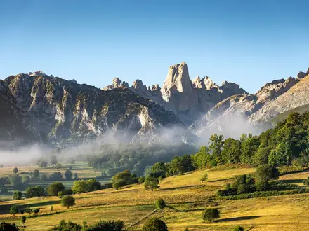
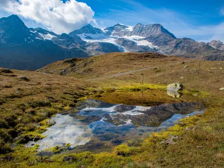
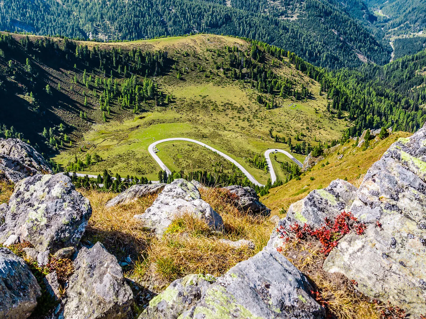
Image by Lumixera The Nockberge Trail is an eight-day hut-to-hut crossing of Carinthia’s rounded Nockberge mountains, running south from Katschberg/Katschberghöhe to Seeboden on Millstätter See. It is alpine in effort but softer in shape than Austria’s jagged limestone ranges: broad grass summits, high Almen, stone-pine forest and long skyline walking through the Biosphärenpark Kärntner Nockberge.
The route builds from the northern edge of Carinthia into the central Nockberge, passing Innerkrems, Turracher Höhe and Falkertsee before dropping to Bad Kleinkirchheim. Its high point is Großer Königstuhl at 2,336 m, a broad summit that gives the trail its main mountain-day feel without turning it into a technical climb.
This is a strong choice for fit hikers who want a waymarked Austrian trek with huts, guesthouses and optional luggage transfer, but without committing to glacier terrain or via ferrata. The finish above Lake Millstatt gives the walk a satisfying mountains-to-lake shape, with a long final descent to Seeboden.
The trail still asks for proper mountain fitness. Across 128 km there is about 6,500 m of ascent, several long stages, two days with over 1,000 m of climbing, and sections that are rocky, exposed or rope-secured enough to require sure-footedness and a head for heights.
This guide covers stages, daily planning, accommodation, food, transport, terrain and the common mistakes to avoid.
Stage-by-Stage Guide
Distances on the Nockberge Trail are approximate and stage difficulty depends heavily on weather, hut opening times and how much kit is carried. The route is waymarked throughout, but it crosses open alpine pasture, forest, high passes and exposed rocky sections, so each day still needs a map, GPS track or route app, and an early enough start to avoid afternoon weather changes.
Food and water planning is simple but important: treat the stage-end huts, hotels and villages as the reliable resupply points unless current accommodation or route notes state otherwise. In summer, livestock graze the Almen, so do not assume every stream or trough is safe drinking water without treatment.
Stage 1: Katschberg / Katschberghöhe to Neue Bonner Hütte — approx. 11 km
The opening stage leaves Katschberg / Katschberghöhe, near the Aineck valley station above the Katschberg pass, and quickly establishes the character of the trail: high pasture, forest edges and broad Nockberge slopes rather than a low-level valley walk. At around 11 km it is one of the shorter days, but it should still be treated as a mountain stage because the route starts at altitude and leads into hut country.
Underfoot, expect a mix of natural mountain paths, Alm tracks and dirt or gravel tracks. The walking is not technical in normal summer conditions, but it is a practical first test of fitness, footwear and pack weight before the longer middle stages.
The main objective is Neue Bonner Hütte, the first hut night on the route. This is the key place for dinner, breakfast and water before Stage 2, so arrival time matters; hut opening dates, meal times and reservation details should be checked before travelling.
Access to the start is by road to Katschberghöhe rather than by rail. The nearest mainline rail hubs used for access are Spittal-Millstättersee, Bischofshofen and Unzmarkt, with onward station shuttle, Kärnten transfer or local taxi to Katschberghöhe; current shuttle and taxi arrangements should be checked before travelling.
Navigation is usually straightforward on the signed Nockberge-Trail line, but the first day is where many problems begin if the waymarks are followed casually out of the resort area. Leave with the correct onward direction towards Neue Bonner Hütte, not local ski-area or short walking loops.
Stage 2: Neue Bonner Hütte to Innerkrems — approx. 15 km
Stage 2 continues through the northern Nockberge towards Innerkrems. It is longer than the first day and moves from a hut setting towards a valley settlement, giving a useful change from mountain accommodation to village services.
The route uses the typical Nockberge mix of natural paths, Alm and forest tracks, and unsealed access routes. Expect open grazed pasture as well as forested sections, with conditions that can become slippery after rain even where the gradients are not extreme.
Innerkrems is the main landmark and overnight stop at the end of the stage. Accommodation is in village hotels or inns rather than a remote hut, making it a practical place to recharge devices, dry kit and reorganise food before the long Stage 3.
Food and water should be taken from Neue Bonner Hütte for the day unless a booked itinerary specifies an open stop en route. Innerkrems offers the best end-of-day service point, but current opening times and meal arrangements should be checked before relying on them.
Innerkrems has road access, making it one of the more useful points for joining, leaving or adjusting the route. Public transport options are not specified for the stage and should be checked before travelling; taxis or arranged transfers may be more practical than relying on spontaneous bus connections.
In navigation terms, this is still a waymarked mountain day, not a valley promenade. In poor visibility, pasture tracks and forestry lines can look similar, so keep checking the Nockberge-Trail markings at junctions rather than following the most obvious track downhill.
Stage 3: Innerkrems to Turracher Höhe — approx. 21 km
Stage 3 is one of the major days of the route, running about 21 km from Innerkrems to Turracher Höhe. It is a full mountain stage and should be started early, especially in warm weather or when storms are forecast.
The stage climbs back into high Nockberge terrain, with a long traverse through pasture, forest and open slopes before reaching the high pass and lake at Turracher Höhe. The finish at Turracher See is one of the clear landmarks of the trail and marks the entry into the central Nockberge section.
Path surfaces are varied: natural mountain path, Alm tracks, dirt roads and gravel sections are all likely. Although the Nockberge are rounded rather than jagged, long distance, cumulative ascent and exposure to weather make this a demanding stage.
Carry enough food and water for a long day. Do not rely on intermediate refreshment stops unless these are included in a current booking or checked locally; the dependable services are at Innerkrems before setting out and at Turracher Höhe at the end.
Turracher Höhe has road access and accommodation in hotels or inns. It is also a practical point for route adjustment, but public transport availability and onward connections should be checked before travelling.
Navigation is important on this stage because fatigue can build before the finish. In mist, the rounded terrain can be deceptive: the next broad summit or track bend may not be the correct line, so follow the waymarks and keep an offline map or GPS track available.
Stage 4: Turracher Höhe to Falkertsee — approx. 18 km
Stage 4 is the high-level heart of the Nockberge Trail. From Turracher Höhe and Turracher See, the route continues through the central Nockberge towards Falkertsee, reaching the trail’s high point on Großer Königstuhl at 2,336 m.
This is one of the most memorable stages, with broad views across the rounded grass-covered summits and, in clear conditions, towards the Hohe Tauern. The walking remains more alpine-hill than jagged-rock climbing, but the altitude, exposure to weather and length of the day make it serious.
Terrain is mainly natural mountain path, high pasture and mountain tracks, with some rocky or exposed sections. Occasional rope-secured passages are a feature of the Nockberge Trail as a whole, so walkers should be comfortable using hands for balance where required and should not start this stage in unsuitable weather.
Falkertsee, below the Falkert area, is the end point and the main accommodation and service location for the night. Food and water should be carried from Turracher Höhe unless current route notes or the booked itinerary identify open facilities en route.
Road access exists at both Turracher Höhe and the Falkertsee area, making this stage logistically more flexible than the remote hut-to-hut sections. Actual public transport options, transfer availability and taxi access should be checked before travelling.
Navigation deserves particular care on and around high open ground. In fog, rain or early-season snow patches, broad grassy summits and ridges can lose definition quickly; if visibility is poor, keep closely to the marked trail and avoid drifting onto local summit or pasture tracks.
Stage 5: Falkertsee to Bad Kleinkirchheim — approx. 11 km
Stage 5 is a shorter stage from Falkertsee to Bad Kleinkirchheim, and it gives a useful partial recovery after the long, high central days. The route drops from the alpine lake and pasture setting towards one of the best-known spa towns on the trail.
The walking is still on mountain terrain, with natural paths, pasture tracks and forest or gravel sections, but the day is less about distance and more about descending efficiently and arriving with time to recover. Wet grass, mud and polished stones can make descents slower than expected after rain.
Bad Kleinkirchheim is a major landmark on the route and an important mid-trail service point. It has hotels and inns rather than hut accommodation, and its thermal-spa character makes it a sensible place to plan a more comfortable overnight stop.
Food and water are available at the start and finish if accommodation is open and booked, but do not assume extensive services between Falkertsee and Bad Kleinkirchheim. Carry a normal day supply and check opening times before setting out.
Bad Kleinkirchheim has road access and is one of the better places to join, leave or pause the trail. Public transport details are not specified for this stage and should be checked before travelling.
Navigation is generally helped by the clear destination, but the descent into a settled area can introduce more junctions, local paths and access tracks. Stay with the Nockberge-Trail waymarks rather than following signs only for nearby hotels, lifts or local walking loops.
Stage 6: Bad Kleinkirchheim to Erlacherhaus — approx. 13 km
Stage 6 leaves Bad Kleinkirchheim and returns to a hut-based mountain setting at Erlacherhaus. After a night in town, this stage is a reminder that the route remains a serious alpine trek, with climbing back into the Nockberge rather than simply contouring south.
The route passes through the characteristic mix of Zirbenwälder, summer Almen and open slopes. Path conditions are likely to vary between natural mountain paths, forest tracks, Alm routes and gravel or dirt sections.
Erlacherhaus is the stage-end hut and the key accommodation point. As with all hut nights on this trail, reserve ahead, check opening dates and confirm whether meals are included or need to be arranged separately.
Bad Kleinkirchheim is the best place to buy or organise food before leaving. Carry enough water for the day, and be cautious with untreated water on grazed pasture because livestock are common on the Almen in summer.
Road access is available at Bad Kleinkirchheim, while Erlacherhaus is a mountain accommodation point rather than a large transport hub. Any taxi, transfer or emergency exit arrangement for Erlacherhaus should be checked before travelling.
Navigation is usually uncomplicated where waymarks are followed, but the change from town streets or access roads to forest and pasture tracks requires attention. Ensure the correct trail is taken out of Bad Kleinkirchheim, as local walking routes can share the same general direction at first.
Stage 7: Erlacherhaus to Millstätter Hütte — approx. 22 km
Stage 7 is the longest listed stage of the official itinerary at about 22 km, linking Erlacherhaus with Millstätter Hütte. It is one of the days that gives the Nockberge Trail its hard rating: the challenge is not technical climbing, but sustained mountain walking, cumulative ascent and time on feet.
The stage runs through the southern Nockberge above the Millstätter See area, with high pasture, forest and broad slopes continuing to dominate the landscape. The approach to the Millstätter Hütte brings the trail onto the Millstätter Alm balcony above Lake Millstatt.
Expect a full range of Nockberge surfaces: natural mountain path, Alm tracks, forest tracks and rougher or rockier sections. Where the route crosses open slopes or exposed ground, poor visibility and wind can make progress slower and more tiring than the distance alone suggests.
Food and water should be planned carefully. Start from Erlacherhaus with enough for a long day, and do not rely on intermediate services unless they are part of a current, checked itinerary; Millstätter Hütte is the key end-of-stage accommodation and meal stop.
Millstätter Hütte is a mountain hut, so reservations are essential in the main summer season. Hut capacity, opening periods and luggage-transfer arrangements should be checked before travelling, especially if walking in early June or late autumn.
Public transport access is limited by the mountain setting. Road or transfer options for either end of the stage should be arranged in advance rather than assumed on arrival.
Navigation matters late in the day, when fatigue can lead to mistakes at pasture-track junctions. Keep checking the waymarked line towards Millstätter Hütte, especially if cloud lowers over the Alm or if local forestry and hut-access tracks cross the trail.
Stage 8: Millstätter Hütte to Seeboden am Millstätter See — approx. 16 km
The final stage descends from Millstätter Hütte to Seeboden am Millstätter See, finishing near the Klingerpark area on the shore of Lake Millstatt. Although the route is now heading down to about 590 m, this is still a 16 km mountain-to-lake day and should not be treated as a casual stroll.
The first part remains in the Millstätter Alm landscape, with broad views over Lake Millstatt when conditions are clear. The route then loses height towards Seeboden, moving from open mountain and forest terrain into the lakeside settlement.
Underfoot, expect mountain paths, Alm and forest tracks, dirt or gravel roads, and more settled approach paths near the finish. The long descent can be hard on knees and feet, particularly after seven previous days; trekking poles can be useful if normally carried.
Carry food and water from Millstätter Hütte for the descent. Seeboden has the main end-of-route services and accommodation, but opening hours for any specific restaurant, shop or hotel should be checked before relying on them.
Seeboden is served by regional and public buses around Lake Millstatt, with Spittal an der Drau the nearest mainline rail hub for onward travel towards places such as Villach, Salzburg and Vienna. Current bus times and rail connections should be checked before travelling, particularly at weekends or outside the July–August high season.
Navigation is usually easier as the route approaches the lake, but the descent includes multiple local paths, forest tracks and settlement access routes. Stay on the Nockberge-Trail waymarks until the official finish at Seeboden rather than cutting down early on unplanned shortcuts.
Recommended Itinerary
Standard 8-day itinerary
The Nockberge Trail is best planned around its official 8-stage hut-to-hut structure. The spacing uses the established overnight points, keeps the highest central section manageable, and avoids forcing very long mountain days where accommodation options are limited.
Book all hut, hotel and guesthouse nights ahead, especially in July and August. Hut opening dates, luggage transfer, shuttle arrangements and any seasonal changes should be checked before travelling.
| Day | From | To | Approx. distance | Why this stage makes sense | Services/accommodation notes |
|---|---|---|---|---|---|
| 1 | Katschberg / Katschberghöhe | Neue Bonner Hütte | 11 km | A relatively short first mountain day from the Katschberg start, useful for settling into the terrain before the longer central stages. | Overnight at Neue Bonner Hütte. There is no railway station at Katschberghöhe, so plan arrival by shuttle, transfer or taxi from a mainline rail hub before starting. |
| 2 | Neue Bonner Hütte | Innerkrems | 15 km | Builds distance without yet reaching the biggest days, continuing south through the northern Nockberge. | Innerkrems gives a valley overnight between hut stages. Confirm accommodation and any onward luggage arrangements before setting off. |
| 3 | Innerkrems | Turracher Höhe | 21 km | One of the long stages, ending at the high pass and lake of Turracher Höhe / Turracher See. An early start is sensible in unsettled weather. | Turracher Höhe has hotel/inn accommodation rather than a remote hut night. This is a key resupply and recovery point before the highest section. |
| 4 | Turracher Höhe | Falkertsee | 18 km | The main high-level stage of the route, crossing the central Nockberge and taking in Großer Königstuhl, the trail’s high point at 2,336 m. | Overnight around Falkertsee / Falkert. This stage is exposed to alpine weather, so check the forecast and leave enough time for the summit section. |
| 5 | Falkertsee | Bad Kleinkirchheim | 11 km | A shorter day after the high central crossing, descending to Bad Kleinkirchheim and giving a useful recovery point mid-route. | Bad Kleinkirchheim is the main spa-town stop on the trail, with hotel/guesthouse accommodation. It is the most obvious place to add a rest night. |
| 6 | Bad Kleinkirchheim | Erlacherhaus | 13 km | Returns from the valley to the mountain-hut rhythm without an excessive distance, setting up the long southern stage that follows. | Overnight at Erlacherhaus. Hut capacity and opening periods should be checked before booking the overall itinerary. |
| 7 | Erlacherhaus | Millstätter Hütte | 22 km | The longest stage by distance, crossing the southern Nockberge towards the Millstätter Alm area above Lake Millstatt. Treat it as a full mountain day. | Overnight at Millstätter Hütte. Start early, carry enough food and water for the day, and avoid committing to this stage in poor visibility without suitable navigation. |
| 8 | Millstätter Hütte | Seeboden am Millstätter See | 16 km | A final descent from the high pastures to Seeboden on Lake Millstatt, finishing the point-to-point traverse far below the start elevation. | Seeboden has finish-line accommodation and bus links around Lake Millstatt, with Spittal an der Drau the nearest mainline rail hub for onward travel. |
Slower itinerary
The most practical slower version keeps the same walking stages but adds a rest night, usually at Bad Kleinkirchheim after Day 5. This suits hikers who want recovery time after the high central stages, those using the thermal-spa stop, or anyone who prefers a buffer before the longer final mountain days.
Adding nights at the start in Katschberg / Katschberghöhe or at the finish in Seeboden can also make transport easier, especially when arriving by train and shuttle or connecting onward via Spittal an der Drau. These are travel-planning additions rather than route changes.
Splitting individual stages may be possible only where accommodation and transfers allow. Check official mapping, hut availability and booking options before relying on any non-standard stage break.
Faster itinerary
A faster itinerary is not the best fit for most walkers on this trail. The route is already compressed into eight mountain days, with several stages around 18–22 km, around 6,500 m of total ascent, exposed sections and hut or valley overnights that strongly shape the pacing.
Combining stages would create very long alpine days and may bypass booked accommodation points. Only very fit, experienced mountain hikers should consider any compressed schedule, and exact distances, elevation gain, transport and accommodation must be checked against official mapping before booking.
Planning the Route
How many days to allow
Plan the Nockberge Trail around the official 8-stage itinerary unless there is a strong reason not to. The stage ends are not arbitrary: they line up with the practical overnight points on the route, alternating between mountain huts and valley or resort accommodation.
Walking it faster means combining already substantial alpine days, including long middle and southern stages. That is only realistic for very fit hikers who are comfortable with long hours, cumulative ascent and exposed mountain ground on consecutive days.
A slower itinerary is usually more useful than a faster one. Extra nights are most naturally added at places with more services, especially Turracher Höhe or Bad Kleinkirchheim, rather than trying to split the high hut-to-hut stages in unsupported places. Availability and current opening dates should be checked before travelling.
Stage structure and overnight planning
The route is best planned as a hut-to-hut trek with fixed accommodation targets each day. Do not assume there will be many alternative beds between official stage ends, particularly on the higher sections through the central Nockberge and the southern stages above Millstätter See.
| Section | Overnight planning point |
|---|---|
| Katschberg / Katschberghöhe to Neue Bonner Hütte | Start logistics matter: the trail begins above the Katschberg pass, with no railway station on the route itself. |
| Neue Bonner Hütte to Innerkrems | A hut night is followed by a valley stop, so food, water and luggage arrangements should be clear before leaving the hut. |
| Innerkrems to Turracher Höhe | One of the longer days; start early enough to allow for weather changes and slower progress on mountain paths. |
| Turracher Höhe to Falkertsee | High-level central Nockberge terrain, including the section around Großer Königstuhl, the trail’s highest point. |
| Falkertsee to Bad Kleinkirchheim | A shorter day on paper, useful for recovery before the later southern stages. |
| Bad Kleinkirchheim to Erlacherhaus | Leaving a service town for a hut-style overnight means supplies should be sorted before departure. |
| Erlacherhaus to Millstätter Hütte | One of the longest stages; this is not a day to leave flexible or under-supplied. |
| Millstätter Hütte to Seeboden am Millstätter See | A long descent to the lake finish, with onward transport to arrange from Seeboden or Spittal an der Drau. |
Booking accommodation
Accommodation is the first thing to organise. The trail uses a mix of Hütten, hotels, inns and guesthouses, and huts such as Neue Bonner Hütte, Erlacherhaus and Millstätter Hütte can be small compared with the number of summer hikers.
The Trail Angels booking service handles reservations for the official route and can also organise optional luggage transfer. Independent hikers who book directly should still secure every night in order before committing to travel dates, especially in July and August.
Check what each overnight stop provides before setting off: meals, packed lunches, payment methods, bedding requirements and opening dates can vary. This should be checked before travelling.
Food and water planning
Treat each day as a self-contained mountain stage. The route passes recognised overnight places, but it should not be planned on the assumption that there will be shops or full services between them.
Carry enough food for the walking day, plus a reserve in case of delay. Packed lunches are best arranged the night before where available, particularly before the longer stages from Innerkrems to Turracher Höhe and from Erlacherhaus to Millstätter Hütte.
Water should be filled before leaving each accommodation stop. Natural water sources on alpine pastures and forest sections should not be relied on unless you are prepared to treat water and make your own judgement on safety.
Transport and section hiking
The Nockberge Trail is a point-to-point route, so transport must be planned at both ends. The start at Katschberg / Katschberghöhe is reached via mainline rail hubs such as Spittal-Millstättersee, Bischofshofen or Unzmarkt, followed by a station shuttle, Kärnten transfer or local taxi up to the pass area.
At the finish, Seeboden am Millstätter See is served by regional and public buses around Lake Millstatt, with Spittal an der Drau the nearest mainline rail hub for onward travel. Current bus, shuttle and taxi arrangements should be checked before travelling.
Section hiking is possible, but it is less straightforward than on a trail with railway stations along the line. The most practical sections are likely to use road-accessible overnight places such as Katschberg / Katschberghöhe, Turracher Höhe, Bad Kleinkirchheim and Seeboden, but intermediate public transport should not be assumed. This should be checked before travelling.
Shortening, extending and rest days
Shortening the route is mainly a transport exercise rather than a trail-design feature. Leaving at a stage end may be possible where there is road access, but arranging a taxi or transfer can be necessary.
Extending the route is more comfortable than compressing it. Bad Kleinkirchheim is the most obvious place to add a rest or recovery night because it is a service town and thermal-spa stop midway through the trail.
Extra nights can also be useful at the start or finish to reduce transport pressure. An overnight before starting at Katschberg / Katschberghöhe avoids a rushed first day, while a night in Seeboden makes the final descent and onward travel less tight.
Navigation, weather and timing
The Nockberge Trail is waymarked along its length, but that is not a substitute for carrying reliable navigation. Use an offline map, GPS track or paper map, and know the next stage end before leaving each morning.
The standard hiking season is roughly early June to early October, with July and August the busiest period. Early and late season conditions can be more variable at altitude, and high sections around the central Nockberge should be checked for snow, storms or seasonal closures before committing to the day.
This is rounded grass-covered Nockberge terrain rather than jagged limestone, but the route still includes rocky, exposed and occasional rope-secured passages. Sure-footedness, a head for heights and conservative weather decisions matter more than the gentle profile of the hills might suggest.
Permits and protected-area considerations
The trail crosses the Biosphärenpark Kärntner Nockberge, so stay on marked paths, respect grazing areas and follow local signage. Current access restrictions, hut opening dates and any seasonal closures should be checked before travelling.
Permits are not the main planning constraint for most walkers on this route. Accommodation, transport, food, weather windows and the ability to complete consecutive mountain days are the decisions that will determine whether the itinerary works.
Towns, Villages and Overnight Stops
The Nockberge Trail alternates between high mountain huts and more serviced valley or resort stops. Accommodation is not something to leave to chance: the official route is built around specific stage ends, and the hut nights in particular should be booked ahead, especially in July and August.
Trail Angels run the official information and booking centre and can arrange reservations and optional luggage transfer. If booking independently, check opening dates, meal arrangements and whether packed lunches are available before committing to each stage.
| Place | Role on the route | Overnight usefulness |
|---|---|---|
| Katschberg / Katschberghöhe | Start | Pre-hike night useful if arriving by public transport or shuttle |
| Neue Bonner Hütte | End of Stage 1 | Essential hut stop for the official itinerary |
| Innerkrems | End of Stage 2 | Valley overnight before a long Stage 3 |
| Turracher Höhe | End of Stage 3 | Serviced high pass/lake stop; important recovery point |
| Großer Königstuhl | On Stage 4 | Summit/high point, not an overnight stop |
| Falkertsee | End of Stage 4 | Alpine lake stop before the descent towards Bad Kleinkirchheim |
| Bad Kleinkirchheim | End of Stage 5 | Best mid-route service stop; thermal-spa town |
| Erlacherhaus | End of Stage 6 | Mountain hut stop for the southern stages |
| Millstätter Hütte | End of Stage 7 | Final high hut before the descent to Lake Millstatt |
| Seeboden am Millstätter See | Finish | Best post-hike overnight and onward transport base |
Katschberg / Katschberghöhe
Katschberg / Katschberghöhe is the northern trailhead, around 1,640 m, by the Aineck valley station above the Katschberg pass on the Salzburg–Carinthia boundary. The waymarked Nockberge-Trail leads south from here into the Biosphärenpark Kärntner Nockberge.
It is a practical pre-hike overnight if arrival times are awkward, if using a shuttle from a mainline railway station, or if starting Stage 1 early. The first stage to Neue Bonner Hütte is relatively short by Nockberge Trail standards, but beginning already at the pass avoids adding any approach logistics on the morning of departure.
There is no railway station on the route itself. Access is normally via mainline stations such as Spittal-Millstättersee, Bischofshofen or Unzmarkt, followed by a station shuttle, Kärnten transfer or local taxi to Katschberghöhe. Current shuttle arrangements and taxi availability should be checked before travelling.
Food and last-minute supplies should not be assumed once on the hill. Buy anything critical before transferring to the start, especially specialist items, blister care, gas compatibility if carrying a stove, and food for the first walking day.
Neue Bonner Hütte
Neue Bonner Hütte is the first official overnight stop, reached from Katschberg / Katschberghöhe on Stage 1. It is a mountain hut rather than a village, and it sets the tone for the hut-to-hut parts of the route.
This is a key booking point, not an optional extra, if following the standard 8-stage itinerary. Huts in the Nockberge can be small, so summer reservations should be made well in advance through the Trail Angels booking service or directly with the accommodation.
Do not plan around shops here. Check when booking whether dinner, breakfast and packed lunches are available, and carry enough snacks for the next day to Innerkrems.
Transport access at hut stops is inherently limited compared with the valley settlements. If a walker needs to leave the route from here, onward options are likely to require local taxi or accommodation-arranged help; this should be checked before travelling.
Innerkrems
Innerkrems is the end of Stage 2 and the first valley-style stop after the opening hut night. It is a useful place to reset before Stage 3, one of the longer days on the official itinerary, which continues to Turracher Höhe.
Accommodation is in the hotel/inn or guesthouse category rather than a high hut. This makes Innerkrems a practical point for a shower, device charging and a more conventional evening meal before returning to higher ground.
Food availability should be treated as accommodation-based unless current local shop and restaurant opening times are known. In small alpine settlements, off-season and rest-day closures can matter, so confirm meals and packed lunch options when booking.
There is no rail link on the trail. Any public transport, taxi or transfer option from Innerkrems should be checked before relying on it, particularly for section-hikers joining or leaving the route here.
Turracher Höhe (Turracher See)
Turracher Höhe is reached at the end of the long Stage 3 from Innerkrems. It is a high mountain pass and lake settlement beside Turracher See, and is one of the more serviced stops on the trail.
This is a strong overnight point because it comes after a demanding day and immediately before the high central Nockberge section over Großer Königstuhl towards Falkertsee. It is also one of the better places on the route to recover indoors if the weather has been poor.
Accommodation is in hotels or inns rather than a simple mountain hut. Even so, book ahead in the main summer season, as the official itinerary concentrates walkers into the same stage ends.
Turracher Höhe is a sensible place to ask about the next day’s conditions, especially if wind, thunderstorm risk or lingering snow is a concern early or late in the season. The route ahead crosses high, exposed ground, so do not treat this as a casual valley-to-valley transfer day.
Food and café options may be better here than at hut stops, but exact opening hours vary by season. Packed lunch availability for Stage 4 should be confirmed before setting out.
Großer Königstuhl
Großer Königstuhl, at 2,336 m, is the high point of the Nockberge Trail. It lies in the central section between Turracher Höhe and Falkertsee and is a summit objective within the walking day, not an overnight stop.
There should be no accommodation, shop or transport plan built around Großer Königstuhl. Treat it as a high, exposed part of Stage 4 where the priority is timing, weather judgement and enough food and water to continue safely to Falkertsee.
This is also the section where the Nockberge’s rounded grass-covered summits can feel deceptively gentle. The route is still alpine: conditions can change quickly, and visibility on broad grassy terrain can become difficult in cloud.
Falkertsee (Falkert)
Falkertsee is the end of Stage 4, reached after the high-level crossing from Turracher Höhe via the central Nockberge. The lake sits below the Falkert area and provides the overnight stop before Stage 5 descends towards Bad Kleinkirchheim.
This is an important place to have accommodation fixed in advance. It comes after the trail’s highest stage, and pushing on because a bed is unavailable would disrupt the official itinerary.
Food should again be arranged through the overnight accommodation unless current restaurant or shop options have been checked. Ask specifically about breakfast timing and packed lunches, because Stage 5 is shorter but still a mountain stage.
Transport from Falkertsee should not be assumed. Section-hikers or anyone planning an emergency exit should check current taxi or transfer options before travelling.
Bad Kleinkirchheim
Bad Kleinkirchheim is reached at the end of Stage 5 and is the most useful mid-route service stop on the Nockberge Trail. It is a well-known thermal-spa town, making it the obvious place for recovery, laundry where available, and a more comfortable overnight between mountain sections.
Accommodation availability is broader here than at the huts, with hotels and inns forming part of the route’s overnight pattern. It is still worth booking ahead, especially if walking in high summer or coordinating luggage transfer.
This is the best place on the route to deal with practical issues before the final three stages: food, weather reassessment, equipment problems, foot care and onward transport decisions. Specific shop, pharmacy, restaurant and spa opening times should be checked locally or before arrival.
There is no railway station on the trail itself, so Bad Kleinkirchheim should not be treated as a rail-access point. Any bus, taxi or transfer used for joining, leaving or taking a rest day here should be checked before travelling.
Erlacherhaus
Erlacherhaus is the end of Stage 6 from Bad Kleinkirchheim and one of the key hut-style stops on the southern half of the route. It marks the return to a more remote mountain rhythm after the services of Bad Kleinkirchheim.
Book this night in advance, particularly because Stage 7 to Millstätter Hütte is one of the longest days on the official itinerary at about 22 km. A missed reservation here can create a serious planning problem rather than a minor inconvenience.
Confirm meals, breakfast time and packed lunch availability when booking. The following day is long, so relying on finding food en route is poor planning unless current options have been checked.
Transport links are limited compared with the valley towns. If using Erlacherhaus as a section start or finish, transfer arrangements should be made in advance.
Millstätter Hütte
Millstätter Hütte is the final high overnight stop, reached from Erlacherhaus on Stage 7. It sits above the Millstätter See area and positions walkers for the last day’s descent to Seeboden.
This is a classic final hut night: practical, scenic and strategically important. The next day is not just a stroll to the lake; it is still a 16 km stage with a significant descent, so a good night’s rest and an early, organised start are worthwhile.
As with the other huts, reservations are strongly recommended. Check meal service, drinking water arrangements, payment method and whether packed lunches are available before arrival.
There should be no assumption of shops or easy public transport at the hut. Anyone needing to leave the route before Seeboden should arrange local transfer options in advance.
Seeboden am Millstätter See
Seeboden am Millstätter See is the southern finish of the Nockberge Trail, reached after the descent from Millstätter Hütte to the Klingerpark area on the shore of Lake Millstatt. At around 590 m, it is much lower than the start at Katschberghöhe, so the final day includes a substantial drop from the high hut country.
Seeboden is the best place for a post-hike overnight, especially if onward travel would be rushed after finishing Stage 8. It also gives a buffer if bad weather, tired legs or transport timings make the final day slower than expected.
Accommodation, food and lake-area services are more practical here than at the mountain stops, but high-season availability should still be booked ahead. Confirm check-in times if arriving late from the final stage.
For onward travel, Seeboden is served by regional/public buses around Lake Millstatt, with Spittal an der Drau the nearest mainline rail hub for connections towards places such as Villach, Salzburg and Vienna. Current bus times and connections to Spittal-Millstättersee station should be checked before travelling.
Getting to the Start
The Nockberge Trail starts at Katschberg / Katschberghöhe, around 1,640 m, at the Aineck valley station above the Katschberg pass. There is no railway station on the route itself, so almost every public-transport journey finishes with a road transfer up to Katschberghöhe.
By train
Use Austria’s mainline rail network to reach one of the practical IC/EC rail hubs for the trailhead: Spittal-Millstättersee at Spittal an der Drau, Bischofshofen or Unzmarkt. From there, continue to Katschberghöhe by station shuttle, Kärnten transfer or local taxi.
Spittal-Millstättersee is also useful at the end of the walk, as Seeboden am Millstätter See connects back towards Spittal by regional/public bus around Lake Millstatt. This makes it a sensible hub for walkers wanting one rail base for both arrival and departure.
Train and transfer times can change by season, and the final climb to Katschberghöhe is the part most likely to catch hikers out. This should be checked before travelling, especially if arriving late in the day or starting the first stage immediately after travel.
By bus
Katschberghöhe is not a simple rail-to-trail start. The usual public-transport solution is to combine a train to Spittal-Millstättersee, Bischofshofen or Unzmarkt with a pre-arranged shuttle, Kärnten transfer or taxi for the final road section to the pass.
Do not assume there will be a convenient walk-up bus connection that matches long-distance train arrivals. Current bus and shuttle times, booking requirements and operating seasons should be checked before travelling.
By car
Drivers can head for Katschberg / Katschberghöhe and the Aineck valley station area, where the Nockberge-Trail waymarks lead south from the start. The main planning issue is not reaching the start, but what to do with the car during an 8-day point-to-point walk ending at Seeboden am Millstätter See.
Long-stay parking arrangements at Katschberghöhe, hotels or lift-area car parks should be checked before travelling. If leaving a car at the start, also plan the return from Seeboden: regional/public buses connect the Lake Millstatt area with Spittal an der Drau, from where onward rail or taxi arrangements can be made.
For many walkers, it is simpler to travel by train to a mainline station and book a transfer up to Katschberghöhe, rather than managing a car retrieval after the finish.
From the nearest airport
No airport sits directly on the route. The practical airport approach is to fly into an Austrian or regional international airport with good rail links, then travel by train to Spittal-Millstättersee, Bischofshofen or Unzmarkt and continue by shuttle or taxi to Katschberghöhe.
Airport choice should be based on flight times, rail connections and whether a same-day transfer to the trailhead is realistic. This should be checked before travelling; a late flight arrival may require an overnight stop before transferring to Katschberghöhe.
Where to stay before starting
The most convenient pre-walk overnight is at or near Katschberg / Katschberghöhe, so the first stage can be started without relying on a morning road transfer. This is especially sensible if using luggage transfer or a booked hut-to-hut package, as bags and timings need to be aligned from the first morning.
Staying lower down near a rail hub such as Spittal an der Drau, Bischofshofen or Unzmarkt can work if the transfer to Katschberghöhe is arranged for the morning. Build in enough time: Stage 1 to Neue Bonner Hütte is not the longest day of the trail, but it still starts high and should not be rushed after a complicated journey.
Getting Home from the Finish
The Nockberge Trail finishes in Seeboden am Millstätter See, around the Klingerpark area on the shore of Lake Millstatt. There is no railway station at the finish, so the key onward move is getting from Seeboden to Spittal an der Drau, the nearest mainline rail hub.
If the final descent from Millstätter Hütte takes longer than expected, do not rely on making a tight same-day long-distance connection. Bus times, taxi availability and rail connections should be checked before travelling, especially outside peak summer or if finishing late in the afternoon.
By train
Use Spittal-Millstättersee station at Spittal an der Drau for onward rail travel. It is the nearest mainline rail hub to Seeboden and has onward connections towards Villach, Salzburg and Vienna.
From the trail finish, first travel from Seeboden to Spittal by regional bus around Lake Millstatt or by taxi. Build in a sensible buffer: the final stage is a 16 km descent from Millstätter Hütte, and delays from weather, tired legs or a long lunch stop can easily make a tight train connection stressful.
For international rail journeys, overnighting in Seeboden or Spittal is usually the safer plan than trying to connect directly from the trail to a late long-distance train. Current rail and local transfer times should be checked before travelling.
By bus
Seeboden is served by regional/public buses around Lake Millstatt, with Spittal an der Drau the useful interchange for trains and wider onward travel. Bus services are the natural public-transport option from the finish, but they are timetable-dependent and may be less convenient in the evening or outside the main summer season.
Check the current Lake Millstatt/Seeboden bus times before committing to a same-day departure. If the last useful bus has gone, a taxi to Spittal or an overnight stay at the lake will be the practical alternatives.
By car/taxi
If a car has been left at the finish, Seeboden is the easiest place on the trail to end: it is a lakeside town rather than a high hut or remote pass. Parking arrangements should still be checked with accommodation or the relevant local car park before leaving a vehicle for multiple days.
For hikers without a car, a taxi from Seeboden to Spittal-Millstättersee station is the simplest fallback if bus times do not line up. Pre-booking is sensible if finishing late, travelling with a group, or needing to catch a specific train.
Do not plan on returning casually to the Katschberg start by public transport without checking the full chain of connections. The route is point-to-point, and the start at Katschberghöhe also requires a shuttle, transfer or taxi connection rather than a direct rail stop.
From the nearest airport
The practical first step for any airport journey is to reach Spittal-Millstättersee station from Seeboden, then continue by rail towards a suitable larger transport hub such as Villach, Salzburg or Vienna. Airport-specific rail and bus connections are timetable-dependent and should be checked before travelling.
For flights on the same day as finishing, allow a large margin or stay overnight at the finish. The final trail day is still a mountain-stage descent, and missed local connections can quickly undermine a tight flight plan.
Where to stay at the finish
Seeboden am Millstätter See has hotels/guesthouses at the end of the route, making it a practical and comfortable place to stop after the final descent. Staying overnight also gives more flexibility with buses to Spittal and onward trains the next morning.
An overnight at the finish is especially sensible if onward travel involves a long rail journey, an airport transfer, or a return to the Katschberg start. Book ahead in the main summer season, particularly if using the Trail Angels booking service for the wider hut-to-hut itinerary.
Which Direction Should You Walk?
Standard direction: Katschberg to Seeboden
The official and most practical direction is southbound, from Katschberg/Katschberghöhe to Seeboden am Millstätter See. This follows the published 8-stage itinerary, keeps the way the route is normally described, and gives the strongest sense of progression: high pass and alpine pastures first, the central Nockberge summits in the middle, then a long descent towards Millstätter See (Lake Millstatt).
It also makes transport cleaner for most walkers. Katschberg/Katschberghöhe has no railway station, so the awkward transfer by station shuttle, Kärnten transfer or taxi from Spittal-Millstättersee, Bischofshofen or Unzmarkt is dealt with at the start. At the finish, Seeboden has regional/public buses around Lake Millstatt, with Spittal an der Drau as the nearest mainline rail hub for onward travel.
The southbound route also has a useful psychological finish. After hut and mountain days through the Nockberge, ending at Seeboden on the lake shore feels like a proper arrival rather than finishing at a pass requiring another transfer.
Reverse direction: Seeboden to Katschberg
Walking northbound is possible in principle, but it is less attractive for most hikers. The route starts at roughly 590 m in Seeboden and finishes around 1,640 m at Katschberghöhe, so the overall profile is uphill rather than downhill. Because the standard route already involves about 6,500 m of ascent, reversing it adds roughly the net height difference between the lake and Katschberg to the climbing load.
The first reverse day would also turn the final southbound descent from Millstätter Hütte to Seeboden into a sustained climb from the lake towards the mountains. That is a demanding way to begin an 8-day hut-to-hut trek, especially with a full pack.
Transport is the other drawback. Starting in Seeboden is straightforward enough via buses from the Lake Millstatt area and Spittal an der Drau, but finishing at Katschberghöhe leaves the less convenient transfer to the end of the trip. Shuttle and taxi arrangements should be checked before travelling.
Scenery, weather and accommodation considerations
Southbound gives the better natural build-up: from Katschberg into the Nockberge, over the higher central stages around Turracher Höhe, Großer Königstuhl and Falkertsee, then down through the southern stages towards Millstätter Hütte and the lake. Reverse walkers still see the same landscape, but the dramatic “mountains to lake” ending is lost.
There is no clear route-wide weather or prevailing-wind advantage in either direction. The important planning point is not direction but timing: the high middle stages need early starts and flexible judgement in unsettled alpine weather.
Accommodation works best when matched to the official stage order, especially if using the Trail Angels booking service or luggage transfer. Reverse itineraries may be possible, but hut and inn availability, luggage logistics and any transfer arrangements should be checked before booking.
Recommendation
Walk the Nockberge Trail southbound from Katschberg/Katschberghöhe to Seeboden. It follows the official stage order, gives easier end-of-walk transport, reduces the overall climbing compared with the reverse, and finishes with the strongest scenic and psychological reward at Millstätter See.
Accommodation Along the Route
The Nockberge Trail is set up as a booked hut-to-hut and inn-to-inn route, with overnight stops at the official stage ends. Accommodation alternates between small mountain huts and valley or resort accommodation, so the planning problem is less about finding a bed every night and more about securing the right bed in the right place on the correct date.
Booking ahead is strongly recommended in the normal snow-free season, especially in July and August. The hut nights are the main constraint: Neue Bonner Hütte, Erlacherhaus and Millstätter Hütte have a much more limited capacity than the valley resorts, and relying on arrival without a reservation is a poor strategy on an 8-day point-to-point walk.
Trail Angels run the official information and booking centre for the Nockberge-Trail and can handle accommodation reservations and optional luggage transfer. That is the simplest way to manage the mixed hut/hotel itinerary, particularly if walking the route as a continuous trek rather than as separate sections.
Accommodation by place
| Place | Accommodation level | Best for | Notes |
|---|---|---|---|
| Katschberg / Katschberghöhe | Limited | Pre-trail night before Stage 1 | The route starts at Katschberghöhe near the Aineck valley station. Staying nearby avoids a same-day transfer to the start before walking to Neue Bonner Hütte. Current availability should be checked before travelling. |
| Neue Bonner Hütte | Limited | Essential hut night after Stage 1 | A mountain hut stage end, not a large resort. Book ahead, especially in summer, and do not assume spare beds will be available. |
| Innerkrems | Limited | Valley overnight after Stage 2 | A practical stop between hut and high-mountain sections. Accommodation choice is more limited than in the larger resort towns, so reservations matter. |
| Turracher Höhe / Turracher See | Good | Resort overnight after the long Stage 3 | One of the stronger accommodation points on the trail, with hotel/inn options at a high mountain pass and lake. Useful after the 21 km stage from Innerkrems. |
| Großer Königstuhl | None | High point only | This is the trail’s highest summit, not an overnight base. Accommodation is at the surrounding stage ends, chiefly Turracher Höhe and Falkertsee on the official itinerary. |
| Falkertsee / Falkert | Limited | Overnight after the high Stage 4 | A key mountain-stage stop below the Falkert area. Treat it as a booked overnight rather than a place where beds can be improvised late in the day. |
| Bad Kleinkirchheim | Good | Rest, recovery and inn/hotel comfort | The strongest mid-route service stop, with hotels/inns and the added advantage of being a thermal-spa town. A sensible place for a more comfortable night before the southern stages. |
| Erlacherhaus | Limited | Hut night after Stage 6 | A mountain hut stage end. Capacity is limited compared with valley accommodation, so advance booking is important. |
| Millstätter Hütte | Limited | Final hut night before descending to Lake Millstatt | The last mountain overnight, positioned above the descent to Seeboden. Book ahead and check seasonal opening dates before relying on it. |
| Seeboden am Millstätter See | Good | Finish night and onward travel | A practical end-point on Lake Millstatt, with better scope for post-trail accommodation and onward transport via regional/public buses towards Spittal an der Drau. |
Hut nights versus hotel nights
The route is not a pure hotel-to-hotel walk. It includes several genuine hut nights, and walkers who want private rooms, en-suite facilities or full hotel comfort every night need to plan carefully.
Bad Kleinkirchheim, Turracher Höhe and Seeboden offer the best chance of a more conventional hotel or inn stay. Innerkrems and Falkertsee are more limited, while Neue Bonner Hütte, Erlacherhaus and Millstätter Hütte should be treated as mountain-hut overnights.
A hut sleeping system, earplugs, a compact towel and flexible expectations are sensible. Exact room types, meal arrangements and payment requirements should be checked when booking, as hut facilities and operating dates can change between seasons.
Can the trail be walked inn-to-inn?
It works well as a mixed hut-and-inn trek, which is how the official stage structure is designed. It is much less straightforward as a strict inn-to-inn route because several stage ends are mountain huts rather than valley villages.
If avoiding hut nights is essential, taxi transfers to alternative accommodation may be possible on some sections, but this should be checked before travelling. Such changes can affect walking times, start points and the continuity of the route, and should not be assumed when booking flights or rail travel.
Luggage transfer is useful for reducing pack weight between overnights, but it does not remove the need to reserve the right accommodation at each stage end. It also does not turn the route into an easy valley walk: the middle and southern stages still involve long alpine days between fixed overnight points.
Booking strategy
Book the constrained hut nights first, then fit the valley and resort accommodation around them. This is especially important for July and August, when the main summer hiking season puts pressure on small huts.
For a standard 8-day itinerary, each overnight should match the official stage end: Neue Bonner Hütte, Innerkrems, Turracher Höhe, Falkertsee, Bad Kleinkirchheim, Erlacherhaus, Millstätter Hütte and Seeboden. Adding an extra night is most practical at stronger service points such as Bad Kleinkirchheim or Seeboden, rather than at the small hut stops.
Seasonal opening dates should be checked before committing to early June or late-season autumn dates. The standard snow-free season is roughly early June to early October, but individual huts and services may not all operate across that full window.
Camping and Wild Camping
The Nockberge Trail is best planned as a hut-and-inn trek, not a camping route. The official stage ends are built around mountain huts and valley accommodation such as Neue Bonner Hütte, Innerkrems, Turracher Höhe, Falkertsee, Bad Kleinkirchheim, Erlacherhaus, Millstätter Hütte and Seeboden, with reservations available through the Trail Angels booking service.
Carrying a full camping load is possible in a physical sense, but it makes this route significantly harder. Several days are long, the total ascent is about 6,500 m, and some sections are rocky, exposed or rope-secured; a heavier pack will make those sections slower and more committing.
Campsites and planned camping
No specific campsite network is established in the route information for the Nockberge Trail. If you want to camp, identify legal campsites before booking transport and do not assume that each stage end has a camping option.
The most realistic places to investigate are the larger settlements and resort stops on or near the route: Katschberg/Katschberghöhe, Innerkrems, Turracher Höhe, Falkertsee, Bad Kleinkirchheim and Seeboden am Millstätter See. Availability, opening dates and whether a site accepts one-night backpacking stays should be checked before travelling.
A camping-based itinerary may also require detours from the waymarked line or longer days between legal overnight stops. That can be awkward on a route already designed around eight mountain stages, so avoid building an itinerary that depends on finding an informal pitch late in the day.
Wild camping and bivouacking
Do not treat the Nockberge Trail as a wild-camping route. It crosses the UNESCO Biosphere Reserve Carinthian Nockberge, with alpine pastures, forest, privately used alm land and sensitive mountain habitats; sleeping outside formal accommodation should only be considered where it is clearly legal and permitted locally.
Wild-camping rules in Austria can be local and land-use dependent. Before planning any tent or bivouac night, check the current rules with the relevant local authority, the Biosphärenpark Kärntner Nockberge, tourist offices, accommodation providers or landowners. This should be checked before travelling.
Permission matters especially on the summer Almen, where grazing land, huts, access tracks and water points may be in active agricultural use. A quiet-looking pasture is not automatically available for camping.
Where camping is least appropriate
The high middle and southern stages are poor places to rely on an unplanned pitch. The route crosses open alpine ground around Turracher Höhe, Großer Königstuhl, Falkertsee, Erlacherhaus and Millstätter Hütte, where exposure, weather and protected-land responsibilities make informal camping a bad default plan.
The final descent to Seeboden ends at Lake Millstatt, where accommodation and onward transport are more practical than trying to camp informally near the finish. Around lakes, resort areas and huts, expect land to be managed, private or subject to local restrictions.
Water and cooking
Plan water around huts, guesthouses and settlements rather than assuming that streams, lakes or pasture troughs are safe or accessible. Turracher See, Falkertsee and Millstätter See are landmarks on or near the trail, but they should not be treated as guaranteed drinking-water sources without proper treatment and local confirmation.
Carry enough water for the full walking day, particularly on the longer stages from Innerkrems to Turracher Höhe and from Erlacherhaus to Millstätter Hütte. If camping, the extra water needed for cooking and washing can quickly become a major weight penalty.
Open fires should not be used unless explicitly permitted by the landowner or local rules. In forest, pasture and protected landscapes, a stove is the only sensible cooking option, and even stove use should be handled carefully in dry or windy conditions.
Leave No Trace expectations
If camping is legally permitted, keep the impact minimal: arrive late, leave early, camp on durable ground, avoid livestock areas, keep well away from huts and buildings unless permission has been granted, and remove every item of waste.
Human waste must be dealt with responsibly and well away from water, paths, huts and grazing areas. Do not wash with soap in lakes, streams or troughs, and do not contaminate water used by huts, farms or livestock.
Noise, lights and visible tents are particularly intrusive in open Nockberge terrain. The rounded grass summits and high pastures offer little visual screening, so a tent can be obvious from long distances.
Seasonal and weather considerations
The normal hiking season is roughly early June to early October, with July and August the busiest period. Even in that season, high overnight temperatures can be low, storms can arrive quickly, and exposed pasture or summit terrain offers little shelter.
Early or late season camping increases the risk of cold nights, wet ground and lingering snow on higher sections. Hut and accommodation opening dates also vary, so do not rely on using huts for meals or water unless current opening dates have been checked before travelling.
For most hikers, the safest and simplest approach is to book the huts and valley accommodation in advance and keep the pack light. Camping only makes sense if every overnight stop has been confirmed as legal, available and compatible with the trail’s stage lengths.
Food, Water and Resupply
The Nockberge Trail is best planned as a catered hut-and-inn walk rather than a self-sufficient backpacking route. Most food planning should revolve around the overnight stops: huts such as Neue Bonner Hütte, Erlacherhaus and Millstätter Hütte, plus hotels or guesthouses in places such as Innerkrems, Turracher Höhe, Bad Kleinkirchheim and Seeboden.
Do not rely on finding food during the walking day unless it has been arranged in advance or is clearly available at the next stage end. Several stages cross open alpine pasture, forest and high rounded summits, with long gaps between settlements.
Food strategy
Book accommodation ahead and check what is included: dinner, breakfast and whether a packed lunch can be provided. Hut and rural accommodation opening dates, kitchen hours and packed-lunch arrangements can change with season and weather, especially at the beginning and end of the standard June to early October walking season.
Carry lunch and high-energy snacks every day. This is particularly important on the longer mountain stages from Innerkrems to Turracher Höhe, Turracher Höhe to Falkertsee, and Erlacherhaus to Millstätter Hütte.
Bad Kleinkirchheim is the most useful mid-route place for a proper reset, as it is a larger resort stop compared with the high huts and pasture stages. Seeboden is the finish and is also better suited to onward food, travel and recovery needs than the isolated hut stops.
Sunday closures and short rural opening hours are a real planning issue in Austria. Any plan that depends on buying food from a shop, café or guesthouse rather than eating at booked accommodation should be checked before travelling.
Water strategy
The safest water plan is to refill at accommodation each morning and again at the next overnight stop. Ask the hut or guesthouse before setting out if there is any reliable refill point on the stage ahead.
The route crosses alpine pastures and forested mountain country, so streams and springs may be present, but they should not be treated as guaranteed drinking water. Grazing animals are common on the Almen, so any natural water should be filtered or treated unless it is explicitly signed or provided as potable.
For most stages, carry enough water for a full mountain day between staffed stops. As a practical baseline, many hikers will want around 1.5–2 litres; on hot, exposed, long or high-ascent days, carry more. The long 21–22 km stages deserve a conservative water carry, especially if walking in July or August.
| Section | Food availability | Water availability | Notes |
|---|---|---|---|
| Katschberg / Katschberghöhe to Neue Bonner Hütte | Start-point services may be available at Katschberghöhe, but do not depend on mid-stage food. Evening food should be arranged with Neue Bonner Hütte. | Fill before leaving Katschberghöhe and again at Neue Bonner Hütte. Treat any natural water unless clearly potable. | A shorter first stage, but still a mountain-hut day. Check the hut’s opening dates and meal arrangements before booking travel. |
| Neue Bonner Hütte to Innerkrems | Food is mainly at the hut at the start and accommodation/services at Innerkrems. Carry lunch and snacks. | Refill at Neue Bonner Hütte before departure and at Innerkrems on arrival. | Do not assume a café or shop during the walking day unless checked in advance. |
| Innerkrems to Turracher Höhe | Limited during the stage; carry a full day’s food. Turracher Höhe is a better service point at the end of the day. | Start with a full water carry from Innerkrems. Refill at Turracher Höhe. | One of the longer stages at about 21 km, so pack lunch, snacks and enough water for several hours without support. |
| Turracher Höhe to Falkertsee | Food should be planned from Turracher Höhe and the Falkertsee overnight stop. Carry lunch and emergency snacks. | Fill at Turracher Höhe. Refill at Falkertsee accommodation. Natural sources should be filtered or treated. | This is a high mountain stage via the central Nockberge and the Großer Königstuhl area; weather and exposure can increase food and water needs. |
| Falkertsee to Bad Kleinkirchheim | Carry food for the walking day, but Bad Kleinkirchheim is the best mid-route place for broader food and recovery needs. | Fill at Falkertsee and again in Bad Kleinkirchheim. | A useful point to reorganise supplies, but individual shop, café and restaurant opening times should be checked before relying on them. |
| Bad Kleinkirchheim to Erlacherhaus | Stock up or arrange lunch before leaving Bad Kleinkirchheim. Food at Erlacherhaus should be booked or checked ahead. | Fill in Bad Kleinkirchheim and at Erlacherhaus. | After leaving the resort town, expect a return to more rural mountain logistics. |
| Erlacherhaus to Millstätter Hütte | Carry a full day’s food. Food at Millstätter Hütte should be arranged in advance. | Leave Erlacherhaus with a full water carry and refill at Millstätter Hütte. Treat natural water if used. | At about 22 km, this is the longest stage in the official itinerary and not a day to gamble on unplanned food or water. |
| Millstätter Hütte to Seeboden am Millstätter See | Breakfast and/or packed food should be arranged at Millstätter Hütte. Seeboden has the best end-of-route access to food and services. | Fill at Millstätter Hütte before the descent and refill in Seeboden. | Although the route finishes in a lakeside town, the descent is still a proper walking day; carry lunch or snacks rather than waiting until the finish. |
Terrain, Conditions and Difficulty in Practice
The Nockberge Trail is hard because of sustained mountain walking over eight consecutive days, not because it is a technical alpine climb. The landscape is the rounded, grass-covered “Nocken” terrain of the Biosphärenpark Kärntner Nockberge, but the walking still reaches 2,336 m on Großer Königstuhl and accumulates about 6,500 m of ascent.
Expect a mixture of natural mountain paths, Alm and forest tracks, dirt and gravel roads. The trail is waymarked throughout, but the surface is not uniformly easy: some sections are rocky, exposed and occasionally rope-secured, so sure-footedness and a head for heights are required.
What the walking feels like underfoot
Much of the route crosses open alpine pasture, rounded ridges and stone-pine forest rather than sharp limestone terrain. This makes the scenery look gentler than many Austrian high routes, but it can be misleading: long climbs, high traverses and repeated descents still make this a demanding hut-to-hut trek.
The easier kilometres are generally on Alm tracks, forest tracks and gravel or dirt roads. These allow steady progress, but they can still be tiring with a multi-day pack, especially late in the day or after rain.
The more serious sections are the rocky and exposed passages. These are not described as climbing terrain, but they are unsuitable for walkers who are uncomfortable with narrow mountain paths, drops to one side or using fixed ropes for balance and security.
Climbs, descents and cumulative fatigue
The official stages range from about 11 km to 22 km, with daily walking times roughly between 3.25 and 7.25 hours. The hardest days are not only the longest: two stages involve more than 1,000 m of ascent, and several days are in the 18–22 km range.
The route also has a major overall descent, starting at Katschberghöhe at about 1,640 m and finishing at Seeboden am Millstätter See at about 590 m. That net loss of height does not make the trail easy; repeated descents on mountain paths and tracks can be as wearing as the climbs, particularly for knees and feet.
The long middle and southern stages need proper pacing. Innerkrems to Turracher Höhe is about 21 km, Turracher Höhe to Falkertsee takes the route into the high central Nockberge, and Erlacherhaus to Millstätter Hütte is about 22 km. These are days where poor weather, a late start or heavy pack weight can turn a manageable stage into a much harder one.
Stage-by-stage difficulty pressure points
| Stage | Route | Approx. distance | Practical difficulty notes |
|---|---|---|---|
| 1 | Katschberg / Katschberghöhe to Neue Bonner Hütte | 11 km | A shorter opening day, but already in mountain terrain rather than lowland walking. Useful for settling into pack weight and hut rhythm. |
| 2 | Neue Bonner Hütte to Innerkrems | 15 km | Moderate distance, with continued mountain-path and pasture terrain before dropping to a valley settlement. |
| 3 | Innerkrems to Turracher Höhe | 21 km | One of the long stages. The distance makes pacing, weather timing and food/water planning more important. |
| 4 | Turracher Höhe to Falkertsee | 18 km | High central Nockberge terrain, including the Großer Königstuhl area, the trail’s highest point at 2,336 m. Exposure, wind and weather matter more here. |
| 5 | Falkertsee to Bad Kleinkirchheim | 11 km | Shorter on paper, but still a mountain stage before reaching the spa town of Bad Kleinkirchheim. Do not treat it as a rest day unless conditions are straightforward. |
| 6 | Bad Kleinkirchheim to Erlacherhaus | 13 km | A return from valley/resort level into hut-to-hut terrain. The stage is not long, but it restores the high-route character. |
| 7 | Erlacherhaus to Millstätter Hütte | 22 km | The longest listed stage. Fatigue from the previous six days is often the main difficulty, alongside distance and mountain conditions. |
| 8 | Millstätter Hütte to Seeboden am Millstätter See | 16 km | A final long descent towards Lake Millstatt. Easier navigation and lower altitude do not remove the physical strain of sustained downhill walking. |
Exposure and technical difficulty
This is a walking route, not a via ferrata or mountaineering route. However, the presence of rocky, exposed and occasional rope-secured passages means it is not suitable for inexperienced walkers expecting simple forest tracks throughout.
The key skills are sure-footed movement on uneven ground, confidence on exposed paths, and the judgement to slow down or turn back if weather makes a section unsafe. Trekking poles can help on long descents and loose or wet surfaces, but they are not a substitute for balance on exposed ground.
Weather and seasonal conditions
The standard snow-free hiking season is roughly early June to early October, with July and August the high season. Conditions at over 2,000 m can still change quickly, especially on the high middle section around Großer Königstuhl and Falkertsee.
Early summer can bring lingering snow or wet ground on higher sections, while autumn brings shorter days and a greater need to manage timing carefully. Current trail conditions, hut opening dates and any seasonal closures should be checked before travelling.
After heavy rain, natural mountain paths, pasture tracks and forest sections can become slippery. Grass-covered slopes can be particularly awkward when wet, and rocky sections demand more care. In poor visibility, the rounded Nockberge terrain can also feel less defined, so carry reliable navigation even though the route is signposted.
Winter is a separate ski or snowshoe undertaking, not the same hike. The summer Nockberge Trail should not be treated as a winter walking route without the appropriate skills, equipment and current local advice.
Pastures, livestock and managed mountain terrain
The trail crosses summer-grazed Almen, so livestock may be present in season. Give animals plenty of space, keep dogs under close control where allowed, and do not cut directly through herds if the marked path can be followed around them safely.
Where the route uses pasture and Alm tracks, leave gates or barriers as found and stay on the waymarked line. These are working mountain landscapes as well as hiking terrain, and shortcuts can damage pasture or create erosion on the rounded slopes.
What makes the route harder than it first appears
The Nockberge Trail can look deceptively moderate because the summits are rounded and grassy rather than jagged. In practice, the difficulty comes from the combination of altitude, distance, repeated ascent and descent, variable mountain weather and eight consecutive days on natural surfaces.
Fit walkers with hut-to-hut experience should find it a demanding but realistic alpine trek. Beginners, walkers without a head for heights, or anyone unaccustomed to long mountain days should build experience on shorter Austrian hut routes before committing to the full crossing.
Weather and Best Time to Walk
Best walking window
The normal hiking season for the Nockberge Trail is roughly early June to early October, with July and August the main high season. For most hikers, the most reliable planning window is mid-summer into early autumn, when the high stages over the central Nockberge are more likely to be snow-free and huts, hotels and luggage-transfer arrangements are operating.
June can be excellent, but early-season snow can linger on higher ground, especially around the high middle section between Turracher Höhe, Großer Königstuhl and Falkertsee. October can bring clear, quiet walking, but the days are shorter and cold snaps or early snow become more realistic. Hut and accommodation opening dates should be checked before travelling, particularly at the start and end of the season.
Month-by-month planning
| Period | What to expect | Planning implications |
|---|---|---|
| Early June | Start of the usual snow-free season, but conditions can still be mixed high up. | Check current trail conditions and hut openings before committing to the full route. Carry kit for cold, wet and potentially wintry conditions on high stages. |
| Late June to August | Main summer walking period, with the longest daylight and best chance of open services. | Book accommodation ahead, especially in July-August. Start long stages early to avoid heat and afternoon storms. |
| September | Often a strong choice for fit hikers: cooler days, fewer peak-season pressures and generally good walking conditions. | Shorter daylight means less margin on the 18-22 km stages. Cold mornings and rapid weather changes are more likely. |
| Early October | End of the standard season. Conditions may still be walkable, but service availability and weather become less predictable. | Check hut openings, transfers and local conditions before booking. Be prepared to alter plans if snow, ice or closures affect the higher sections. |
| Winter | A separate ski/snowshoe crossing exists. | The summer hiking route should not be treated as a normal winter walk. Winter travel requires different equipment, skills, route judgement and logistics. |
Weather hazards that matter on this route
This is an alpine hut-to-hut trek, not a valley ramble. The trail reaches Großer Königstuhl at 2,336 m and spends several days on open high pastures, ridges and passes where wind, cold and poor visibility can arrive quickly.
The rounded “Nocken” terrain can look less severe than jagged limestone ranges, but it is still exposed mountain country. Mist or low cloud can make broad grassy slopes and high alm terrain harder to navigate, even on a waymarked route.
Rain makes the natural mountain paths, grassy slopes, alm tracks and rocky sections more tiring and more slippery. The route also includes exposed and occasional rope-secured passages, so wet rock, mud or frost can turn otherwise straightforward walking into slow, careful movement.
In summer, thunderstorms are one of the main reasons to start early. This is especially important on the longer and higher stages, including the Innerkrems to Turracher Höhe stage, the Turracher Höhe to Falkertsee stage via the central Nockberge, and the long Erlacherhaus to Millstätter Hütte day.
Heat, cold and daylight
Although much of the route is high, midsummer heat can still be a factor, particularly on long climbs, open pasture sections and the final descent towards Seeboden am Millstätter See. Carry enough water between reliable stops and avoid leaving the hardest climbing until late in the day.
Cold conditions remain possible in any month of the walking season at higher elevations. A waterproof jacket, warm layer, hat and gloves are sensible even in July and August, especially for early starts, windy ridges and hut-to-hut days where there may be no easy escape once committed.
Daylight is generous in June and July, which helps on the longest stages. By September and especially October, shorter days reduce the safety margin on 18-22 km days, so accommodation, pace and start times need to be planned more tightly.
Trail surface by season
Early in the season, lingering snow patches or saturated ground may slow progress on higher sections. Wet grass and mud are more significant here than on a hard-surfaced lowland trail, because much of the route uses natural mountain paths and alm terrain.
In high summer, the main issue is usually a combination of heat, storms and crowding at accommodation rather than trail surface. In autumn, frost, wet leaves in forest sections and early snow on high ground can make descents and exposed passages more serious.
Accommodation and seasonal services
The route depends on a chain of mountain huts, inns and hotels, including places such as Neue Bonner Hütte, Turracher Höhe, Falkertsee, Bad Kleinkirchheim, Erlacherhaus and Millstätter Hütte. These should be booked ahead in summer, as hut capacity can be limited and July-August is the busiest period.
At the edges of the season, do not assume every hut, transfer or luggage service is operating. Current opening dates, booking conditions, luggage-transfer availability and any seasonal closures should be checked before travelling.
Safety Notes
The Nockberge Trail is a demanding alpine hut-to-hut walk, not a technical climb. The main risks are cumulative fatigue, long days, fast-changing mountain weather, exposed or rocky passages, and the consequences of being between accommodation points with limited easy escape options.
Emergency help
Use 112 for emergency help in Austria. Carry a charged phone, but do not plan on having reliable signal everywhere on the route, especially on higher or more remote sections between huts and valley settlements.
A power bank is strongly recommended if using a phone for navigation, accommodation contact and weather checks. Keep essential emergency information accessible offline, including accommodation phone numbers and the day’s route details.
Weather and exposure
Much of the route crosses open alpine pasture, high passes and broad grassy summits, including the high central section around Großer Königstuhl (2,336 m). These rounded “Nocken” look less severe than jagged limestone terrain, but they are still exposed mountain ground.
Start early on the longer stages, particularly the 18–22 km days, and avoid being caught high in deteriorating weather. Wind, rain, low cloud and sudden temperature drops can make navigation and progress much harder, even in summer.
Carry waterproofs, warm layers, gloves or a hat in shoulder season, and sun protection for clear days on open pasture. Heat can be an issue on long climbs and open tracks, while cold can become serious quickly if you are wet, tired or delayed.
Terrain, exposure and rope-secured sections
The trail is waymarked, but it still uses natural mountain paths, alm tracks, forest tracks, dirt and gravel roads, plus some rocky, exposed and occasional rope-secured passages. Sure-footedness and a head for heights are required.
Do not treat the rope-secured sections as via ferrata. They are there to help movement on exposed ground, not to remove the need for balance, concentration and suitable footwear.
If a section feels unsafe in bad weather, turn back or wait rather than pushing on. This should be checked before travelling if there are any current route closures, diversions or seasonal warnings.
Long stages and fatigue
The biggest practical safety issue is the accumulation of hard mountain days. The route totals around 6,500 m of ascent, with several stages over 18 km and the longest stages from Innerkrems to Turracher Höhe and Erlacherhaus to Millstätter Hütte.
Fatigue increases the risk of slips, poor decisions and late arrivals at huts. Keep a steady pace, take proper food and water breaks, and avoid underestimating the shorter stages: even an 11–13 km day can involve sustained climbing or descent.
Water, food and hut reliance
Plan each day around the next reliable food and water stop: huts, hotels, guesthouses and valley settlements are the practical anchors of this route. Do not assume that streams, lakes or pasture water are safe to drink untreated.
Carry enough water to complete the day comfortably, especially in warm weather and on open high pasture. If relying on huts for meals or packed lunches, arrange this in advance where possible and check opening dates before travelling.
Livestock on the Almen
The route crosses summer-grazed alpine pastures, so expect livestock on some stages. Give animals plenty of space, pass calmly, and do not walk between cows and calves.
Close gates where required and keep any dog under close control. This trail is a long alpine hut-to-hut route with exposed and rope-secured sections, so taking a dog should be considered carefully and accommodation rules should be checked before booking.
Roads, tracks and vehicles
The trail is not primarily a road walk, but it does use dirt roads, gravel roads, alm tracks and valley approaches at times. Stay alert for farm, forestry or service vehicles, particularly near huts, pastures and settlements.
On any road section, walk defensively, stay visible in poor weather or low light, and do not rely on drivers expecting walkers around bends.
Solo hiking
Solo hikers should be conservative with weather decisions and daily timing. Leave each day’s destination and expected arrival time with accommodation or a trusted contact, and check in when possible.
Navigation should not rely on waymarks alone. Carry offline mapping or a GPS file, plus enough battery to use it at the end of a long day when mistakes are most likely.
Check before setting off each day
Before leaving each morning, check:
- the current mountain weather forecast, especially wind, thunderstorms, heavy rain and visibility;
- the day’s distance, ascent, descent and estimated walking time;
- whether the next hut, hotel or guesthouse booking is secure and reachable that day;
- current route diversions, closures or seasonal issues — this should be checked before travelling;
- food and water for the full stage, not just to the next visible hut or road;
- daylight available, especially in early June, late September and early October;
- phone battery, offline maps and power bank;
- a realistic fallback plan if progress is slower than expected.
The standard hiking season is roughly early June to early October, with July and August the main high season. Outside the normal snow-free season, the route becomes a different undertaking and should not be treated as a standard hut-to-hut walk.
Gear Recommendations
The Nockberge Trail is a hut-to-hut and inn-to-inn alpine walk, not a technical mountaineering route, but the gear needs to match eight consecutive mountain days, around 6,500 m of ascent, long stages and exposed high ground up to Großer Königstuhl at 2,336 m. Pack for changeable alpine weather even in the standard early June to early October walking season.
Footwear
Choose footwear for long days on natural mountain paths, alm and forest tracks, gravel roads, rocky sections and occasional exposed or rope-secured passages. Lightweight walking boots or robust trail shoes with excellent grip are the most suitable choice for fit hikers who are used to mountain terrain.
Ankle support is helpful if carrying a full pack, especially on the long descents towards Bad Kleinkirchheim, Millstätter Hütte and Seeboden. Whatever the choice, footwear should already be well tested before starting at Katschberghöhe; this is not a route for breaking in new boots.
Waterproofs and warm layers
Carry a proper waterproof jacket and waterproof overtrousers, not just a wind shell. The trail crosses open, rounded Nockberge summits and high pastures where poor weather can leave little shelter between stage ends.
A warm mid-layer, hat and gloves are sensible even in summer. The route reaches high alpine ground around Turracher Höhe, Falkertsee and Großer Königstuhl, where wind and rain can make conditions feel cold well before autumn.
Navigation and electronics
The Nockberge-Trail is signposted along its full length, but waymarks should not be the only navigation plan. Carry an offline map or GPS route on a phone or GPS device, with the day’s stage downloaded before leaving accommodation.
A power bank is strongly recommended, especially for hikers using a phone for mapping, accommodation details and transport arrangements at the start or finish. Keep electronics protected from rain, and do not rely on being able to recharge during the day between stage ends.
Water and food carry
Treat each stage as a self-contained mountain day unless a lunch stop or packed lunch has been arranged in advance. This matters most on the longer stages from Innerkrems to Turracher Höhe and from Erlacherhaus to Millstätter Hütte, both of which are full-day undertakings for many walkers.
Carry enough water capacity for several hours away from services; in hot July and August conditions, more capacity is useful on the open Almen and summit sections. Do not assume every stream, hut or alm building on the map will provide drinkable water or be open.
Pack high-energy snacks and a lunch that can be eaten in bad weather without a long stop. Hut and guesthouse packed-lunch options should be requested when booking, not assumed on arrival.
Trekking poles
Trekking poles are very useful on this route. They reduce strain over the repeated climbs and long descents, and help with rhythm on the longer 18–22 km stages.
They should be collapsible or easy to stow for any rocky, exposed or rope-secured passages where hands may be needed. Rubber tips are useful on gravel roads and harder tracks.
Sleeping and hut items
For hikers using the standard hut and inn accommodation, full camping equipment is unnecessary and adds weight. A lightweight sleeping liner is commonly expected in mountain-hut style accommodation, but current requirements should be checked with the booked huts and guesthouses before travelling.
Carry hut-friendly essentials: earplugs, a small towel, indoor footwear or lightweight hut shoes if required by the accommodation, and cash/card options suitable for remote stage ends. Exact payment arrangements vary and should be checked when booking.
Sun, insects and exposure
The Nockberge landscape includes broad, open grass-covered summits and high pastures, so sun protection matters. Carry sunglasses, sun cream and a cap or brimmed hat, especially through July and August.
Insect repellent is useful around pastures, forests and lake areas in warm weather. A small tick remover is a sensible addition for summer walking in grassy and wooded terrain.
Seasonal extras
In early June or early October, pack more conservatively: warmer gloves, an insulated layer and a more robust bad-weather setup are worthwhile. Snow-free conditions are not guaranteed at all elevations at the edges of the season, and hut opening dates or seasonal closures should be checked before travelling.
A headtorch is recommended throughout the season. It is useful for hut nights and provides a safety margin if a long stage takes longer than expected.
Packing style by hiker type
| Hiker type | Gear approach |
|---|---|
| Inn-to-inn or hut-to-hut hikers | Keep the pack light and focused: waterproofs, insulation, navigation, water, food, hut essentials and personal items. If using the Trail Angels luggage-transfer option, still carry everything needed to finish the day safely in bad weather. |
| Campers | The Nockberge Trail is set up around huts, hotels and guesthouses rather than camping. Camping rules, permitted locations and practical resupply are not part of the standard itinerary. This should be checked before travelling. |
| Fast or section hikers | A lighter pack is possible, but only if fitness, weather and escape logistics are realistic. Do not strip out waterproofs, warm layers, navigation, power backup, food or water on the longer middle and southern stages. |
Budget and Costs
The Nockberge Trail is a hut-and-inn trek, so the largest cost is accommodation rather than permits or specialist logistics. Costs are paid in euros (€), and current prices should be checked before booking because hut tariffs, hotel rates, transfers and luggage services change by season and availability.
For an 8-stage walk, budget for seven stage-end nights between Katschberghöhe and Seeboden, plus any pre-walk night at Katschberg/Katschberghöhe and post-walk night in Seeboden am Millstätter See. Those extra nights can make a significant difference to the final trip cost, especially if travel connections require arriving the day before Stage 1 or staying after the finish.
Main cost items
| Cost item | What to budget for |
|---|---|
| Accommodation | A mix of mountain huts such as Neue Bonner Hütte, Erlacherhaus and Millstätter Hütte, plus hotels or guesthouses at places such as Innerkrems, Turracher Höhe, Bad Kleinkirchheim and Seeboden. Private rooms and hotel nights will raise the total compared with shared hut accommodation where available. |
| Food | Breakfast, evening meals, packed lunches and snacks. Check what each overnight booking includes; do not assume meals are included unless stated. |
| Transport to the start | Rail to a mainline station such as Spittal-Millstättersee, Bischofshofen or Unzmarkt, then a station shuttle, Kärnten transfer or local taxi to Katschberghöhe. |
| Transport from the finish | Regional/public buses from Seeboden around Lake Millstatt, with Spittal an der Drau the nearest mainline rail hub for onward trains. Timetables should be checked before travelling. |
| Local taxis and transfers | Useful for awkward arrival times, missed connections, bad-weather changes or leaving the trail early. Mountain transfers can add noticeably to the budget. |
| Luggage transfer | Optional through the Trail Angels booking service. Check the current price, baggage rules and whether it covers every stage before booking. |
| Booking service or package | Trail Angels run the official information and booking centre and can handle reservations. Always check what is included: accommodation category, meals, transfers, luggage movement and cancellation terms. |
| Rest or spa time | Bad Kleinkirchheim is a practical mid-route place to slow down or add a recovery night, but any extra night increases the total cost. |
Budget approaches
| Approach | How to keep costs under control | Trade-offs |
|---|---|---|
| Lower-cost realistic | Book early, take shared hut places where available, choose simpler guesthouse rooms, avoid luggage transfer, use public transport where possible and minimise extra nights before/after the walk. | Availability may be limited, especially in small huts and in July-August. Some stage ends are not low-cost backpacker locations, so savings are not always fully under your control. |
| Standard self-guided | Reserve the full hut/inn sequence in advance, use a mix of hut accommodation and hotels/guesthouses, pay for normal meals, and use public transport plus the necessary start transfer. | This is the most typical way to walk the trail, but the total still depends heavily on room type and what each overnight stay includes. |
| More comfortable | Choose private rooms where available, use hotels at the valley stops, add luggage transfer, take taxis or organised transfers for convenience, and consider an extra night in Bad Kleinkirchheim or Seeboden. | The trail becomes much easier logistically, but transport and room upgrades can quickly exceed the base walking budget. |
Accommodation budgeting
The official route is not a campsite-based itinerary. Plan around huts, hotels and guesthouses rather than assuming camping will be available or practical at the stage ends. Any camping option should be checked directly and in advance; do not rely on turning up without a booking.
Hut nights and valley hotel nights should be priced separately. The mountain huts are likely to be the key availability constraint, while places such as Bad Kleinkirchheim and Seeboden offer a more hotel-based cost profile. High season in July and August can make early booking important.
Food and cash planning
Food costs depend on what is included in each booking. Ask each hut or hotel whether breakfast is included, whether dinner is available, and whether a packed lunch can be arranged for the next stage.
The longer middle and southern stages make snack and lunch planning important. Do not assume there will be a convenient shop or restaurant during every walking day; carry enough food for the stage unless the day’s supply has been arranged in advance.
Carry a payment backup. Card acceptance and payment arrangements can vary between mountain huts and valley hotels, so it is sensible to have some cash in euros as well as a card.
Transport and transfer costs
The start at Katschberghöhe has no railway station on the trail itself. The usual cost calculation is mainline rail travel to Spittal-Millstättersee, Bischofshofen or Unzmarkt, followed by a shuttle, Kärnten transfer or taxi up to the pass area.
At the finish, Seeboden is connected by regional/public buses around Lake Millstatt, with Spittal an der Drau used for onward rail connections. Check bus times before committing to a same-day train, especially if finishing late after the descent from Millstätter Hütte.
A contingency fund for taxis is sensible on this route. Weather, fatigue, missed connections or a decision to stop at Bad Kleinkirchheim can all turn a low-cost public-transport plan into a transfer day.
Luggage transfer and booking packages
The Trail Angels booking service is the main official route-planning option and offers optional luggage transfer. This is worth pricing if carrying a full pack over consecutive alpine stages would reduce safety or enjoyment.
Before paying for any package or transfer, check exactly which nights, meals, baggage movements and start/end transfers are included. Cancellation terms matter on an alpine route where weather, hut openings and personal fitness can affect the plan.
Luggage Transfer, Guided Tours and Support Services
The Nockberge Trail is one of the easier Austrian hut-to-hut routes to organise with support, because the official route infrastructure is linked to Trail Angels, which runs the trail’s information and booking centre and offers optional luggage transfer. That makes it practical to walk with a lighter day pack while accommodation, stage logistics and bag movements are arranged in advance.
Support is still not a substitute for alpine self-sufficiency. Several stages are long, high and exposed, and the route includes rocky and occasional rope-secured sections, so you should always carry waterproofs, warm layers, food, water, navigation, emergency kit and anything needed if weather or transport delays occur.
Main support options
| Service | Who provides it | Best for | What to check before booking |
|---|---|---|---|
| Accommodation booking | Trail Angels official booking centre | Walkers who want the 8-stage itinerary reserved as one trip rather than contacting each hut, hotel and guesthouse separately | Current hut opening dates, room availability and any deposit/cancellation rules |
| Luggage transfer | Trail Angels optional luggage service | Hikers who want to avoid carrying a full multi-day pack over the longer mountain stages | Bag size/weight rules, exact drop-off points and whether all booked stage accommodation can receive luggage |
| Self-guided package | Trail Angels / official route booking service | Independent walkers who want logistics handled but do not need a guide on the trail | What is included: accommodation, luggage transfer, route notes/GPS material, transfers and meals |
| Guided walking | Local guiding or tourism arrangements may be possible | Groups, less confident alpine walkers, or anyone wanting support on navigation, weather judgement and exposed sections | This should be checked before travelling |
| Taxi and transfer services | Station shuttle, Kärnten transfer and local taxis | Reaching Katschberghöhe, leaving Seeboden via Spittal an der Drau, or shortening/escaping a stage where roads and accommodation allow | Current availability, booking deadlines and prices |
Luggage transfer on the Nockberge Trail
Luggage transfer is most useful on this route because the daily walking is not technically extreme but is physically sustained: roughly 128 km over 8 stages with about 6,500 m of ascent. Carrying only a day pack is a significant advantage on the long Innerkrems–Turracher Höhe stage and the Erlacherhaus–Millstätter Hütte stage.
Use the official Trail Angels service if luggage transfer is important to the trip. The route mixes mountain huts such as Neue Bonner Hütte, Erlacherhaus and Millstätter Hütte with hotels and guesthouses at places such as Innerkrems, Turracher Höhe, Bad Kleinkirchheim and Seeboden, so luggage logistics should be tied to the accommodation booking rather than arranged separately at the last minute.
Before committing, check the current baggage rules carefully. Mountain luggage services often set limits on bag weight, number of bags, labelling, collection times and delivery windows; current details and prices should be confirmed when booking.
Even with luggage transfer, keep critical items with you all day. Do not send waterproof clothing, insulation, medication, travel documents, phone power bank or hut essentials ahead in the luggage bag.
Self-guided packages
A self-guided arrangement suits most fit independent hikers on the Nockberge Trail. The route is waymarked along its full length, and the official 8-stage structure makes it well suited to a package that books accommodation and moves luggage while you walk independently each day.
Trail Angels is the key provider to use for this style of trip, as it operates the official trail information and booking centre. A typical self-guided booking may include accommodation reservations and optional luggage transfer; any inclusions beyond that should be checked directly before paying.
This option is particularly useful in July and August, when small huts and popular stage stops can fill. It is also useful if the itinerary includes recovery time in Bad Kleinkirchheim or if transfers are needed at the start or finish.
Guided options
The Nockberge Trail does not require a guide for experienced mountain walkers who are comfortable with waymarked alpine paths, long days, exposure and changeable weather. Most competent hikers will find a self-guided booking with luggage transfer the more flexible and cost-effective option.
A guided option can still make sense for groups, first-time hut-to-hut walkers, or anyone unsure about managing alpine weather, pacing and exposed ground. Availability of guided departures or private guiding should be checked with the official trail booking centre or local tourism offices before travelling.
Taxis, station shuttles and local transfers
There is no railway station directly on the route. For the start at Katschberg/Katschberghöhe, walkers normally use mainline rail hubs such as Spittal-Millstättersee, Bischofshofen or Unzmarkt, then continue by station shuttle, Kärnten transfer or local taxi to the pass area.
At the finish in Seeboden am Millstätter See, regional/public buses connect around Lake Millstatt, with Spittal an der Drau the nearest mainline rail hub for onward journeys. Taxi transfer is a practical fallback if bus times do not fit the final descent from Millstätter Hütte or onward train connections.
For mid-route changes, transfers are most realistic from established stage locations such as Innerkrems, Turracher Höhe, Falkertsee, Bad Kleinkirchheim and Seeboden. Current taxi availability and costs should be checked before relying on a same-day pick-up, especially outside high season or in poor weather.
Shorter Hikes and Best Sections
The Nockberge Trail works best as a hut-to-hut journey, but its official stage ends also make it possible to sample shorter sections. Distances below use the official stage distances, so treat them as planning figures rather than GPS-exact measurements.
Transport is the main constraint. There is no railway station on the route itself, so most short trips need a station shuttle, Kärnten transfer, local taxi or a pre-arranged lift at one or both ends. Seeboden has the easiest onward link, with regional/public buses around Lake Millstatt and Spittal an der Drau as the nearest mainline rail hub.
| Best for | Section | Approx. distance | Why choose it | Transport notes |
|---|---|---|---|---|
| Best hard day walk | Turracher Höhe to Falkertsee | 18 km | The high-level central stage, including Großer Königstuhl, the trail’s highest point at 2,336 m | No rail access at either end; arrange taxi/shuttle and check seasonal road/access options before travelling |
| Best easier taste | Falkertsee to Bad Kleinkirchheim | 11 km | One of the shorter official stages, finishing in the thermal-spa town of Bad Kleinkirchheim | Transport from Falkertsee is the weak point; arrange a taxi/shuttle. Bad Kleinkirchheim has accommodation and services, but onward public transport details should be checked before travelling |
| Best weekend section | Turracher Höhe to Bad Kleinkirchheim | 29 km over 2 stages | A compact version of the central Nockberge: Turracher See, Großer Königstuhl, Falkertsee and the descent to Bad Kleinkirchheim | Practical as a 2-day hike if transfers are arranged at both ends; no railway station on the section |
| Best 3-day section | Innerkrems to Bad Kleinkirchheim | 50 km over 3 stages | A demanding short trek taking in the long approach to Turracher Höhe, the trail high point and the finish in Bad Kleinkirchheim | Requires hut/inn bookings at Turracher Höhe and Falkertsee. Arrange access to Innerkrems and onward travel from Bad Kleinkirchheim in advance |
| Best 5-day section | Turracher Höhe to Seeboden am Millstätter See | 80 km over 5 stages | The strongest “mountains to lake” version of the route: Großer Königstuhl, Falkertsee, Bad Kleinkirchheim, Erlacherhaus, Millstätter Hütte and the final descent to Lake Millstatt | Start access to Turracher Höhe needs a transfer or taxi. Finish is the simplest end point for onward travel, with buses around Lake Millstatt and Spittal an der Drau nearby for mainline rail |
| Best for scenery | Turracher Höhe to Falkertsee | 18 km | The most concentrated alpine stage, with rounded Nockberge summits, high pastures, stone-pine country and the Großer Königstuhl crossing | Treat as a full mountain day. Transport must be arranged; check weather carefully before committing |
| Best for villages and accommodation | Bad Kleinkirchheim to Seeboden am Millstätter See | 51 km over 3 stages | Combines the spa-town stop, hut nights at Erlacherhaus and Millstätter Hütte, and the lakeside finish at Seeboden | Good if accommodation comfort matters, but still includes mountain hut logistics. Seeboden gives the cleanest onward public-transport connection via Lake Millstatt buses and Spittal an der Drau |
| Best public-transport finish | Millstätter Hütte to Seeboden am Millstätter See | 16 km | A final-stage taster with the descent from the Millstätter Alm area to Lake Millstatt | Public transport is useful at the finish only. Reaching or overnighting at Millstätter Hütte still needs planning; this should be checked before travelling |
| Camping option | Not recommended as the basis for this route | — | The route is built around booked huts, hotels and guesthouses rather than camping | Camping rules, permitted sites and bivouac restrictions should be checked before travelling |
Best hard day walk: Turracher Höhe to Falkertsee
This is the best single-day sample of the Nockberge Trail for strong walkers who want the central alpine character without committing to the whole 8-day crossing. The stage is about 18 km and includes Großer Königstuhl, the trail’s high point at 2,336 m.
It is worth choosing for scenery rather than convenience. Expect a proper mountain day across exposed high ground, with broad grassy summits, open alpine pasture and wide views across the Nockberge.
Transport is the limiting factor. Turracher Höhe and Falkertsee are not railheads, so a taxi, shuttle or arranged transfer is needed, and seasonal access should be checked before travelling.
Best easier taste: Falkertsee to Bad Kleinkirchheim
At about 11 km, Falkertsee to Bad Kleinkirchheim is one of the shortest official stages and is the most sensible choice for a first taste of the trail. It still belongs to a mountain route, so it should not be treated as an easy lowland stroll.
The appeal is the contrast between the alpine lake setting at Falkertsee and the finish in Bad Kleinkirchheim, where accommodation and thermal-spa facilities make recovery straightforward. It is a good choice for fit walkers who want a shorter day and a comfortable end point.
The main drawback is access to Falkertsee. Arrange a taxi or transfer in advance; onward transport from Bad Kleinkirchheim should also be checked before travelling.
Best weekend section: Turracher Höhe to Bad Kleinkirchheim
For a 2-day break, Turracher Höhe to Bad Kleinkirchheim gives the strongest short version of the route. It links the 18 km Turracher Höhe–Falkertsee stage with the 11 km Falkertsee–Bad Kleinkirchheim stage, for about 29 km in total.
This short itinerary includes Turracher See, the Großer Königstuhl high point, Falkertsee and the descent into Bad Kleinkirchheim. It is much more representative than simply taking the first or last stage in isolation.
Book accommodation at Falkertsee before committing. Neither end has a railway station, so transfers need to be organised; this is not a turn-up-and-ride weekend unless local transport has been checked carefully.
Best 3-day section: Innerkrems to Bad Kleinkirchheim
Innerkrems to Bad Kleinkirchheim is the best 3-day section for hikers who want the core Nockberge experience. It covers about 50 km across stages 3, 4 and 5: Innerkrems to Turracher Höhe, Turracher Höhe to Falkertsee, and Falkertsee to Bad Kleinkirchheim.
This is a demanding short trek, not a soft introduction. The first day to Turracher Höhe is about 21 km, followed by the high central traverse over Großer Königstuhl and then the shorter stage down to Bad Kleinkirchheim.
Accommodation needs to be booked at Turracher Höhe and Falkertsee. Access to Innerkrems and onward travel from Bad Kleinkirchheim require advance planning, usually by shuttle, transfer or taxi.
Best 5-day section: Turracher Höhe to Seeboden am Millstätter See
Turracher Höhe to Seeboden is the best 3–5 day choice if five walking days are available. At about 80 km, it covers stages 4 to 8 and gives a complete high-country-to-lake finish without walking the full 128 km trail.
This section includes Großer Königstuhl, Falkertsee, Bad Kleinkirchheim, Erlacherhaus, Millstätter Hütte and the final descent to Seeboden on Lake Millstatt. It is the most satisfying shorter itinerary for scenery and route variety.
The start at Turracher Höhe still needs a transfer or taxi. The finish is comparatively straightforward, as Seeboden has regional/public buses around Lake Millstatt and Spittal an der Drau is the nearest mainline rail hub.
Best section for public transport
No part of the Nockberge Trail is genuinely rail-friendly, because the route has no railway station on the line. The best strategy for transport is to finish at Seeboden, then connect by bus around Lake Millstatt to Spittal an der Drau for mainline trains.
For a very short sample, the final stage from Millstätter Hütte to Seeboden is about 16 km. This gives the lakeside finish, but it only works cleanly if the previous night is spent at Millstätter Hütte or access to the hut has been arranged.
For a more complete short trek with the same practical finish, Bad Kleinkirchheim to Seeboden takes about 51 km over three stages. It still needs mountain accommodation and start transport, but the end of the trip is easier to manage than most other exit points.
Best section for villages, huts and accommodation
Bad Kleinkirchheim to Seeboden is the strongest shorter section for walkers who want a mix of town comfort, hut nights and a lakeside finish. The route runs for about 51 km via Erlacherhaus and Millstätter Hütte before descending to Seeboden am Millstätter See.
Bad Kleinkirchheim is useful as a serviced starting point, especially if a recovery night or spa stop is part of the plan. Erlacherhaus and Millstätter Hütte keep the hut-to-hut character of the route, while Seeboden gives a comfortable end point with onward transport links around Lake Millstatt.
Book accommodation ahead, especially in the summer season. Hut capacity can be limited, and luggage-transfer options should be arranged through the official booking service before the trip.
Is there a good camping version?
Camping is not the natural way to walk the Nockberge Trail. The route is designed around huts, hotels and guesthouses at the official stage ends, with booking and optional luggage support available through Trail Angels.
Do not assume that wild camping or bivouacking is permitted. Camping rules, any designated sites and local restrictions in the Biosphärenpark Kärntner Nockberge should be checked before travelling.
Highlights and Points of Interest
The Nockberge Trail is less about isolated showpiece landmarks and more about a continuous change of mountain character: rounded grass summits, high Almen, stone-pine forest and a final descent to Millstätter See. The best places to build in extra time are Turracher Höhe, Falkertsee, Bad Kleinkirchheim and Seeboden, where accommodation and services make a slower schedule more practical.
Biosphärenpark Kärntner Nockberge
The whole route crosses the UNESCO Biosphere Reserve Carinthian Nockberge, designated by UNESCO in July 2012. Its defining feature is the soft, rounded “Nocken” landscape: broad grass-covered summits, summer-grazed alpine pastures and Zirbenwälder rather than jagged limestone peaks.
This protected status is central to the trail’s identity. A major ski-and-hotel development was rejected in a 1980 Carinthian referendum, the area became Nockberge National Park on 1 January 1987, and it was later redesignated as the biosphere reserve. Walkers interested in the landscape story should treat the central stages as more than transit days; they are the core of the route.
Katschberg / Katschberghöhe
Katschberg / Katschberghöhe is the northern gateway to the trail, sitting high at about 1,640 m on the Salzburg–Carinthia boundary. The route begins near the Aineck valley station and heads south into the Nockberge from the pass area.
It is mainly a practical start point rather than a place to linger for several days. Allow enough time here for arrival logistics, especially if using rail to Spittal-Millstättersee, Bischofshofen or Unzmarkt followed by shuttle, transfer or taxi to Katschberghöhe.
Neue Bonner Hütte and the first alpine stage
The first stage ends at Neue Bonner Hütte, giving an early hut night without the very long distances of the middle stages. This is where the trail quickly shifts from access logistics into its hut-to-hut rhythm.
For walkers new to Austrian hut trekking, this is a useful first adjustment point: organise arrival well, keep the first day unhurried, and avoid starting tired. Hut opening dates and reservation arrangements should be checked before travelling.
Innerkrems and the approach to the central Nockberge
Innerkrems is the stage end before the long crossing to Turracher Höhe. It is a natural place to prepare for one of the more sustained walking days, with Stage 3 listed at about 21 km.
This section is important because it leads into the central Nockberge, where the route becomes more distinctly high-level. If shortening or splitting the itinerary is being considered, this is one of the areas where current transport and accommodation options should be checked before travelling.
Turracher Höhe and Turracher See
Turracher Höhe is a high mountain pass and lake settlement reached at the end of the long Stage 3 from Innerkrems. Turracher See gives the route one of its clearest lake-and-pass settings before the trail continues into the higher central stages.
This is one of the better places to spend an extra night if a rest or weather buffer is needed. It breaks the demanding middle of the itinerary and gives time to recover before the high stage towards Großer Königstuhl and Falkertsee.
Großer Königstuhl, 2,336 m
Großer Königstuhl is the trail’s highest point at 2,336 m. It is a broad grassy summit in the central Nockberge, reached on the high-level section between Turracher Höhe and Falkertsee.
This is one of the key viewpoint days of the route, with wide views across the Nockberge and towards the Hohe Tauern. Despite the rounded terrain, it remains a high alpine section: poor visibility, wind or unsettled weather can make navigation and pacing more demanding.
Falkertsee and the Falkert
Falkertsee is an alpine lake below the Falkert, which rises to 2,308 m. It marks the end of the high Stage 4 and is one of the most memorable overnight settings on the trail.
The lake location makes Falkertsee a strong candidate for an extra night if the aim is to enjoy the central mountains rather than simply pass through them. It also comes immediately after the trail’s highest section, so it works well as a recovery stop before the descent towards Bad Kleinkirchheim.
Zirbenwälder and summer Almen
The stone-pine forests and summer Almen are among the most characteristic features of the Nockberge Trail. These are not incidental scenery: they define much of the central route, where forest, high pasture and rounded summits alternate through the walking day.
The Almen also affect the practical feel of the trail. Expect a mix of natural mountain paths, alm and forest tracks, dirt roads and open pasture terrain rather than a consistently narrow ridge path.
Bad Kleinkirchheim
Bad Kleinkirchheim is the main midway town on the trail and a well-known thermal-spa resort. It is reached on Stage 5 after the high section from Falkertsee.
This is the most obvious planned rest stop on the route. It offers a useful reset between the central mountains and the southern stages towards Erlacherhaus, Millstätter Hütte and Millstätter See. Walkers wanting a more comfortable night, laundry time or a spa recovery break should consider adding time here.
Erlacherhaus and the southern high stages
Erlacherhaus is one of the key hut stops on the southern half of the trail. It sits between Bad Kleinkirchheim and Millstätter Hütte, positioning walkers for the long Stage 7 of about 22 km.
This part of the route should not be underestimated. The scenery remains classic Nockberge, but the logistics become more hut-focused again and the day to Millstätter Hütte is one of the longest in the official itinerary.
Millstätter Hütte and the Millstätter Alm
Millstätter Hütte is the final mountain hut stage end before the descent to Seeboden. The surrounding Millstätter Alm gives the route its balcony above Lake Millstatt, with the lake becoming the dominant objective for the final day.
This is one of the best places to pause if the weather is clear, because the contrast between high pasture and the lake below is a defining finish to the route. As with the other huts, opening dates and bookings should be checked before travelling.
Millstätter See and Seeboden
The trail ends in Seeboden am Millstätter See, near the Klingerpark area on the shore of Lake Millstatt. After starting at about 1,640 m on Katschberg / Katschberghöhe and finishing at around 590 m, the final arrival has a noticeably different, lower-elevation feel.
Seeboden is the best place to add a final recovery night. It also simplifies onward travel, with regional and public buses around Lake Millstatt and Spittal an der Drau as the nearest mainline rail hub for connections towards places such as Villach, Salzburg and Vienna.
Common Mistakes and Planning Tips
| Common mistake | Why it causes problems on the Nockberge Trail | Better plan |
|---|---|---|
| Treating the rounded “Nocken” hills as easy walking | The scenery is softer than jagged limestone ranges, but the route is still an 8-day alpine trek with about 6,500 m of ascent, several long stages and some exposed or rope-secured passages. | Train for repeated mountain days, not just one long day. Be comfortable on rocky natural paths, alm tracks, high pastures and exposed ground before committing to the full trail. |
| Booking accommodation too late | Stage ends include small huts such as Neue Bonner Hütte, Erlacherhaus and Millstätter Hütte as well as valley hotels and guesthouses. Capacity can be limited in the main summer season. | Reserve every night before travelling, especially for July and August. The Trail Angels booking service can arrange accommodation and optional luggage transfer, but current availability should still be checked before relying on it. |
| Assuming the route is easy to improvise day by day | This is a point-to-point hut-to-hut trail, not a walk with frequent large towns. Stage ends are fixed by the mountain geography and accommodation pattern. | Plan the full Katschberghöhe to Seeboden itinerary in advance, including overnight stops, meals, transfers and any rest or recovery time in Bad Kleinkirchheim. |
| Underestimating the long middle and southern stages | Stage 3 from Innerkrems to Turracher Höhe is about 21 km, and Stage 7 from Erlacherhaus to Millstätter Hütte is about 22 km. Two stages also involve more than 1,000 m of climbing. | Start early on the longest days, keep pack weight controlled and avoid adding unnecessary variants. If unsure about fitness, use the official stage structure rather than trying to combine days. |
| Forgetting that the finish is far lower than the start | The trail starts at Katschberghöhe at around 1,640 m and finishes at Seeboden on Lake Millstatt at around 590 m. The overall descent is significant, especially after several days of walking. | Use poles if they suit your walking style, protect knees on the final descent from the Millstätter Hütte, and do not treat the last day as a simple lakeside stroll. |
| Relying only on waymarks | The Nockberge-Trail is signposted, but weather, fatigue, forestry tracks, pasture paths and route variants can still make navigation slower. | Carry an offline map or reliable GPS track as well as using the waymarks. Be aware that different mapping platforms may quote slightly different total distances because of GPS tracking and minor route variations. |
| Using old GPX files without checking the current route | Mountain routes, access tracks and signposting can change, and accommodation-linked itineraries depend on the current official line. | Download current route information before departure and cross-check it with the official stage descriptions. This should be checked before travelling. |
| Assuming all transport is simple because the route is in Austria | There is no railway station directly on the trail. The start at Katschberg/Katschberghöhe requires onward transfer from rail hubs such as Spittal-Millstättersee, Bischofshofen or Unzmarkt, and the finish at Seeboden connects by regional/public bus towards Spittal an der Drau. | Arrange the first and last mile before booking tight train connections. Check station shuttle, Kärnten transfer, taxi and Seeboden bus times before travelling, especially at weekends or outside peak season. |
| Planning too tightly around public transport | A late arrival at Katschberghöhe can compromise the first hut stage, and a delayed final descent can make onward travel from Seeboden more stressful. | Build in time at both ends. For international or long-distance rail connections, allow a buffer via Spittal an der Drau rather than assuming an immediate connection from the lakeshore. |
| Counting on shops at every overnight stop | The route mixes huts, small settlements, resort areas and valley towns. Not every stage end should be treated as a reliable resupply point. | Plan food around hut and hotel meals, and carry enough snacks for the full walking day. Do any larger resupply in bigger places on the route, such as Bad Kleinkirchheim, rather than expecting every hut or pass to cover all needs. |
| Carrying either far too much or far too little | Optional luggage transfer can reduce load, but high stages still require proper mountain kit. Conversely, carrying a heavy expedition pack makes the long ascent and descent days harder. | If using luggage transfer, keep waterproofs, warm layers, food, water, navigation, first aid and hut essentials in the day pack. If carrying everything, pack for hut and guesthouse nights rather than for wilderness camping. |
| Ignoring shoulder-season limitations | The standard snow-free walking season is roughly early June to early October, but hut opening dates, transfers and weather conditions vary. Early and late season can still bring alpine complications. | Check hut openings, seasonal closures, snow conditions and transport before committing to dates. This should be checked before travelling. |
| Treating the high pastures as low-risk terrain in bad weather | Much of the trail crosses open alpine pasture, broad ridges and high passes, including the section around Großer Königstuhl at 2,336 m. Exposure to wind, rain, poor visibility and storms matters even on rounded summits. | Check the mountain forecast each evening and morning. Start early on exposed stages, carry warm and waterproof layers, and be prepared to stop or reroute if conditions make the high ground unsafe. |
| Assuming a head for heights is optional | The trail is not a technical climb, but it includes rocky, exposed and occasional rope-secured passages. | Anyone uncomfortable with exposure should assess this before booking the full route. Sure-footedness is a genuine requirement, not just a nice-to-have. |
| Overlooking recovery opportunities | The route is demanding because the effort accumulates over eight consecutive days. Bad Kleinkirchheim sits mid-route and is a practical place to recover, not just a sightseeing stop. | Consider whether an extra night in Bad Kleinkirchheim would make the second half more enjoyable, particularly before the later mountain stages towards Erlacherhaus and Millstätter Hütte. |
| Confusing the trail high point with other Nockberge summits | The route’s high point is Großer Königstuhl at 2,336 m. Other higher Nockberge summits exist, but they are not the relevant benchmark for this itinerary. | Plan around the signed Nockberge-Trail and its official stage line rather than chasing separate summit data or unrelated high points in the range. |
Final Advice
The Nockberge Trail is best suited to fit walkers who want a hut-to-hut alpine crossing without technical climbing, but who are still comfortable with long days, repeated ascent, exposed ground and changeable mountain weather. The rounded “Nocken” scenery can look gentle, but the route is not a soft valley walk: the cumulative effort over eight days is the real challenge.
The main planning priority is accommodation. Stage ends are fixed around huts, inns and valley bases such as Neue Bonner Hütte, Innerkrems, Turracher Höhe, Falkertsee, Bad Kleinkirchheim, Erlacherhaus and Millstätter Hütte, so book ahead rather than relying on turning up. Hut opening dates, luggage transfer, shuttle arrangements and local bus times should be checked before travelling.
The most rewarding section for many hikers will be the high central part of the route: Turracher Höhe, Großer Königstuhl, Falkertsee and the surrounding Zirbenwälder and Almen. This is where the trail feels most like a sustained Nockberge crossing, with broad grassy summits, high pastures and wide mountain views rather than short isolated day walks.
The route works best as the full eight-day traverse from Katschberghöhe to Seeboden, because the landscape gradually changes from high pass and alpine pasture to the final descent towards Lake Millstatt. Section-hiking is still possible, especially if time or fitness is limited, but transfers need more thought because there is no railway station directly on the trail.
Do not underestimate Stages 3, 4 and 7, which include the longer mountain days and the highest ground. Carry proper waterproofs, warm layers, reliable navigation and enough food and water for long stretches between services. If the forecast is poor, exposed or rope-secured passages should be treated conservatively.
For hikers with the fitness and preparation, the Nockberge Trail is one of Carinthia’s most satisfying multi-day walks: scenic, well-defined, varied in accommodation and logistically manageable with advance booking. Treat it as a real alpine trek, not a casual lakeside holiday add-on, and it will reward careful planning.
A shorter opening stage from Katschberg to Neue Bonner Hutte, taking about 3:15 with roughly +310 m / -230 m.
Mountain stage to Innerkrems, around 5:15, with approximately +821 m / -989 m.
A long day to Turracher Hohe and the Turracher See, taking about 7:15 with roughly +1,060 m / -815 m.
A demanding high-level stage to Falkertsee, around 7:00, with approximately +1,189 m / -1,082 m.
A shorter but descent-heavy day to the thermal-spa town of Bad Kleinkirchheim, about 4:45 with +441 m / -1,247 m.
A climbing stage out of Bad Kleinkirchheim to Erlacherhaus, taking around 5:30 with +1,153 m / -522 m.
One of the longest stages, continuing to Millstatter Hutte in about 7:15 with approximately +1,060 m / -832 m.
The final stage descends to Seeboden on Lake Millstatt, around 5:00, with roughly +162 m / -1,447 m.
Reviews
How would you rate Nockberge Trail?
Tap a star to start your review — you could be the first.