Via Alpina (Slovenian Section)
How would you rate Via Alpina (Slovenian Section)?
Tap a star to share your experience and help other hikers.
Via Alpina (Slovenian Section): Karst to Julian Alps Thru-Hike
HikeList Score
Via Alpina (Slovenian Section) scored 86/100 on HikeList's trail-quality metrics.
See score breakdownHide breakdown
- Ideal length 87
- Balanced challenge 80
- Scenery & wildness 85
- Varied terrain 89
- Accommodation 92
- Food & support 88
- Path quality 87
- Season flexibility 76
Computed from length, challenge, scenery & wildness, terrain variety, accommodation, food & support, path quality and season flexibility.
The Via Alpina Slovenian Section is the 14-stage Slovenian part of the Via Alpina Red Trail, running about 230 km from Muggia near Trieste to the Korensko Saddle / Peč–Tromeja tri-border. It is a point-to-point hike across the Karst, Triglav National Park and the Julian Alps. Individual stages are officially framed as moderate, but the full thru-hike is hard because of its length, daily climbing and exposed high-alpine passes. It suits fit hut-to-hut hikers planning a serious multi-day route in Slovenia.
Route Overview
The route runs south to north, starting on the Adriatic side at Muggia near Trieste, crossing into Slovenia, then climbing through Matavun/Divača, Lipica, Nanos, Predjama and Idrija before entering the Julian Alps. The northern half links Porezen, Črna Prst, Dom na Komni, Koča pri Triglavskih jezerih, Hribarice Pass, Tržaška koča na Doliču, the Trenta Valley, Vršič Pass, Tamar Valley and Podkoren, finishing near Korensko Saddle at the Italy-Austria-Slovenia tri-border. This is a point-to-point thru-hike, so plan separate start and finish logistics. For shorter alpine trips nearby, compare the Kranjska Gora to Trenta Trail and Bohinj to Triglav Trail.
History and Via Alpina context
The Via Alpina was created around 2000–2002 by partners from the eight Alpine countries, with EU Interreg support, to promote sustainable tourism and cross-border cooperation across the Alps. Its Red Trail is the main backbone of the network. In Slovenia, the route also passes major cultural sites: Idrija’s mercury-mining heritage, the Lipica stud farm and landscapes linked to the WWI Isonzo/Soča Front near Vršič and Trenta. For a focused route around the mining heritage, see the Idrija Mercury Trail.
Notable highlights
- Triglav National Park & Triglav Lakes Valley: Slovenia’s only national park covers much of the northern half of the route. The trail crosses the Valley of the Triglav Lakes, a chain of seven glacial-karst lakes below the Triglav massif.
- Hribarice Pass (~2,358 m): The route’s highest point and the highest pass in the Julian Alps. It crosses a stark limestone landscape between the Triglav Lakes Valley and the Dolič saddle; the route does not summit Triglav.
- Vršič Pass (1,611 m): Slovenia’s highest road pass, reached after the high-alpine section. The Russian Chapel commemorates WWI prisoners of war who died building the road.
- Škocjan Caves (UNESCO): Near Divača and Matavun, these caves are known for a major underground river canyon carved by the Reka River. They are one of the key Karst landmarks early on the route.
- Idrija: A historic mercury-mining town and UNESCO-listed heritage site. It makes the middle section culturally rich as well as physically demanding.
- Lipica stud farm: The Karst home of the Lipizzaner horse, founded in 1580, and a distinctive lowland contrast before the route climbs towards the Alps.
Challenges to expect
Expect a long, committing 14-day walk rather than a technical climbing route. The main difficulties are sustained distance, repeated ascent, hut booking, weather changes and exposed limestone passes in the Julian Alps. Hribarice and other high sections can hold snow into early summer, so late June to September/October is the usual window. Surfaces vary from Karst tracks to dirt paths, scree, rock and short paved village sections.
HikeList Score
Via Alpina (Slovenian Section) scored 86/100 on HikeList's trail-quality metrics.
See score breakdownHide breakdown
- Ideal length 87
- Balanced challenge 80
- Scenery & wildness 85
- Varied terrain 89
- Accommodation 92
- Food & support 88
- Path quality 87
- Season flexibility 76
Computed from length, challenge, scenery & wildness, terrain variety, accommodation, food & support, path quality and season flexibility.
 Slovenia
Show more data Show less
- Karst
- Forest
- Mountainous
- Dirt
- Rocky
- Scree
- Gravel
- Paved
- Huts
- Guesthouses
- Hotels
- Campsites
- Pet Friendly
- Restrooms
- Water Sources
- Campsites
- Shelters
Download Our Full Guide to Via Alpina (Slovenian Section) FREE!
Get our comprehensive guide to this hike for free. Save it for later reading or print out at home.
In these collections
Photos from hikers
Taken on the trail by people who've reviewed Via Alpina (Slovenian Section).
Via Alpina (Slovenian Section): The Complete Guide
 i
Image by ksenish
i
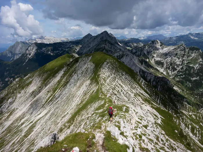
Image by ksenish The Slovenian section of the Via Alpina Red Trail is a compact but serious traverse: from the Adriatic edge near Muggia and Trieste, across the Kras (Karst) and the Idrija–Cerkno hills, then into Triglavski narodni park (Triglav National Park) and the Julijske Alpe (Julian Alps). It suits fit, experienced hut-to-hut walkers who want a varied mountain journey rather than a gentle point-to-point ramble.
The southern days ease you in with limestone plateaux, forest tracks, villages and Karst landmarks such as Škocjanske jame (Škocjan Caves), Kobilarna Lipica (Lipica stud farm), Nanos and Predjamski grad (Predjama Castle). The middle section is quieter and more logistical, linking Idrija, Ermanovec, Porezen and Črna Prst through ridges, pastures and smaller settlements.
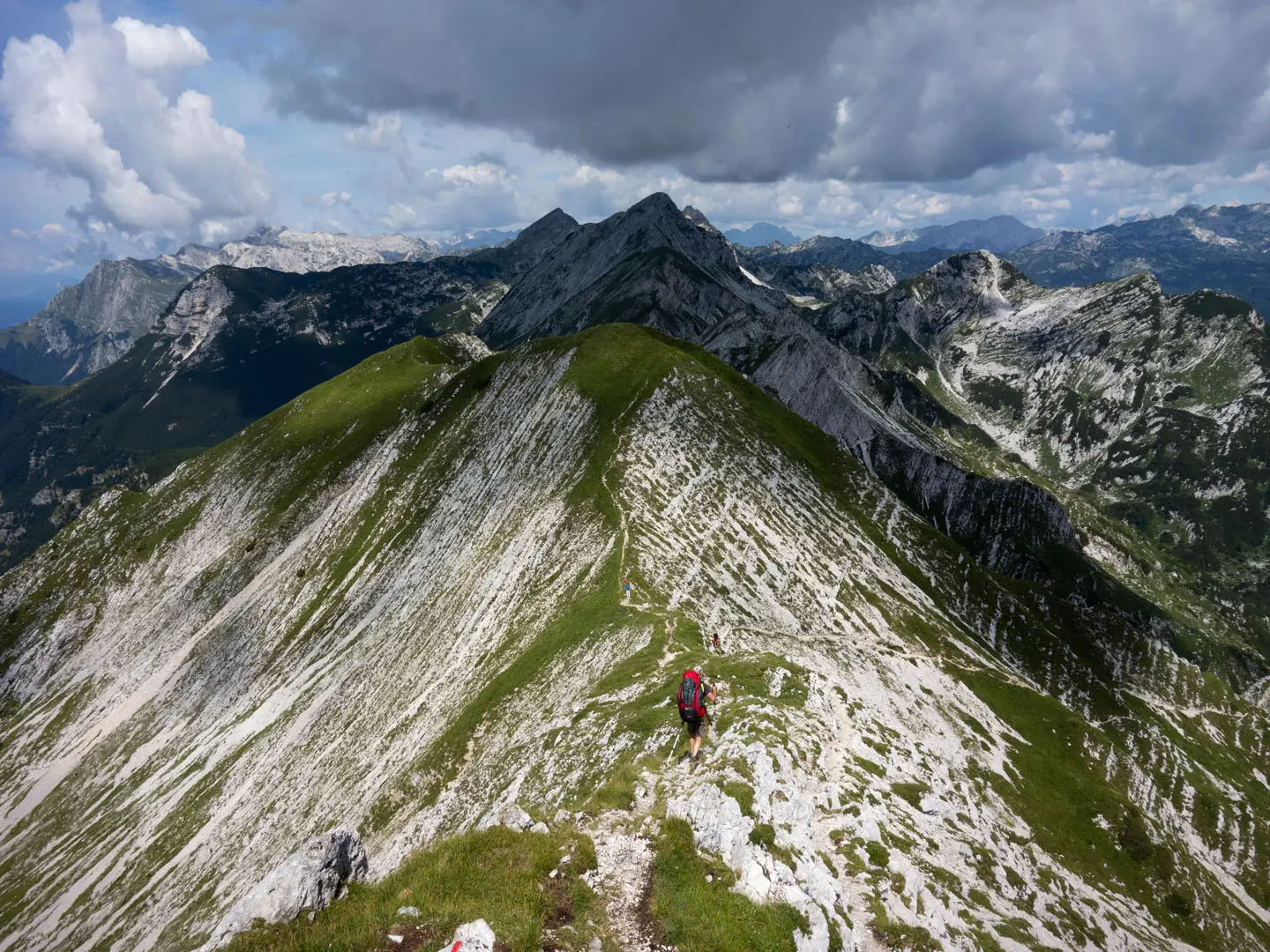
The walk changes character sharply in the north. From Komna and Dolina Triglavskih jezer (Valley of the Triglav Lakes), the route enters high limestone country, crosses Hribarice pass at about 2,358 m, drops to Trenta and then climbs over Vršič before finishing through Tamar and on towards the Korensko sedlo tri-border.
As a thru-hike, this is hard because of the cumulative ascent, committing hut stages, limited resupply in the middle hills and exposed alpine terrain in the Julian Alps. High huts must be booked ahead in peak summer, cash is useful, and snow or poor weather can make Hribarice and other high crossings a serious proposition.
This guide covers stages, daily planning, accommodation, food, transport, terrain and the common mistakes to avoid.
Stage-by-Stage Guide
The stages below follow a practical 14-day northbound sequence from Muggia (Milje) to the Korensko sedlo (Korensko Saddle) / tri-border finish. Distances are approximate, and accommodation, hut opening dates, meals, water and transport should be checked before travelling, especially outside July and August.
Stage 1: Muggia (Milje) / Rifugio Premuda to Matavun (Divača) — approx. 25 km
This is a long opening day that moves quickly from the Adriatic edge into the Kras (Karst). Northbound walkers start from Muggia near Trieste, pass the Val Rosandra / Glinščica area and cross early into Slovenia, with Rifugio Premuda as the first hut on the Via Alpina system.
The terrain is gentler than the northern half of the route: tracks, forest paths, limestone ground, village links and Karst plateau walking rather than high mountain terrain. Expect hard surfaces in places and typically dry karst conditions; do not rely on finding water between settlements unless this has been checked.
The key landmarks are Lokev, Kobilarna Lipica (Lipica stud farm) and the approach to Matavun, close to Škocjanske jame (Škocjan Caves). The caves are a major side attraction, but visiting them usually needs time beyond a normal walking day.
Food and water are best planned around the start, settlements en route and Matavun/Divača at the end. Accommodation in the Karst is typically guesthouses, B&Bs, small hotels or tourist farms rather than mountain huts; book ahead if arriving late after the full stage.
Muggia is reached from Trieste by local transport, while road access exists at several settlements along the stage. Navigation is generally straightforward on marked paths, but the route uses a mixture of local tracks, village links and Via Alpina waymarking, so a GPX track and map are useful from day one.
Stage 2: Matavun (Divača) to Razdrto — approx. 20 km
This stage continues across the Karst plateau, with limestone scenery, woodland, sinkholes and open rural ground. It is less dramatic than the later Nanos and Julian Alps stages, but it is important for building rhythm before the hillier middle section.
Surfaces are likely to vary between dirt tracks, forest paths, gravel and short paved links. In hot weather the Karst can feel exposed and dry, so start with enough water and do not assume regular sources between villages.
Matavun gives access to the Škocjan Caves area before departure, if time has been allowed. The walking then trends north-east towards Razdrto, which sits below the Nanos area and makes a logical staging point before the first serious climb.
Food and accommodation at Razdrto should be arranged before arrival. This should be checked before travelling, as the brief does not support relying on a specific shop, restaurant or lodging.
Road access is present at both ends of the stage. Navigation is not technically difficult, but karst tracks and forest paths can branch frequently; keep an eye on Via Alpina signs, Knafelc red-and-white blazes and the mapped line.
Stage 3: Razdrto to Predjama — approx. 18 km
This is the first major mountain-style day of the Slovenian section, climbing onto Nanos, a High Karst ridge above 1,000 m. The stage is shorter than the opening day but more strenuous, with a significant ascent and more exposed hill terrain.
The route moves from village-edge tracks onto steeper paths and ridge walking. Underfoot conditions can include rocky limestone, dirt, grass and gravel, and poor weather will make the ridge feel much more committing than the previous Karst stages.
Nanos is the main feature of the day. In clear conditions there are distant views back towards the Adriatic, and the small hilltop church of sv. Hieronim is one of the recognised landmarks on the ridge.
The stage ends at Predjama, known for Predjamski grad (Predjama Castle), the cave castle built into a rock face. Predjama has guesthouse-style accommodation options in the wider route corridor, but beds should be booked in advance and current food availability checked.
There is road access at both Razdrto and Predjama. Navigation needs more attention on Nanos than on the earlier plateau: keep to the marked route, avoid shortcuts on steep or rocky ground, and allow extra time if cloud, wind or rain reduces visibility.
Stage 4: Predjama to Črni Vrh — approx. 20 km
The route now leaves the headline Karst sights and enters the quieter Notranjska / Inner Carniola hill country. This is a practical linking stage through forested ridges, high pastures, hamlets and old routeways rather than a stage built around a single major summit.
Terrain is more undulating than the southern Karst, with repeated climbs and descents. Expect a mix of forest paths, tracks, gravel, occasional paved village links and potentially muddy woodland sections after wet weather.
Food and water should be treated conservatively. Predjama and Črni Vrh are the obvious planning points, and anything in between should be checked before relying on it.
Črni Vrh is a useful overnight stop before the descent to Idrija. Accommodation should be arranged in advance, as the middle section has fewer large towns and less margin for arriving without a booking.
Road access exists at the end settlement, but public transport options for this stage are not detailed in the route information. This should be checked before travelling. Navigation is usually on established Slovenian marked mountain paths, but forest junctions and hamlet links require concentration.
Stage 5: Črni Vrh to Idrija — approx. 15 km
This is a shorter day into Idrija, but it still sits within the hill section of the route rather than being an easy valley stroll. The walking continues through forested ridges and rural terrain before dropping towards one of the most important cultural stops on the route.
Idrija is a UNESCO-listed historic mercury-mining town, also known for Idrija lace. It is the best opportunity in the middle part of the hike for a proper reset: food, accommodation, laundry or equipment issues should be dealt with here rather than postponed into the hill huts.
Underfoot, expect paths, tracks, gravel and local road links. After wet weather, wooded slopes can be slippery or muddy, so trekking poles may be useful even though the stage is not high-alpine.
Food, water and accommodation are much more reliable at Idrija than on the stages immediately before and after, but opening times and lodging availability should still be checked. The town also has bus links useful for section-hiking or leaving the route.
Navigation into a town can be more awkward than open-ridge walking because of local roads, junctions and waymark changes. Follow the marked route carefully rather than simply aiming for the town centre.
Stage 6: Idrija to Planinska koča na Ermanovcu (Ermanovec hut) — approx. 16 km
This stage climbs out of Idrija into the Cerkljansko / Idrija hills, marking the start of a more sustained hut-and-ridge rhythm. The day is not especially long in kilometres, but the cumulative ascent after leaving town makes it a serious walking day.
The terrain is typical of the middle Slovenian section: forested slopes, tracks, high pastures and quiet hill country. Surfaces may include dirt, gravel, grass and local paved links, with mud possible in woodland after rain.
Idrija is the last significant service point before the route becomes more rural again. Start with food for the day and enough water; do not rely on casual resupply between Idrija and Ermanovec unless this has been checked.
Planinska koča na Ermanovcu is the stage-end accommodation. As with all huts on this route, opening dates, meals and booking requirements should be checked before travelling, and carrying cash is sensible.
Road access near the hut and any public transport escape should be checked in advance. Navigation is generally on marked mountain paths, but the combination of forestry tracks, pasture paths and small roads can be confusing without a map or GPX.
Stage 7: Planinska koča na Ermanovcu to Porezen — approx. 17 km
This is one of the key transition stages between the Idrija/Cerkno hills and the outer Julian Alps. The route continues over ridges and pastures towards Porezen, a 1,630 m grassy summit with wide views towards Triglav and the higher Julijske Alpe (Julian Alps) in clear weather.
The walking is hillier and more exposed than the Karst stages, although still largely non-technical. Expect grassy ridges, forest sections, tracks and rougher mountain paths, with weather playing a bigger role as the route gains height.
Porezen is associated with partisan and Second World War memorials, so allow time on the summit area if visibility and weather are favourable. It is also a useful psychological marker: the route is now approaching the alpine north rather than the gentler south.
Food and water between Ermanovec and the Porezen area should not be assumed. Carry enough for the full day, and check the current status of any accommodation or meals at or near Porezen before setting out.
Cerkno lies near this part of the route and is useful for section-hiking logistics, with bus links in the wider area. Reaching or leaving the route from the ridge may require a descent, so do not treat Porezen as an easy public-transport exit without checking the details.
Stage 8: Porezen to Črna Prst — approx. 15 km
This stage continues north towards the Lower Bohinj Mountains and becomes more alpine in character. Črna Prst, at 1,844 m, is a botanically famous ridge summit and an important gateway from the foothills into the high Julian Alps.
The route uses a mixture of grassy ridges, mountain paths, forest and more open ground. It is not described as technical, but the altitude, weather exposure and cumulative fatigue make it a demanding stage in a thru-hike context.
Petrovo Brdo / Podbrdo lie near this section of the route and can be relevant for access or section planning. Any transport, accommodation or descent plan here should be checked before travelling.
Food and water availability is limited compared with the town stages. Check accommodation at or near Črna Prst before committing to this day, and carry enough supplies to cover a remote finish if services are closed or full.
Navigation on the ridges is normally by Slovenian mountain waymarks and Via Alpina signs. In mist, ridge junctions and path splits can become easy to misread; a paper map or offline map should be carried rather than relying only on signs.
Stage 9: Črna Prst to Dom na Komni (Komna) — approx. 14 km
This stage brings the route firmly into the Julian Alps approach. From Črna Prst the walking trends towards Komna, with Bohinj lying below the route and Triglavski narodni park (Triglav National Park) becoming the dominant setting of the northern half.
The terrain changes from grassy ridge and pasture into rougher mountain paths, dwarf pine, limestone and more sustained alpine ground. Although the stage is moderate in length, it should not be underestimated after several consecutive hill days.
Dom na Komni is a major hut-style overnight on the route and should be booked ahead in the main season. High huts are seasonal, busy in July and August, and cash is useful; opening dates and meal availability should be checked before travelling.
Bohinj below the route is a useful wider-area transport and escape reference, with bus links in the area. Any descent from the route to reach transport or extra accommodation needs to be planned rather than improvised late in the day.
Food and water should be based around the start hut/overnight and Dom na Komni. Do not assume reliable intermediate resupply on the mountain section.
Stage 10: Dom na Komni to Koča pri Triglavskih jezerih — approx. 7 km
This is a short stage on paper, but it is one of the scenic centrepieces of the route. It leads towards Dolina Triglavskih jezer (Valley of the Triglav Lakes), a chain of glacial-karst lakes below the Triglav massif.
The walking is alpine rather than village-based: limestone, mountain paths, dwarf pine and open high-country terrain. The shorter distance can be useful for recovery before the Hribarice crossing, but poor weather can still make the day slow.
Stay on marked paths in Triglav National Park and avoid cutting corners through fragile alpine terrain. Navigation is usually clear in good visibility, but limestone basins and path junctions are less forgiving in mist.
Koča pri Triglavskih jezerih is a key hut and should be booked well in advance for July and August. Food and water planning should revolve around Dom na Komni and Koča pri Triglavskih jezerih, with enough carried to be self-sufficient between them.
There is no convenient road access on this stage. Treat it as a committed hut-to-hut mountain day despite the short distance.
Stage 11: Koča pri Triglavskih jezerih to Tržaška koča na Doliču via Hribarice pass — approx. 8 km
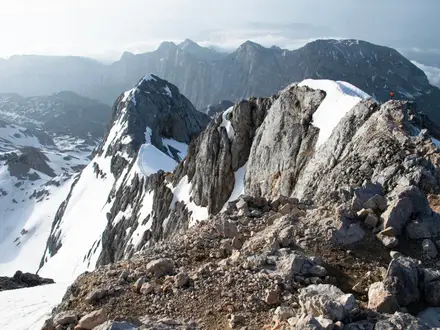
This is the highest and most serious stage of the Slovenian section. The route crosses Čez Hribarice / Hribarice pass at about 2,358 m, the high point of the route and the highest pass in the Julian Alps.
The terrain is stark, rocky and alpine: bare karstic limestone, scree, rock and exposed high-pass walking between the Triglav Lakes valley and the Dolič saddle. The route does not climb Triglav itself, but it passes through terrain where mountain weather, snow and poor visibility matter.
Snow can remain on Hribarice into early summer, and early- or late-season crossings may require axe and crampons or a lower alternative. This should be checked before travelling. Do not start this stage in poor weather without a clear plan, current conditions and the right equipment.
There is no reliable food or water between the huts. Carry enough for a full mountain day, even though the distance is short, and assume slower progress on snow, scree or wet limestone.
Tržaška koča na Doliču is the stage-end hut and must be booked ahead in the busy season. It is a high mountain hut, so check opening dates, payment expectations and meal arrangements before setting out from Koča pri Triglavskih jezerih.
Navigation is critical on this stage. Waymarks can be harder to follow on pale limestone, snow patches or in cloud, so carry a proper map and offline GPX and be prepared to turn back if conditions deteriorate.
Stage 12: Tržaška koča na Doliču to Trenta (Soča valley) — approx. 14 km
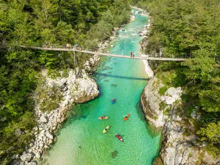
This stage descends from the high Dolič area into Trenta in the Soča valley. It is a major change in character: from bare limestone and hut-to-hut terrain down towards the emerald Soča (Isonzo) and a settled valley floor.
The upper part remains mountain terrain, with rocky paths and exposed weather. Lower down the route becomes less austere, but the descent can still be hard on tired legs, especially after the Hribarice day.
Trenta is associated with the Soča valley, the river’s source area and First World War Isonzo/Soča Front heritage. It is a logical place to reset before the final crossing over Vršič towards Tamar.
Food and water should be carried from Dolič until services are reached in the valley. Accommodation in or near Trenta should be booked before arrival; this should be checked before travelling.
Road access exists in the Soča valley, but current public transport options should be checked before relying on them. Navigation is mostly about staying on the marked descent and not underestimating the time needed to lose height safely.
Stage 13: Trenta to Dom v Tamarju via Vršič pass — approx. 14 km
This is the final major alpine crossing of the route, climbing from Trenta to Vršič pass at 1,611 m and then continuing towards Tamar. It links the Soča side of Triglav National Park with the Planica/Tamar side below Jalovec and Mojstrovka.
The terrain combines a big ascent, pass crossing and descent, with mountain paths and some contact with the Vršič road corridor. Vršič is Slovenia’s highest road pass, but the stage should still be treated as a full mountain day rather than a simple road-pass transfer.
Tičarjev dom na Vršiču provides a potential hut stop at the pass area, while Dom v Tamarju is the planned stage end. Both should be checked and booked as needed, especially in the main summer season.
The Ruska kapelica (Russian Chapel) near the Vršič road commemorates First World War prisoners of war who died building the pass road. The Sleme/Tamar area gives classic views towards Jalovec and Mojstrovka in clear weather.
Food and water planning should be based on Trenta, the Vršič hut facilities if open, and Dom v Tamarju. Snow and poor weather can affect Vršič in the shoulder seasons, so June and October conditions should be checked before travelling.
Road access at Vršič can be useful for exit or stage-splitting, but do not assume current transport without checking timetables. Navigation is generally marked, but the road-pass environment can create confusing junctions between paths, tracks and roads.
Stage 14: Dom v Tamarju to Podkoren / Korensko sedlo (Korensko Saddle) — tri-border — approx. 8 km
This short final stage completes HikeList’s Slovenian-section finish by continuing from Dom v Tamarju in the Tamar valley towards Podkoren, Korensko sedlo and the Peč / Tromeja tri-border area where Italy, Austria and Slovenia meet.
The walking is much shorter than the preceding alpine stages, but it still needs to be planned as a point-to-point finish. Weather, tiredness and onward transport can make a short final leg awkward if arrangements are left until arrival.
Food and water are best sorted at Dom v Tamarju if open, with additional services only relied on where checked in advance. Accommodation may be needed either before the final link at Tamar or afterwards in the Planica–Kranjska Gora–Podkoren area; this should be booked before travelling in busy periods.
Road access and onward transport are strongest in the Planica / Kranjska Gora / Podkoren corridor. Buses connect the wider area with Jesenice, where there is rail access on the Ljubljana / Villach line, but current connections should be checked before committing to a same-day onward journey.
Navigation is usually less technical than Hribarice or Vršič, but be clear about the chosen finish point. The Red Trail continues beyond Tamar towards Podkoren / Korensko sedlo and the tri-border, so walkers treating Tamar as the overnight stop should not accidentally omit the final Slovenian-section link.
Recommended Itinerary
Standard 14-day itinerary
This is the most practical way to walk the Slovenian Red Trail as a continuous hut-to-hut and village-to-village route. It follows the 14-stage sequence, keeps the short high-alpine days short where they need to be, and leaves the hardest terrain for booked mountain huts rather than over-ambitious link-ups.
Distances are approximate. Use official mapping and current hut information before booking, especially from Dom na Komni onwards, where snow, weather and seasonal hut opening dates can change the plan.
| Day | From | To | Approx. distance | Why this stage makes sense | Services/accommodation notes |
|---|---|---|---|---|---|
| 1 | Muggia (Milje) / Rifugio Premuda | Matavun (Divača) | 25 km | A long but logical opening stage from the Adriatic end into the Karst, crossing the early border section and finishing near the Škocjanske jame (Škocjan Caves) area. | Arrange accommodation in the Matavun/Divača area before starting. Do not rely on turning up late after a 25 km first day. |
| 2 | Matavun (Divača) | Razdrto | 20 km | Continues across the Kras/Karst plateau and positions you at the foot of the first major climb, rather than starting Nanos late in the day. | Razdrto is a practical stage break before Nanos, but accommodation and food options should be checked before travelling. |
| 3 | Razdrto | Predjama | 18 km | This is the first serious mountain day, crossing Nanos before descending towards Predjamski grad (Predjama Castle). Keeping it as a standalone stage avoids combining the route’s first big climb with the following hill-country section. | Predjama has visitor pressure because of the castle, so book ahead rather than assuming availability. |
| 4 | Predjama | Črni Vrh | 20 km | The route leaves the headline Karst sights and moves into the quieter Notranjska and Idrija hill country, with more sustained upland walking. | This is a less service-dense part of the route. Accommodation should be fixed in advance. |
| 5 | Črni Vrh | Idrija | 15 km | A shorter day is useful here because Idrija is the main practical and cultural stop in the middle section, with time for food, laundry or route admin. | Idrija is one of the better places on the route for resupply and guesthouse-style accommodation. It is also a useful exit or joining point for section hikers. |
| 6 | Idrija | Planinska koča na Ermanovcu (Ermanovec hut) | 16 km | The route leaves town and returns to high, forested hill terrain. Ending at the Ermanovec hut keeps the day contained before the more remote ridge stages ahead. | Check current hut opening and booking requirements before travelling. Carry enough cash for hut stays where card payment may not be dependable. |
| 7 | Planinska koča na Ermanovcu (Ermanovec hut) | Porezen | 17 km | A compact but demanding hill stage, building towards the Julian Alps foothills and the broad views from Porezen. | Accommodation at or near the stage end must be arranged in advance. Resupply is limited through this middle section. |
| 8 | Porezen | Črna Prst | 15 km | This stage moves from the Cerkljansko/Idrija hills towards the Lower Bohinj Mountains, making Črna Prst the natural gateway into the higher Julian Alps section. | Treat this as a mountain-stage booking, not a village-stage booking. Check opening dates and sleeping arrangements before committing to the itinerary. |
| 9 | Črna Prst | Dom na Komni (Komna) | 14 km | The route enters the Triglav National Park high country and reaches one of the key Julian Alps hut bases without overloading the day. | Dom na Komni is a major mountain hut stop. Book ahead in July and August and check seasonal opening dates outside peak summer. |
| 10 | Dom na Komni (Komna) | Koča pri Triglavskih jezerih (Dolina Triglavskih jezer / Valley of the Triglav Lakes) | 7 km | The short distance is intentional: this is scenic, high-alpine terrain where weather, photography stops and hut timing matter more than mileage. | Koča pri Triglavskih jezerih is one of the most important huts on the route and can be busy. Advance booking is essential in the main season. |
| 11 | Koča pri Triglavskih jezerih | Tržaška koča na Doliču, via Hribarice pass | 8 km | Although short on paper, this is one of the most serious days: the route crosses Hribarice at about 2,358 m, the high point of the Slovenian section. Keep this day deliberately short for weather, snow and exposure. | Tržaška koča na Doliču is a high mountain hut. Check opening dates, snow conditions on Hribarice and the forecast before setting out. |
| 12 | Tržaška koča na Doliču | Trenta (Soča valley) | 14 km | A descent from the high limestone world into the Soča valley gives a useful reset after the most committing pass crossing. | Trenta offers valley accommodation and is a sensible place to recover, eat properly and reassess weather before Vršič. |
| 13 | Trenta (Soča valley) | Dom v Tamarju, via Vršič pass | 14 km | This is a major crossing day over Vršič, Slovenia’s highest road pass, before dropping towards Tamar below Jalovec and Mojstrovka. | Dom v Tamarju should be booked ahead. If the weather is poor or the day feels too long, Tičarjev dom na Vršiču can be used as a logical split point, subject to availability. |
| 14 | Dom v Tamarju (Tamar / Planica) | Podkoren / Korensko sedlo (Korensko Saddle) — tri-border | 8 km | A short final stage completes the Slovenian section towards the Italy–Austria–Slovenia tri-border without needing to rush onward transport. | Plan finish logistics from the Tamar/Planica–Kranjska Gora–Podkoren area. Bus connections towards Jesenice and onward rail links should be checked before travelling. |
Slower variant: 15 days or more
A slower plan suits hikers who want more margin for weather, hut availability, sightseeing in the Karst and Idrija, or a less pressured finish through Triglavski narodni park (Triglav National Park).
The cleanest 15-day walking split is to break Day 13 at Vršič, using Tičarjev dom na Vršiču if available. This changes the end of the itinerary to:
| Day | From | To | Approx. distance | Why this stage makes sense | Services/accommodation notes |
|---|---|---|---|---|---|
| 13 | Trenta | Tičarjev dom na Vršiču | Check official mapping before booking | Shortens the Vršič crossing and gives more margin in poor weather or after a tiring Dolič–Trenta descent the previous day. | Book the Vršič hut in advance and check seasonal opening. |
| 14 | Tičarjev dom na Vršiču | Dom v Tamarju | Check official mapping before booking | Keeps the final mountain section into Tamar separate from the climb out of Trenta. | Book Dom v Tamarju ahead, especially in July and August. |
| 15 | Dom v Tamarju | Podkoren / Korensko sedlo — tri-border | 8 km | Leaves the final tri-border walk as an unhurried completion day with easier onward logistics. | Check bus times from the Planica/Kranjska Gora/Podkoren area before travelling. |
Another sensible slower option is to add a non-walking night in Idrija, or in the Bohinj-area access zone below the route, depending on accommodation availability and personal resupply needs. This is particularly useful if hut dates in the Julian Alps force a fixed booking sequence.
Faster variant: 13 days or a very fast traverse
A 13-day version is possible for strong, efficient walkers by combining the final Tamar and tri-border day. This means walking from Trenta to Podkoren / Korensko sedlo via Vršič and Dom v Tamarju in one long final push of about 22 km, using the stage distances. It only makes sense with stable weather, an early start and realistic onward transport or accommodation plans.
Another possible time-saving combination is Dom na Komni to Tržaška koča na Doliču in one day, linking the 7 km stage to Koča pri Triglavskih jezerih with the 8 km Hribarice stage. That keeps the distance moderate on paper, but it removes a valuable high-hut night before the route’s most exposed pass and should only be considered in settled conditions with no problematic snow on Hribarice.
Very strong walkers have completed the Slovenian portion in about seven long days, but that is a fastpacking-style traverse rather than the recommended itinerary. It suits only hikers already comfortable with repeated long mountain days, minimal delays, limited resupply windows and fully pre-arranged hut logistics.
Planning the Route
How many days to allow
Plan around the standard 14-stage structure unless there is a strong reason to do otherwise. Most independent walkers should allow 13–15 days, with an extra weather or rest day if travelling in the main hut season or if the Hribarice crossing is likely to be affected by snow.
Although very strong walkers have completed the Slovenian section in about seven long days, that is a fastpacking-style schedule rather than the best way to plan a hut-to-hut journey. The route becomes more committing in the north, where short map distances can still mean slow progress over limestone, scree and exposed passes.
A slower itinerary is usually more robust. It gives more flexibility around hut bookings, afternoon storms, heat in the Karst, and the high crossing from Koča pri Triglavskih jezerih to Tržaška koča na Doliču over Hribarice.
Let accommodation dictate the stages
This is not a route where every day can be freely adjusted at the last minute. In the southern Karst and Idrija/Cerkno hills, stage ends are tied to villages, guesthouses, tourist farms, small hotels and B&Bs. In the Julijske Alpe (Julian Alps), the itinerary is much more hut-led.
The key high-mountain nights to plan carefully are around Dom na Komni, Koča pri Triglavskih jezerih, Tržaška koča na Doliču, Tičarjev dom na Vršiču and Dom v Tamarju. These huts are seasonal, busy in July and August, and should be booked ahead.
Carry cash for mountain huts and do not rely on being able to change plans easily once in Triglavski narodni park (Triglav National Park). Opening dates, booking arrangements and meal availability should be checked before travelling.
Planning by route section
| Route section | Planning character | Main issue |
|---|---|---|
| Muggia / Rifugio Premuda to Razdrto | Lower, more settled Karst stages with village links and cultural stops such as Škocjanske jame and Kobilarna Lipica | Heat, water planning and arranging accommodation in the correct villages |
| Razdrto to Idrija | The first serious hill section, including Nanos and Predjama | Longer climbs and fewer easy ways to rearrange the day once started |
| Idrija to Črna Prst | Remote-feeling Cerkljansko/Idrija hills and Julian Alps foothills, via Ermanovec and Porezen | Limited resupply and the need to line up overnight stops carefully |
| Črna Prst to Trenta | Entry into the high Julian Alps, including Komna, Dolina Triglavskih jezer and Hribarice | Hut booking, snow conditions, exposed limestone terrain and mountain weather |
| Trenta to Tamar / Korensko sedlo | Final crossing via Vršič and the Planica/Tamar area | Transport out, weather on the pass and deciding whether to finish at Tamar or continue to the tri-border |
Shortening, extending and rest days
The simplest short version is to walk only one broad block of the route rather than trying to cut days randomly from the full crossing. Practical section breaks include Idrija, Cerkno and the Bohinj area, all of which have bus links useful for joining, leaving or pausing the route.
In the north, shortening is less straightforward because the route is governed by hut locations and passes. The high section over Hribarice should not be treated as a casual add-on; snow, poor visibility or storms can make a short stage much more serious.
The natural extension is to continue from Dom v Tamarju towards Podkoren, Korensko sedlo and the Peč / Tromeja tri-border, which HikeList treats as the finish of the Slovenian section. If transport, accommodation or weather make that final leg awkward, finishing at Tamar is a practical endpoint, but the tri-border is the cleaner route finish.
Section hiking
Section hiking is practical, especially in the southern and middle parts of the route. Muggia/Trieste, Idrija, Cerkno and the Bohinj area are the most useful planning anchors mentioned on the route, with onward public transport options varying by season and day of week.
For a first section, the Karst stages to Predjama or Idrija are easier to organise than the high-alpine hut chain. For a mountain-focused section, the Komna–Triglav Lakes–Dolič–Trenta–Vršič–Tamar part is the scenic core, but it needs the most careful booking and weather judgement.
Public transport at the finish requires separate planning from the walk itself. From the Tamar/Planica–Kranjska Gora–Podkoren area, buses connect towards Jesenice, where there is rail access on the line to Ljubljana and Villach; current services should be checked before travelling.
Food, water and resupply
Do not plan this as a fully serviced village-to-village walk throughout. The Karst and town stages offer more options, but the middle hills and the Julian Alps require more self-sufficiency between overnight stops.
Carry enough food for long days between known accommodation points, especially between Idrija, Ermanovec, Porezen, Črna Prst and the high huts. In the hut section, meals are usually part of the planning, but availability and opening dates should be checked before travelling.
Water planning matters in both the limestone Karst and the high mountains. Do not rely on every stream, spring or hut tap being available without checking locally; carry enough capacity for hot, exposed stages and for long climbs between settlements or huts.
Navigation and maps
The route is waymarked as the Via Alpina Red Trail, using existing Slovenian marked mountain paths and Knafelc red-and-white blazes. Even so, carry proper mapping and offline navigation, particularly where the route crosses forested hills, high limestone terrain and exposed passes.
Use the official Via Alpina stage information and GPX alongside Slovenian mountain maps from Planinska zveza Slovenije (PZS). The relevant map coverage includes the Karst/Nanos area in the south and Julijske Alpe / Triglav sheets for the northern stages.
Take care not to follow information for the Via Alpina Purple Trail. That is a different Slovenian route and leads away through the Karavanke and Kamnik–Savinja Alps rather than along this Red Trail line to Tamar and Korensko sedlo.
Weather, snow and timing
The planning constraint in the north is not just distance; it is mountain conditions. Hribarice, at about 2,358 m, can hold snow into early summer, and early or late-season crossings may require winter equipment or a lower alternative.
June and October need particular caution on the high passes, including Hribarice and the Vršič area. Snow conditions, hut opening dates and trail diversions should be checked before travelling.
In midsummer, book huts early and start days with enough margin for heat, storms and slower progress on rock. A spare day is more useful than an over-tight schedule, especially between Komna, the Triglav Lakes, Dolič and Trenta.
Permits and park rules
The route passes through Triglavski narodni park (Triglav National Park), so current park rules and any access restrictions should be checked before travelling. Do not treat hut reservations as a substitute for checking local regulations.
In practical terms, the main planning burden is accommodation, transport, food, water, navigation and weather rather than paperwork. The high-alpine section rewards a conservative itinerary with confirmed hut nights and clear escape options.
Towns, Villages and Overnight Stops
Accommodation planning is one of the main constraints on the Slovenian Red Trail. The route begins with settlements, guesthouses and valley services in the Karst and Idrija/Cerkno hills, then becomes a hut-to-hut mountain journey through Triglavski narodni park (Triglav National Park).
Do not assume every stage-end has a full range of services. Book beds ahead, carry cash for high huts, and check current PZS hut opening dates before committing to the northern stages.
Muggia (Milje)
Muggia is the Adriatic start point near Trieste, with the Red Trail beginning at Piazza Marconi before crossing into Slovenia early in the walk. It is a practical place to arrive the day before starting, especially if travelling internationally via Trieste.
Trieste has rail and bus connections and an airport nearby; Muggia is reached from Trieste by a short bus or ferry hop. Current local transport times should be checked before travelling.
Accommodation and food options are better here than on the first walking day, so it is sensible to stock up before leaving the coast. Northbound walkers commonly start after visiting the Adriatic, but the route quickly becomes a cross-border walking stage rather than a coastal holiday stop.
Rifugio Premuda
Rifugio Premuda is the first hut associated with the route after the Muggia start, near Val Rosandra / Glinščica. It is notable as the lowest Alpine-club hut on the Via Alpina, but for many walkers it is more of an early route marker than a main overnight stop if continuing to Matavun.
Use it as a useful staging point only if the first day is being split. Opening, food availability and booking arrangements should be checked before travelling.
Val Rosandra / Glinščica
Val Rosandra / Glinščica is the early border-area valley between the Trieste/Muggia start and the Slovenian Karst. It is a useful navigation landmark rather than a major resupply point.
Do not plan around reliable services here unless they have been checked in advance. Most walkers will have bought food before leaving Muggia or Trieste and will continue towards the Karst settlements.
Lokev
Lokev is one of the first Slovenian Karst villages on or near the route. The briefed accommodation pattern for this southern section includes guesthouses, tourist farms, small hotels and B&Bs, and Lokev is one of the named Karst stops where these may be relevant.
It can work as a shorter first-stage overnight if the full Muggia/Rifugio Premuda to Matavun day is too long. Food and shop availability should be checked before relying on it, particularly outside the main walking season.
Matavun / Divača and Škocjanske jame (Škocjan Caves)
Matavun, near Divača, is the first major practical stage-end in the 14-day sequence. It is also the access point for Škocjanske jame (Škocjan Caves), the UNESCO-listed karst cave system carved by the Reka river.
This is a good place to overnight if following the standard south-to-north itinerary, because the next day continues across the Karst towards Razdrto. Accommodation should be booked ahead rather than left to chance, especially if also allowing time for the caves.
Food options are more plausible here than at isolated hill stops, but hikers should still check opening hours and avoid assuming late arrivals will find a meal. Divača is the nearest larger named settlement in this area; onward transport details should be checked before travelling.
Lipica
Lipica, home of Kobilarna Lipica (Lipica stud farm), is passed early in the Slovenian section. It is an important landmark and potential pause, but it is not one of the main stage-end overnights in the standard itinerary.
It is useful mainly for timing the first stage and for anyone building a slower Karst itinerary. Do not depend on it for resupply without checking current visitor facilities and opening times.
Razdrto
Razdrto is the usual overnight after Matavun/Divača and sits before the first serious climb over Nanos. It is a strategic stop because the following day changes character from gentler Karst walking to a bigger upland stage.
Treat Razdrto as a functional village stop: secure accommodation in advance and arrive with enough food for the next day if local shop or meal options are uncertain. This should be checked before travelling.
Nanos
Nanos is the first major height gain on the route, rising above 1,000 m and giving the first real mountain feel of the Slovenian section. It is not primarily a village resupply stop; it is the upland crossing between Razdrto and Predjama.
The stage over Nanos should be planned as a self-sufficient walking day. Carry food, water and bad-weather layers from the valley, and do not assume services on the ridge unless specifically checked before travelling.
Predjama
Predjama is the stage-end after the Nanos crossing and is known for Predjamski grad (Predjama Castle), built into the rock face. It is one of the named southern accommodation areas where guesthouses, tourist farms, small hotels or B&Bs may be part of the overnight plan.
This is a logical place to stop because the next day heads towards Črni Vrh across quieter country. Book ahead and check whether evening meals are available at the accommodation; village services may not suit late walkers.
Črni Vrh
Črni Vrh is the next practical overnight between Predjama and Idrija. It marks the transition into the more remote Notranjska and Idrija/Cerkno hill section, where daily ascent becomes more sustained and resupply becomes less convenient.
Accommodation is likely to be more limited than in larger towns, so this is not a place to improvise. Check lodging, meals and any shop opening times before travelling, and carry enough provisions to reach Idrija if local services are closed.
Idrija
Idrija is the most important town stop in the middle of the route. It is a UNESCO-listed historic mercury-mining town, known also for Idrija lace, and it is the clearest opportunity to reset after the early Karst and hill stages.
This is one of the best places on the route for a planned overnight, laundry, food resupply and recovery. The briefed accommodation pattern includes small hotels, B&Bs and other town-based options here.
Idrija also has bus links useful for section-hiking or leaving the trail. Timetables and onward connections should be checked before travelling, but it is one of the more practical mid-route access points.
Planinska koča na Ermanovcu (Ermanovec hut)
Planinska koča na Ermanovcu is the stage-end after Idrija and the first hut-style overnight in the practical itinerary. It sits in the Idrija/Cerkno hill country before the route continues towards Porezen.
Book ahead and check opening dates, meals and payment arrangements. Even before the high Julian Alps, hut logistics matter: carry cash and do not rely on a shop at the hut.
Cerkno area
Cerkno lies near the route in the middle hill section and is a useful reference point for accommodation and transport planning. The briefed accommodation pattern for the Idrija/Cerkno hills includes guesthouses, tourist farms, small hotels and B&Bs.
It can be useful for section-hikers or anyone needing to adjust the itinerary around the Ermanovec–Porezen stages. Cerkno has bus links useful for access or escape, but current timetables should be checked before travelling.
Porezen
Porezen is the stage-end after Ermanovec and one of the first major viewpoints towards the higher Julijske Alpe (Julian Alps). It is a hill and hut-style stop rather than a service village.
Plan to be self-contained for food between the previous stop and Porezen unless meals have been arranged. Accommodation, opening dates and payment should be checked in advance, particularly outside the main summer season.
Petrovo Brdo / Podbrdo area
Petrovo Brdo and Podbrdo sit near the route between Porezen and Črna Prst. They are useful planning names for anyone shortening, joining or leaving the walk around the foothills before the route enters the higher Julian Alps.
Do not assume frequent transport or full services without checking. This should be checked before travelling, especially if using the area as a section-hike access point.
Črna Prst
Črna Prst is the stage-end before the route drops into the Bohinj side and then climbs towards Komna. At 1,844 m, it is a serious mountain stop and the gateway from the foothills into the high Julian Alps.
Treat this as a hut-based overnight with limited backup options nearby. Book ahead, carry cash, and check whether the hut is open on the intended dates.
The following stages move into Triglav National Park terrain, so this is a good point to review weather, food, hut bookings and the condition of the higher passes. Early or late in the season, snow conditions higher up may affect plans.
Dom na Komni (Komna)
Dom na Komni is a key Julian Alps hut and a logical overnight before the Dolina Triglavskih jezer (Valley of the Triglav Lakes). The standard stage into Komna follows Črna Prst, and the next day to Koča pri Triglavskih jezerih is shorter in distance but still mountain terrain.
This is one of the huts that should be booked ahead in July and August. It is seasonal, cash-friendly and should not be treated like a valley hotel with guaranteed last-minute space.
Bohinj area
Bohinj lies below the route and is not the direct stage-end in the standard sequence, but it is an important practical support area for the Komna and Triglav Lakes section. It can be useful for section-hikers, rest logistics or escape from the high route.
The Bohinj area has bus links useful for access and route adjustment. Current connections should be checked before travelling.
If dropping from the route for services, factor in the extra time and ascent needed to regain the high-level itinerary. This is not a casual detour if hut bookings have already been fixed further north.
Koča pri Triglavskih jezerih (Valley of the Triglav Lakes)
Koča pri Triglavskih jezerih is one of the most important overnights on the whole Slovenian section. It sits in Dolina Triglavskih jezer (Valley of the Triglav Lakes), between Komna and the high crossing of Hribarice.
Book this hut well ahead in peak season. The location is popular, remote and central to several high-mountain itineraries, so turning up without a reservation in July or August is poor planning.
Carry cash and enough food margin for delays. The next stage to Tržaška koča na Doliču crosses the route high point at Hribarice, so weather and snow conditions matter more here than in the southern half.
Hribarice pass
Hribarice pass is not an overnight stop. It is the high point of the route at about 2,358 m and the highest pass in the Julian Alps, crossed between Koča pri Triglavskih jezerih and Tržaška koča na Doliču.
Plan this as a committing high-alpine crossing. Snow can linger into early summer, and early or late-season conditions may require winter equipment or a lower alternative; this should be checked before travelling.
Tržaška koča na Doliču (Dolič)
Tržaška koča na Doliču is the hut after the Hribarice crossing and one of the most exposed-feeling overnight stops on the Slovenian Red Trail. It sits near the Dolič saddle, with the route continuing down towards Trenta.
This hut must be planned carefully: check opening dates, book ahead, carry cash and arrive with a realistic bad-weather plan. The route does not summit Triglav, but this is still high Julian Alps terrain where conditions can change quickly.
Trenta (Soča valley)
Trenta is the valley stop after the descent from Dolič. It is the main low-level recovery point inside the northern mountain section and sits in the Soča valley, associated with the izvir Soče (source of the Soča) and WWI Isonzo/Soča Front heritage.
This is a valuable overnight because it breaks the high huts before the Vršič crossing and final approach to Tamar. It is also the place to reassess weather and energy before crossing Slovenia’s highest road pass.
Accommodation and meals should still be booked or checked ahead, particularly in summer. Transport details from Trenta are not specified here; this should be checked before travelling if using it as an exit point.
Vršič pass and Tičarjev dom na Vršiču
Vršič pass, at 1,611 m, is crossed on the route from Trenta towards Tamar. Tičarjev dom na Vršiču is the relevant hut stop at the pass area, and it can be used to split the final mountain stage if needed.
The pass is also a key weather and logistics checkpoint. Conditions on or around Vršič can still matter in June and October, so check the forecast and any snow information before committing to the crossing.
The Ruska kapelica (Russian Chapel) beside the road commemorates WWI prisoners of war who died building the pass road. For hikers, the practical value of Vršič is that it provides a hut and road-pass staging point before the route continues towards Tamar and Planica.
Dom v Tamarju (Tamar / Planica)
Dom v Tamarju is the standard final hut-style overnight in the Tamar valley at the head of the Planica valley, below Jalovec and Mojstrovka. HikeList treats the Slovenian section as continuing a short way beyond Tamar towards Podkoren / Korensko sedlo and the tri-border.
Book ahead in the main season and carry cash. Although this is near the end of the Slovenian section, it is still a mountain hut rather than a town stop with full services.
From the Tamar/Planica–Kranjska Gora–Podkoren area there are bus links towards Jesenice, which has a railway station on the line to Ljubljana and Villach. Current bus times and seasonal onward connections should be checked before travelling.
Podkoren / Korensko sedlo (Korensko Saddle) and the tri-border
Podkoren and Korensko sedlo form the practical end area for the Slovenian Red Trail, with the route reaching the Peč / Tromeja tri-border where Italy, Austria and Slovenia meet. This is the finish logistics zone rather than a remote final bivouac point.
Use Podkoren and the nearby Kranjska Gora area for onward buses towards Jesenice and wider connections. Timetables vary by season and should be checked before travelling.
If finishing at the tri-border, keep enough time for the final short stage from Tamar and for onward travel afterwards. Do not assume that transport will line up neatly with the walking finish without advance planning.
Getting to the Start
The Slovenian Red Trail starts at Piazza Marconi in Muggia (Milje), just south of Trieste on the Adriatic. Most walkers should treat Trieste as the main transport gateway, then make the short local transfer to Muggia before starting.
By train
Trieste has a railway station and is the most practical railhead for the start. From there, continue to Muggia by local bus, ferry or taxi; the exact local service pattern changes seasonally and by day of week. This should be checked before travelling.
If arriving from within Slovenia, Ljubljana is the main rail hub, but the route starts over the border in Italy rather than at a Slovenian station. Plan the cross-border leg to Trieste carefully, especially if aiming to reach Muggia the same evening. This should be checked before travelling.
By bus
Muggia is a short bus hop from Trieste, making it straightforward to sleep in Trieste and transfer to the start in the morning. Local bus times should be checked close to departure, particularly for early starts, Sundays and public holidays.
Long-distance buses may be useful for reaching Trieste from elsewhere in Italy or Slovenia, but connections and stopping points vary. Build in enough margin if the first walking day continues beyond Muggia towards Rifugio Premuda, Val Rosandra / Glinščica and Matavun near Divača.
By car
Driving to the start is usually less convenient than public transport because this is a point-to-point route finishing far to the north around Tamar, Planica, Podkoren and the Korensko sedlo (Korensko Saddle) tri-border. Leaving a car at Muggia or Trieste means arranging a long return journey from the finish via the Kranjska Gora / Jesenice side of the route.
Long-stay parking options in Muggia or Trieste should be checked before travelling. If using a car, the cleaner plan is often to park at or near the finish and use public transport back towards Trieste before starting, but current bus and rail links must be checked carefully.
From the nearest airport
Trieste is the nearest practical airport gateway for the start, with onward transfer by local transport or taxi to Muggia. Ljubljana is also relevant for international arrivals, especially if combining the start or finish logistics with Slovenian rail and bus travel.
Do not assume late-evening public transport will line up with flight arrivals. If arriving late, stay in Trieste or Muggia and start the trail the following morning.
Where to stay before starting
Muggia is the most convenient place to stay if you want to begin directly from Piazza Marconi and make an early start. Trieste gives more transport flexibility and is still close enough for a short transfer to the start.
Some itineraries begin with the short approach from Muggia towards Rifugio Premuda before continuing into Slovenia. If planning to use Rifugio Premuda as part of the first night’s logistics, check its current opening arrangements before travelling.
For a smooth first day, arrive the day before, buy any remaining food and cash, and avoid depending on a same-day international arrival. The route crosses into Slovenia early, then continues through the Karst towards Lokev, Matavun / Divača, Škocjanske jame (Škocjan Caves) and Lipica, so missed morning connections can make the opening stage unnecessarily tight.
Which Direction Should You Walk?
The standard and most practical direction for the Slovenian Via Alpina Red Trail is south to north: Muggia (Milje) / Trieste to Tamar, Podkoren and Korensko sedlo. This follows the natural progression of the route from the Adriatic Karst into the Julijske Alpe (Julian Alps), with the hardest and most exposed ground saved for the final third.
Walking it in reverse is possible, but it changes the character of the trip significantly. A southbound itinerary puts the high huts, Hribarice pass and Vršič pass at the start, before the body has had several walking days to settle into the rhythm of the route.
| Direction | Main advantages | Main drawbacks |
|---|---|---|
| Northbound: Muggia → Tamar / Korensko sedlo | Best scenery progression; easier first days through the Karst; Trieste and Muggia are straightforward starting logistics; high-alpine section comes after several conditioning days | Finish logistics from Tamar / Planica require bus connections via Kranjska Gora, Podkoren or Jesenice; high huts still need advance booking |
| Southbound: Tamar / Korensko sedlo → Muggia | Ends near Trieste, which can be convenient for onward travel; difficult alpine section completed early if weather is settled | Starts with the most committing terrain; hut bookings and mountain weather become immediate constraints; less satisfying scenery progression for most walkers |
Why northbound works better
Northbound gives the route a useful build-up. The early stages through the Kras/Karst, around Matavun, Lipica, Razdrto and Nanos, are still long enough to matter, but they are less committing than the high limestone passes in Triglavski narodni park (Triglav National Park).
This direction also makes the scenery feel increasingly alpine. The route moves from olive groves, vineyards, limestone plateaux and forest tracks into the Cerkljansko/Idrija hills, then on to Porezen, Črna Prst, Komna, Dolina Triglavskih jezer (Valley of the Triglav Lakes), Hribarice and Vršič. For most walkers, that south-to-north escalation is the strongest way to experience the Slovenian section.
The psychological finish is also better northbound. Reaching Dom v Tamarju beneath Jalovec and Mojstrovka, then continuing towards Podkoren, Korensko sedlo and the Italy–Austria–Slovenia tri-border, feels like a clear mountain finish rather than a gradual descent out of the Alps.
Transport and accommodation direction
Starting northbound is usually simpler: Trieste has a railway station and nearby airport, and Muggia is a short bus or ferry hop from Trieste. That makes the start easy to control, especially if arriving from outside Slovenia.
The finish needs more planning. From the Tamar / Planica / Kranjska Gora / Podkoren area, buses connect towards Jesenice, which has rail links towards Ljubljana and Villach, with seasonal and onward connections varying by date. This should be checked before travelling.
Accommodation also favours northbound planning. The route begins with guesthouses, tourist farms, small hotels and B&B-style stops in the Karst and Idrija/Cerkno hills, then becomes a hut-to-hut mountain route in the Julian Alps. By the time you reach Dom na Komni, Koča pri Triglavskih jezerih, Tržaška koča na Doliču, Tičarjev dom na Vršiču and Dom v Tamarju, the walking is more alpine and the booking stakes are higher.
In reverse, the opposite applies: the trip starts with the seasonal, busy, cash-friendly high huts and the most weather-sensitive stages. That can work for an experienced party with fixed hut reservations and a stable forecast, but it leaves little room for adjustment at the beginning.
Are the climbs easier one way?
There is no simple “easier” direction for the whole route. The Slovenian section has sustained ascent whichever way it is walked, and the high point at Čez Hribarice / Hribarice pass must be crossed in either direction.
Northbound has the practical advantage of progression. The legs are warmed up before the route reaches the long, exposed limestone stages around Komna, the Triglav Lakes, Dolič, Trenta and Vršič. Southbound concentrates the hardest mountain logistics and terrain in the opening days, which is less forgiving if fitness, weather or snow conditions are uncertain.
Prevailing wind is not a major planning factor for this route. Mountain weather, thunderstorm risk, snow on high passes and hut opening dates matter far more than walking direction.
Recommendation
Walk the Via Alpina Slovenian section northbound, from Muggia to Tamar and Korensko sedlo, unless there is a strong transport or accommodation reason to do otherwise. It gives the best build-up in terrain, the most satisfying scenery progression, easier early logistics from Trieste, and a stronger finish in the high Julian Alps near the tri-border.
Accommodation Along the Route
Accommodation on the Slovenian Red Trail changes sharply as the route moves north. The Karst and Idrija/Cerkno hills use a mix of guesthouses, tourist farms, small hotels and B&Bs, while the Julijske Alpe (Julian Alps) section becomes a true hut-to-hut mountain itinerary using planinske koče run by the Alpine Association of Slovenia (PZS).
The most important planning point is that the northern huts are not optional conveniences: they are the backbone of the route through Triglavski narodni park (Triglav National Park). Dom na Komni, Koča pri Triglavskih jezerih, Tržaška koča na Doliču, Tičarjev dom na Vršiču and Dom v Tamarju should be booked ahead, especially in July and August and over weekends.
High huts are seasonal, typically operating from around mid-June to late September or early October. Exact opening dates, meal availability and booking arrangements should be checked before travelling. Carry cash for the high huts, as card reliability should not be assumed in the mountains.
Where accommodation is easiest
The strongest choice is in the larger valley and town stops rather than on the ridges. Idrija is the best mid-route town for a proper hotel or guesthouse night, laundry, food and a reset before the tougher northern half. The Cerkno area also gives more flexibility than the smaller ridge and hut stops around Ermanovec, Porezen and Črna Prst.
In the southern Karst section, accommodation exists in places such as Lokev, Senožeče and Predjama, but many stops are small. Beds can be limited and may be spread between nearby villages rather than directly on the line of the trail, so contact accommodation before fixing daily stages.
The main accommodation bottlenecks
The biggest bottlenecks are the high-alpine hut stages from Komna through Dolina Triglavskih jezer (Valley of the Triglav Lakes), Hribarice and Dolič. There is no practical settlement fallback on the Hribarice crossing itself, and the stage between Koča pri Triglavskih jezerih and Tržaška koča na Doliču should not be treated casually if beds are unavailable.
Porezen and Črna Prst are also limited overnight points. They work well in a classic hut-to-hut schedule, but alternatives are less flexible than in the Karst and town sections. If travelling early or late in the season, their current opening status should be checked before travelling.
Inn-to-inn, luggage transfer and taxi options
This route only partly suits inn-to-inn walkers. The southern and middle sections can be planned around guesthouses, tourist farms, small hotels and B&Bs, but the Julian Alps section is a mountain-hut itinerary unless the walker deliberately drops off route into valleys and later rejoins.
A route-wide luggage-transfer service should not be assumed. Local transfers may help around road-served settlements or valley stops, but they are not a solution for the high hut chain around Komna, the Triglav Lakes, Hribarice and Dolič. Any taxi or bag arrangement should be organised in advance; this should be checked before travelling.
| Place | Accommodation level | Best for | Notes |
|---|---|---|---|
| Muggia (Milje) / Trieste area | Good | Pre-start night | Practical base before starting from Piazza Marconi in Muggia. Start transport from Trieste to Muggia should be checked before travelling. |
| Rifugio Premuda / Val Rosandra (Glinščica) | Limited | First hut option / early-stage logistics | The first hut on the route after Muggia and the lowest Alpine-club hut on the Via Alpina. Useful if splitting the opening section. |
| Lokev / Matavun / Divača | Limited | Karst overnight and Škocjanske jame access | Early-stage guesthouse-style accommodation is possible in this area, but beds should be booked rather than assumed. |
| Senožeče / Razdrto | Limited | Karst stage break before Nanos | Small-place accommodation. Check exact location against the trail before booking. |
| Predjama | Limited | Overnight after the Nanos stage | Convenient for Predjamski grad (Predjama Castle), but accommodation choice is not large. Book ahead. |
| Črni Vrh | Limited | Breaking the Predjama–Idrija section | A practical stage stop, but not a large accommodation centre. This should be checked before travelling. |
| Idrija | Good | Best mid-route town stop | One of the strongest places for a comfortable night, resupply and a rest before the hillier middle section. |
| Planinska koča na Ermanovcu | Limited | Hut-to-hut continuation after Idrija | A key route stop rather than a flexible accommodation base. Check current opening dates before travelling. |
| Cerkno area | Good | Alternative town facilities / rest planning | The route passes near Cerkno; useful where a town-based night is preferred to a ridge stop. Transfers or route access should be checked. |
| Porezen | Limited | Ridge overnight and approach to the Julian Alps | Limited accommodation in the route-stop area. Check opening and booking before relying on it. |
| Petrovo Brdo / Podbrdo area | Limited | Section break or valley alternative | Useful for adjusting the Porezen–Črna Prst section, but accommodation and transport details should be checked before travelling. |
| Črna Prst | Limited | Gateway into the higher Julian Alps | A limited high-ridge overnight point. Important to book or check availability in advance. |
| Dom na Komni | Limited | Start of the main Julian Alps hut chain | PZS hut accommodation. Book ahead in summer and at weekends. |
| Koča pri Triglavskih jezerih | Limited | Dolina Triglavskih jezer overnight | One of the key scenic and logistical hut stops. High demand in July–August; advance booking is strongly advised. |
| Hribarice pass | None | High crossing only | No accommodation at the route high point. Do not start the crossing without a secure plan for the next hut or valley. |
| Tržaška koča na Doliču | Limited | Essential hut after Hribarice | A critical high-mountain overnight stop. Check opening, weather and booking before committing to this stage. |
| Trenta | Limited | Valley night in the Soča area | Useful after descending from Dolič and before the Vršič crossing. Accommodation should be arranged ahead in the summer season. |
| Vršič pass / Tičarjev dom na Vršiču | Limited | Pass overnight or backup stage split | Tičarjev dom na Vršiču provides a hut option at the pass. Check opening and booking before relying on it. |
| Dom v Tamarju / Planica | Limited | Final hut night before Podkoren / Korensko sedlo | Good for finishing the Slovenian section around Tamar, Planica and the tri-border continuation. Book ahead at busy times. |
| Podkoren / Korensko sedlo (Korensko Saddle) | Limited | Finish logistics | The saddle/tri-border is a finish point rather than an accommodation hub. Plan onward travel and any final night in advance. |
Camping and Wild Camping
Camping is not the natural way to plan the Slovenian Via Alpina Red Trail. The route is set up far more as a mixed guesthouse-and-hut traverse: villages, tourist farms and small hotels in the Karst and Idrija/Cerkno hills, then PZS mountain huts through the Julijske Alpe (Julian Alps), including Dom na Komni, Koča pri Triglavskih jezerih, Tržaška koča na Doliču, Tičarjev dom na Vršiču and Dom v Tamarju.
A tent can add useful flexibility in the southern and middle sections, but it also adds weight on a route with sustained daily ascent and several long, committing days. In the high northern section through Triglavski narodni park (Triglav National Park), hut-to-hut planning is normally the more realistic approach.
Formal campsites
No campsite chain sits neatly at the end of every stage. If camping is part of the plan, treat it as a partial strategy rather than a complete end-to-end solution.
The most plausible places to look for formal camping or camper-style accommodation are lower valleys and settlements near the route, especially around larger service points such as the Trieste/Muggia start area, Divača/Matavun, Idrija, Cerkno, Bohinj below the route, Trenta and the Kranjska Gora/Planica side near the finish. Availability, opening dates and exact location relative to the trail should be checked before travelling.
In the mountain section, do not assume that huts allow camping nearby. PZS huts are accommodation in their own right, often seasonal and busy in July–August, and should be booked ahead rather than used as a fallback after arriving with a tent.
Wild camping and bivouacking
Do not plan this hike around informal wild camping. The route crosses private land, working rural areas, forest, karst plateaux and, in the north, Triglavski narodni park (Triglav National Park), where camping and bivouac rules must be checked locally before relying on any overnight plan outside official accommodation.
A genuine emergency bivouac is different from choosing to camp for convenience. If bad weather, injury or darkness forces an unplanned stop, keep it minimal, leave at first light and leave no trace. It should not be used as a routine accommodation strategy.
Before carrying a tent for the high-alpine stages, check the current Triglav National Park regulations and any local municipal rules. This should be checked before travelling.
Where camping makes most sense
Camping is most practical in the lower, inhabited parts of the route where road access, shops, guesthouses and possible formal camping are more likely to be nearby. That means the early Adriatic/Kras and Karst stages, and some of the Idrija/Cerkno hill country, rather than the exposed limestone passes of the Julian Alps.
From Črna Prst northwards, the route becomes increasingly hut-based and alpine. The stages over Dom na Komni, Koča pri Triglavskih jezerih, Hribarice pass, Tržaška koča na Doliču, Trenta, Vršič and Tamar are better planned around booked huts or valley accommodation.
Water and cooking
Water planning is a major reason camping is awkward on this route. The Karst and high Julian limestone terrain can be dry on the surface, with sinkholes, caves, scree and bare rock rather than reliable streams beside the path.
Refill whenever possible in settlements, guesthouses and huts. Do not assume that water will be available at a convenient camp spot, and carry enough for the evening, overnight and the next morning if staying away from accommodation.
In the Dolina Triglavskih jezer (Valley of the Triglav Lakes) and other sensitive high-alpine areas, avoid washing, cooking or camping near lakes and water sources. Treat any untreated water before drinking.
Fires, stoves and impact
Open fires are not appropriate on this route. Much of the walk passes through forest, karst grassland, working countryside and protected alpine terrain, and fire rules can vary with season and drought conditions.
If cooking outside formal accommodation, use a small stove only where it is lawful and safe, keep it off vegetation, and be prepared to cook nothing if wind, drought restrictions or local rules make stove use unsuitable. Gas or fuel availability along the route should be checked before travelling.
Follow strict Leave No Trace practice: pack out all litter, food waste and hygiene products; camp only where permitted; avoid trampling pasture or fragile alpine vegetation; keep well away from huts, houses, livestock and water sources; and never leave toilet paper or waste behind.
Seasonal considerations
Camping gear does not remove the need for proper mountain judgement. The Hribarice pass is around 2,358 m and can hold snow into early summer, while Vršič and the surrounding high routes are exposed to rapid weather changes.
A tent also makes the pack heavier on a hard thru-hike with big cumulative ascent. For most walkers, the best balance is to use fixed accommodation and huts, with any camping limited to lower sections where formal, lawful sites can be arranged in advance.
Food, Water and Resupply
Food planning changes sharply along this route. The southern Karst and Idrija/Cerkno hills pass through villages and small towns where guesthouses, tourist farms, cafés or small shops may solve many meals, but opening times can be rural, seasonal and limited on Sundays or public holidays. The northern half becomes a hut-to-hut mountain walk: food is normally taken at staffed planinske koče (mountain huts), with little or no shop-style resupply between them.
Do not plan on finding a supermarket or petrol-station resupply every day. Use larger settlements and valley towns — especially places such as Idrija, Cerkno/nearby valley access, Trenta and the Bohinj or Kranjska Gora/Podkoren areas if using transport or a detour — for more substantial food planning. Current shop and restaurant opening times should be checked before travelling.
Practical food strategy
Book dinners and breakfasts with accommodation wherever possible, especially once the route reaches the Alpine huts. Huts such as Dom na Komni, Koča pri Triglavskih jezerih, Tržaška koča na Doliču, Tičarjev dom na Vršiču and Dom v Tamarju are not supermarkets: expect meals and drinks when open, not a reliable full resupply for several onward days.
Carry a packed lunch or high-energy trail food every day. This is particularly important on the longer or more remote middle stages around Ermanovec, Porezen and Črna Prst, and on the high limestone section over Hribarice, where bad weather or a slow crossing can make the day longer than planned.
A sensible baseline is to leave each overnight stop with that day’s lunch, snacks and an emergency meal. If walking outside the main hut season, or if any hut opening is uncertain, carry substantially more food or re-plan the stage. PZS hut opening dates and meal availability should be checked before travelling.
Water planning
The route crosses extensive limestone and karst terrain, where surface water can be unreliable. In the Julijske Alpe (Julian Alps), the high sections between huts and passes are also poor places to assume an easy refill. Treat huts, accommodation, cafés and signed potable taps as the main water sources rather than planning around streams.
For most summer stages, start with at least enough water for the full walking day. Around 2 litres is a practical minimum for many walkers; in hot weather, on exposed Karst stages, on Nanos, around Porezen/Črna Prst, and on the Hribarice and Vršič crossings, 3 litres or more may be needed. Natural water should be filtered or treated unless clearly marked as drinking water.
Resupply by section
| Section | Food availability | Water availability | Notes |
|---|---|---|---|
| Muggia / Rifugio Premuda to Matavun / Divača | Best at the start around Muggia/Trieste and in settled areas; cafés or village services may be possible but should not be assumed all day. | Refill before leaving accommodation or cafés. Karst terrain means natural water is not a reliable plan. | Start with lunch and snacks despite the relatively populated feel of the early route. Sunday and seasonal opening times should be checked. |
| Matavun / Divača to Razdrto and Predjama | Food is possible in settlements and accommodation, but the Nanos stage is not a shop-to-shop walk. | Carry enough from the start of the day, especially for the climb over Nanos. | Nanos is the first serious climb; do not rely on finding food or water high on the ridge. |
| Predjama to Črni Vrh and Idrija | Better resupply prospects once reaching Idrija; smaller places before that may only cover accommodation meals. | Refill at overnight stops and in settlements. Treat any unsigned natural water. | Idrija is one of the most useful mid-route places to reset food supplies, laundry and logistics. |
| Idrija to Ermanovec, Porezen, Petrovo Brdo / Podbrdo area and Črna Prst | Food becomes more dependent on huts, guesthouses or pre-arranged accommodation meals. Little reliable shop-style resupply on the ridges. | Leave each stop with a full day’s water. Springs or taps cannot be assumed on the ridge stages. | Carry lunches and an emergency meal through this middle section. Check hut/accommodation opening before committing to consecutive stages. |
| Črna Prst to Dom na Komni, Koča pri Triglavskih jezerih and Tržaška koča na Doliču | Hut meals are the main food source when huts are open and booked. No meaningful shop resupply on the high route. | Refill at huts. The high limestone terrain between huts, including Hribarice, should be treated as dry unless current local information says otherwise. | This is the most committing food-and-water section. Carry snacks, lunch and reserve calories even if eating dinner and breakfast in huts. |
| Dolič to Trenta, Vršič, Tamar and Podkoren / Korensko sedlo | Trenta gives a valley opportunity; Vršič and Tamar rely on hut/road-pass services when open. Wider resupply is easier after reaching the Kranjska Gora/Podkoren side. | Refill in Trenta and at open huts/accommodation. Carry enough for the Vršič crossing and the final approach to Tamar/Podkoren. | Do not assume every road-pass or valley service is open outside the main season. Confirm current opening times before relying on them. |
Terrain, Conditions and Difficulty in Practice
The Slovenian Red Trail is not uniformly hard from start to finish. The southern Karst stages are comparatively gentle underfoot, the middle section becomes a sustained hill-walk with repeated climbs, and the northern stages in Triglavski narodni park (Triglav National Park) are true high-alpine walking on limestone, scree and exposed passes.
The route is waymarked as the Via Alpina Red Trail and also follows Slovenian marked mountain paths with Knafelc red-and-white blazes. Navigation is usually based on established paths and tracks rather than wilderness route-finding, but in poor visibility the high limestone sections still need proper map, GPX and compass discipline.
Surfaces underfoot
Expect a mixed surface rather than a continuous mountain path. The trail uses paved village links, dirt and gravel tracks, forest paths, old military roads, pasture paths, scree and bare rock.
The easiest walking is in the Adriatic and Kras/Karst stages around Muggia, Val Rosandra / Glinščica, Lokev, Matavun / Divača, Lipica and Razdrto. Here the route crosses limestone plateaux, sinkholes, vineyards, olive groves and forest paths, with some harder surfaces on tracks and village connections.
North of Razdrto the character changes quickly with the climb over Nanos. From there through Predjama, Črni Vrh, Idrija, Ermanovec, Porezen and Črna Prst, the walking is less technically difficult than the Julian Alps but more tiring in practice: forested ridges, high pastures, hamlets and repeated ascent/descent make days feel bigger than the stage distances suggest.
The roughest terrain is from the Lower Bohinj Mountains into the Julijske Alpe (Julian Alps), especially around Črna Prst, Komna, Dolina Triglavskih jezer (Valley of the Triglav Lakes), Hribarice and Dolič. Surfaces become stonier and more abrasive, with dwarf pine, grassy ridges, bare karstic limestone, scree and rocky paths.
Climbs, descents and cumulative effort
The route’s difficulty is cumulative. Many individual stages are not extreme on paper, but walking them back-to-back with hut bookings, food, weather windows and a full pack makes the Slovenian section a demanding thru-hike.
Nanos is the first serious climb and rises to over 1,000 m, marking the point where the route stops feeling like a lowland Karst walk. The Cerkljansko/Idrija hills that follow do not reach the same alpine height as the northern section, but they are not a rest: the route repeatedly gains and loses height over ridges, pasture and forest.
The high-alpine stages are short in distance but committing. The crossing from Koča pri Triglavskih jezerih to Tržaška koča na Doliču over Hribarice pass is only around 8 km in the standard stage plan, but it reaches about 2,358 m, the highest point of the route and the highest pass in the Julian Alps. This is the stage where conditions matter most.
The descent from Dolič towards Trenta drops from high mountain terrain into the Soča valley, and the following stage climbs again to Vršič pass at 1,611 m before continuing towards Tamar. These late stages can be physically harder than their distances imply, especially after many consecutive days on rough ground.
Exposure and technicality
This is a non-technical, waymarked hiking route, not a via ferrata or climbing itinerary. It does not summit Triglav, and the high point is Hribarice pass rather than Triglav itself.
That said, the Julian Alps section is exposed mountain terrain. The bare limestone around Hribarice, Dolič and the approaches to the high huts gives little shelter in poor weather, and cloud can make the pale rock and path lines harder to read.
The main practical risks are not technical climbing moves but slips on rock or scree, loss of visibility, snow lingering on high passes, and being committed between seasonal huts. Strong walkers comfortable on British-style hill paths may still find the limestone terrain slower and harsher underfoot than expected.
Mud, wet ground and slippery surfaces
This is not primarily a boggy route. The dominant difficulties are limestone, scree, forest paths, gravel tracks and sustained ascent rather than prolonged peat or marsh.
After rain, forest sections and grassy pasture paths in the Notranjska, Idrija/Cerkno and foothill stages can become slippery. In the Julian Alps, wet limestone is the more important hazard: polished or angled rock can slow progress significantly, especially on descents.
Road walking and track walking
There are paved village links and sections on dirt, gravel and old military roads, particularly in the Karst and middle hill country. These are useful for making distance but can be tiring on the feet with a full pack.
The route also reaches Vršič, Slovenia’s highest road pass, so expect the mountain-road environment there rather than a purely remote footpath crossing. The presence of a road pass does not make the surrounding mountain stages easy; weather, altitude and rough ground still govern the difficulty.
Seasonal conditions
Summer and autumn are the normal seasons for the full Slovenian section. The high huts in the Julian Alps are seasonal, and their opening dates should be checked before travelling.
Early summer can still bring snow problems on Hribarice and other high passes. Some early- or late-season crossings may require an ice axe and crampons, or a lower alternative; this should be checked before travelling.
July and August offer the most straightforward hut logistics but also mean busy high huts, so bookings are important. Autumn can bring quieter trails and stable days, but shorter daylight and fresh snow risk become more important as the season progresses, especially around Hribarice and Vršič.
What makes it harder in practice
- Back-to-back climbing: the middle and northern stages accumulate fatigue even where daily distances look modest.
- Rough limestone: the Julian Alps are slow underfoot, especially around the Triglav Lakes, Hribarice and Dolič.
- Weather exposure: high passes give little shelter and should not be treated like lowland walking days.
- Seasonal snow: Hribarice can hold snow into early summer, and June or October conditions need particular care.
- Hut-to-hut commitment: once in the high mountains, accommodation spacing and hut opening dates shape the day more than convenience.
- Limited mid-route resupply: the Idrija/Cerkno hills are quieter and more logistically demanding than the gentler Karst start.
What makes it easier
- Waymarked paths: the route follows established Slovenian mountain paths with Via Alpina signage and Knafelc blazes.
- A gradual build-up: the first Karst stages are gentler before the route reaches Nanos and the higher mountains.
- Mixed terrain: not every day is rocky; there are tracks, forest paths, village links and pasture sections between the harder alpine stages.
- Valley access points: Idrija, Cerkno, the Bohinj area and Trenta provide useful breaks or exit options for section-hikers.
In practical terms, the route suits fit, experienced hut-to-hut walkers who can handle long consecutive days, rough limestone paths, exposed high passes and changeable mountain conditions. It is not a beginner’s first long-distance walk, even though the early Karst stages are relatively forgiving.
Weather and Best Time to Walk
The best window for the Via Alpina Slovenian Section is summer into early autumn, with the most practical thru-hiking period usually mid-June to late September. This is when the route is most likely to be walkable end to end, high mountain huts are generally operating, and the Julijske Alpe (Julian Alps) stages are at their most realistic for non-technical hut-to-hut hikers.
The route changes character sharply from south to north, so the weather risk is not the same throughout. The early Karst and Idrija/Cerkno hills can feel like a long hill walk with village accommodation, while the final stages through Triglavski narodni park (Triglav National Park) cross exposed limestone, scree and high passes where snow, fog, wind and storms matter much more.
Best months
| Period | Practical verdict |
|---|---|
| May to early June | Usually too early for a full thru-hike unless prepared for lingering snow and uncertain hut openings in the high Julian Alps. The southern stages may be feasible, but Hribarice and other high terrain should be checked before travelling. |
| Mid-June to late June | Possible in good years, but still a conditional period. Snow can remain on Hribarice pass and high north-facing ground; some early/late-season crossings may require axe/crampons or a lower alternative. Hut opening dates must be checked. |
| July to August | The most dependable season for a complete route, with the highest chance of open huts and snow-free high passes. It is also the busiest period in the Julian Alps, so book PZS huts well ahead, especially around Dom na Komni, Koča pri Triglavskih jezerih, Tržaška koča na Doliču, Tičarjev dom na Vršiču and Dom v Tamarju. |
| September | Often the best balance for experienced walkers: still within the main mountain season, generally less crowded than August, and suitable for the high stages if conditions remain stable. Days are shorter, so long stages over Porezen, Črna Prst, Hribarice and Vršič need disciplined starts. |
| October | Increasingly uncertain. High huts may be closing or already closed, daylight is shorter, and snow or icy conditions can affect Hribarice, Dolič and other exposed sections. This should be checked before travelling. |
| Winter | Not a realistic standard thru-hike. The northern half becomes a serious winter-mountain undertaking, many huts are seasonal, and the route’s exposed limestone passes are not suitable for ordinary long-distance hiking conditions. |
Snow and high-pass conditions
The key seasonal constraint is the high-alpine section between Dolina Triglavskih jezer (Valley of the Triglav Lakes), Hribarice pass and Tržaška koča na Doliču. Hribarice is the high point of the route at about 2,358 m and can hold snow into early summer.
Do not treat the southern stages as evidence that the whole route is clear. It is entirely possible for the Karst, Nanos and Idrija/Cerkno hills to be dry and walkable while the Julian Alps still have snow on high passes.
Before committing to June or October dates, check current PZS hut information, trail conditions and snow on Hribarice and around Vršič. If snow remains on the line, the crossing may require winter equipment and judgement, or a lower alternative.
Heat, rain, wind and storms
The early stages from Muggia, Val Rosandra / Glinščica, Lokev, Matavun, Lipica and Razdrto pass through low Karst country before the first serious climb over Nanos. In high summer, these lower tracks and village links can be hot compared with the later mountain stages, so early starts and reliable water planning matter.
Rain affects the route differently by zone. In the Karst and forested middle section it can make dirt and gravel tracks slower; in the Julian Alps, wet limestone, scree and rock require more care, especially on exposed passes and descents.
Fog and low cloud are a serious planning issue in the high Julian Alps. The route is waymarked, but visibility can deteriorate quickly on bare limestone terrain around Hribarice, Dolič and Vršič, where navigation errors are more consequential than on the lower village-to-village stages.
High wind and thunder are also more serious in the northern half. Avoid being on exposed passes, ridges or open limestone during storms, and build enough flexibility into the itinerary to wait at a hut rather than forcing a crossing in unsafe conditions.
Daylight and daily timing
July and August give the most forgiving daylight for a 13–15 day schedule. Even then, several stages involve sustained ascent, rough ground and exposed terrain, so starting early is sensible rather than relying on a late finish.
By September, shorter days make timing more important. This particularly applies to the bigger mountain days from Porezen to Črna Prst, Koča pri Triglavskih jezerih to Tržaška koča na Doliču via Hribarice, and Trenta to Dom v Tamarju via Vršič.
Accommodation season
Accommodation is the other major seasonal limiter. The southern and middle sections use guesthouses, tourist farms, small hotels and B&Bs, but the northern stages depend heavily on PZS mountain huts.
High huts are seasonal and are commonly open from around mid-June to late September or early October, but dates vary by hut and by year. Current opening dates and bookings should be checked before travelling.
In July and August, assume the popular Triglav National Park huts will be busy. Book ahead, carry enough cash for high huts, and avoid building a schedule that depends on turning up late without a reservation.
Safety Notes
The Slovenian Via Alpina Red Trail is not a technical climbing route and it does not summit Triglav, but it is still a serious long-distance mountain walk. The main risks are cumulative fatigue, exposed limestone terrain in the Julijske Alpe (Julian Alps), changeable mountain weather, seasonal snow on high passes, and long sections where accommodation, food and exit options are limited.
Emergency help
The emergency number in Slovenia and Italy is 112. Use it for mountain rescue, medical emergencies, fire or police assistance.
Mobile signal should not be relied on throughout the route, especially in remote hills, valleys and high-alpine terrain. Carry offline maps or GPX, a charged phone, a power bank and suitable Slovenian mountain maps, particularly for the Julijske Alpe (Julian Alps) and Triglavski narodni park (Triglav National Park).
Weather and exposure
The route changes character sharply: the southern Kras/Karst stages can be hot and dry, while the northern stages cross exposed alpine ground around Dolina Triglavskih jezer (Valley of the Triglav Lakes), Hribarice pass and Vršič. Start early on hot days and on any stage with a high pass, as afternoon storms are a common mountain hazard in summer.
Carry waterproofs, warm layers, hat and gloves even in summer once the route reaches the Julian Alps. Bare limestone, scree and open passes offer little shelter, and wind, rain or cloud can make navigation and footing much harder.
Snow and high passes
Hribarice pass, at about 2,358 m, is the highest point of the route and can hold snow into early summer. Early- and late-season crossings may require winter equipment such as an ice axe and crampons, or a lower alternative. This should be checked before travelling.
Vršič pass is lower at 1,611 m but is still a mountain pass and should not be treated as a simple valley walk in poor weather. Check the forecast, current trail conditions and hut advice before committing to the high stages.
Remote sections and hut logistics
The middle section through the Notranjska and Cerkljansko/Idrija hills has limited resupply between settlements and huts. Do not leave Idrija, Ermanovec, Porezen or the Bohinj/Komna area assuming there will be shops or food available en route unless this has been planned in advance.
In the Julian Alps, the route depends heavily on mountain huts such as Dom na Komni, Koča pri Triglavskih jezerih, Tržaška koča na Doliču, Tičarjev dom na Vršiču and Dom v Tamarju. These huts are seasonal and busy in July and August, so opening dates and reservations should be checked before travelling. Carry enough cash, food and water to manage delays or a missed meal stop.
Terrain underfoot
Expect a mix of paved village links, dirt tracks, gravel, forest paths, scree and rock. The Karst and Nanos stages are generally lower, but limestone surfaces can still be rough, sharp and slippery when wet.
In the high mountains, keep to waymarked paths and avoid shortcuts across scree or bare limestone. Mist can make the pale karst landscape disorientating, particularly around the Triglav Lakes, Hribarice and Dolič.
Roads and traffic
Some stages use paved links between villages and around road passes, including the Vršič area. Walk on the appropriate side of the road, use visible clothing in poor light or bad weather, and take extra care on bends where drivers may have little time to react.
Water, heat and cold
The Karst landscape does not guarantee reliable surface water, and hot weather can make the southern stages dehydrating. Carry enough water for the full day, especially before longer sections between settlements.
Treat natural water before drinking unless it is clearly provided as potable. Rivers, lakes and springs in the Soča and Triglav Lakes areas can be very cold; avoid unnecessary risks near fast water, wet rock or steep banks.
Livestock and rural sections
The route crosses high pastures and rural tracks. Give livestock space, close gates where used, and do not feed or approach animals. If animals are on the path, pass quietly and leave plenty of room rather than pushing through the middle of a herd.
Solo hiking
Solo hikers should be realistic about daily distance and ascent, especially on the Idrija–Porezen–Črna Prst section and the high-alpine stages from Komna to Dolič and onwards to Vršič and Tamar. Leave a route plan with someone reliable, including the intended hut or village for each night.
If walking alone, avoid starting a long high pass late in the day. Turning back to the last hut or valley is usually safer than pressing on into cloud, thunder, snow or darkness.
Check before setting off each day
Before leaving each morning, check:
- the local mountain weather forecast, especially wind, thunderstorms and temperature;
- current trail conditions, snow cover and any diversions on high passes such as Hribarice and Vršič;
- that the next hut, guesthouse or food stop is open and expecting you;
- water availability for the day’s section;
- daylight remaining against the planned distance and ascent;
- phone battery, offline mapping and a backup navigation option;
- an escape option or lower alternative if weather or fatigue makes the planned stage unsafe.
Gear Recommendations
The Slovenian Red Trail changes character sharply: low Karst tracks near Muggia, Lokev and Divača; longer forested and pastoral stages through Nanos, Idrija and Cerkno; then exposed limestone, scree and high passes in the Julijske Alpe (Julian Alps). Pack for a hut-to-hut mountain journey, not just a long village walk.
Footwear
Use footwear with reliable grip on limestone, gravel, scree and rock. A lightweight boot or robust mountain walking shoe is the safest all-round choice, especially for the later stages over Črna Prst, Dolina Triglavskih jezer (Valley of the Triglav Lakes), Hribarice and Vršič.
Experienced walkers may be comfortable in trail shoes on the Karst and mid-route hills, but the high-alpine section is harder on feet and less forgiving in wet or cold conditions. Whatever the choice, prioritise a stiff enough sole for rocky paths and a tread that grips polished limestone.
Waterproofs and warm layers
Carry full waterproofs throughout the route. The southern stages can feel low and benign, but the walk finishes with committing mountain days in Triglavski narodni park (Triglav National Park), where wind, rain and poor visibility can make exposed passes serious.
A warm insulating layer is essential even in summer. Add hat and gloves for the Julian Alps, particularly around Hribarice pass at about 2,358 m, Tržaška koča na Doliču and Vršič.
Early summer and autumn crossings need extra caution. Snow can remain on Hribarice into early summer, and June or October itineraries may require an ice axe and crampons, or a lower alternative; this should be checked before travelling.
Navigation
The route is waymarked as the Via Alpina Red Trail and largely follows Slovenian marked mountain paths with Knafelc red-and-white blazes, but do not rely on paint marks alone. Carry offline mapping, the official Via Alpina GPX where available, and suitable Slovenian mountain maps from Planinska zveza Slovenije (PZS), especially for the Julijske Alpe.
A phone is useful but should not be the only navigation tool. Carry a power bank and keep key hut, town and exit-point information available offline, including Idrija, Cerkno, Bohinj below the route, Trenta, Kranjska Gora/Podkoren and Jesenice transport options.
Water and food carry
Carry enough water for a full stage plus a reserve. This matters on the Karst and high limestone sections, where the landscape is not a reliable source of surface water, and in the remote mid-route hills where resupply is limited.
Do not assume every small settlement, hut or seasonal facility will provide food when needed. Carry substantial day food between accommodation stops, plus an emergency meal or two for delayed arrivals, closed services or bad-weather changes.
High huts such as Dom na Komni, Koča pri Triglavskih jezerih, Tržaška koča na Doliču, Tičarjev dom na Vršiču and Dom v Tamarju are seasonal and busy in July–August. Bring cash in euros for huts and small services, and check opening dates, meal availability and booking conditions before travelling.
Trekking poles
Trekking poles are strongly recommended. They help with the repeated ascent and descent through the Idrija/Cerkno hills and reduce strain on long rocky descents in the Julian Alps.
Poles are also useful on loose limestone and scree near the high passes. They are not a substitute for traction equipment if snow remains on Hribarice or other exposed sections.
Sun, heat and insects
Pack sunglasses, sun hat and high-factor sunscreen. The Karst, Nanos, Črna Prst and the pale limestone basins of the Julian Alps can all be exposed, with limited shade on ridges and high ground.
Insect repellent is sensible for forested sections, pastures and warm evenings around lower accommodation. It is not a dominant planning issue on this route, but it is worth carrying in summer.
For inn-to-inn and hut-to-hut hikers
Keep the pack compact, but not minimalist. The essential kit is waterproofs, warm layer, navigation, water capacity, snacks, headtorch, first-aid basics, power bank, cash and booked accommodation details.
A lightweight sleeping liner is sensible for dormitory-style mountain huts; check individual hut requirements before travelling. Earplugs and a small towel are useful in shared hut accommodation, while heavy spare clothing should be avoided because the route has sustained climbing.
For campers
Camping is not the natural default for this itinerary, as the route is built around guesthouses, tourist farms and PZS mountain huts. Carrying a full camping load makes the long ascents and high rocky stages significantly harder.
Do not assume wild camping is permitted, particularly inside Triglavski narodni park. Camping rules, legal overnight options and any campsite-based itinerary should be checked before travelling.
If camping is part of the plan, use lightweight mountain-capable equipment, a warm sleep system, secure food storage and enough water capacity for dry limestone terrain. The itinerary should still be planned around reliable resupply and safe escape options, not improvised high-alpine camps.
For fast or section hikers
Fast hikers can reduce clothing duplicates and town items, but should not cut mountain safety kit on the northern stages. Waterproofs, warm layer, offline navigation, headtorch, water reserve and emergency food remain non-negotiable between Komna, the Triglav Lakes, Hribarice, Dolič, Trenta, Vršič and Tamar.
Section hikers tackling only the Karst or Idrija/Cerkno hills can travel lighter, especially where bus links and towns such as Idrija, Cerkno and the Bohinj area are being used. For any section entering the Julian Alps, pack as for a full mountain day rather than a short approach walk.
Budget and Costs
All costs on the Slovenian section should be planned in euros (€). Prices change by season, room type, hut tariff and transport operator, so current prices should be checked before booking rather than relying on a fixed per-day figure.
The route itself is not expensive because of permits or technical access costs. The main budget items are paid accommodation every night, meals in huts or guesthouses, public transport at each end, optional attraction entry fees, and a contingency for taxis or weather delays.
Main cost drivers
| Cost item | What to budget for | Practical notes |
|---|---|---|
| Accommodation | Every night unless leaving the trail | The southern and middle sections use guesthouses, tourist farms, small hotels and B&Bs; the northern section uses mountain huts such as Dom na Komni, Koča pri Triglavskih jezerih, Tržaška koča na Doliču, Tičarjev dom na Vršiču and Dom v Tamarju. |
| Food | Breakfast, packed lunches, snacks and evening meals | Hut and guesthouse meals reduce the need to carry food, but the remote middle hills and high-alpine stages need planned lunch and snack supplies. |
| Transport | Start, finish and possible escape transport | Budget for travel to Trieste/Muggia at the start and from Tamar/Planica, Kranjska Gora, Podkoren or Jesenice at the finish. Timetables and fares should be checked before travelling. |
| Cash reserve | High huts, small settlements and emergencies | The mountain huts are cash-friendly, and carrying enough euros for accommodation, meals and basic extras is prudent in the Julian Alps. |
| Optional sights | Škocjanske jame, Kobilarna Lipica, Predjamski grad and other visits | These are worthwhile additions but separate from the walking budget. Check current entry prices and opening times before building them into the itinerary. |
| Contingency | Weather, missed connections, taxis, extra night | The Hribarice and Vršič stages can be affected by mountain weather or snow early/late in the season, so an extra-night fund is sensible. |
Budget, mid-range and comfortable approaches
| Approach | How to keep costs under control | Trade-offs |
|---|---|---|
| Budget | Use dormitory-style hut accommodation where available, choose simpler rooms in villages, self-cater lunches from shops when possible, use buses and trains rather than taxis, and skip paid attractions if necessary. | Less privacy, more need to plan food carefully, and fewer options if accommodation is full. Advance booking is still essential in July–August. |
| Mid-range | Mix private rooms in towns such as Idrija or Cerkno with hut beds in the Julian Alps, eat hut or guesthouse dinners, and allow for one or two optional visits such as Škocjanske jame or Predjamski grad. | This is the most realistic approach for most independent hikers: comfortable enough without relying on taxis or premium rooms throughout. |
| Comfortable | Book private rooms wherever available, add rest or buffer nights, use taxis selectively for awkward transport gaps, and include major paid sights along the Karst and Idrija sections. | Private-room availability is limited in huts and busy mountain areas, so comfort still depends on early booking rather than simply paying more. |
Accommodation costs
Accommodation will vary more in the southern half than in the hut section. Around Lokev, Senožeče, Predjama, Idrija and Cerkno, expect the usual spread of guesthouses, tourist farms, small hotels and B&Bs, with price depending heavily on room type and meal arrangements.
In the Julijske Alpe (Julian Alps), the budget is shaped by hut tariffs and whether breakfast, dinner or packed food is added. Huts in Triglavski narodni park (Triglav National Park) are seasonal, often busy and should be booked ahead for July and August.
Do not rely on turning up late in the day and choosing the cheapest bed. On a point-to-point route with committing hut-to-hut stages, a booked bed is part of the safety plan as well as the budget plan.
Food and drink costs
Food costs are lowest when lunches and snacks are bought in towns before entering quieter sections. The route has useful settlements such as Idrija and Cerkno, but the middle hills and high-alpine stages have limited resupply, so carrying food between accommodation stops is necessary.
Mountain huts are the simplest option for hot meals in the Julian Alps. Budget separately for dinner, breakfast, drinks and any packed lunch rather than assuming they are included with the bed.
Transport, taxis and section-hiking costs
The start is normally reached via Trieste, with Muggia a short bus or ferry hop from the city. The finish requires onward travel from the Tamar/Planica–Kranjska Gora–Podkoren area, with buses towards Jesenice for rail connections to Ljubljana or Villach.
Public transport is the cheapest practical option, but fares and seasonal timetables should be checked before travelling. This is especially important at the finish and for any section-hiking plans using Idrija, Cerkno or the Bohinj area as access points.
Taxis are best treated as a contingency rather than a core plan. They can be useful for missed buses, late arrivals, weather changes or shortening an exposed day, but rural availability and prices should be checked locally.
Camping, luggage transfer and packages
Camping is not the natural budget model for this route. The listed stage ends are primarily villages, towns and mountain huts, and any camping plan — especially in or near Triglav National Park — should be checked before travelling.
Do not assume luggage transfer is available across the full Slovenian Red Trail. It may be possible to arrange local transfers in some valley sections, but the high hut-to-hut stages over Komna, Dolina Triglavskih jezer, Hribarice, Dolič, Vršič and Tamar are not a simple baggage-transfer itinerary. This should be checked before travelling.
Guided or self-guided packages may include accommodation booking, route notes and some transfers, but inclusions vary. Before paying, check whether the package covers high huts, meals, start and finish transport, luggage movement, weather delays and any optional sights.
Luggage Transfer, Guided Tours and Support Services
Luggage transfer
Treat the Slovenian section of the Via Alpina Red Trail as a carry-your-own hut-to-hut route, not as a classic inn-to-inn luggage-transfer holiday. The route changes from road-linked Karst villages and hill settlements into genuine high-mountain terrain in Triglavski narodni park (Triglav National Park), where several overnight stops are mountain huts rather than drive-up accommodation.
A private transfer may be possible on some lower sections between places such as Lokev, Matavun / Divača, Razdrto, Predjama, Črni Vrh, Idrija and Cerkno, but there is no single supported baggage system that hikers should assume covers the full Muggia-to-Tamar / Korensko sedlo route. This should be checked before travelling.
The northern hut section is the limiting factor. Between Dom na Komni, Koča pri Triglavskih jezerih and Tržaška koča na Doliču, luggage transfer is not a practical planning model; pack for several days of mountain walking and keep the load small enough to carry over Hribarice pass.
For most independent hikers, the best approach is:
- carry one compact mountain pack for the whole route;
- avoid duplicate clothing and heavy town items;
- use hut meals where available rather than carrying excessive food;
- carry enough cash for high huts;
- leave any non-walking luggage at the start or finish only if accommodation or a station luggage facility can arrange it — this should be checked before travelling.
Guided and self-guided packages
A fully packaged self-guided holiday for the entire Slovenian Red Trail is less straightforward than on shorter European inn-to-inn routes. The route crosses several different accommodation styles, includes seasonal PZS mountain huts, and requires careful timing through the Julijske Alpe (Julian Alps).
Walking-holiday companies and local mountain-service operators may be able to arrange a bespoke itinerary, typically helping with accommodation reservations, route notes, selected transfers and emergency contacts. Before booking, check whether the package covers the full Red Trail from Muggia / Trieste through to Tamar or Korensko sedlo, or only a shorter Slovenian Alps section.
Guided support is most useful for hikers who are less confident with alpine decision-making, early-season snow, poor-weather navigation, or the commitment of the Hribarice and Vršič stages. A guide is not normally necessary for experienced hut-to-hut walkers in settled summer weather, as the route follows marked Slovenian mountain paths and Via Alpina signage, but it can add a valuable safety margin in the high section.
For any guided or self-guided arrangement, ask specifically about:
- whether hut bookings are included and guaranteed;
- what happens if Hribarice pass is affected by snow or bad weather;
- whether transfers are included at the start, finish or escape points;
- whether the itinerary follows the Red Trail rather than the separate Via Alpina Purple Trail;
- what support is available in the remote middle stages between Idrija, Ermanovec, Porezen and Črna Prst.
Taxi transfers and local transport support
Taxis are best treated as a targeted support tool, not a daily service. They can be useful for reaching off-route accommodation, shortening a stage after bad weather, returning to a bus or rail connection, or leaving the route from road-linked valleys and towns.
The most useful places to think about transfer support are the larger or better-connected points on or below the route: Trieste / Muggia at the start, Divača / Matavun, Idrija, Cerkno, the Bohinj area below the route, Trenta in the Soča valley, and the Kranjska Gora / Podkoren / Jesenice side at the finish. Rural transfers should be arranged ahead where possible, especially outside the main summer season.
Public transport remains important for section-hiking and exit plans. Idrija, Cerkno and the Bohinj area have bus links useful for breaking the route, while the finish area connects via Kranjska Gora / Podkoren towards Jesenice railway station. Current bus and train times should be checked before travelling.
When support services are worth paying for
Support is most valuable if time is tight, if hut bookings feel difficult to coordinate, or if the itinerary needs built-in weather flexibility in the Julian Alps. It is also useful for hikers walking only selected sections and needing transfers back to a rail or bus point.
Support is less necessary for fit, experienced hikers who are comfortable carrying a pack, booking huts directly, navigating with maps / GPX, and adjusting plans around mountain weather. For this route, good planning and a light pack usually matter more than luggage transfer.
Shorter Hikes and Best Sections
The Slovenian Red Trail works well as a section hike, but the best cuts are not always the most obvious ones. The southern half has easier terrain and more settlement accommodation; the northern half has the strongest scenery but depends heavily on hut bookings, weather and snow conditions.
Distances below use the route stages in this guide. Access walks to or from nearby towns, bus stops or accommodation may add distance, and local transport should be checked before travelling.
Best single-day walk: Razdrto to Predjama via Nanos
| Start | End | Approx. distance | Best for |
|---|---|---|---|
| Razdrto | Predjama | ~18 km | A demanding but manageable taste of the route, with the first major climb |
This is the best one-day sample of the Slovenian Via Alpina if the aim is to feel the route become mountainous without committing to the high Julian Alps. The stage climbs over Nanos, the first serious ascent of the trail, with High Karst terrain, the hilltop church of sv. Hieronim and, in clear weather, views back towards the Adriatic.
Finishing at Predjama gives the day a strong landmark ending at Predjamski grad (Predjama Castle). Transport is the awkward part: both ends are road-accessible, but local bus or taxi options should be checked before travelling.
Best weekend section: Razdrto to Črni Vrh
| Start | End | Approx. distance | Suggested time | Best for |
|---|---|---|---|---|
| Razdrto | Črni Vrh | ~38 km | 2 days | Nanos, Predjama and a proper first section-hike |
This two-day section links two varied stages: Razdrto to Predjama over Nanos, then Predjama to Črni Vrh through the transition towards the Notranjska and Idrija hills. It is a better weekend than choosing one of the very short hut-to-hut stages in the Julian Alps, because the logistics are less dependent on high-mountain huts and snow conditions.
Accommodation is available in the wider Karst and Idrija/Cerkno hill sections in guesthouses, tourist farms, small hotels and B&Bs, but individual places should be booked before setting off. Transport at each end is less straightforward than at the main cities, so plan buses or taxi transfers in advance.
Best 3–5 day section: Dom na Komni to Podkoren / Korensko sedlo
| Start | End | Approx. distance | Suggested time | Best for |
|---|---|---|---|---|
| Dom na Komni | Podkoren / Korensko sedlo | ~51 km | 5 days | The full high-alpine finale without walking the whole route |
This is the strongest short version for experienced mountain hikers. It takes in Dom na Komni, Dolina Triglavskih jezer (Valley of the Triglav Lakes), Hribarice pass, Tržaška koča na Doliču, Trenta, Vršič pass, Tamar and the final approach towards the tri-border.
The section is short in kilometres but serious in character. Hribarice is the high point of the Slovenian route at about 2,358 m, and early- or late-season snow can make the crossing much more committing.
The usual access is from the Bohinj area up to Dom na Komni, which is not included in the route distance above. Bohinj has bus links useful for section-hiking, while the finish around Tamar, Planica, Kranjska Gora and Podkoren has onward bus options towards Jesenice railway station; current services should be checked before travelling.
Best section for scenery: Dom na Komni to Tržaška koča na Doliču
| Start | End | Approx. distance | Suggested time | Best for |
|---|---|---|---|---|
| Dom na Komni | Tržaška koča na Doliču | ~15 km | 2 days | Lakes, limestone, high passes and classic Triglav National Park terrain |
For pure mountain scenery, this is the most concentrated part of the route. The first day from Dom na Komni to Koča pri Triglavskih jezerih is only about 7 km, but it leads into one of the scenic centrepieces of the route: Dolina Triglavskih jezer.
The next stage crosses Hribarice to Tržaška koča na Doliču. The distance is only about 8 km, but the terrain is high, exposed and rocky, and the pass can hold snow into early summer.
This is not a casual short break unless hut places, weather and onward plans are secure. PZS hut opening dates and availability should be checked before booking travel.
Best beginner-friendly taste: Matavun / Divača to Razdrto
| Start | End | Approx. distance | Suggested time | Best for |
|---|---|---|---|---|
| Matavun / Divača | Razdrto | ~20 km | 1 day | Karst terrain without the exposure of the Julian Alps |
The full Slovenian Via Alpina is not a beginner route, but the southern Karst stages are the least committing part. Matavun / Divača to Razdrto keeps to the lower limestone landscape rather than the high passes, making it a sensible first taste for walkers who are fit enough for a full day but not ready for the hut-to-hut alpine section.
It also sits close to Škocjanske jame (Škocjan Caves), one of the key early-route highlights. Transport and accommodation around the start and finish should be checked before travelling, especially if attempting it as a standalone day.
Best for public transport: Bohinj area to Tamar / Planica
| Start | End | Approx. route distance | Suggested time | Best for |
|---|---|---|---|---|
| Bohinj area / Dom na Komni access | Tamar / Planica | ~43 km from Dom na Komni to Dom v Tamarju | 4 days | A high-alpine section with workable start and finish logistics |
For hikers relying on public transport, the Bohinj area and the Kranjska Gora–Planica–Podkoren end of the route are among the more useful access points. The actual route section from Dom na Komni to Dom v Tamarju is about 43 km, but reaching Dom na Komni from Bohinj adds an approach that must be planned separately.
This section still crosses the serious high terrain between Koča pri Triglavskih jezerih, Hribarice and Dolič before dropping to Trenta and crossing Vršič to Tamar. It is transport-practical, not technically easy.
At the finish, buses from the Tamar/Planica–Kranjska Gora–Podkoren area connect towards Jesenice railway station, with onward rail links. Current timetables and seasonal services should be checked before travelling.
Best for villages and accommodation: Matavun / Divača to Idrija
| Start | End | Approx. distance | Suggested time | Best for |
|---|---|---|---|---|
| Matavun / Divača | Idrija | ~73 km | 4 days | Villages, guesthouses and a less hut-dependent section |
This is the best section for hikers who want the Via Alpina experience without relying on high mountain huts every night. It links Matavun / Divača, Razdrto, Predjama, Črni Vrh and Idrija, with a mix of Karst, forested hills, village stops and cultural highlights.
Idrija is the strongest town stop on the middle route, with UNESCO-listed mercury-mining heritage and onward bus links. Accommodation in this southern and middle part is more likely to be guesthouses, tourist farms, small hotels and B&Bs than alpine huts, but places are still limited enough that advance booking is sensible.
Best for camping
There is no clear camping-led version of this route that should be planned in preference to guesthouses and PZS mountain huts. The northern half passes through Triglavski narodni park (Triglav National Park) and depends on high huts such as Dom na Komni, Koča pri Triglavskih jezerih, Tržaška koča na Doliču, Tičarjev dom na Vršiču and Dom v Tamarju.
Anyone intending to camp should check current rules, permitted sites and national park restrictions before travelling. For most walkers, this route is better treated as a booked accommodation and hut-to-hut hike rather than a camping trek.
Highlights and Points of Interest
The Slovenian Via Alpina Red Trail is strongest when treated as three linked landscapes: the Adriatic Karst, the Idrija–Cerkno hills, and the high limestone of the Julijske Alpe (Julian Alps). The highlights below are listed south to north, so they can be matched easily to the walking sequence and used when deciding where to add a rest night or a shorter day.
Adriatic start, Val Rosandra / Glinščica and Rifugio Premuda
The route begins at Muggia (Milje), near Trieste, before crossing early into Slovenia via the Val Rosandra / Glinščica area. Northbound walkers commonly start at the Adriatic terminus in Piazza Marconi and may want to allow time for the coastal start before committing to the inland Karst stages.
Rifugio Premuda is a notable early landmark because it is the lowest Alpine-club hut on the whole Via Alpina. It marks the shift from seaboard logistics into the waymarked long-distance route.
Škocjanske jame (Škocjan Caves)
Škocjanske jame (Škocjan Caves), near Matavun/Divača, are one of the major cultural-natural stops on the early route. This UNESCO World Heritage karst cave system is famous for one of the world’s largest known underground river canyons, carved by the Reka river.
This is one of the best places on the southern half to slow down rather than simply pass through. Cave visits require time and opening arrangements can change, so this should be checked before travelling.
Kobilarna Lipica (Lipica stud farm)
Kobilarna Lipica (Lipica stud farm) is the Karst home of the Lipizzaner horse and was founded in 1580. The route passes Lipica on the descent early in the Slovenian section, making it a practical cultural stop without a major detour in planning terms.
Walkers interested in adding a non-hiking visit should check current opening times before committing to a fixed itinerary. It pairs naturally with the Matavun/Divača and Karst stages rather than the later mountain section.
Nanos
Nanos is the first serious climb of the route, rising over 1,000 m onto a High Karst ridge. It is a clear change in character after the gentler Karst tracks and forest paths, and it gives an early warning of the cumulative ascent that defines the rest of the thru-hike.
The ridge has a small hilltop church, sv. Hieronim, and in clear weather distant views reach back towards the Adriatic. This is one of the first points where weather, wind and visibility matter more than they did on the lowland stages.
Predjamski grad (Predjama Castle)
Predjamski grad (Predjama Castle) is reached at the end of the Nanos stage. Built into a rock face, it is one of the most distinctive man-made landmarks on the route and a natural place to break the journey after a demanding day.
Because it sits directly in the practical stage sequence, Predjama is a good candidate for a slower afternoon or overnight stop. Current visitor access and opening times should be checked before travelling.
Idrija
Idrija is the cultural high point of the middle section. The town is UNESCO-listed for its historic mercury-mining heritage, shared with Almadén, and is also known for Idrija lace.
From a planning perspective, Idrija is more than a sightseeing stop: it is one of the key settlements in the hill section, with services and transport links useful for resupply, rest, section-hiking or leaving the route. It is a sensible place to build in time before the more remote Cerkljansko/Idrija hills and the approach to the Julian Alps.
Porezen
Porezen, at 1,630 m, is a grassy Julian Alps foothill summit with partisan and Second World War memorials. It is also one of the first places where the route begins to feel Alpine rather than simply hilly.
The summit is valued for its broad views towards Triglav and the high Julian Alps. In good conditions it helps orient the northern half of the walk, with the more serious limestone terrain still ahead.
Črna Prst
Črna Prst, at 1,844 m, is a botanically famous ridge summit in the Lower Bohinj Mountains. It marks the gateway from the foothills into the high Julian Alps and is an important transition point in both scenery and commitment.
After Črna Prst, the route moves towards the Komna area and the higher hut-to-hut stages of Triglavski narodni park (Triglav National Park). Accommodation and weather planning become more important from here onwards.
Dolina Triglavskih jezer (Valley of the Triglav Lakes)
Dolina Triglavskih jezer (Valley of the Triglav Lakes) is one of the scenic centrepieces of the Slovenian section. The route passes a chain of glacial-karst lakes below the Triglav massif, with mountain huts providing the practical framework for the crossing.
This is an obvious place to avoid rushing, especially if hut availability allows a shorter day into Koča pri Triglavskih jezerih. The route does not climb Triglav itself, but this area gives some of the strongest high-mountain scenery of the trail.
Hribarice pass
Hribarice pass, at about 2,358 m, is the high point of the Slovenian Red Trail section and the highest pass in the Julijske Alpe (Julian Alps). It is crossed between Koča pri Triglavskih jezerih and Tržaška koča na Doliču, linking the Triglav Lakes valley with the Dolič saddle.
This is a stark, bare-limestone crossing rather than a casual viewpoint. Snow can linger into early summer and the pass is exposed, so conditions should be checked before travelling, particularly in June or October.
Trenta and the Soča valley
Trenta lies in the Soča valley, in the heart of Triglav National Park. The Soča is known for its emerald colour, and the area also carries First World War Isonzo/Soča Front heritage.
The source of the Soča, izvir Soče, is one of the notable natural landmarks associated with this stage. Trenta is also a practical valley stop after the high Dolič crossing and before the climb towards Vršič.
Vršič pass and Ruska kapelica (Russian Chapel)
Vršič pass, at 1,611 m, is Slovenia’s highest road pass and a major landmark on the final mountain stage towards Tamar. It is a useful psychological marker: after Vršič, the route heads towards the Planica and Tamar finish area.
Ruska kapelica (Russian Chapel), beside the road, commemorates First World War prisoners of war who died building the pass road. Nearby Sleme and Tamar offer views towards Jalovec and Mojstrovka, two of the defining peaks around the route’s northern finish.
Tamar, Planica and the tri-border finish
Dom v Tamarju, at 1,108 m, sits in the Tamar valley at the head of the Planica valley, below Jalovec and Mojstrovka. It is the final major mountain-hut stop of the Slovenian section before the route continues towards Podkoren and Korensko sedlo (Korensko Saddle).
HikeList treats the Slovenian section as finishing at the Peč / Tromeja tri-border area, where Italy, Austria and Slovenia meet. This final section is shorter than the high Alpine stages, but it is worth preserving enough time for onward transport logistics from the Planica–Kranjska Gora–Podkoren area.
Best places to allow extra time
| Place | Why it is worth extra time | Planning note |
|---|---|---|
| Matavun/Divača | Access to Škocjanske jame (Škocjan Caves), one of the major UNESCO highlights of the route | Cave access and opening times should be checked before travelling |
| Lipica | Historic stud farm and Lipizzaner horse heritage on the Karst stages | Best fitted into the early southern itinerary |
| Predjama | Dramatic castle built into a rock face at the end of the Nanos stage | A natural place to slow down after the first major climb |
| Idrija | UNESCO mercury-mining heritage, Idrija lace, and useful mid-route services | Strong candidate for a rest, resupply or section-hiking break |
| Koča pri Triglavskih jezerih / Triglav Lakes | One of the most scenic high-mountain areas of the walk | Hut booking is important in peak summer |
| Trenta | Valley recovery point after Dolič, with Soča valley and WWI heritage nearby | Useful before the Vršič crossing |
| Vršič / Tamar | Final high-pass and valley scenery, with views of Jalovec and Mojstrovka | Check onward transport from the Planica–Kranjska Gora–Podkoren area |
Common Mistakes and Planning Tips
Mistake: treating the Slovenian section as an easy 14-day walk
The official stages are mostly moderate on paper, but the full route is a hard hut-to-hut traverse when walked continuously. The difficulty comes from repeated ascent, long days, limited mid-route resupply and the shift from Karst tracks to exposed limestone passes in the Julijske Alpe (Julian Alps).
Fix: plan the route as a demanding mountain journey, not a village-to-village ramble. Build an itinerary of 13–15 days unless already comfortable with very long Alpine days, and avoid judging the route by the gentler early stages around the Kras (Karst), Lipica and Matavun.
Mistake: leaving hut bookings too late
The northern half relies on mountain huts such as Dom na Komni, Koča pri Triglavskih jezerih, Tržaška koča na Doliču, Tičarjev dom na Vršiču and Dom v Tamarju. These huts are seasonal and can be busy in July and August.
Fix: book the high huts well ahead, especially for peak summer weekends. Check current PZS hut opening dates before committing to flights or trains, as many high huts typically operate only from around mid-June to late September or early October.
Mistake: assuming short alpine stages are rest days
The stages from Dom na Komni to Koča pri Triglavskih jezerih and from Koča pri Triglavskih jezerih to Tržaška koča na Doliču are short in distance, but they sit in serious high-alpine terrain. The crossing of Hribarice pass, at about 2,358 m, is the route’s high point and is exposed limestone mountain walking, not a low-level link path.
Fix: treat the Triglav Lakes–Hribarice–Dolič section as one of the key commitment points of the whole walk. Start early, carry proper mountain kit, and check forecast and snow conditions before leaving the hut.
Mistake: planning June or October without checking snow conditions
Hribarice and the higher Julian Alps can hold snow into early summer, and early or late season crossings may require equipment or a lower alternative. Vršič can also be affected by mountain weather outside the main summer window.
Fix: check conditions shortly before travelling, not only when building the itinerary. If snow remains on Hribarice, the safe choice may be to delay, carry appropriate equipment, or use a lower alternative. This should be checked before travelling.
Mistake: confusing the Red Trail with the Purple Trail
This hike follows the Via Alpina Red Trail through Slovenia, from Muggia near Trieste to Tamar, Podkoren and the Korensko sedlo tri-border area. It does not continue through the Karavanke, Zgornje Jezersko, the Kamniško-Savinjske Alpe (Kamnik–Savinja Alps), Solčava or the Logarska dolina; those belong to a different Via Alpina route.
Fix: when downloading GPX files or reading stage notes, check that they are for the Red Trail / Rdeča pot. The correct northern sequence for this route includes Dolina Triglavskih jezer, Hribarice, Tržaška koča na Doliču, Trenta, Vršič, Tamar and Podkoren / Korensko sedlo.
Mistake: relying only on waymarks
The route is waymarked and largely follows Slovenian marked mountain paths with Knafelc red-and-white blazes and Via Alpina signage. That does not remove the need for navigation, especially where stages use existing local paths, old roads, forest tracks or high limestone terrain.
Fix: carry current GPX files from the Via Alpina route information and suitable PZS maps, including sheets for the Julijske Alpe and Triglav area. Cross-check any downloaded track against current hut-to-hut plans and trail diversions before departure.
Mistake: assuming every settlement solves food and transport problems
The route passes named towns and villages, but the mid-route hills and the Julian Alps are not a continuous line of shops and services. Accommodation changes character from guesthouses and tourist farms in the south and middle section to mountain huts in the north.
Fix: plan food carries stage by stage. Idrija, Cerkno, the Bohinj area and Trenta are useful planning points, but do not assume every village or hut can provide a full resupply beyond meals and basic hut service. Opening hours and services should be checked before travelling.
Mistake: carrying too little cash for the hut section
High mountain huts in Slovenia are cash-friendly and may not be as card-reliant as town accommodation. This matters most once the route enters the hut-to-hut section in Triglavski narodni park (Triglav National Park).
Fix: carry enough euros for hut stays, meals and small extras before leaving the larger towns and valleys. Confirm payment options when booking, rather than assuming card payment will be available at altitude.
Mistake: underestimating finish logistics
The finish is not a major transport hub. From Tamar and the Planica valley, onward travel usually means reaching the Kranjska Gora / Podkoren area and then using buses towards Jesenice for rail connections to Ljubljana or Villach.
Fix: plan the exit before starting the walk, especially if finishing on a Sunday, late in the day or outside the busiest summer period. Current bus and rail times from Kranjska Gora, Podkoren, Jesenice and Ljubljana should be checked before travelling.
Mistake: adding Triglav without allowing for it
The Slovenian Red Trail passes below the Triglav massif but does not summit Triglav. The high point of this route is Hribarice pass, not Triglav’s 2,864 m summit.
Fix: keep the base itinerary separate from any optional Triglav ascent. Adding Slovenia’s highest mountain changes the risk, equipment needs, hut booking pattern and time required, and should not be squeezed into the Via Alpina schedule by default.
Mistake: building an itinerary from only one stage numbering system
Stage numbering for the Slovenian Red Trail can vary between platforms, with some sources grouping or splitting days differently. This can cause confusion around Komna, Trenta, Tamar and the final link towards Podkoren / Korensko sedlo.
Fix: plan by place names rather than stage numbers. The practical sequence is Muggia / Rifugio Premuda, Matavun, Razdrto, Predjama, Črni Vrh, Idrija, Ermanovec, Porezen, Črna Prst, Komna, Koča pri Triglavskih jezerih, Dolič, Trenta, Vršič, Tamar and Podkoren / Korensko sedlo.
Final Advice
The Slovenian Red Trail is best suited to fit, experienced hut-to-hut walkers who are happy with long consecutive days, large cumulative ascent and exposed alpine terrain. The southern Karst stages are comparatively gentle, but the route becomes a serious mountain walk as it approaches the Julijske Alpe (Julian Alps), especially through Triglavski narodni park (Triglav National Park).
The main thing to plan carefully is accommodation. Guesthouses and small lodgings work well through the Karst, Idrija and Cerkno sections, but the northern half depends on seasonal PZS mountain huts such as Dom na Komni, Koča pri Triglavskih jezerih, Tržaška koča na Doliču, Tičarjev dom na Vršiču and Dom v Tamarju. Book high huts ahead for July and August, carry cash, and check opening dates before travelling.
The most rewarding section is the high traverse from Črna Prst through Komna, Dolina Triglavskih jezer (Valley of the Triglav Lakes), Hribarice pass and Dolič, followed by the descent to Trenta and the crossing of Vršič. This is also the section with the least margin for poor planning: snow can linger on Hribarice into early summer, weather changes quickly, and escape or resupply options are more limited than in the southern stages.
As a full thru-hike, the route gives a strong south-to-north progression from Adriatic Karst to high limestone Alps and is most satisfying for walkers with 13–15 days available. As a section hike, the most practical breaks are around Idrija, Cerkno, Bohinj/Komna, Trenta and the Kranjska Gora–Podkoren area, where bus links can help with access or exit. Strong walkers can combine stages, but doing so should not come at the expense of safe timing over Hribarice, Dolič or Vršič.
Do not treat this as a casual extension of a Slovenian holiday walk. Carry proper mountain clothing, navigation, hut booking details and enough food between service points, and check snow, hut openings and public transport before departure. The route does not climb Triglav itself; its challenge is the sustained journey across Slovenia’s karst hills and Julian Alpine passes.
Reviews
How would you rate Via Alpina (Slovenian Section)?
Tap a star to start your review — you could be the first.