Ouse Valley Way
How would you rate Ouse Valley Way?
Tap a star to share your experience and help other hikers.
Ouse Valley Way: A Source-to-Sea River Walk
HikeList Score
Ouse Valley Way scored 81/100 on HikeList's trail-quality metrics.
See score breakdownHide breakdown
- Ideal length 93
- Balanced challenge 50
- Scenery & wildness 71
- Varied terrain 89
- Accommodation 100
- Food & support 88
- Path quality 84
- Season flexibility 89
Computed from length, challenge, scenery & wildness, terrain variety, accommodation, food & support, path quality and season flexibility.
The Ouse Valley Way is a 229 km / 142 mile waymarked, point-to-point trail in England, following the River Great Ouse from Syresham near Brackley to King’s Lynn on The Wash. Allow 9–12 days for the full route. It is graded easy: the walking is mostly flat riverside, fenland and farmland, with cumulative distance the main challenge. It suits walkers wanting a low-level long-distance hike with towns, nature reserves and historic river crossings along the way.
Route Overview
The route starts at the King’s Head pub in Syresham, close to the Great Ouse source, then heads generally north-east through Northamptonshire, Buckinghamshire, Milton Keynes, Bedfordshire, Cambridgeshire and Norfolk to Green Quay in King’s Lynn. Key places in order include Stowe Park, Buckingham, Newport Pagnell, Olney, Bedford, St Neots, Godmanchester, Huntingdon, St Ives, Ely, Littleport and Downham Market. This is a source-to-sea, point-to-point walk, so end-to-end logistics need planning around the larger towns. If you like gentle waterside walking, compare it with the Ashby Canal Trail or the lowland Amber Valley Route.
History of the Ouse Valley Way
The first 26-mile section of the Ouse Valley Way opened in 1990 through the old county of Huntingdonshire between Eaton Socon and Earith. The full source-to-sea route was waymarked and launched in 2004, originally maintained by the Countryside Agency. The trail follows a river that was an important trade and transport route, and its southern fen sections cross land reclaimed during the 17th-century draining of the Fens.
Notable highlights
- St Ives Bridge & Chapel: A 15th-century six-arch limestone bridge across the Great Ouse with a tiny chapel dedicated to St Leger. It is one of only four surviving bridge chapels in England.
- Houghton Mill: A working 18th-century National Trust watermill on an island in the Great Ouse near St Ives. It is a memorable riverside stop with working machinery on view.
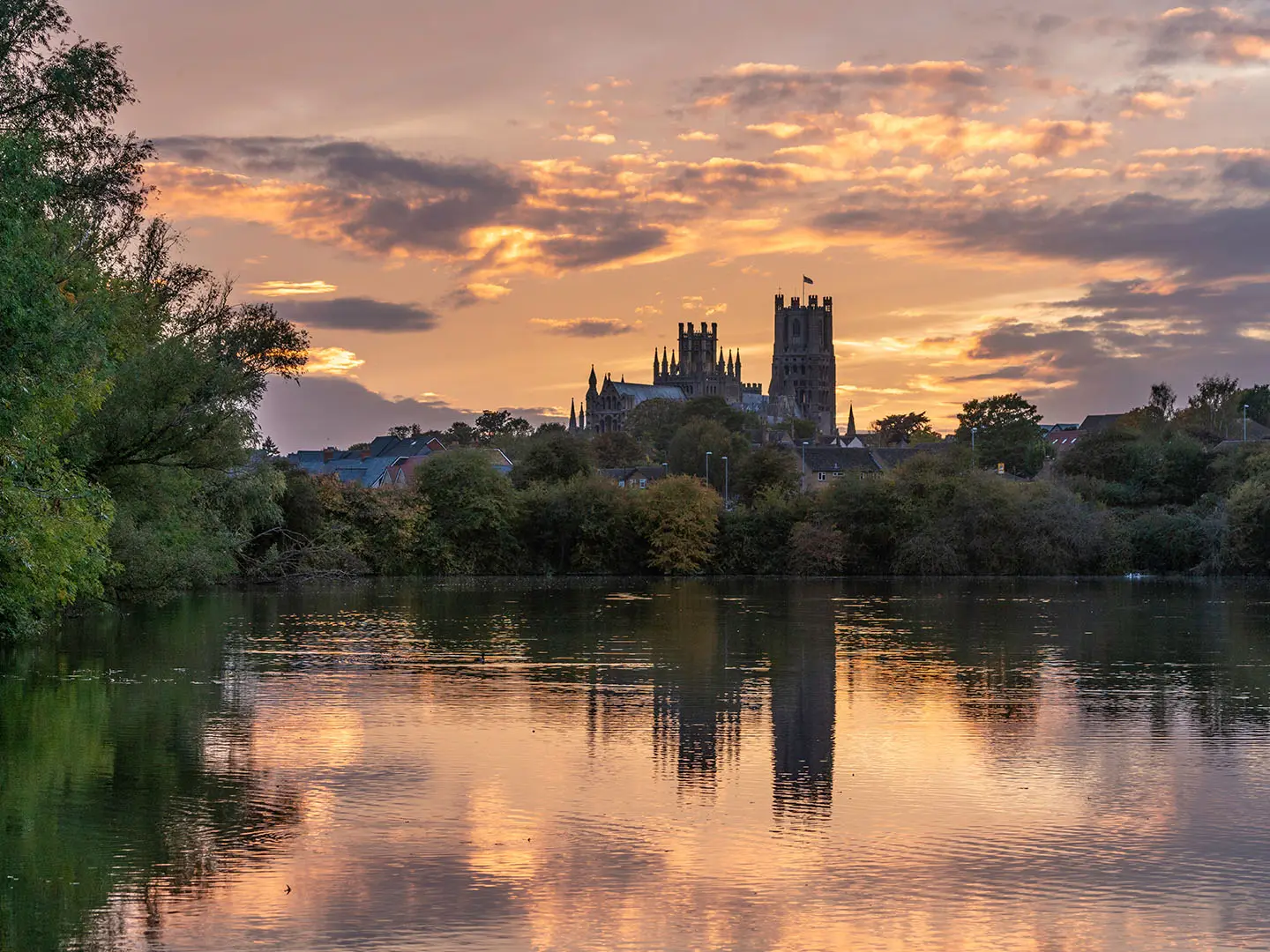
- Ely Cathedral: Known as the “Ship of the Fens” for the way its lantern tower stands above the flat fen landscape. The route passes through the cathedral city of Ely.
- Stowe landscape gardens: Near the start, the path passes Stowe, a major 18th-century landscape garden now cared for by the National Trust.
- Paxton Pits & Fen Drayton Lakes: Former gravel workings turned nature reserves. Paxton Pits is known for its heronry and nightingales, while RSPB Fen Drayton Lakes is a major wetland bird site on the route.
Challenges to expect
The Ouse Valley Way is not technically hard, but it is long. Expect mostly grass, dirt, gravel and some paved stretches, with mud after rain. Low-lying fenland sections can be wet or flooded in winter, and the path sometimes leaves the river to avoid flood ground. Waymarking is end to end, but there are some gaps where path and river temporarily separate. Facilities are sparser on remote fen stretches.
HikeList Score
Ouse Valley Way scored 81/100 on HikeList's trail-quality metrics.
See score breakdownHide breakdown
- Ideal length 93
- Balanced challenge 50
- Scenery & wildness 71
- Varied terrain 89
- Accommodation 100
- Food & support 88
- Path quality 84
- Season flexibility 89
Computed from length, challenge, scenery & wildness, terrain variety, accommodation, food & support, path quality and season flexibility.
 United Kingdom
 England
Show more data Show less
- Riverside
- Fenland
- Farmland
- Grass
- Dirt
- Gravel
- Paved
- Hotels
- Inns
- B&Bs
- Campsites
- Hostels
- Family Friendly
- Pet Friendly
- Restrooms
- Water Sources
- Campsites
- Picnic Areas
In these collections
Photos from hikers
Taken on the trail by people who've reviewed Ouse Valley Way.
Begin at the river’s source in Syresham, winding through gentle Northamptonshire countryside along quiet rural paths and farm tracks. The trail passes through historic villages, skirting riverside meadows and woodland before arriving in the lively market town of Buckingham. Expect fairly quiet paths and the first glimpse of waterside walking.
Leaving Buckingham, the route follows a mix of riverside trails and rural lanes, heading east towards Newport Pagnell on the outskirts of Milton Keynes. Pass through picturesque countryside and small villages, with the landscape gradually becoming more urban as you approach the town.
This section tracks northeast, with the Great Ouse becoming a permanent companion along lush wetland edges and towpaths. The day's hike navigates a mix of open farmland and well-maintained riverside trails, ending in the historic county town of Bedford, known for its riverside parks and amenities.
The trail continues following the riverbank, passing through peaceful meadows and small villages such as Great Barford and Tempsford. Birdlife is abundant and the route offers stretches of serene, uninterrupted countryside before reaching the attractive riverside town of St Neots.
Walk through a patchwork of riverside wetlands and open farmland, with the river guiding your journey eastward. This day covers charming hamlets, nature reserves, and expansive fenland landscapes, ending at the historic bridge and vibrant town center of St Ives.
From St Ives, continue alongside scenic water meadows and through the rich birdlife habitats of RSPB Fen Drayton Lakes and the Ouse Washes. The route skirts several small villages before delivering you into Ely, where the famous cathedral is a major waypoint and rest stop.
This shorter day weaves through fenland pastures and levee banks, following the river northwards to Littleport. Open landscapes, dramatic skies, and wildlife sightings make this a peaceful transition through the northern Fens region.
The path continues alongside the broadening Great Ouse, traversing arable farmland and waterside embankments. Expect flat, open walking with beautiful fenland scenery, culminating in the historic town of Downham Market.
This stage follows high levees and riverside footpaths, tracing the Great Ouse as it winds through the open expanses of West Norfolk. Marshland and wetland habitats increase, and the small, quiet community of Wiggenhall St Germans is a welcome overnight respite.
The final section leads through the tidal reaches of the Great Ouse, approaching The Wash and the historic port of King’s Lynn. The landscape becomes increasingly maritime, passing through salt marshes and ending in the bustling market town, completing the 229km adventure.
Reviews
How would you rate Ouse Valley Way?
Tap a star to start your review — you could be the first.